Perry-Castañeda Library
Map Collection
Virginia Maps
State Maps
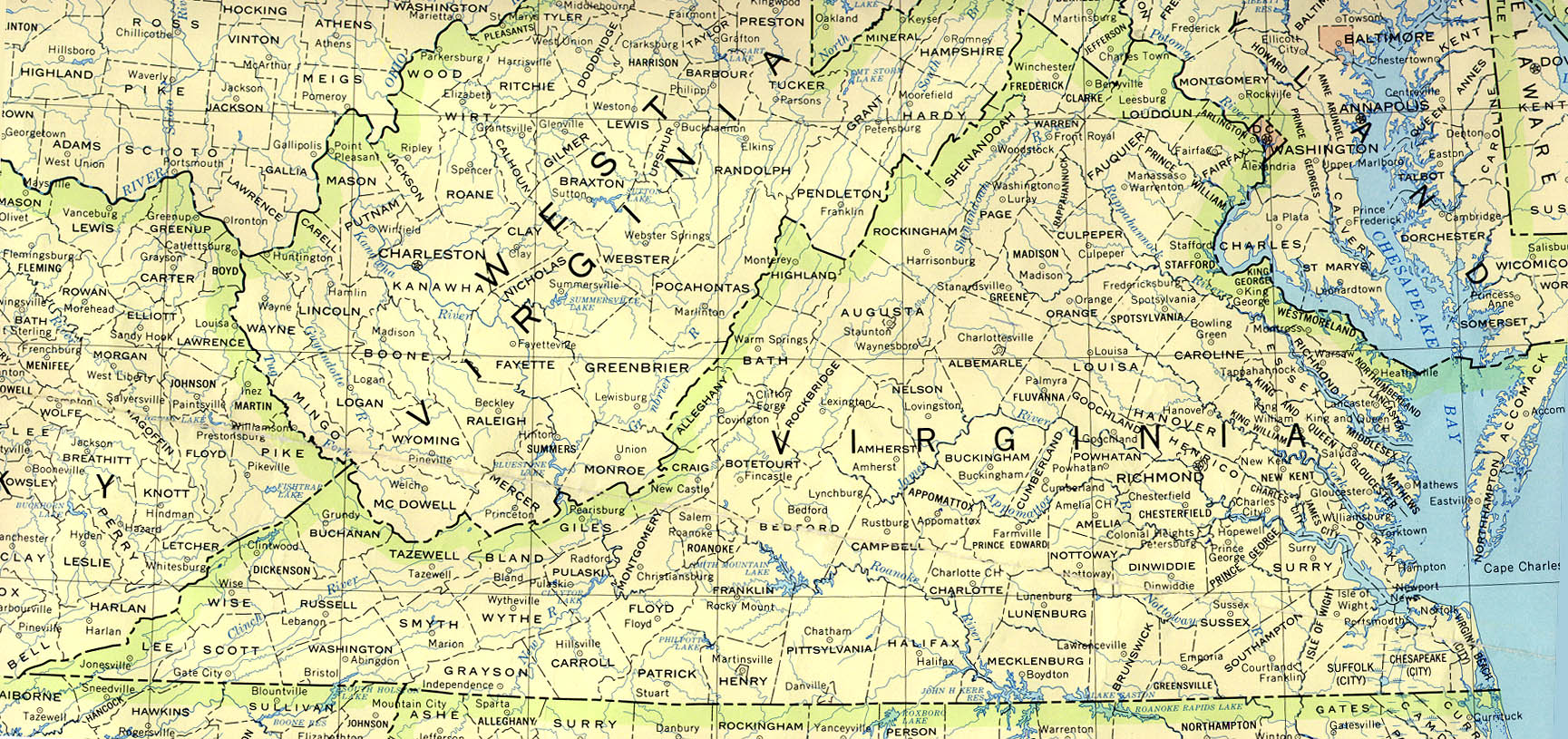
- Virginia (base map) JPEG format (561K) County boundaries and names, county seats, rivers. Original scale 1:2,500,000 U.S. Geological Survey, 1972 limited update 1990
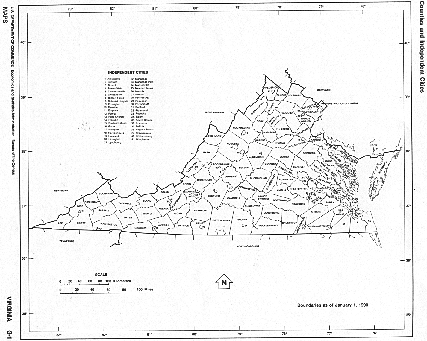
- Virginia (outline map) JPEG format (83K) County boundaries and names. U.S. Bureau of the Census, 1990
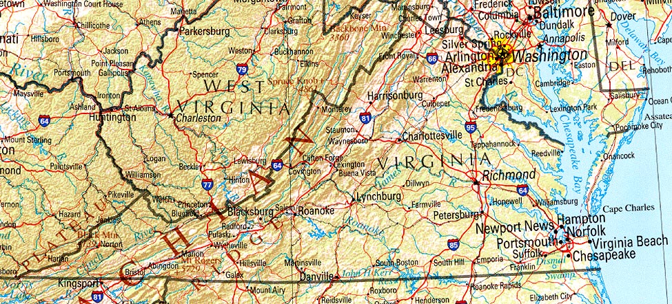
- Virginia (reference map) JPEG format (297K) Shaded relief map with state boundaries, forest cover, place names, major highways. Portion of "The National Atlas of the United States of America. General Reference", compiled by U.S. Geological Survey 2001, printed 2002
- Virginia (reference map) PDF format (300K) Shaded relief map with state boundaries, forest cover, place names, major highways. Portion of "The National Atlas of the United States of America. General Reference", compiled by U.S. Geological Survey 2001, printed 2002
- Virginia - Federal Lands and Indian Reservations PDF format (982K) The National Atlas of the United States of America, U.S. Geological Survey, 2003
City Maps
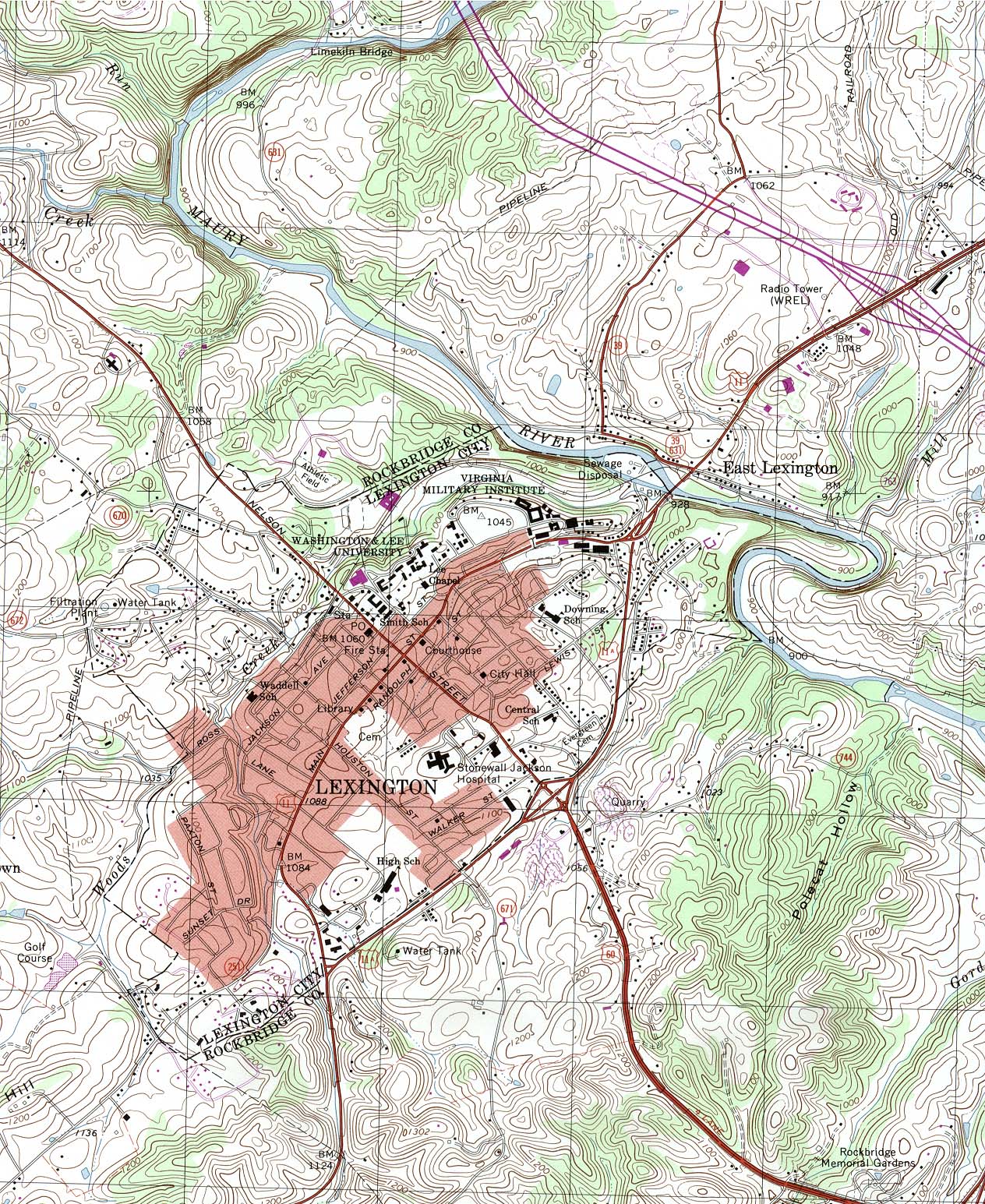
- Lexington (topographic) original scale 1:24,000 U.S.G.S. 1999 (752K)
Historical City Maps
- Bristol [Virginia/Tennessee] 1919 Automobile Blue Book (117K)
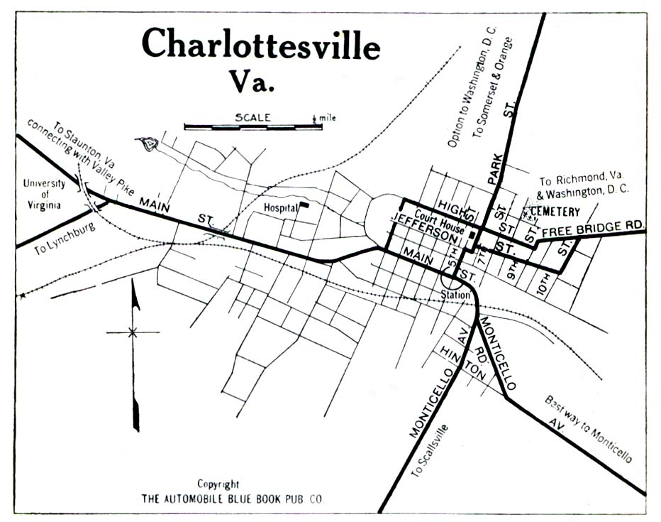
- Charlottesville 1919 Automobile Blue Book (194K)
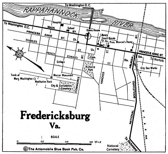
- Fredericksburg 1920 Automobile Blue Book (137K)
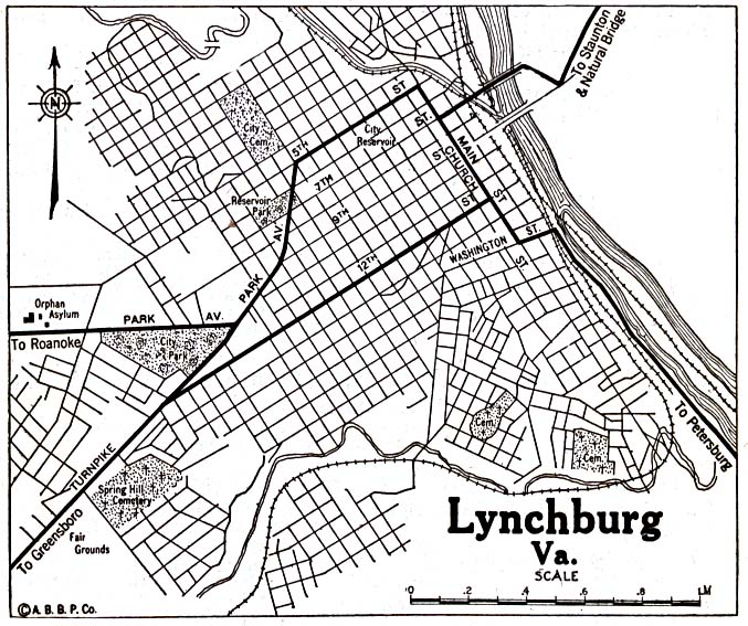
- Lynchburg 1920 Automobile Blue Book (176K)
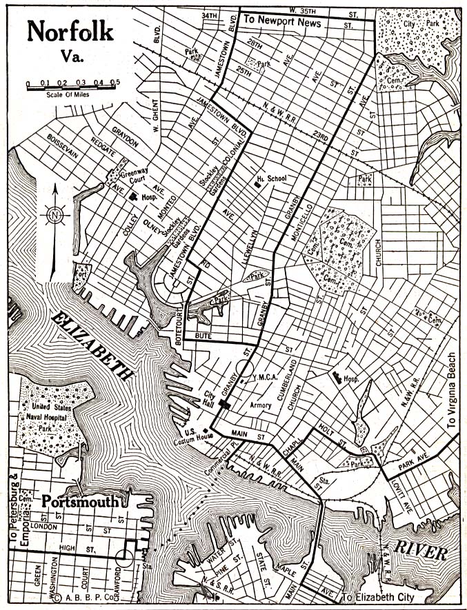
- Norfolk 1920 Automobile Blue Book (293K)
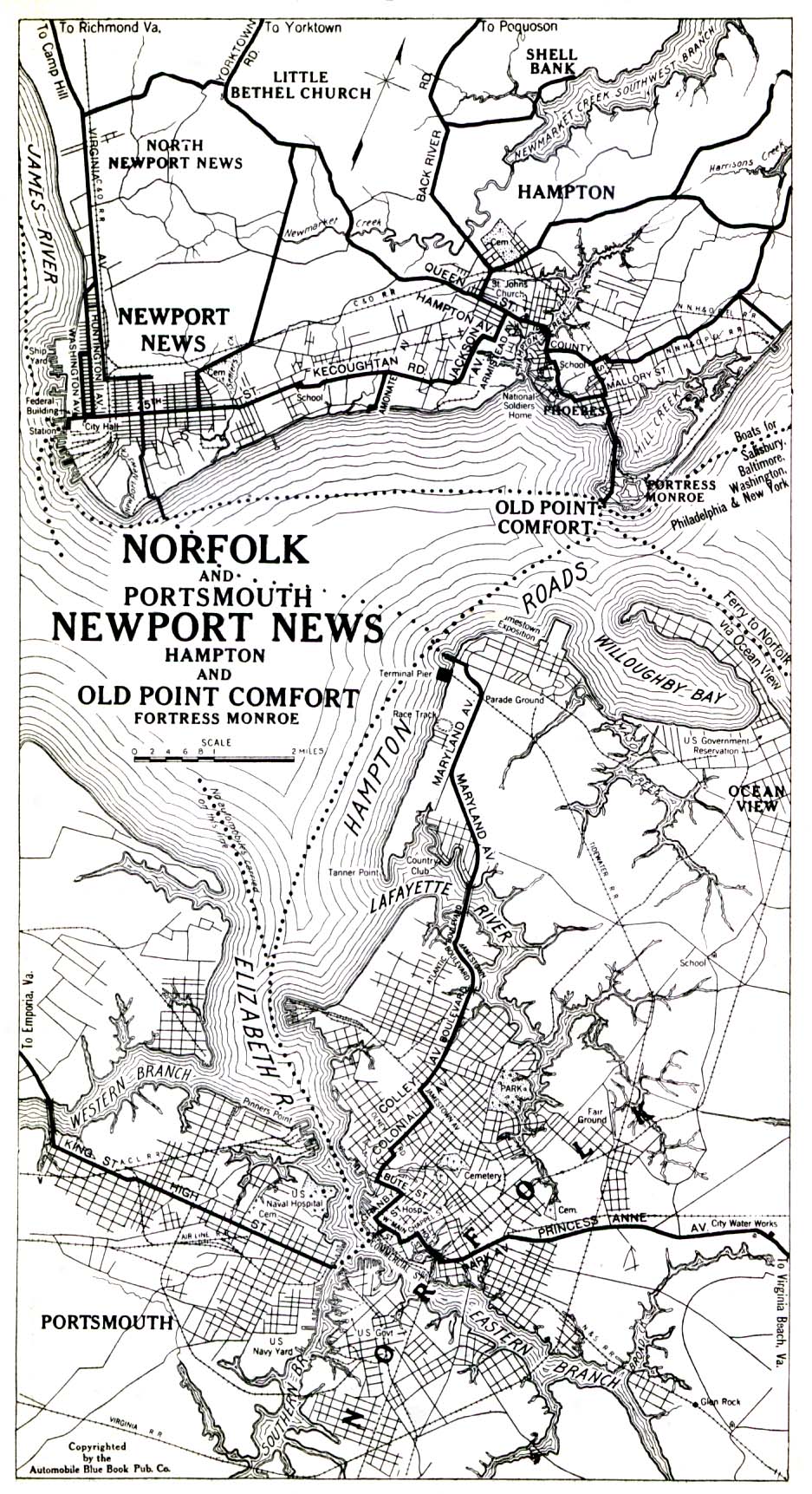
- Norfolk and Portsmouth, Newport News, Hampton and Old Point Comfort, Fortress Monroe 1919 Automobile Blue Book (516K)
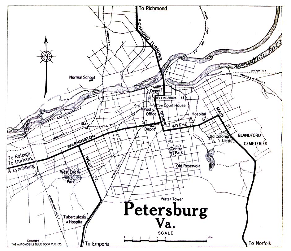
- Petersburg 1919 Automobile Blue Book (258K)
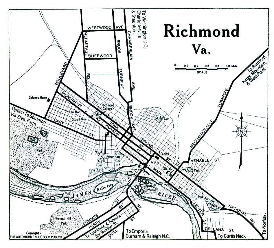
- Richmond 1919 Automobile Blue Book (323K)
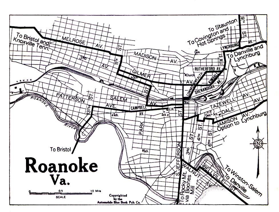
- Roanoke 1919 Automobile Blue Book (323K)
- Staunton 1919 Automobile Blue Book (258K)
- Winchester 1920 Automobile Blue Book 1920, Volume 3 (72K)
![Bristol [Virginia/Tennessee] 1919](historical/bristol_va_tn_1919.jpg)
Historical Maps
- Blue Ridge Parkway 1963 (5.5 MB) U.S. National Park Service
- Virginia Topographic Maps (U.S. Geological Survey)
- Pre-1945 Maps, Scales 1:31,680, 1:62,500, 1:125,000
- Virginia 1796 (5.7MB)
- "The State of Virginia" from Heads of Families First Census of the United States - State Enumerations of Virginia, 1908.
- Pre-1945 Maps, Scales 1:31,680, 1:62,500, 1:125,000
Maps of National Parks, Monuments, and Historic Sites
The following maps were produced by the U.S. National Park Service unless otherwise noted.
- Appomattox Court House National Historic Park (Area Map) (27K)
- Appomattox Court House National Historic Park (Area Map) 1996 (65K) (PDF Format)
- Appomattox Court House National Historic Park (Schematic Map) (483K)
- Appomattox Court House National Historic Park (Schematic Map) 1997 (710K) (PDF Format)
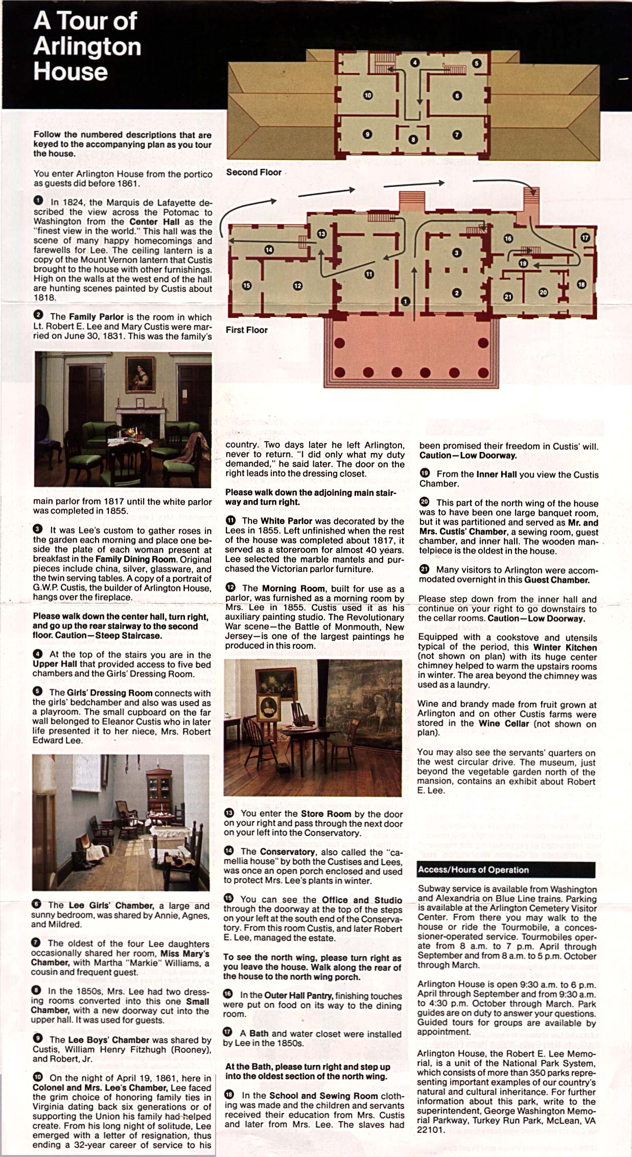
- Arlington House - The Robert E. Lee Memorial (Schematic Map) 1995 (570K)
- Blue Ridge Parkway [Virginia / North Carolina] (Park Map) 1998 (968K) (PDF Format)
- Blue Ridge Parkway - Northern Section [Virginia / North Carolina] (Park Map) 1995 (901K)
- Blue Ridge Parkway - Southern Section [Virginia / North Carolina] (Park Map) 1995 (764K)
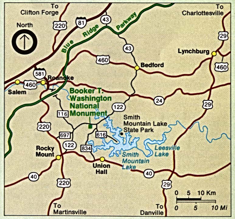
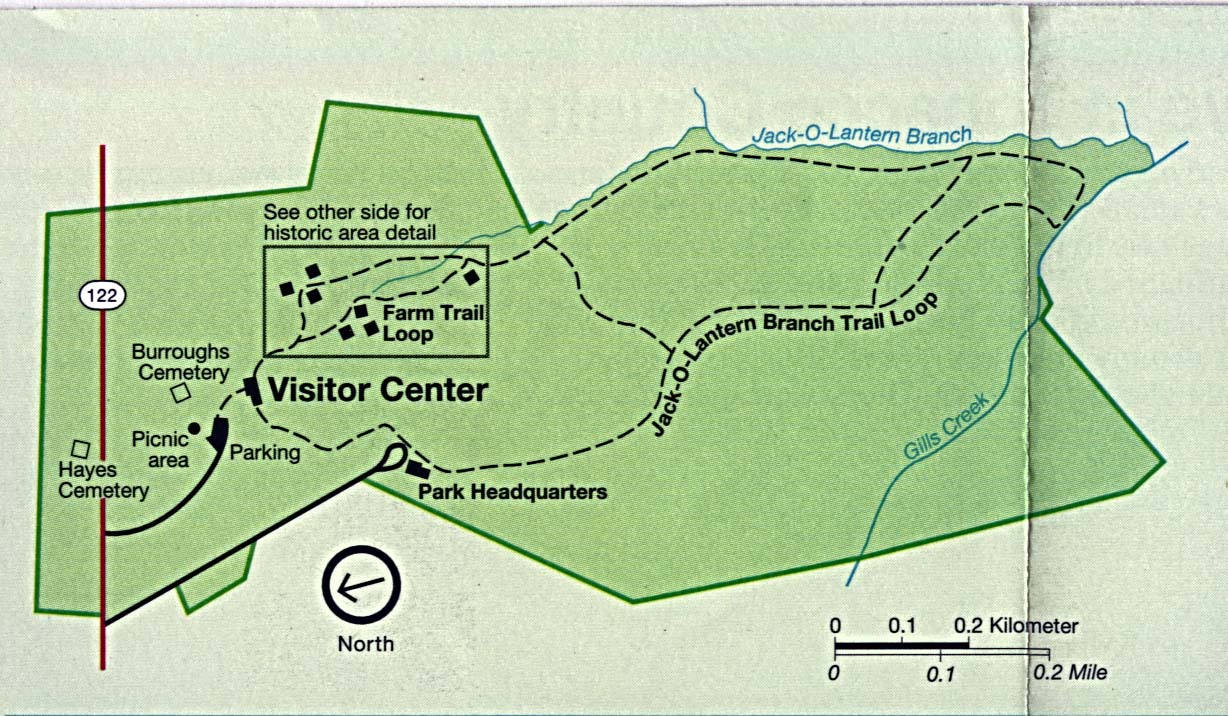
- Booker T. Washington National Monument (Area Map) 1995 (201K)
- Booker T. Washington National Monument (Park Map) 1995 (198K)
- Booker T. Washington National Monument (Park Map) 1997 (65K) (PDF Format)
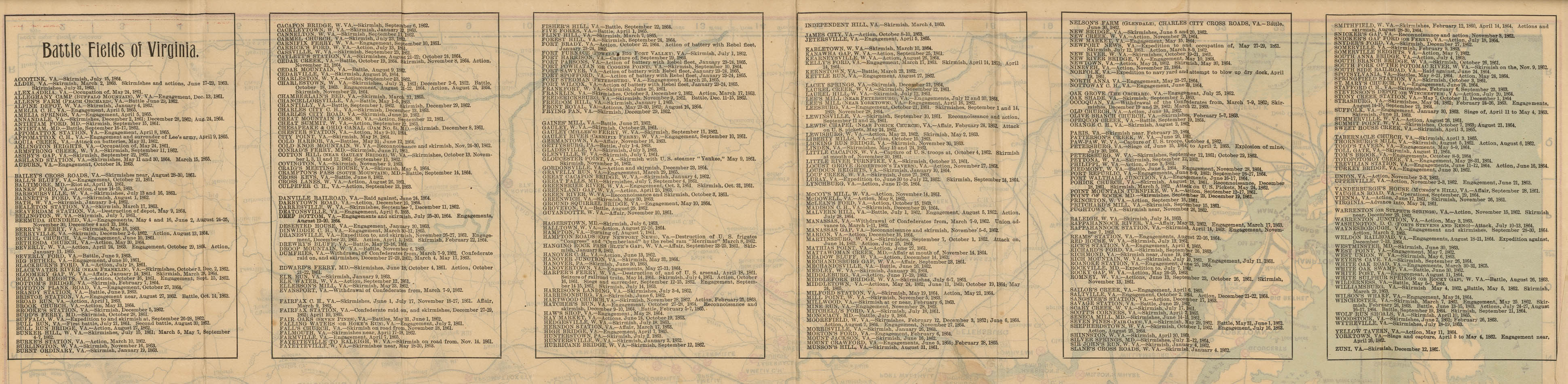
- [Civil War] Battle Fields of Virginia (2.9 MB) "Map Showing the Location of Battle Fields of Virginia 1891", Chesapeake and Ohio Railway Company, 1892. Map shows: "Battle Fields", "Chesapeake & Ohio R.R. after the war", "Other railroads after the war", "Railroads during the war", "Plank roads and turnpikes", "Other roads", "Light houses", rivers, towns, and relief by hachures. Verso: List of "Battle Fields of Virginia" with dates of actions. (852K)
- Colonial Jamestown Island (Park Features / Relief Map) 1994 (351K)
- Colonial National Historic Park (Park Features / Relief Map) 1994 (644K)
- Colonial Yorktown [Virginia] (Park Features) 1994 (293K)
- Cumberland Gap National Historical Park [Tennessee / Kentucky / Virginia] (Park Map) 1999 (323K) (PDF Format)
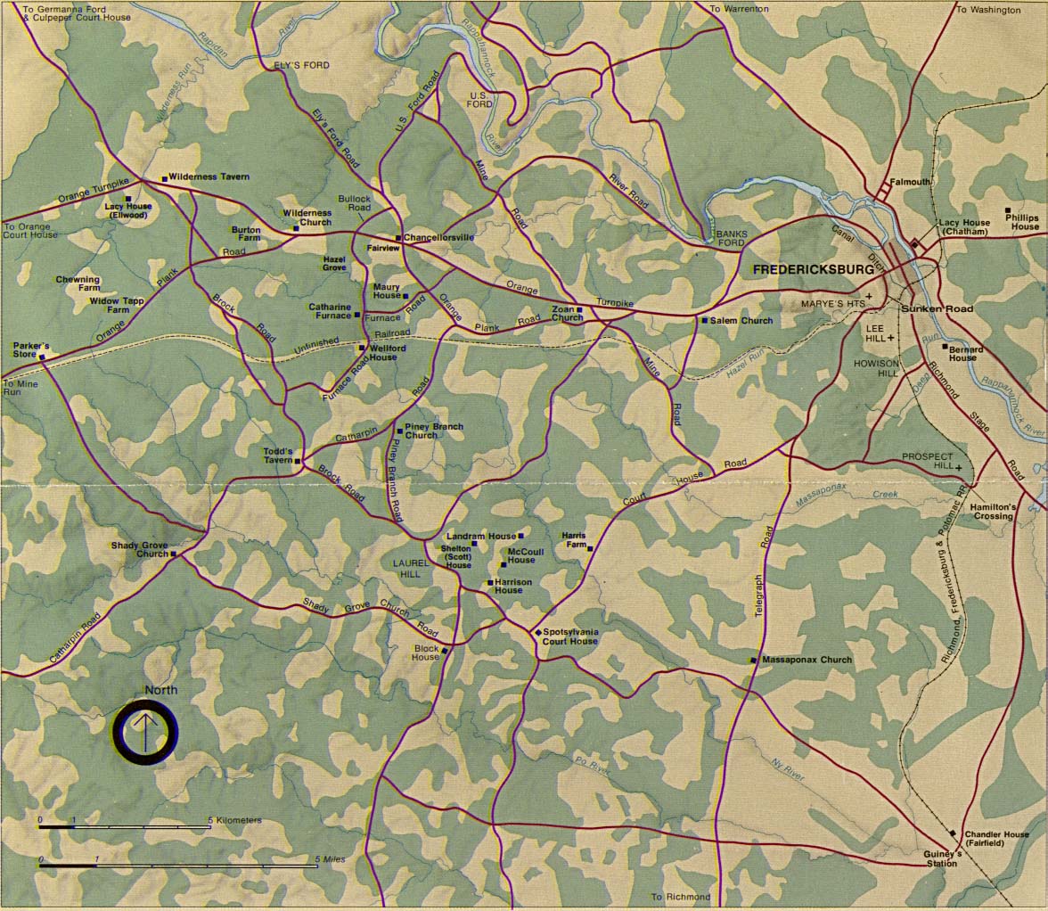
- Fredericksburg and Spotsylvania National Military Park (Area Map) (717K)
- Fredericksburg and Spotsylvania National Military Park (Historical Area Map) (46K)
- Fredericksburg and Spotsylvania National Military Park (Historical Area Map) 1999 (258K) (PDF Format)
- Fredericksburg and Spotsylvania National Military Park (Park Map) 1999 (323K) (PDF Format)
- Fredericksburg and Spotsylvania National Military Park - Fredericksburg to Chatham (Detail Map) 1999 (65K) (PDF Format)
- George Washington Memorial Parkway [Maryland / Virginia / Washington D.C.] (Park Map) 1998 (258K) (PDF Format)
- Great Falls Park (Park Map) 1998 (645K) (PDF Format)
- Jamestown National Historic Site (Park Map) 1998 (323K) (PDF Format)
- Jamestown National Historic Site (Settlement Map) 1998 (65K) (PDF Format)
- Maggie L Walker National Historic Site (Park Map) 1999 (65K) (PDF Format)
- Manassas National Battlefield Park (1861-1862 Battle Map) 1999 (65K) (PDF Format)
- Manassas National Battlefield Park (Park Map) 1999 (65K) (PDF Format)
- Petersburg National Battlefield (Park Map) 1999 (387K) (PDF Format)
- Prince William Forest Park Park (Park Map) 1998 (452K) (PDF Format)
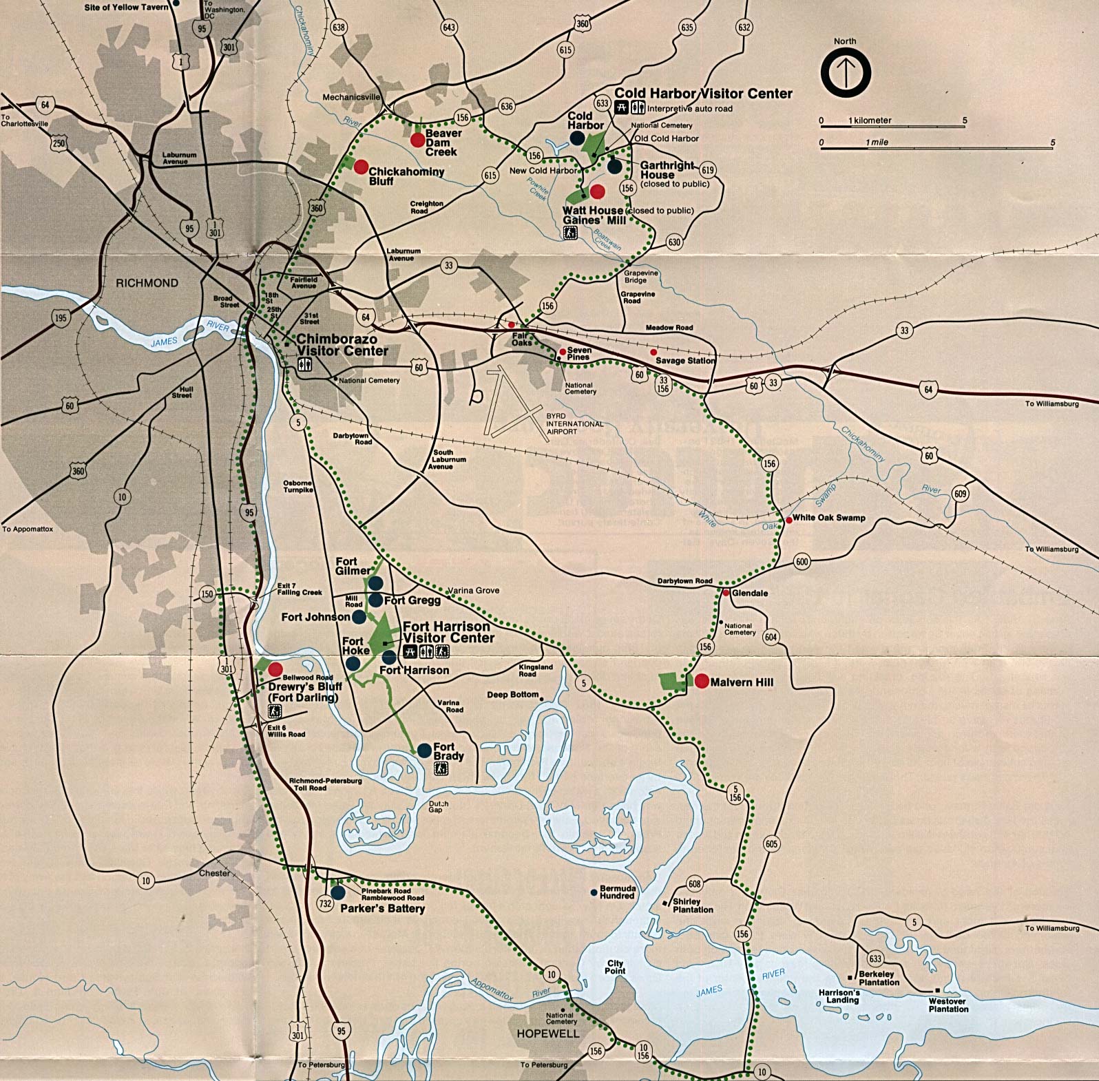
- Richmond National Battlefield Park (Detail Map) 2000 (65K) (PDF Format)
- Richmond National Battlefield Park (Location Map) (430K)
- Richmond National Battlefield Park (Park Map) 2000 (65K) (PDF Format)
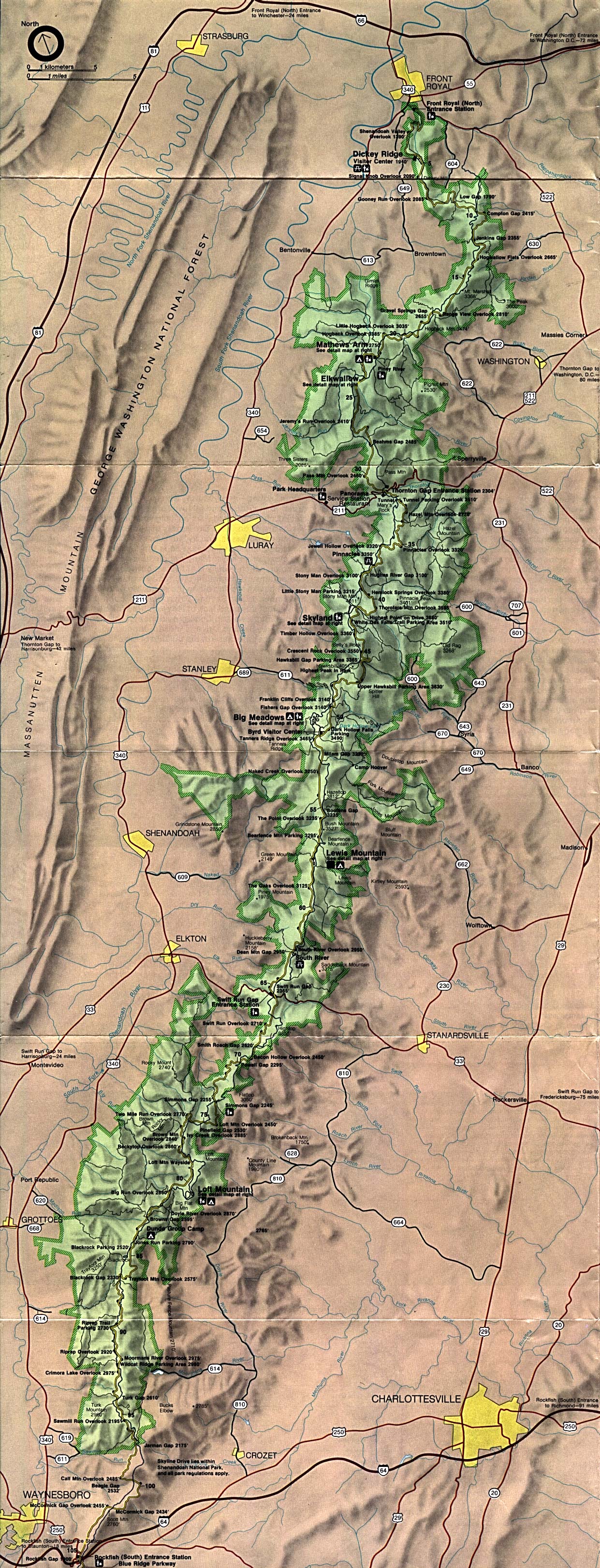
- Shenandoah National Park (Park Map) (1MB)
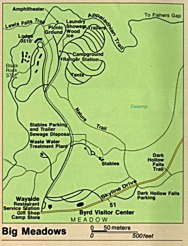
- Shenandoah National Park - Big Meadows (Detail Map) (51K)
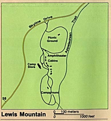
- Shenandoah National Park - Lewis Mountain (Detail Map) (30K)
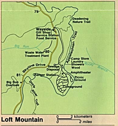
- Shenandoah National Park - Loft Mountain (Detail Map) (36K)
- Shenandoah National Park - Mathews Arm (Detail Map) (7K)
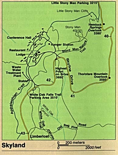
- Shenandoah National Park - Skyland (Skyland) (Detail Map) (49K)
- Wolf Trap Farm Park (Park Map) 1997 (65K) (PDF Format)
- Yorktown National Cemetery (Park Map) 2000 (65K) (PDF Format)
![Blue Ridge Parkway - Northern Section [Virginia / North Carolina]](national_parks/blue_n95.jpg)
![Blue Ridge Parkway - Southern Section [Virginia / North Carolina]](national_parks/blue_s95.jpg)
![[Civil War] Battle Fields of Virginia](historical/txu-pclmaps-virginia_battlefields_1892.jpg)
![Colonial Yorktown [Virginia]](national_parks/coloni_york94.jpg)
Maps on Other Web Sites