Ecuador Topographic Maps 1:50,000
U.S. National Imagery and Mapping Agency, Series J721
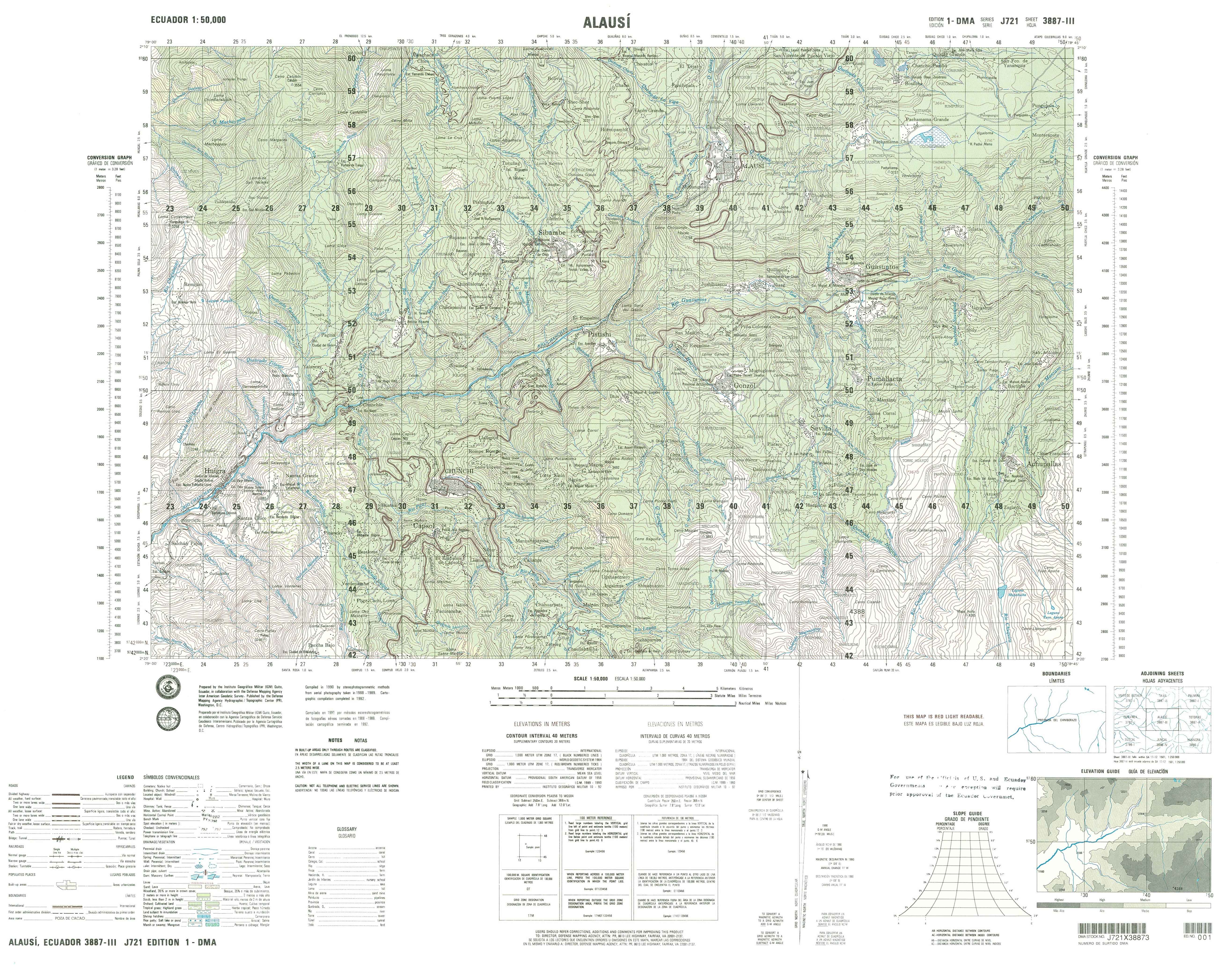
- Alausi (topographic) Sheet 3887 III, 1:50,000 (16.4MB)
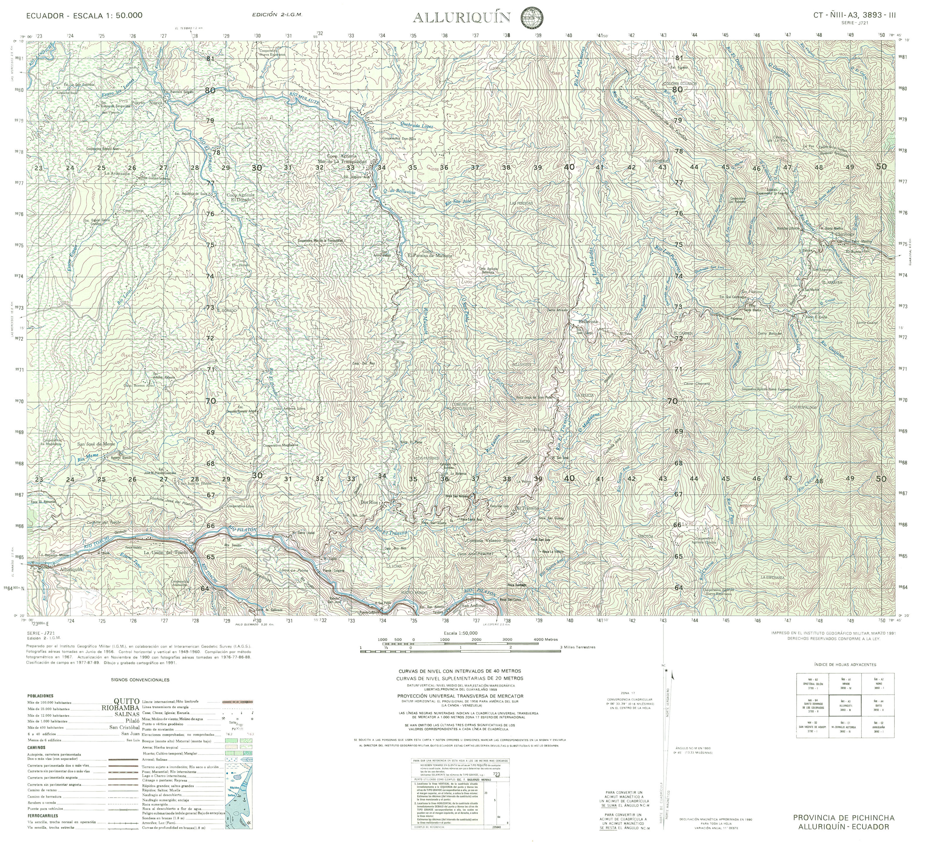
- Alluriquin (topographic) Sheet 3893 III, 1:50,000 (2.5MB)
- Alto Tambo (topographic) Sheet 3896 I, 1:50,000 2005 (3.8MB) [PDF]
- Amazonas (topographic) Sheet 3883 IV, 1:50,000 (4.1MB)
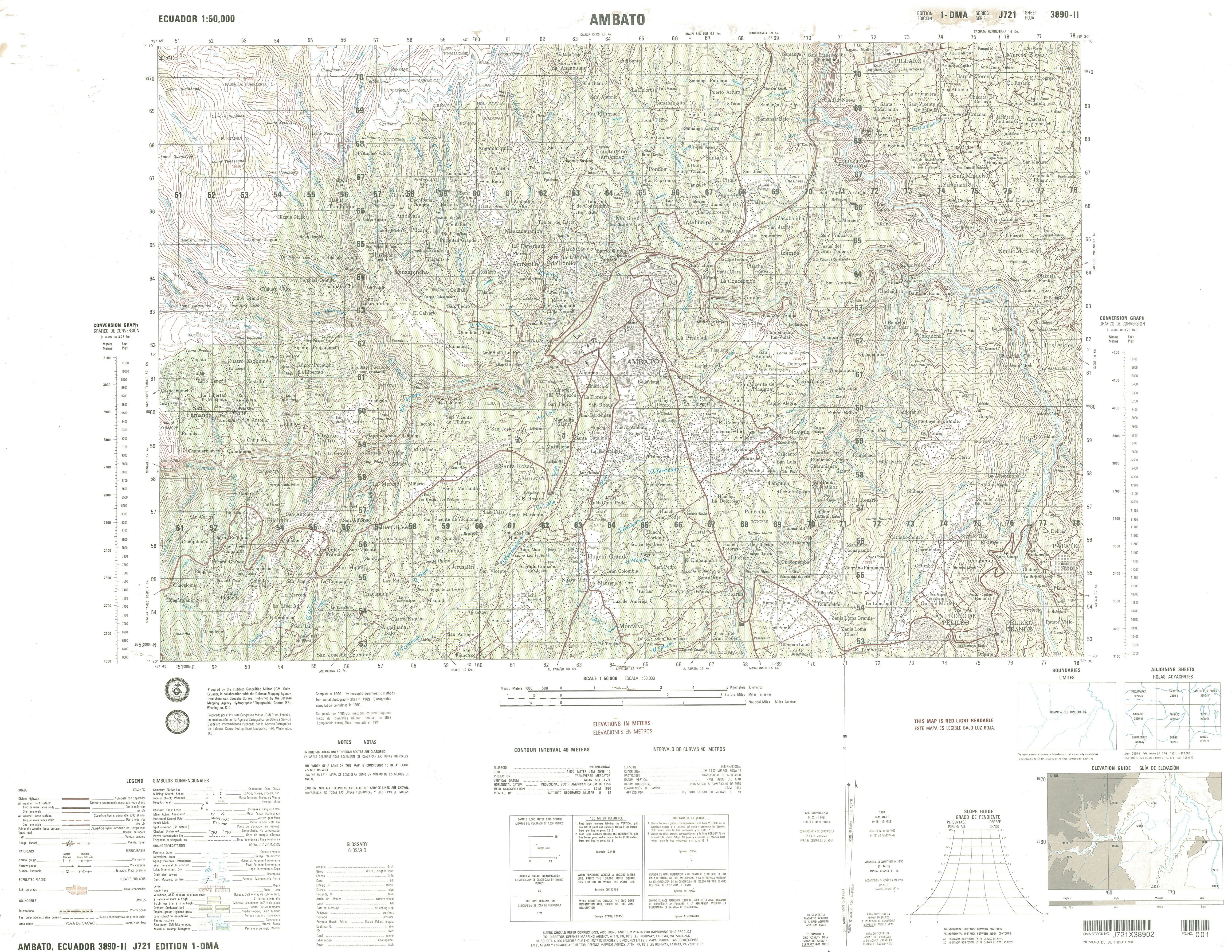
- Ambato (topographic) Sheet 3890 II, 1:50,000 (4.7MB)
- Amuntai (topographic) Sheet 4286 III, 1:50,000 1991 (7.8MB) [PDF]
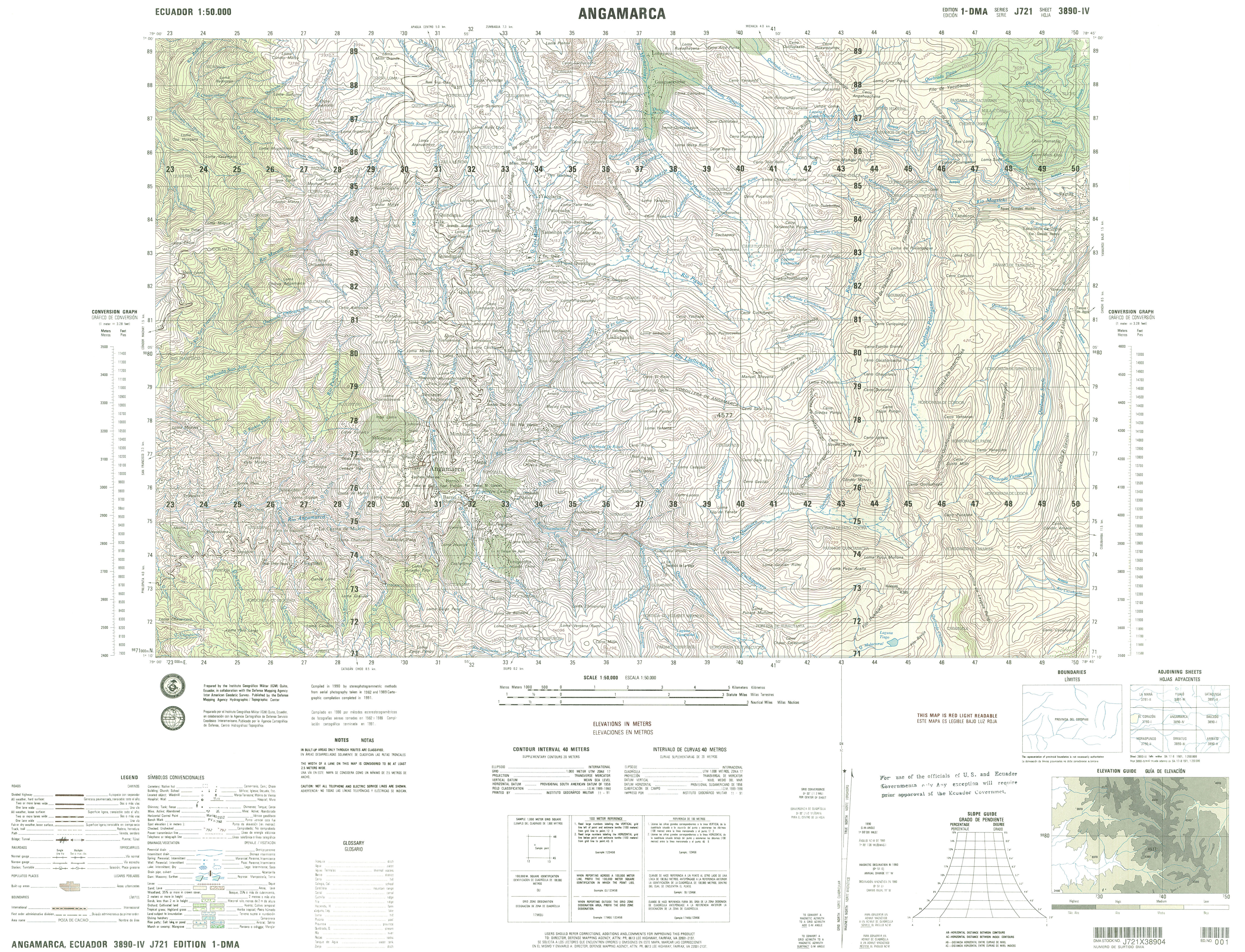
- Angarmarca (topographic) Sheet 3890 IV, 1:50,000 (4.7MB)
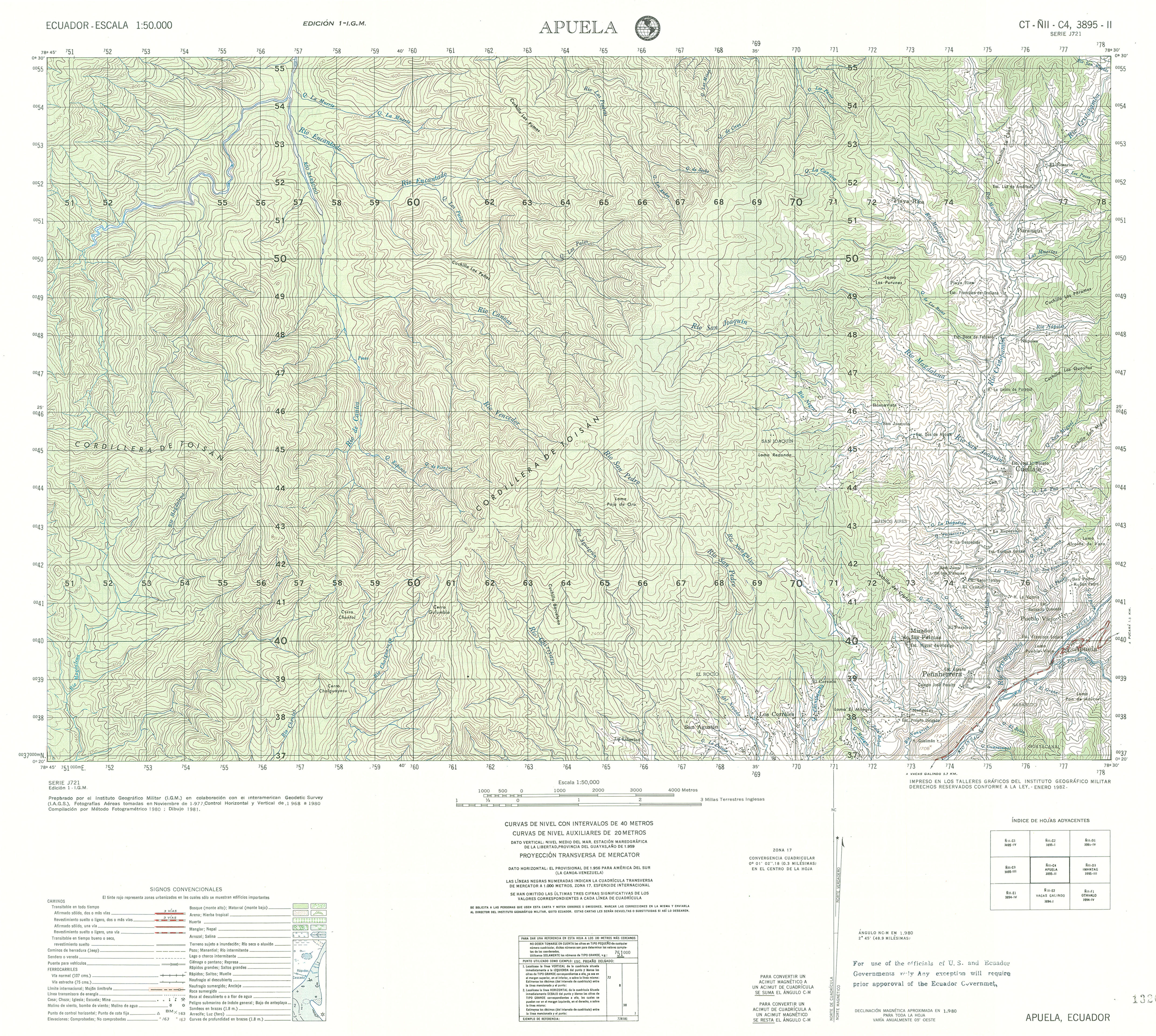
- Apuela (topographic) Sheet 3895 II, 1:50,000 (4.1MB)
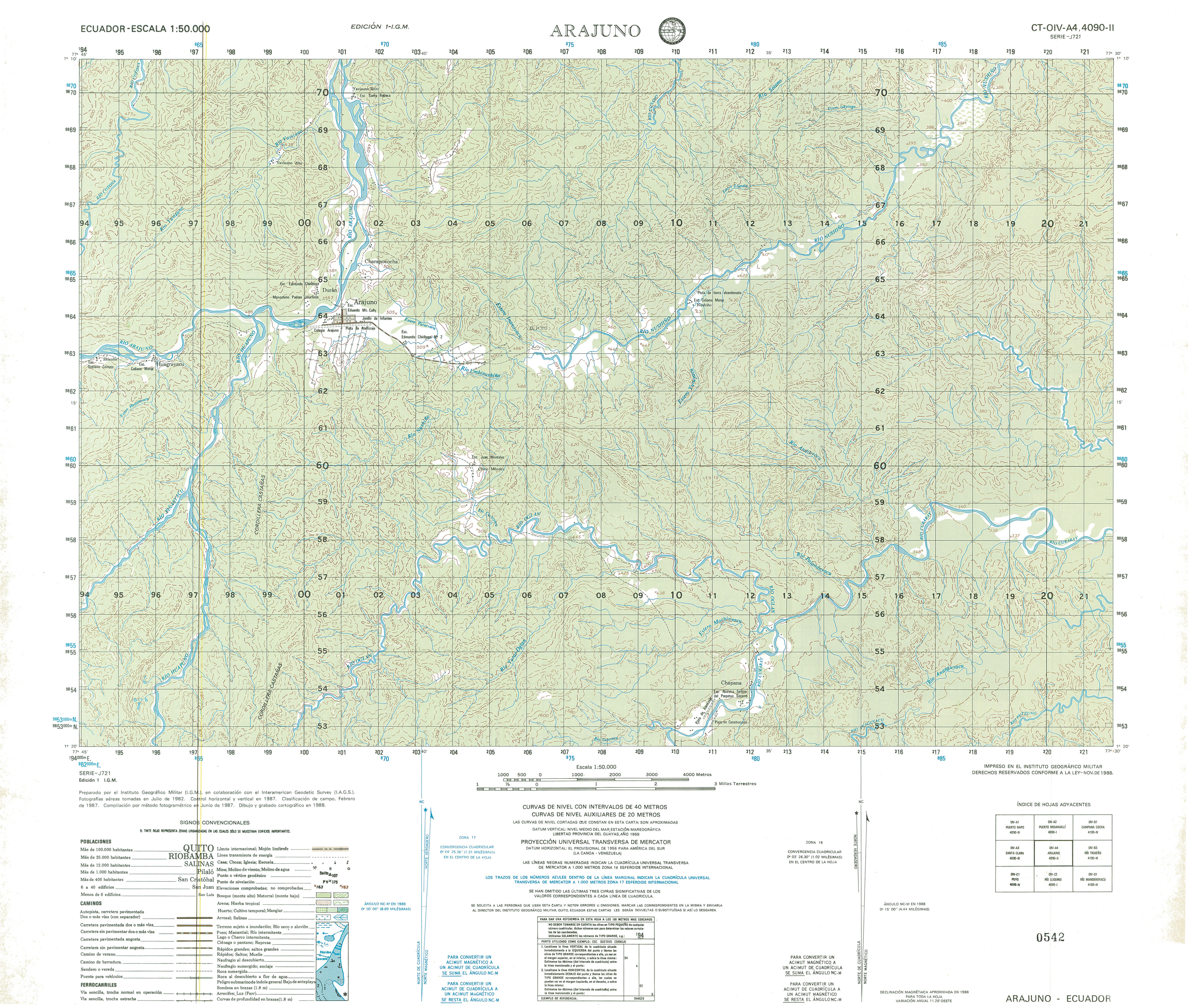
- Arajuno (topographic) Sheet 4090 II, 1:50,000 (3.9MB)
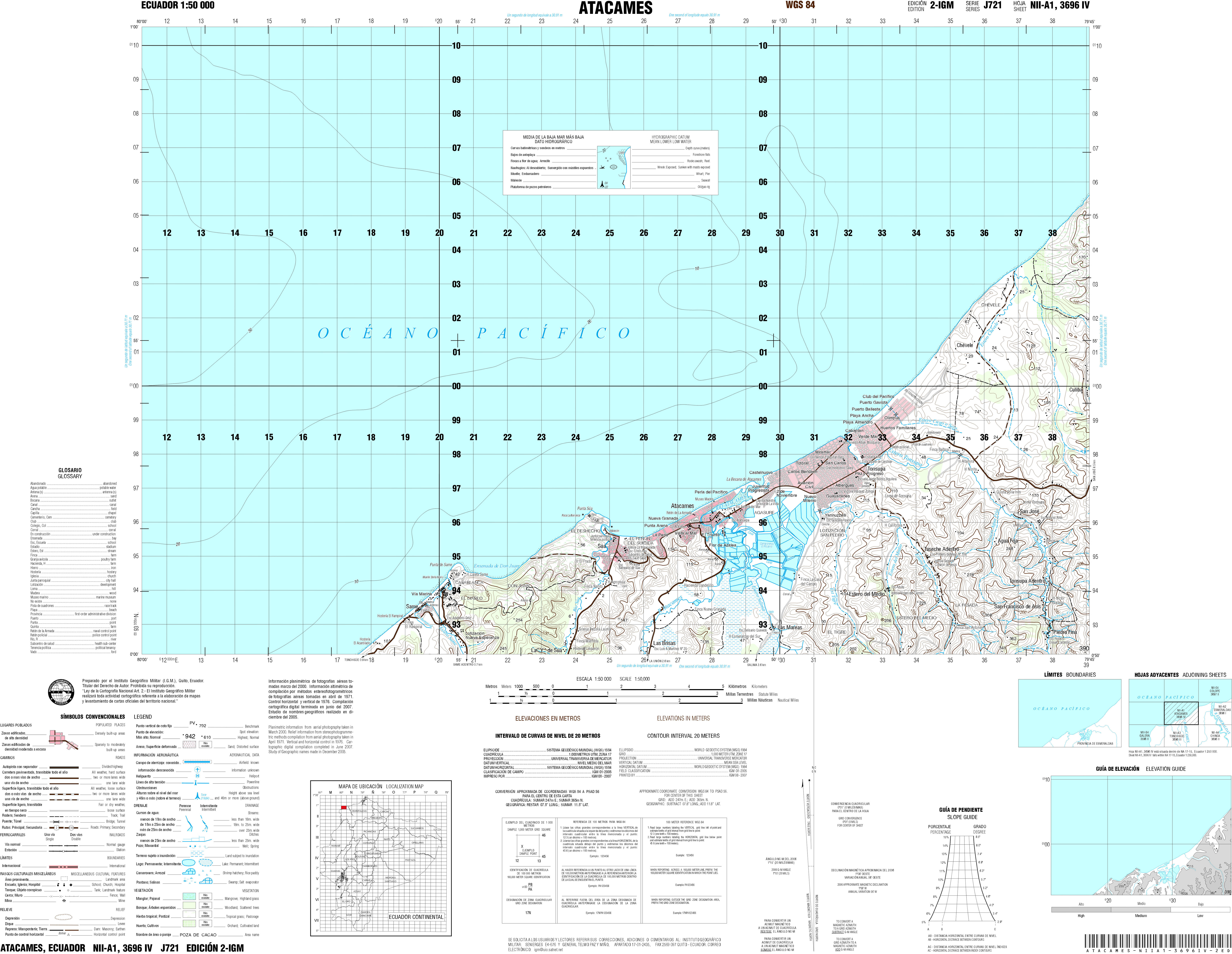
- Atacames (topographic) Sheet 3696 IV, 1:50,000 (4.2MB)
- Atahualpa (topographic) Sheet 3693 IV, 1:50,000 (4.3MB)
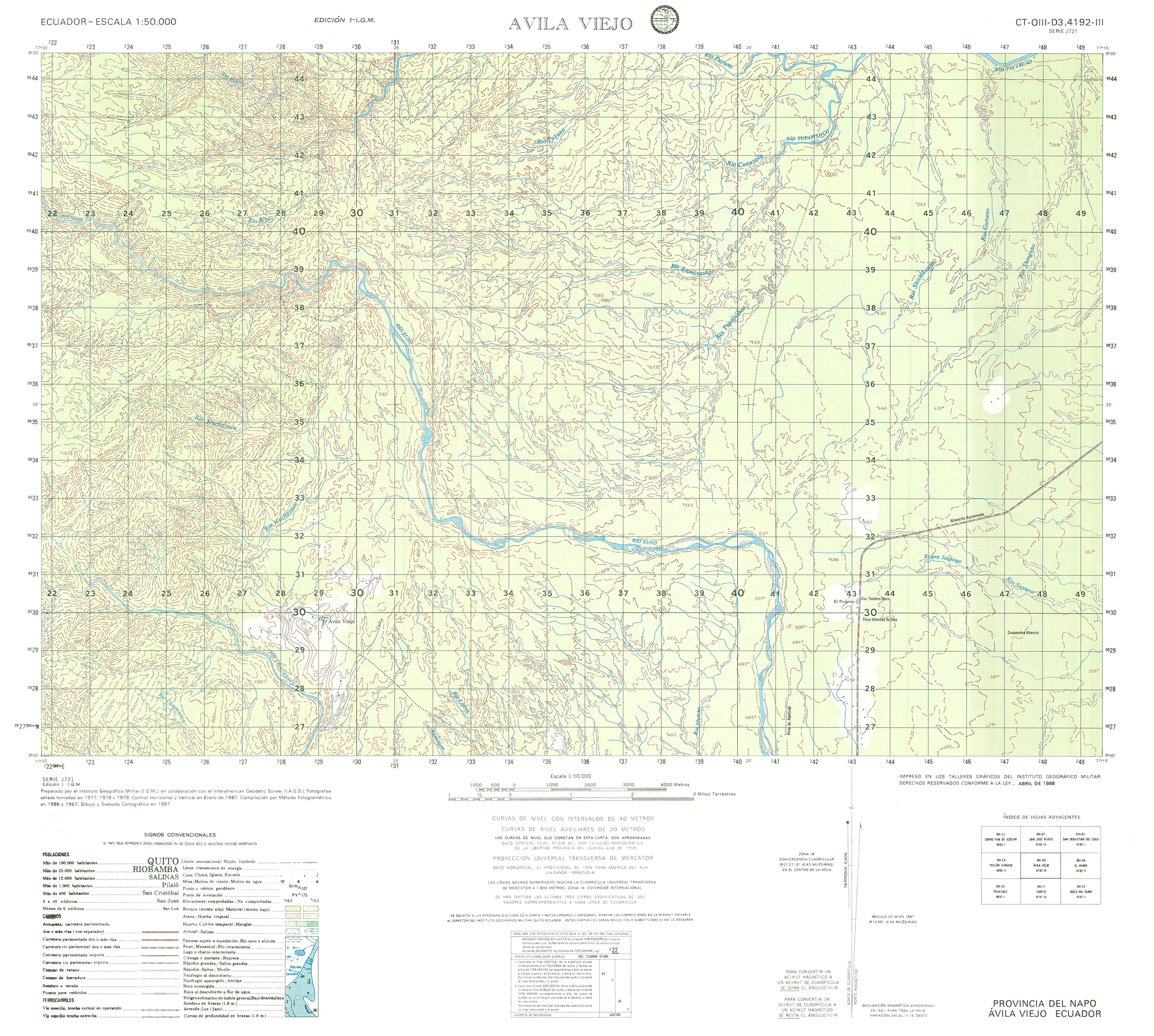
- Avila Vieja (topographic) Sheet 4192 III, 1:50,000 (3.4MB)
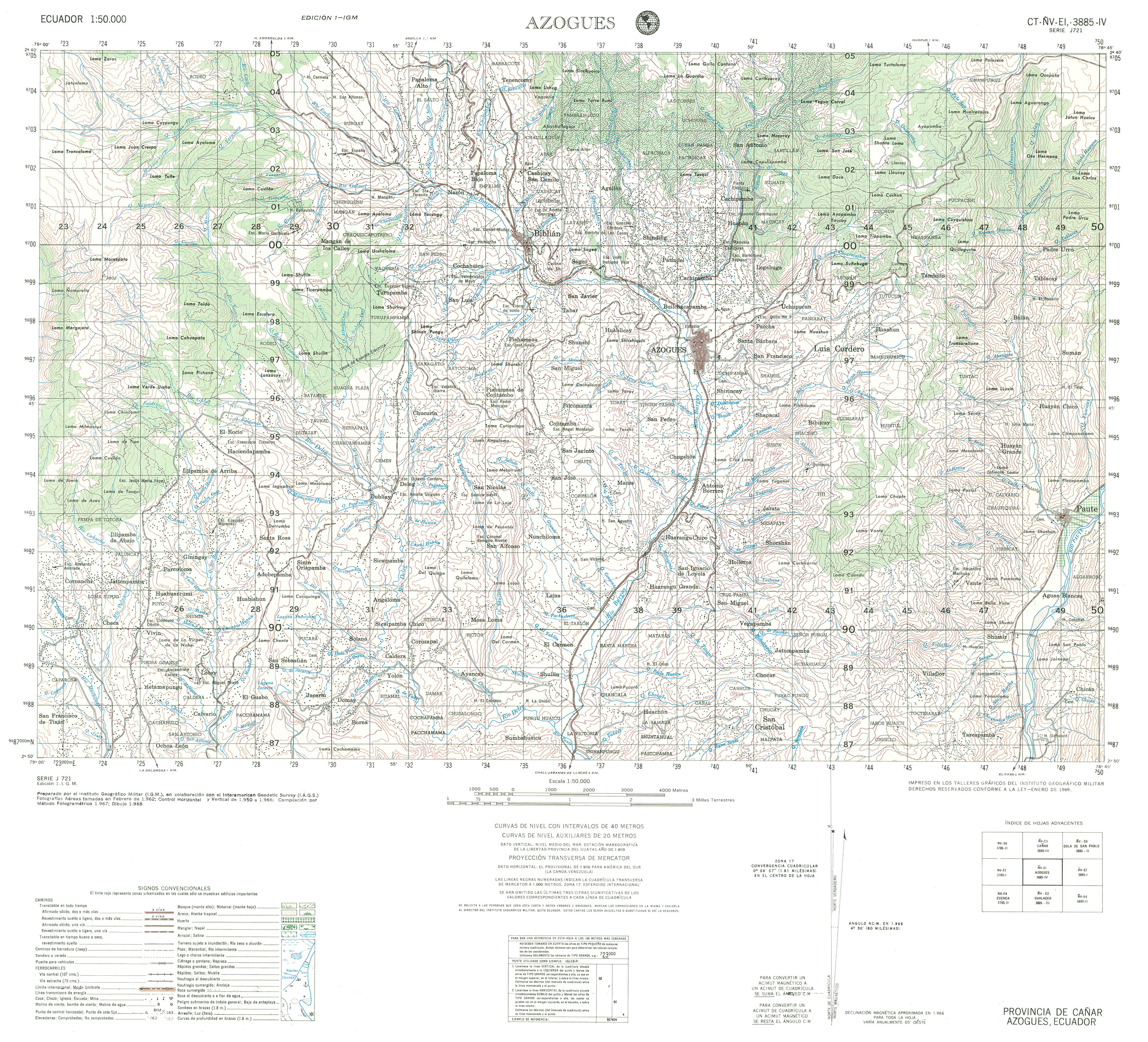
- Azogues (topographic) Sheet 3885 IV, 1:50,000 (4.1MB)
- Babahoyo (topographic) Sheet 3688 I, 1:50,000 1998 (6.3MB) [PDF]
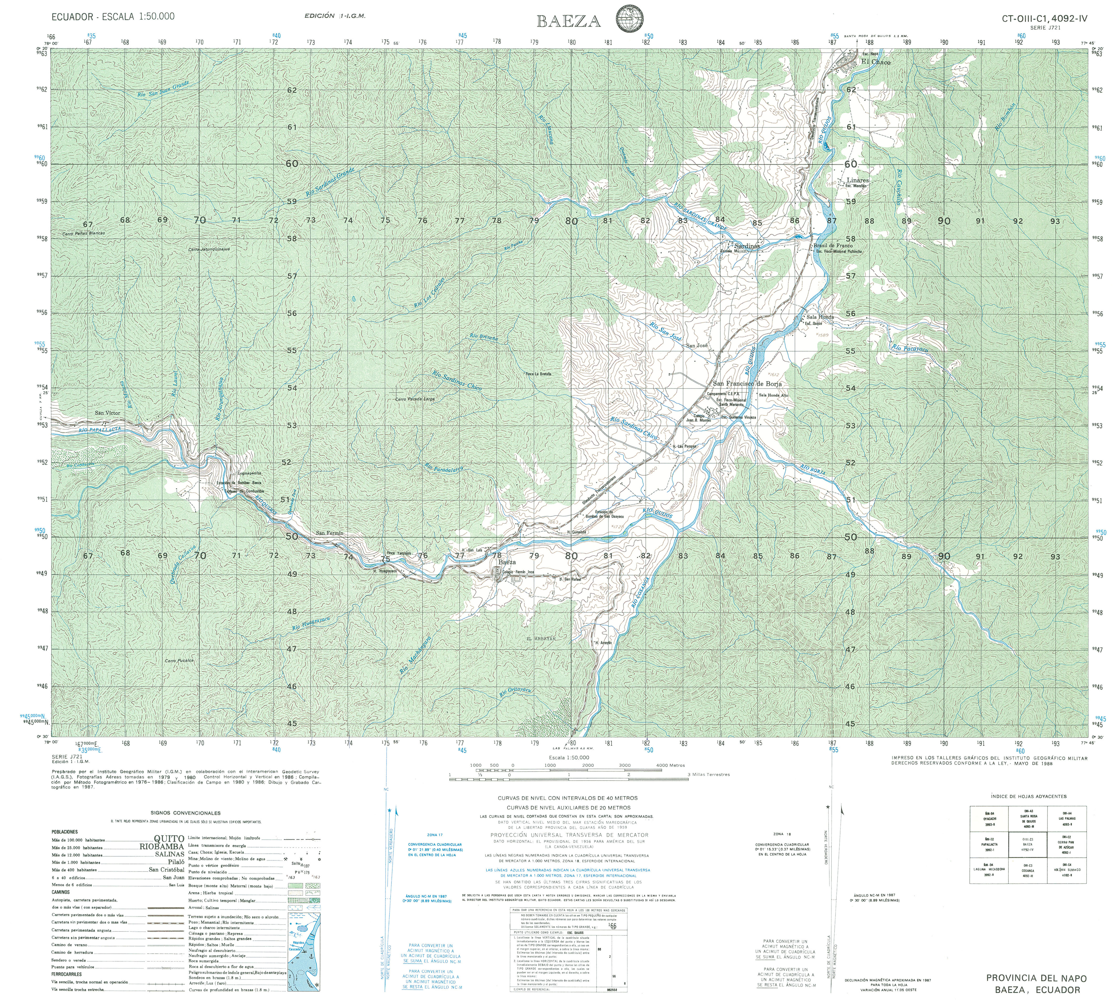
- Baeza (topographic) Sheet 4092 IV, 1:50,000 (3.8MB)
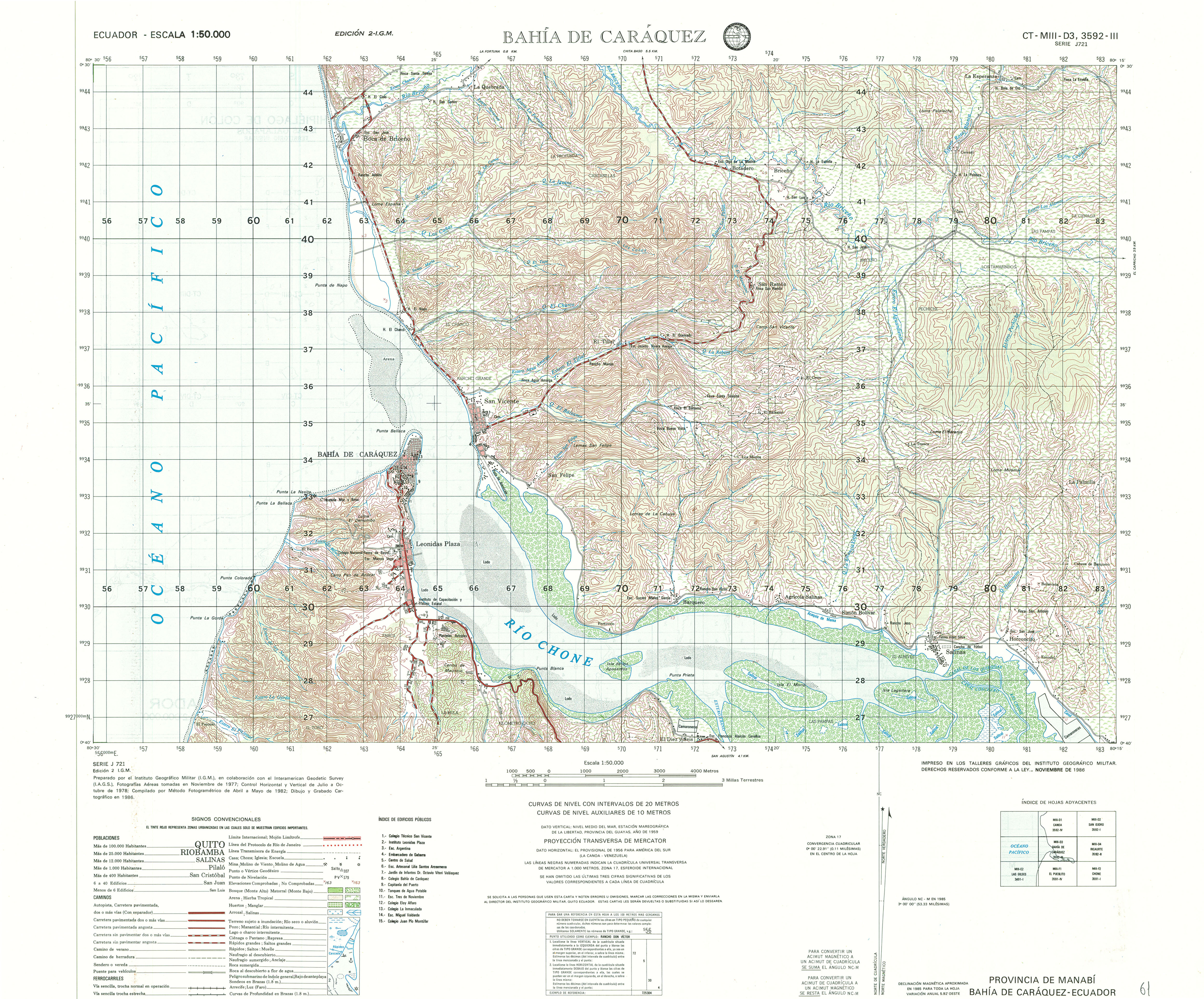
- Bahia de Caraquez (topographic) Sheet 3592 III, 1:50,000 (4.2MB)
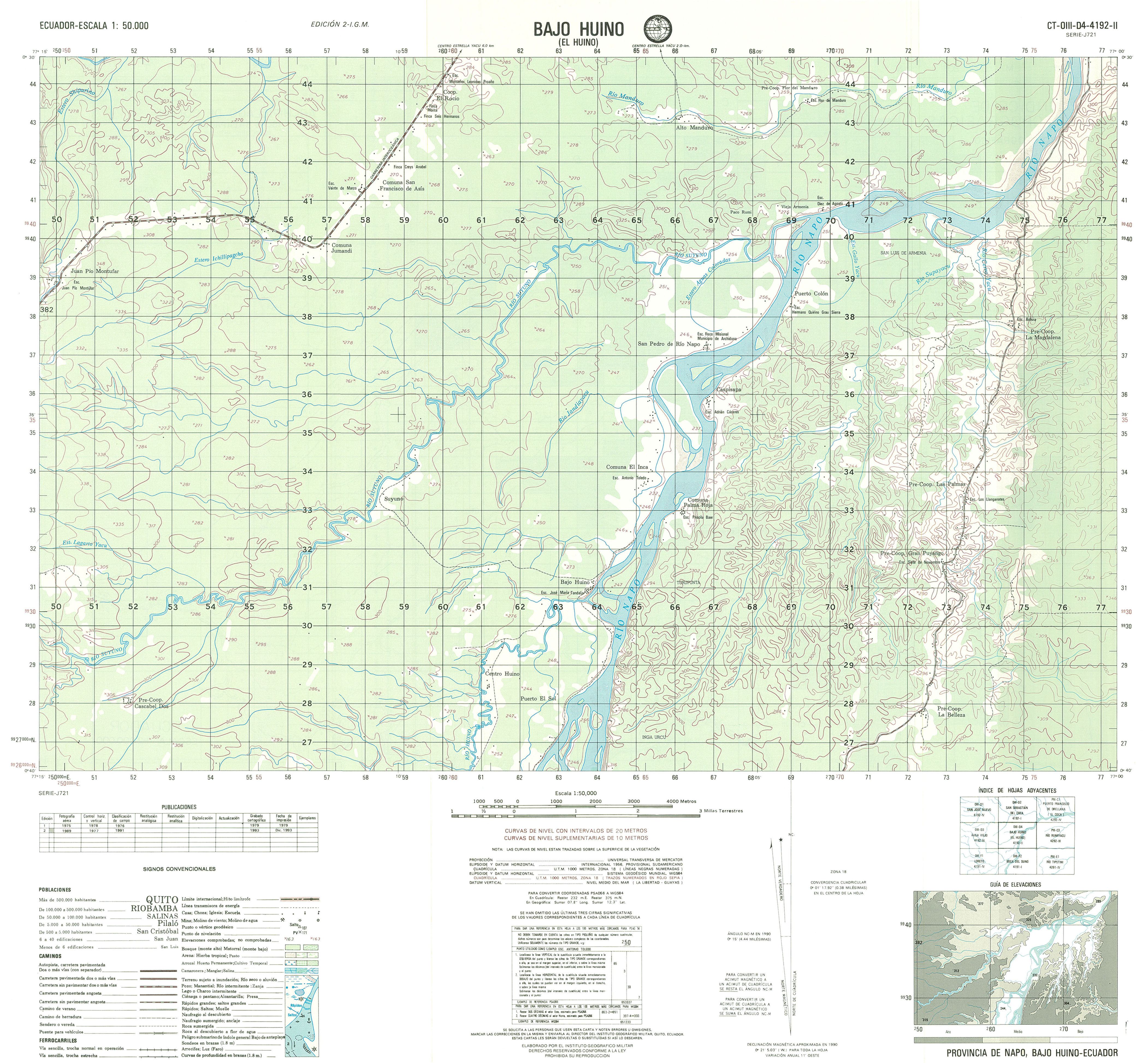
- Bajo Huino (topographic) Sheet 4192 II, 1:50,000 (2.9MB)
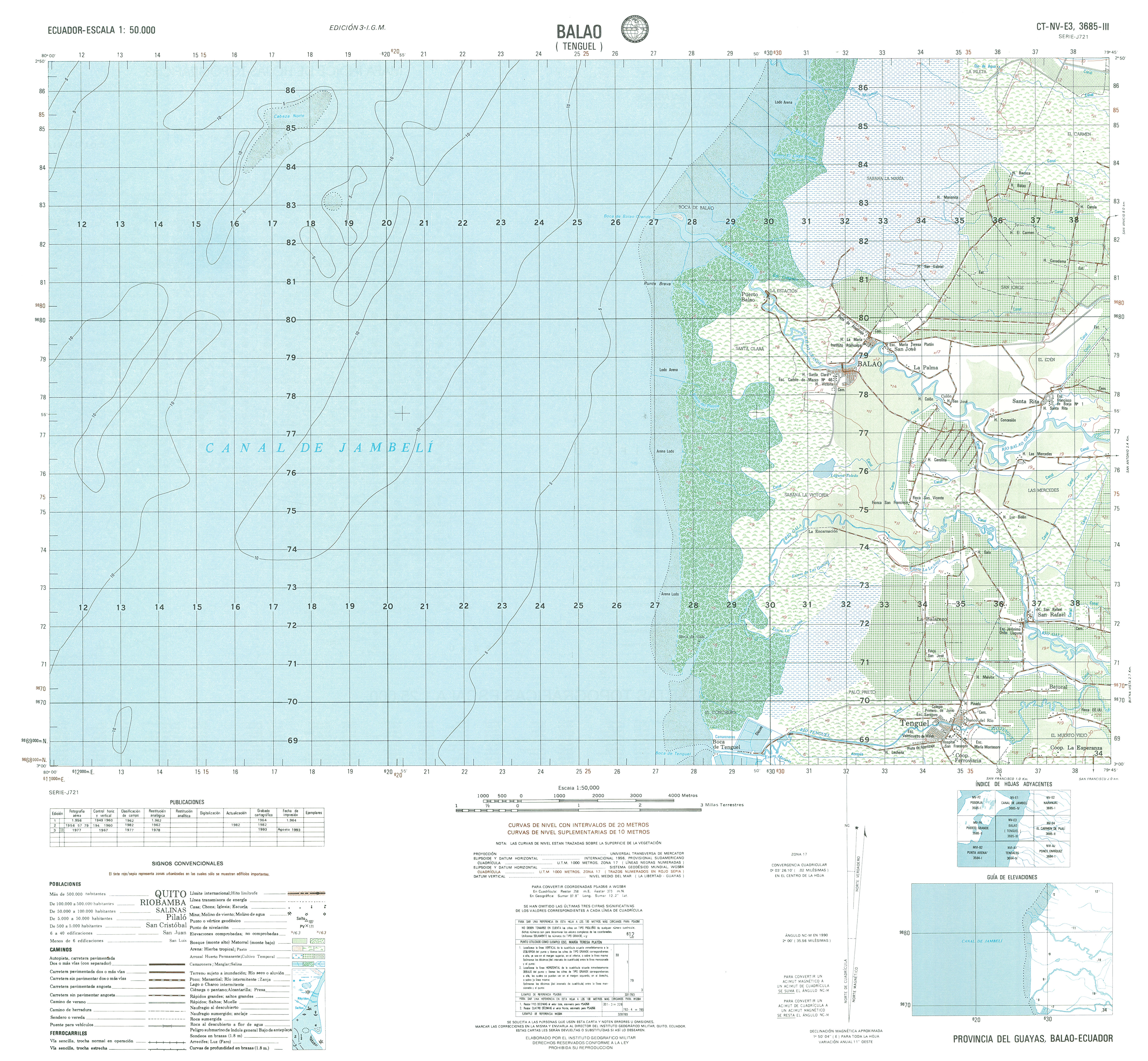
- Balao (topographic) Sheet 3685 III, 1:50,000 (3.7MB)
- Balsas (topographic) Sheet 3587 IV, 1:50,000 1996 (8.6MB) [PDF]
- Balzar (topographic) Sheet 3689 IV, 1:50,000 1994 (7.7MB) [PDF]
- Banos (topographic) Sheet 3989 IV, 1:50,000 2000 (8.4MB) [PDF]
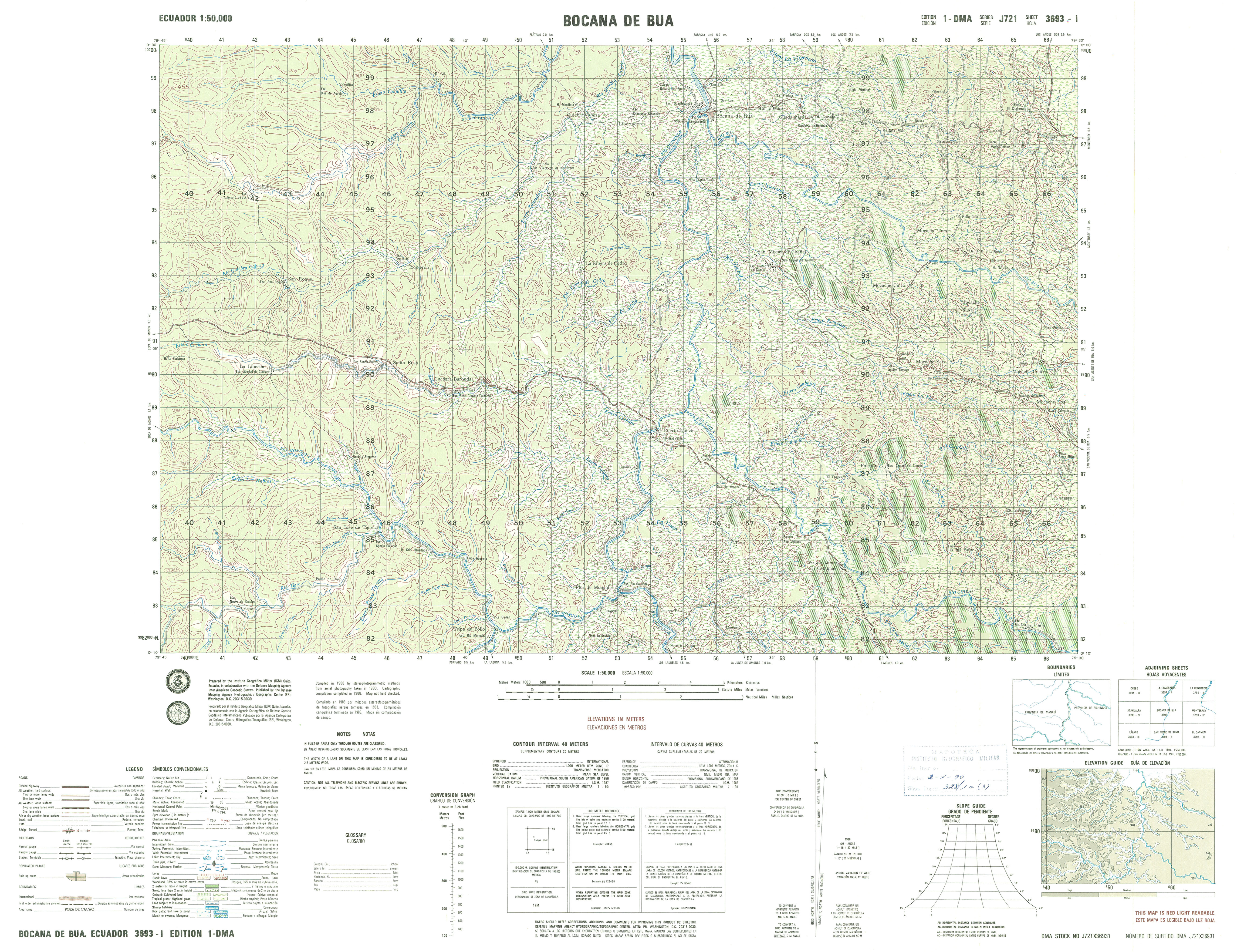
- Bocana Del Bua (topographic) Sheet 3693 I, 1:50,000 (4.8MB)
- Borbon (topographic) Sheet 3897 III, 1:50,000 (3.8MB)
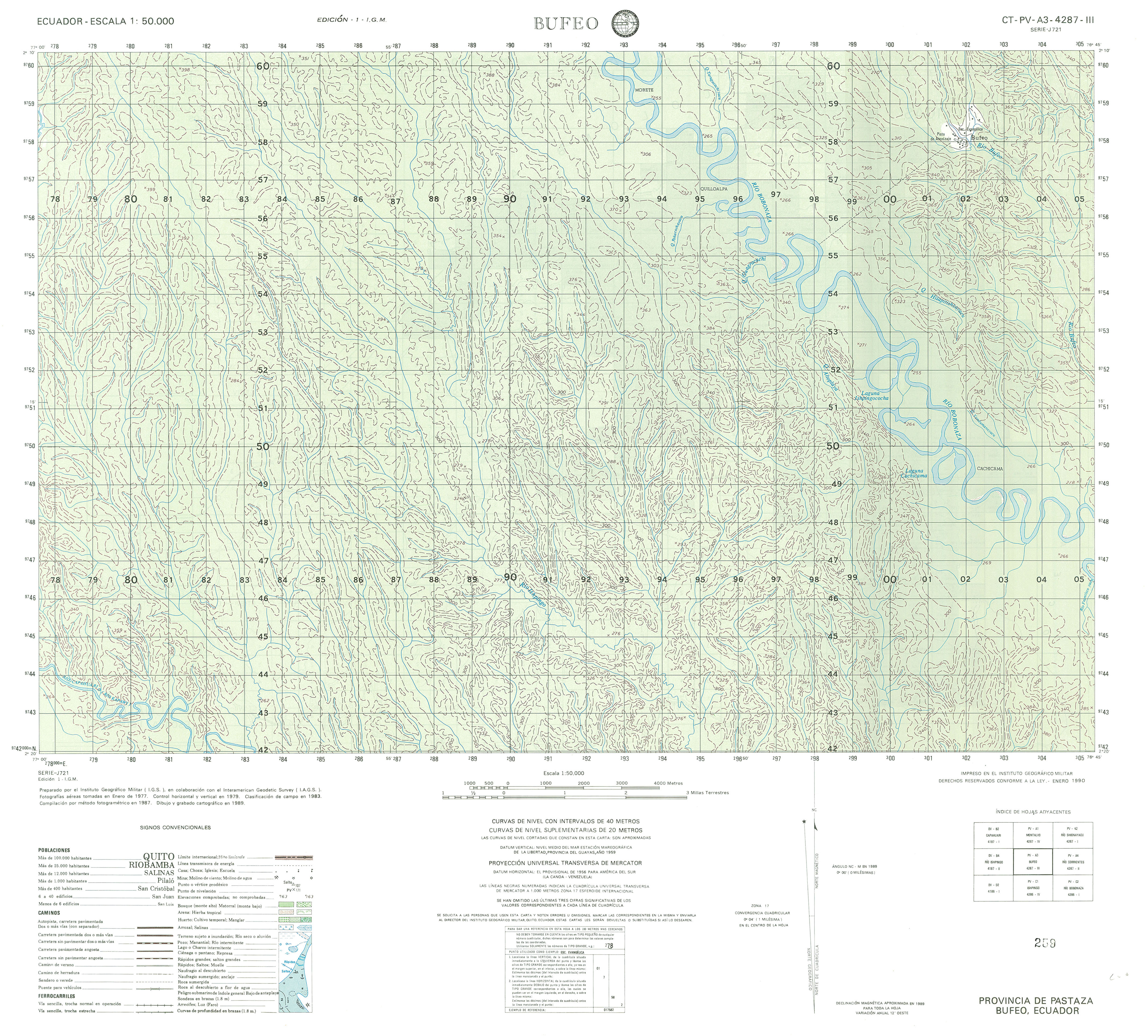
- Bufeo (topographic) Sheet 4287 III, 1:50,000 (3.4MB)
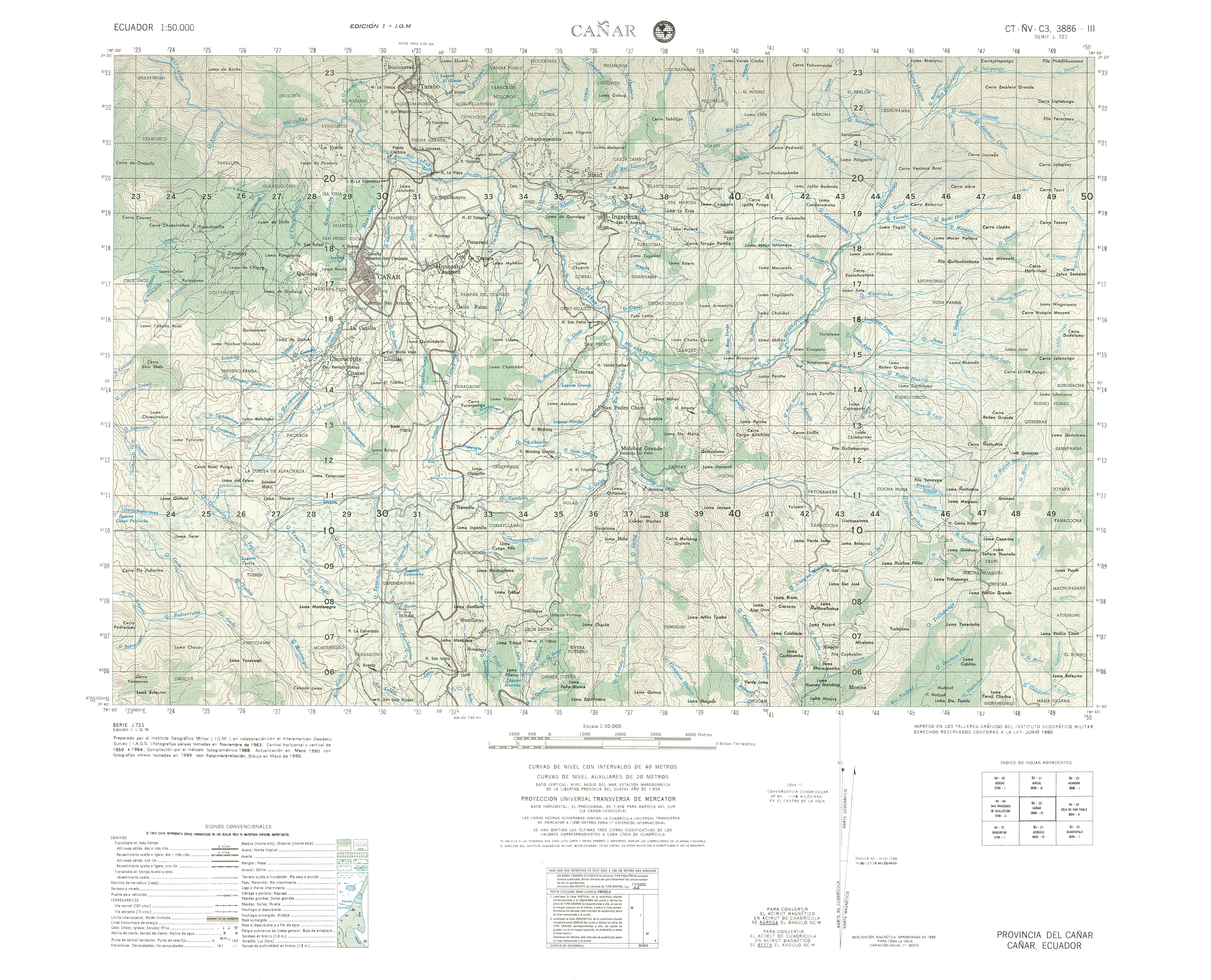
- Cañar (topographic) Sheet 3886 III, 1:50,000 (3.7MB)
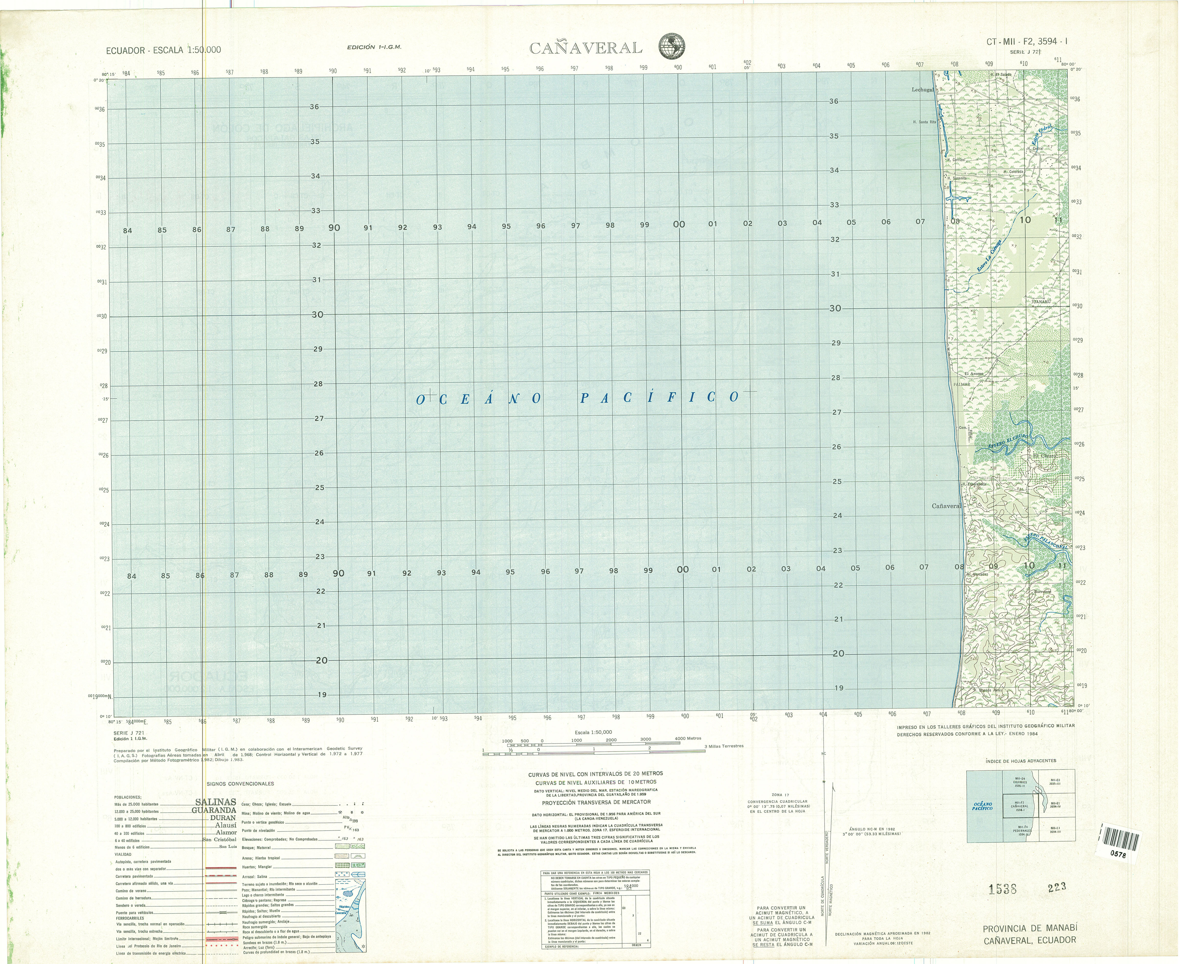
- Cañaveral (topographic) Sheet 3594 I, 1:50,000 (2.7MB)
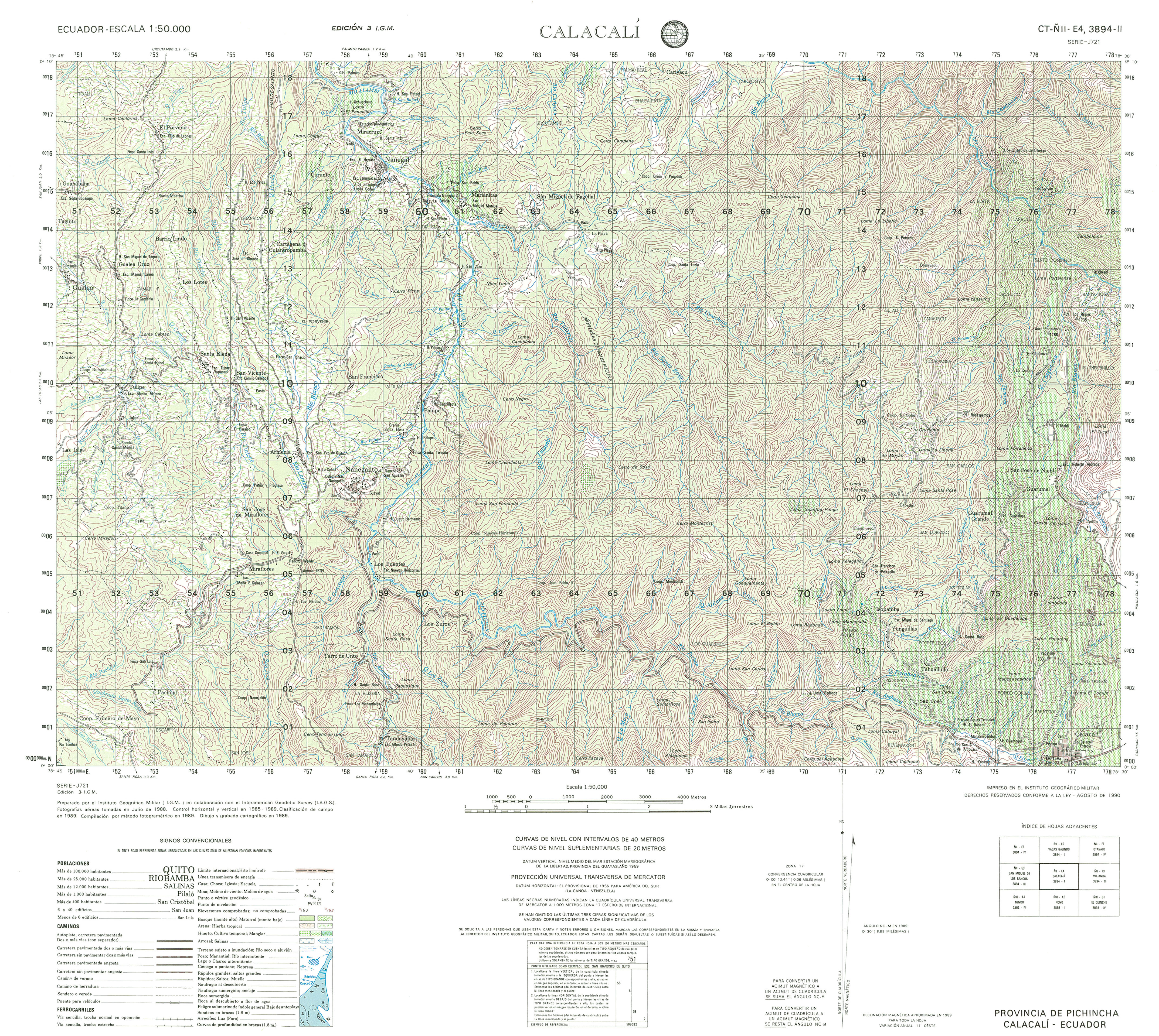
- Calacali (topographic) Sheet 3894 II, 1:50,000 (4.7MB)
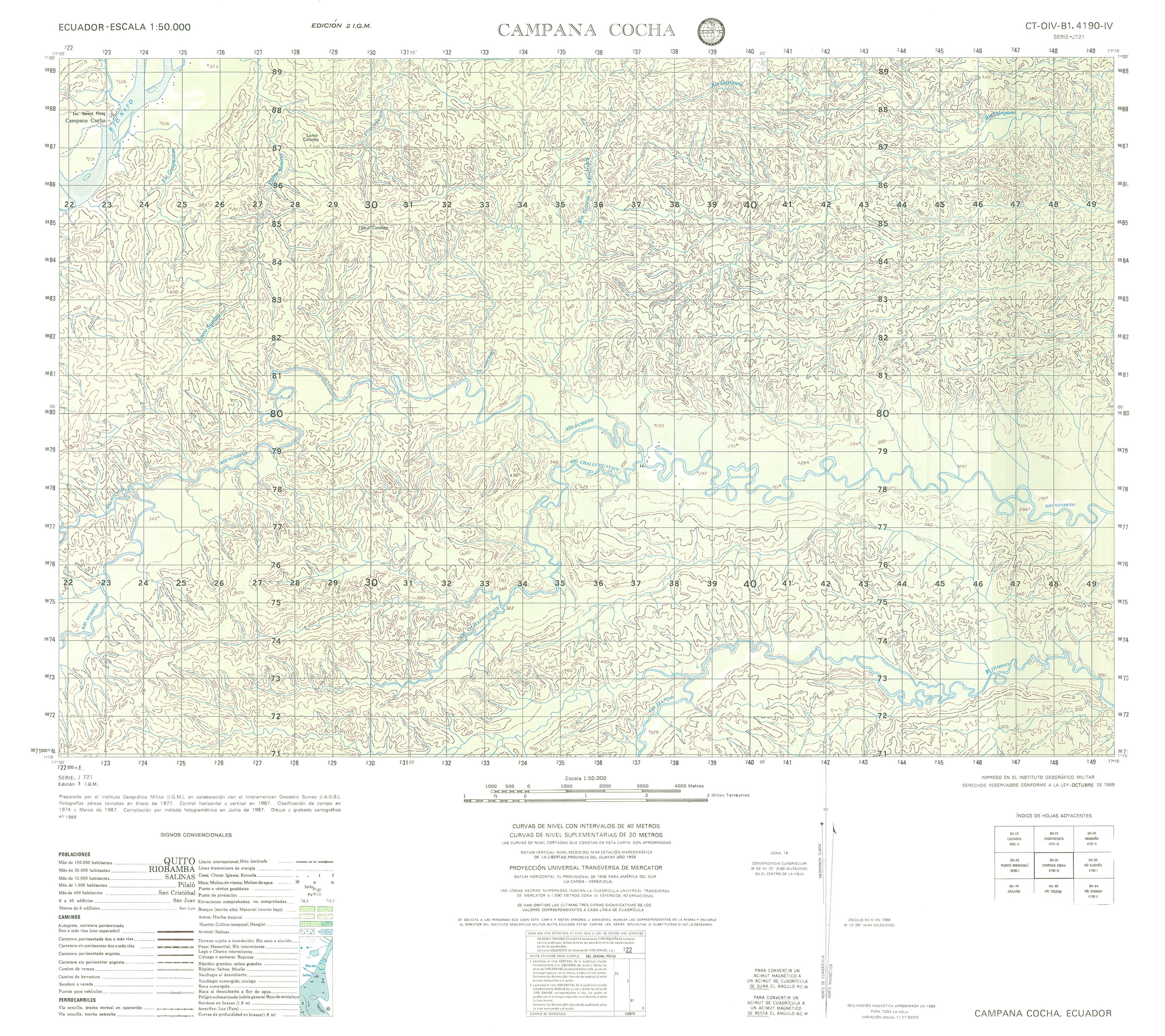
- Campana Cocha (topographic) Sheet 4190 IV, 1:50,000 (3.6MB)
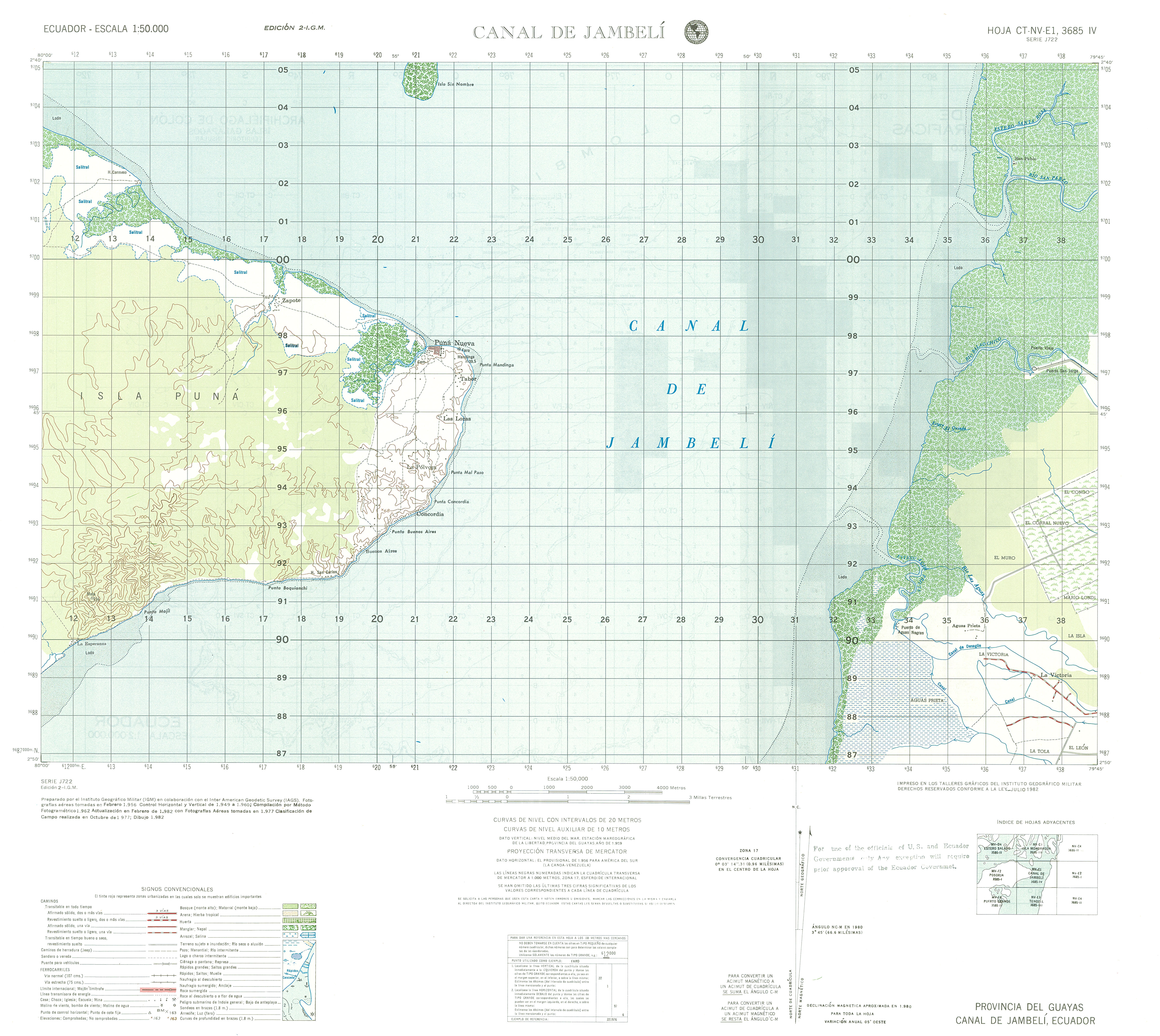
- Canal de Jambelli (topographic) Sheet 3685 IV, 1:50,000 (3.3MB)
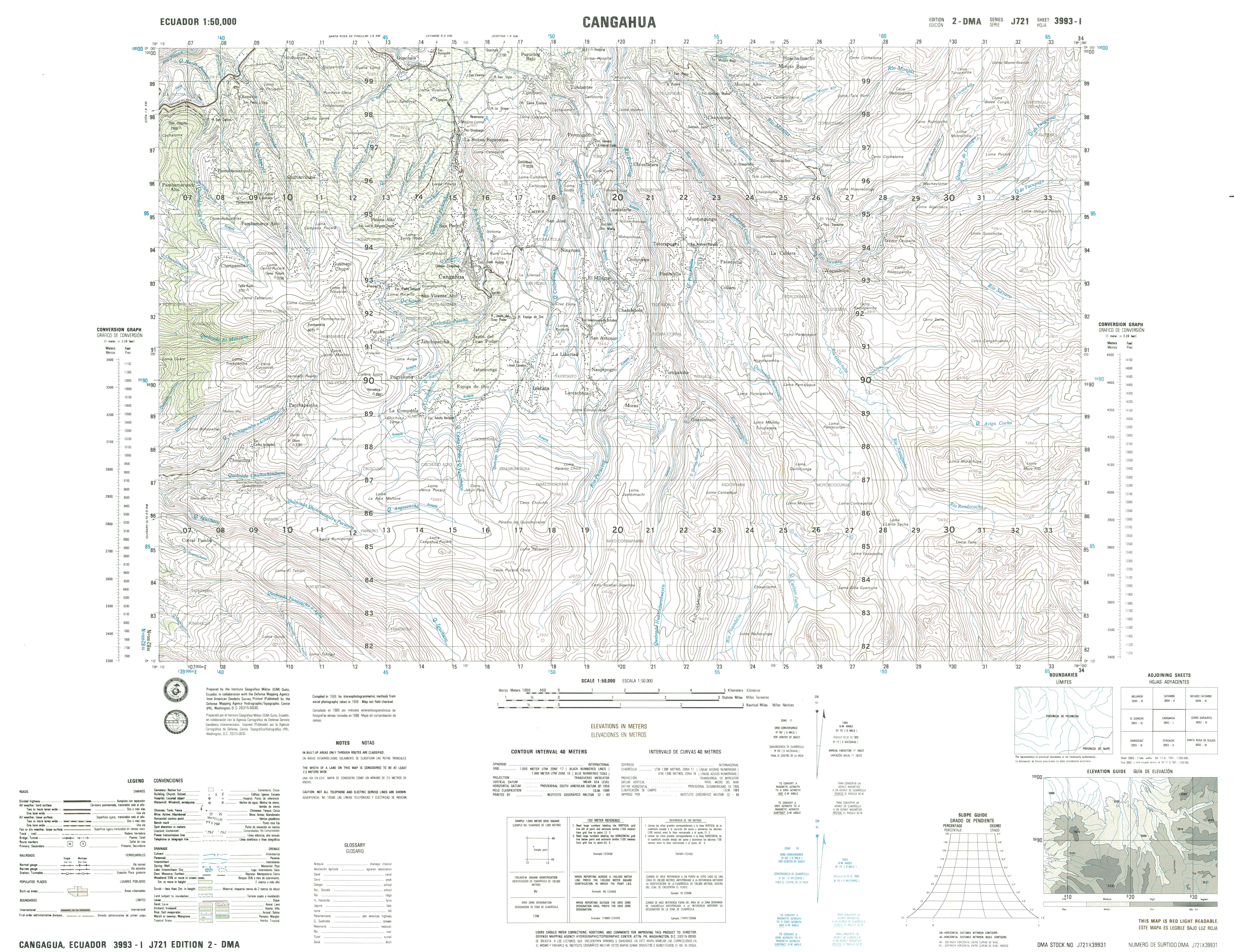
- Cangahua (topographic) Sheet 3993 I, 1:50,000 (4.3MB)
- Cangaime (topographic) Sheet 4087 II, 1:50,000 (3.8MB)
- Canoa (topographic) Sheet 3592 IV, 1:50,000 (4.9MB)
- Capahuari (topographic) Sheet 4187 I, 1:50,000 (4.2MB)
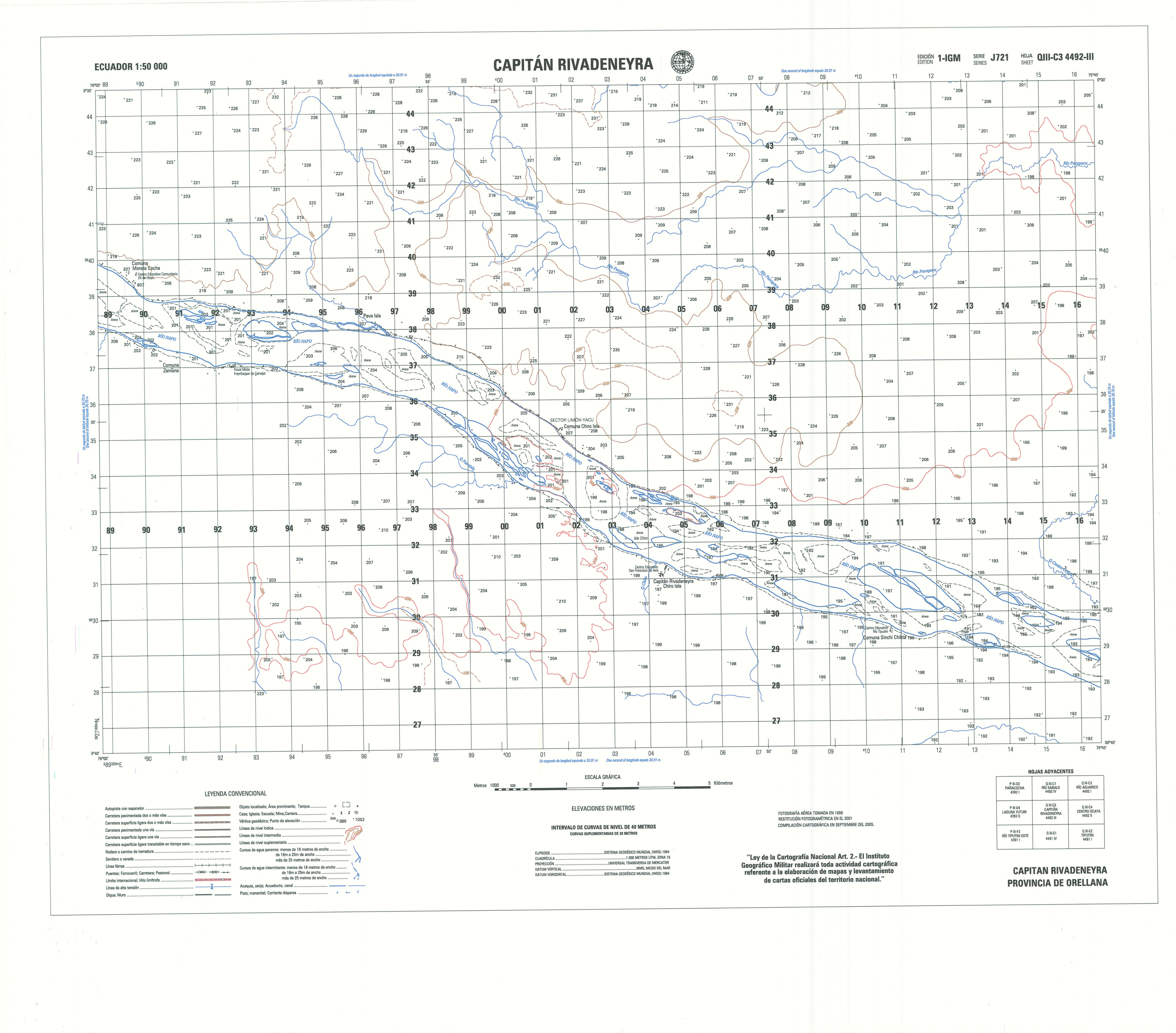
- Capitan Rivadeneira (topographic) Sheet 4492 III, 1:50,000 (1.5MB)
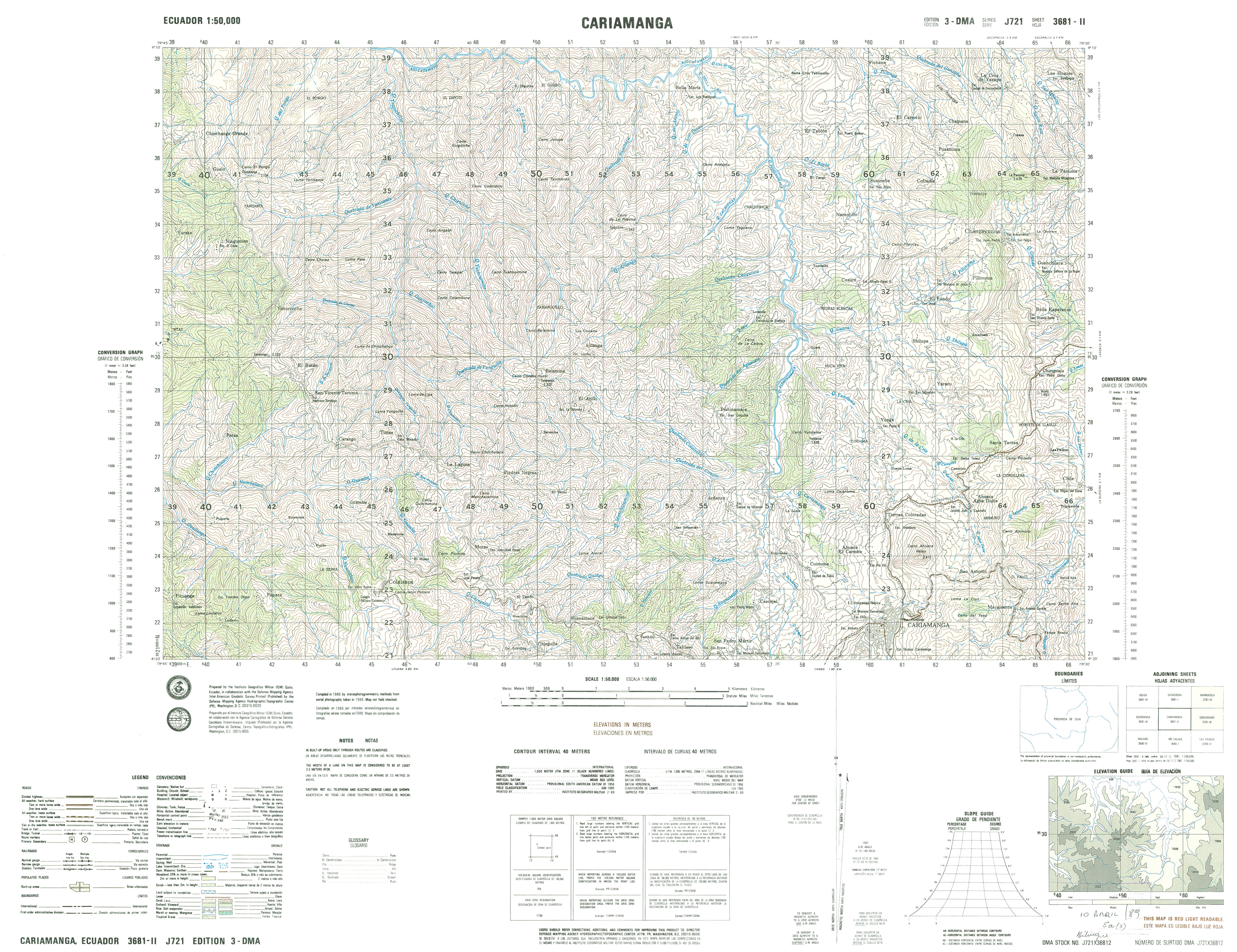
- Cariamanga (topographic) Sheet 3681 II, 1:50,000 (4.8MB)
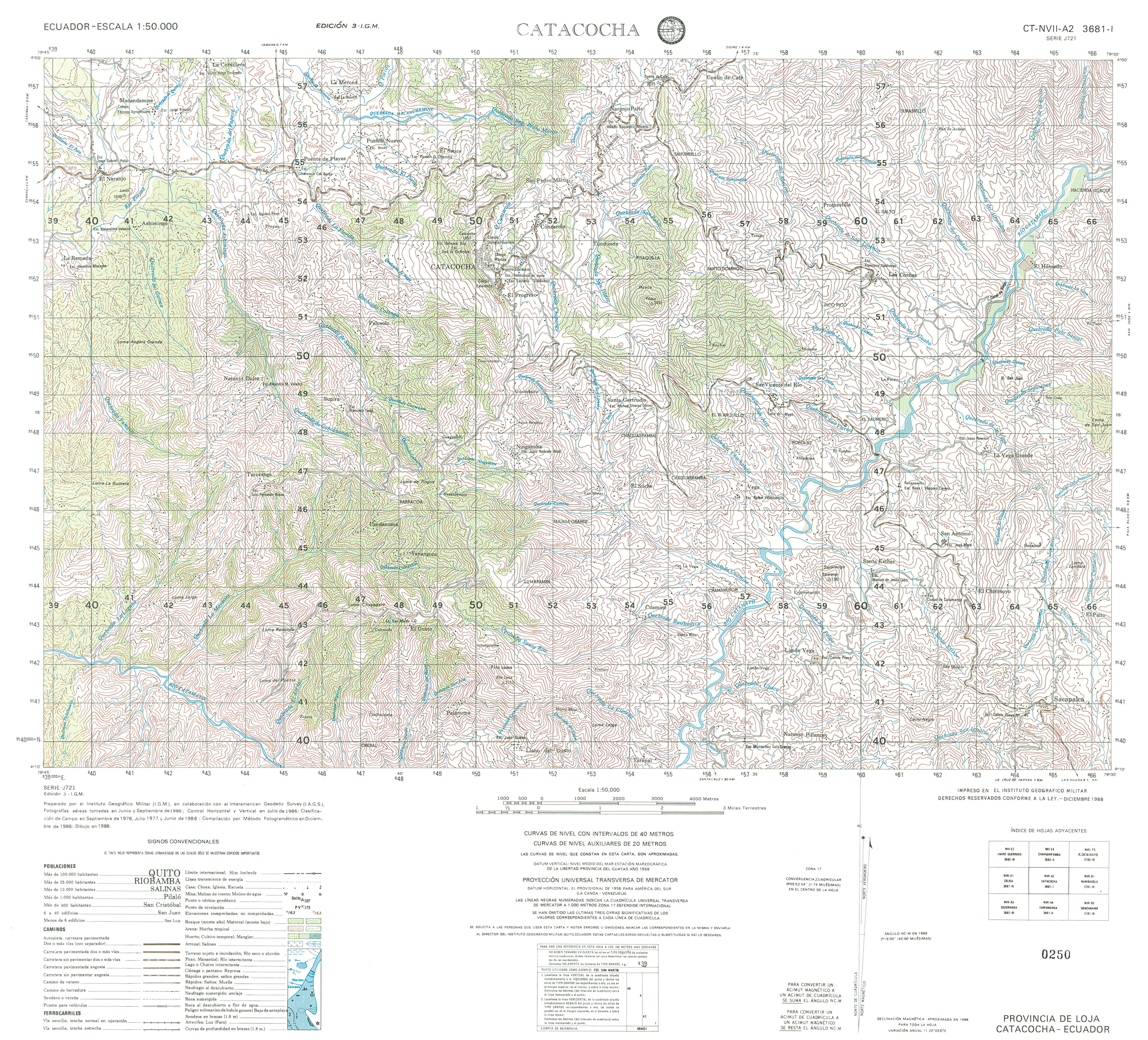
- Catacocha (topographic) Sheet 3681 I, 1:50,000 (4.5MB)
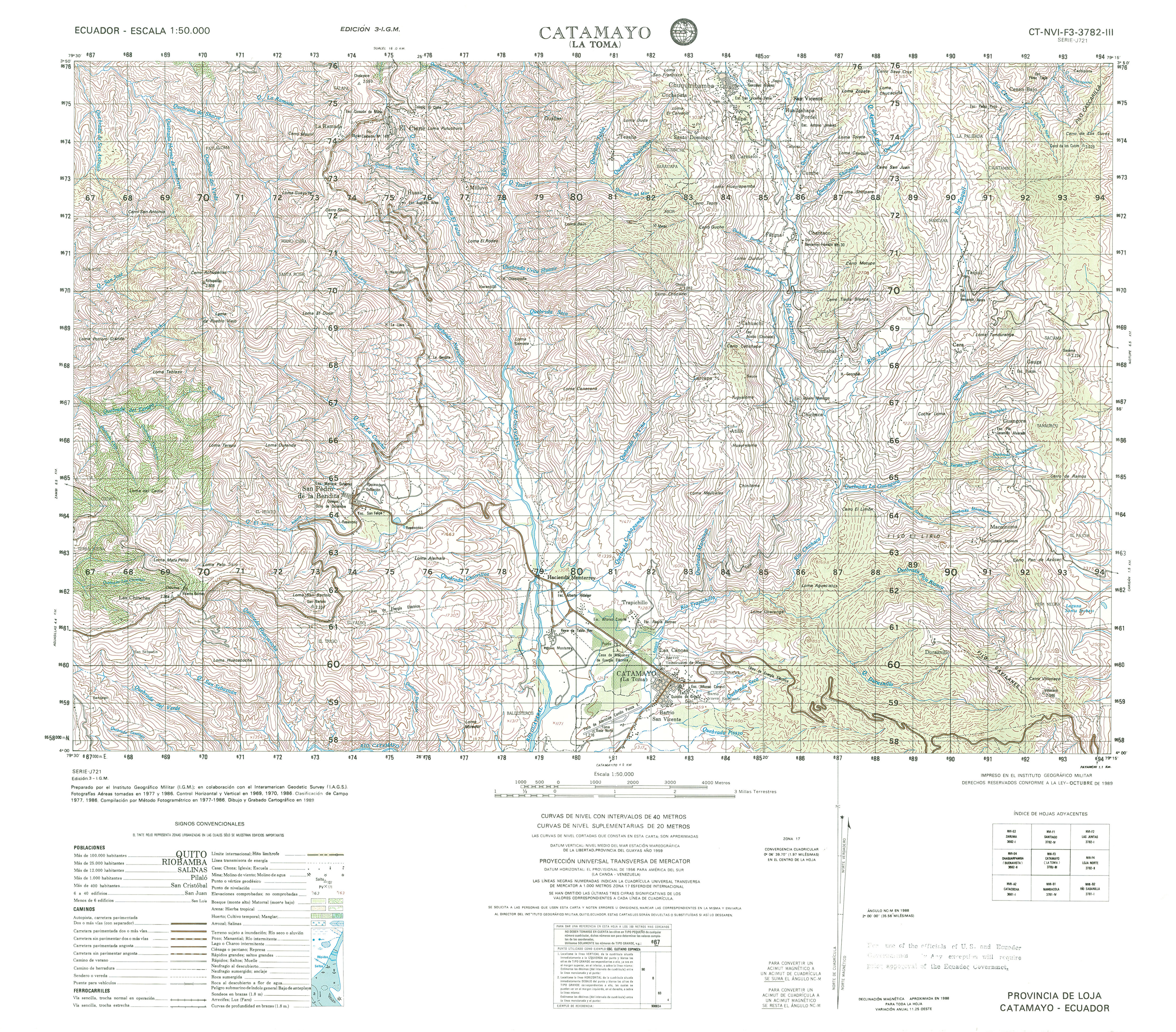
- Catamayo (topographic) Sheet 3782 III, 1:50,000 (4.6MB)
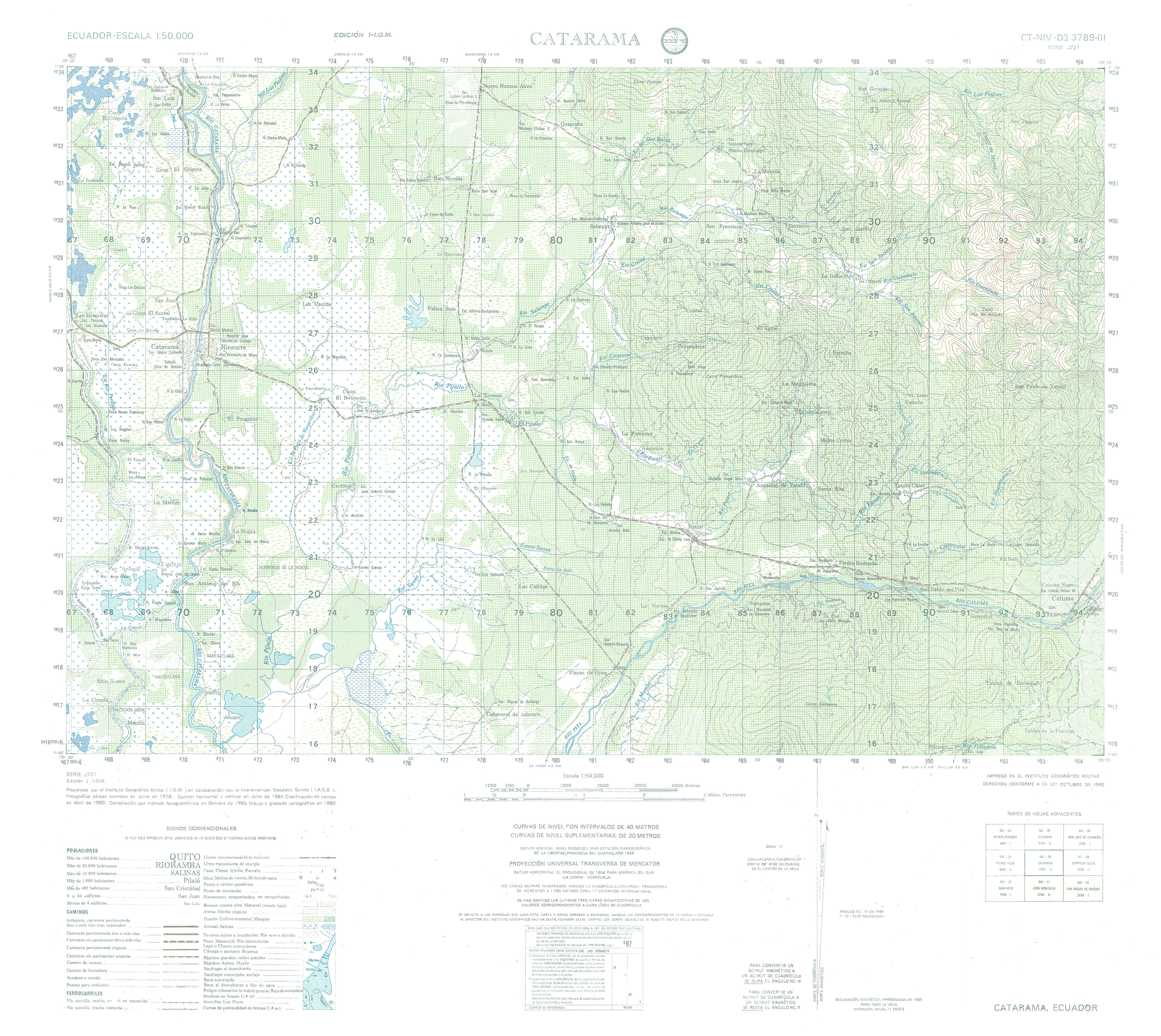
- Catarama (topographic) Sheet 3789 III, 1:50,000 (3.9MB)
- Cayambe (topographic) Sheet 3994 II, 1:50,000 (4.8MB)
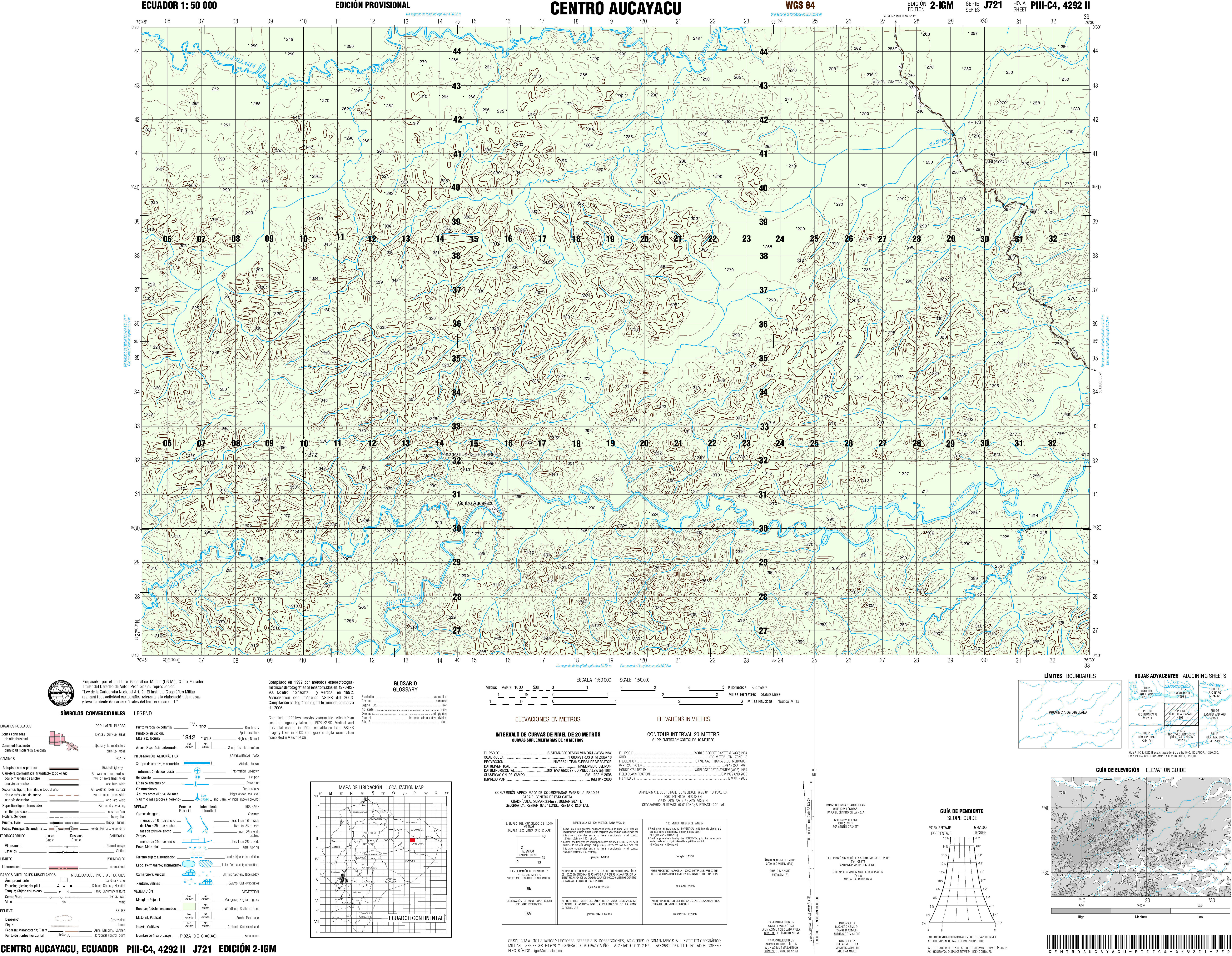
- Centro Aucayacu (topographic) Sheet 4292 II, 1:50,000 (8.0MB)
- Centro Shaime (topographic) Sheet 3881 II, 1:50,000 1992 (7.9MB) [PDF]
- Cerecita (topographic) Sheet 3587 III, 1:50,000 1996 (7.9MB) [PDF]
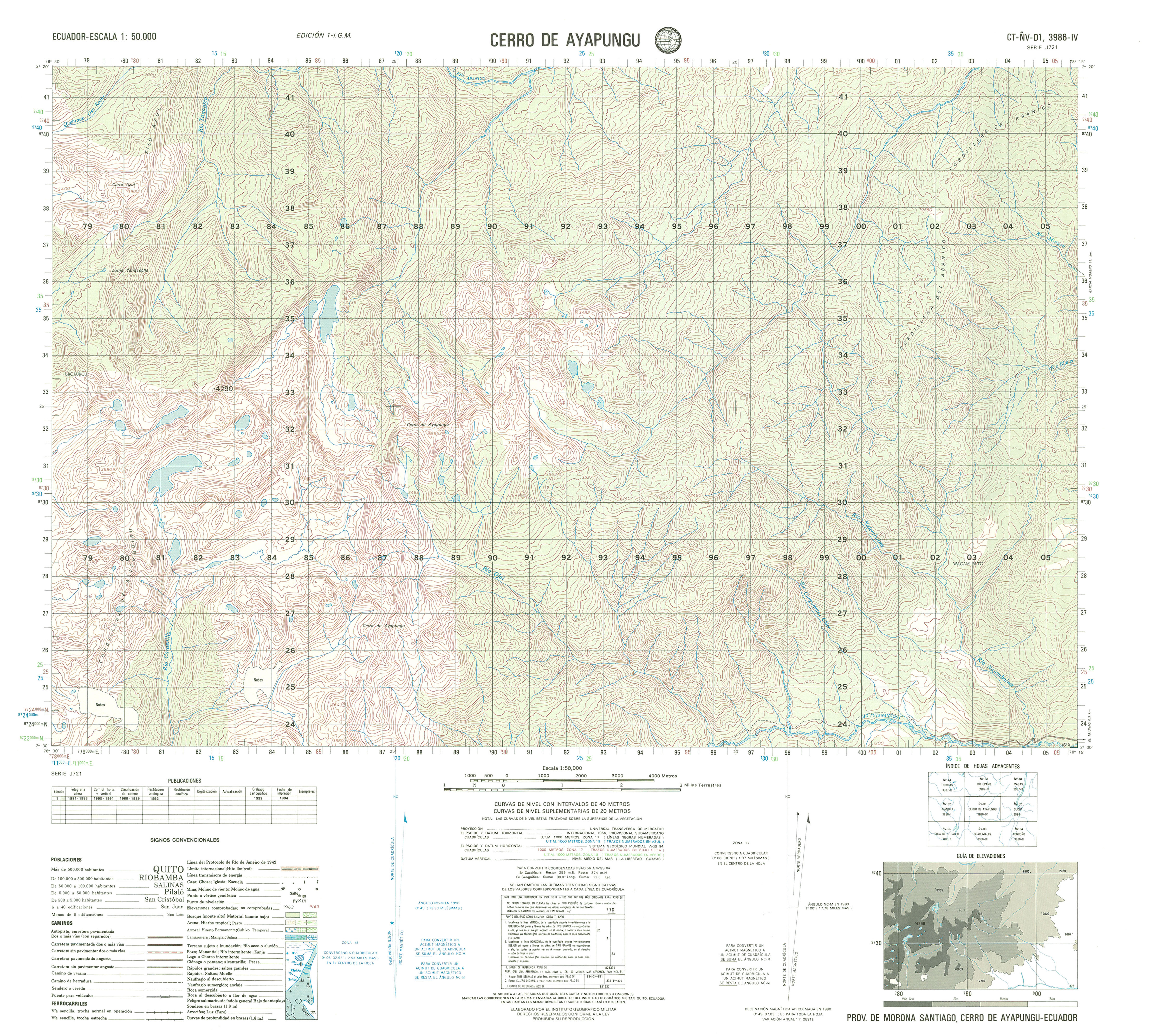
- Cerro de Ayapungu (topographic) Sheet 3986 IV, 1:50,000 (4.2MB)
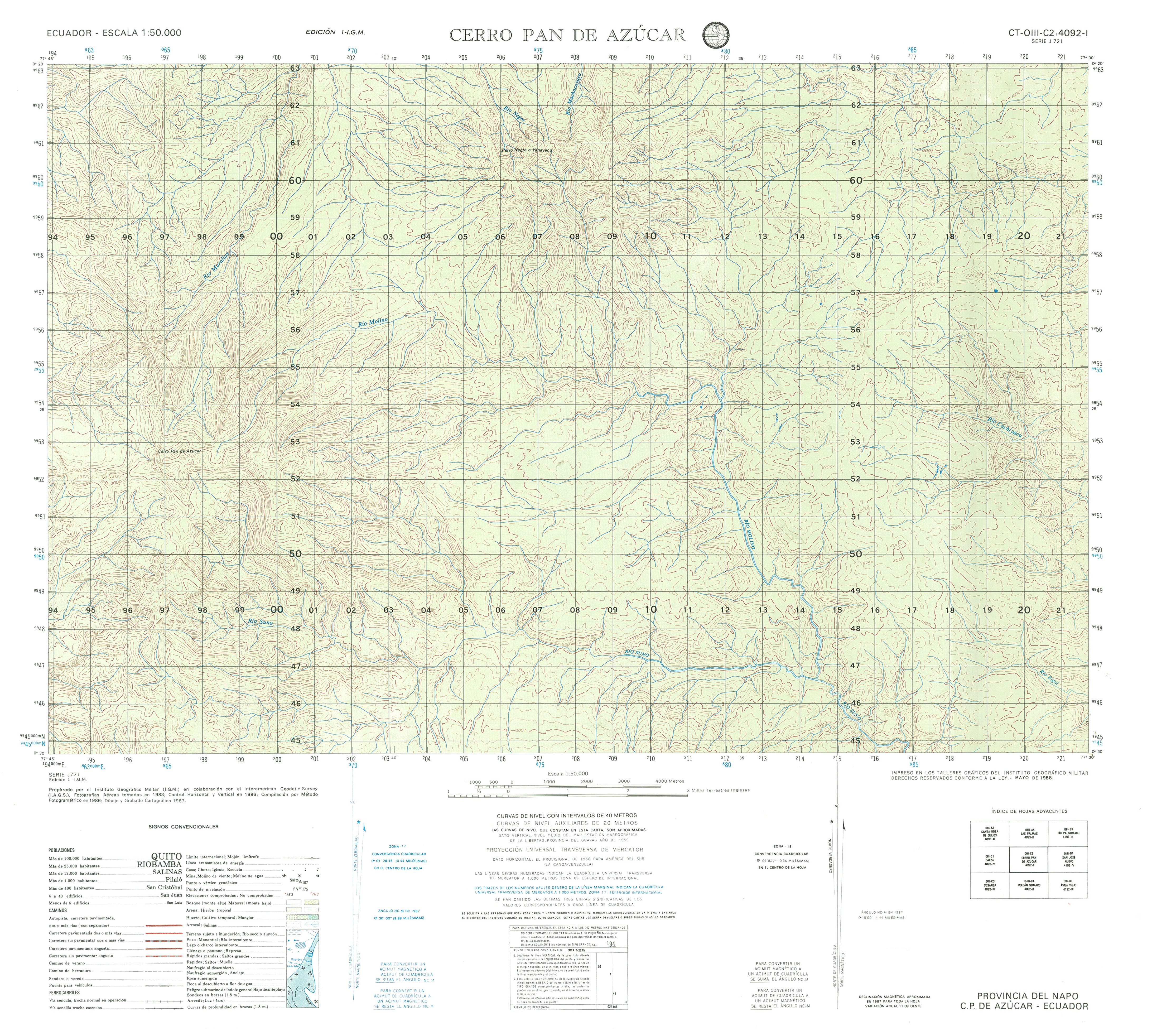
- Cerro de Azucar (topographic) Sheet 4092 I, 1:50,000 (3.9MB)
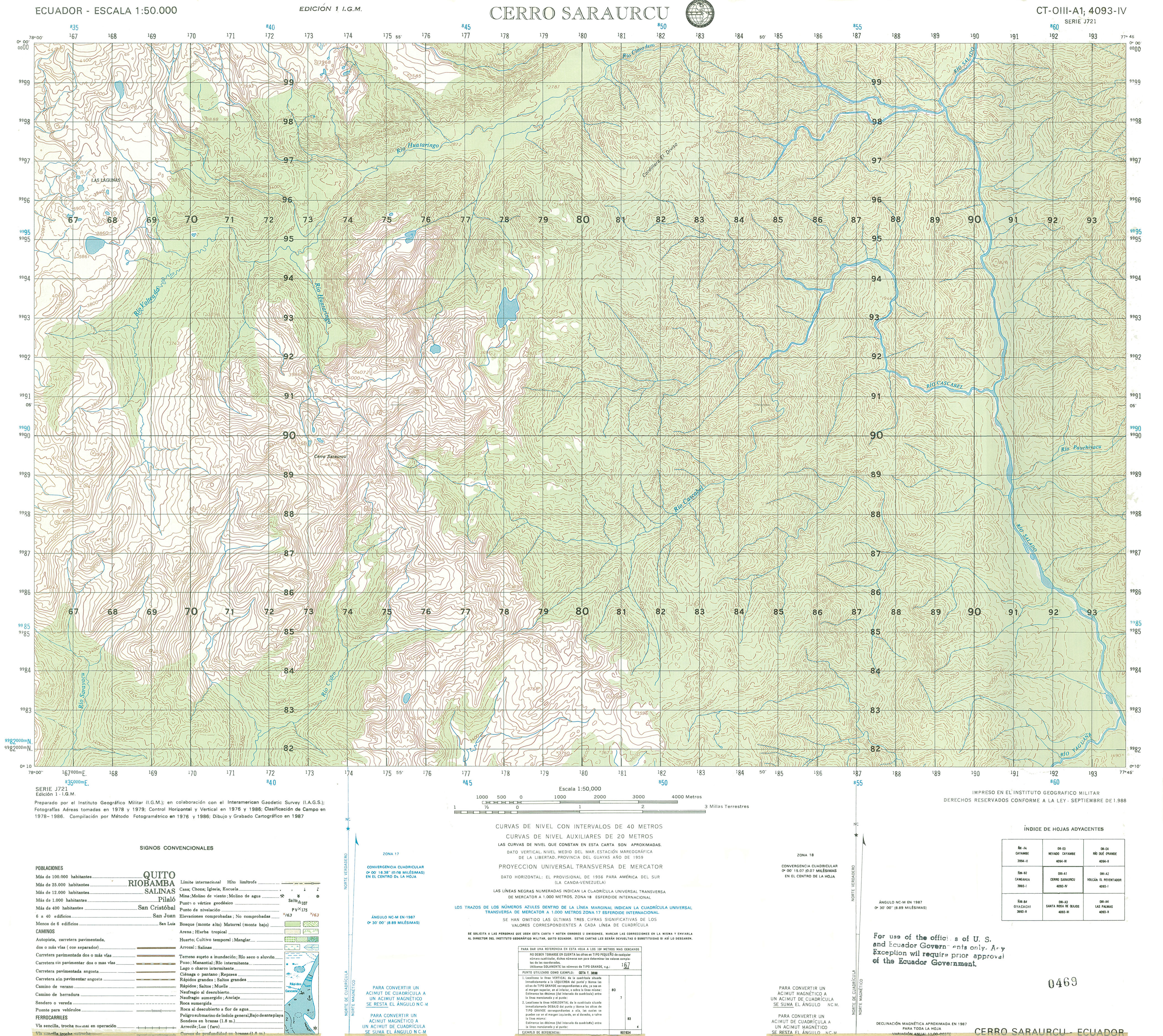
- Cerro Saraurcu (topographic) Sheet 4092 I, 1:50,000 (3.9MB)
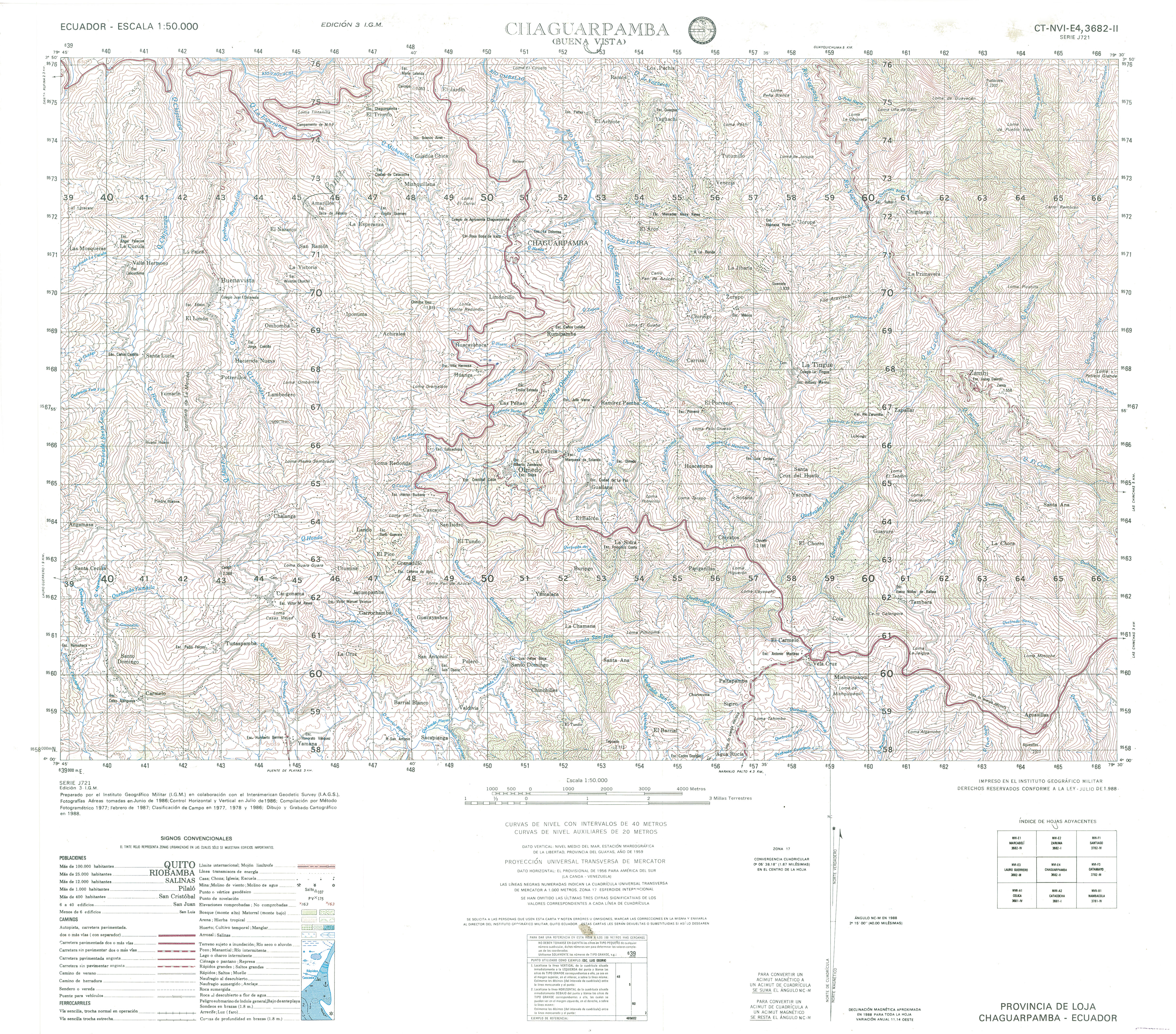
- Chaguarpamba (topographic) Sheet 3682 II, 1:50,000 (5.7MB)
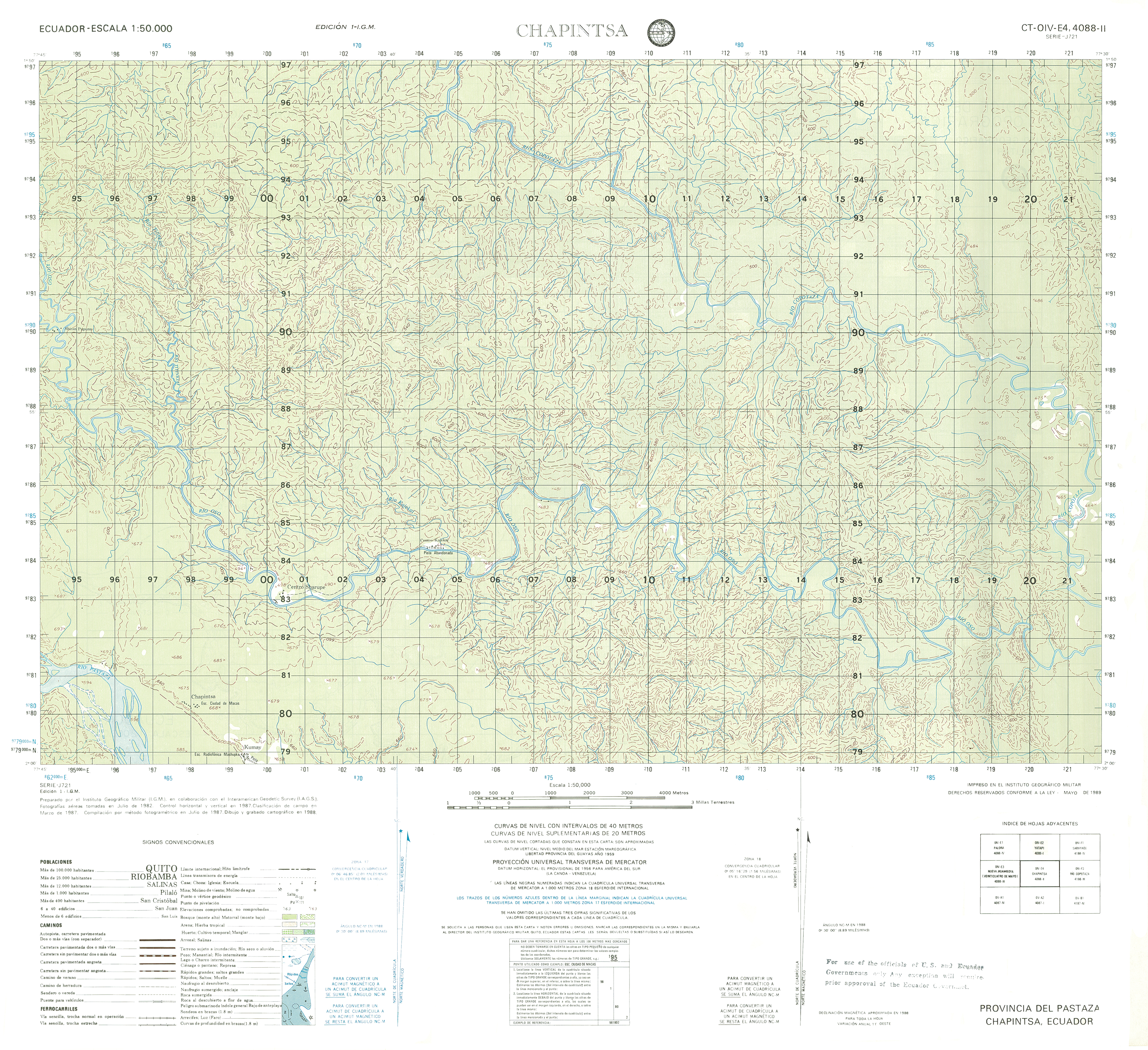
- Chapintsa (topographic) Sheet 4088 II, 1:50,000 (14.7MB)
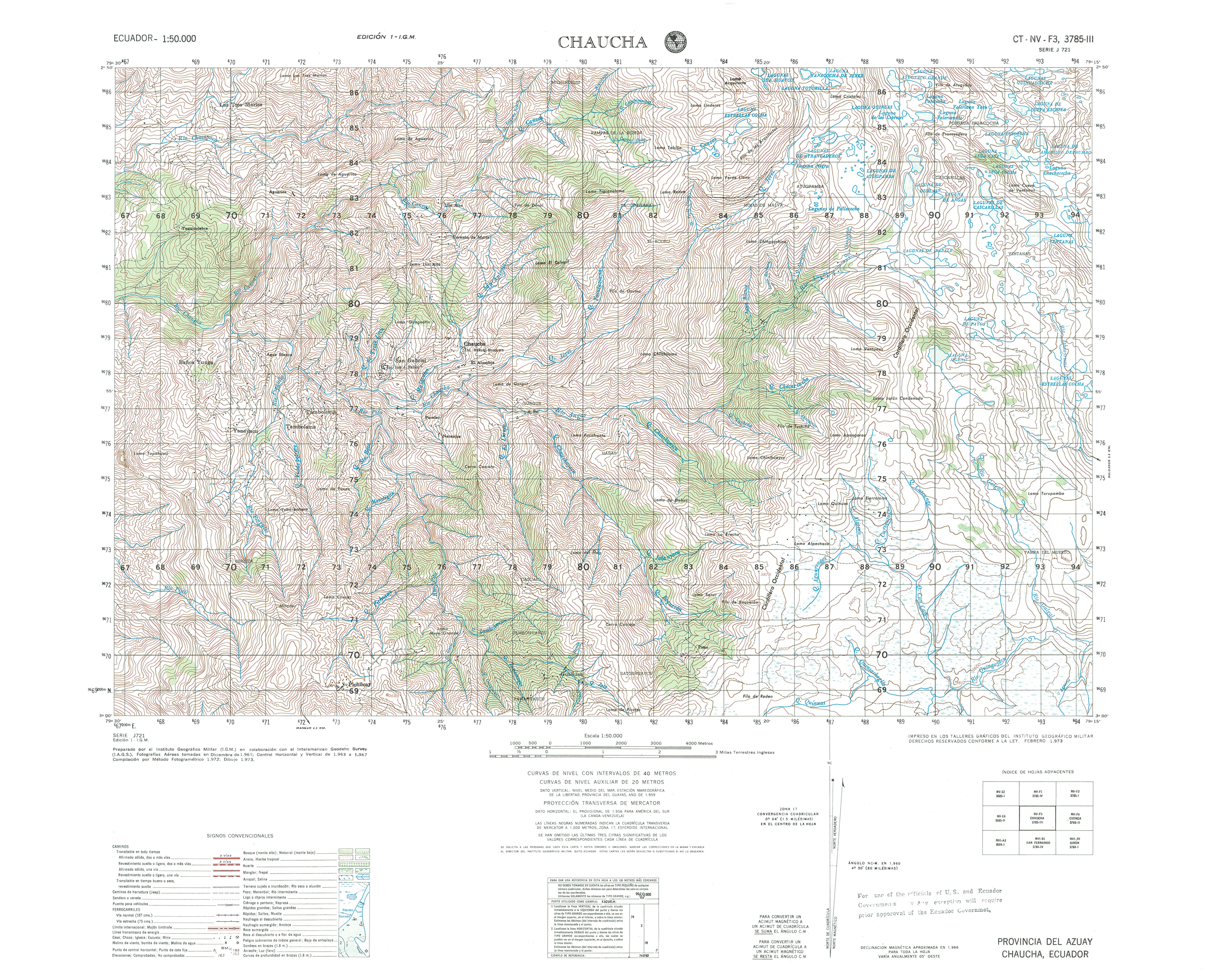
- Chaucha (topographic) Sheet 3785 III, 1:50,000 (4.5MB)
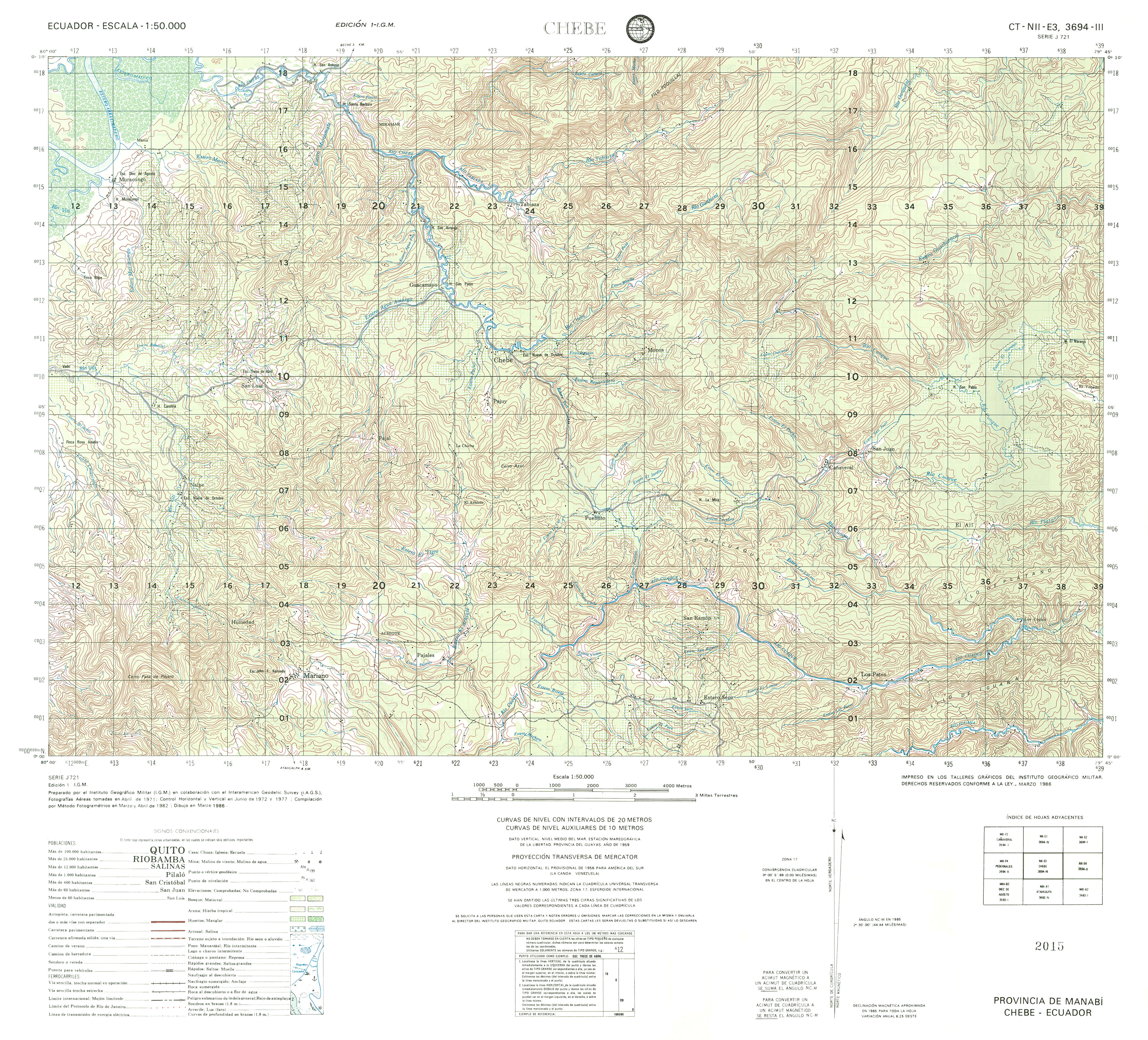
- Chebe (topographic) Sheet 3694 III, 1:50,000 (4.6MB)
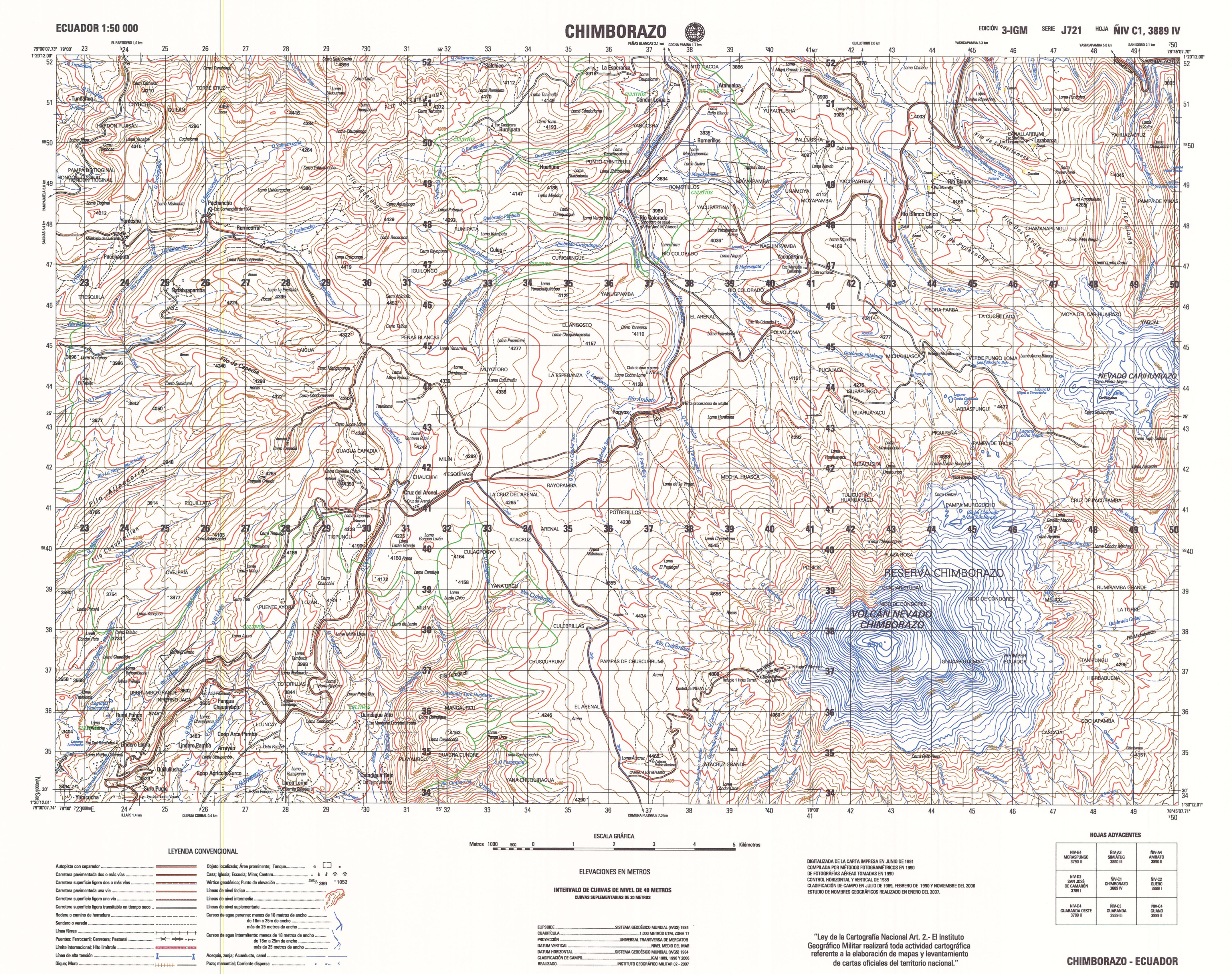
- Chiborazo (topographic) Sheet 3889 IV, 1:50,000 (3.8MB)
- Chigauza (topographic) Sheet 4087 IV, 1:50,000 1991 (8.4MB) [PDF]
- Chiguinda (topographic) Sheet 3884 II, 1:50,000 1997 (8.3MB) [PDF]
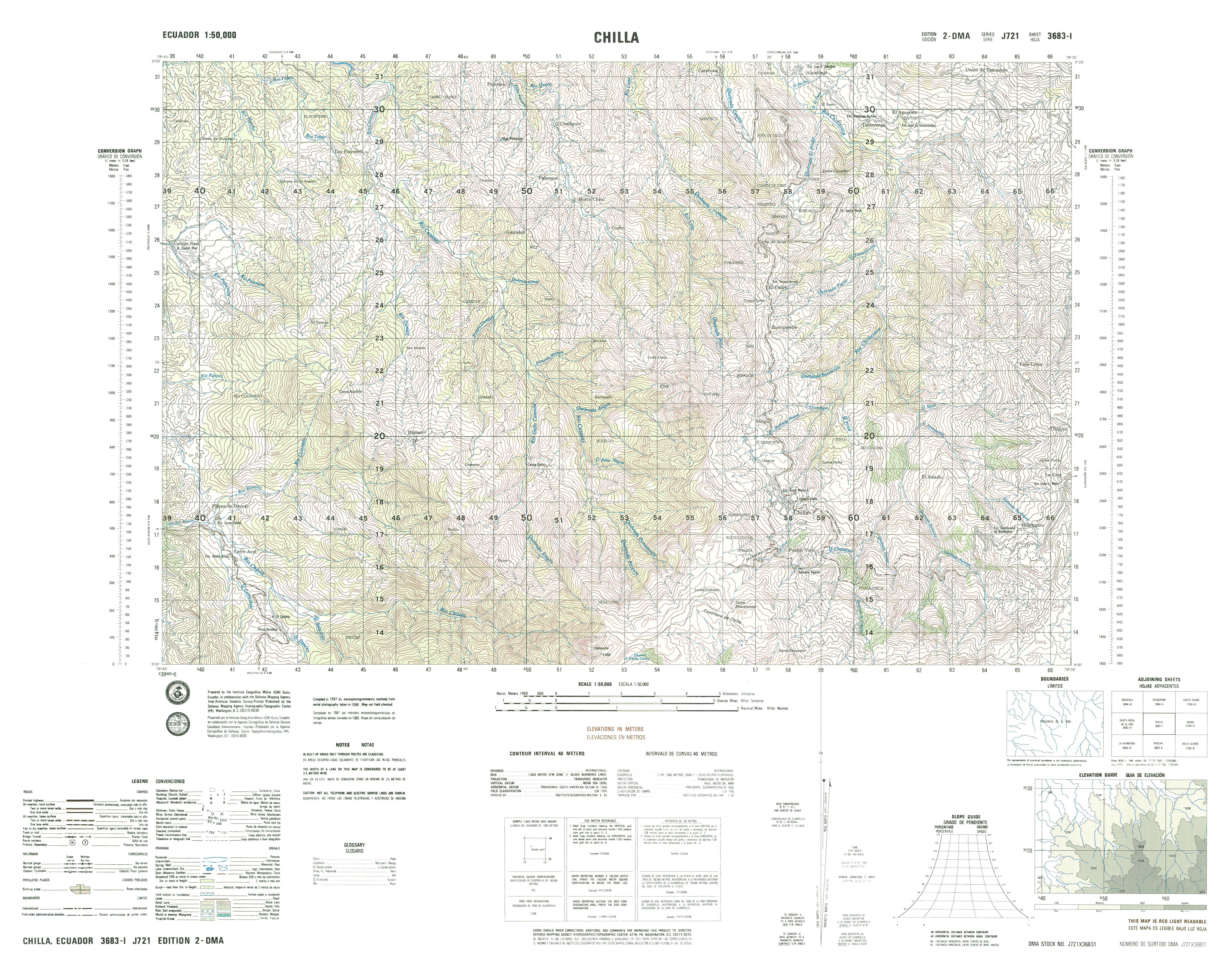
- Chilla (topographic) Sheet 3683 I, 1:50,000 (8.4MB)
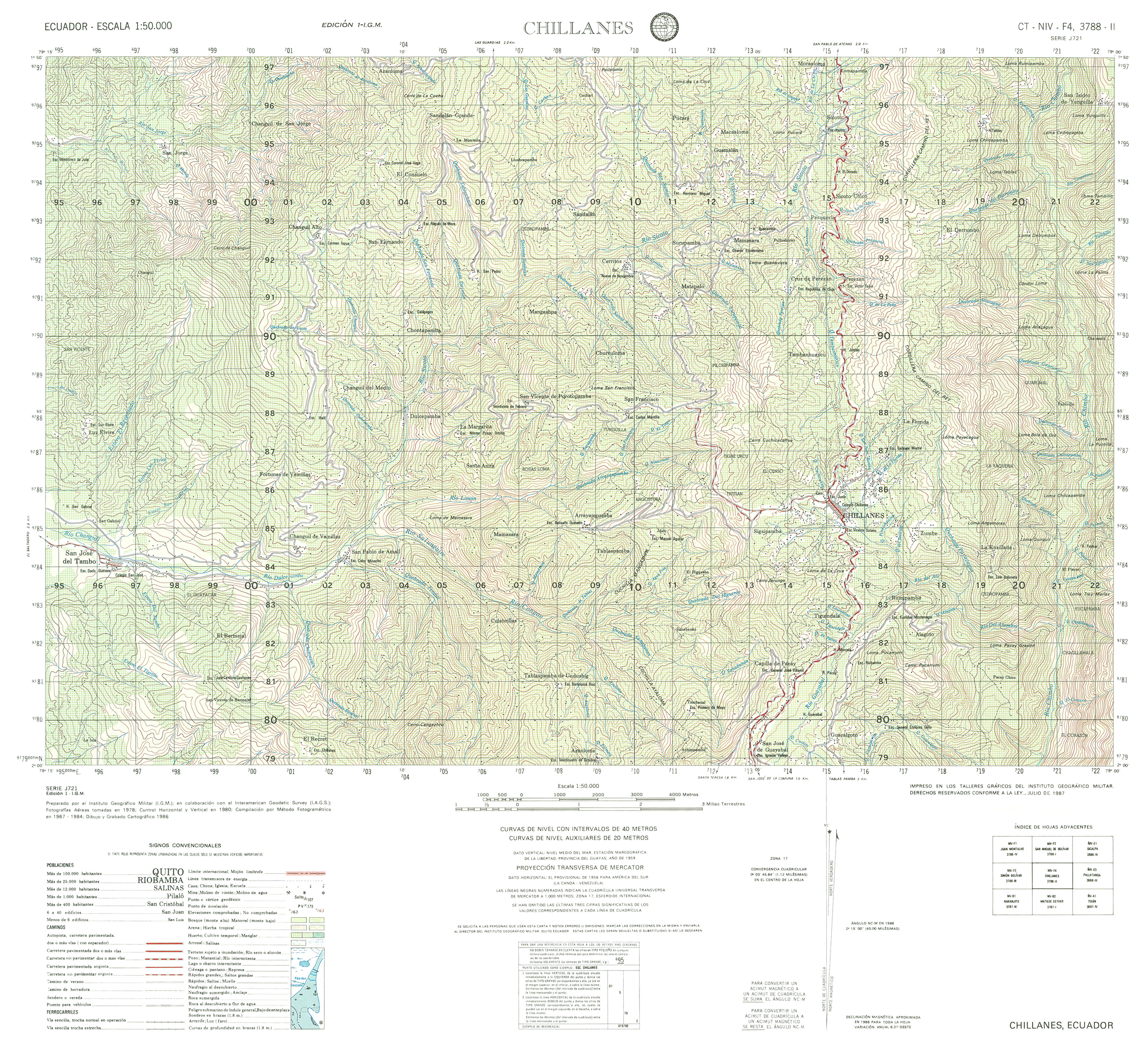
- Chillanes (topographic) Sheet 3788 II, 1:50,000 (4.4MB)
- Chinca (topographic) Sheet 3996 II, 1:50,000 (4.2MB)
- Chiquintad (topographic) Sheet 3785 I, 1:50,000 (4.1MB)
- Chone (topographic) Sheet 3591 I, 1:50,000 (4.6MB)
- Chongon (topographic) Sheet 3587 II, 1:50,000 1995 (8.2MB) [PDF]
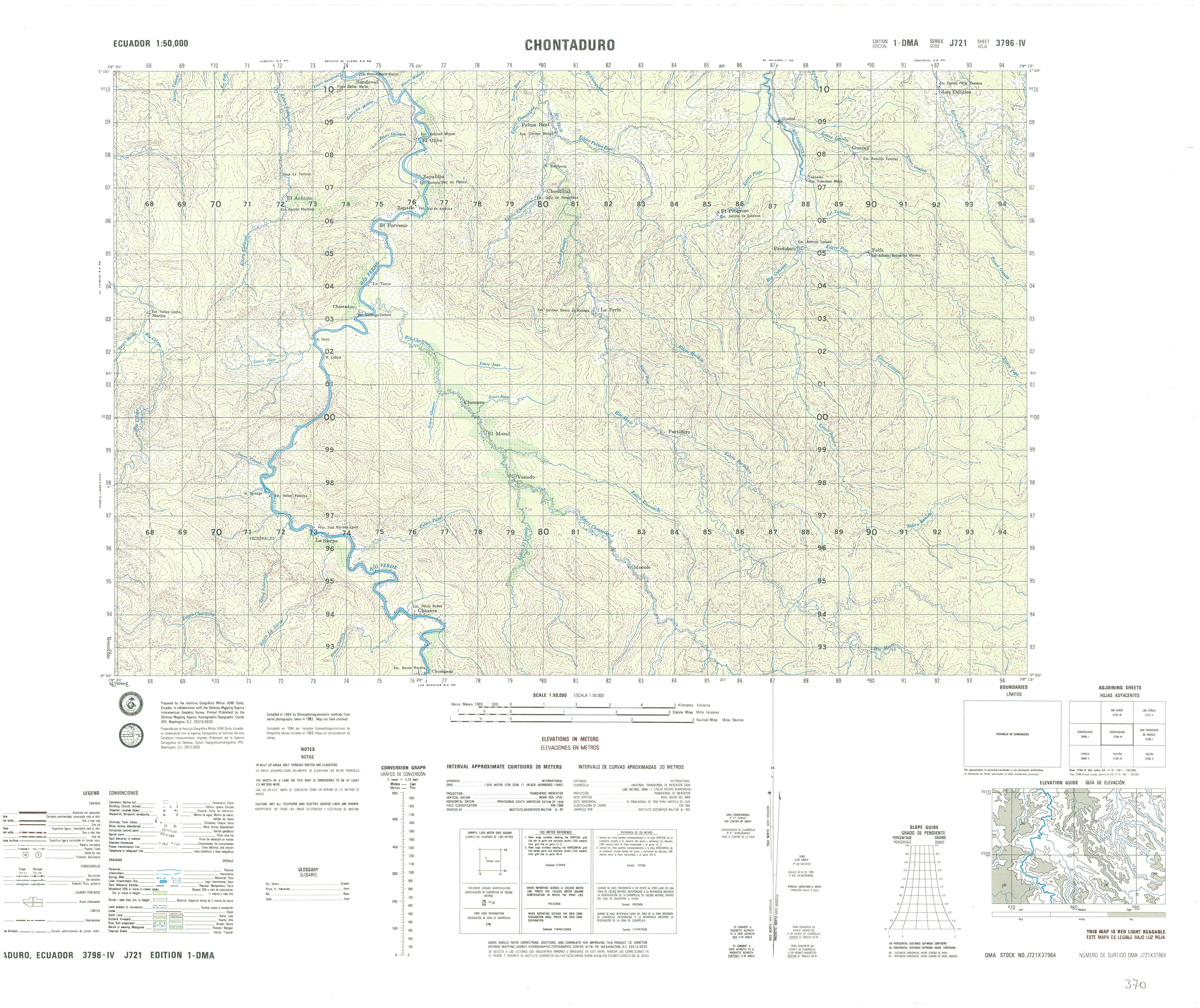
- Chontaduro (topographic) Sheet 3796 IV, 1:50,000 (4.2MB)
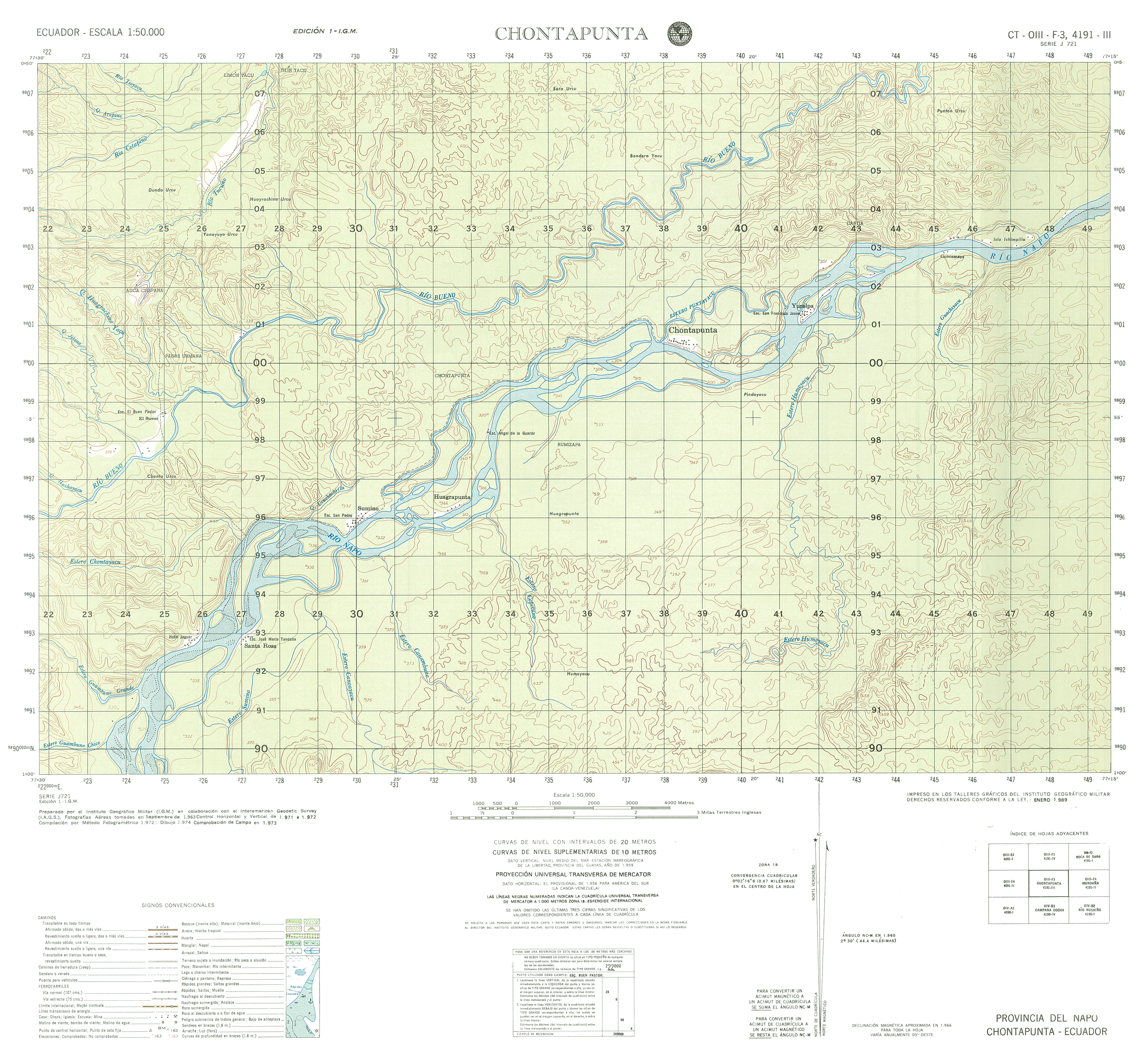
- Chontapunta (topographic) Sheet 4191 III, 1:50,000 (13.8MB)
- Cinco de Junio (topographic) Sheet 3896 IV, 1:50,000 (10.0MB)
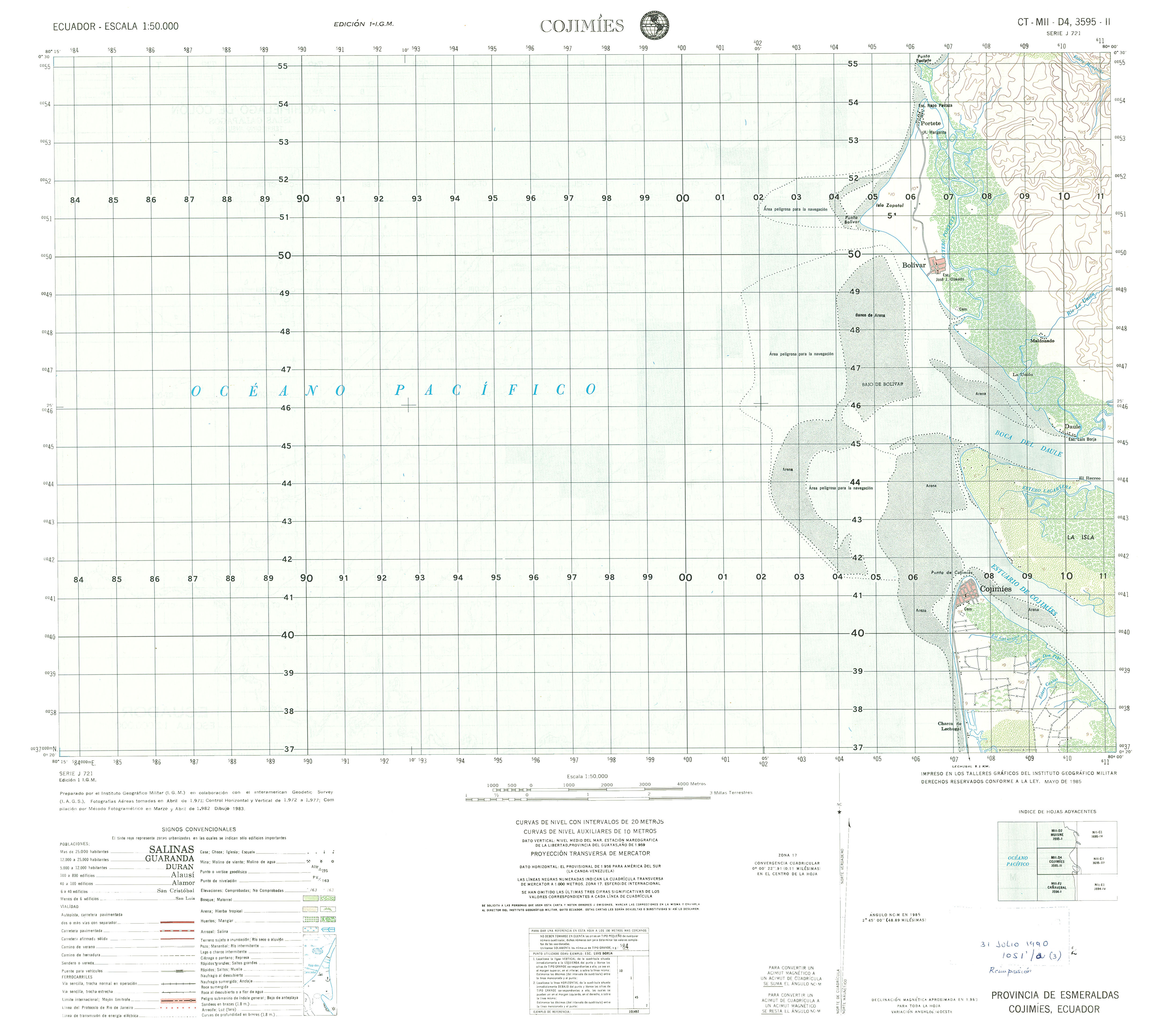
- Cojimies (topographic) Sheet 3596 II, 1:50,000 (1.8MB)
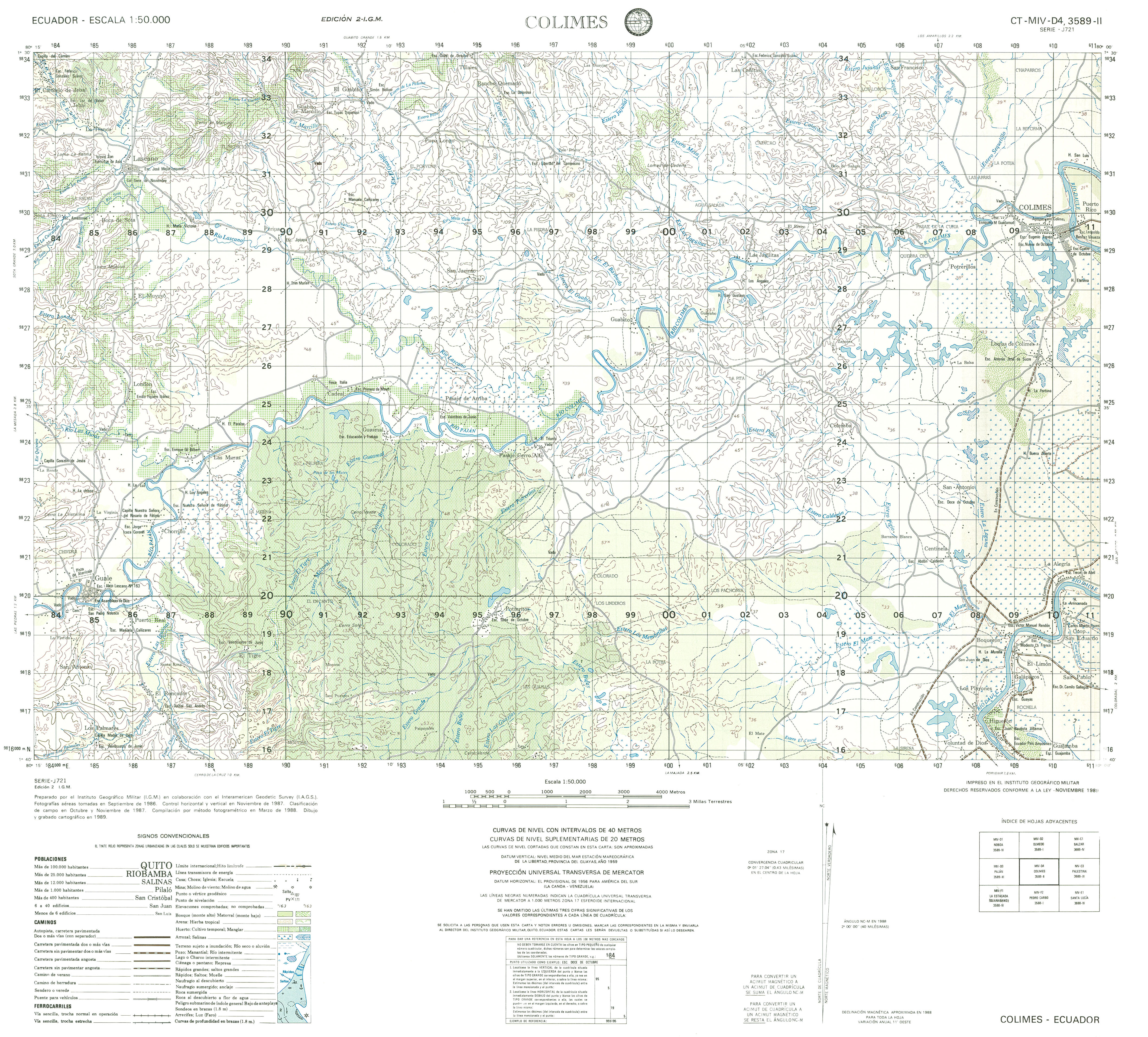
- Colimes (topographic) Sheet 3589 II, 1:50,000 (3.7MB)
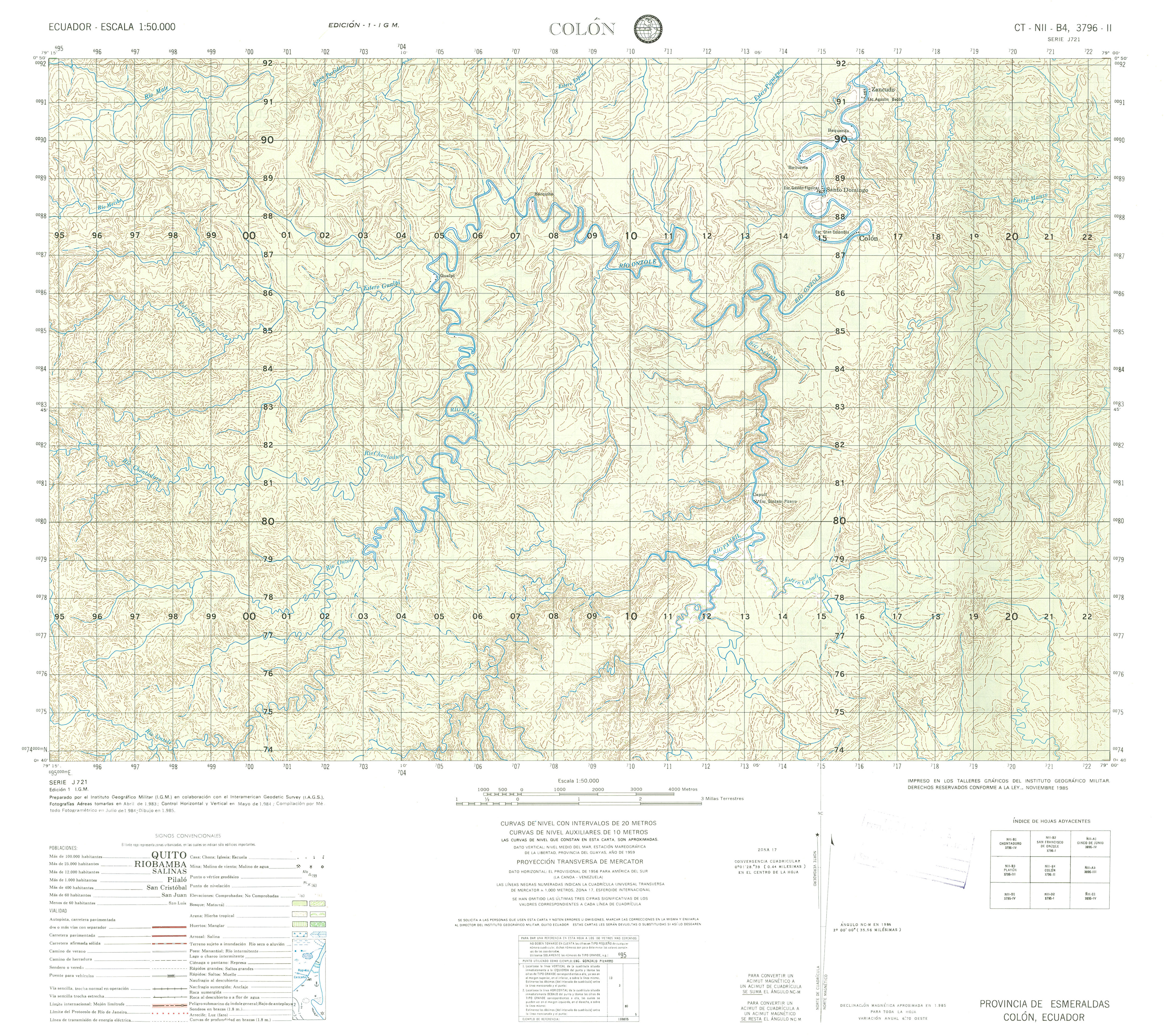
- Colon (topographic) Sheet 3796 II, 1:50,000 (3.9MB)
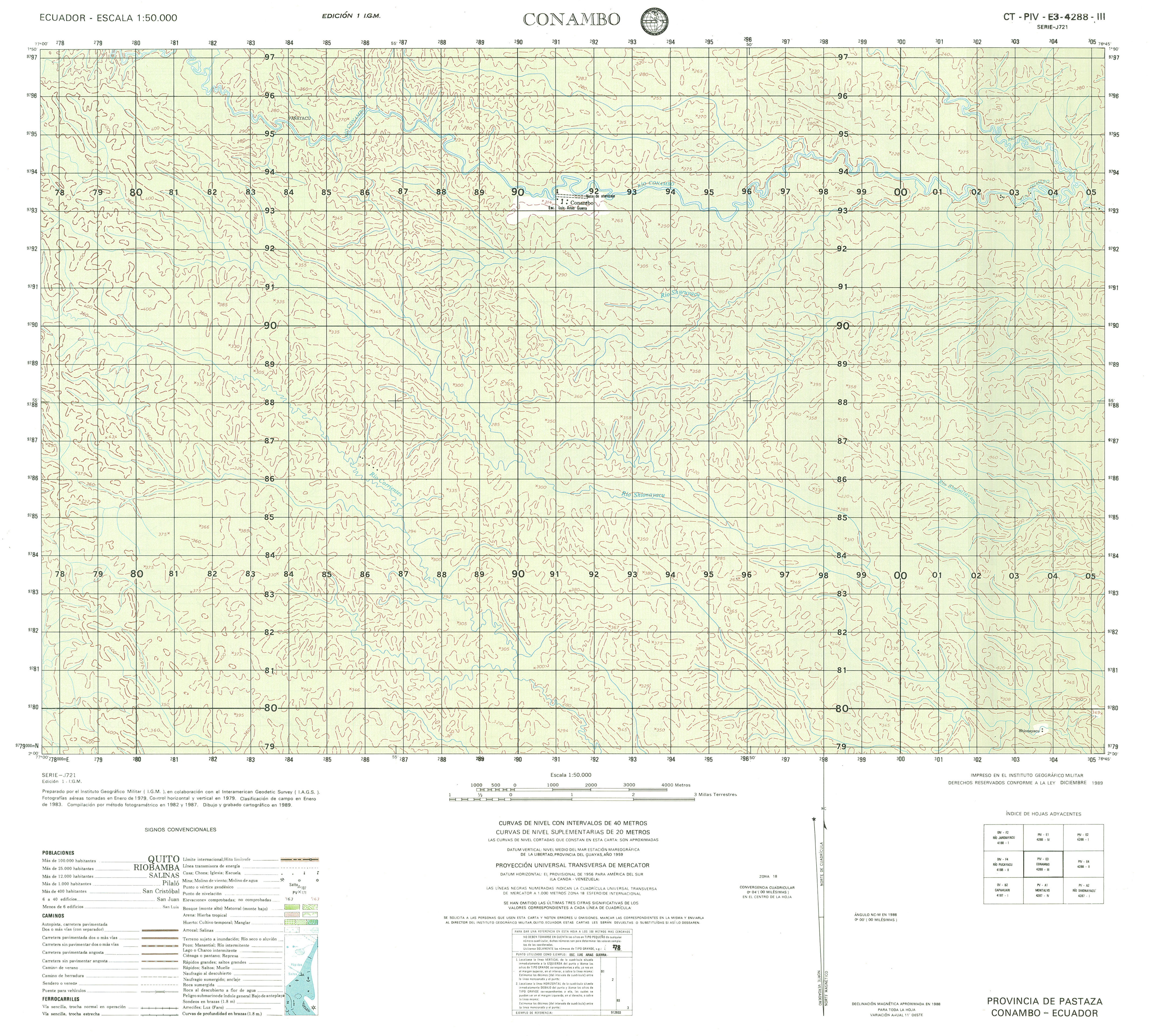
- Conambo (topographic) Sheet 4288 III, 1:50,000 (3.1MB)
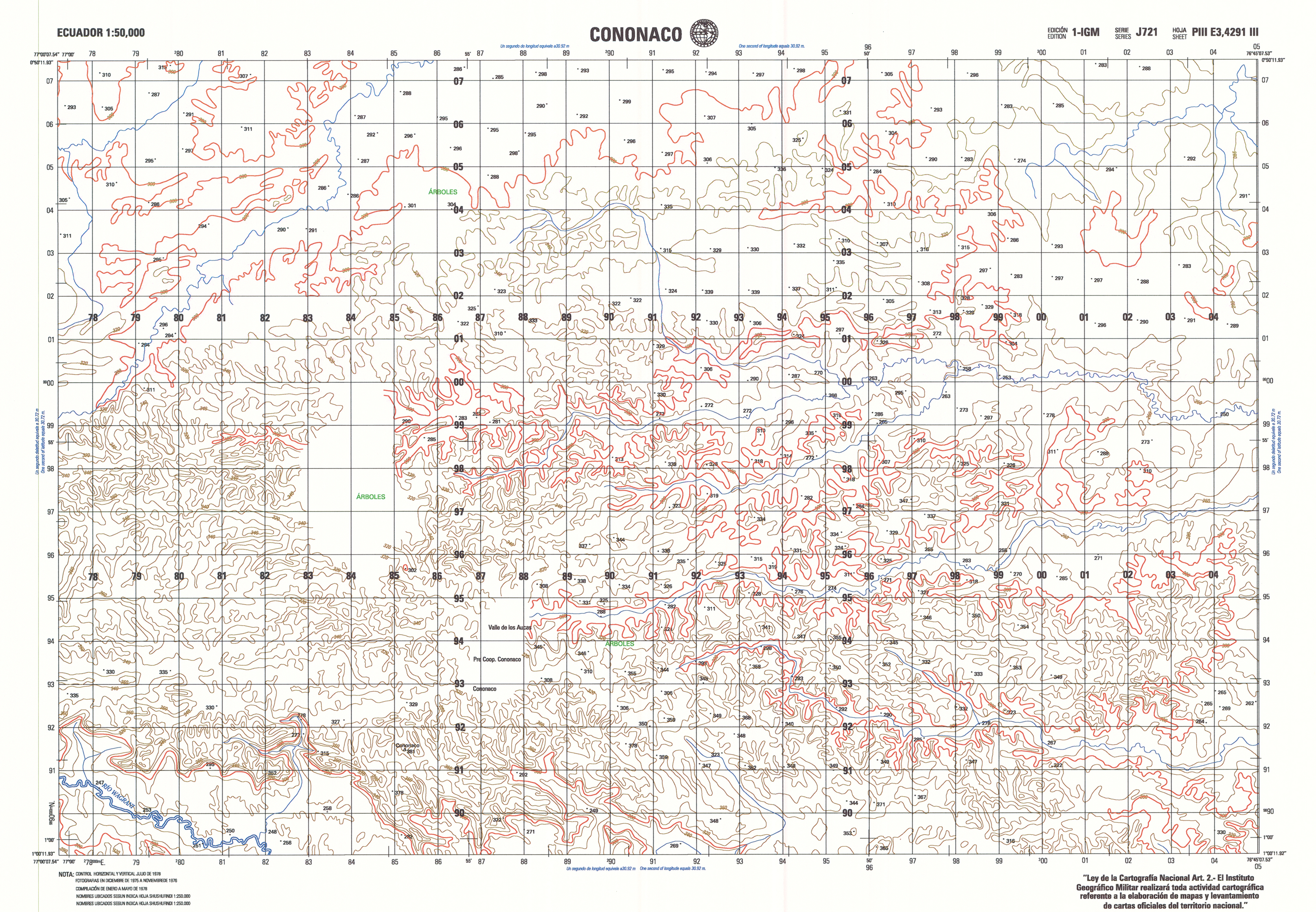
- Cononaco (topographic) Sheet 4291 III, 1:50,000 (10.4MB)
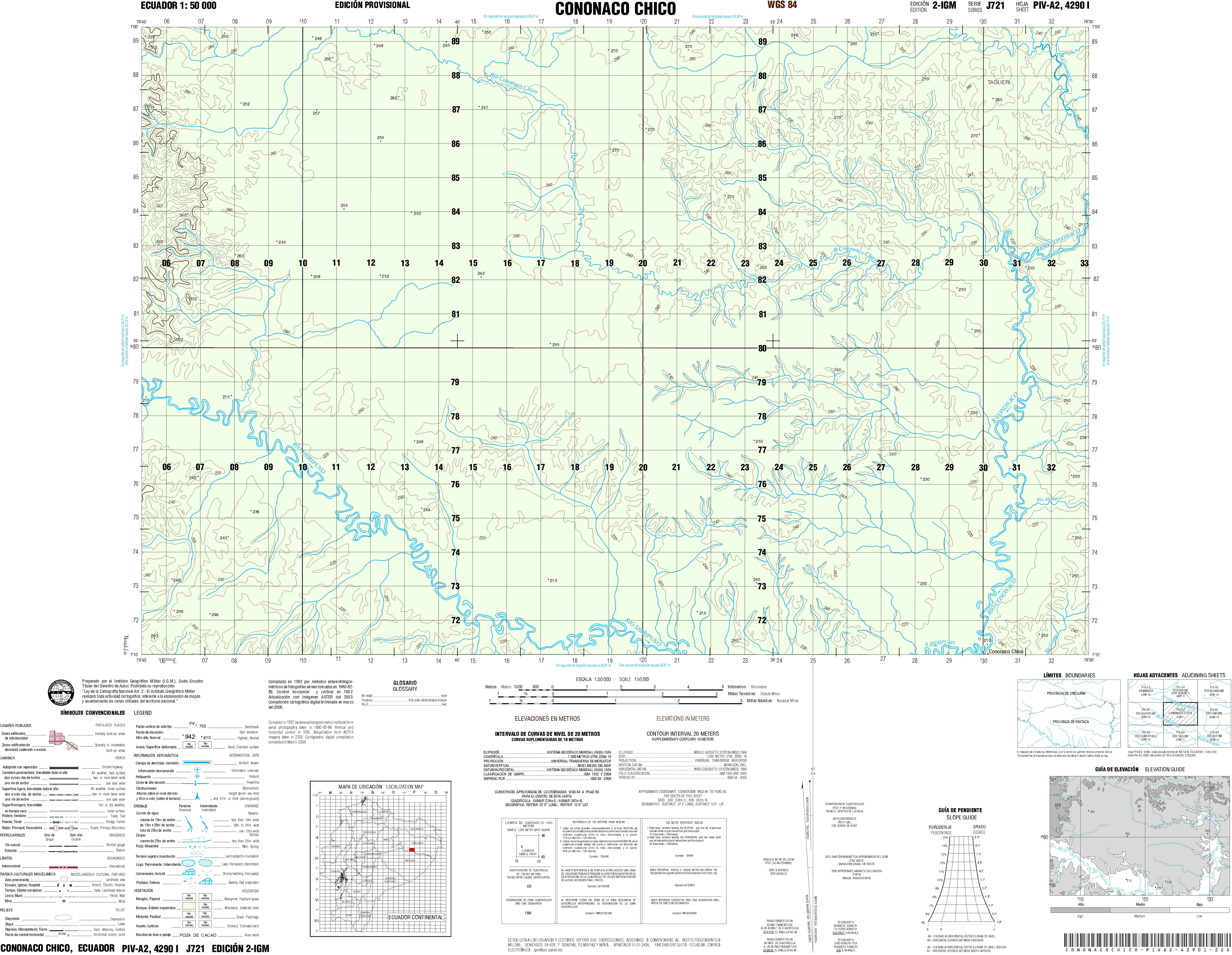
- Cononaco Chico (topographic) Sheet 4290 I, 1:50,000 (4.8MB)
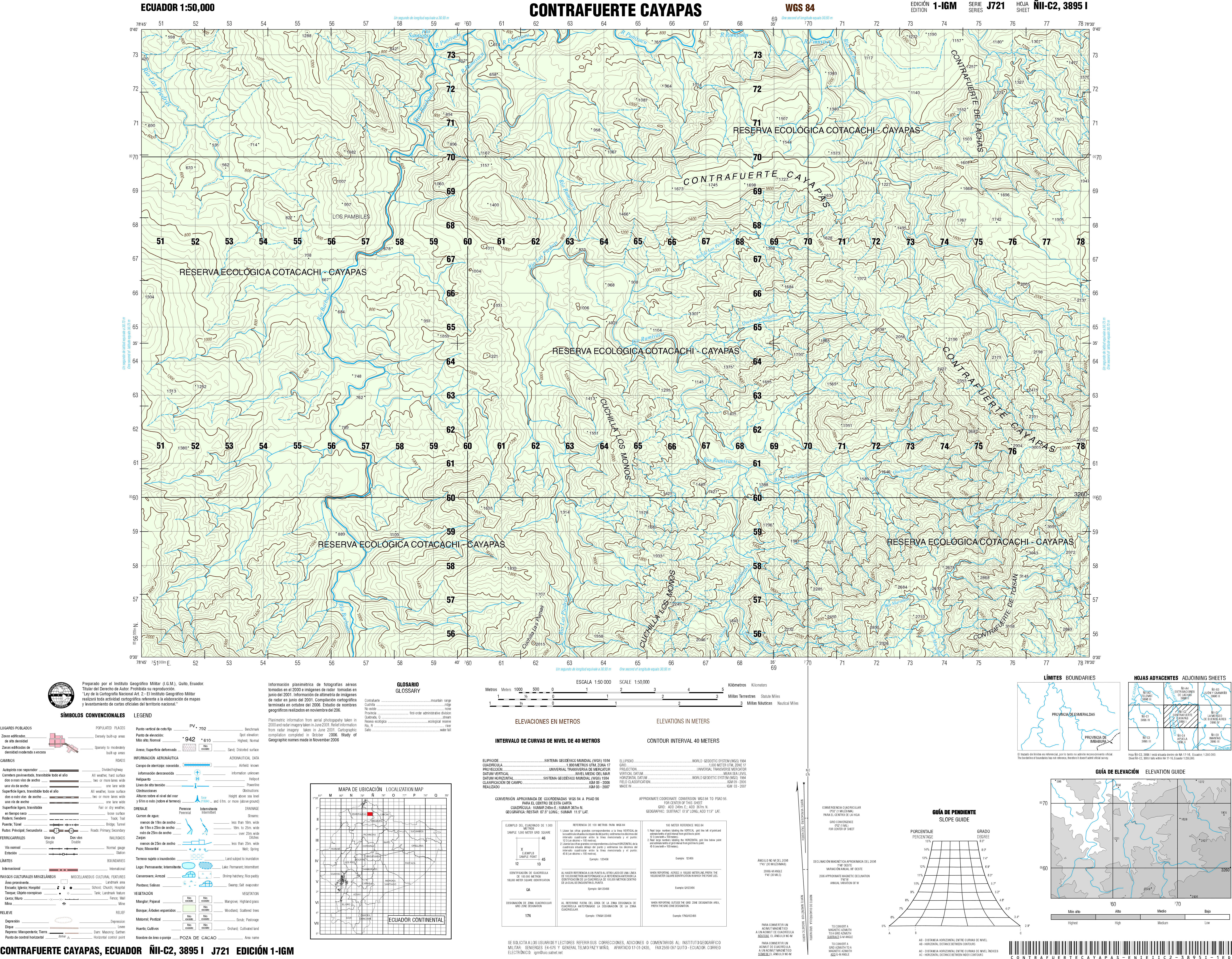
- Contrafuerte Caya (topographic) Sheet 3895 I, 1:50,000 (7.3MB)
- Condor Mirador (topographic) Sheet 3983 III, 1:50,000 1992 (10.0MB) [PDF]
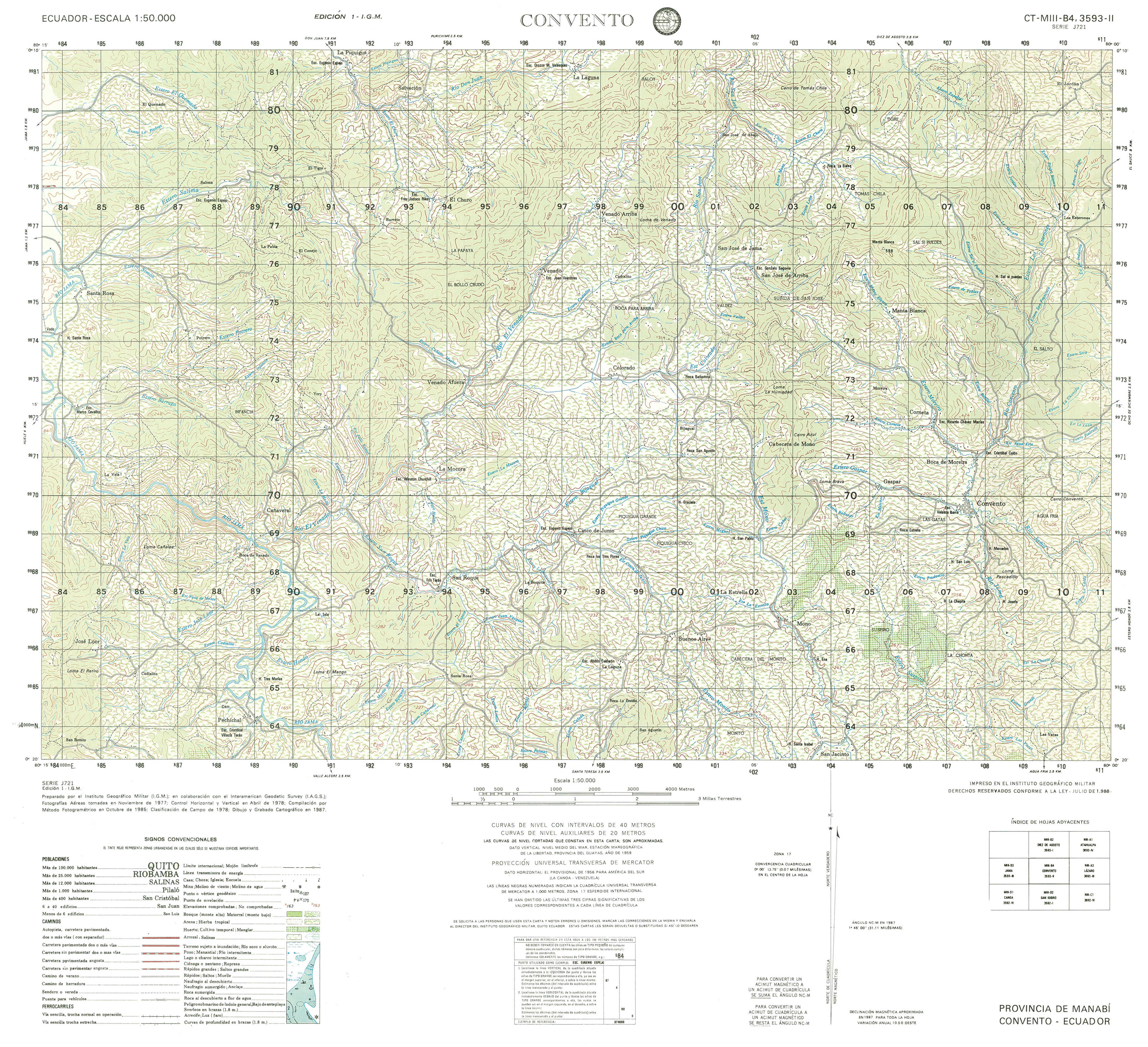
- Convento (topographic) Sheet 3593 II, 1:50,000 (4.3MB)
- Cordillera de Chongon (topographic) Sheet 3587 I, 1:50,000 1996 (8.5MB) [PDF]
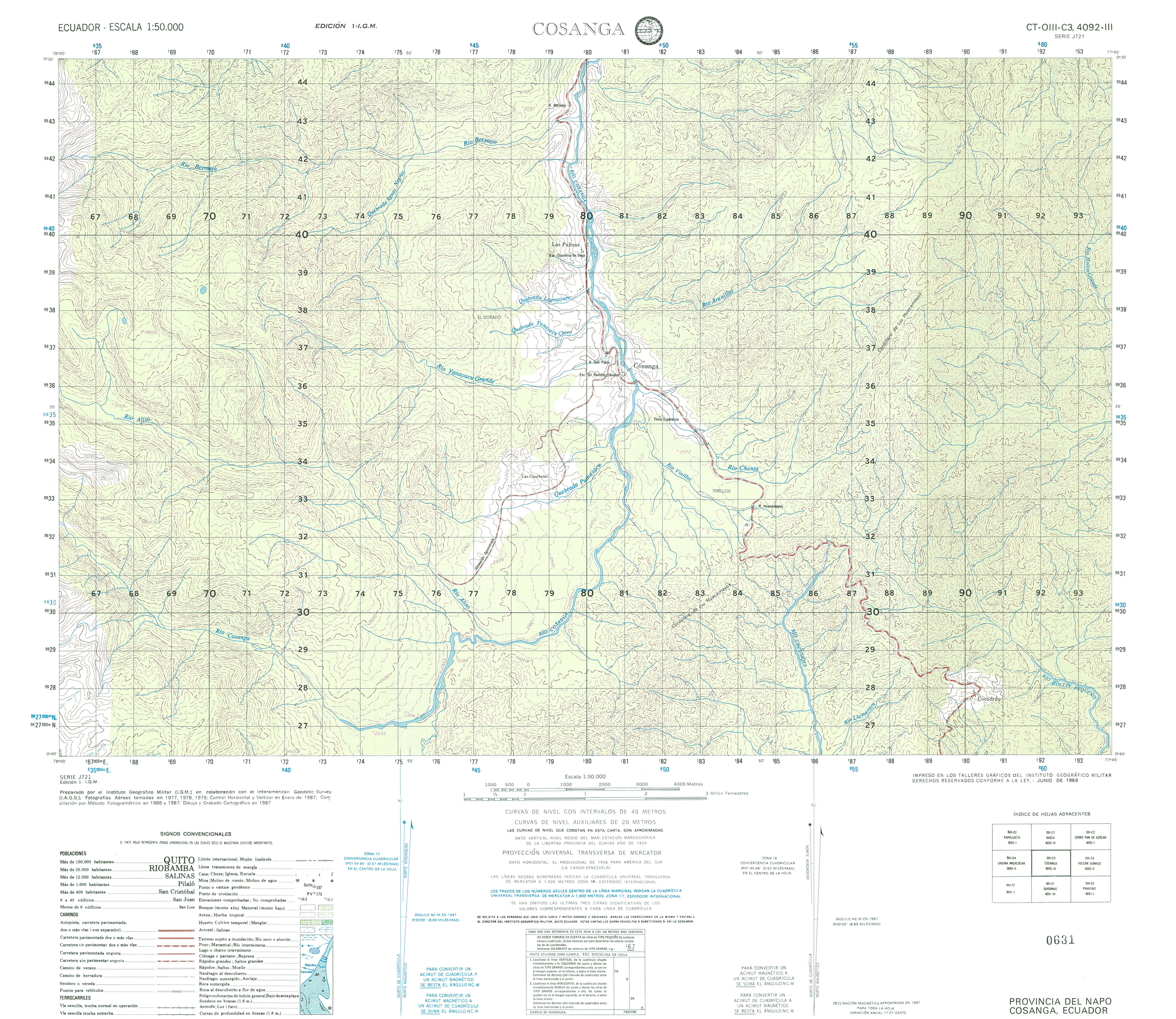
- Cosanga (topographic) Sheet 4092 III, 1:50,000 (4.0MB)
- Cotopoxi (topographic) Sheet 3991 IV, 1:50,000 (6.2MB) [PDF]
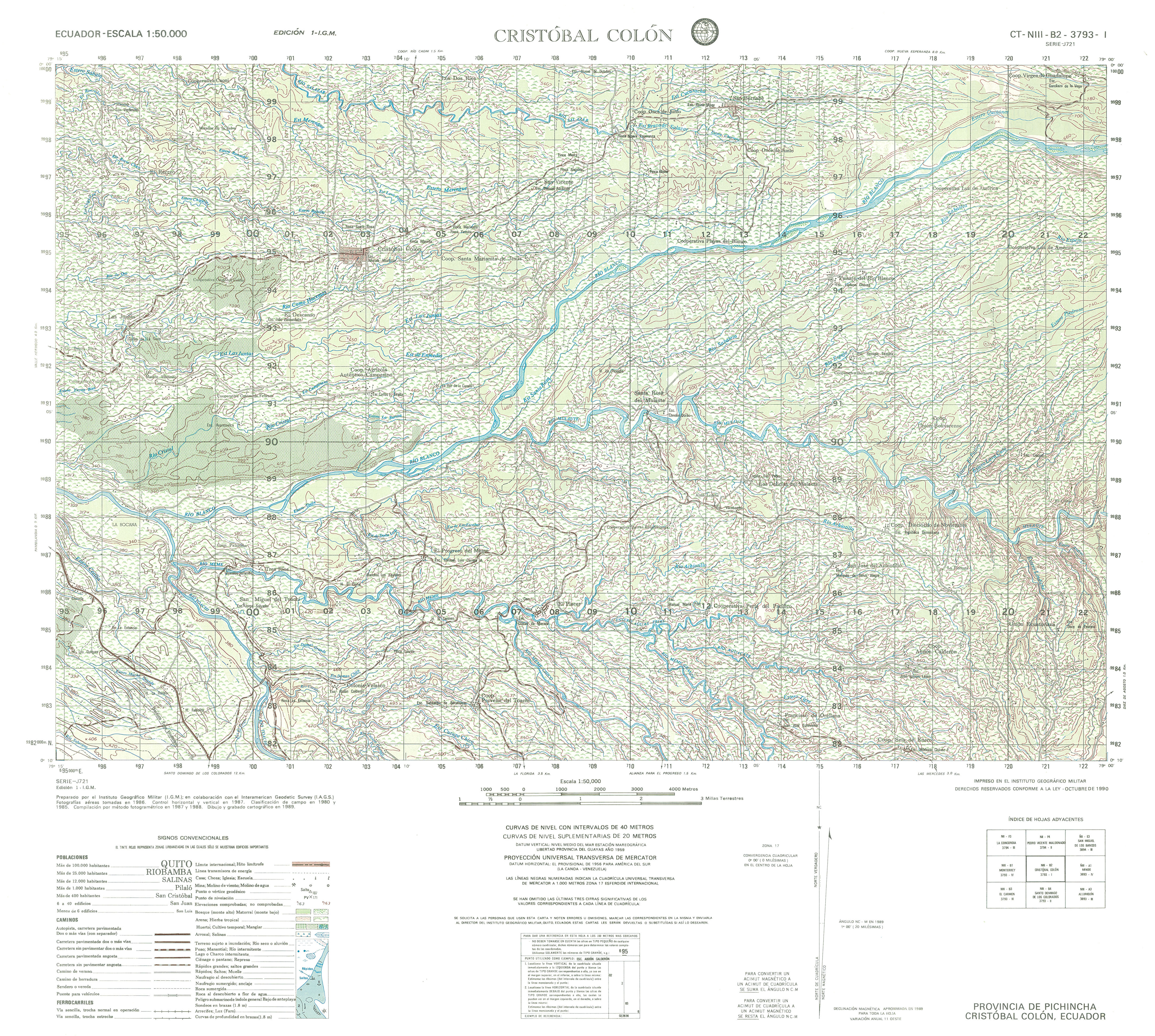
- Cristobal Colon (topographic) Sheet 3793 I, 1:50,000 (4.8MB)
- Cuenca (topographic) Sheet 3785 II, 1:50,000 (4.2MB)
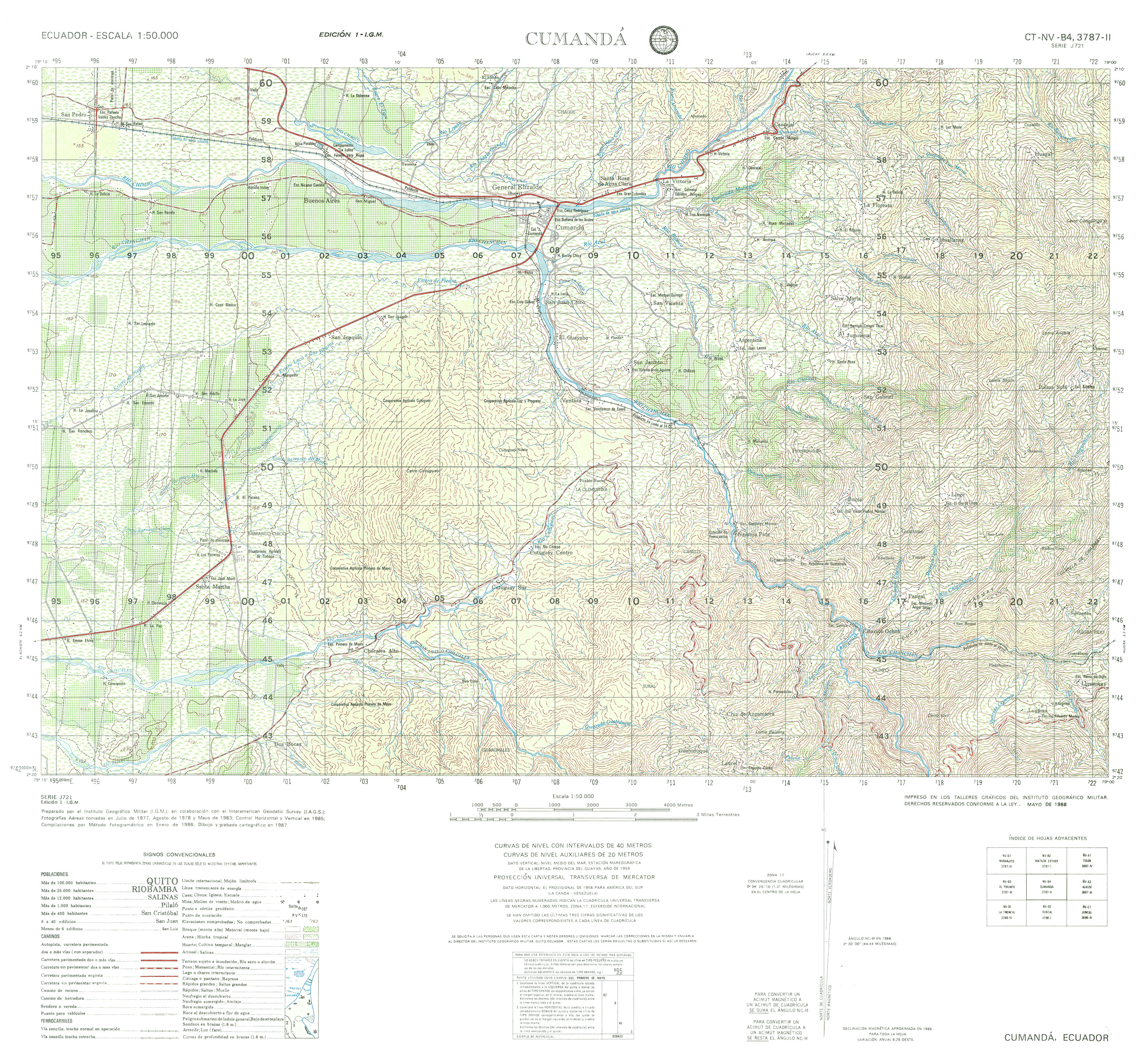
- Cumanda (topographic) Sheet 3787 II, 1:50,000 (4.5MB)
- Curaray (topographic) Sheet 4289 IV, 1:50,000 (2.8MB)
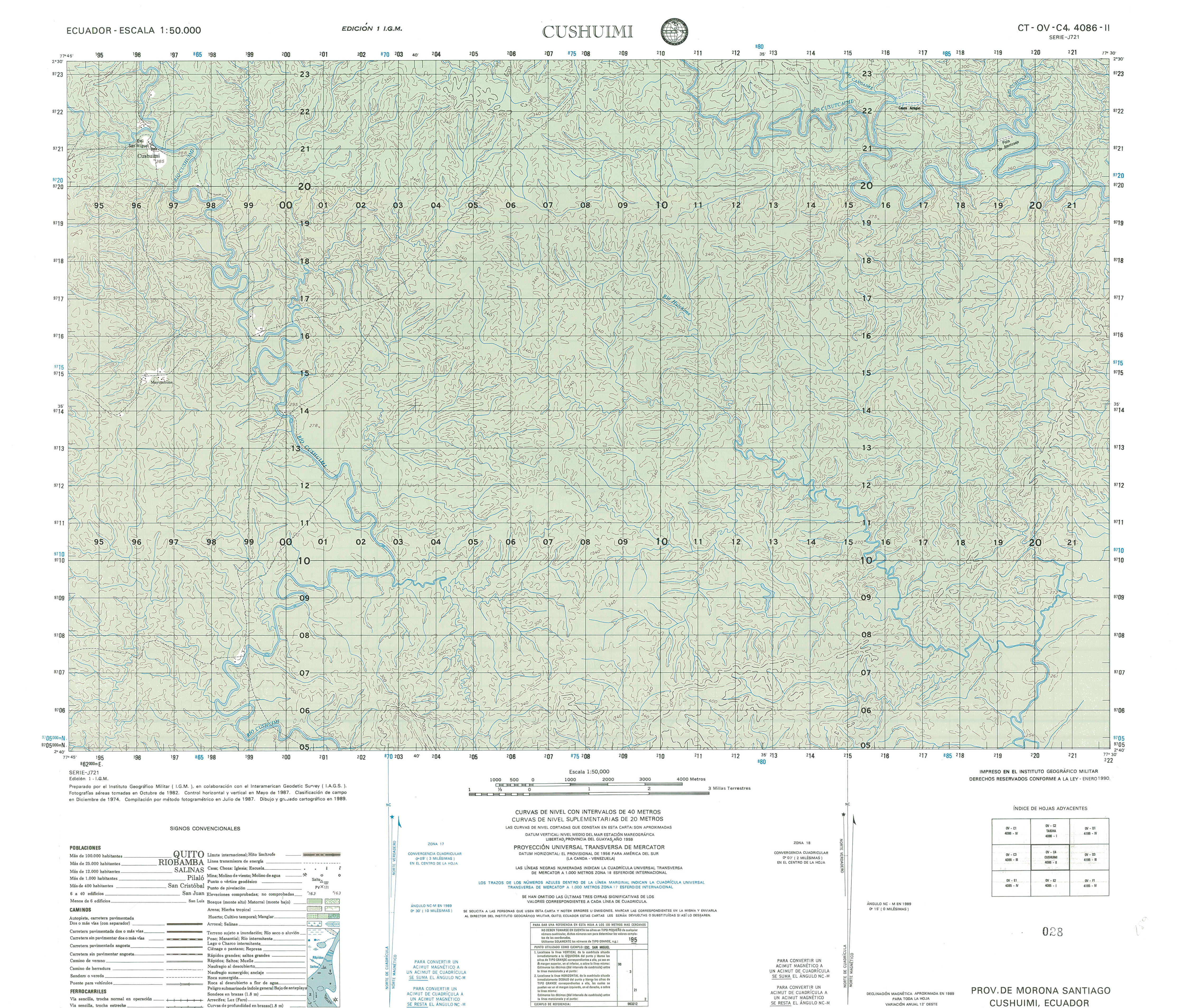
- Cushuimi (topographic) Sheet 4086 II, 1:50,000 (3.7MB)
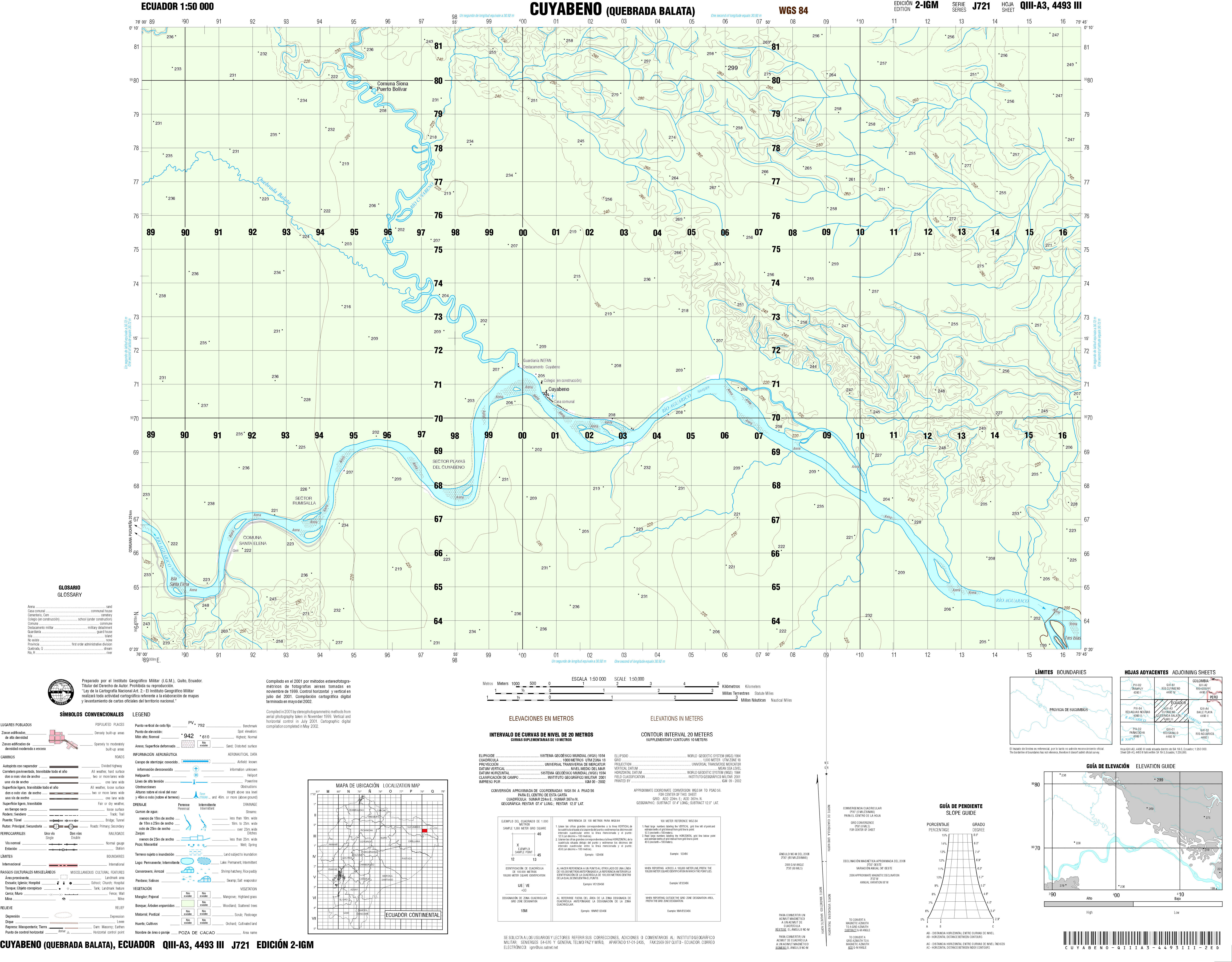
- Cuyabeno (topographic) Sheet 4493 III, 1:50,000 (3.8MB)
- Data de Porsoja (topographic) Sheet 3585 IV, 1:50,000 (1.3MB)
- Daule (topographic) Sheet 3688 III, 1:50,000 (3.3MB)
- Delicias (topographic) Sheet 3488 I, 1:50,000 (4.6MB)
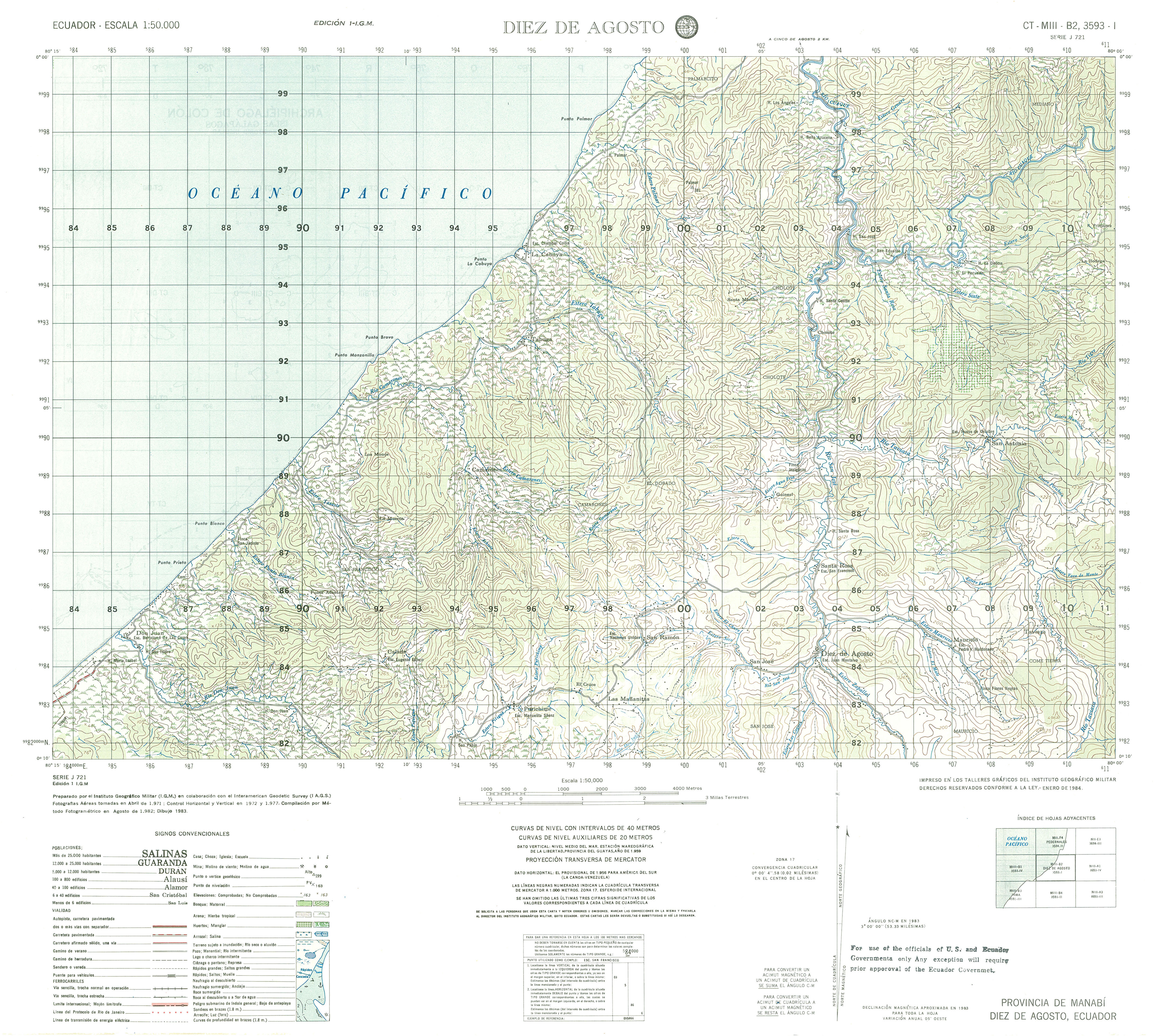
- Diez de Agosto (topographic) Sheet 3593 I, 1:50,000 (3.6MB)
- El Quinche (topographic) Sheet 3993 IV, 1:50,000 2008 (8.2MB) [PDF] [includes northeast part of Quito]
- El Carmen (topographic) Sheet 3793 III, 1:50,000 (5.3MB)
- El Carmen de Pijili (topographic) Sheet 3685 II, 1:50,000 (4.3MB)
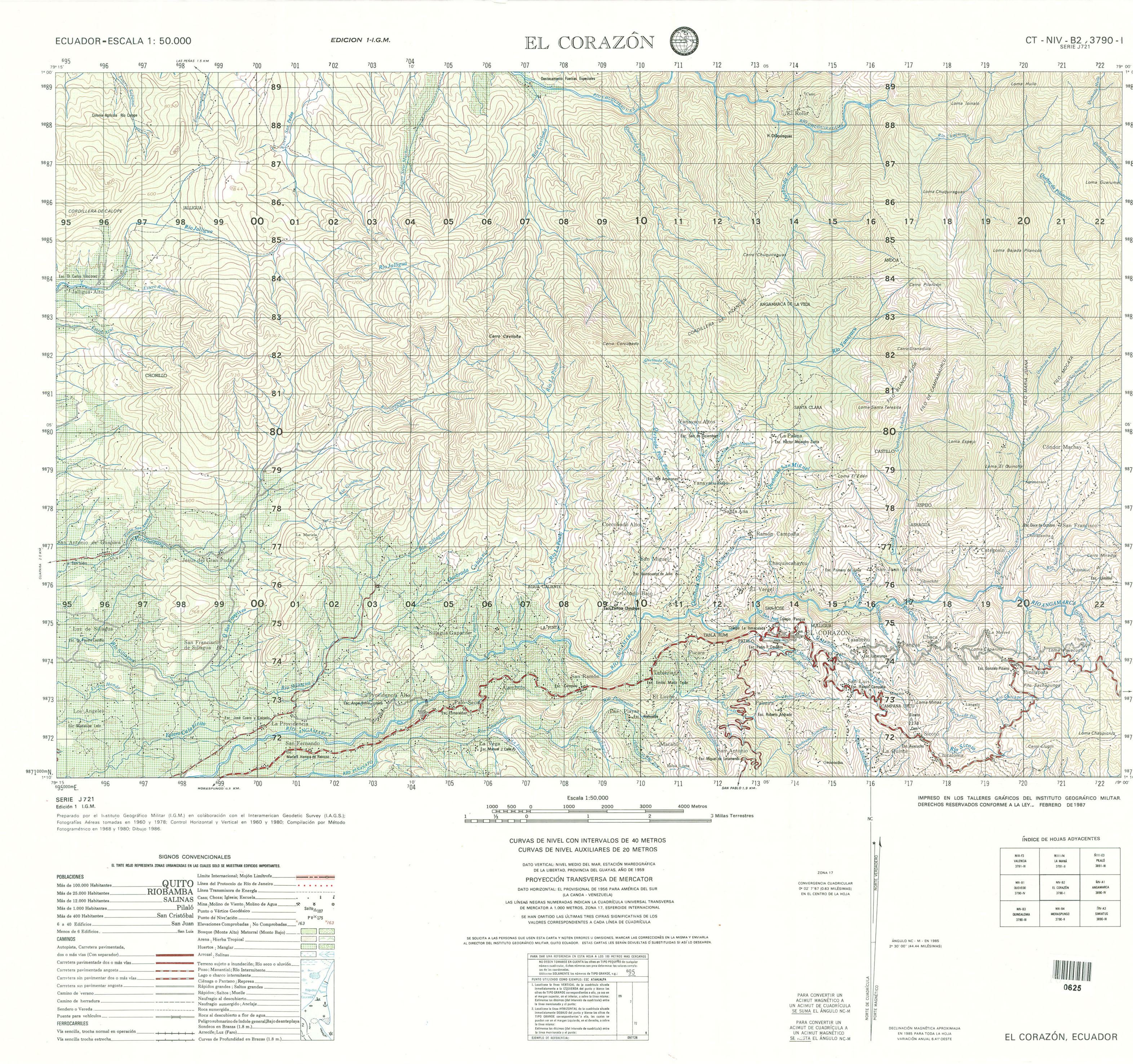
- El Corazon (topographic) Sheet 3790 I, 1:50,000 (2.6MB)
- El Calvario (topographic) Sheet 4195 II, 1:50,000 2007 (4.2MB) [PDF]
- El Dorado de Cascales (topographic) Sheet 4194 II, 1:50,000 2007 (3.0MB) [PDF]
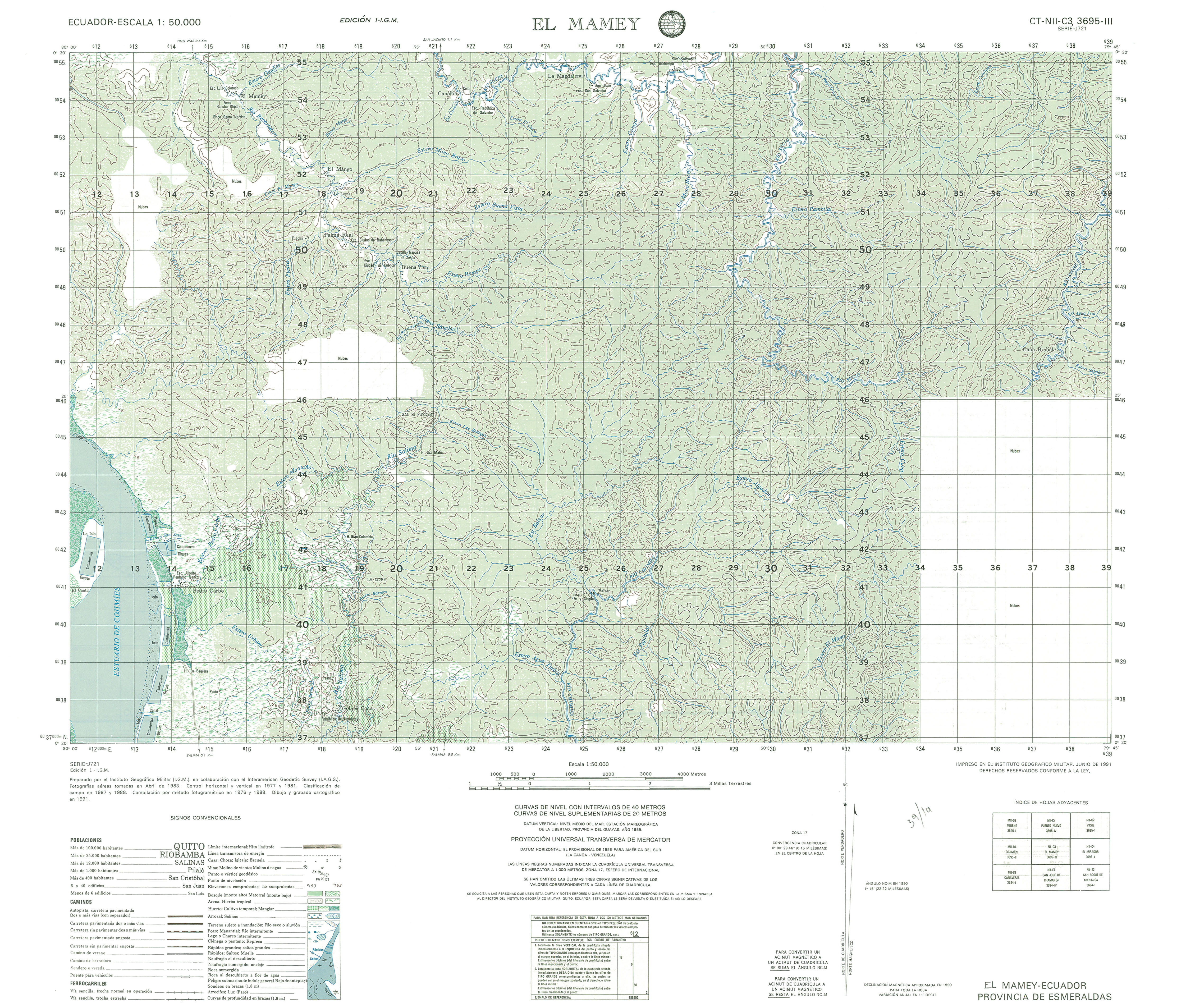
- El Mamey (topographic) Sheet 3695 III, 1:50,000 (3.5MB)
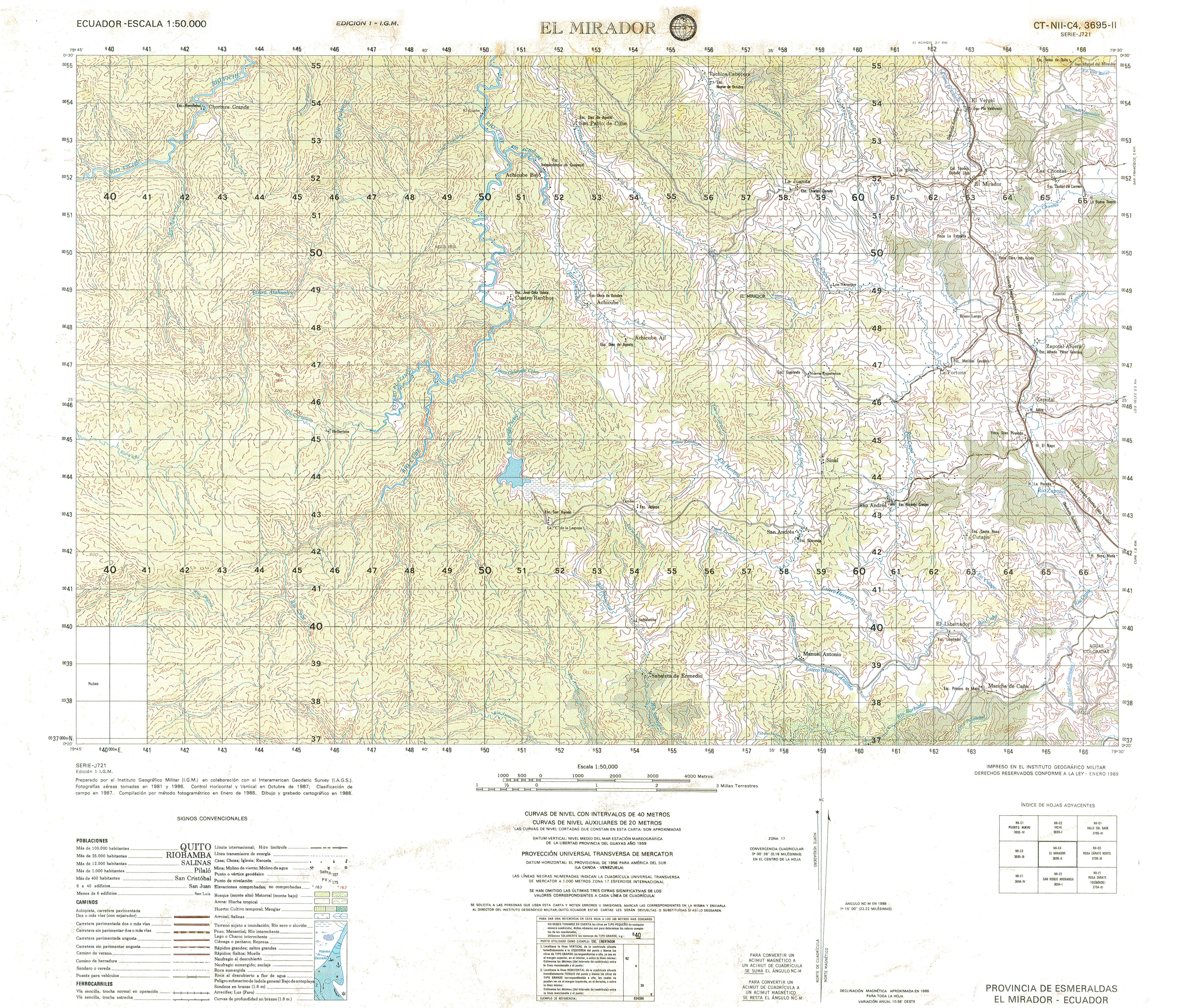
- El Mirador (topographic) Sheet 3695 II, 1:50,000 (5.1MB)
- El Pangui (topographic) Sheet 3883 II, 1:50,000 1991 (9.0MB) [PDF]
- El Pailon (topographic) Sheet 3997 II, 1:50,000 2007 (2.5MB) [PDF]
- El Paraaso (topographic) Sheet 3692 II, 1:50,000 (5.2MB)
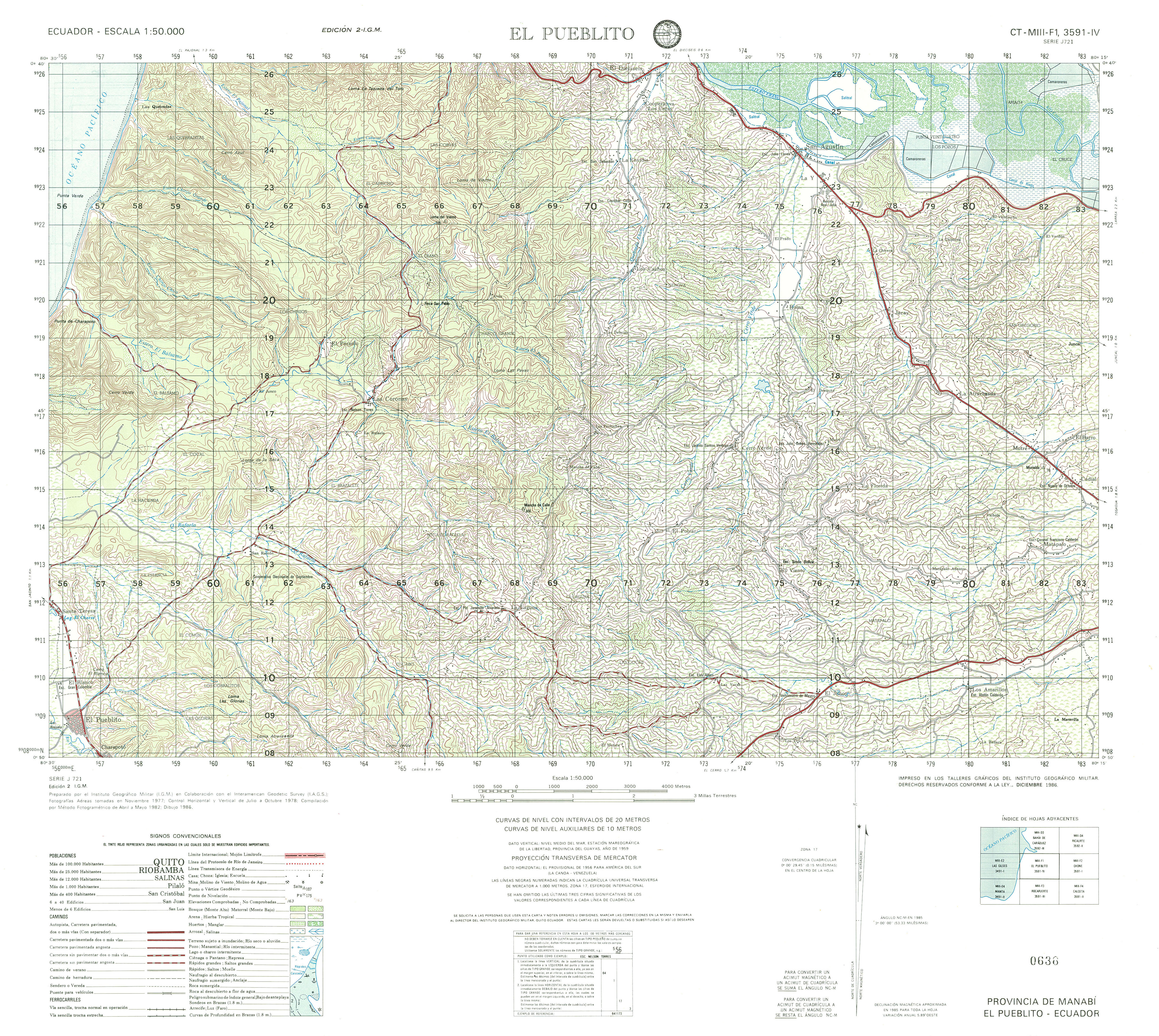
- El Pueblito (topographic) Sheet 3591 IV, 1:50,000 (4.5MB)
- El Quinche (topographic) Sheet 3993 IV, 1:50,000 (5.5MB)
- El Triunfo (topographic) Sheet 3787 III, 1:50,000 (4.4MB)
- Estero Salado (topographic) Sheet 3586 II, 1:50,000 2003 (6.7MB) [PDF]
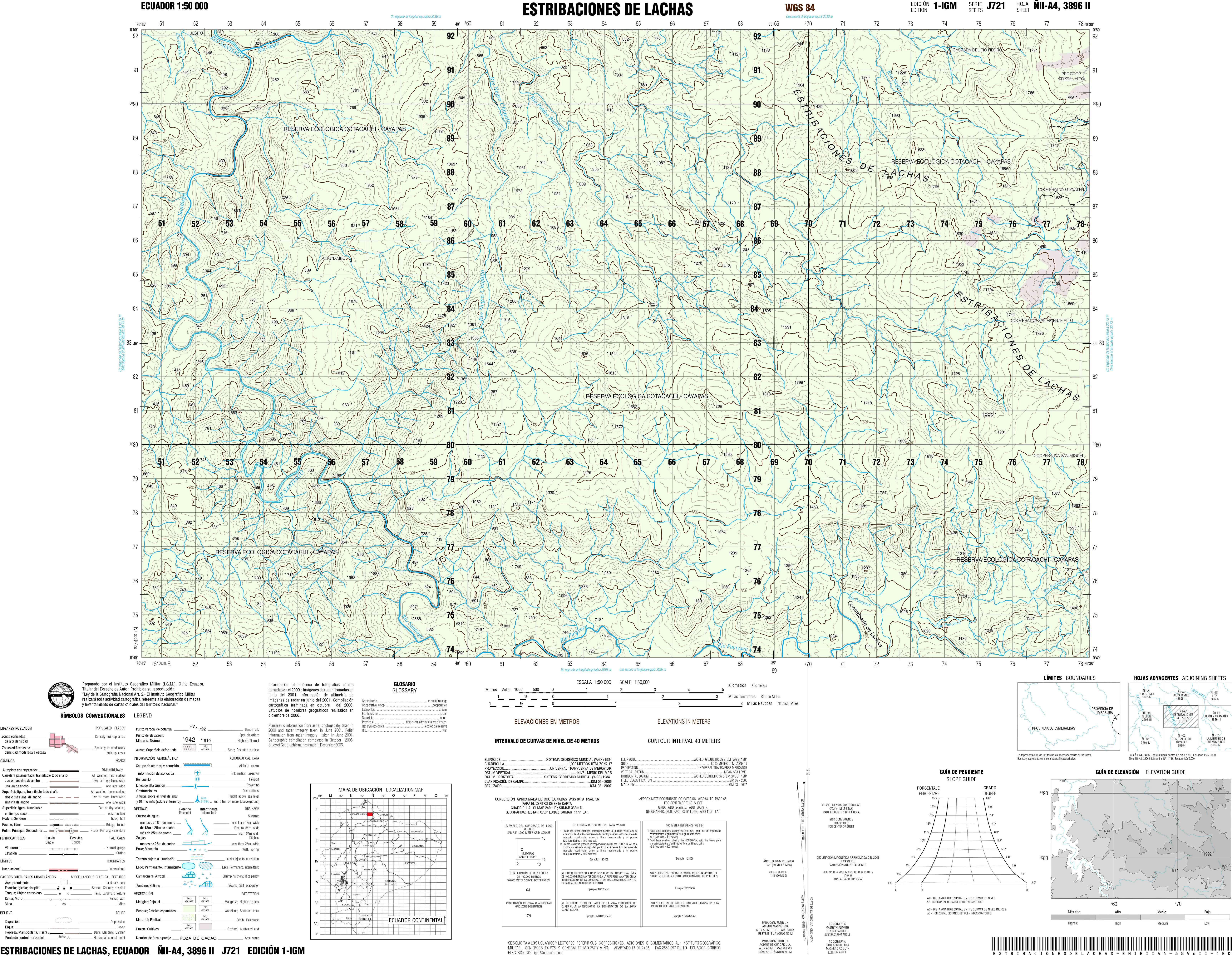
- Estribaciones de Lachas (topographic) Sheet 3896 II, 1:50,000 2003 (6.7MB) [PDF]
- Fatima (topographic) Sheet 3983 IV, 1:50,000 1995 (7.8MB) [PDF]
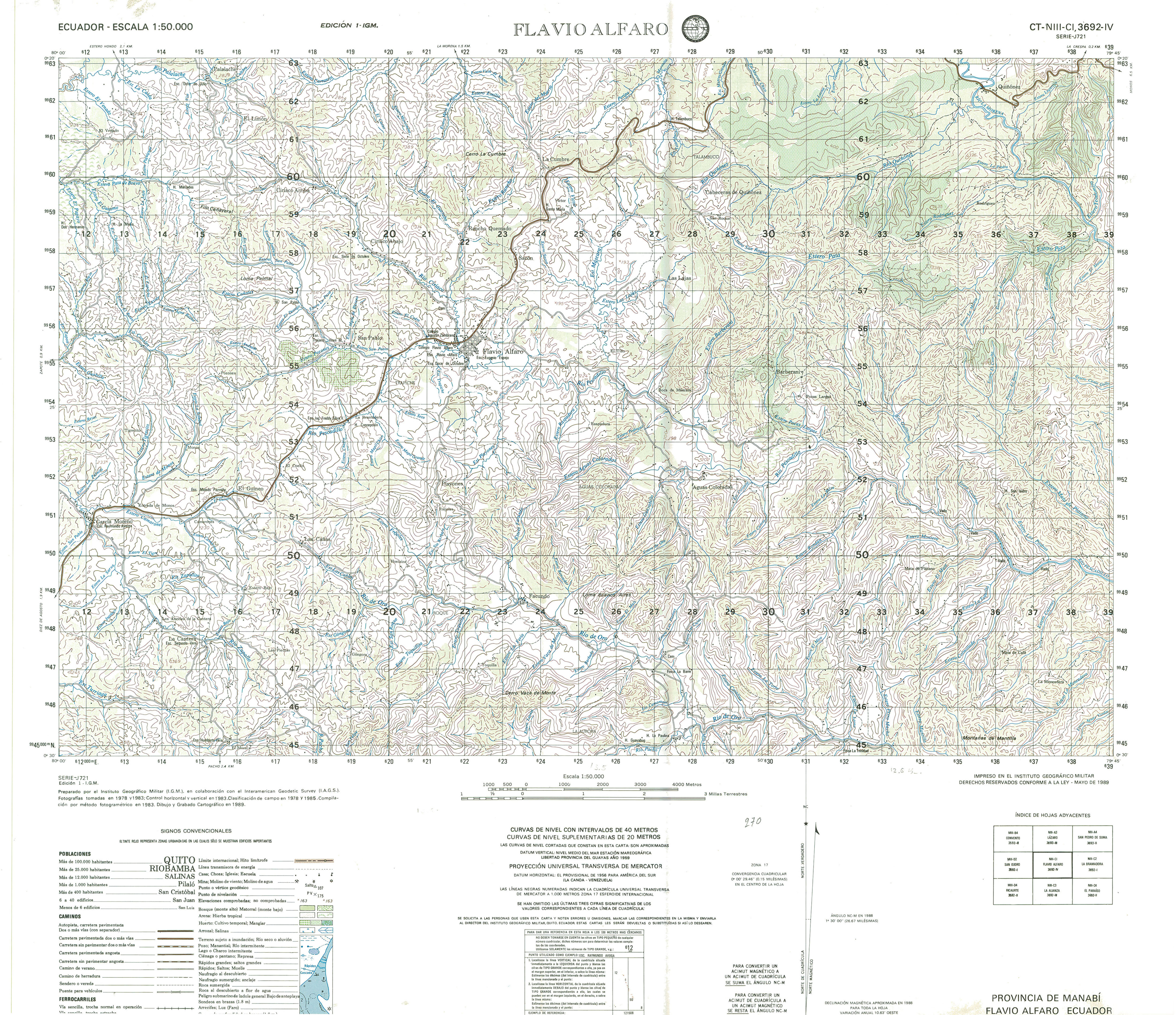
- Flavio Alfaro (topographic) Sheet 3692 IV, 1:50,000 (4.2MB)
- Galera (topographic) Sheet 3593 II, 1:50,000 (3.0MB)
- General Leonidas Plaza (topographic) Sheet 3985 III, 1:50,000 1988 (9.0MB) [PDF]
- General Villamil (topographic) Sheet 3586 III, 1:50,000 1996 (7.3MB) [PDF]
- Gima (topographic) Sheet 3884 III, 1:50,000 1997 (9.3MB) [PDF]
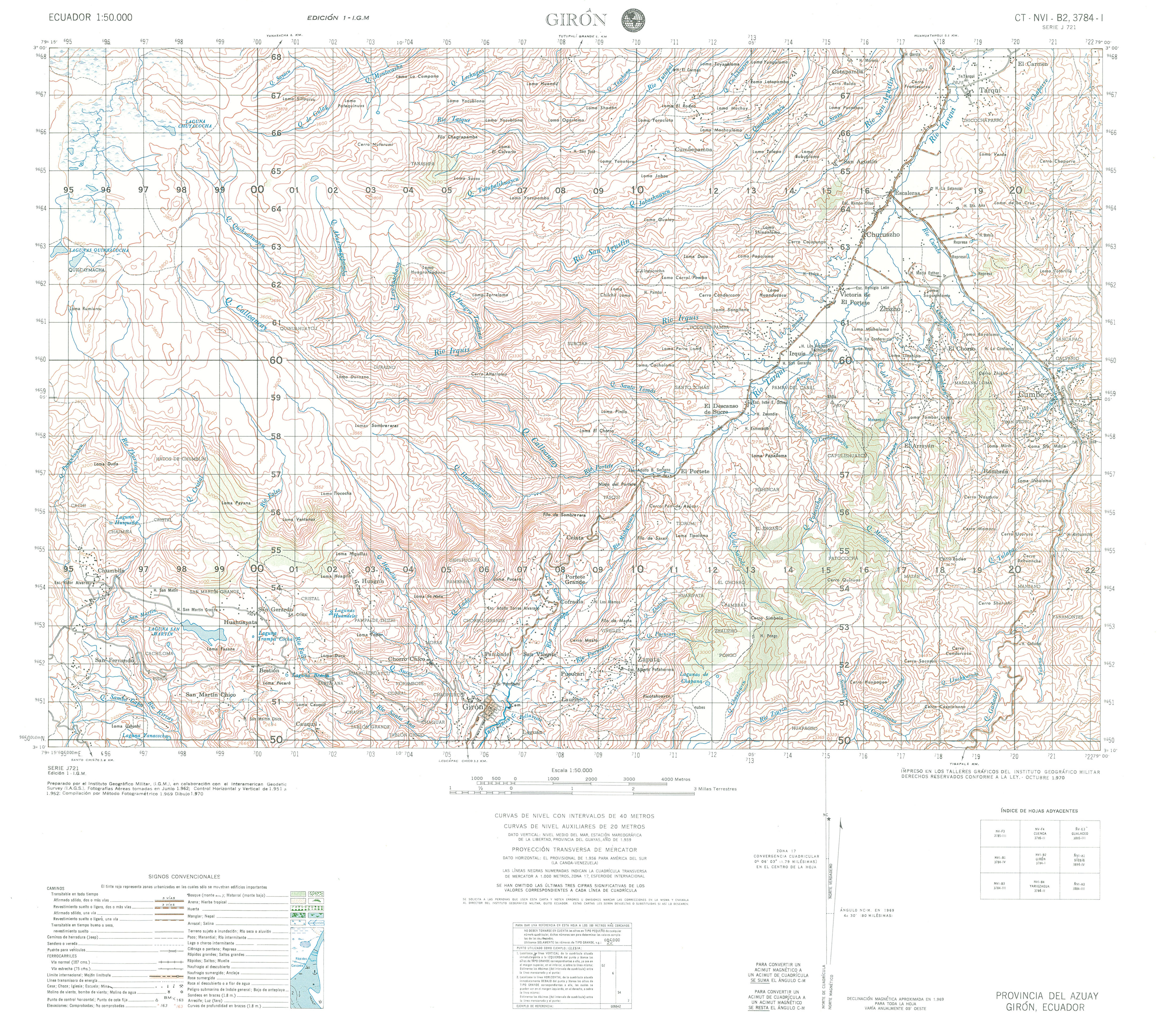
- Giron (topographic) Sheet 3784 I, 1:50,000 (3.8MB)
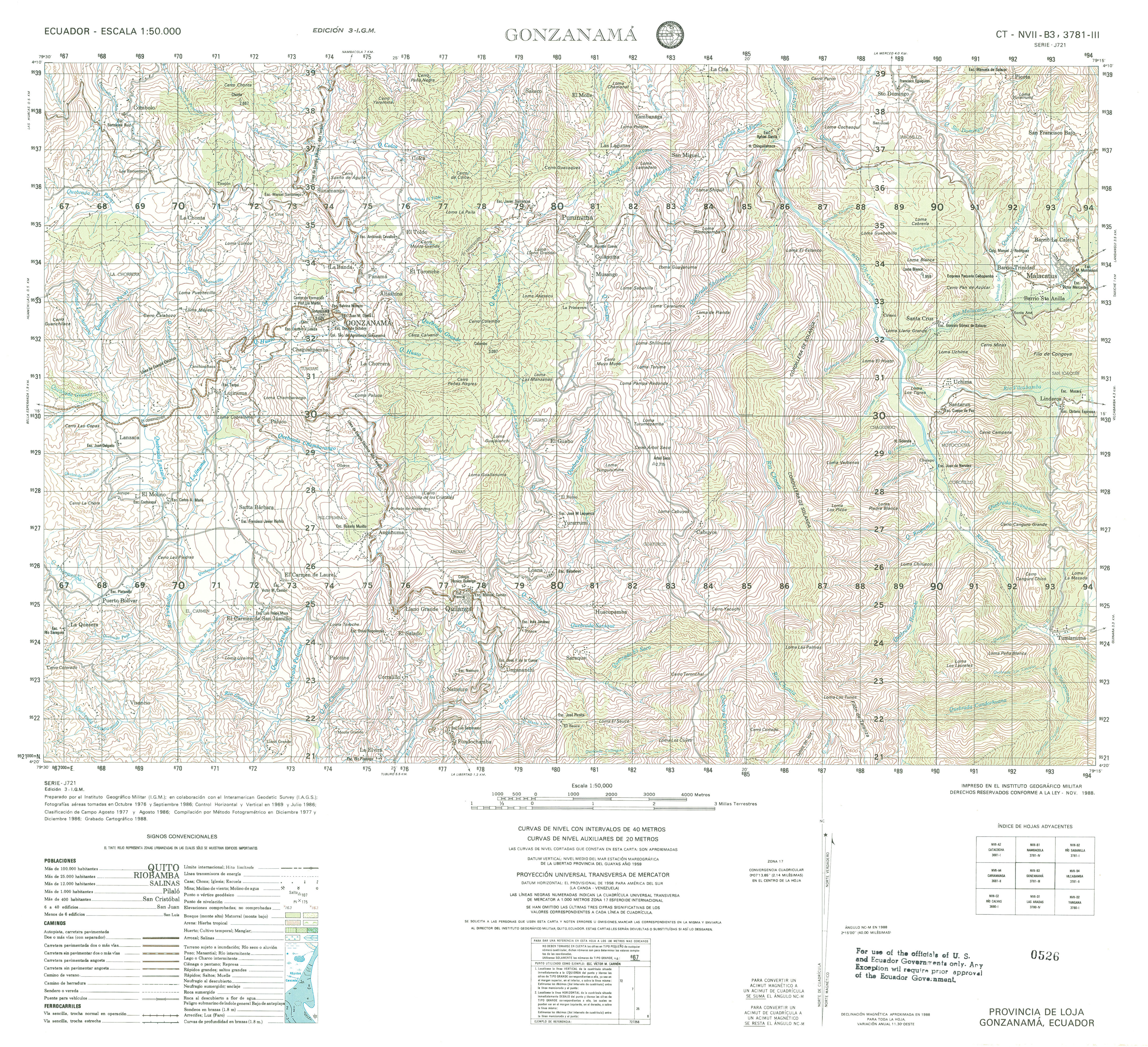
- Gonzanama (topographic) Sheet 3781 III, 1:50,000 (4.3MB)
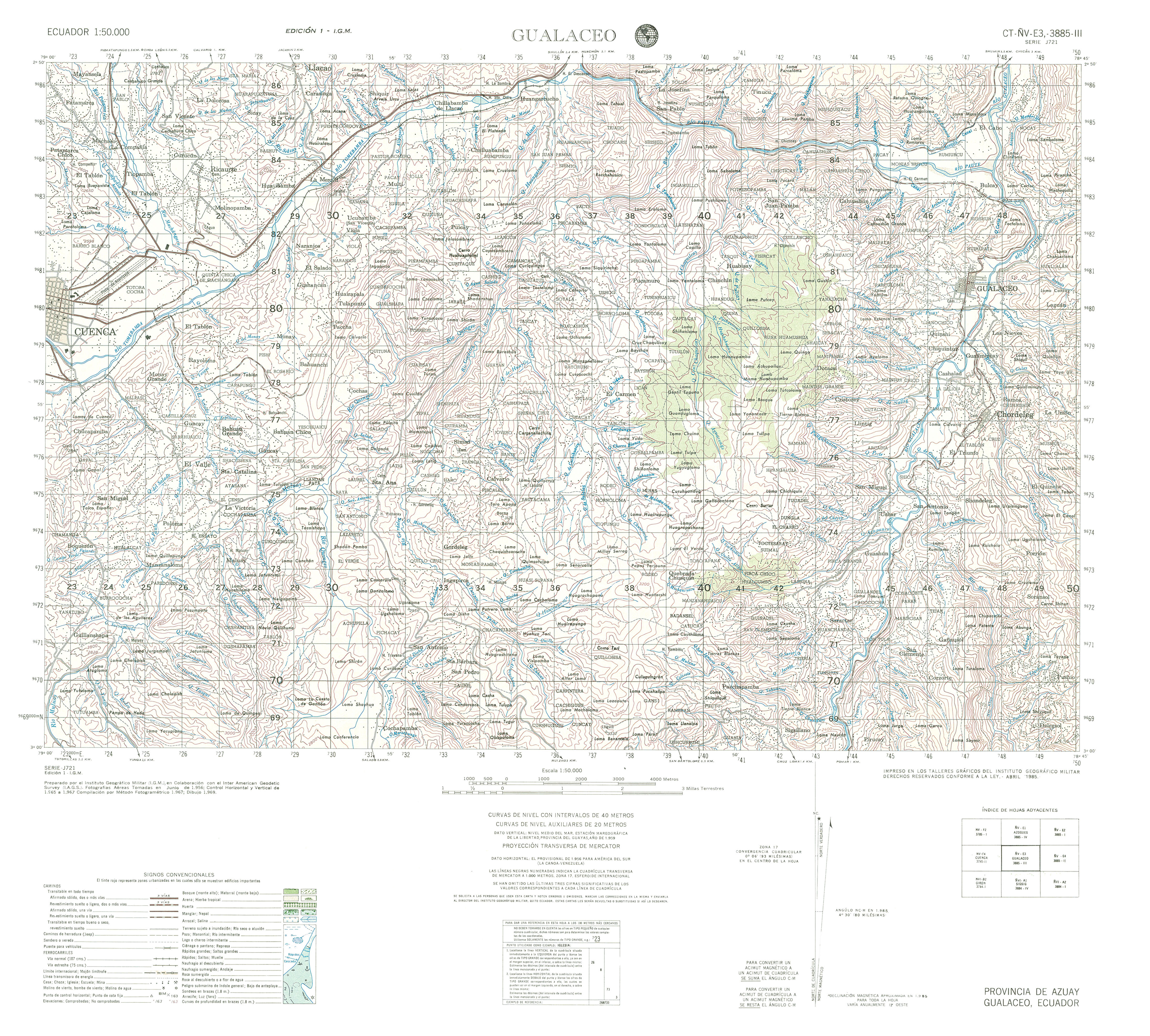
- Gualaceo (topographic) Sheet 3885 III, 1:50,000 (4.0MB)
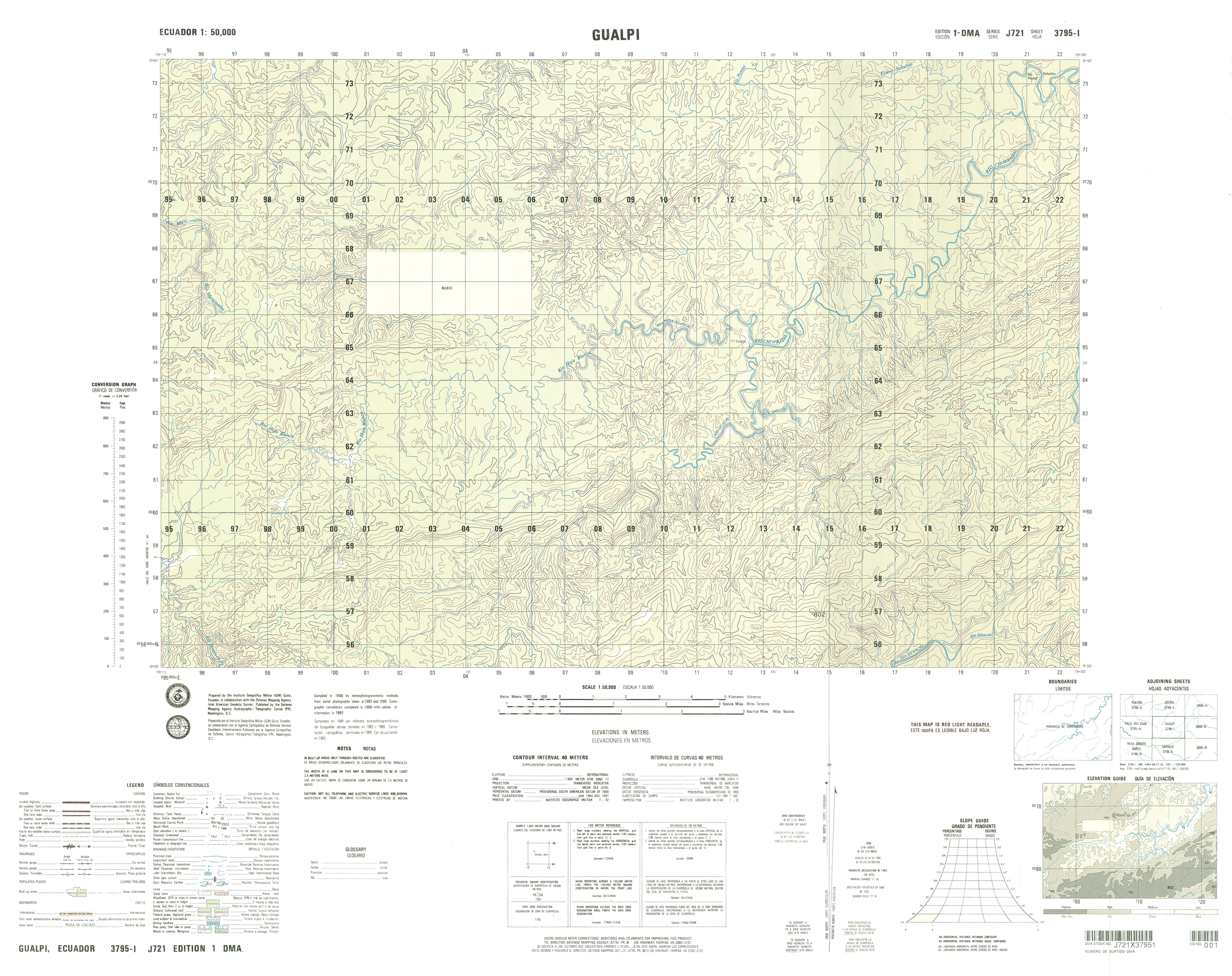
- Gualpi (topographic) Sheet 3795 I, 1:50,000 (3.8MB)
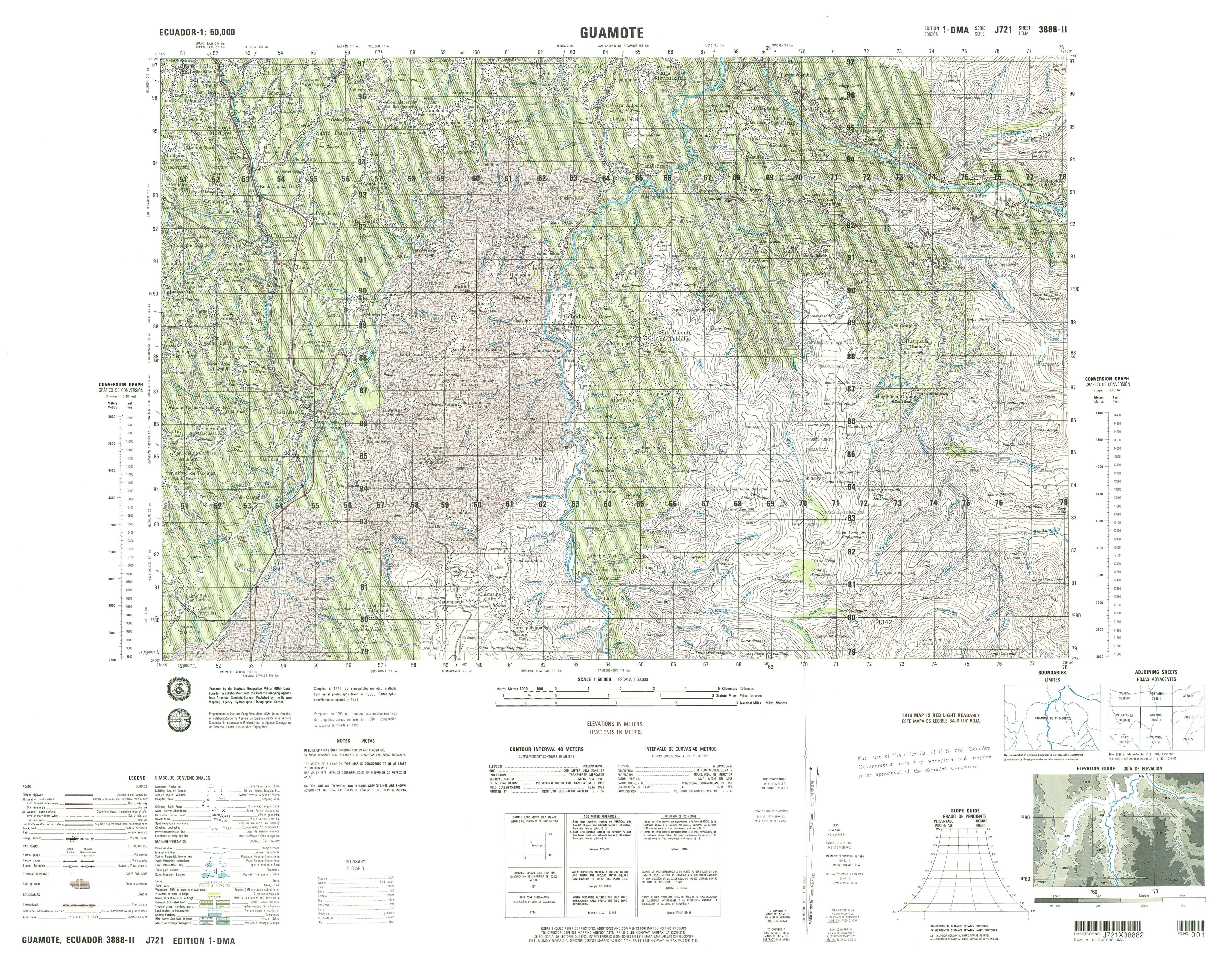
- Guamote (topographic) Sheet 3888 II, 1:50,000 (4.9MB)
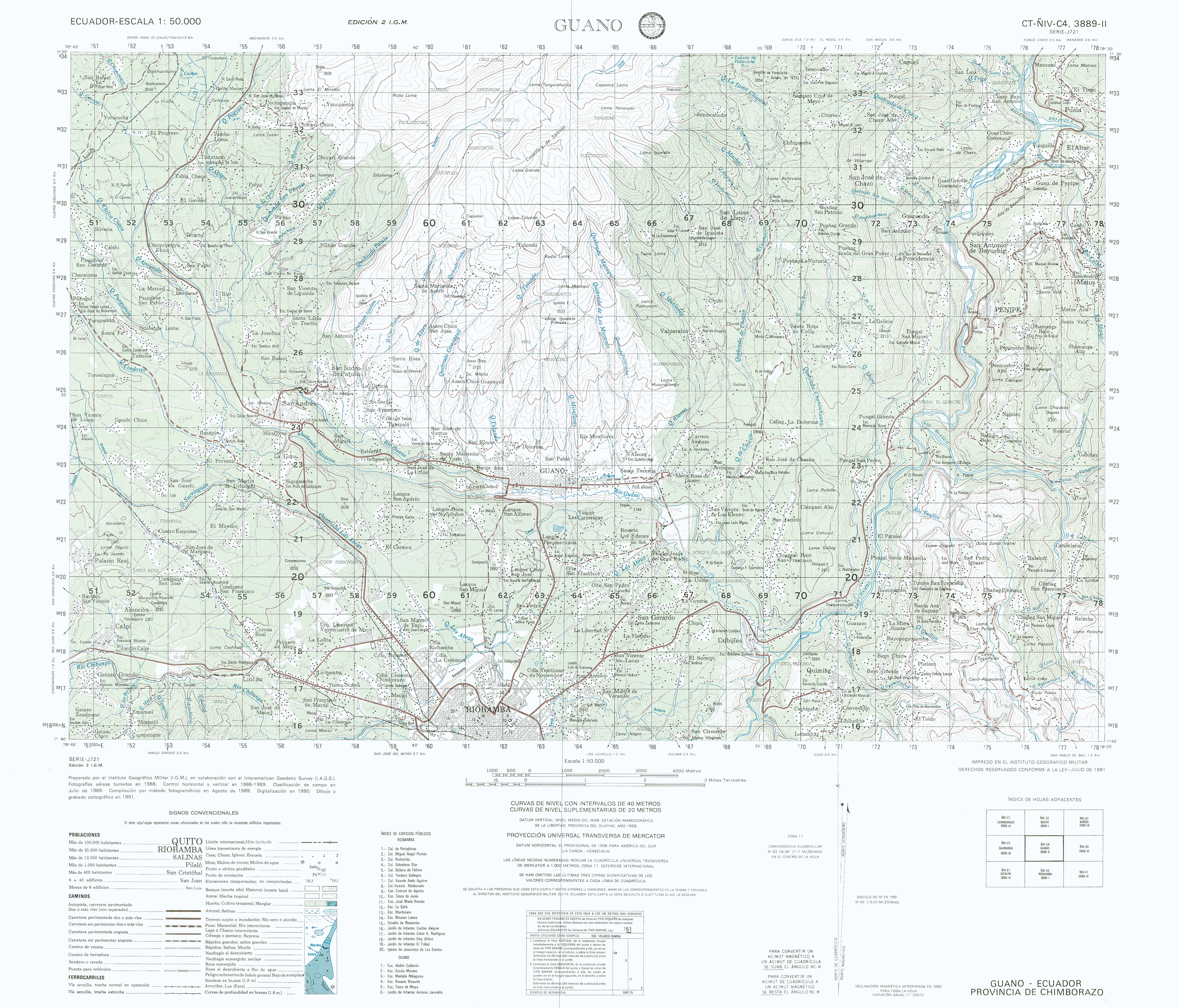
- Guano (topographic) Sheet 3889 II, 1:50,000 (4.9MB)
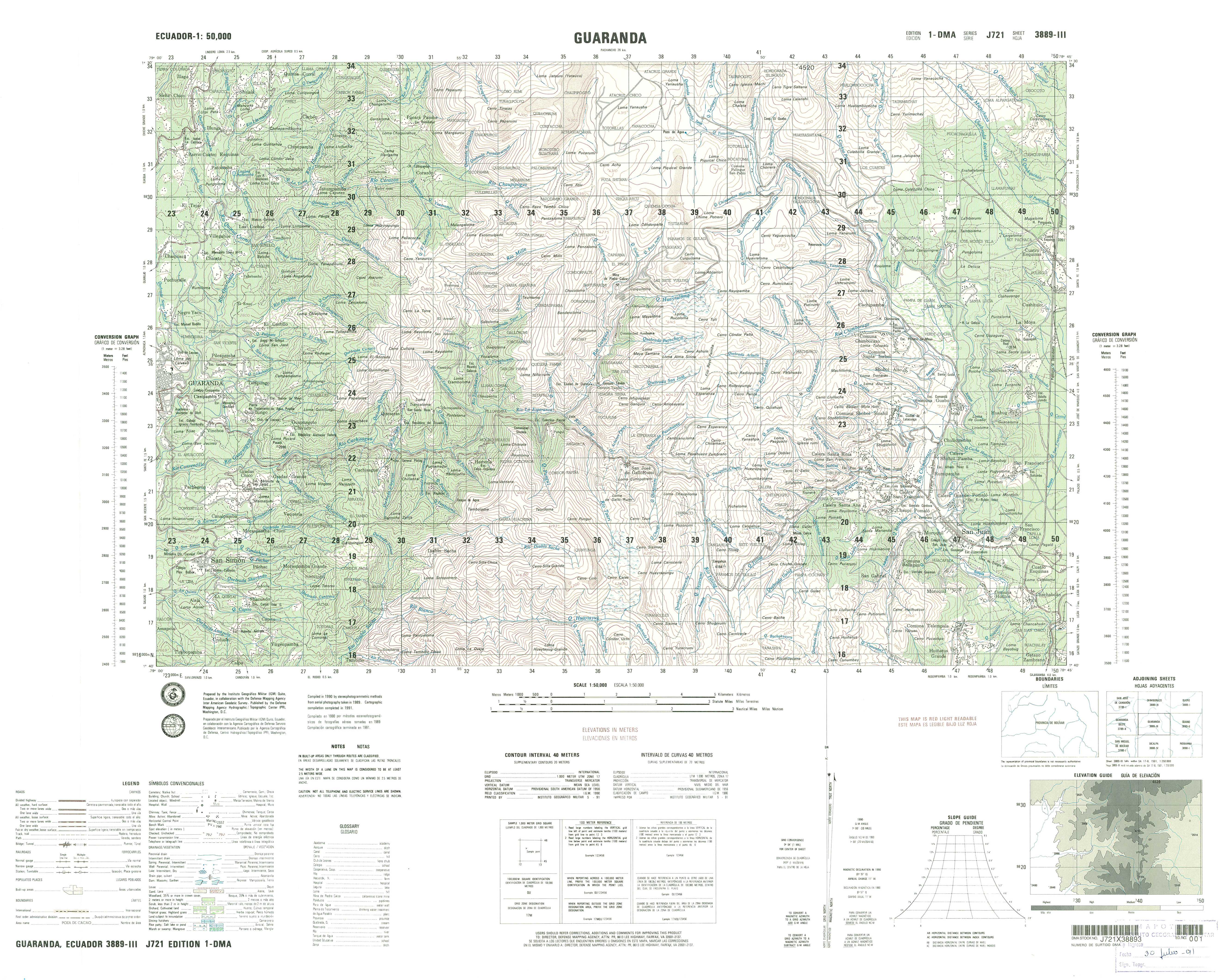
- Guaranda (topographic) Sheet 3889 III, 1:50,000 (5.2MB)
- Guaranda Oeste (topographic) Sheet 3789 II, 1:50,000 (5.3MB)
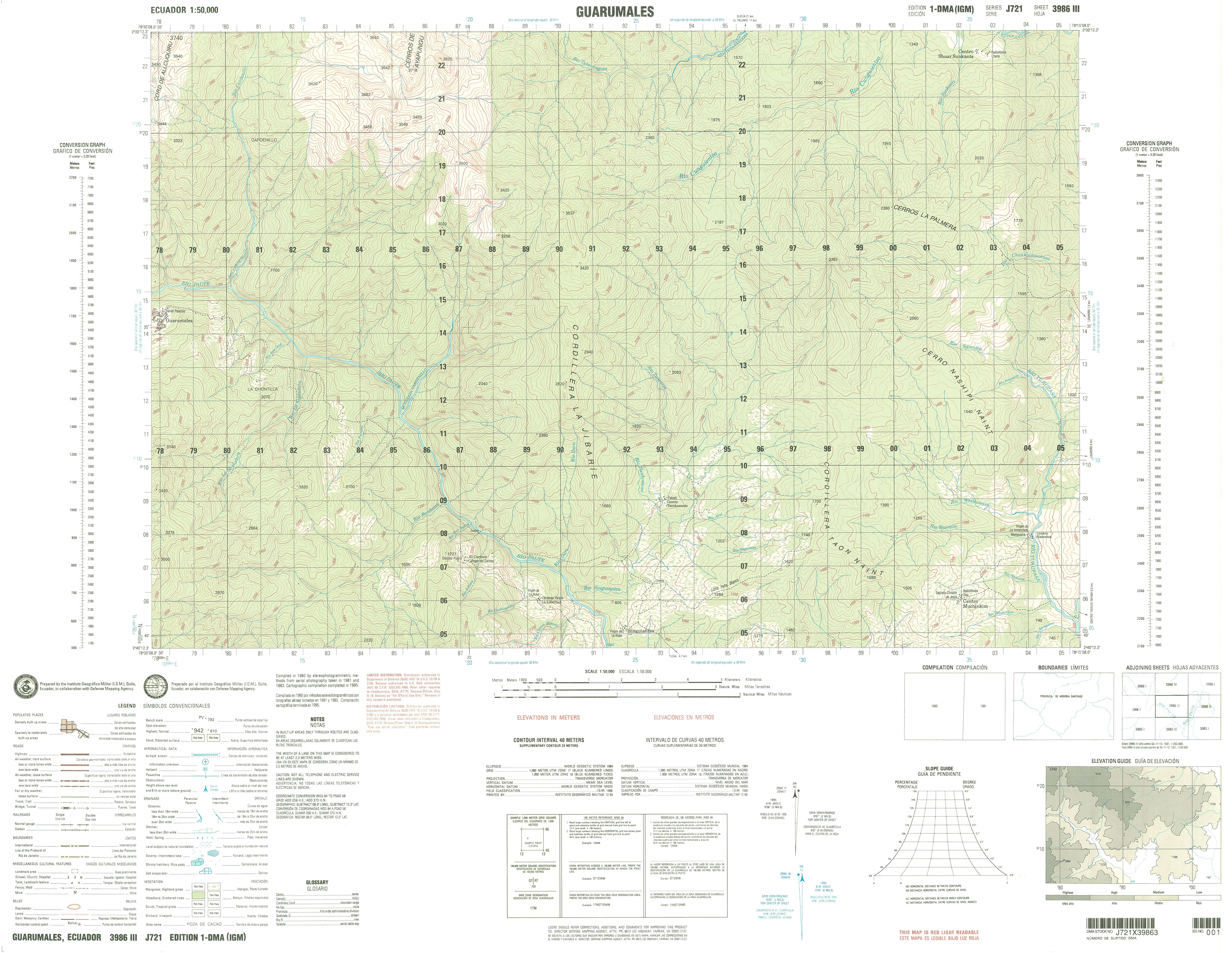
- Guarumales (topographic) Sheet 3986 III, 1:50,000 (3.9MB)
- Hacienda (topographic) Sheet 4096 IV, 1:50,000 (2.8MB) [PDF]
- Huaca (topographic) Sheet 4095 I, 1:50,000 2007 (4.3MB) [PDF]
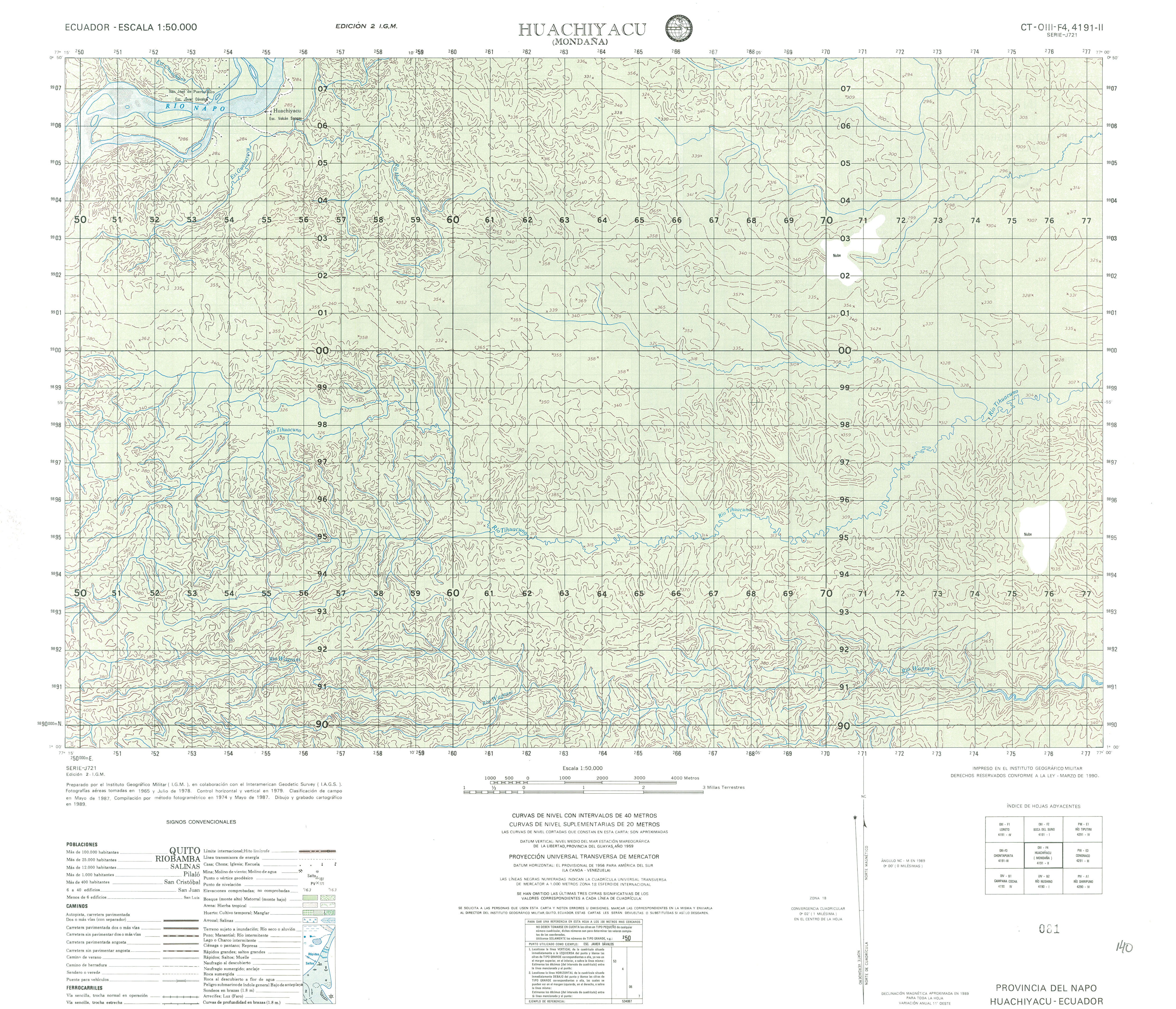
- Huachiyacu (topographic) Sheet 4191 II, 1:50,000 (4.3MB)
- Huangra (topographic) Sheet 3886 I, 1:50,000 (4.1MB)
- Ibarra (topographic) Sheet 3995 II, 1:50,000 (8.5MB)
- Indanza (topographic) Sheet 3984 IV, 1:50,000 1995 (9.7MB) [PDF]
- Imantag (topographic) Sheet 3995 III, 1:50,000 (10.4MB)
- Indanza (topographic) Sheet 3984 IV, 1:50,000 (5.4MB)
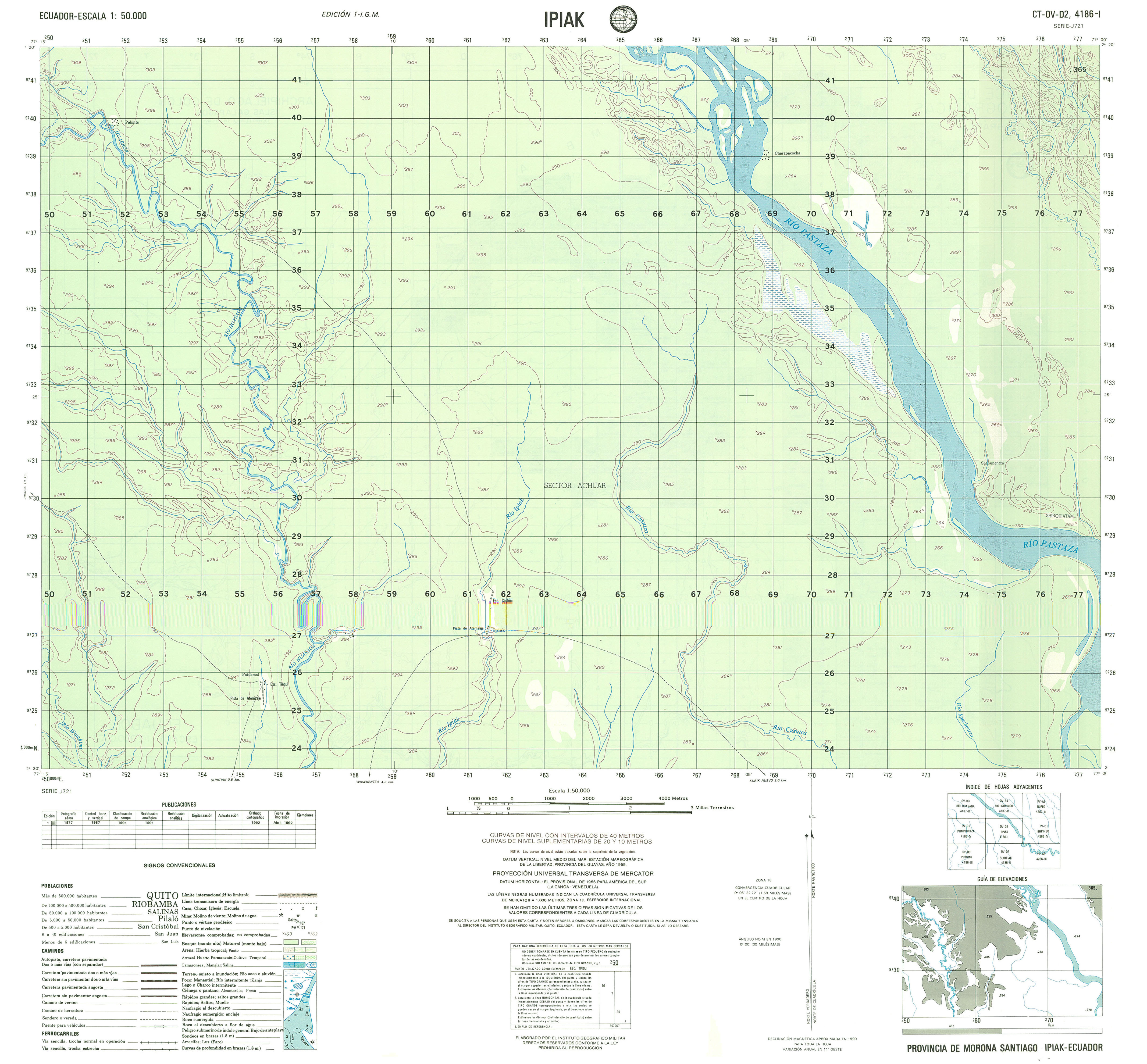
- Ipiak (topographic) Sheet 4186 I, 1:50,000 (2.4MB)
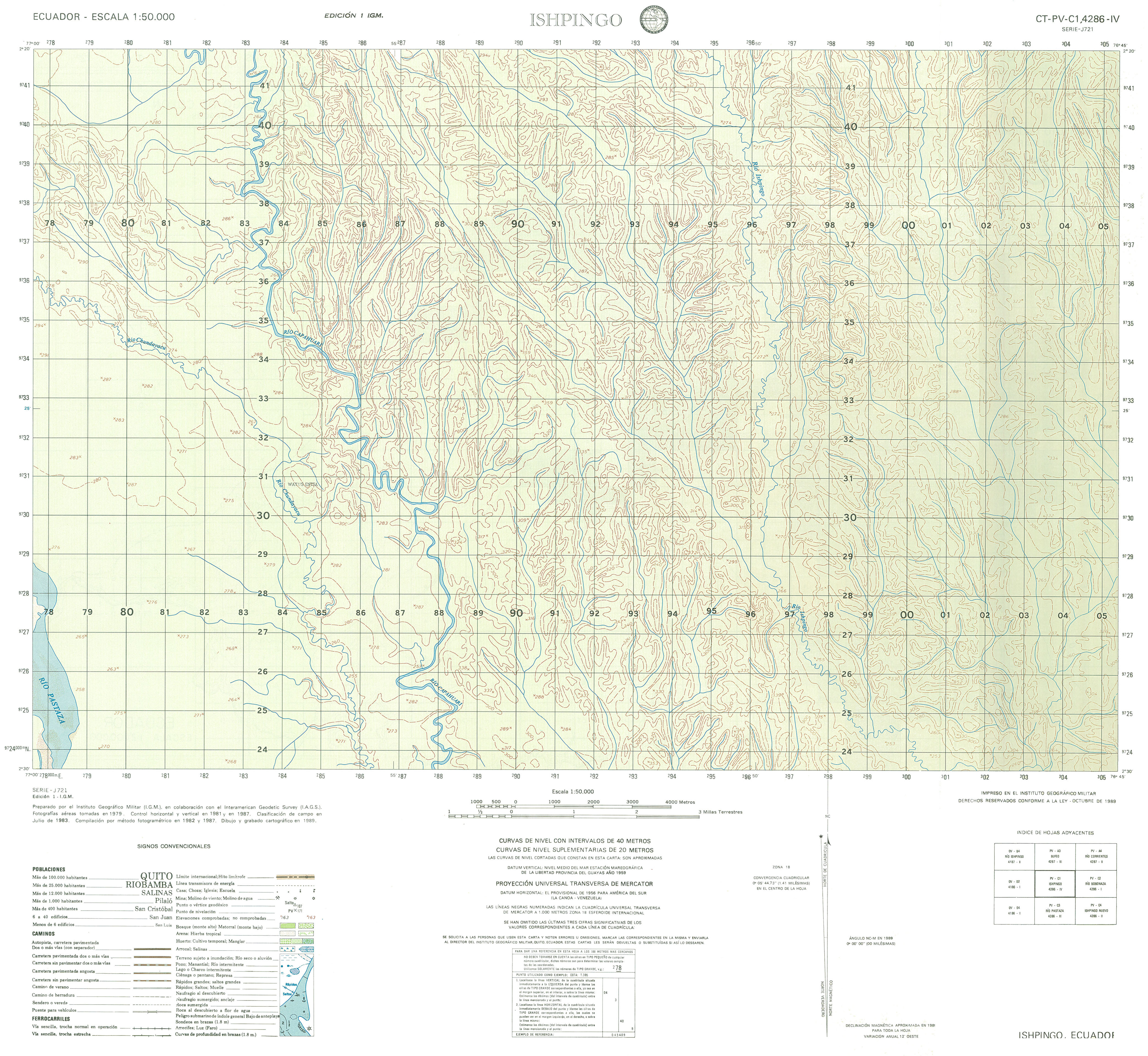
- Ishpingo (topographic) Sheet 4286 IV, 1:50,000 (3.3MB)
- Isidro Ayora (topographic) Sheet 3588 II, 1:50,000 (4.1MB)
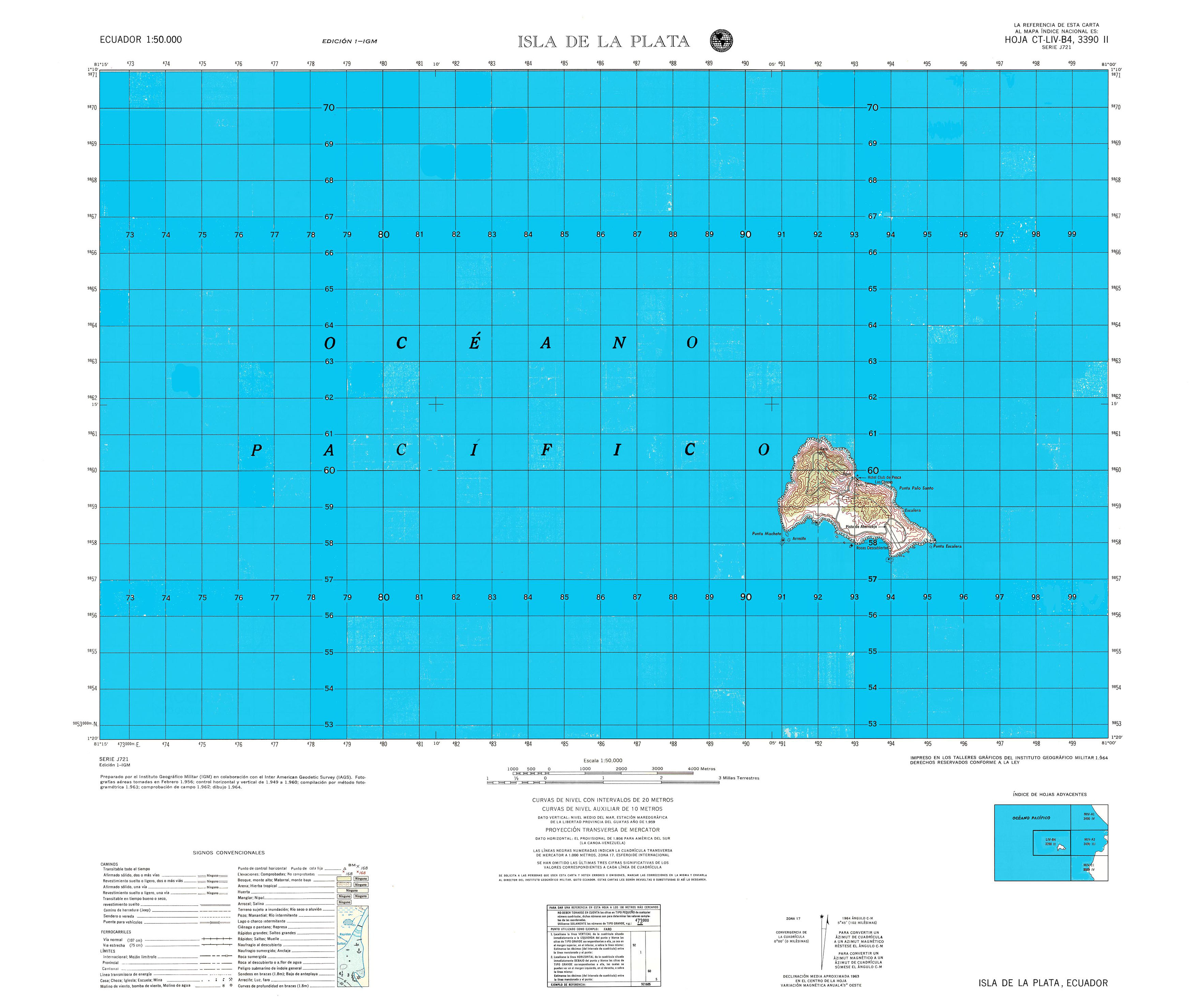
- Isla de la Plata (topographic) Sheet 3390 II, 1:50,000 (1.2MB)
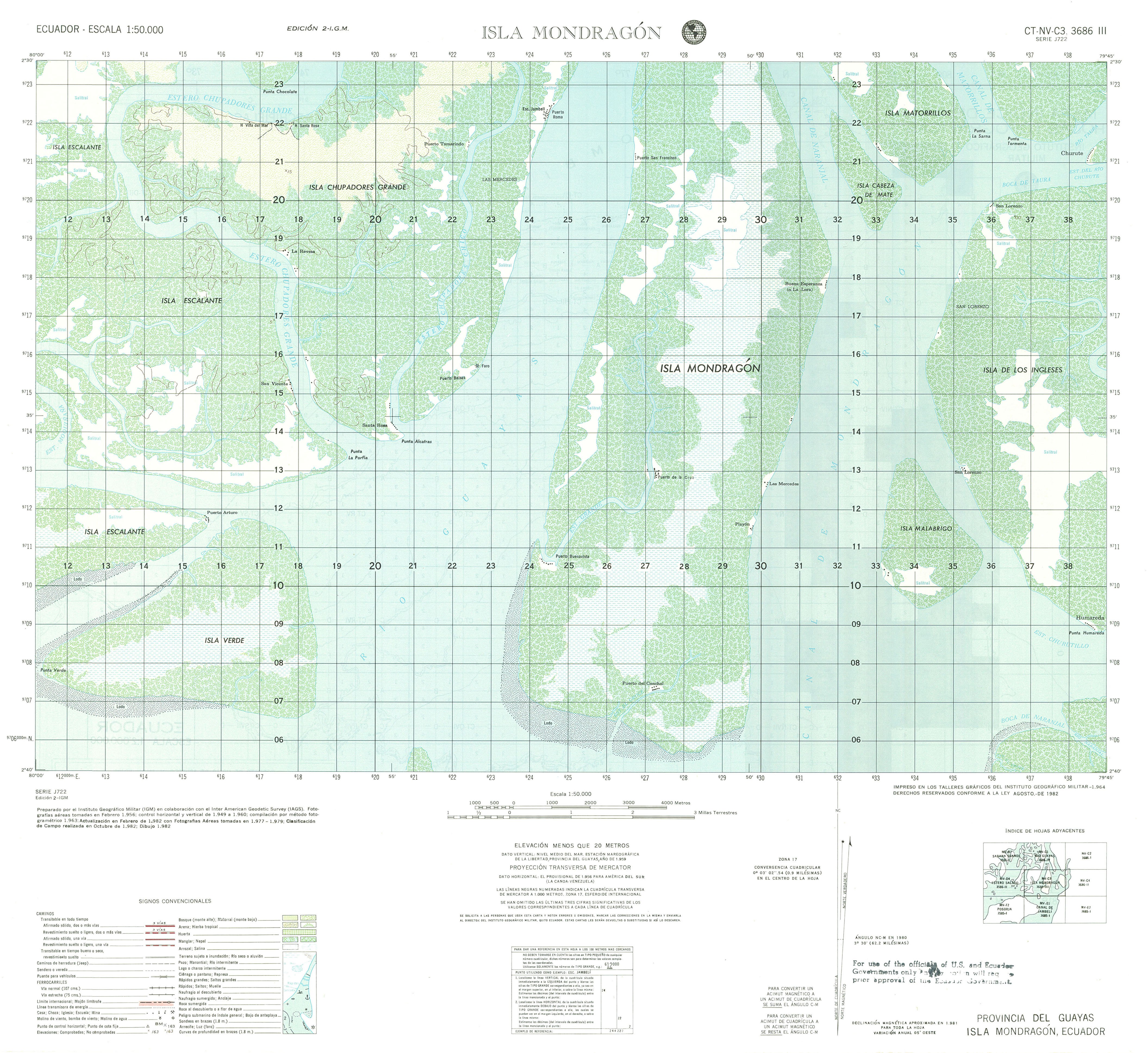
- Isla Mondragon (topographic) Sheet 3686 III, 1:50,000 (3.0MB)
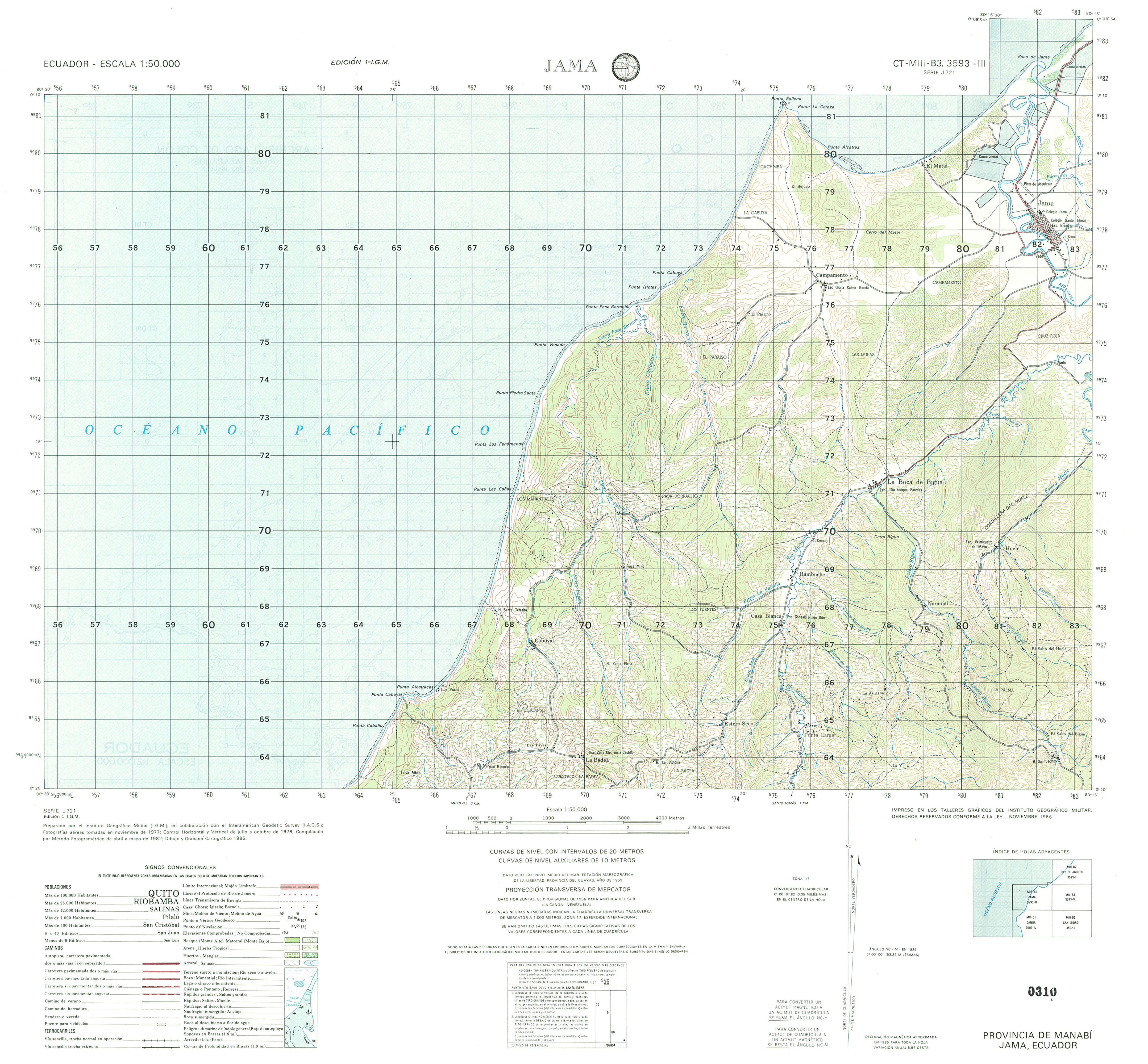
- Jama (topographic) Sheet 3593 III, 1:50,000 (3.0MB)
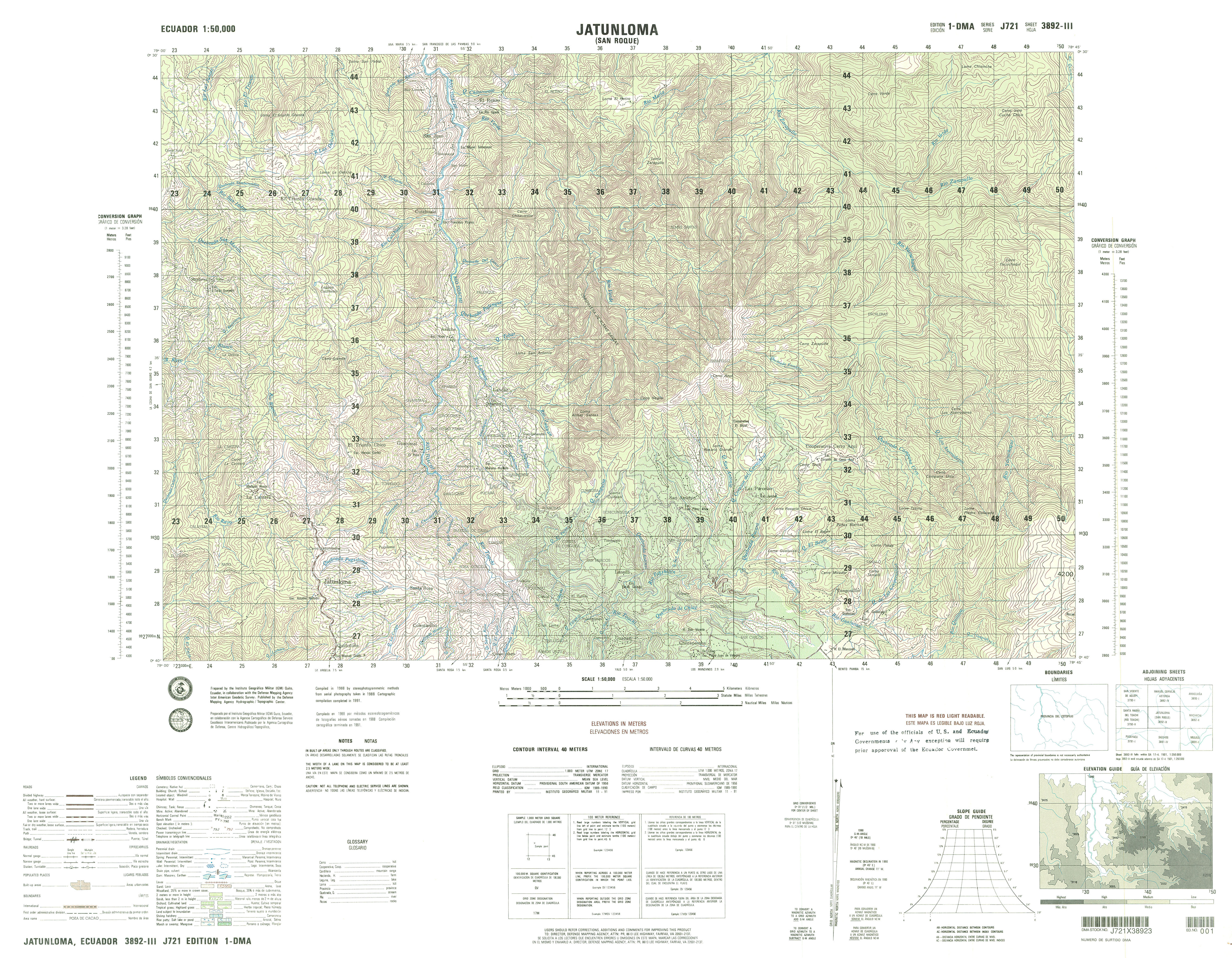
- Jataunloma (topographic) Sheet 3892 III, 1:50,000 (5.1MB)
- Jijon y Caamano (topographic) Sheet 3996 III, 1:50,000 2007 (4.1MB) [PDF]
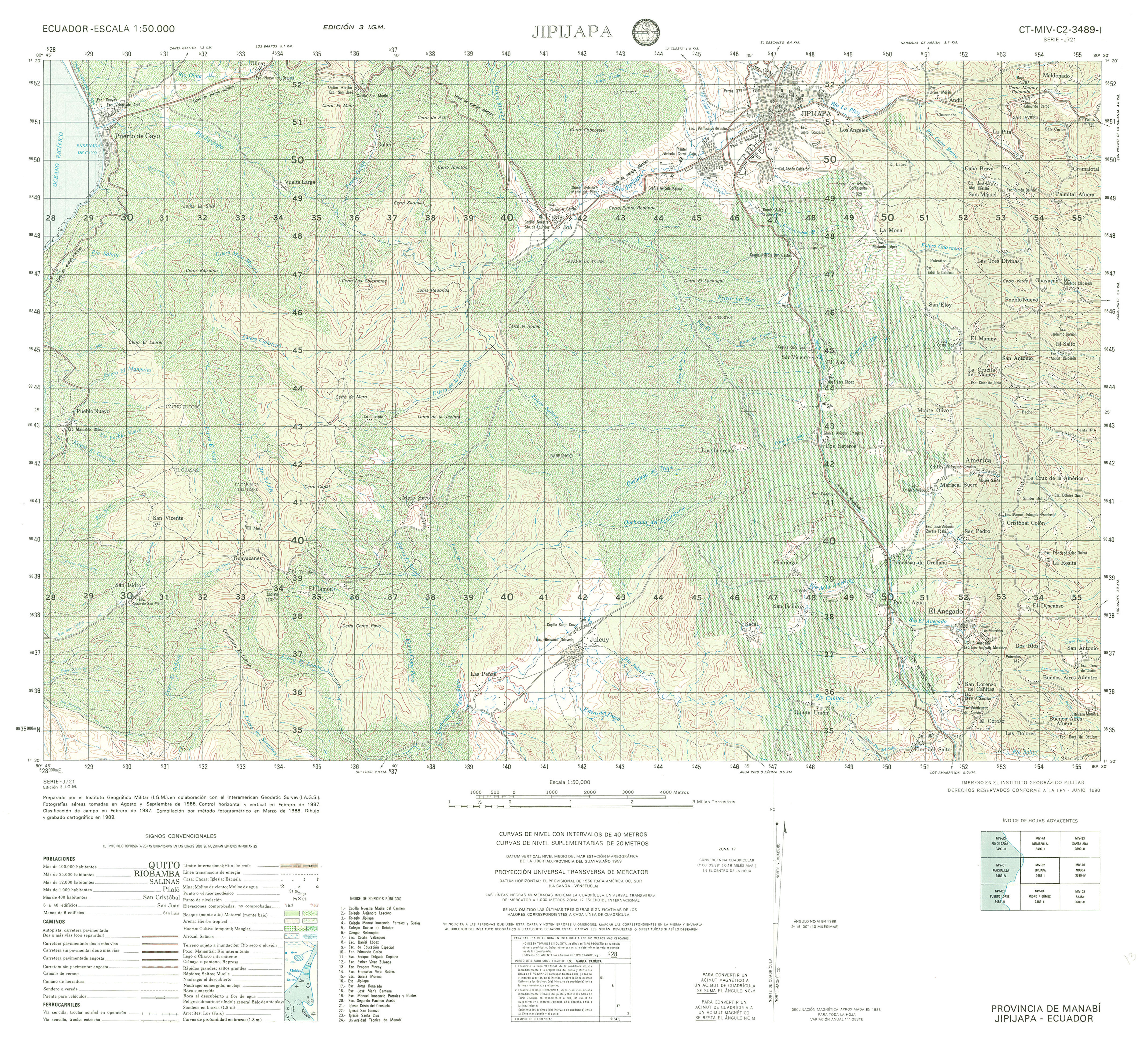
- Jipijapa (topographic) Sheet 3489 I, 1:50,000 (4.5MB)
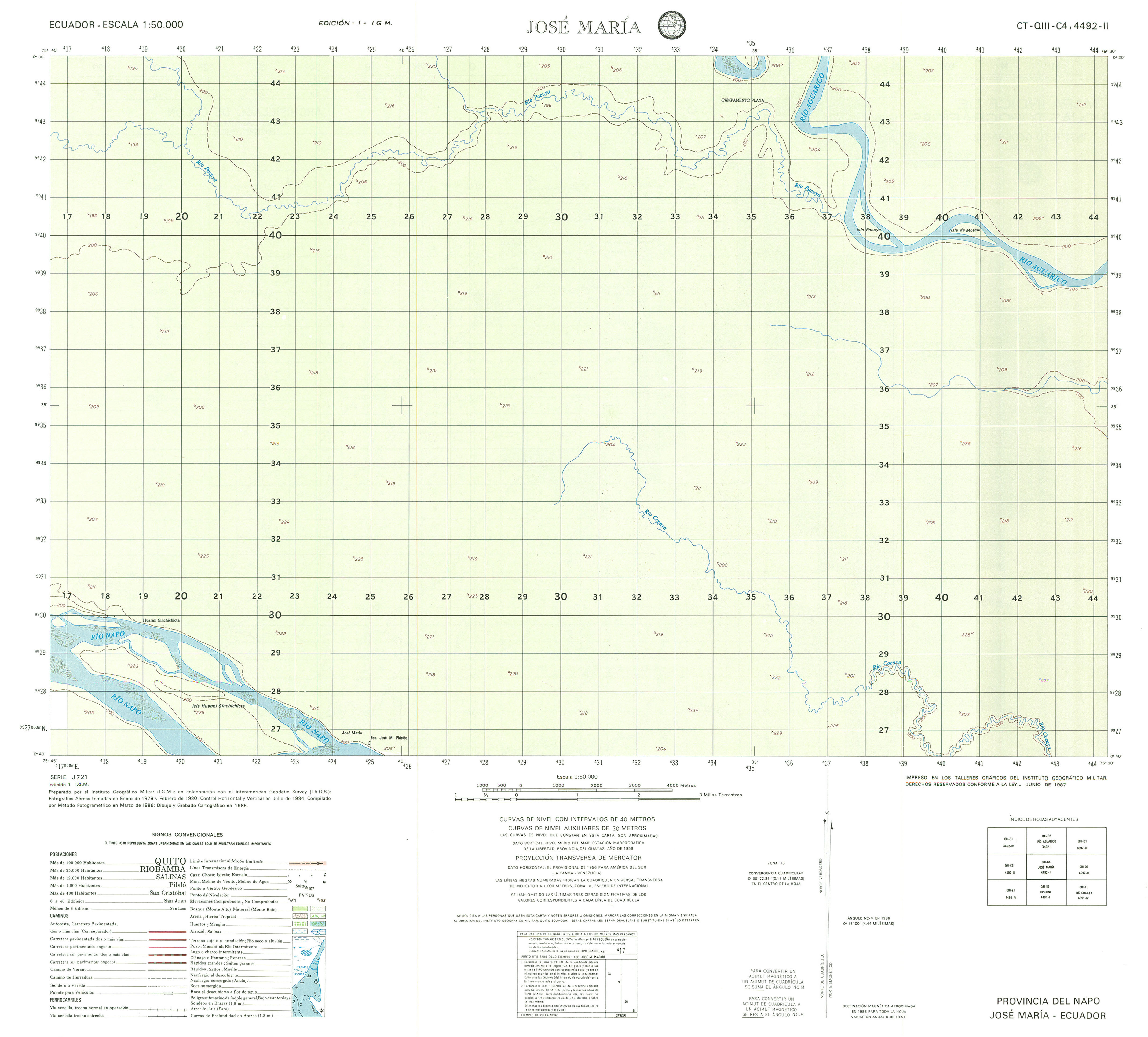
- Jose Maria (topographic) Sheet 4992 II, 1:50,000 (1.7MB)
- Juan Montlvo (topographic) Sheet 3788 IV, 1:50,000 (3.8MB)
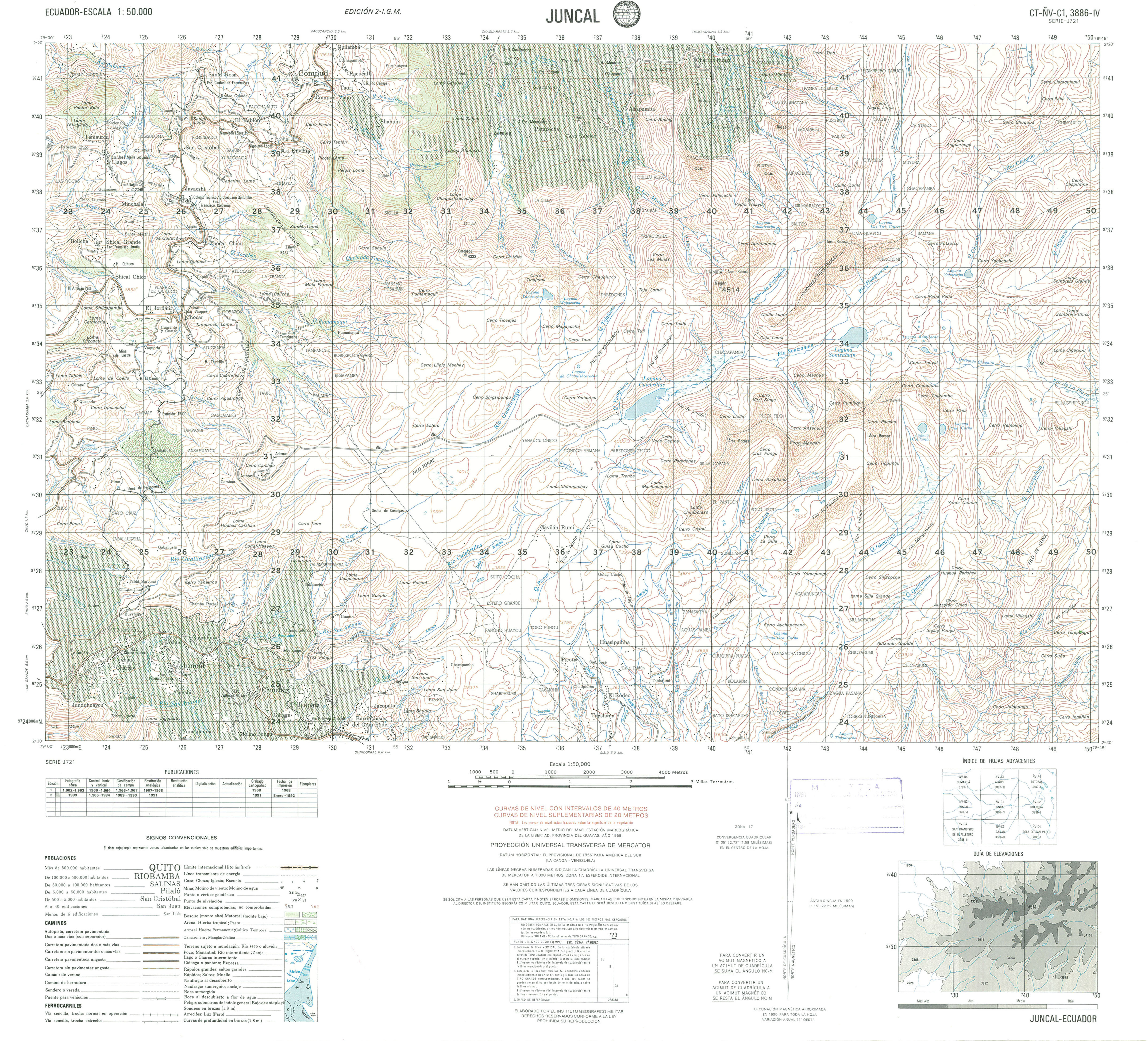
- Juncal (topographic) Sheet 3886 IV, 1:50,000 (4.0MB)
- Loja Sur (Rio Sabanilla) (topographic) Sheet 3781 I, 1:50,000 1998 (8.4MB) [PDF]
- Juan Gomez Rendon (topographic), 1:50,000 1995 (8.3MB) [PDF]
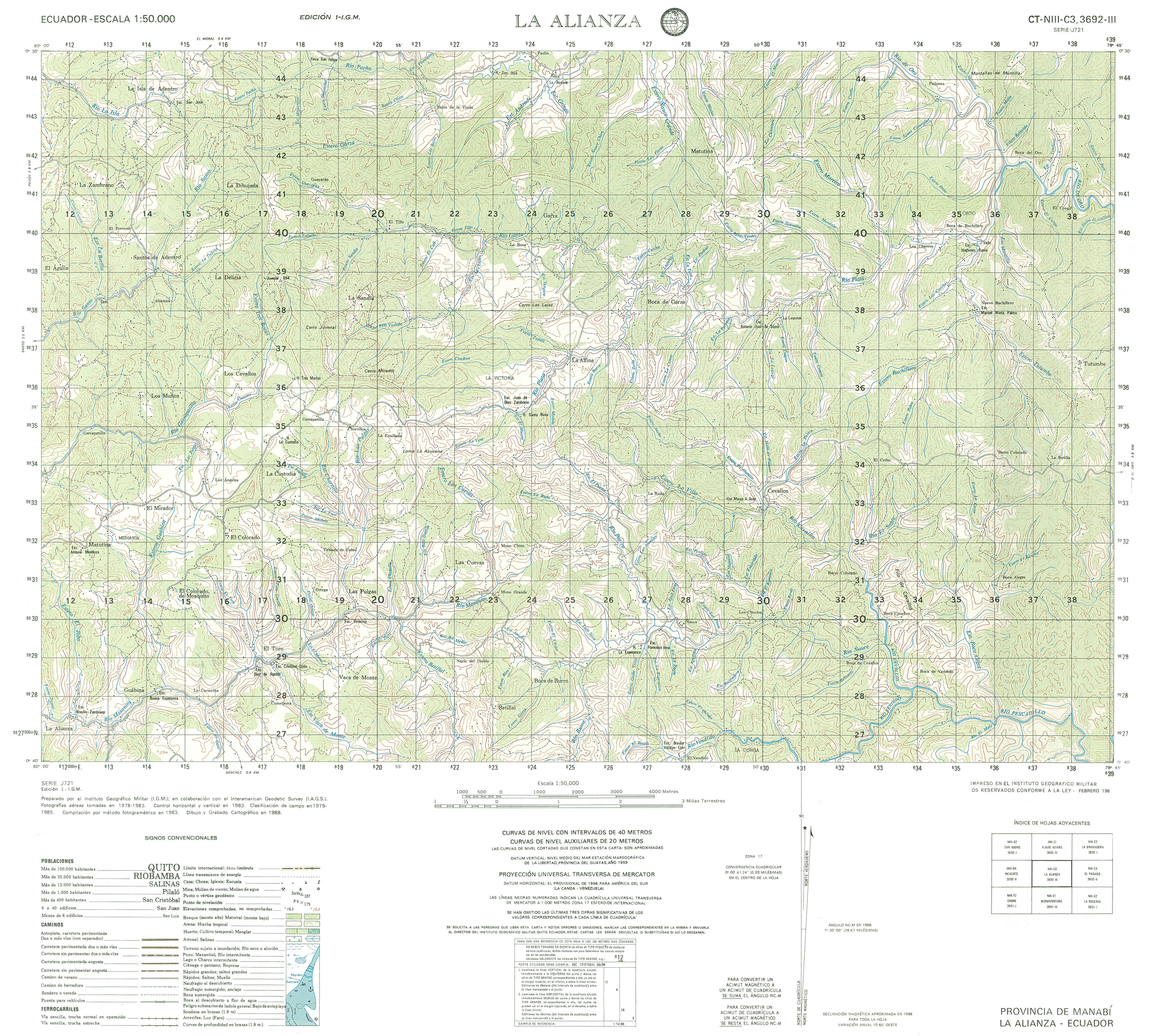
- La Alianza (topographic) Sheet 3692 III, 1:50,000 (4.7MB)
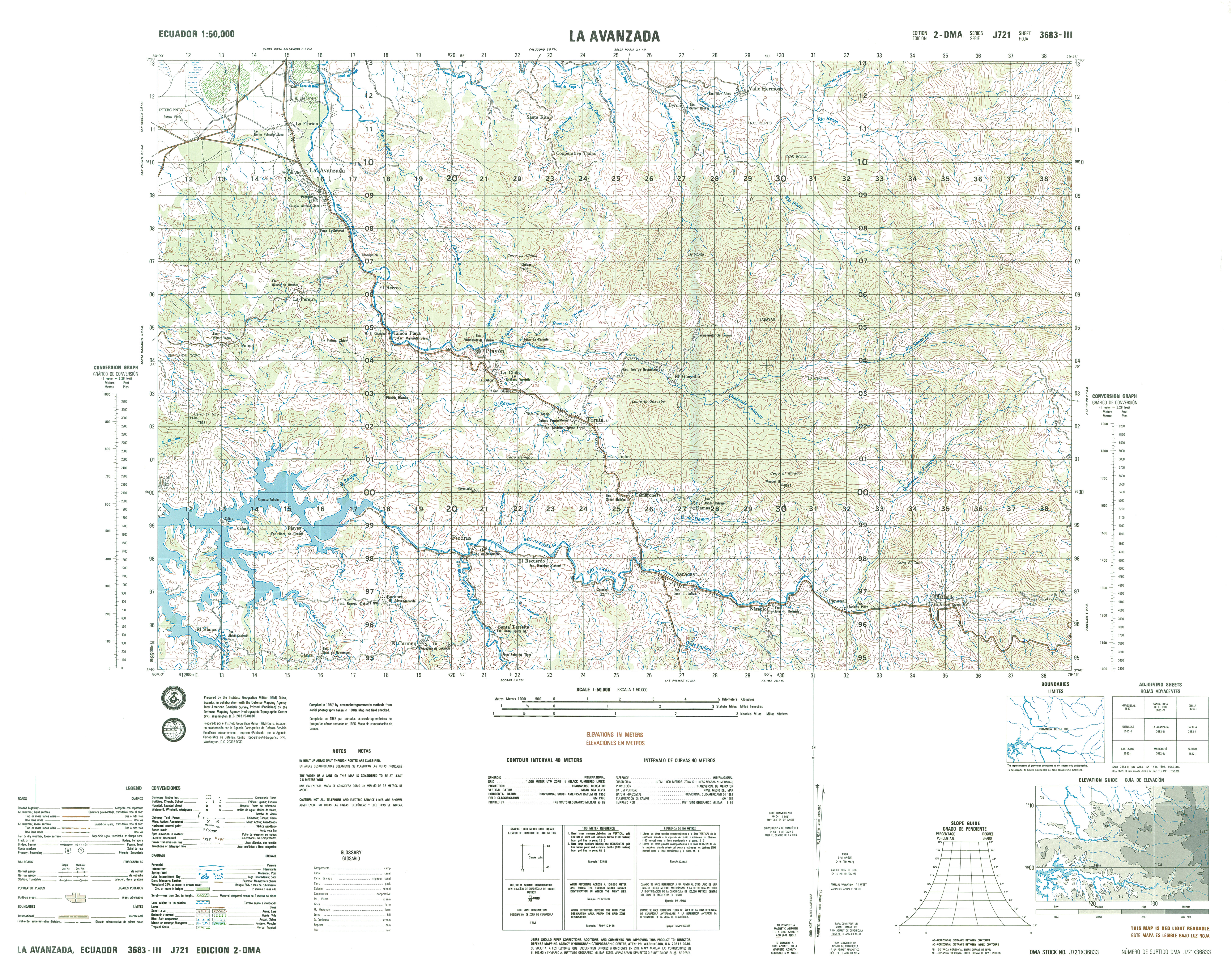
- La Avanzada (topographic) Sheet 3683 III, 1:50,000 (5.7MB)
- La Bramadora (topographic) Sheet 3692 I, 1:50,000 (4.8MB)
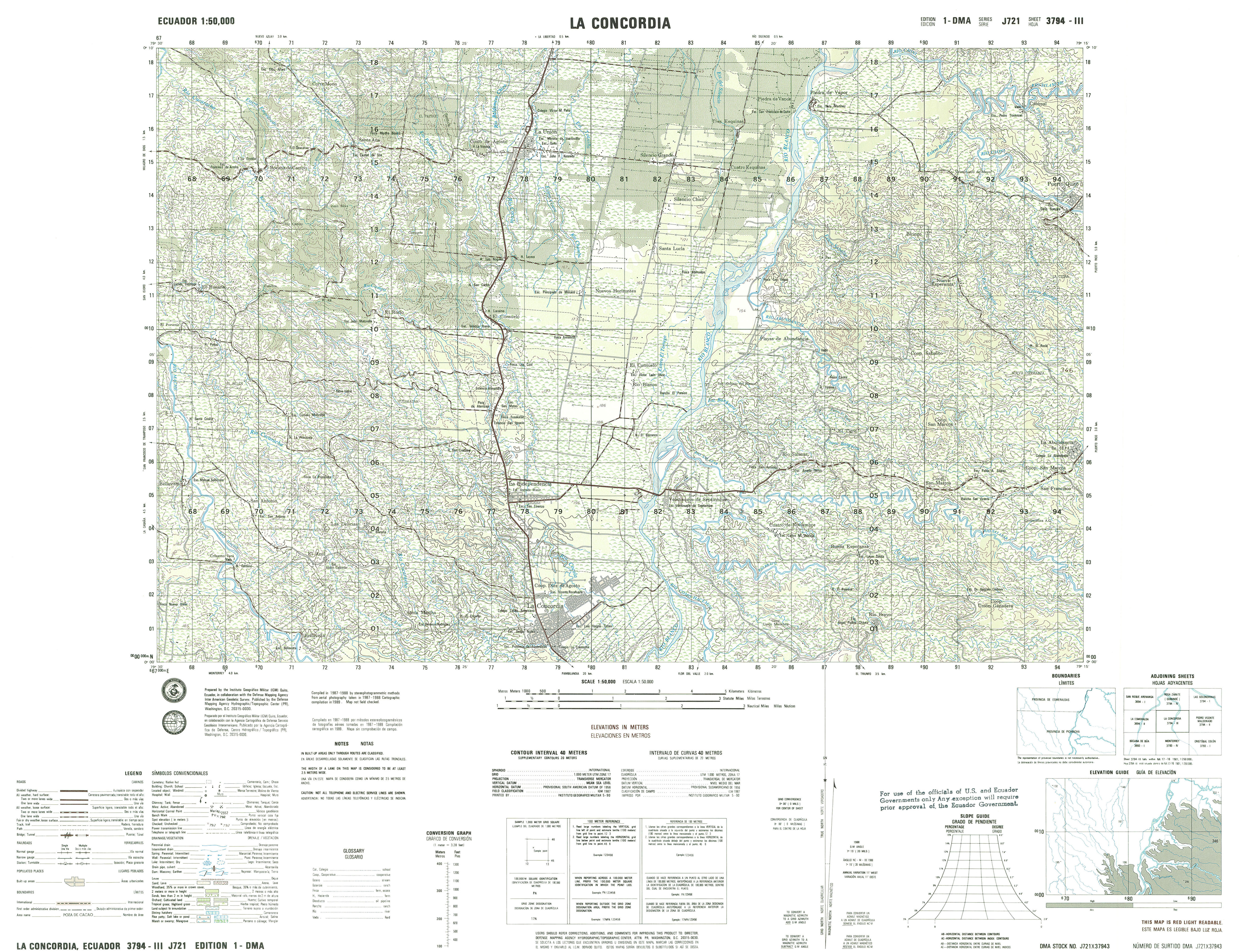
- La Concordia (topographic) Sheet 3794 II, 1:50,000 (4.9MB)
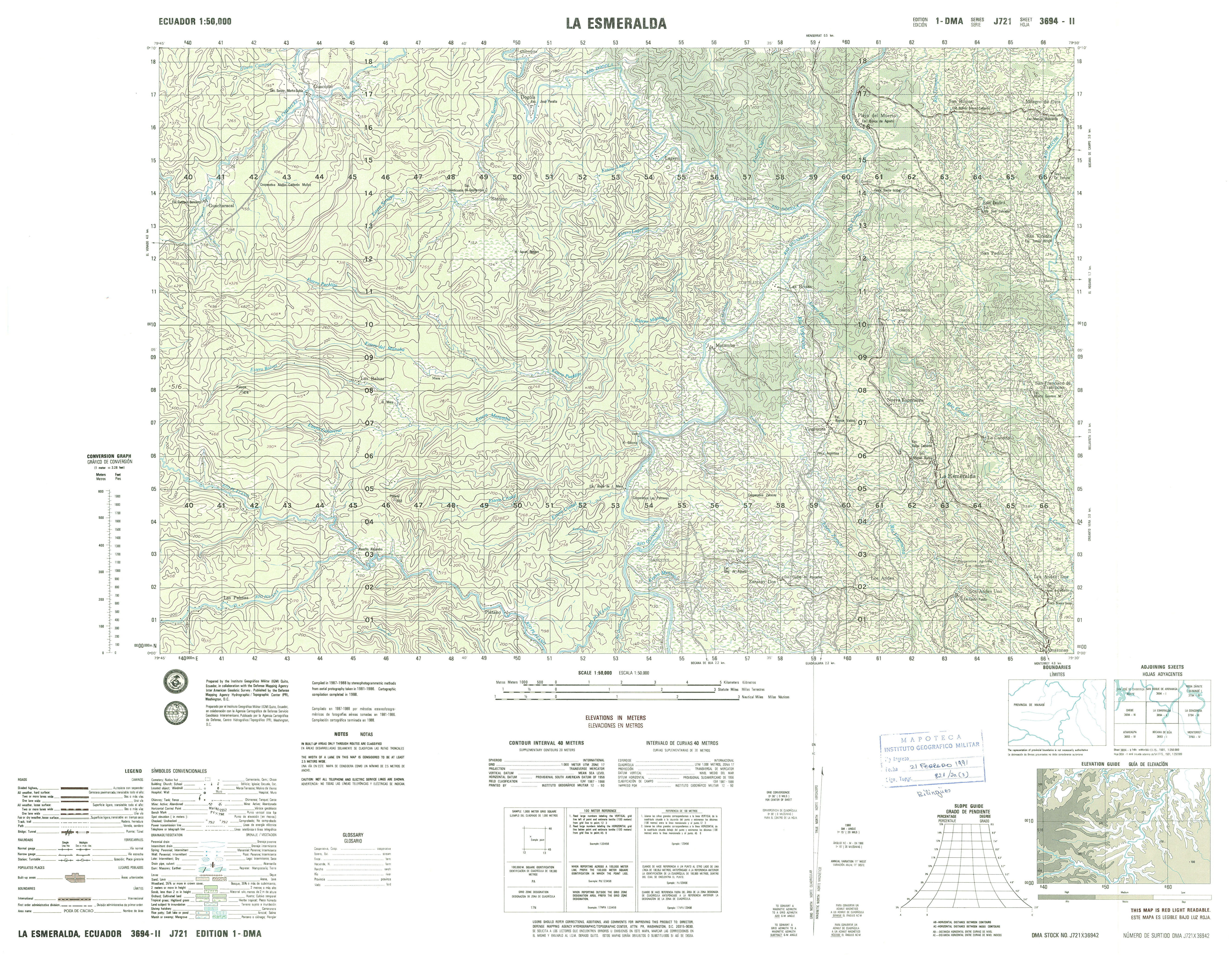
- La Esmeralda (topographic) Sheet 3694 II, 1:50,000 (4.4MB)
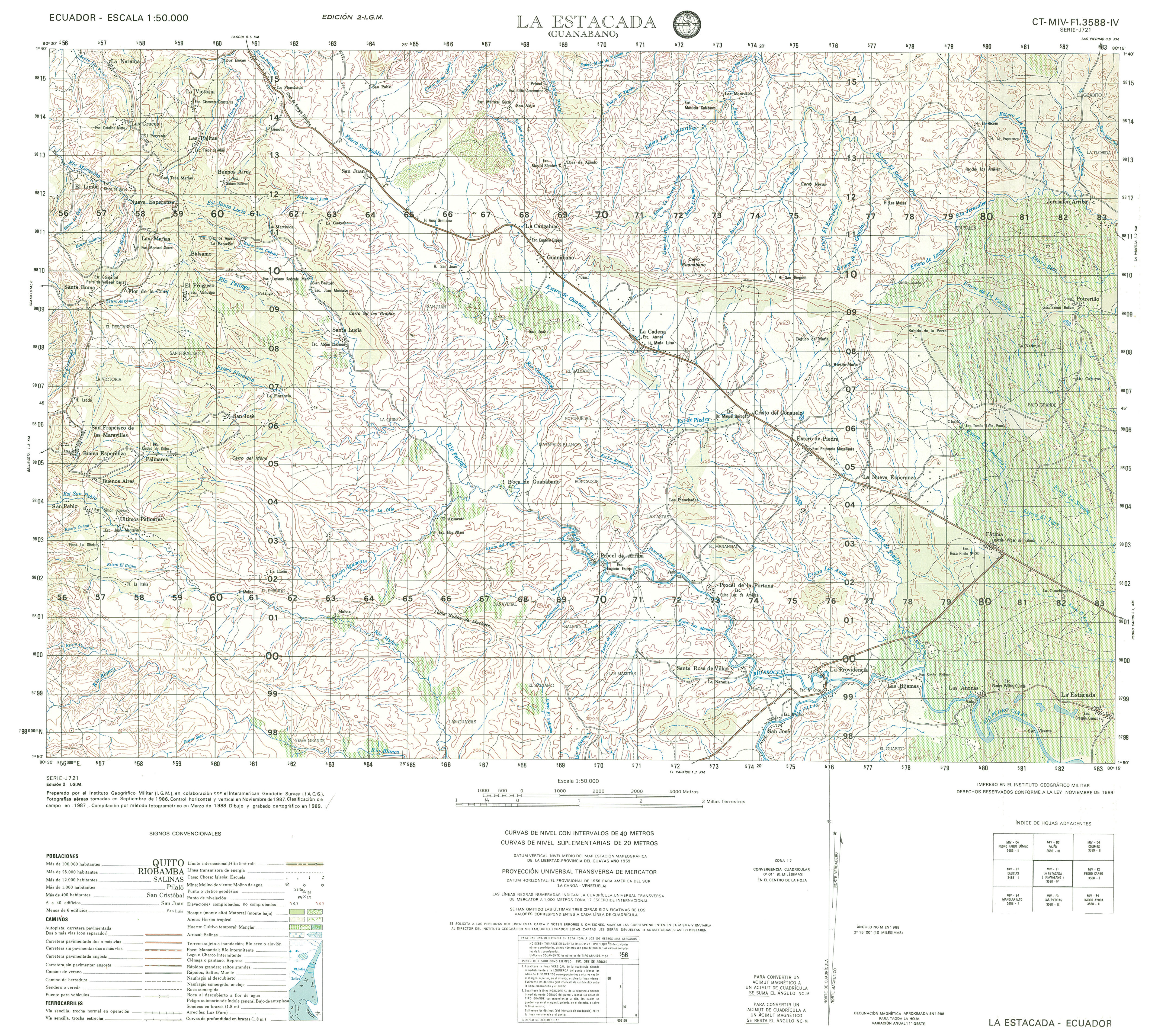
- La Estacada (topographic) Sheet 3588 IV, 1:50,000 (4.0MB)
- La Bonita (topographic) Sheet , 1:50,000 2007 (4.7MB) [PDF]
- La Carolina (topographic) Sheet , 1:50,000 2000 (7.8MB) [PDF]
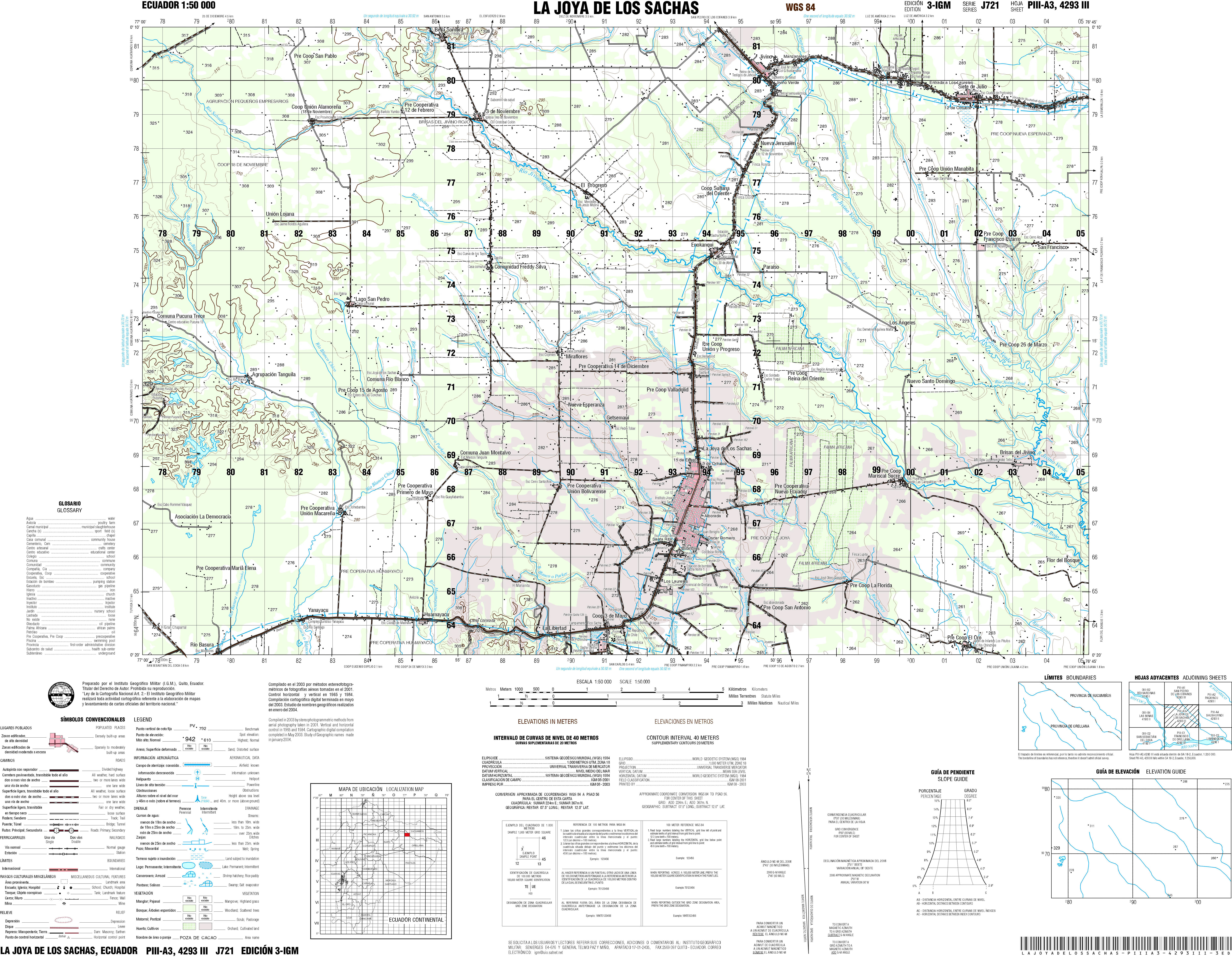
- La Joya de Los Sacha (topographic) Sheet 4293 III, 1:50,000 (5.7MB)
- La Merced de Buenos Aires (topographic) Sheet 3995 IV, 1:50,000 2007 (4.2MB) [PDF]
- La Mana (topographic) Sheet 3791 II, 1:50,000 (4.8MB)
- La Palmera (topographic) Sheet 4195 III, 1:50,000 2007 (3.7MB) [PDF]
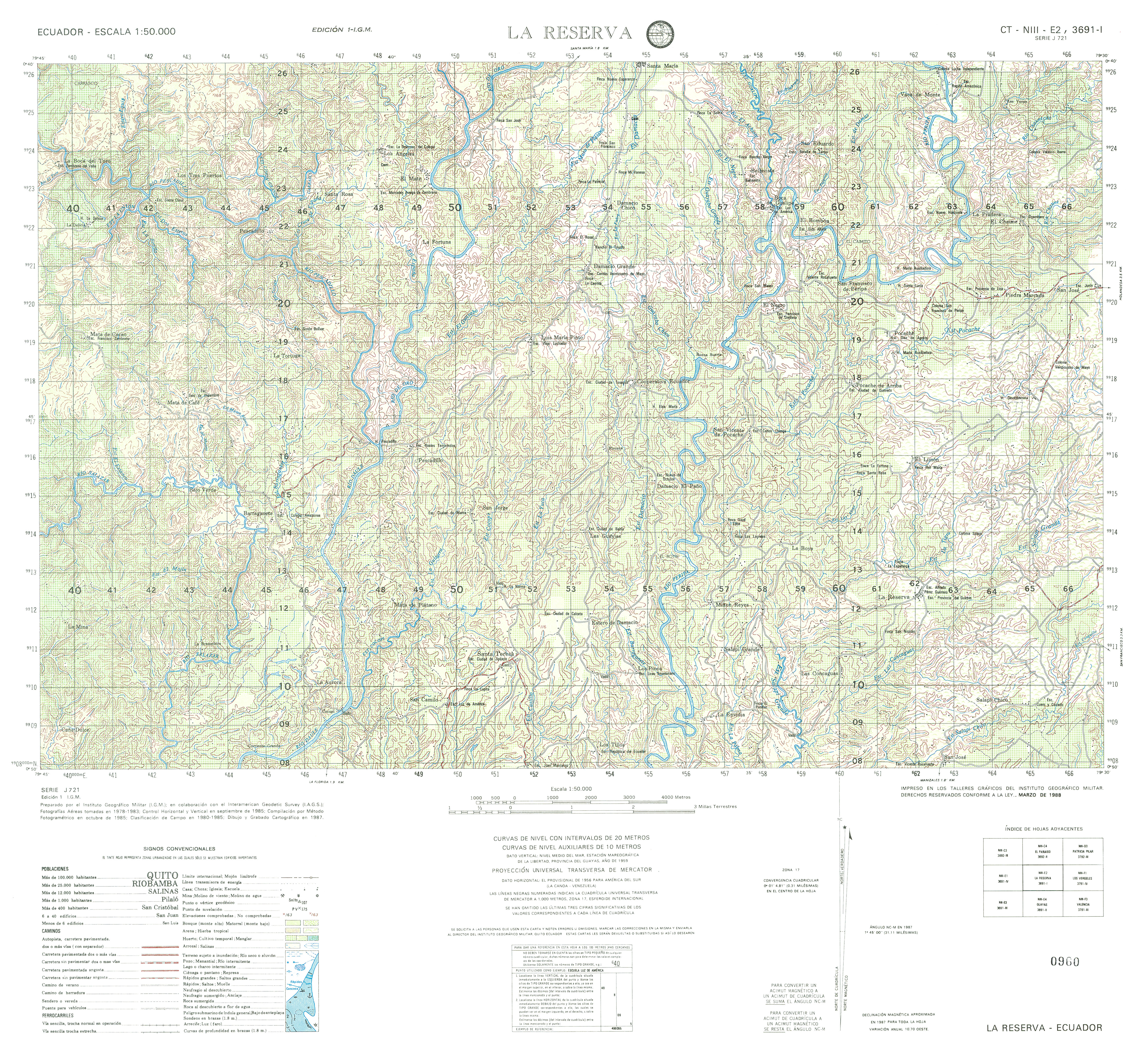
- La Reserva (topographic) Sheet 3691 I, 1:50,000 2007 (6.1MB) [PDF]
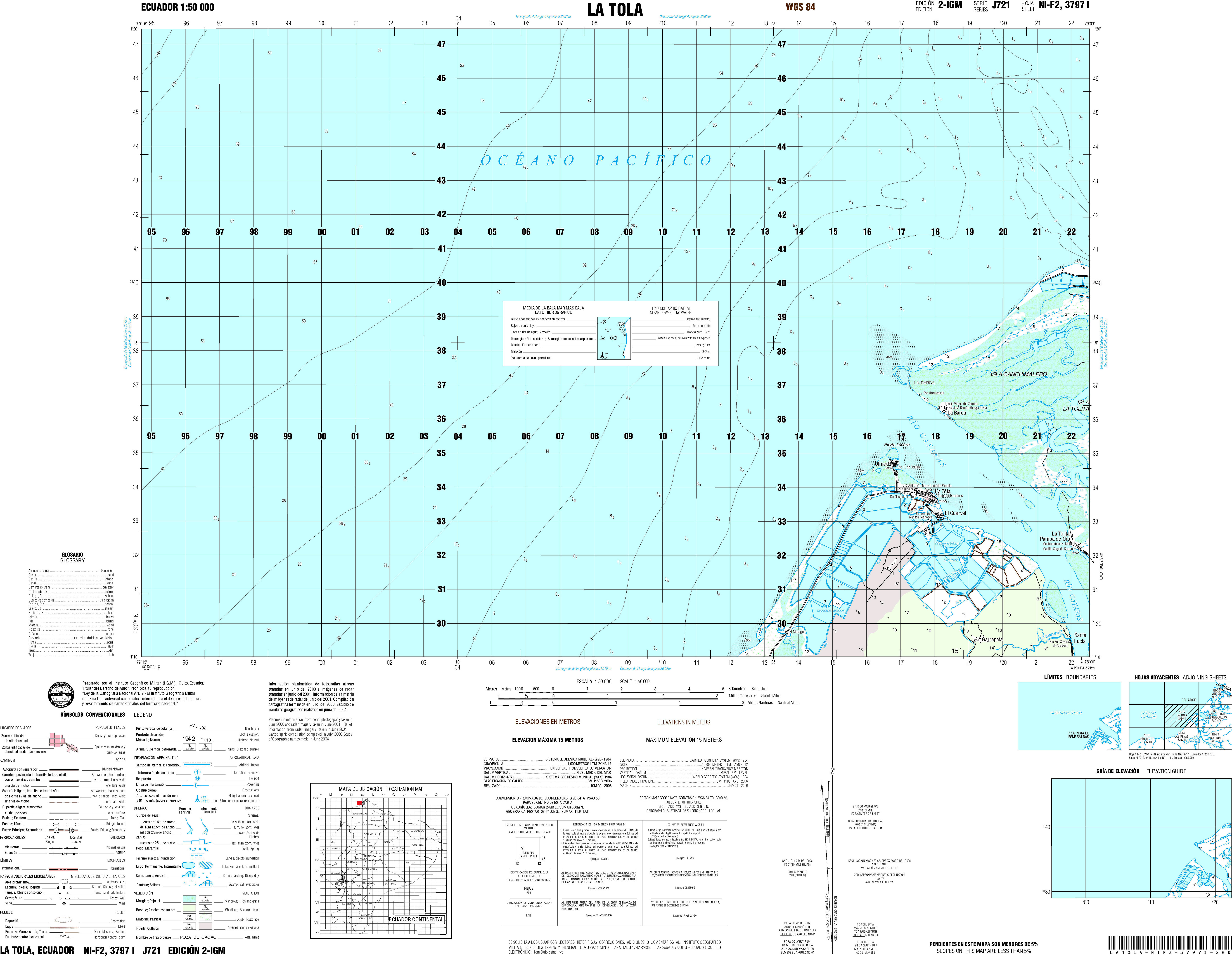
- La Tola (topographic) Sheet 3797 I, 1:50,000 (3.6MB)
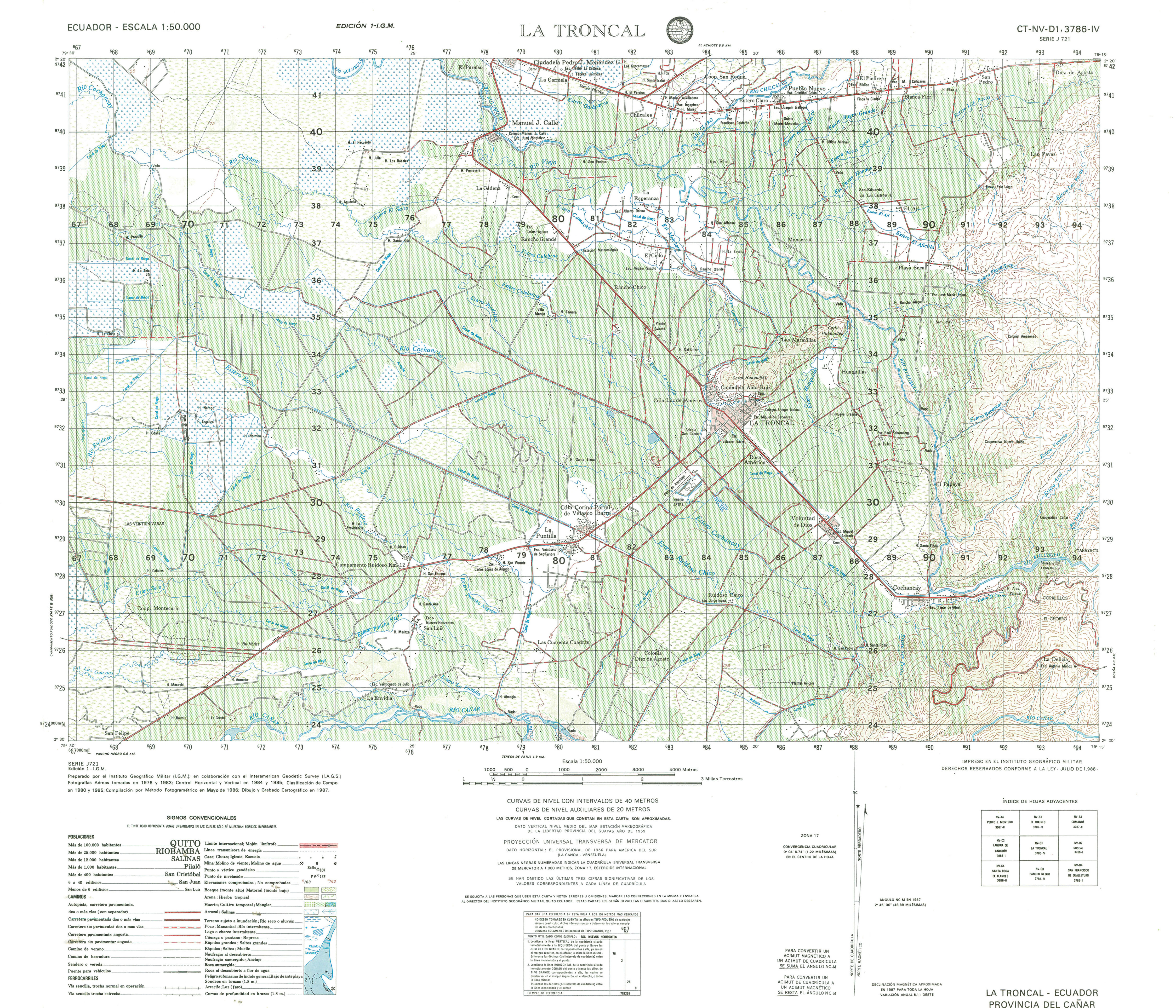
- La Troncal (topographic) Sheet 3786 IV, 1:50,000 (4.5MB)
- Laguna El Canclon (topographic) Sheet J3686 1, 1:50,000 1998 (7.1MB) [PDF]
- Laguna de Anteojos (topographic) Sheet 3991 III, 1:50,000 (3.8MB)
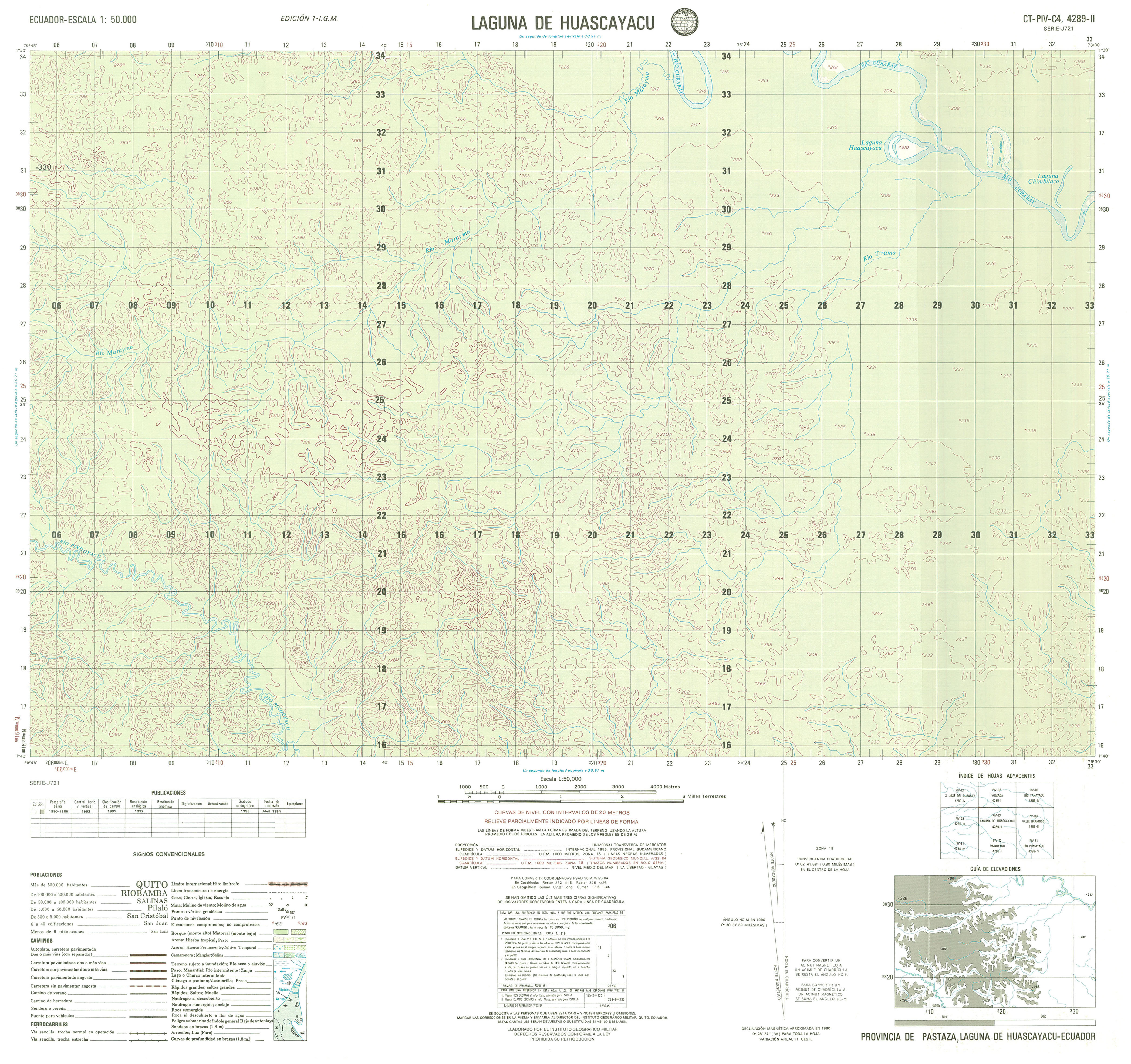
- Laguna de Huascayacu (topographic) Sheet 4289 II, 1:50,000 (2.9MB)
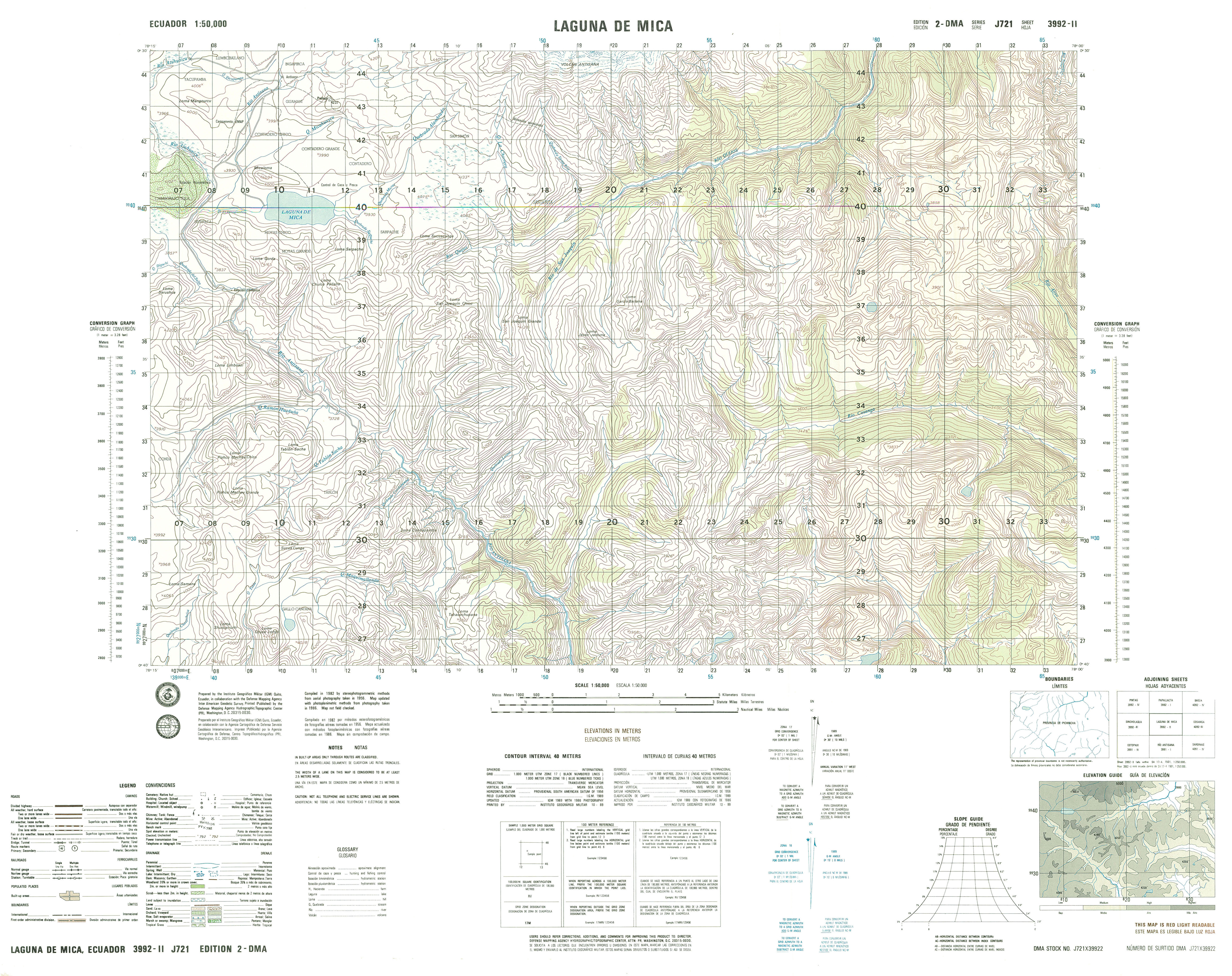
- Laguna de Mica (topographic) Sheet 3992 II, 1:50,000 (4.0MB)
- Laguna el Canclan (topographic) Sheet 3686 I, 1:50,000 (4.6MB)
- Laguna el Canclan (topographic) Sheet 3686 I, 1:50,000 (4.6MB)
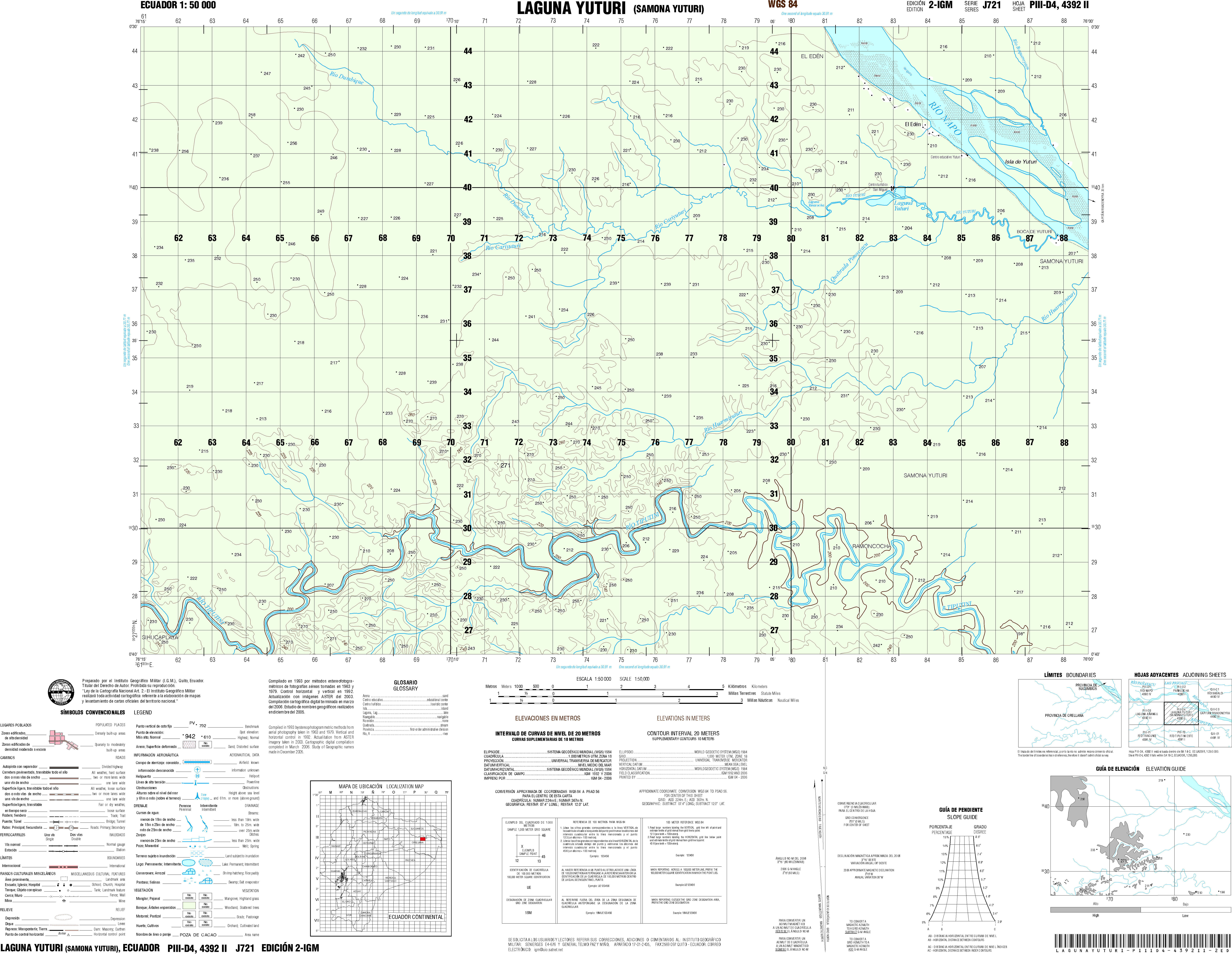
- Laguna Yuturi (topographic) Sheet 4392 I, 1:50,000 (4.3MB)
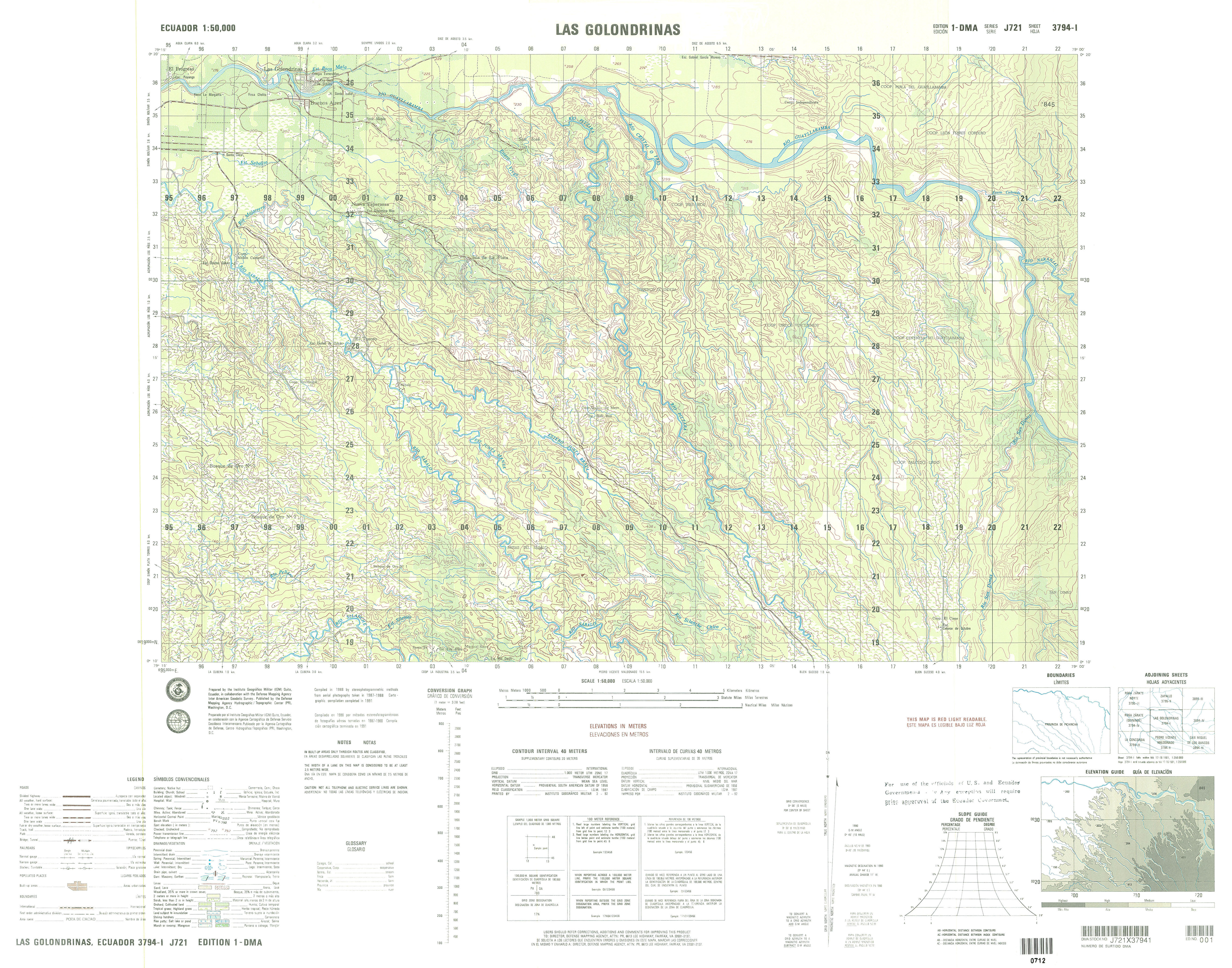
- Las Golondrinas (topographic) Sheet 3794 I, 1:50,000 (4.4MB)
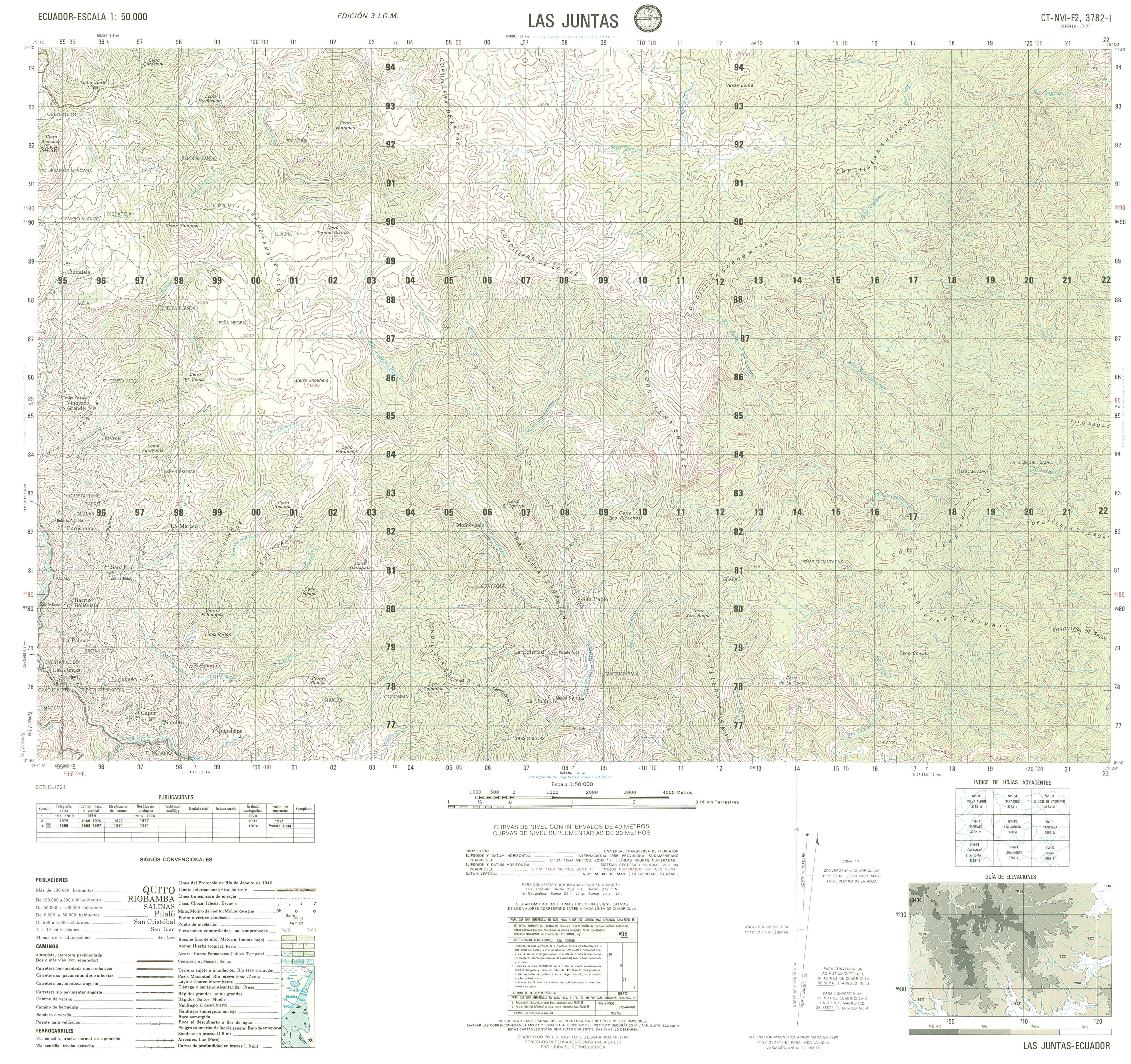
- Las Juntas (topographic) Sheet 3782 I, 1:50,000 (4.2MB)
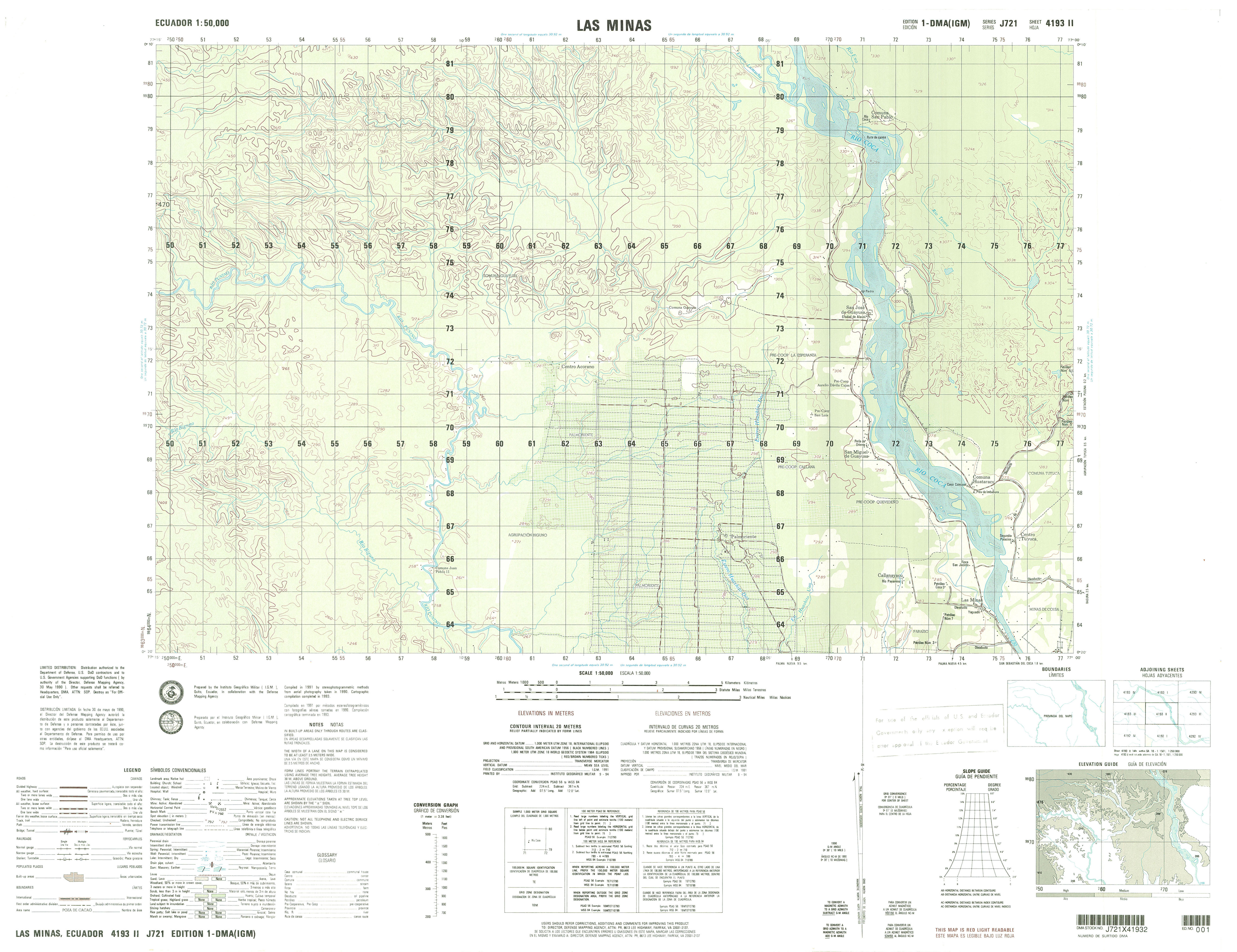
- Las Minas (topographic) Sheet 4193 II, 1:50,000 (3.3MB)
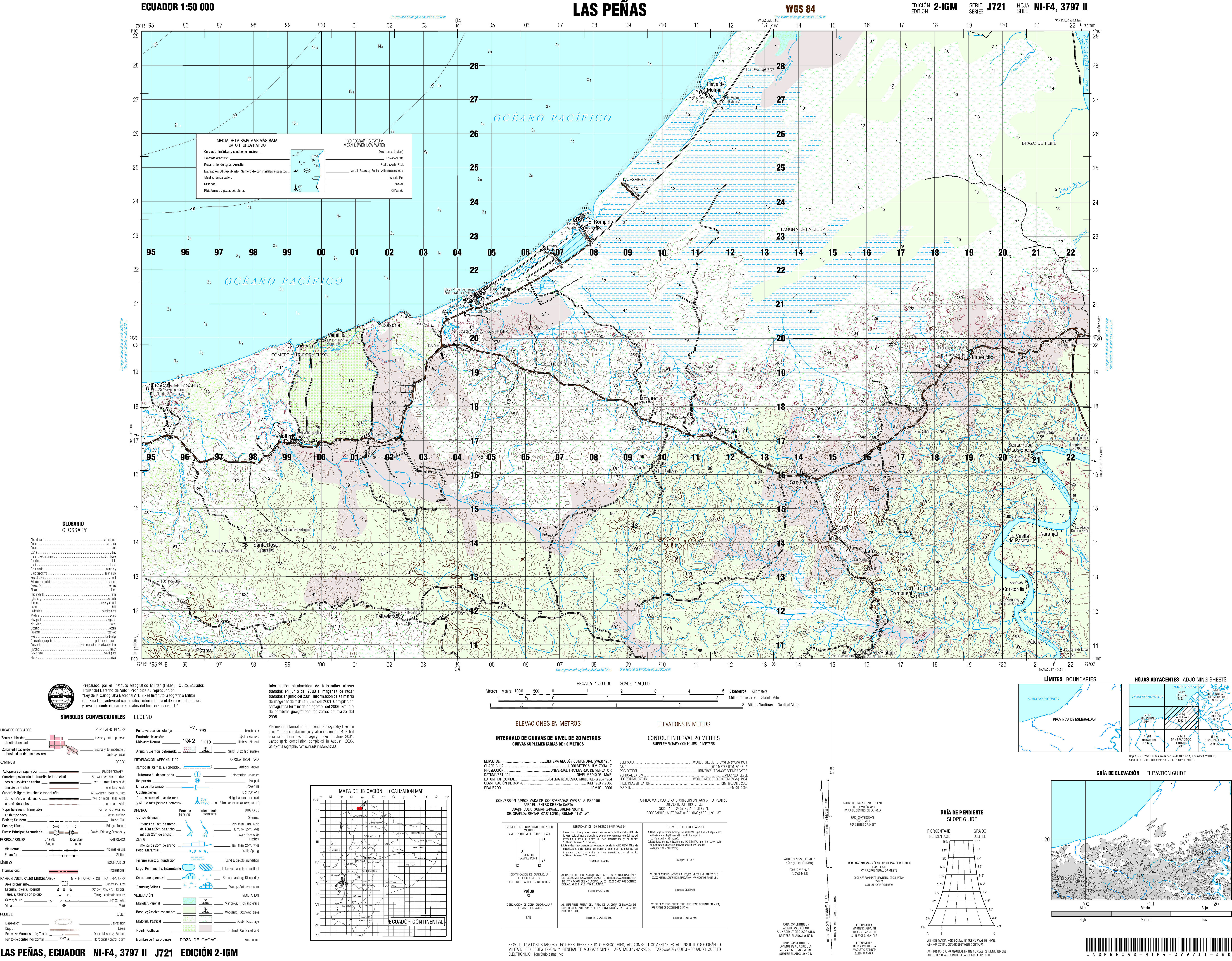
- Las Peaas (topographic) Sheet 3797 II, 1:50,000 (8.1MB)
- Las Piedras (topographic) Sheet 3588 III, 1:50,000 (4.1MB)
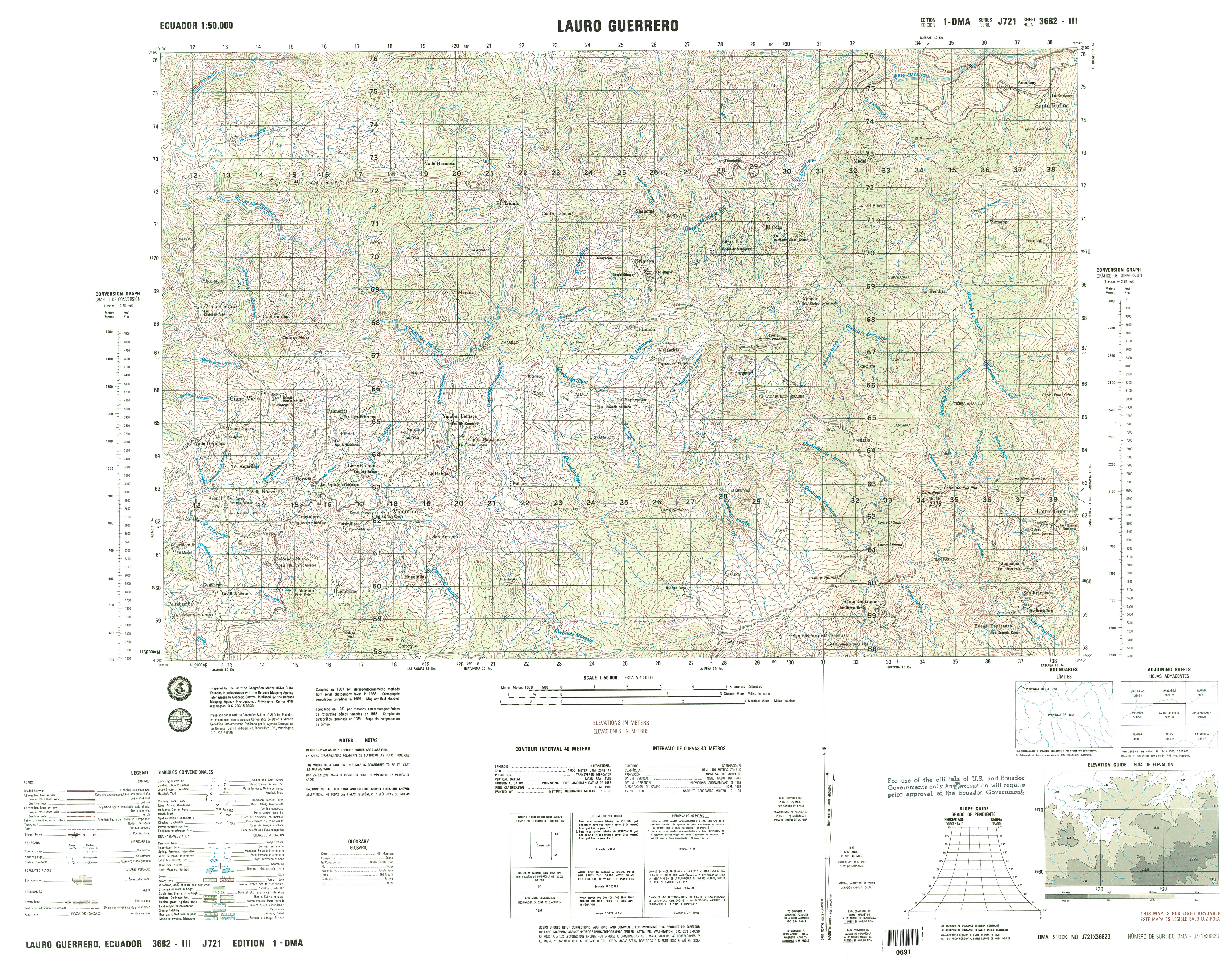
- Lauro Guerrero (topographic) Sheet 3682 III, 1:50,000 (6.0MB)
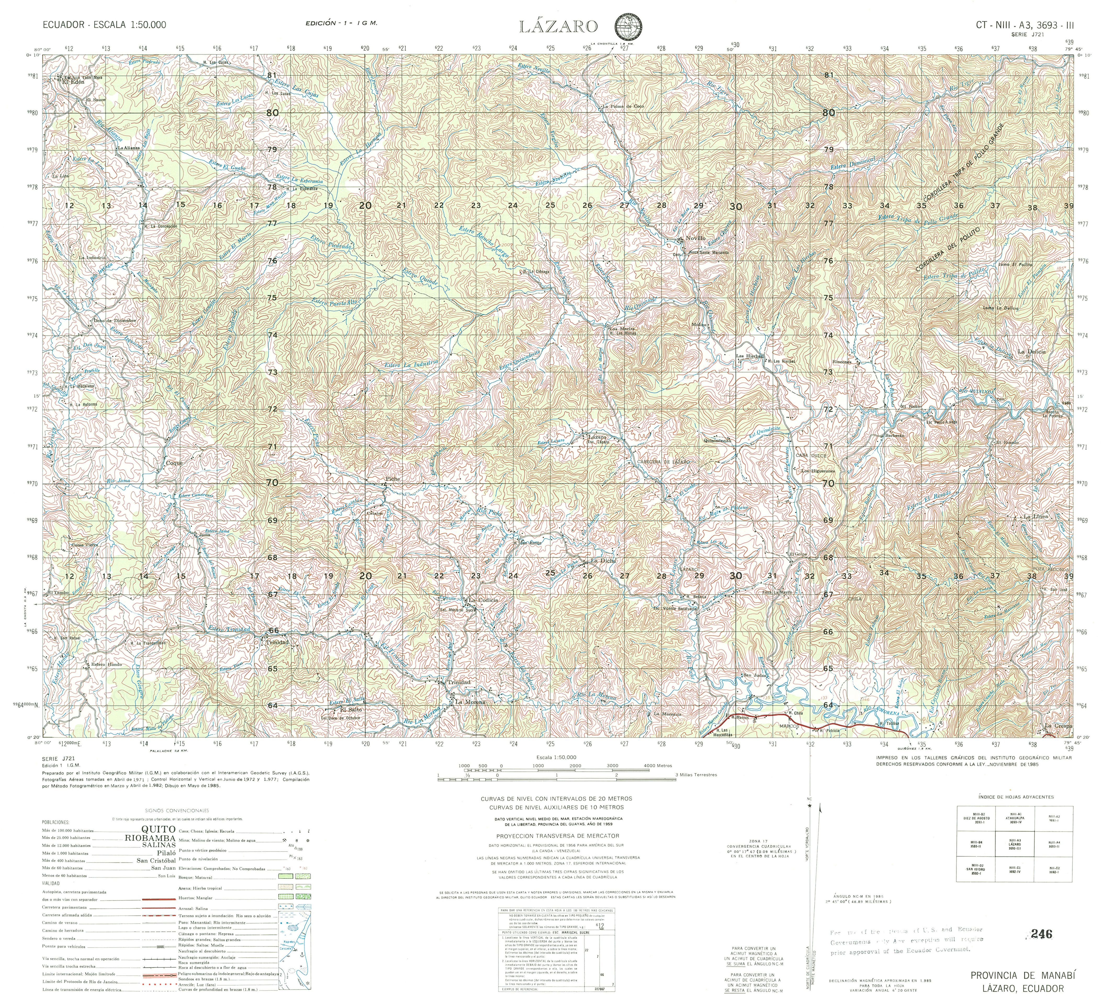
- Lazaro (topographic) Sheet 3693 III, 1:50,000 (4.8MB)
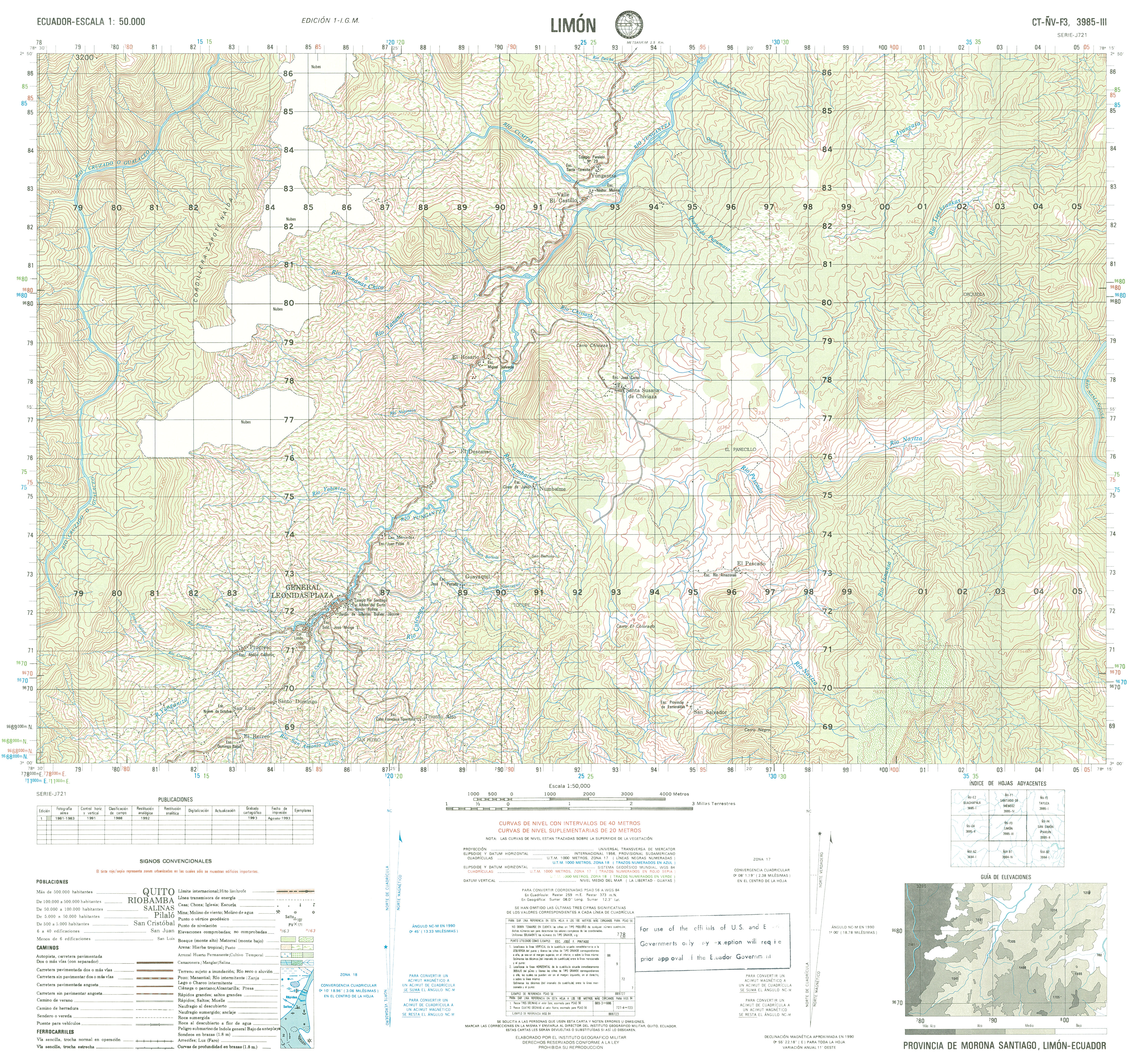
- Limon (topographic) Sheet 3985 III, 1:50,000 (5.6MB)
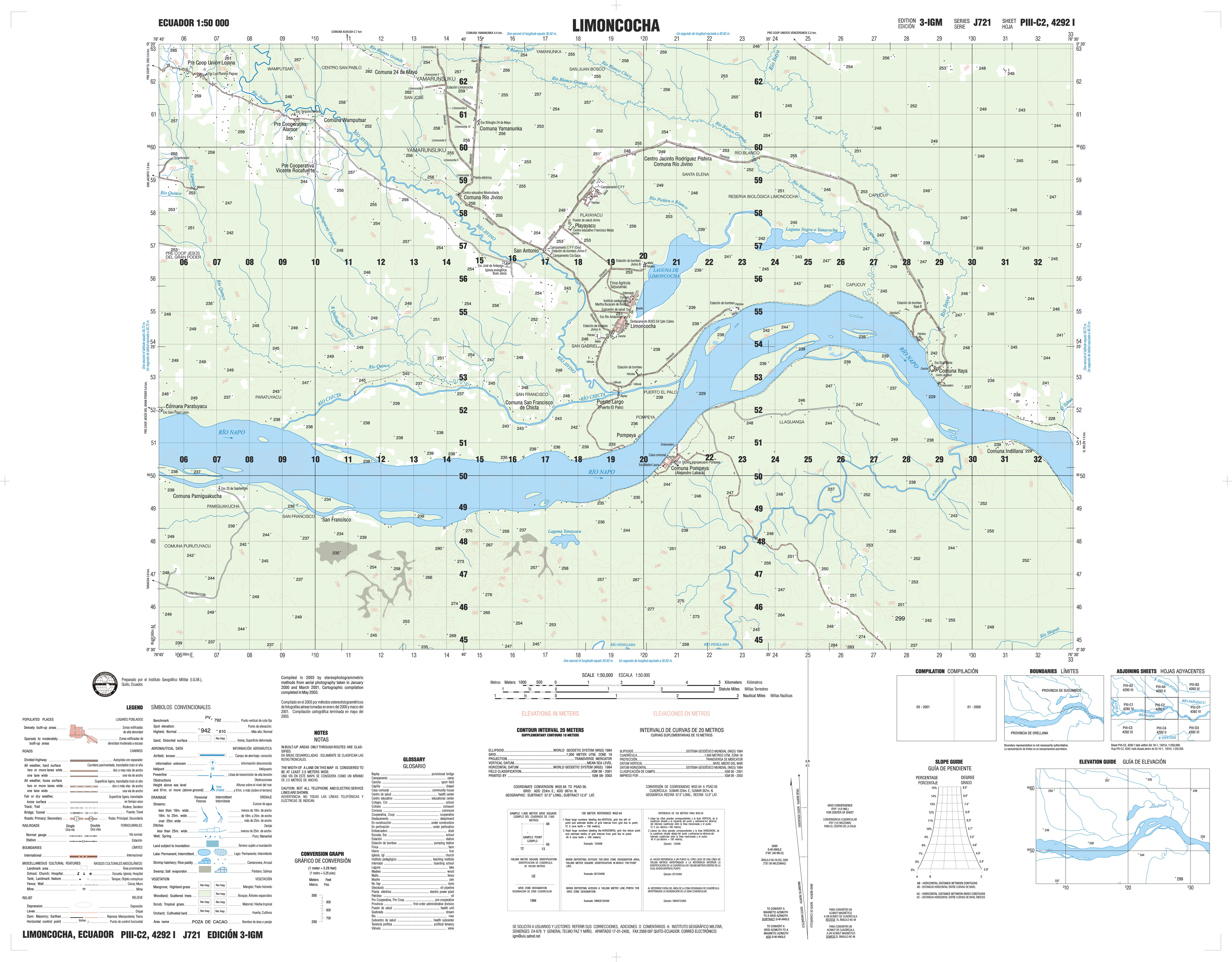
- Limoncocha (topographic) Sheet 4292 I, 1:50,000 (2.2MB)
- Lita (topographic) Sheet 3996 IV, 1:50,000 (8.5MB)
- Llactapamba de Alao (topographic) Sheet 3988 III, 1:50,000 1996 (8.8MB) [PDF]
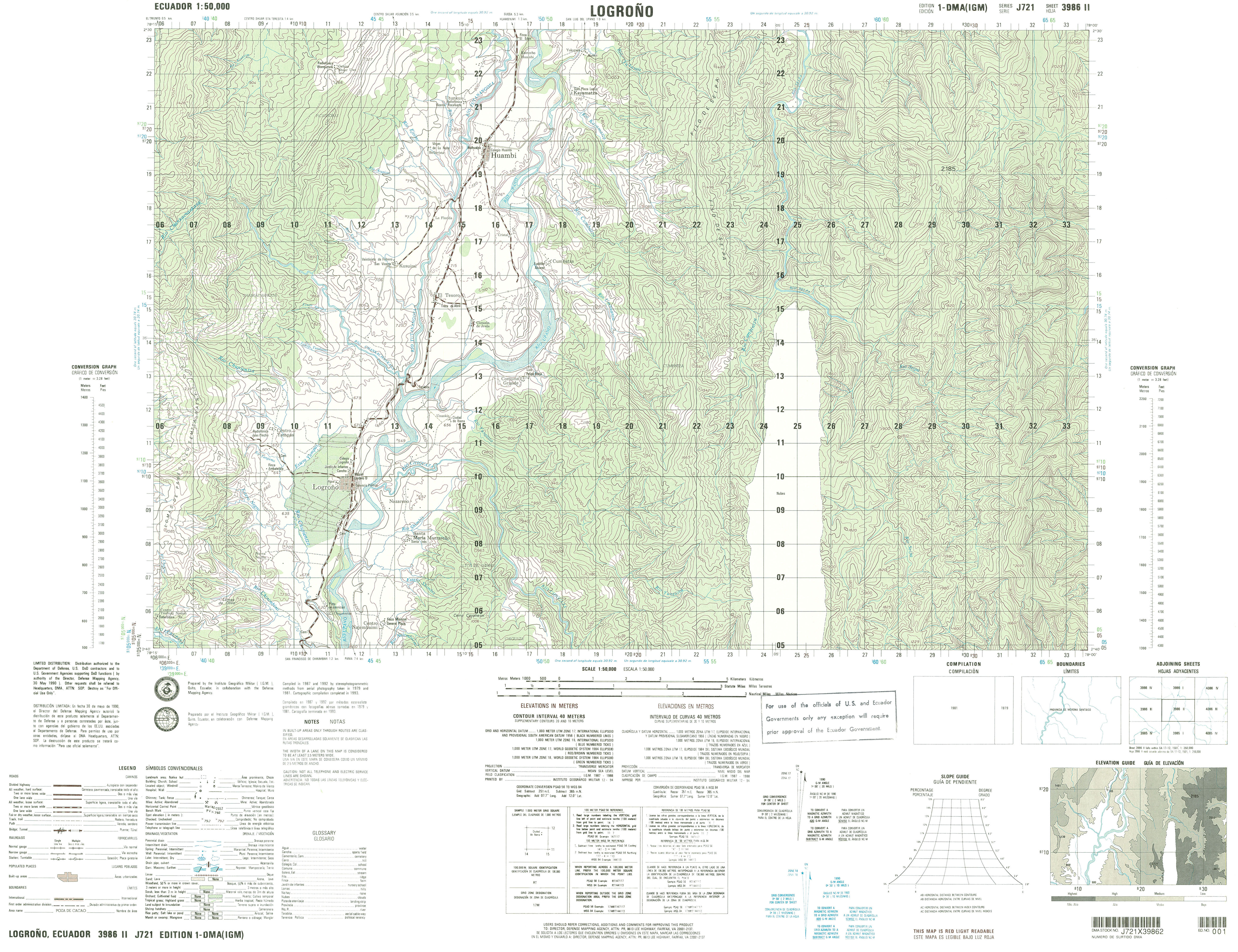
- Logroao (topographic) Sheet 3986 II, 1:50,000 (4.2MB) [PDF]
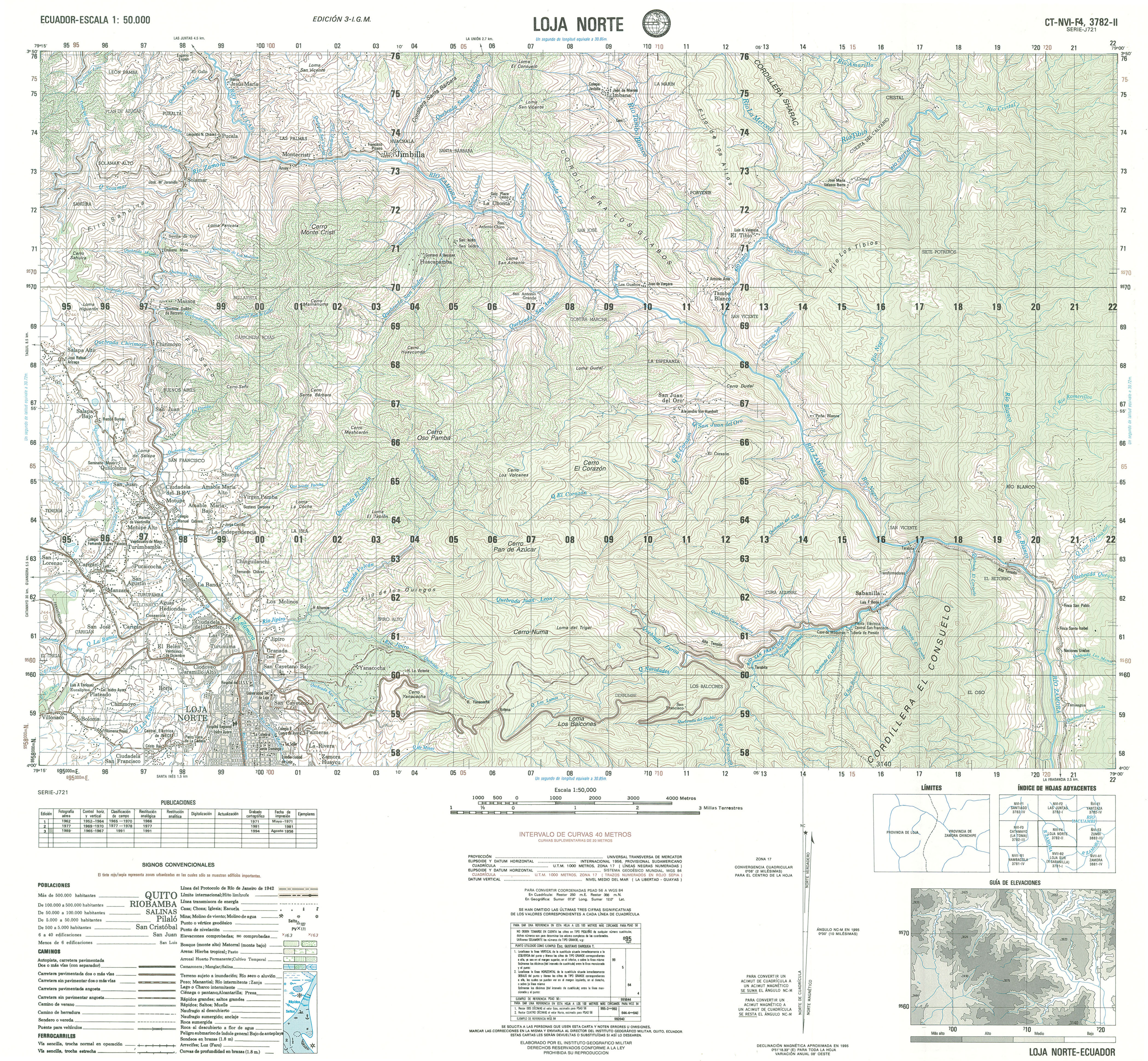
- Loja Norte (topographic) Sheet 3782 II, 1:50,000 (4.3MB) [PDF]
- Loja Sur (topographic) Sheet 3782 I, 1:50,000 (5.1MB) [PDF]
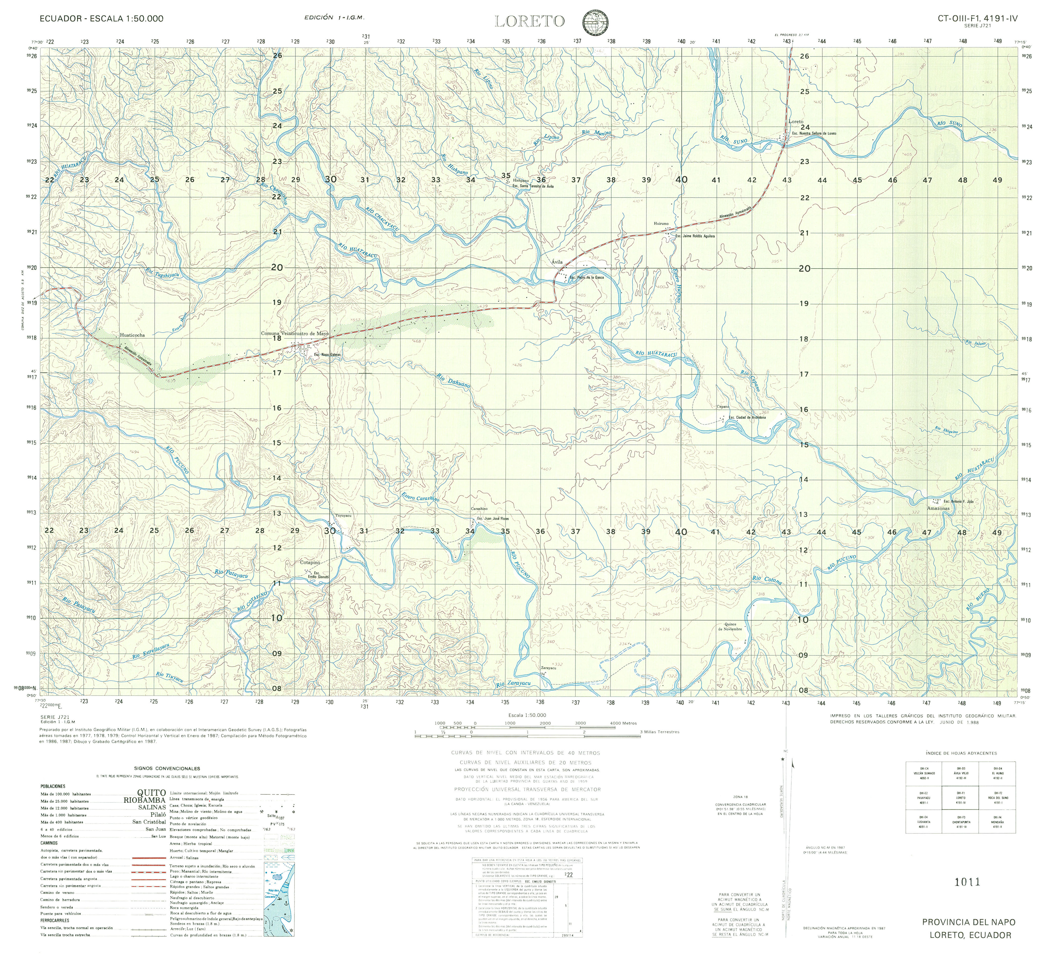
- Loreto (topographic) Sheet 4191 IV, 1:50,000 (2.7MB)
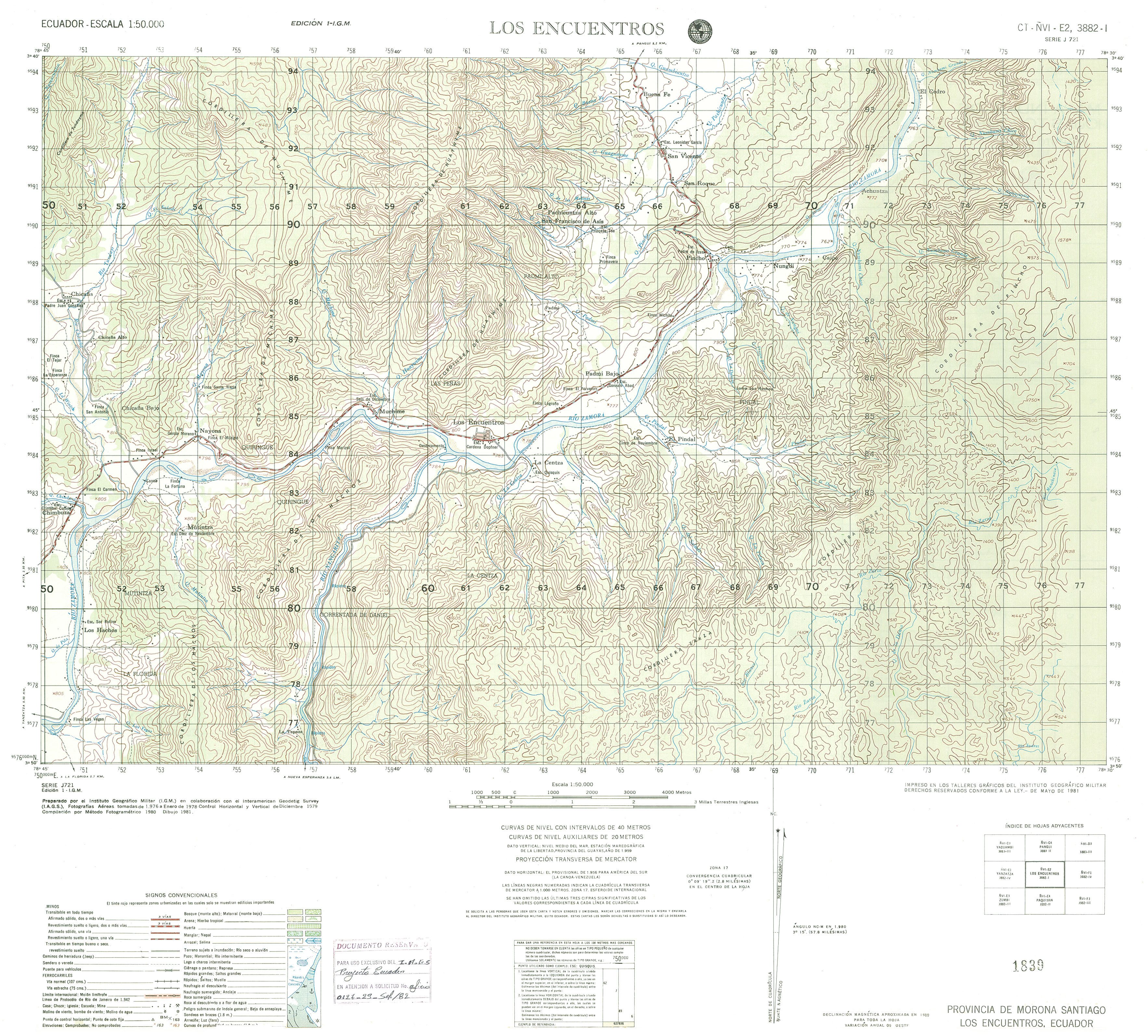
- Los Encuentros (topographic) Sheet 3882 I, 1:50,000 (3.0MB)
- Los Vergeles (topographic) Sheet 3791 IV, 1:50,000 (4.6MB)
- Lumbaqui (topographic) Sheet 4194 III, 1:50,000 2007 (3.2MB) [PDF]
- Lushanta (topographic) Sheet 4091 II, 1:50,000 (3.6MB)
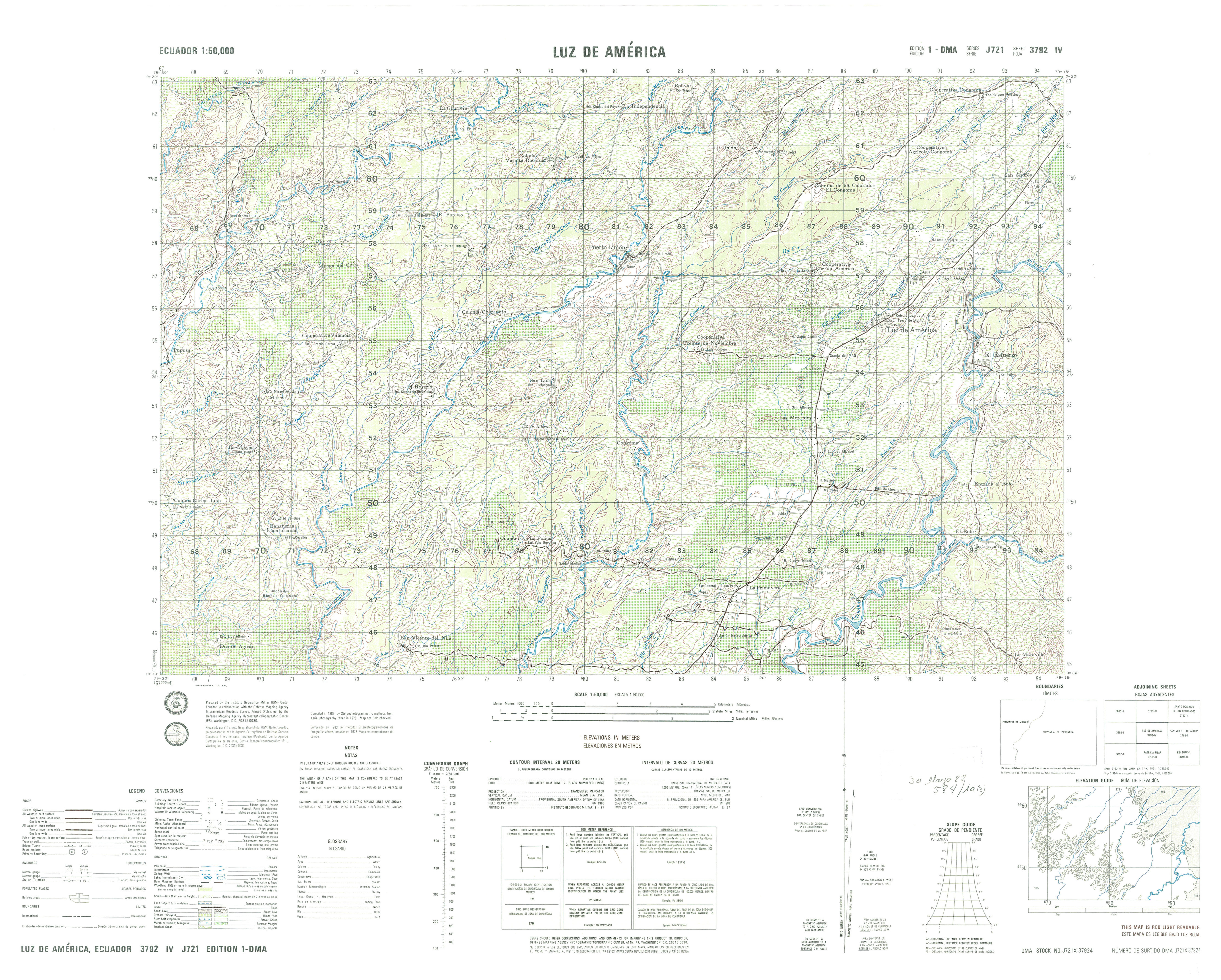
- Luz de America (topographic) Sheet 3792 IV, 1:50,000 (4.5MB)
- Macas (topographic) Sheet 3987 II, 1:50,000 1991 (8.8MB) [PDF]
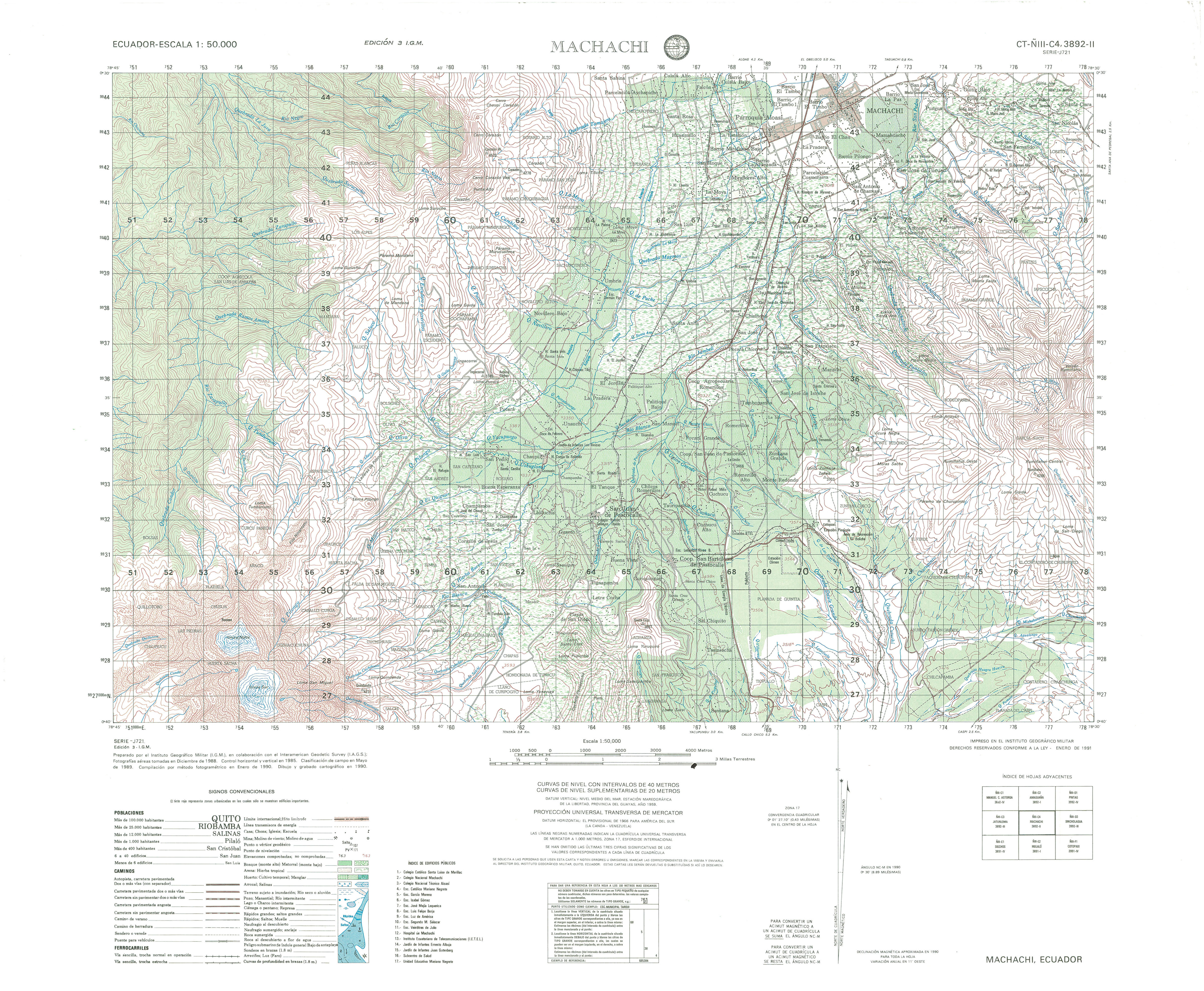
- Machachi (topographic) Sheet 3892 II, 1:50,000 (4.4MB)
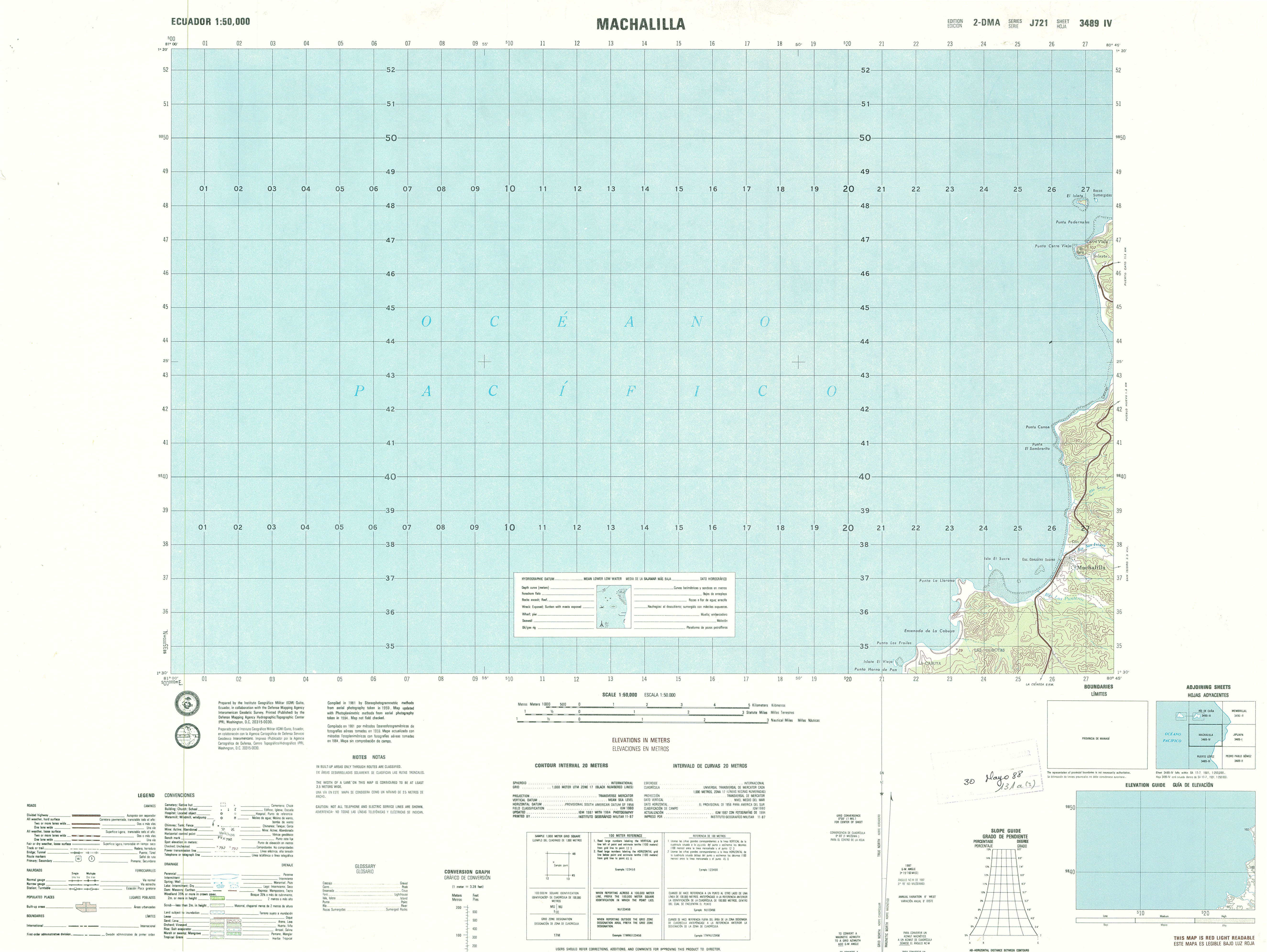
- Machalilla (topographic) Sheet 3489 IV, 1:50,000 (2.2MB)
- Maki (topographic) Sheet 4185 I, 1:50,000 1991 (3.2MB) [PDF]
- Maldonado (topographic) Sheet 3996 I, 1:50,000 2007 (4.1MB) [PDF]
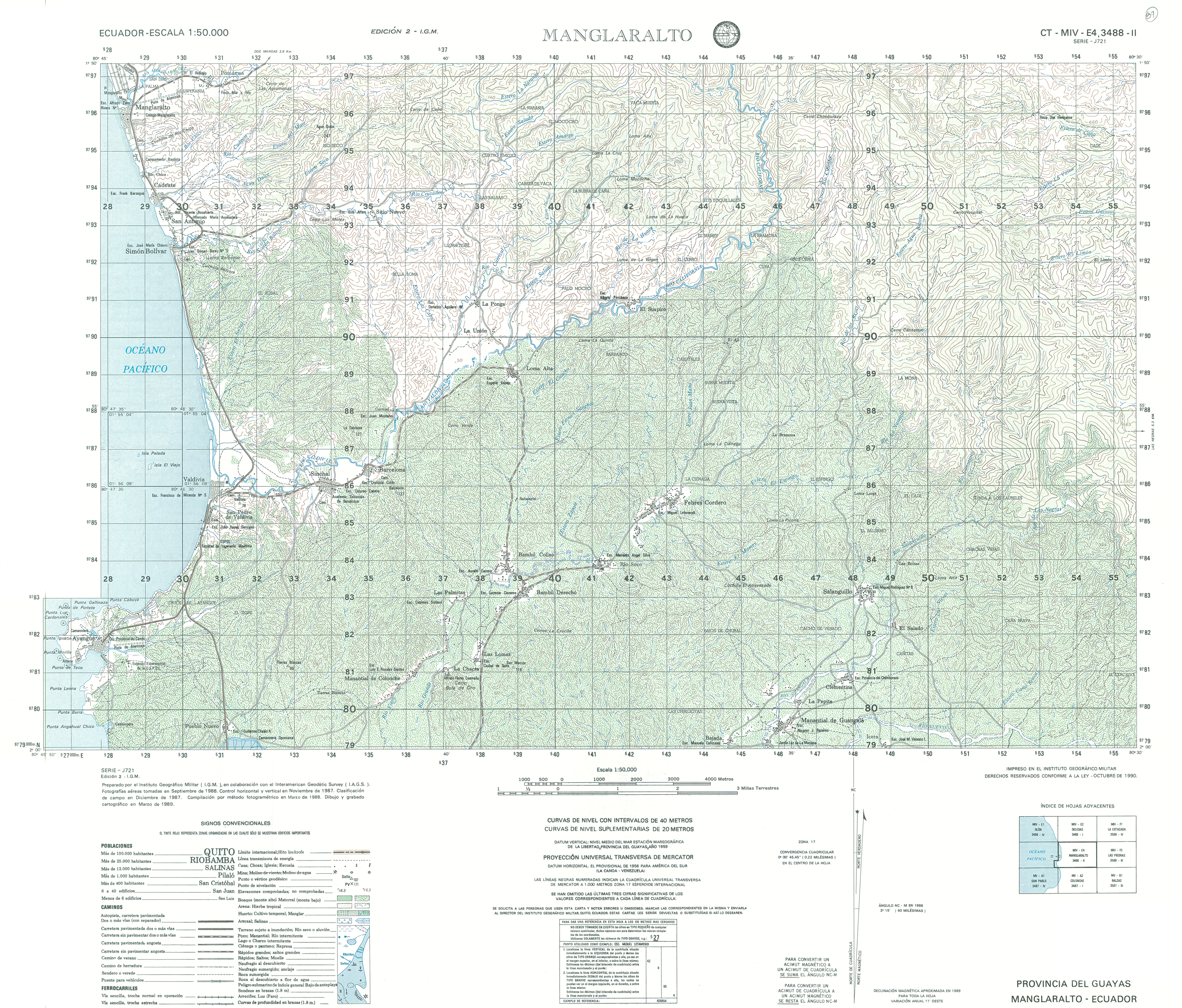
- Manglaralto (topographic) Sheet 3488 II, 1:50,000 (16.9MB)
- Manu (topographic) Sheet 3783 IV, 1:50,000 (14.3MB)
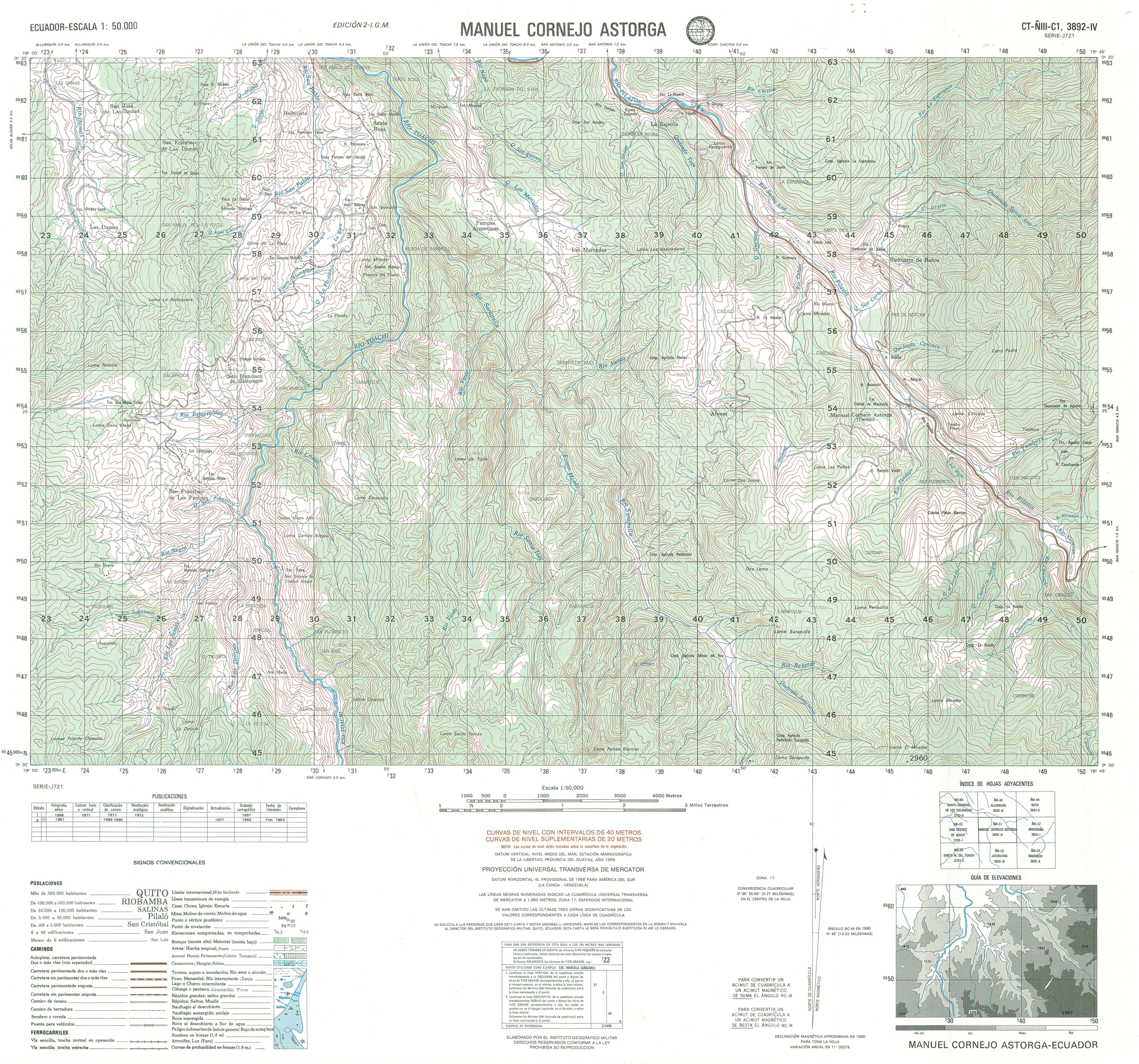
- Manuel Cornejo Astorga (topographic) Sheet 3892 IV, 1:50,000 (17.3MB)
- Maria Magdalena (topographic) Sheet 4096 I, 1:50,000 2008 (2.3MB) [PDF]
- Mariano Moreno (topographic) Sheet 3885 II, 1:50,000 1992 (9.5MB) [PDF]
- Marcabeli (topographic) Sheet 3682 IV, 1:50,000 (6.2MB)
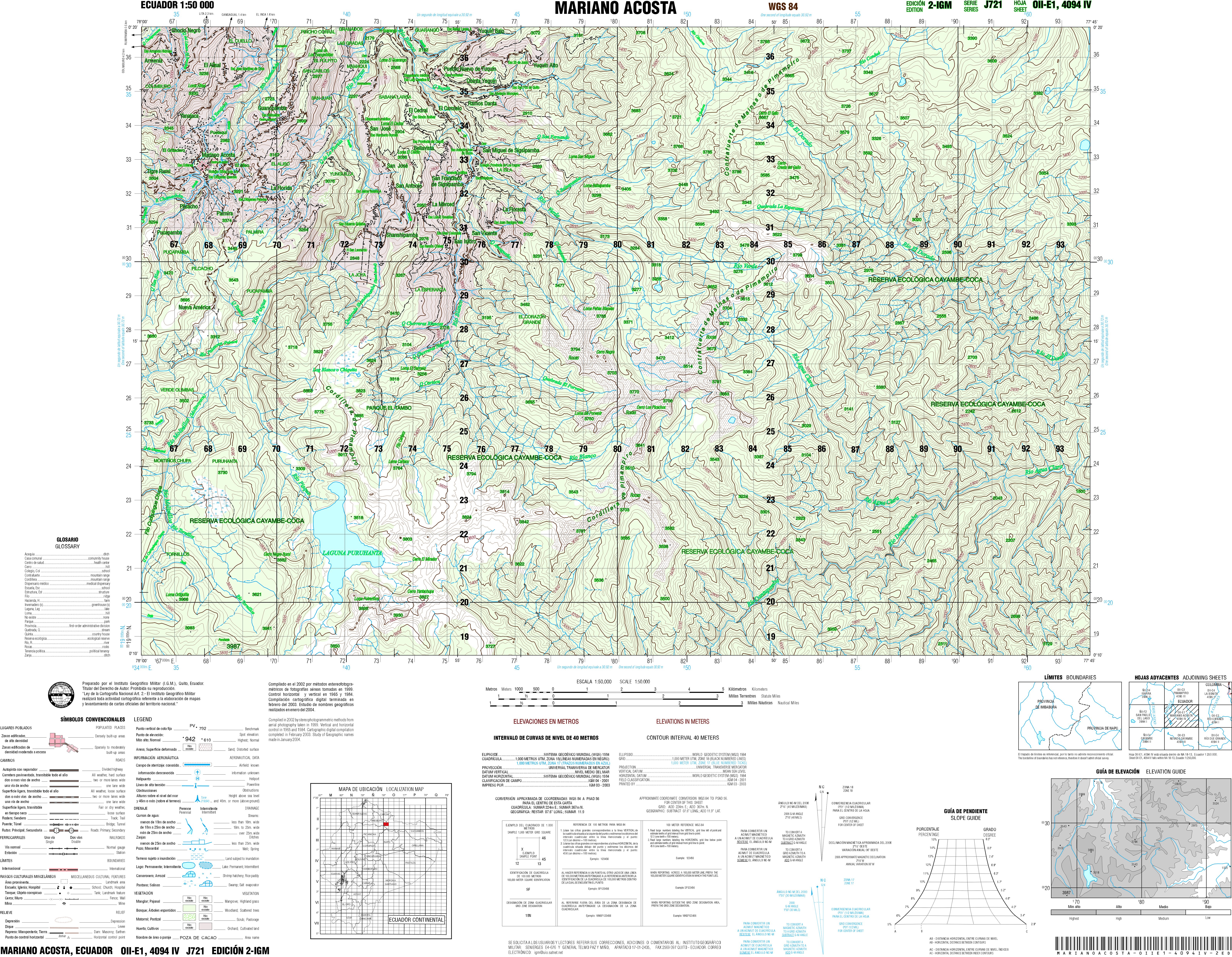
- Mariano Acosta (topographic) Sheet 4094 IV, 1:50,000 (30.4MB)
- Mariano Moren (topographic) Sheet 3885 I, 1:50,000 (17.4MB)
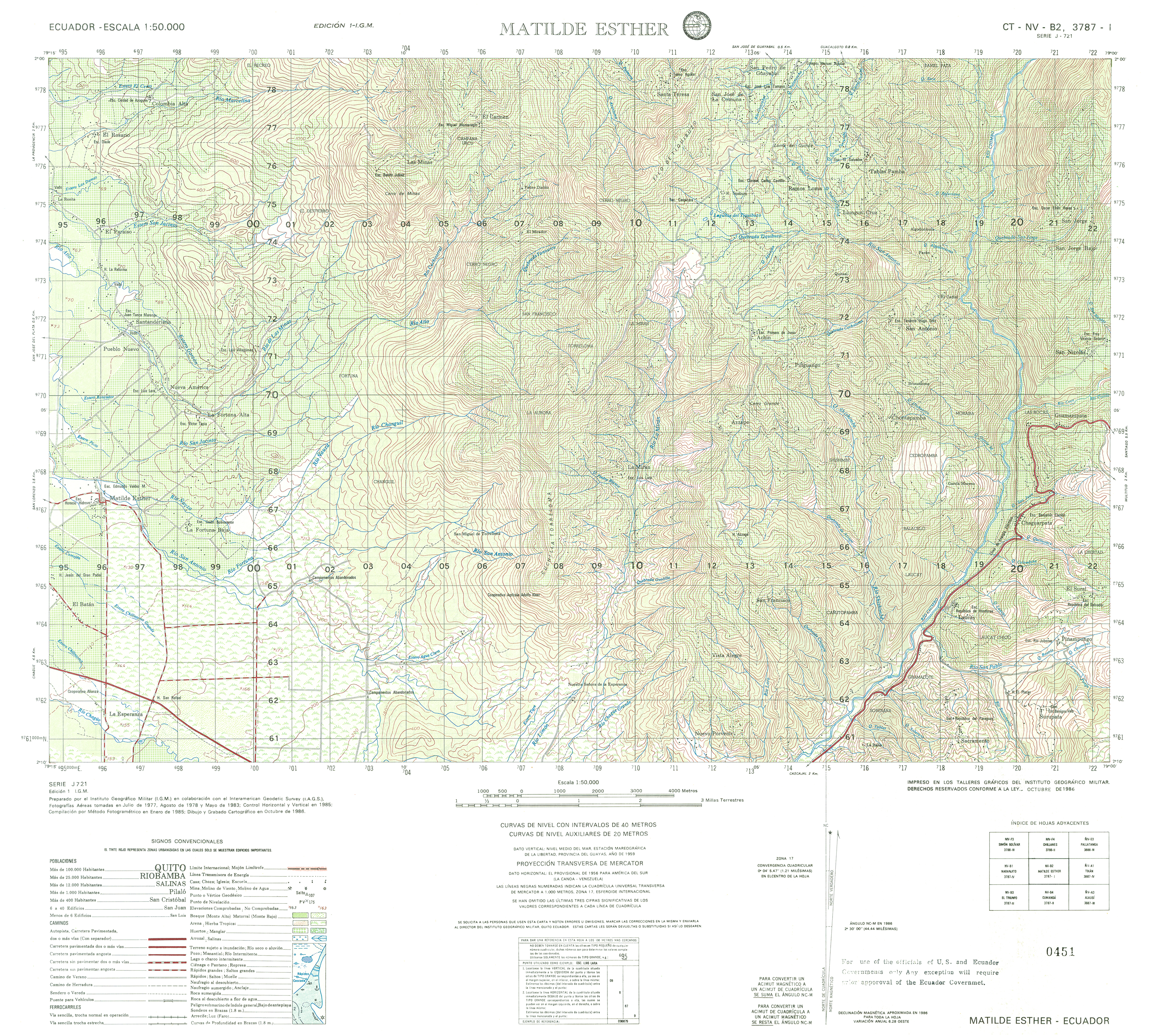
- Matilde Esther (topographic) Sheet 3787 I, 1:50,000 (17.6MB)
- Membrillal (topographic) Sheet 3490 II, 1:50,000 (19.6MB)
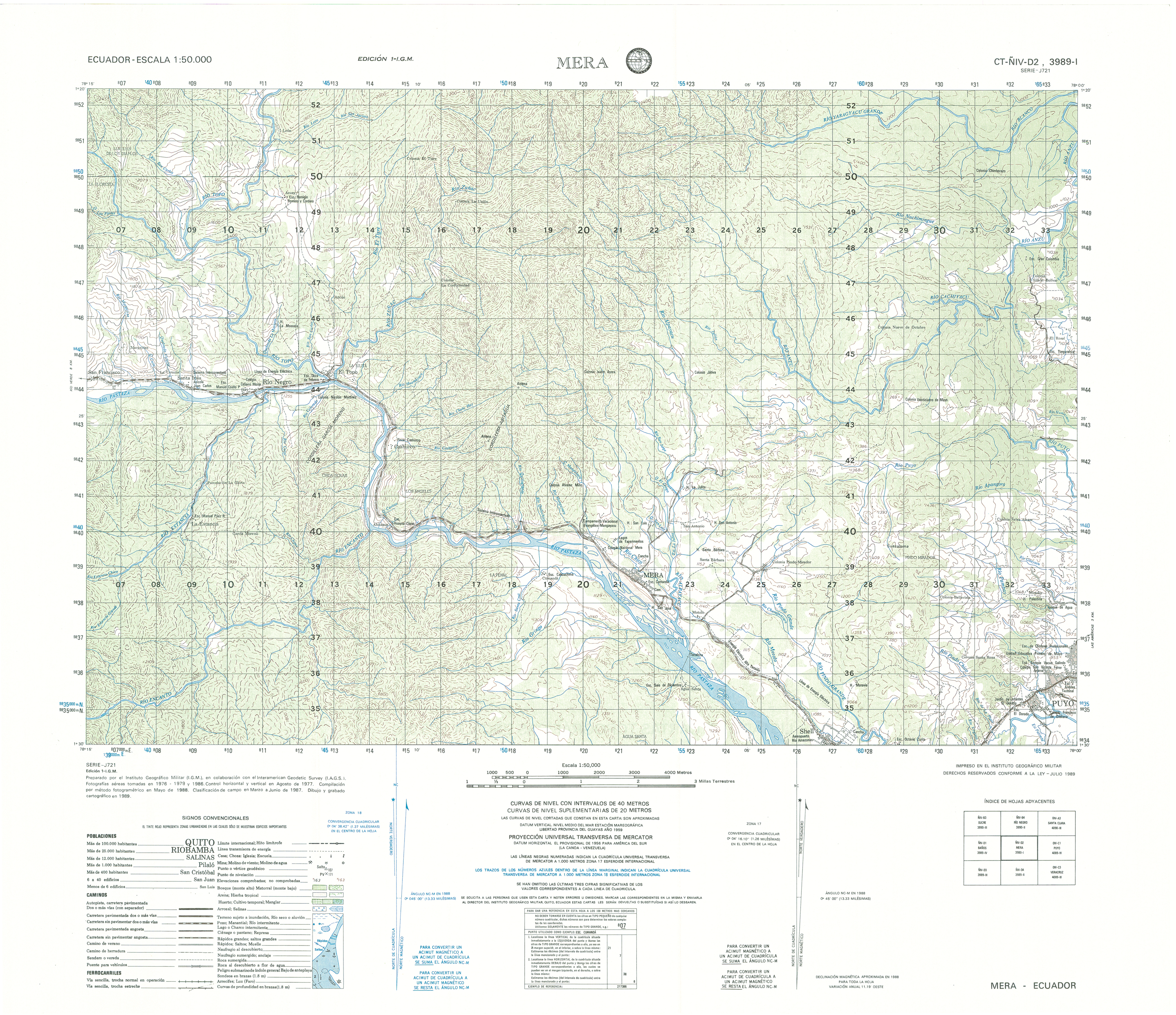
- Mera (topographic) Sheet 3989 I, 1:50,000 (15.7MB)
- Milagro (topographic) Sheet 3687 I, 1:50,000 1997 (7.1MB) [PDF]
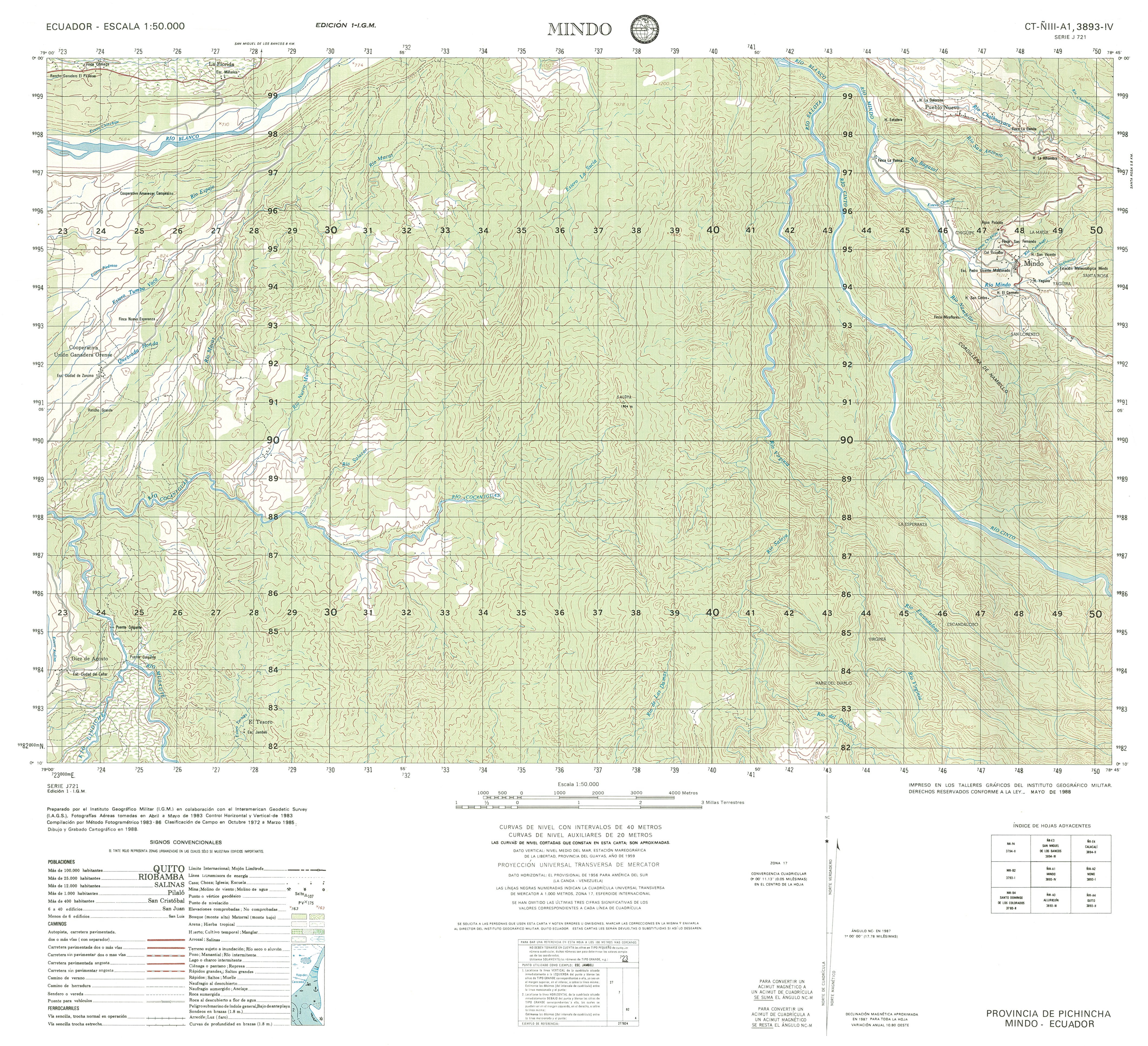
- Mindo (topographic) Sheet 3893 IV, 1:50,000 (14.7MB)
- Mira (topographic) Sheet 3995 I, 1:50,000 1992 (9.8MB) [PDF]
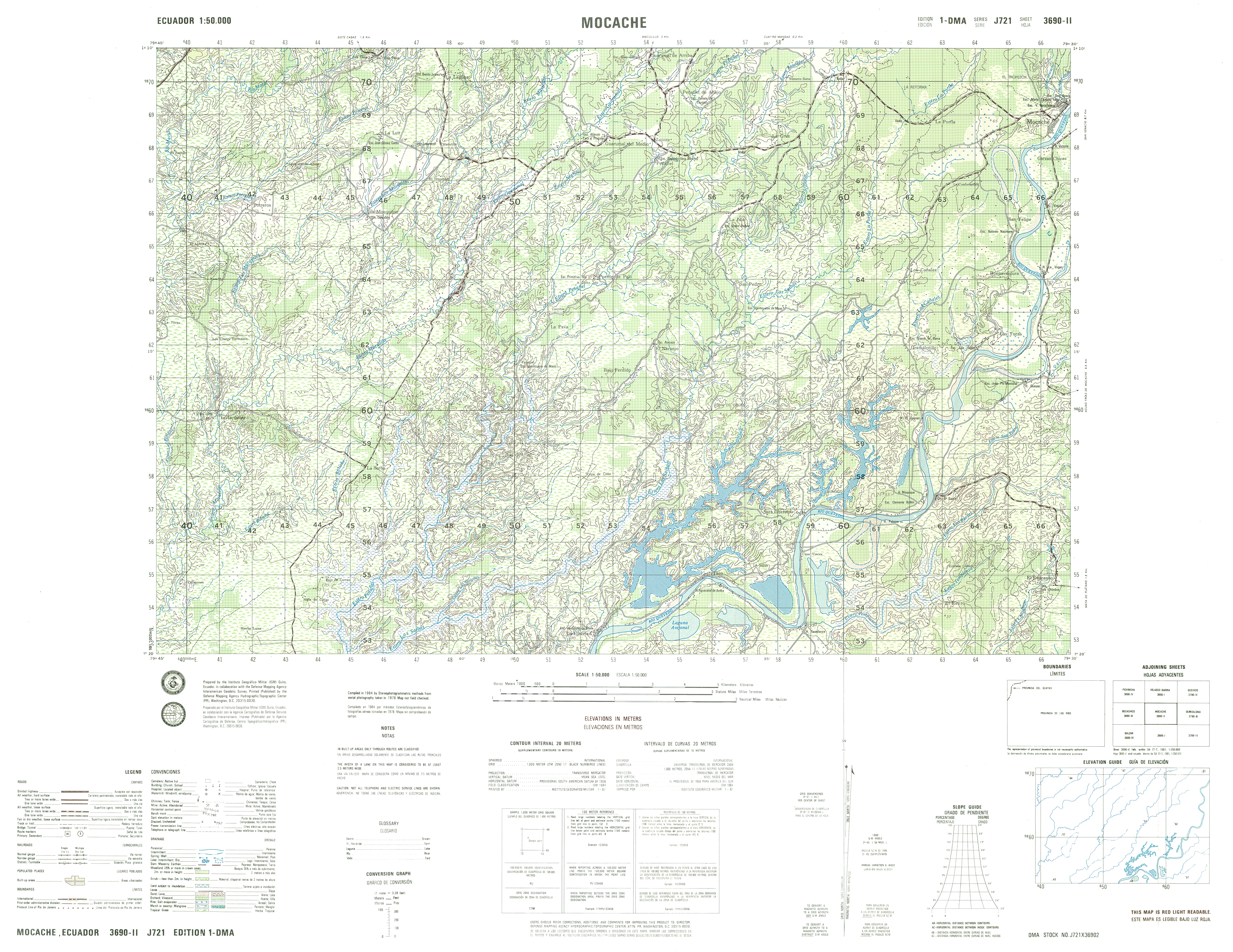
- Mocache (topographic) Sheet 3690 II, 1:50,000 (18.7MB)
- Mojanda (topographic) Sheet 3994 III, 1:50,000 (19.7MB)
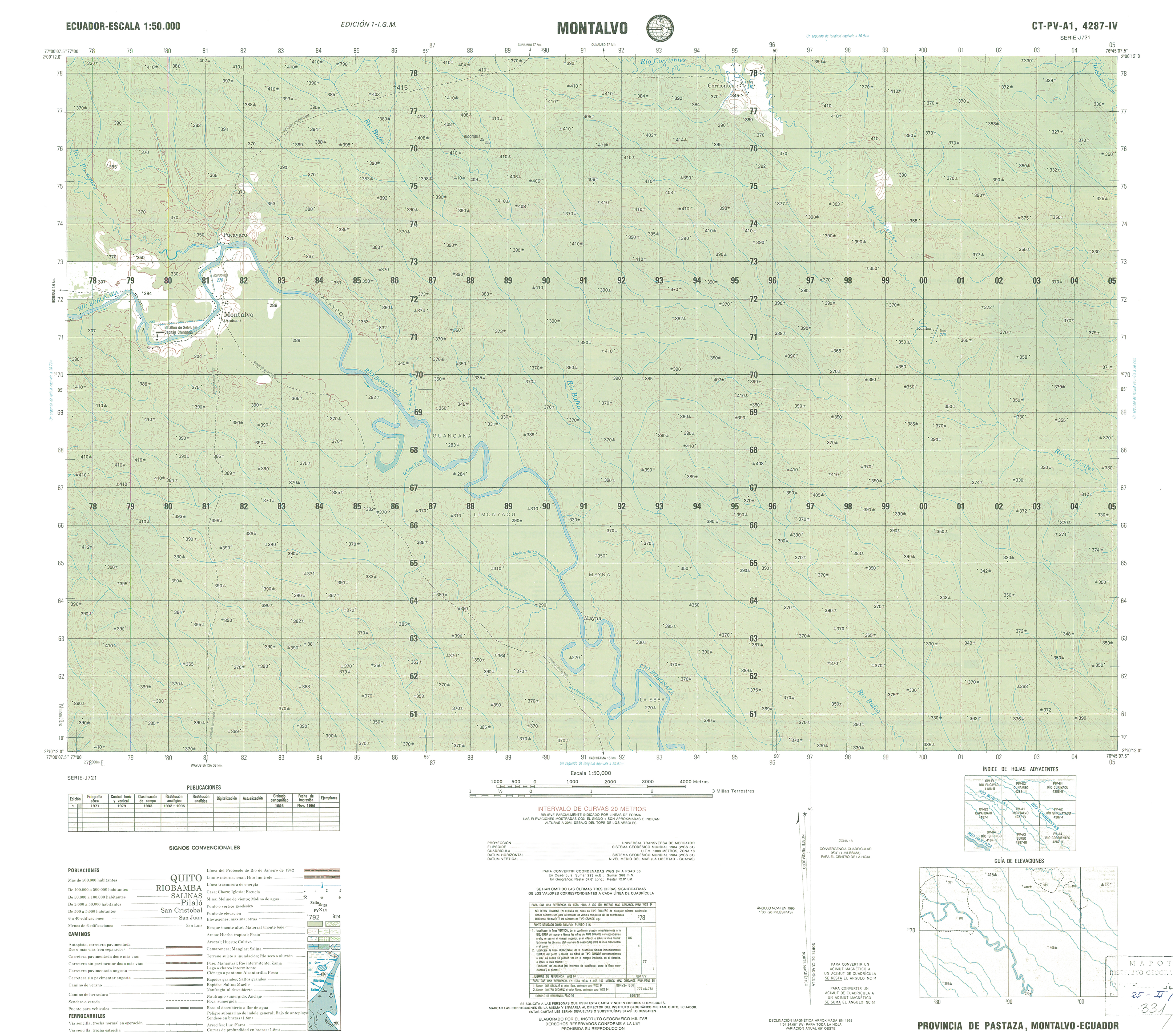
- Montalvo (topographic) Sheet 4287 IV, 1:50,000 (12.9MB)
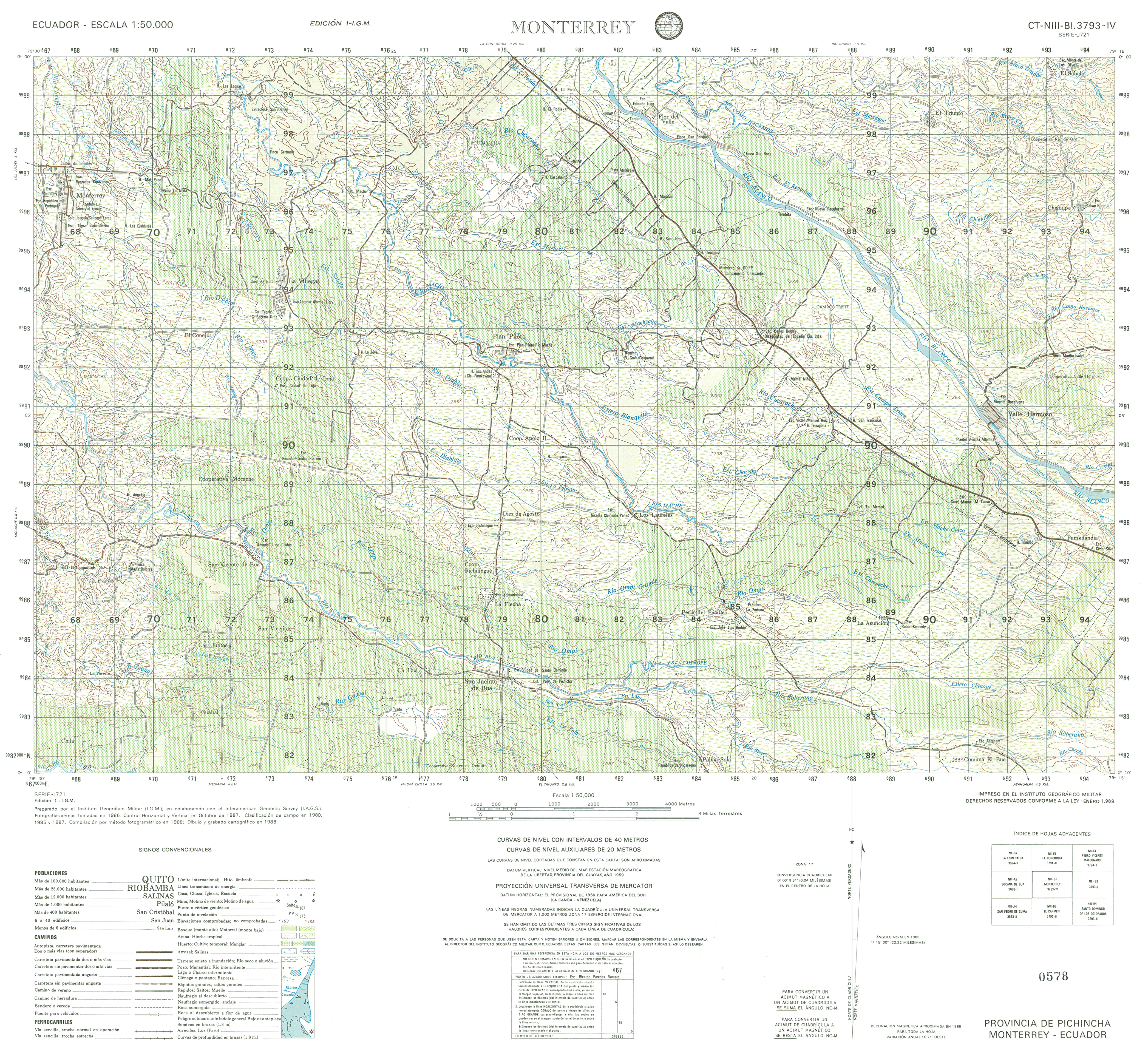
- Monterrey (topographic) Sheet 3793 IV, 1:50,000 (17.1MB)
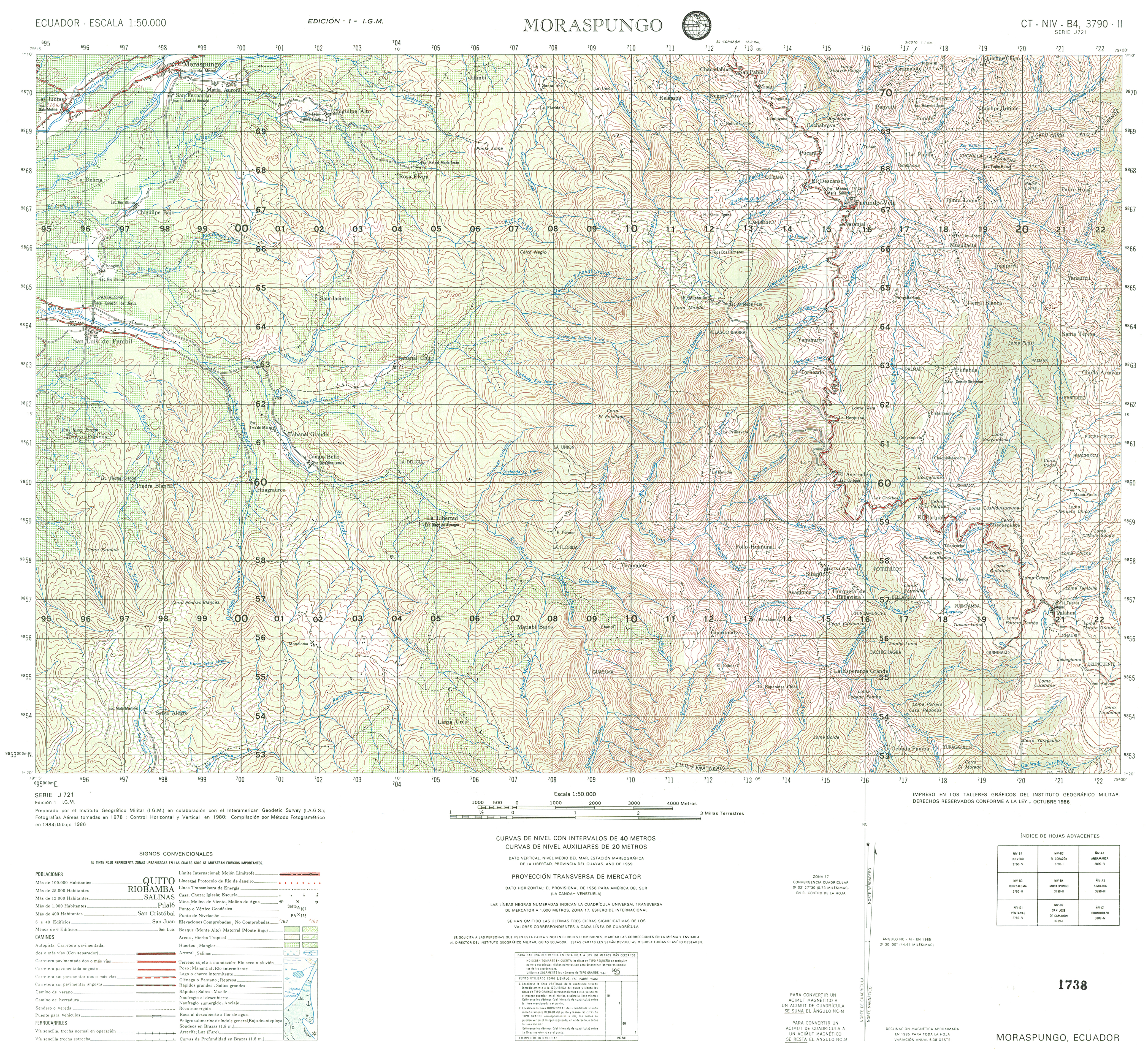
- Moraspungo (topographic) Sheet 3790 II, 1:50,000 (17.3MB)
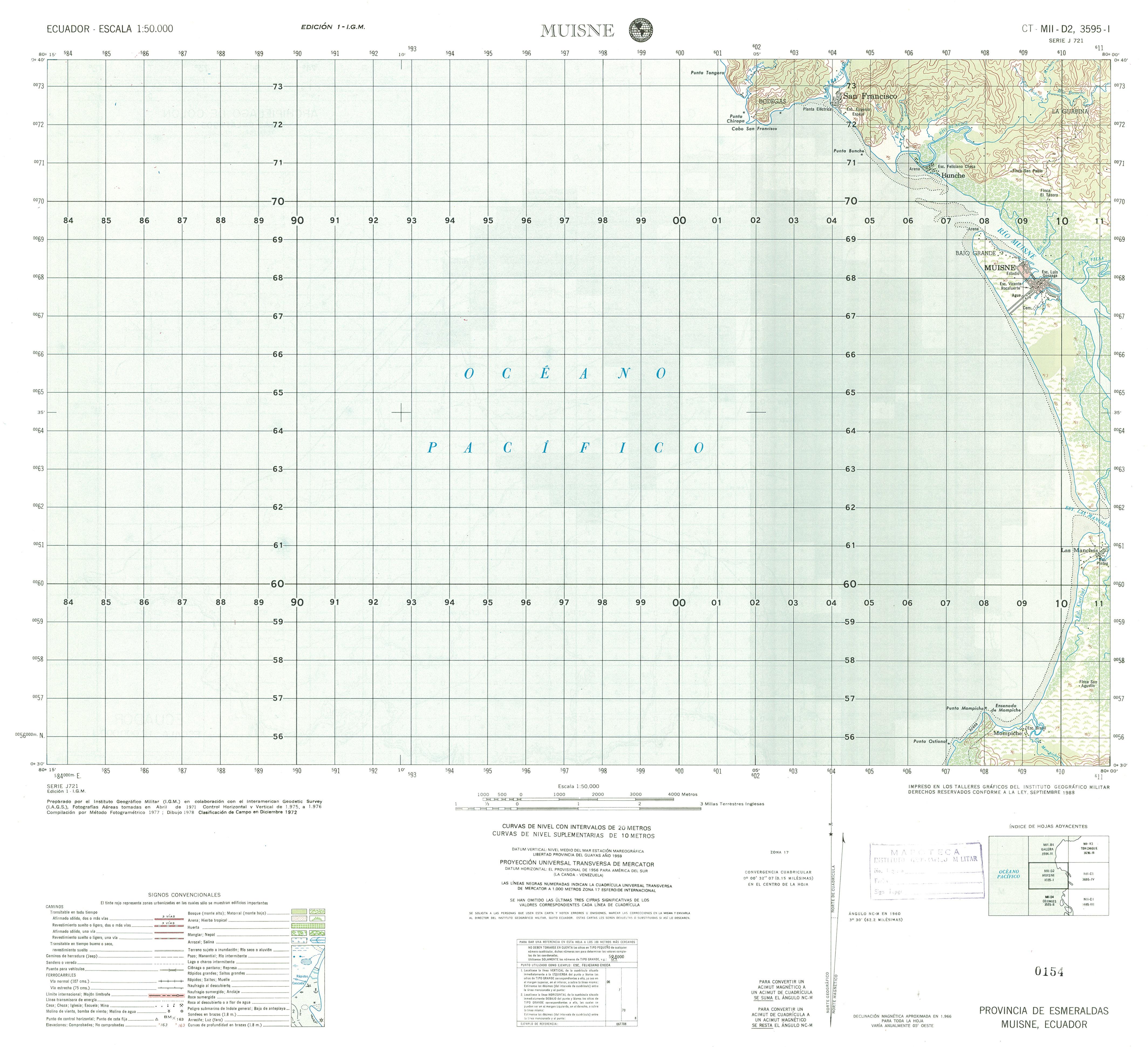
- Muisne (topographic) Sheet 3595 I, 1:50,000 (11.5MB)
- Mulalo (topographic) Sheet 3891 I, 1:50,000 (4.3MB)
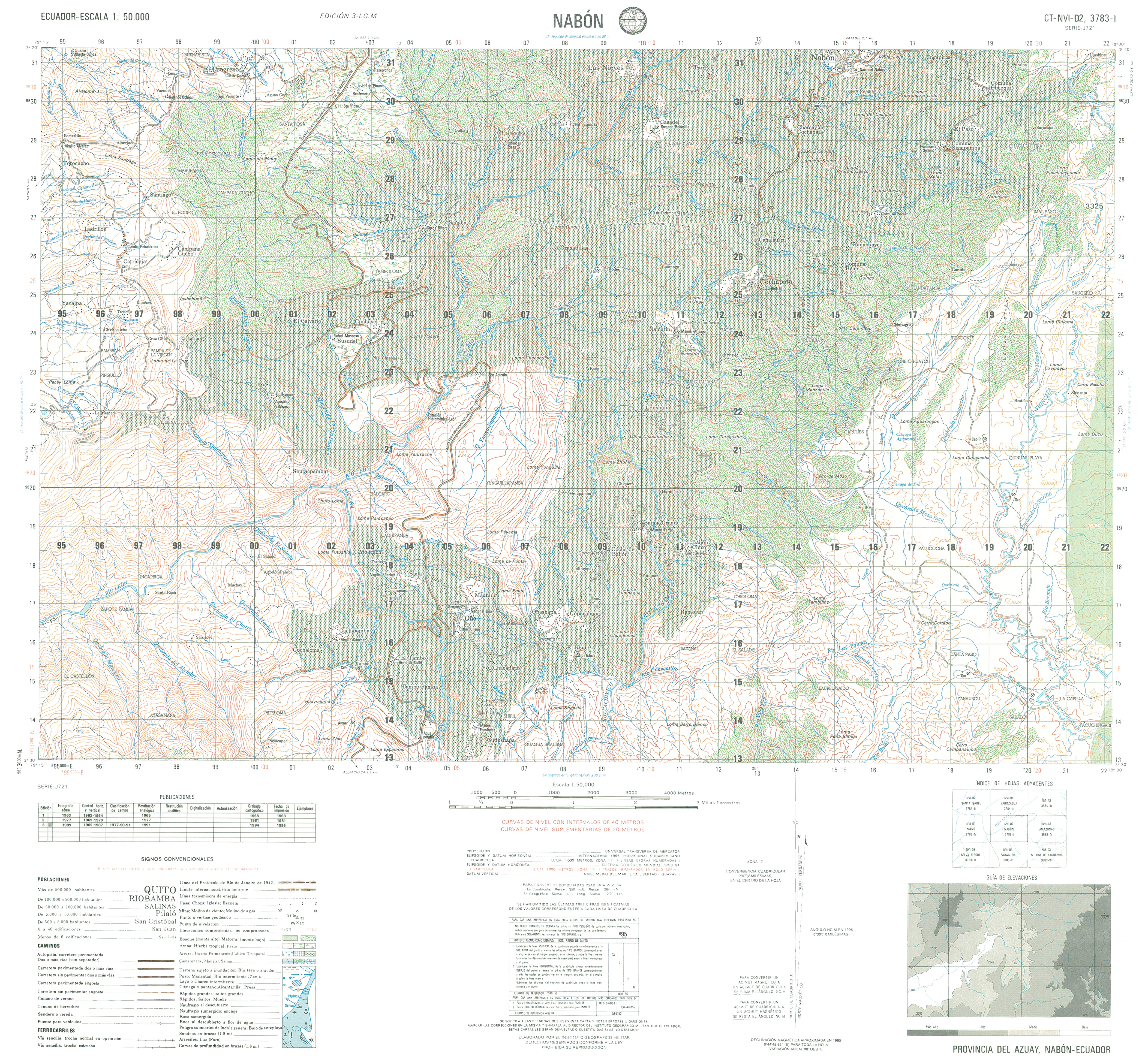
- Nabon (topographic) Sheet 3783 I, 1:50,000 (16.9MB)
- Nambacola (topographic) Sheet 3781 IV, 1:50,000 (15.0MB)
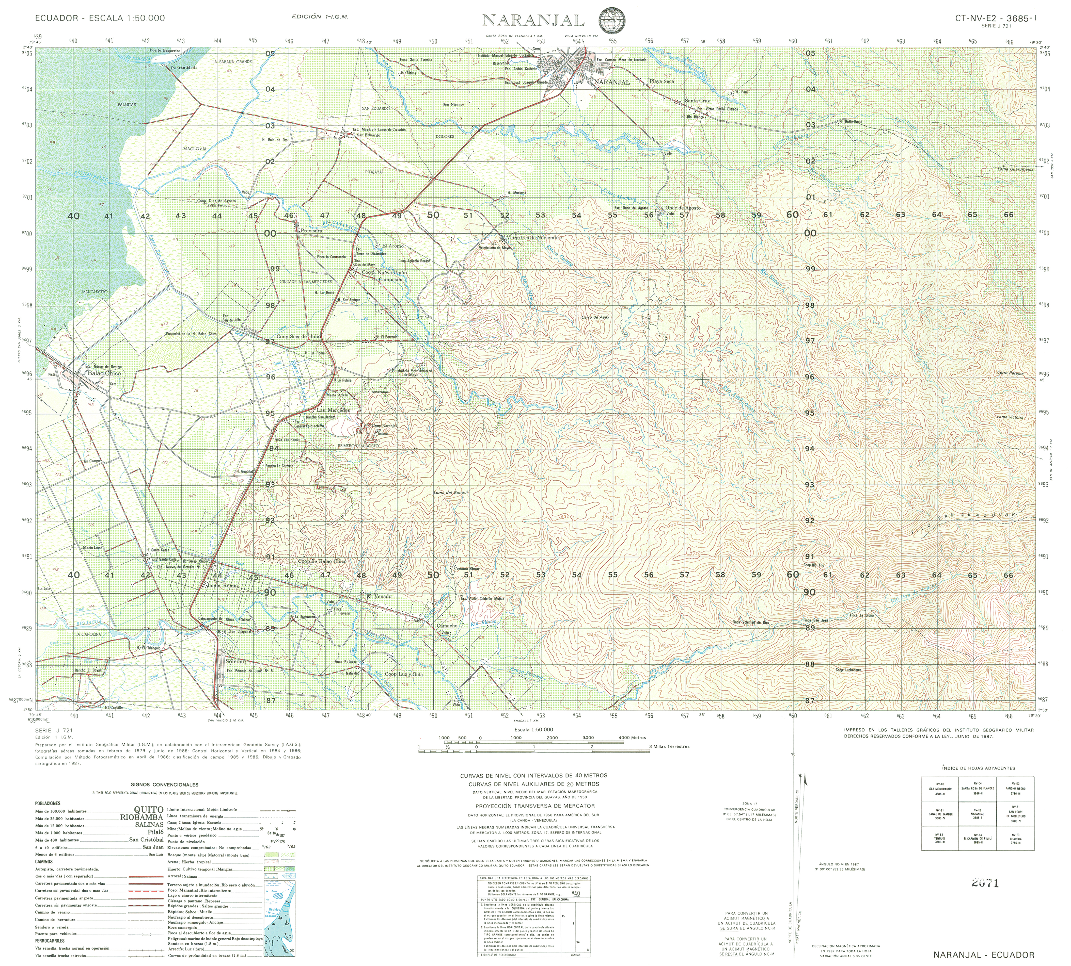
- Naranjal (topographic) Sheet 3685 I, 1:50,000 (15.9MB)
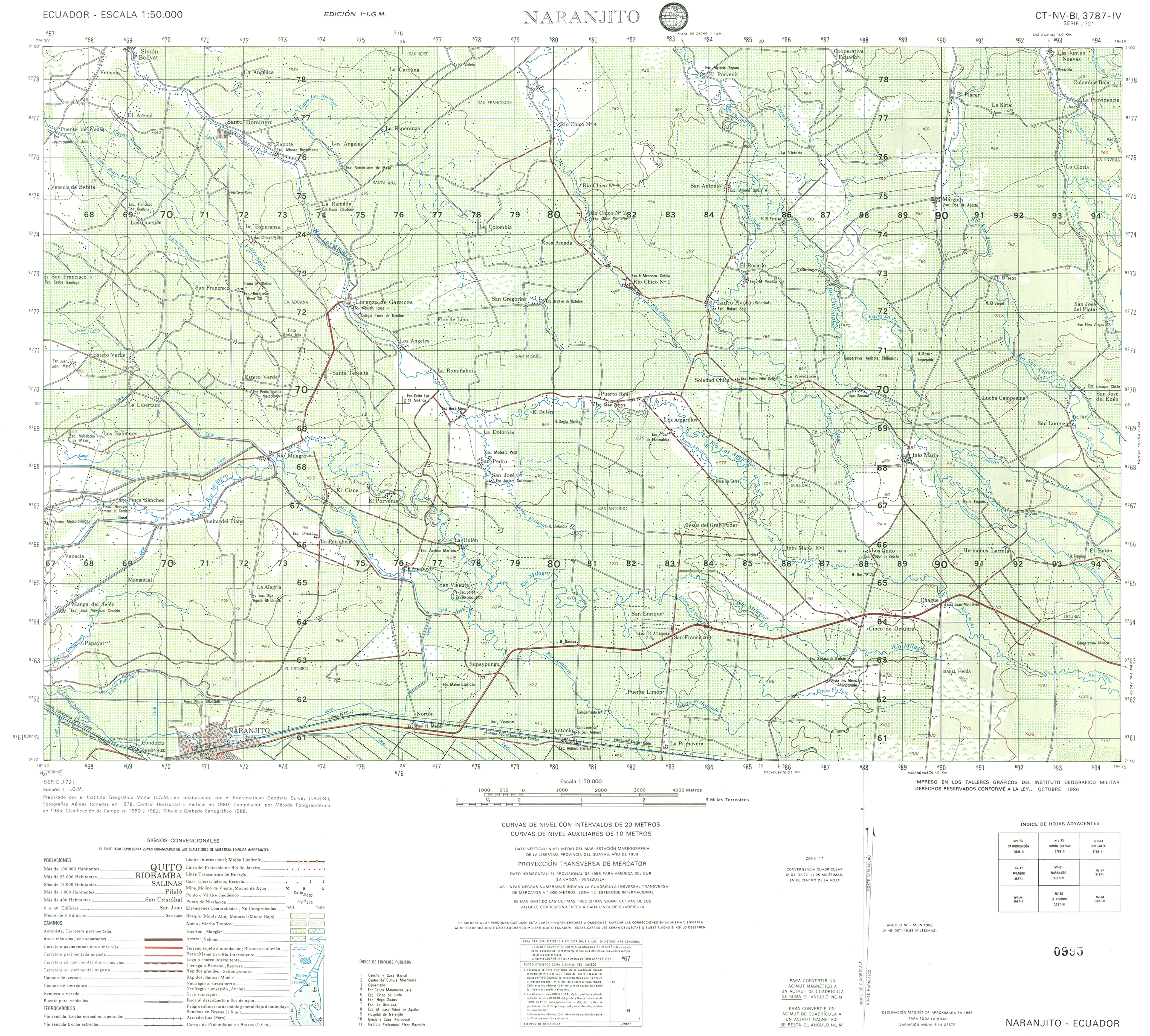
- Naranjito (topographic) Sheet 3787 IV, 1:50,000 (16.0MB)
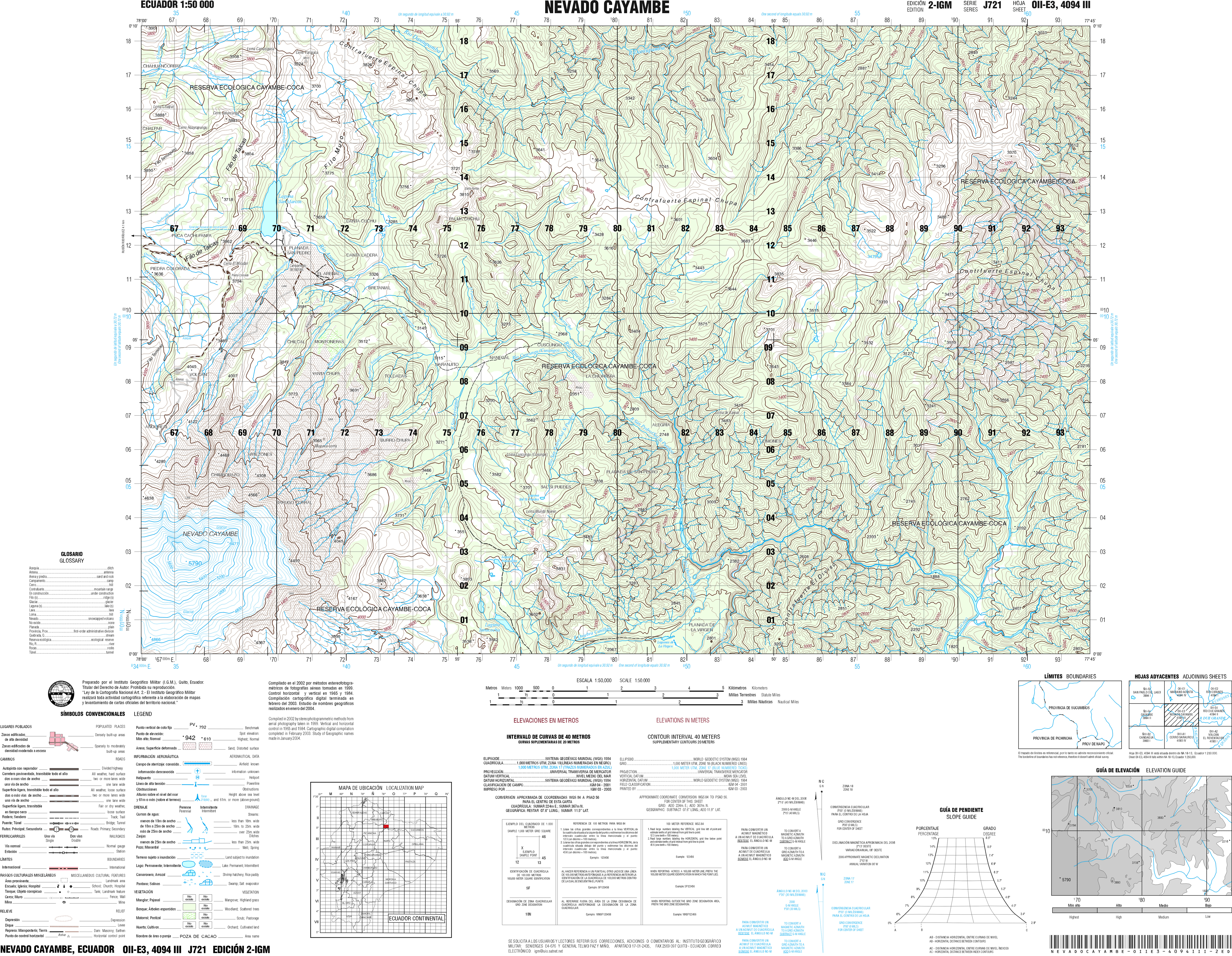
- Nevada Cayambe (topographic) Sheet 4094 III, 1:50,000 (21.0MB)
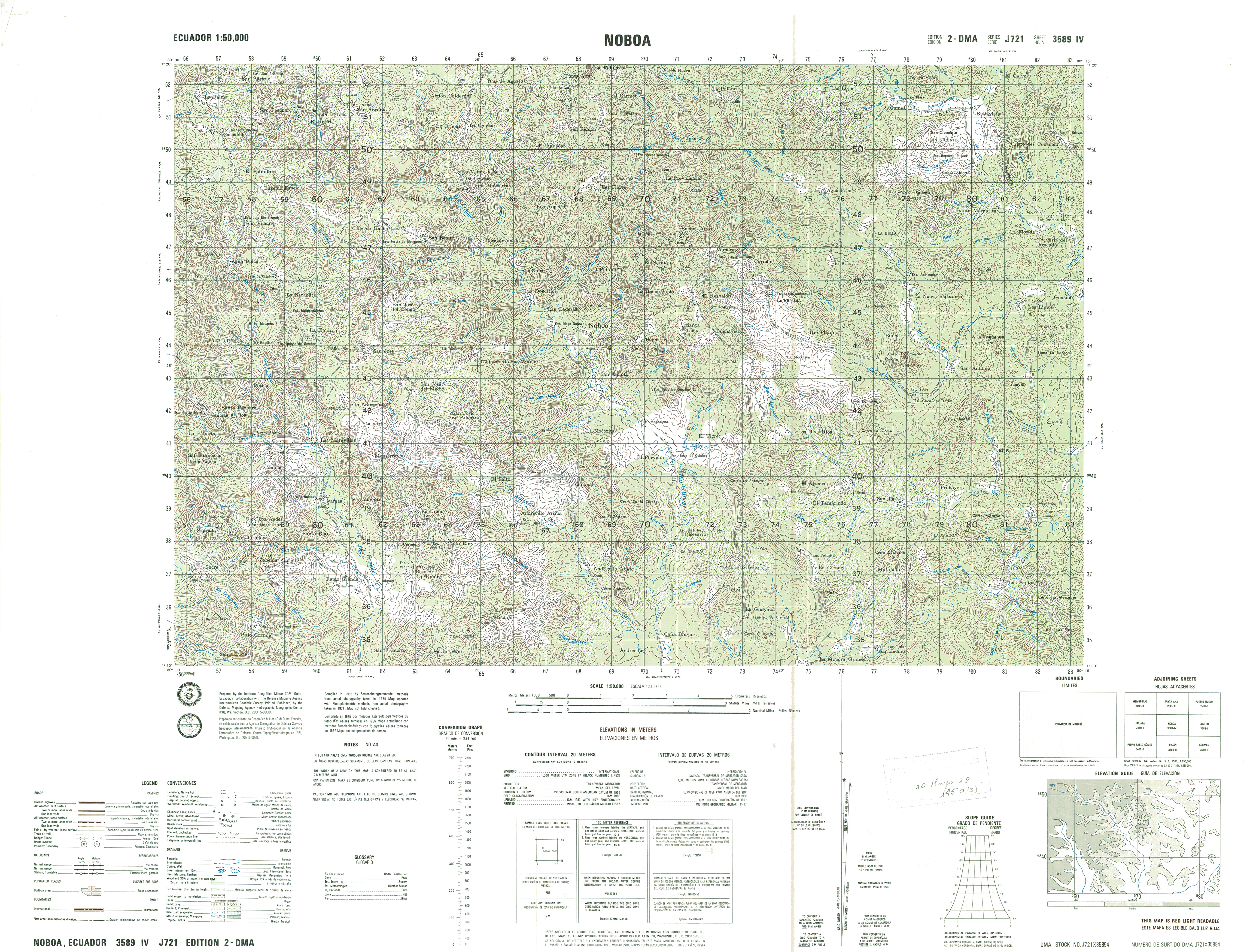
- Noboa (topographic) Sheet 3589 IV, 1:50,000 (18.7MB)
- Nono (topographic) Sheet 3893-I, 1:50,000 1989 (9.9MB) [PDF]
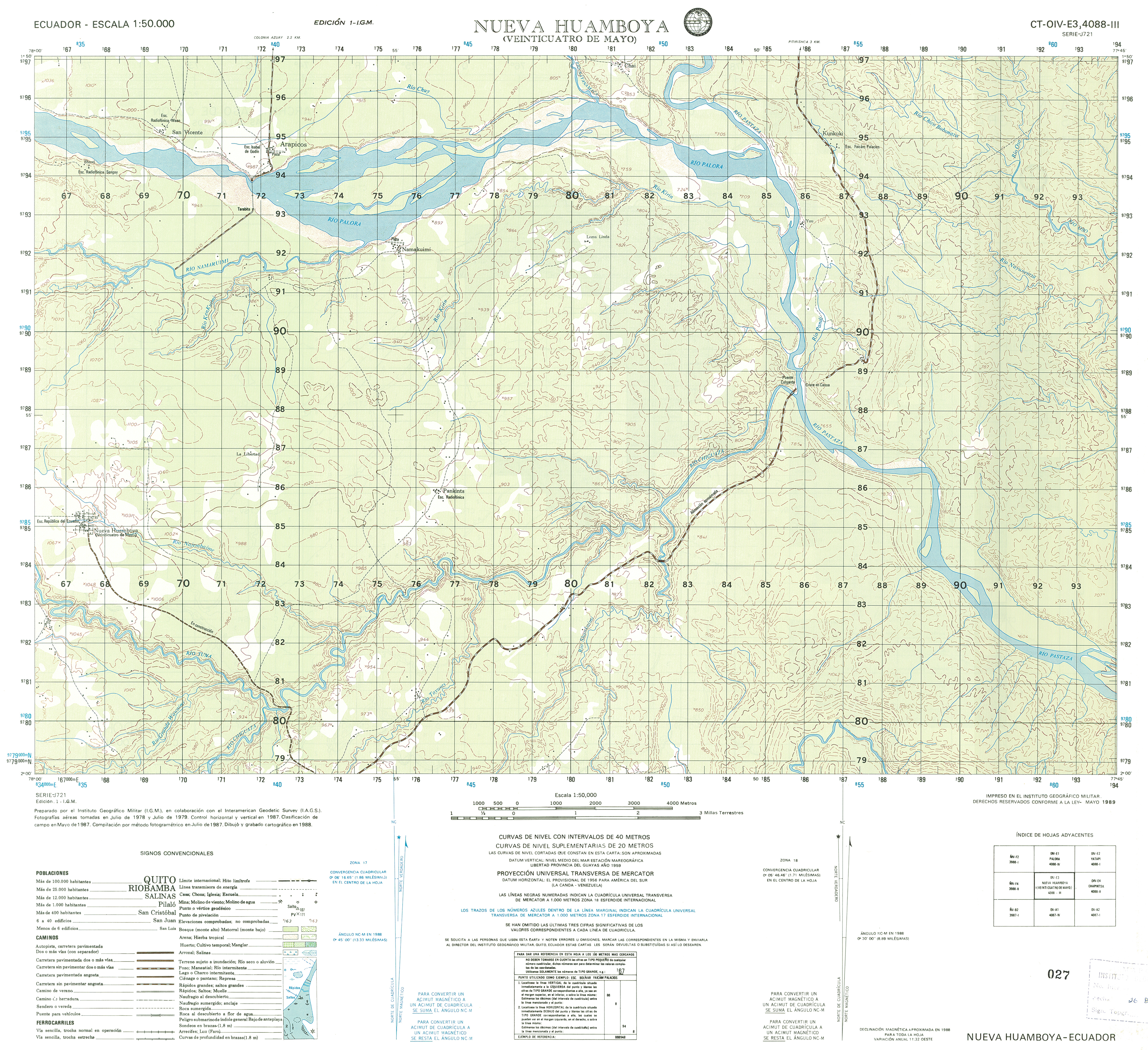
- Nueva Huamboya (topographic) Sheet 4088-III, 1:50,000 (14.2MB)
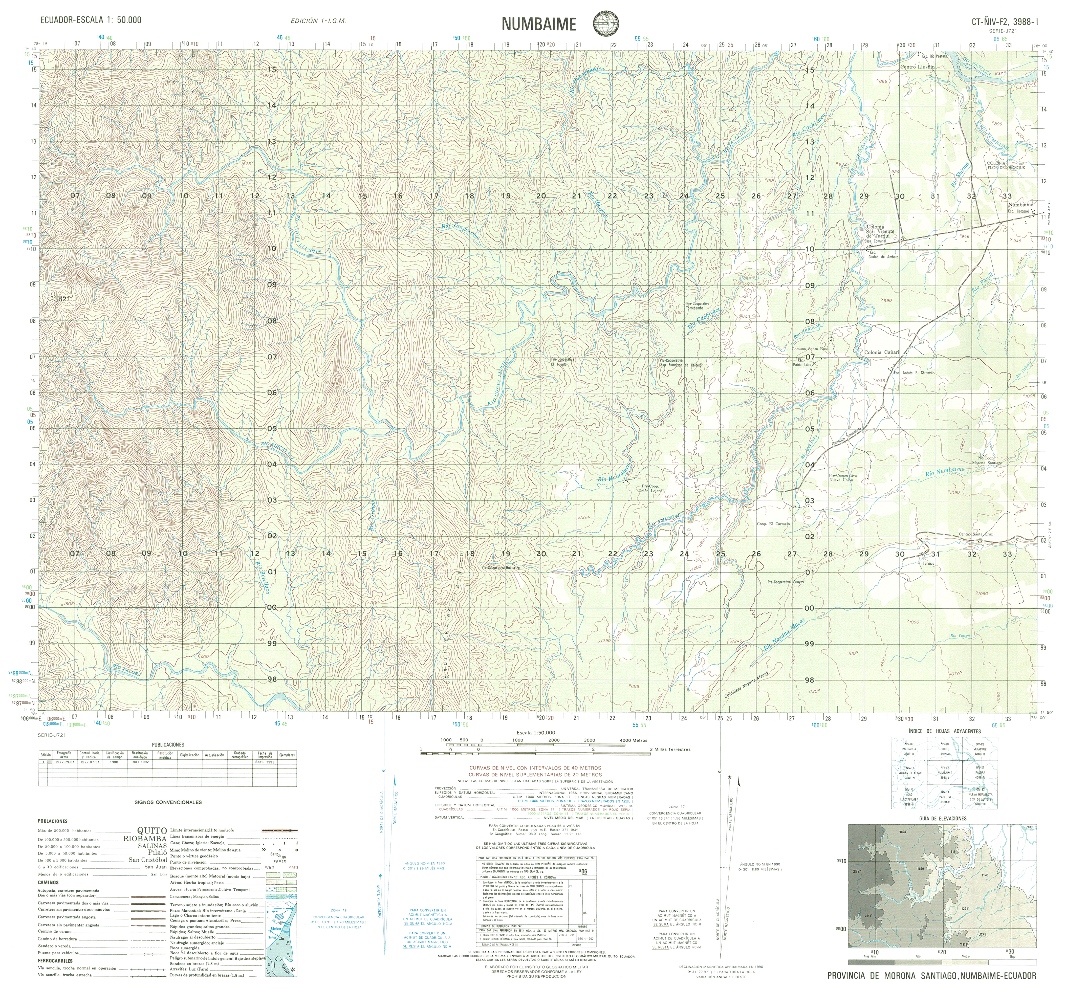
- Numbaime (topographic) Sheet 3988-I, 1:50,000 (15.0MB)
- Olmedo (topographic) Sheet 3589-I, 1:50,000 (16.2MB)
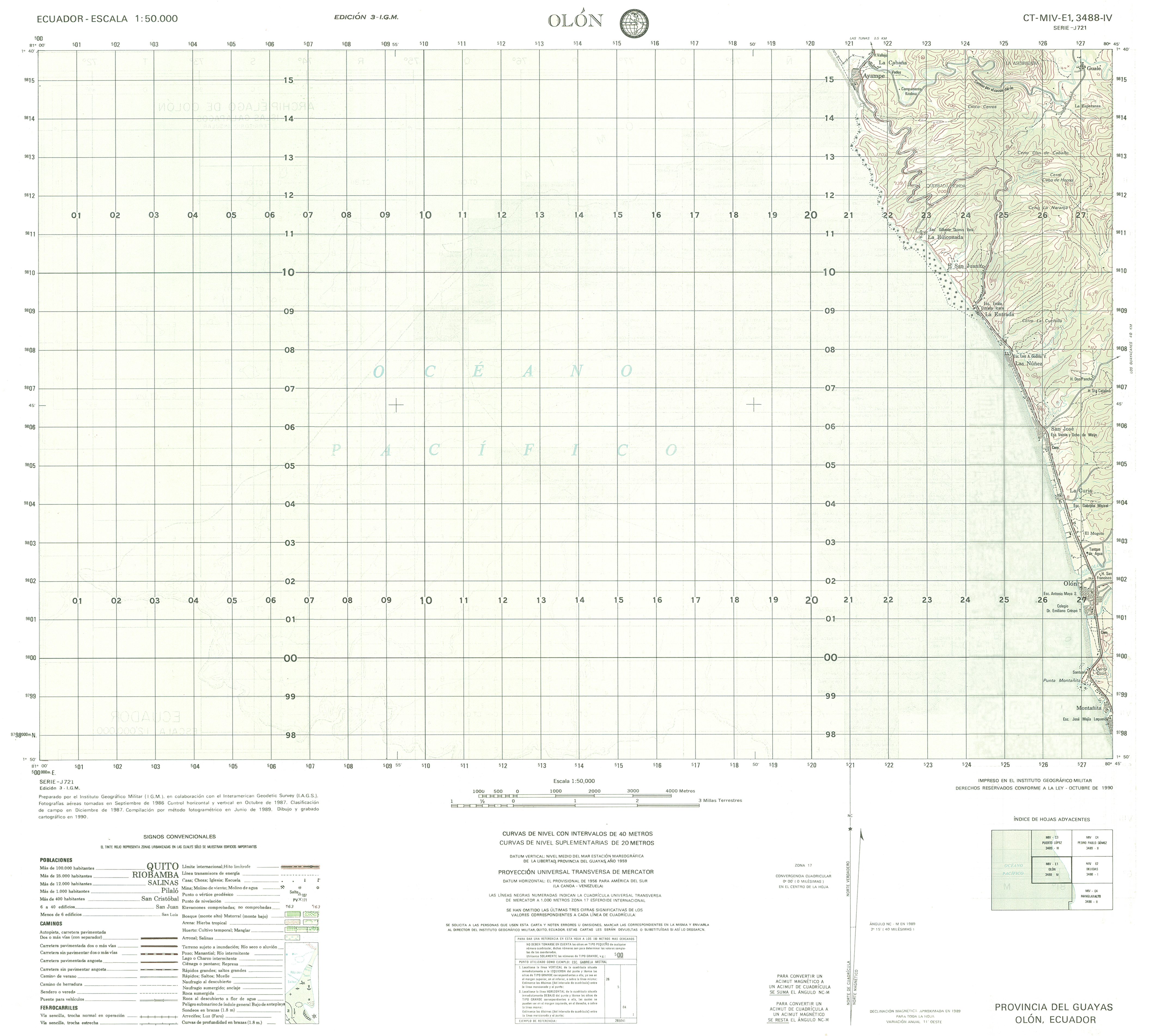
- Olon (topographic) Sheet 3488-IV, 1:50,000 (10.0MB)
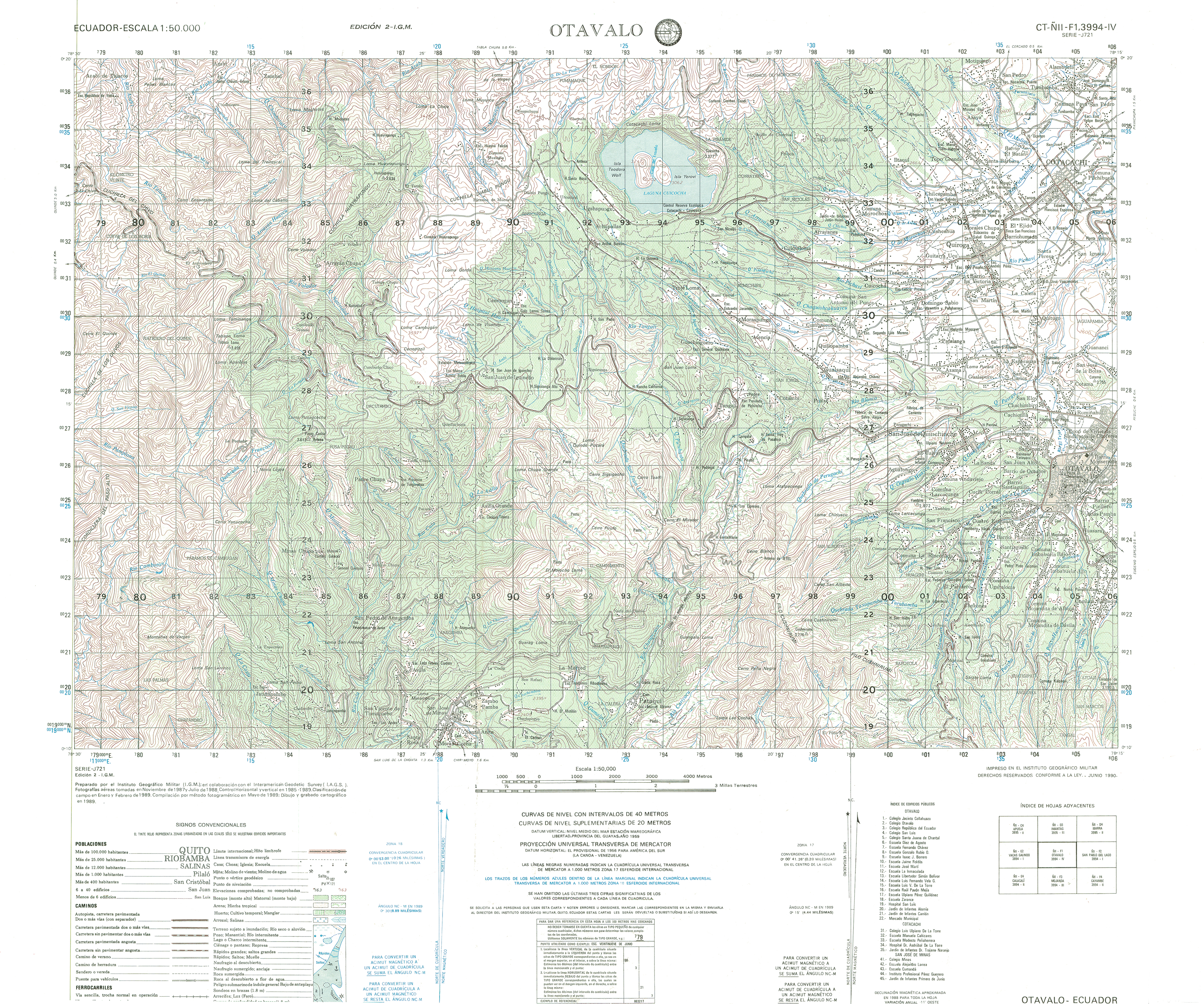
- Otavalo (topographic) Sheet 3994-IV, 1:50,000 (17.8MB)
- Oyacachi (topographic) Sheet 3993-II, 1:50,000 (15.6MB)
- Paaacocha (topographic) Sheet 4392-I, 1:50,000 (14.6MB)
- Pablo VI (topographic) Sheet 3988 II, 1:50,000 1988 (9.1MB) [PDF]
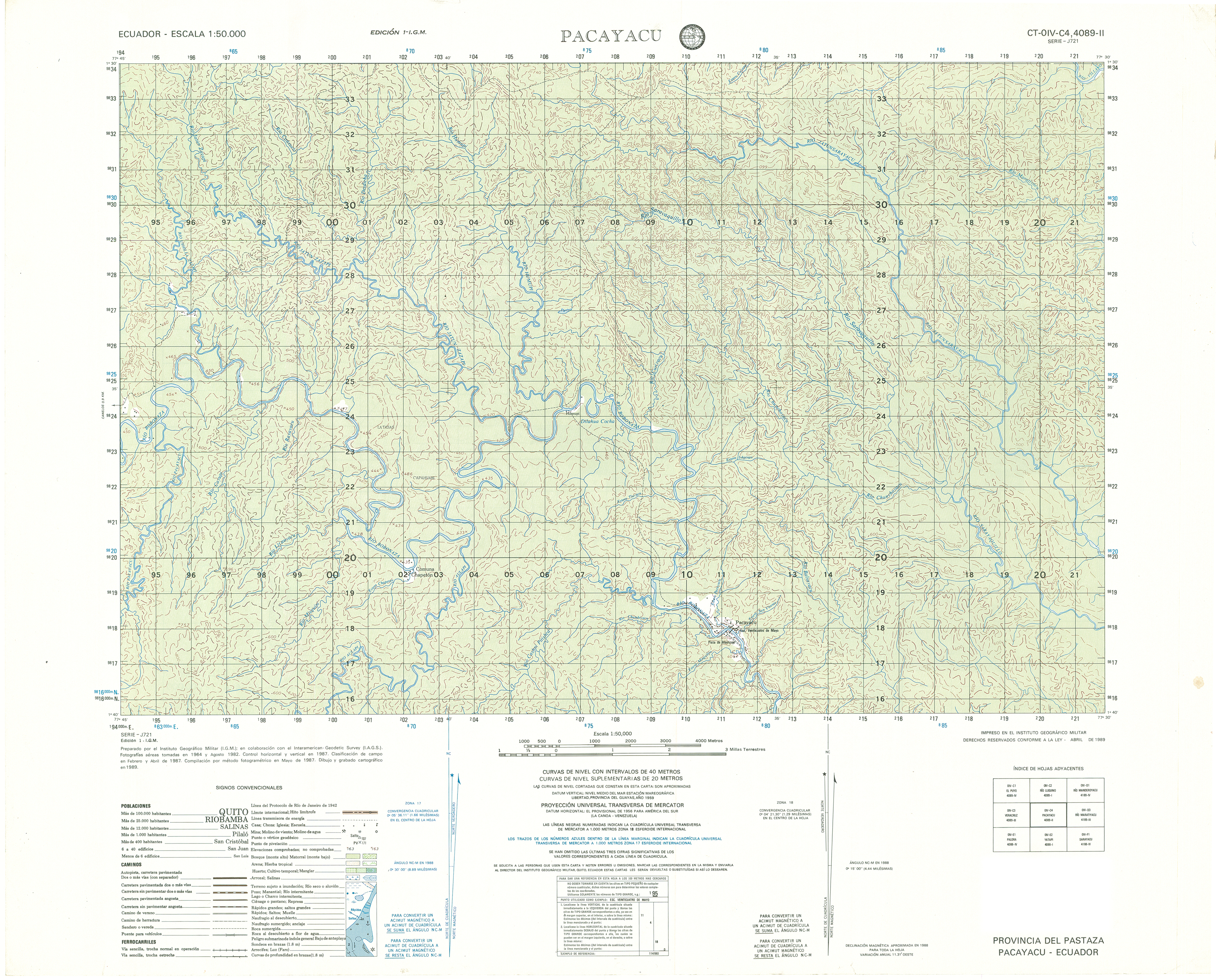
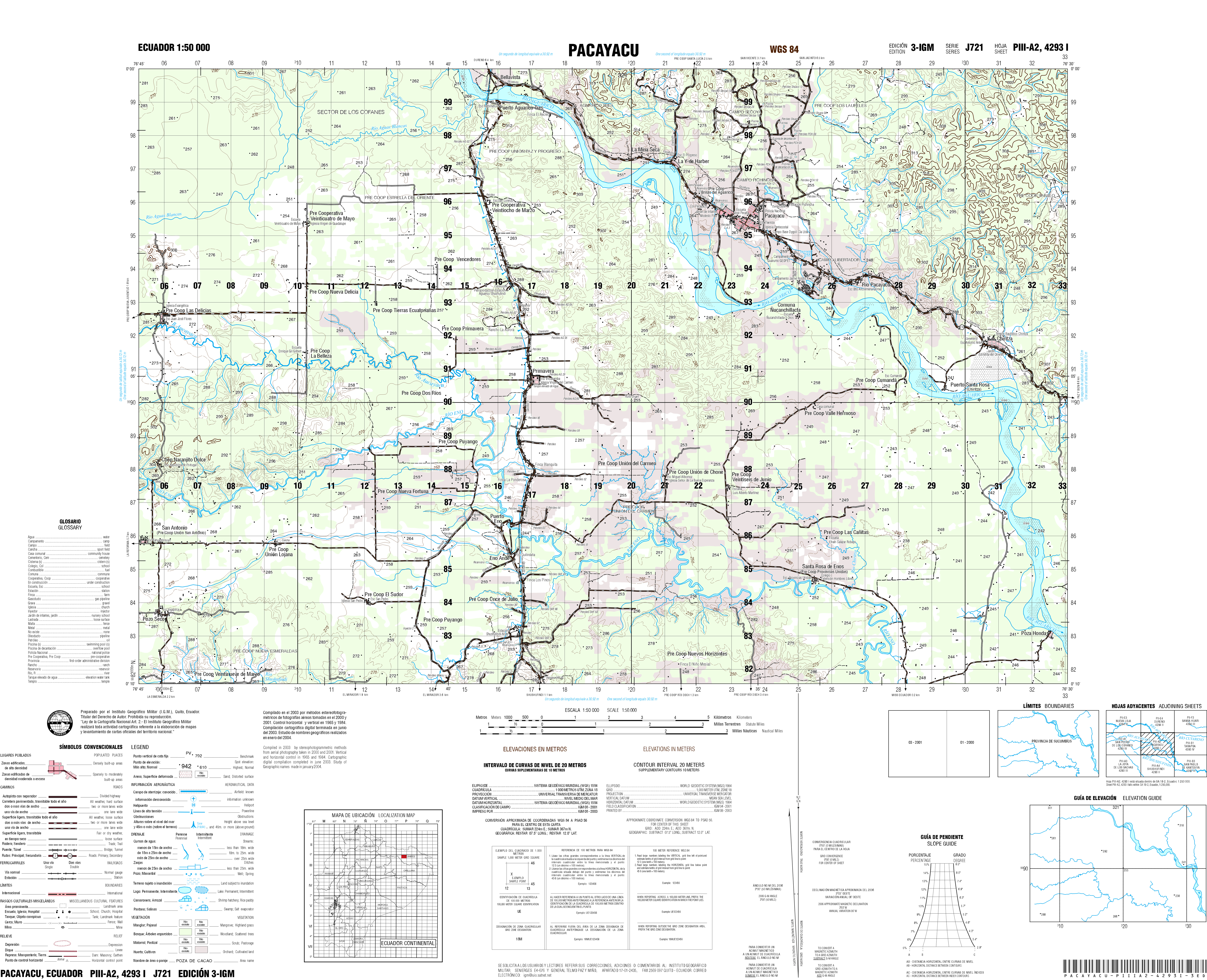
- Pacayacu (topographic) Sheet 4089-II, 1:50,000 (17.4MB)
- Pacayacu (topographic) Sheet 4023-I, 1:50,000 (18.3MB)
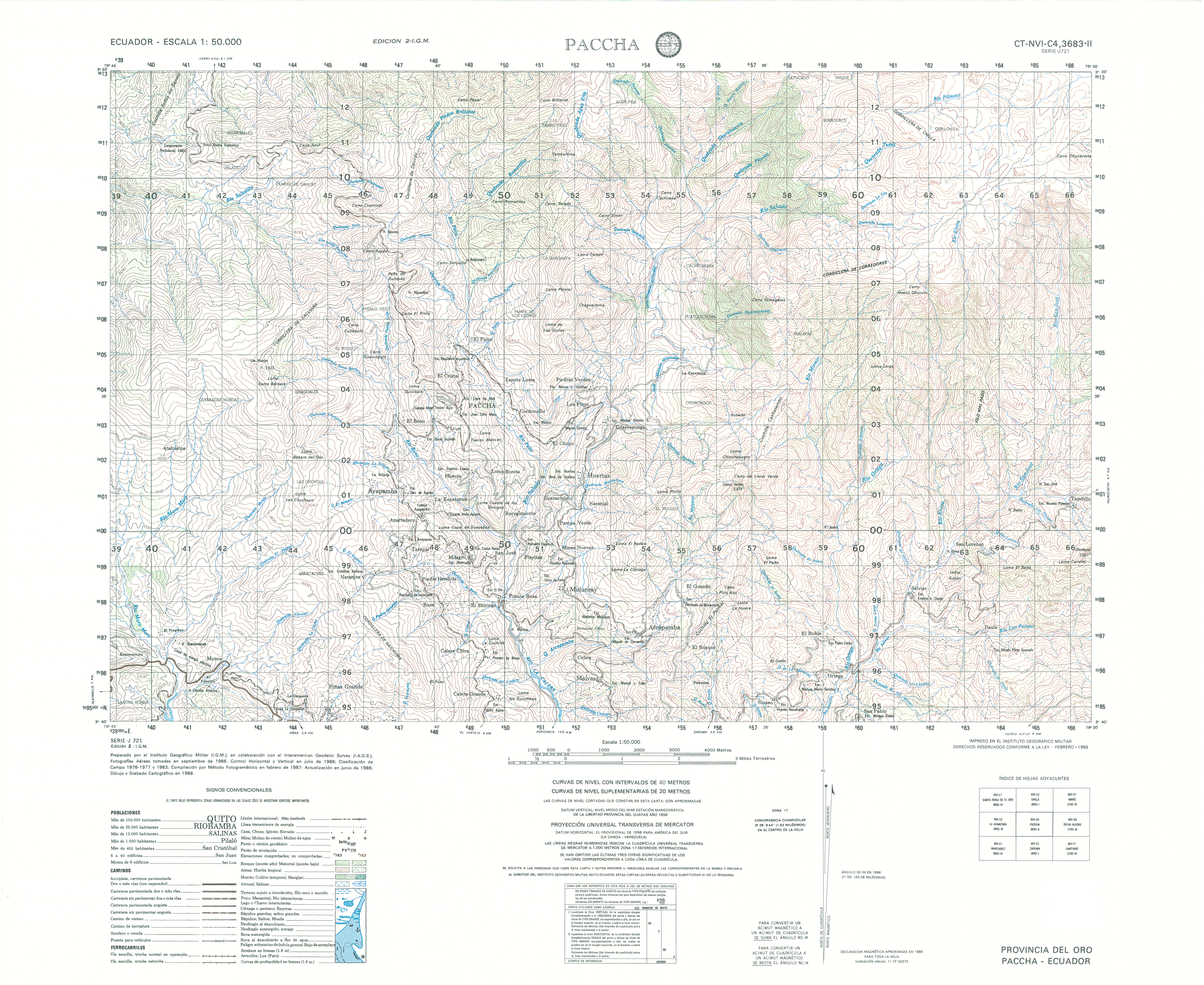
- Paccha (topographic) Sheet 3683-II, 1:50,000 (16.0MB)
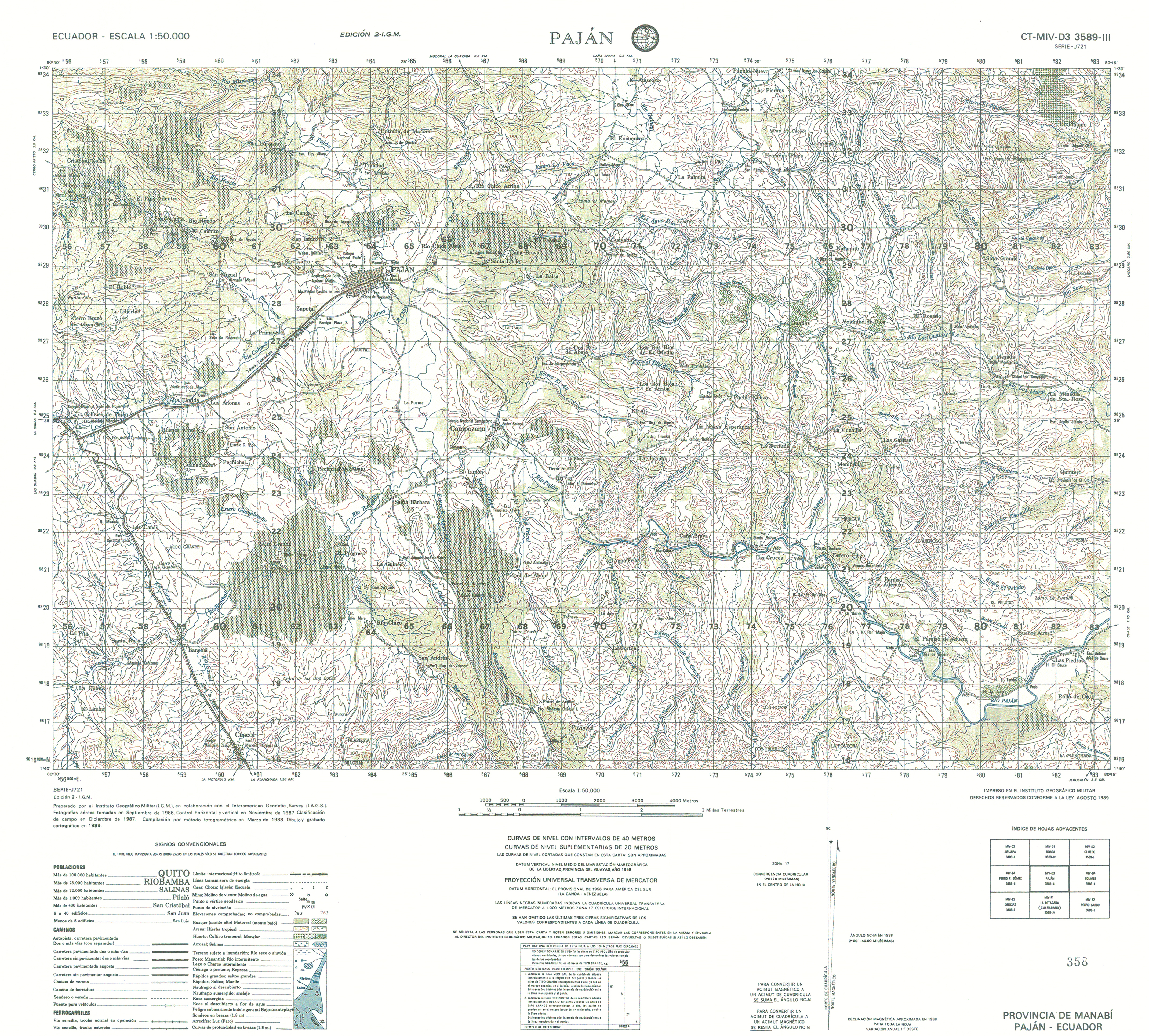
- Pajan (topographic) Sheet 3589-III, 1:50,000 (17.5MB)
- Palestina (topographic) Sheet 3689 III, 1:50,000 1997 (7.5MB) [PDF]
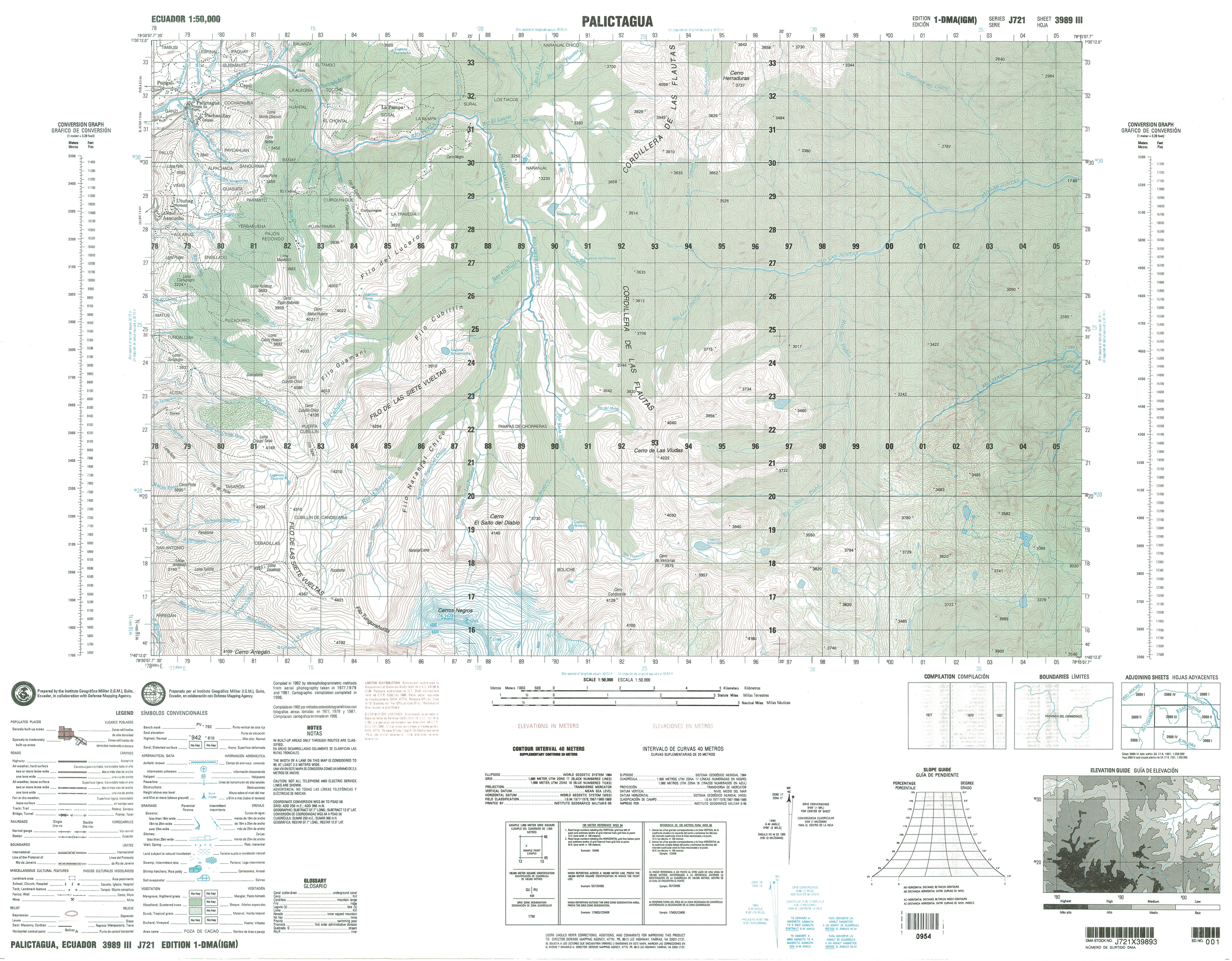
- Palictagua (topographic) Sheet 3989-III, 1:50,000 (16.7MB)
- Palizada (topographic) Sheet 4289 I, 1:50,000 1992 (8.4MB) [PDF]
- Pallatanga (topographic) Sheet 3888-III, 1:50,000 (20.6MB)
- Palmira (topographic) Sheet 3887-I, 1:50,000 (17.2MB)
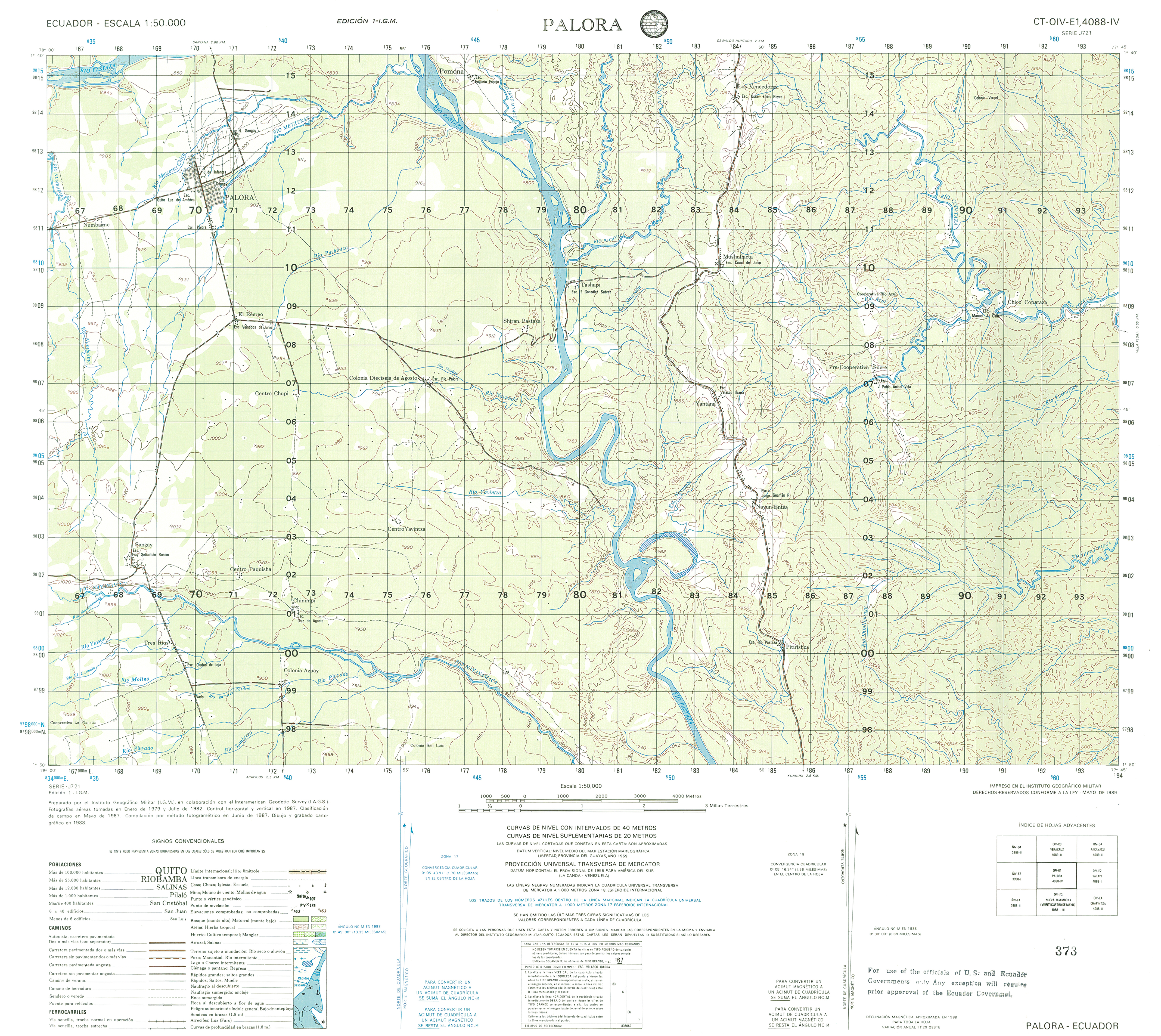
- Palora (topographic) Sheet 4088-IV, 1:50,000 (13.1MB)
- Pancho Negro (topographic) Sheet 3786-II, 1:50,000 (16.8MB)
- Papallacta (topographic) Sheet 3992-I, 1:50,000 (15.8MB)
- Pascuales (topographic) Sheet 3687 IV, 1:50,000 1990 (5.4MB) [PDF] [includes northern part of Guayaquil]
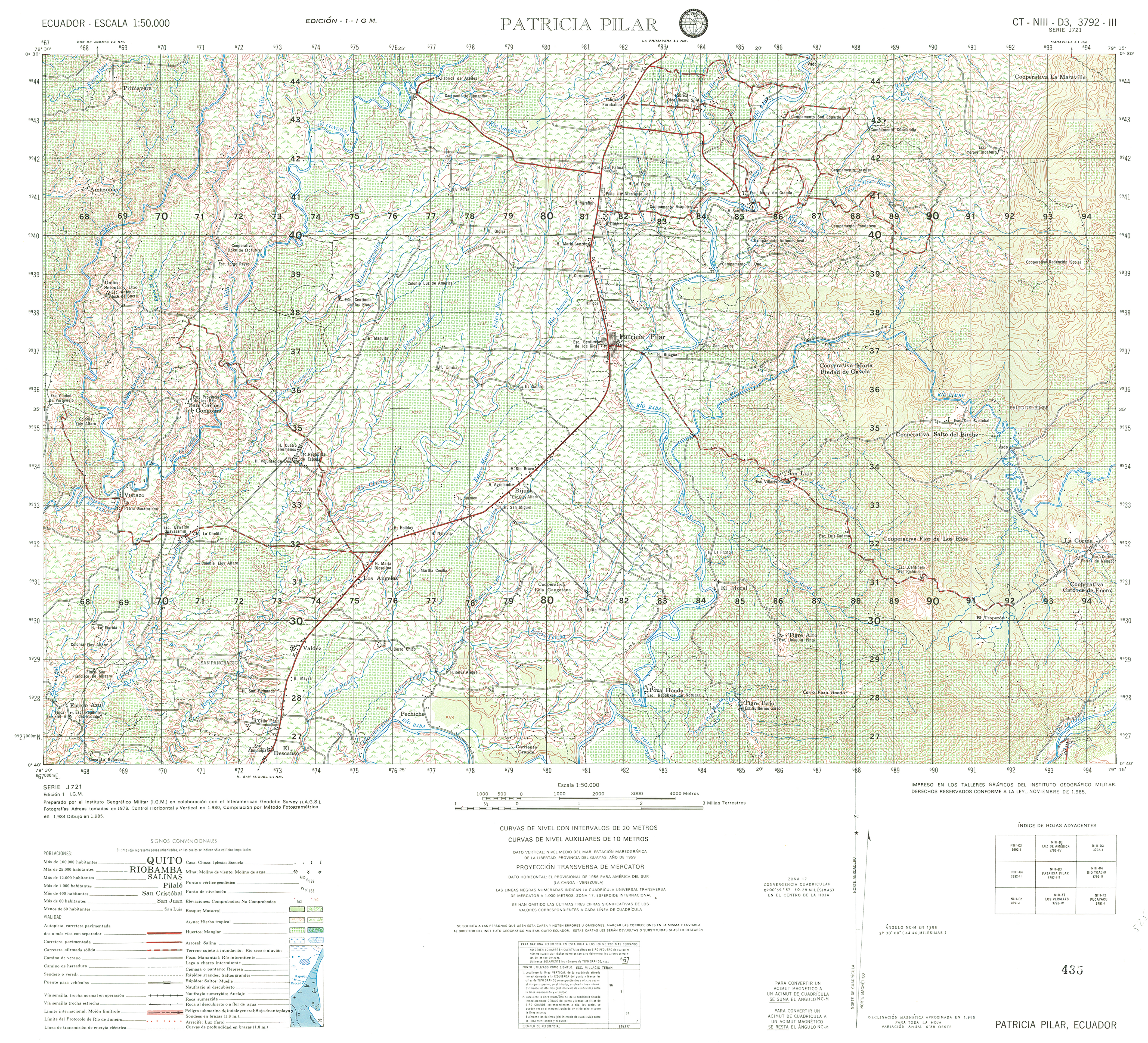
- Patricia Pilar (topographic) Sheet 3792-III, 1:50,000 (17.4MB)
- Peaablanca (topographic) Sheet 4394-IV, 1:50,000 (18.0MB)
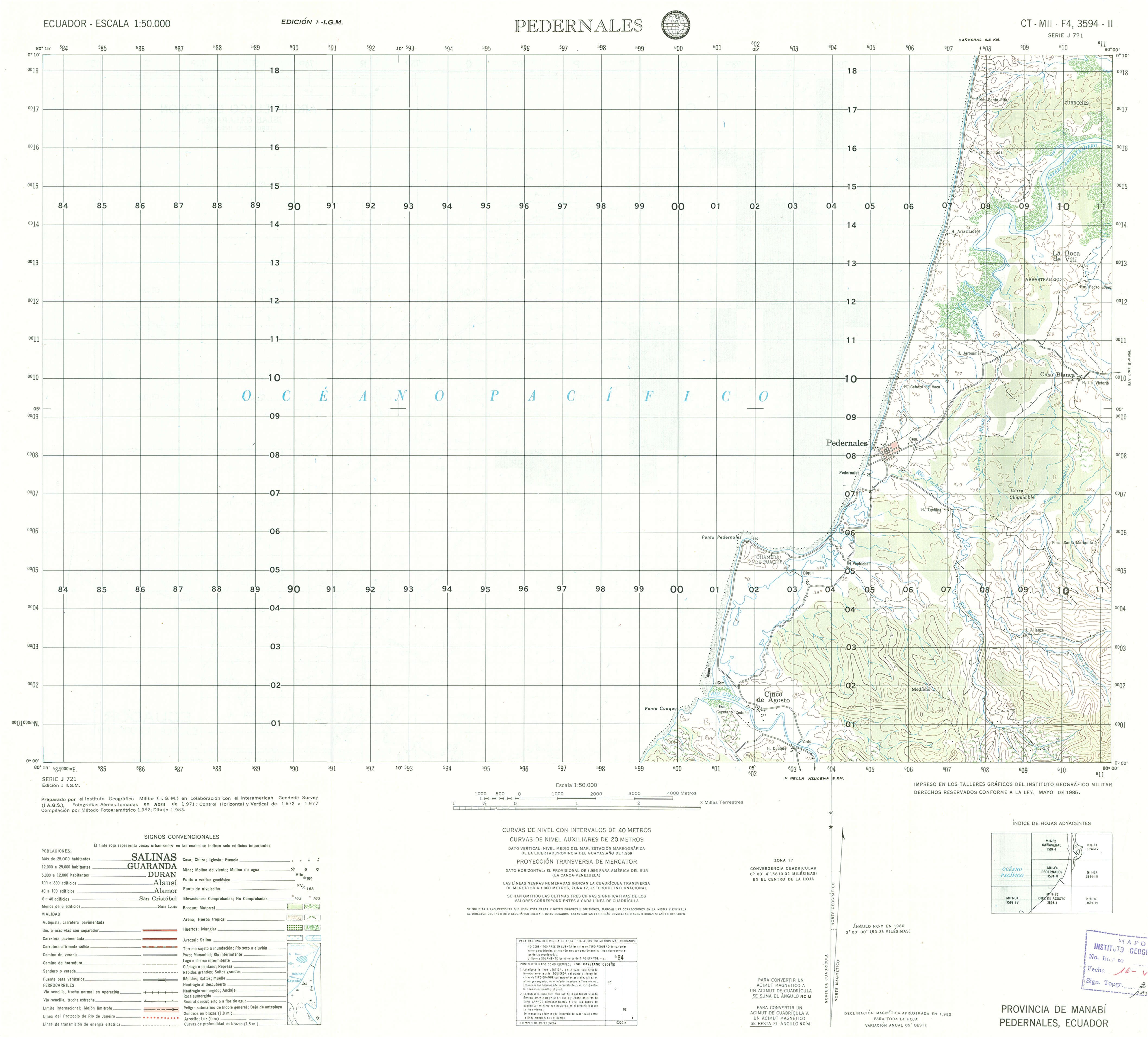
- Pedernales (topographic) Sheet 3594-II, 1:50,000 (10.0MB)
- Pedro Carbo (topographic) Sheet 3588-I, 1:50,000 (15.1MB)
- Pedro Pablo Gomez (topographic) Sheet 3489-II, 1:50,000 (16.4MB)
- Pedro Vicente Maldonado (topographic) Sheet 3794-II, 1:50,000 (19.2MB)
- Pichincha (topographic) Sheet 3690 IV, 1:50,000 1997 (8.1MB) [PDF]
- Pilalo (topographic) Sheet 3891-III, 1:50,000 (5.9MB)
- Pimampiro (topographic) Sheet 4095-III, 1:50,000 (35.2MB)
- Pintoyacu (topographic) Sheet 4288 I, 1:50,000 1991 (8.6MB) [PDF]
- Piraaacocha (topographic) Sheet 4389-II, 1:50,000 (14.2MB)
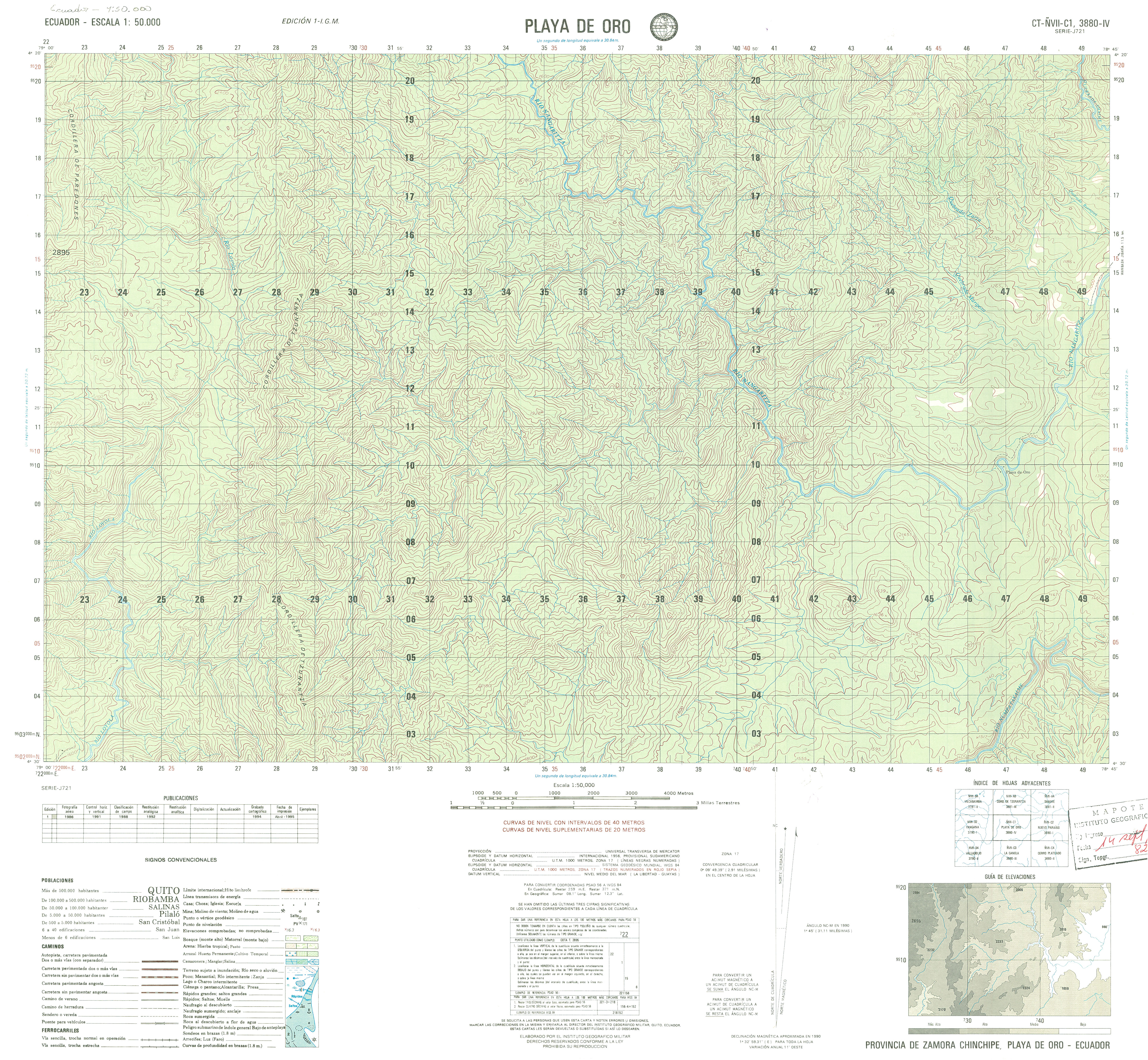
- Playa de Oro (topographic) Sheet 3880-IV, 1:50,000 (5.0MB)
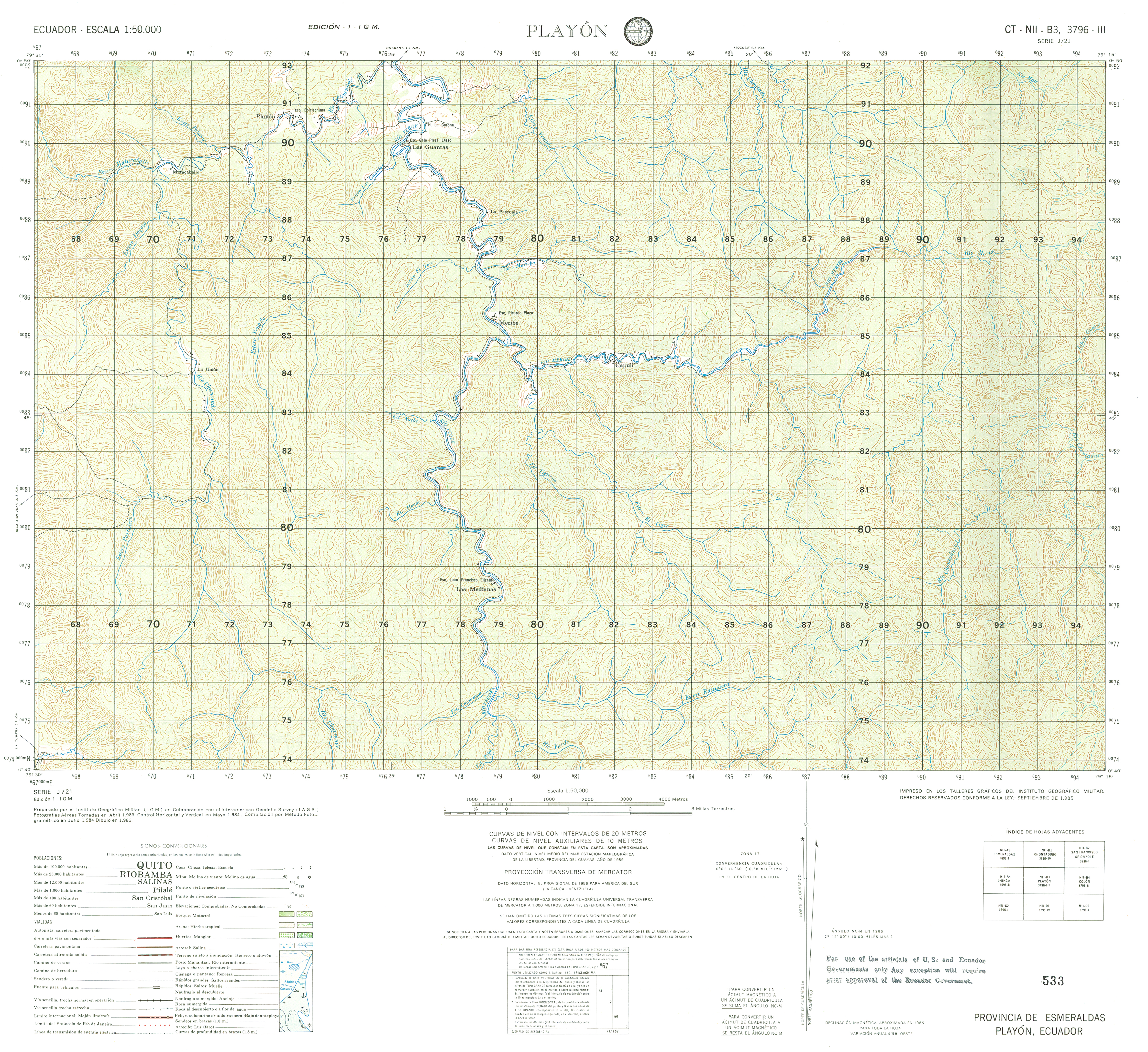
- Playon (topographic) Sheet 3796-III, 1:50,000 (18.7MB)
- Portoviejo (topographic) Sheet 3590 IV, 1:50,000 1996 (8.9MB) [PDF]
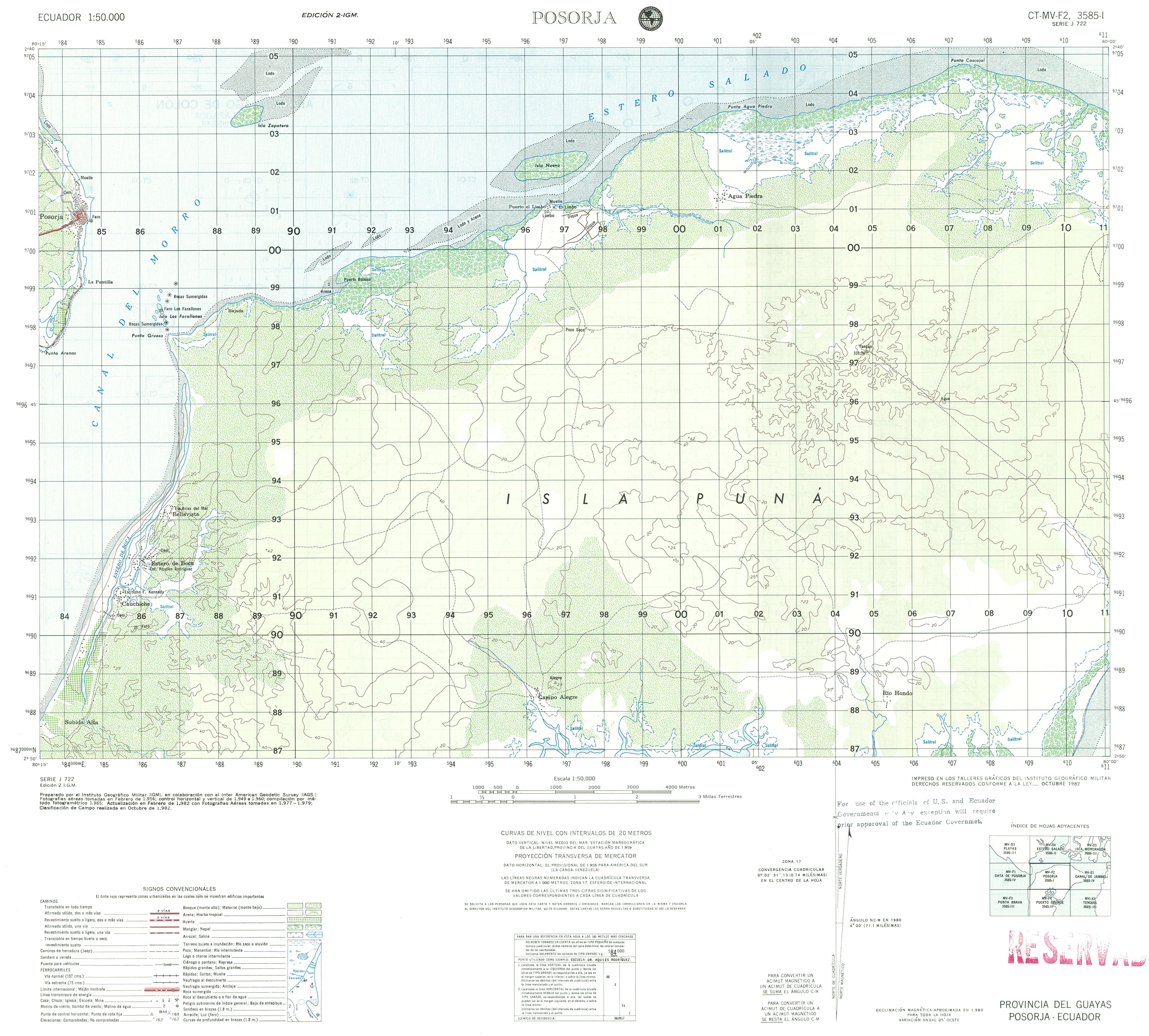
- Posorja (topographic) Sheet 3585-I, 1:50,000 (3.6MB)
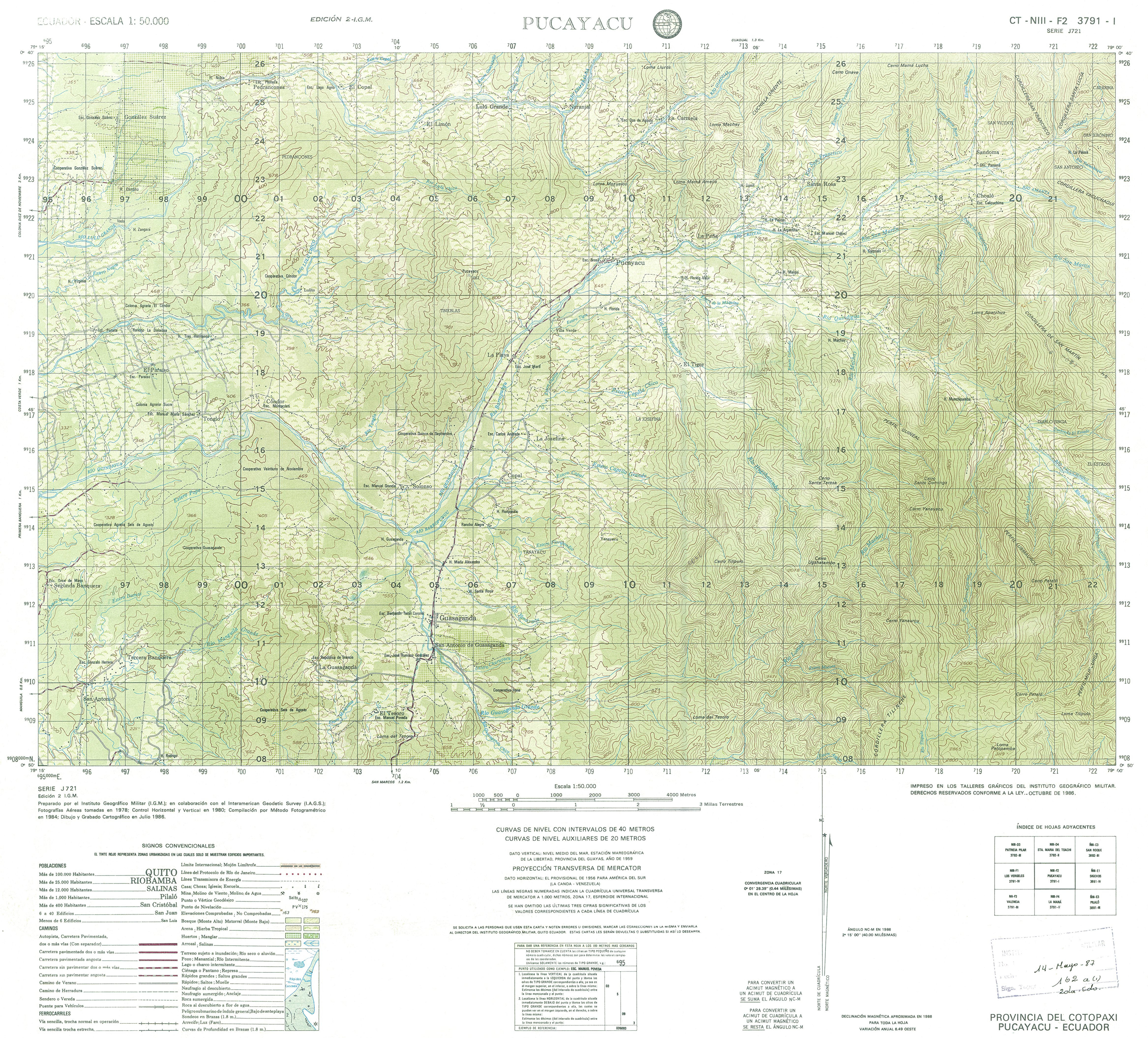
- Pucayacu (topographic) Sheet 3791-I, 1:50,000 (18.5MB)
- Pueblo Nuevo (topographic) Sheet 3590-II, 1:50,000 (20.5MB)
- Alluriquin (topographic) Sheet 3893 III, 1:50,000 (2.5MB)