Perry-Castañeda Library
Map Collection
Senegal Maps
The following maps were produced by the U.S. Central Intelligence Agency, unless otherwise indicated.
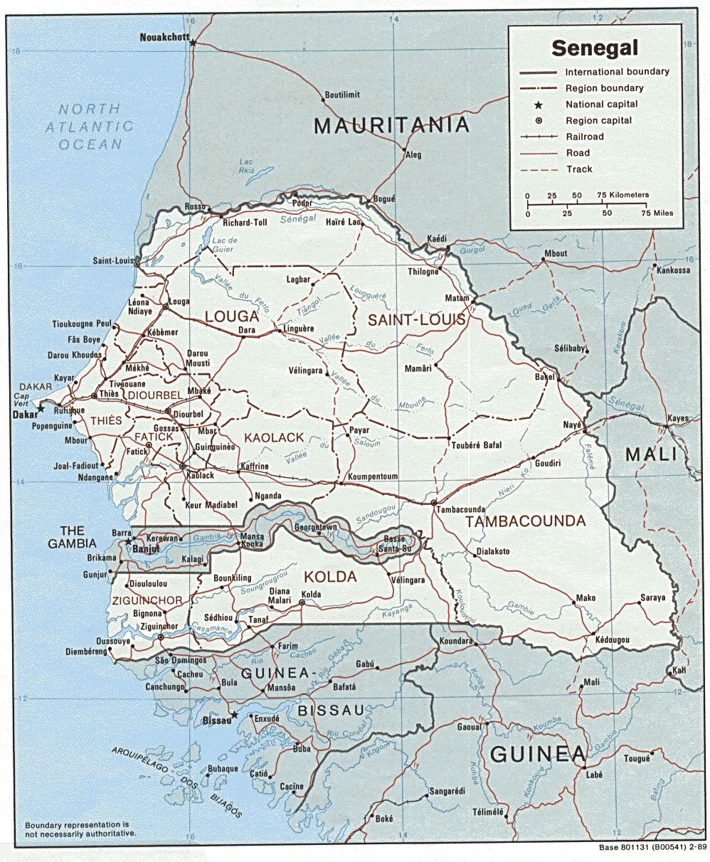
Country Maps- Senegal (Political) 1989 (289K) and pdf format (305K)
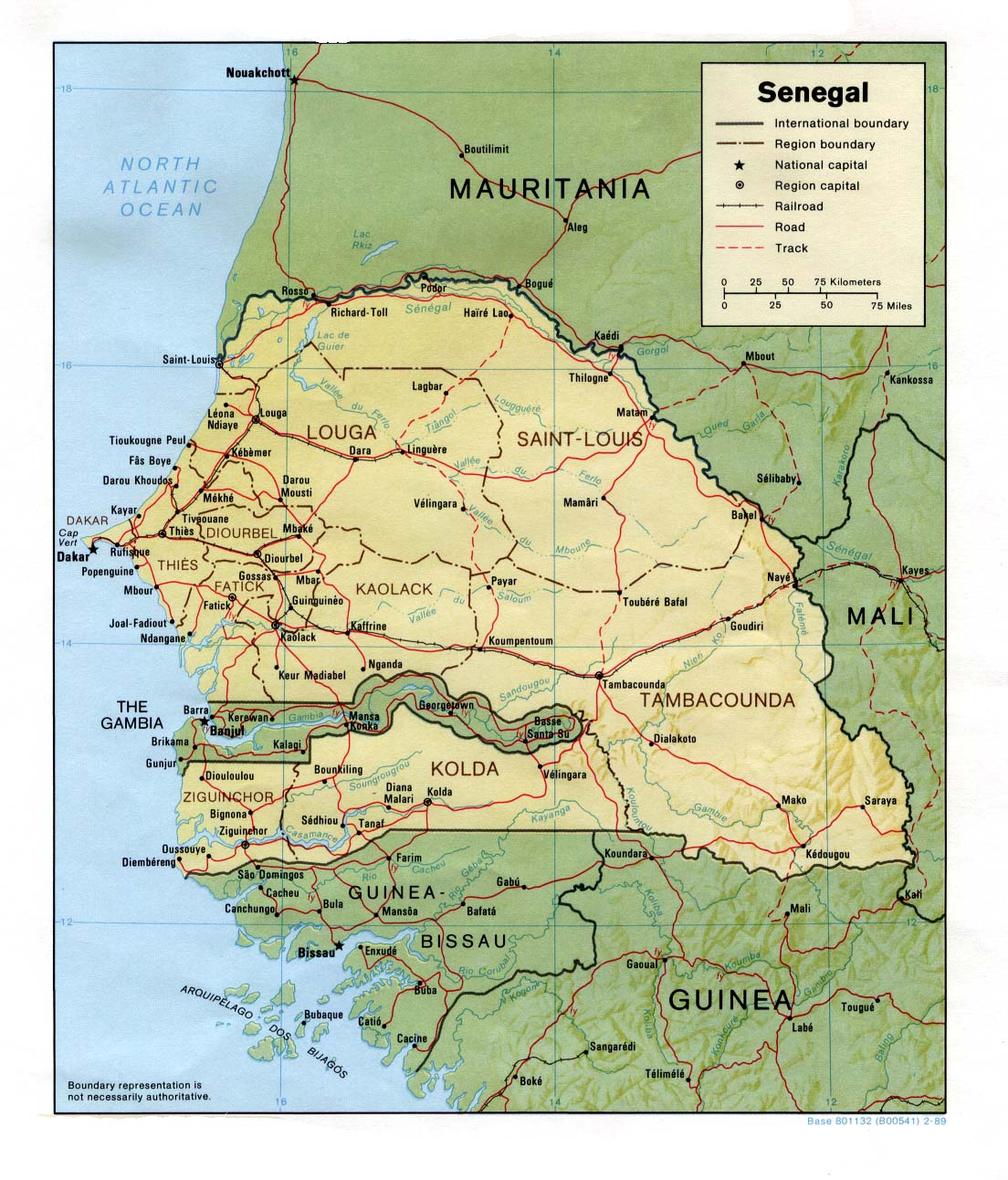
- Senegal (Shaded Relief) 1989 (264K) and pdf format (272K)
- Senegal (Small Map) 2016 (20K)
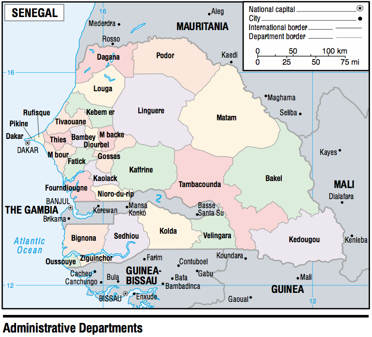
- Senegal (Administrative Departments) 2003 (189K)
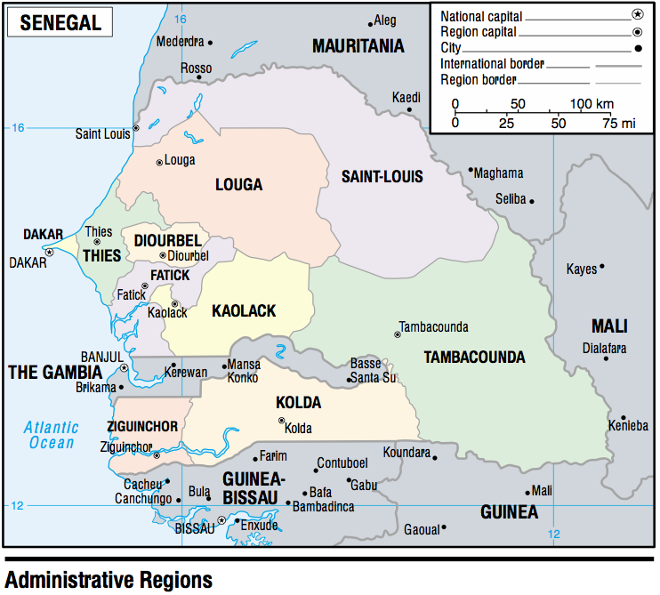
- Senegal (Administrative Regions) 2003 (171K)
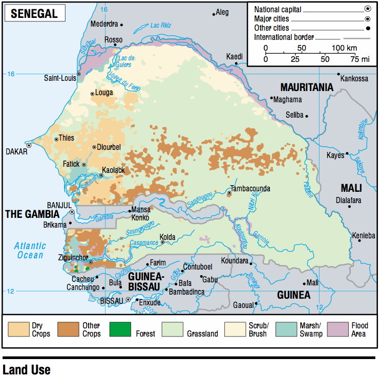
- Senegal - Land Use 2003 (257K)
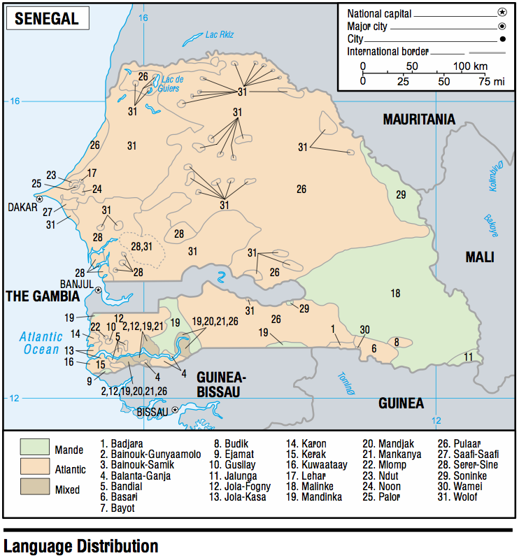
- Senegal - Language Distribution 2003 (217K)
- 1:2,000,000 - Africa Topographic Maps U.S. Army Map Service, Series 2201
- Sheet 11 includes Senegal
- 1:1,000,000 - International Map of the World U.S. Army Map Service
- This series covers all of Senegal
- 1:1,000,000 - Operational Navigation Chart Series U.S. Defense Mapping Agency Aerospace Center. Not for navigational use
- This series includes Senegal
- 1:500,000 - Tactical Pilotage Charts U.S. National Imagery and Mapping Agency. Not for navigational use
- This series includes Senegal
- 1:250,000 - West Africa Topographic Maps U.S. Army Map Service
- This series includes most of Senegal
- 1:250,000 - Joint Operations Graphic U.S. National Imagery and Mapping Agency, Series 1501 Air Not for navigational use
- This series includes parts of Senegal
- 1:200,000 - French West Africa Topographic Maps U.S. Army Map Service, 1940-
- This historical series includes parts of Senegal
- Sheet 11 includes Senegal
- Cape Vert Peninsula 2003 (203K)
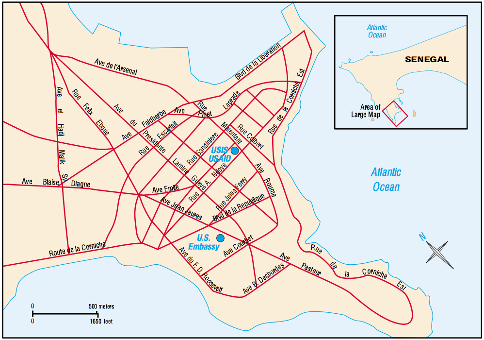
- Dakar 2003 (262K)
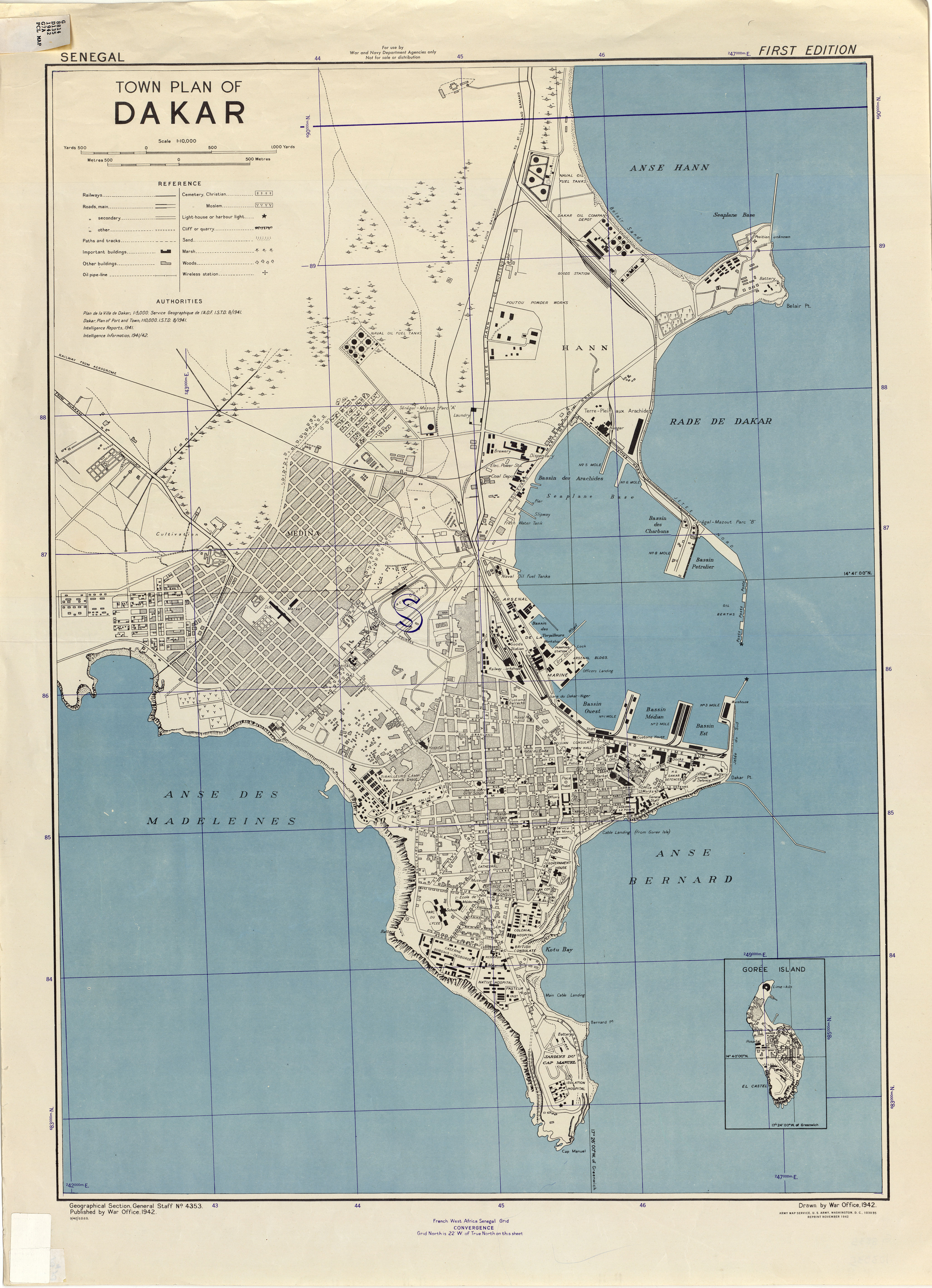
- Dakar 1:10,000, U.S. Army Map Service, 1942 (4.4MB)
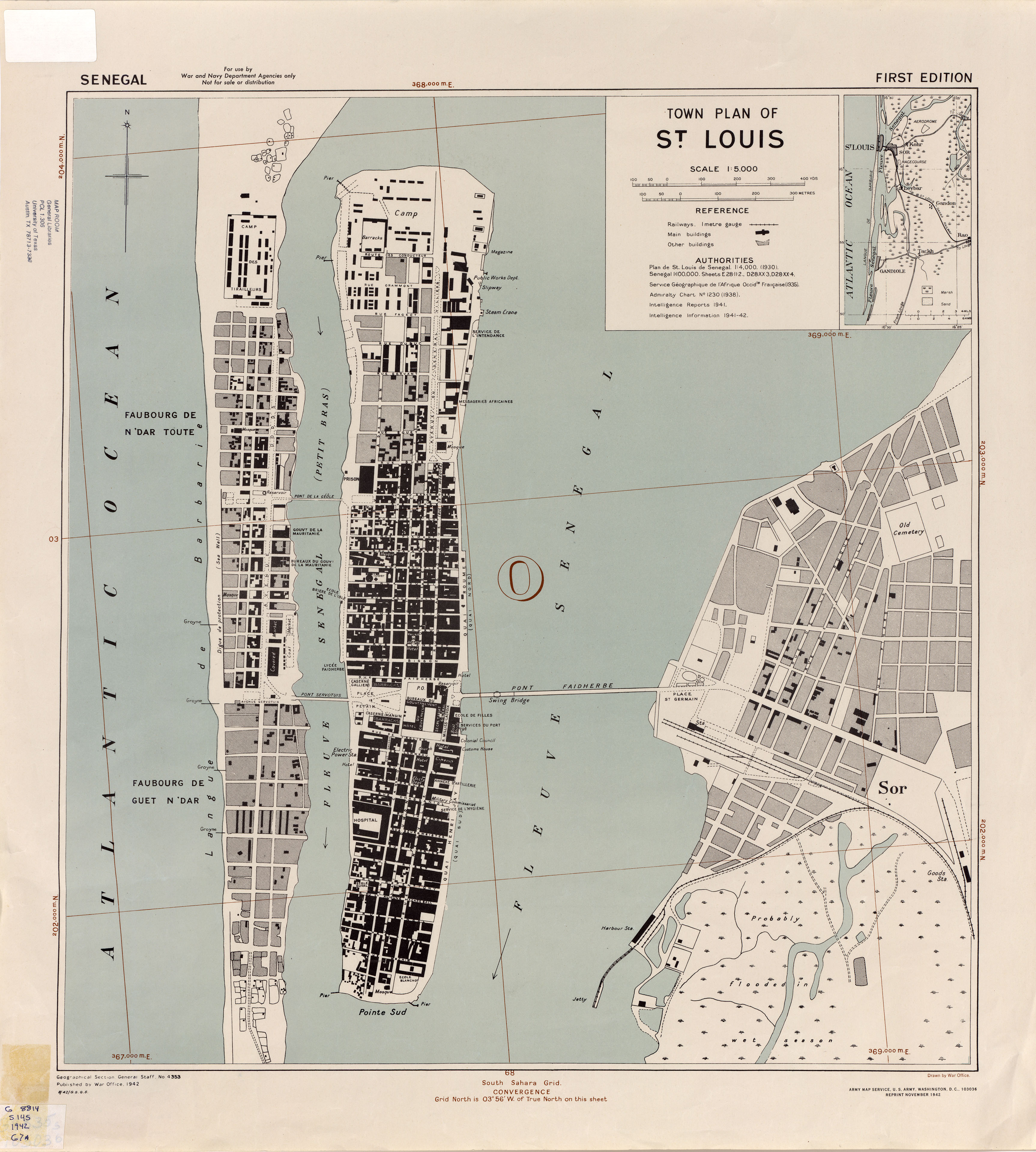
- St. Louis 1:5,000, U.S. Army Map Service, 1942 (2.4MB)