Perry-Castañeda Library
Map Collection
Poland Maps
The following maps were produced by the U.S. Central Intelligence Agency, unless otherwise indicated.
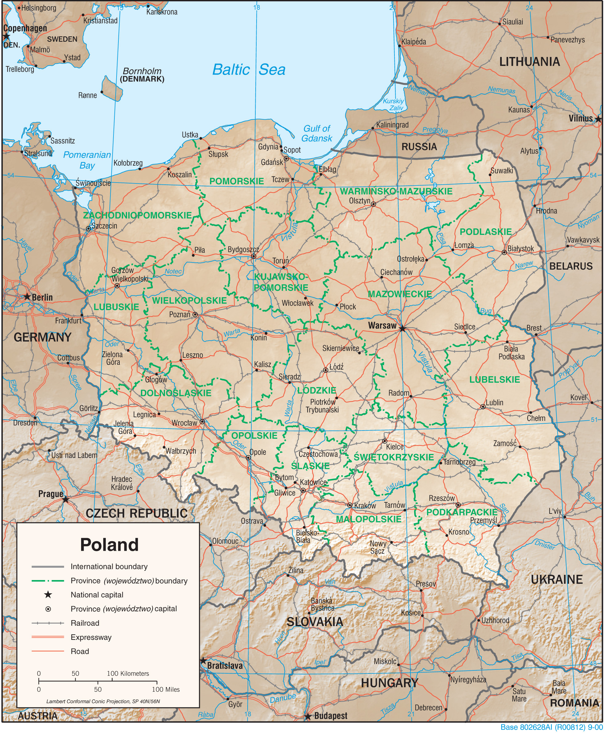
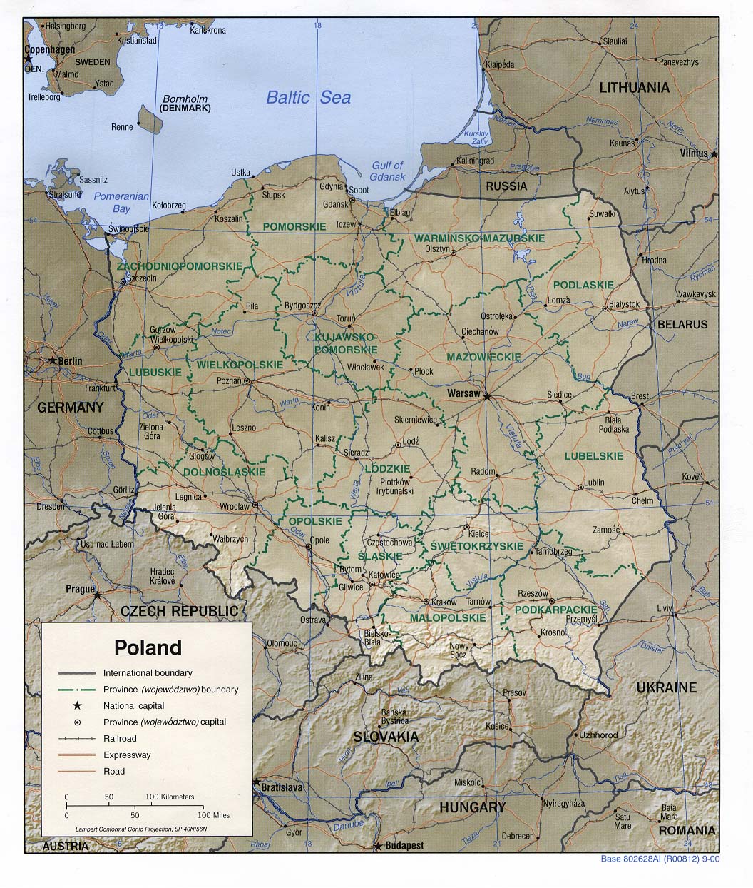
Country Maps- Poland (Physiography) 2000 (2.0MB) and pdf format (2.2MB)
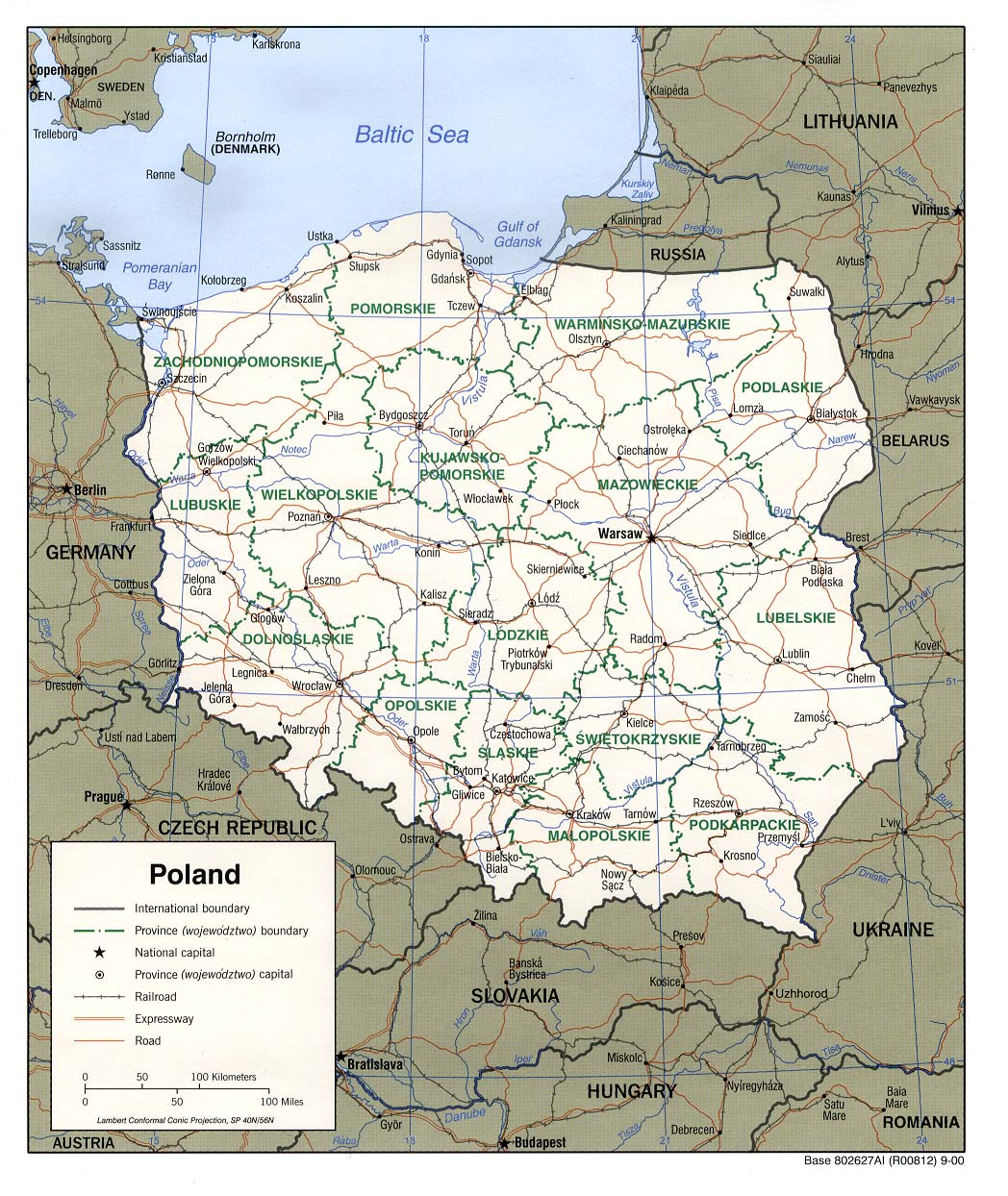
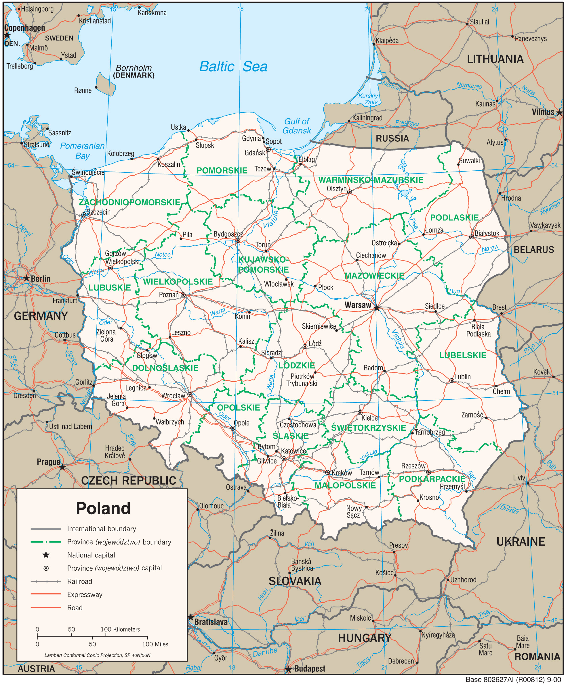
- Poland (Political) 2000 (321K) and pdf format (331K)
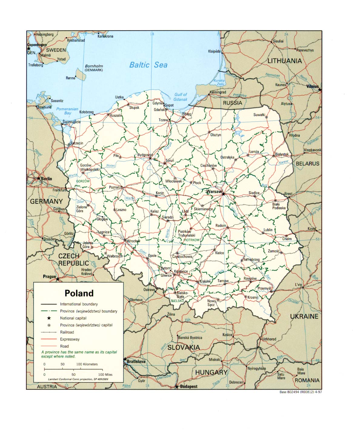
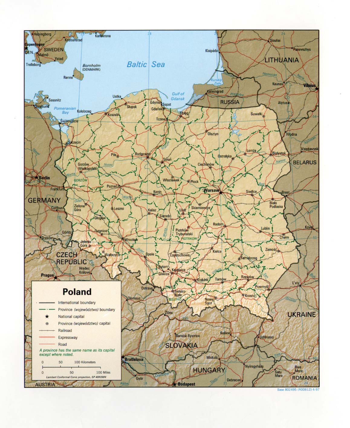
- Poland (Political) 1997 (315K) and pdf format (303K)
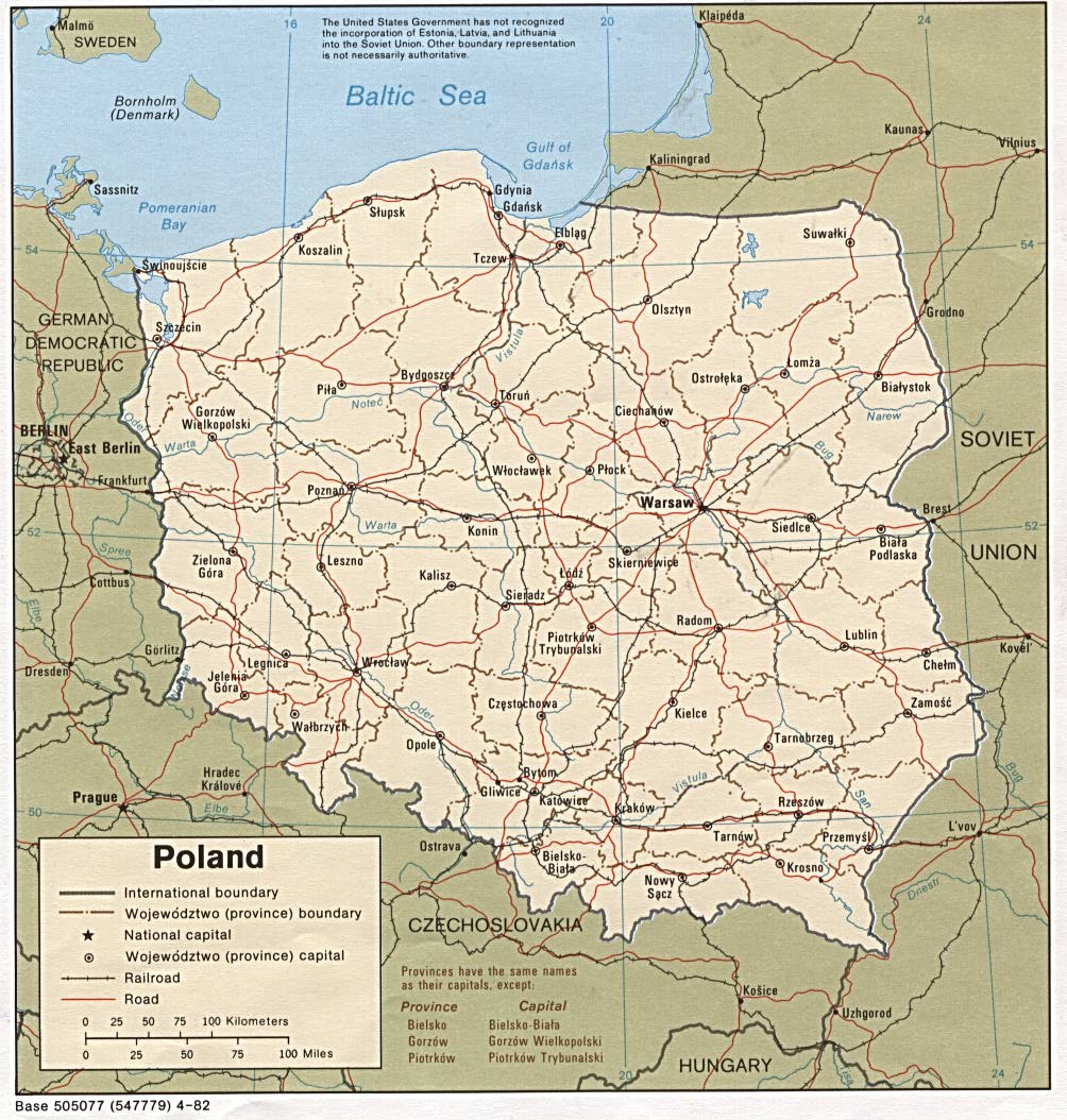
- Poland (Political) 1982 (247K) and pdf format (250K)
- Poland (Shaded Relief) 2000 (285K) and pdf format (329K)
- Poland (Shaded Relief) 1997 (306K) and pdf format (294K)
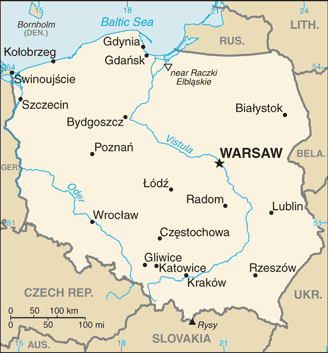
- Poland (Small Map) 2016 (18.6K)
- Poland (Transportation) 2000 (1.7MB) and pdf format (396K)
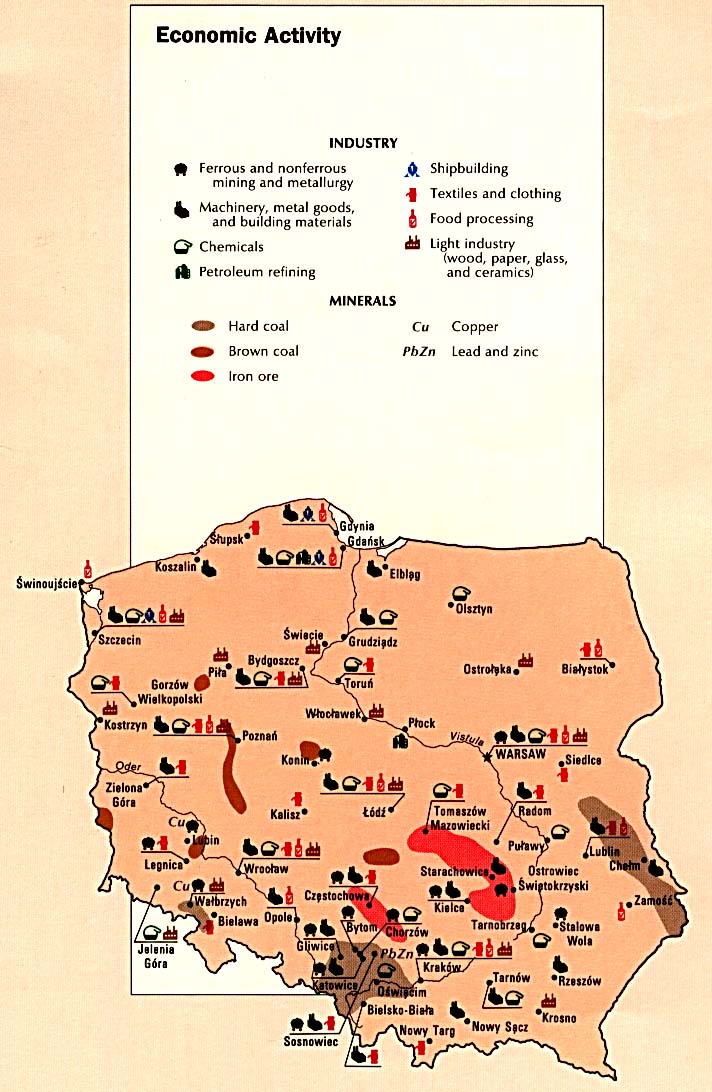
- Poland - Economic Activity from the CIA Atlas of Eastern Europe 1990 (141K)
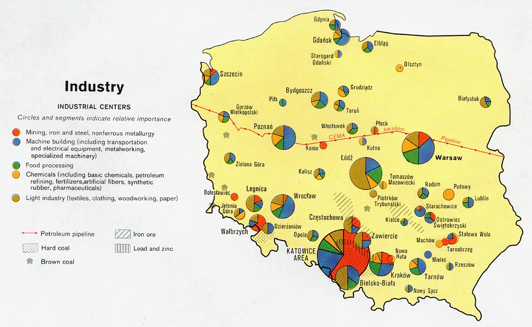
- Poland - Industry from Map No. 503478 1977 (160K)
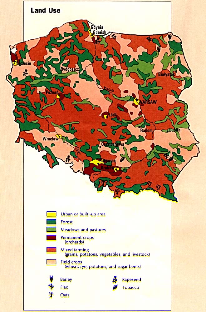
- Poland - Land Use from the CIA Atlas of Eastern Europe 1990 (138K)
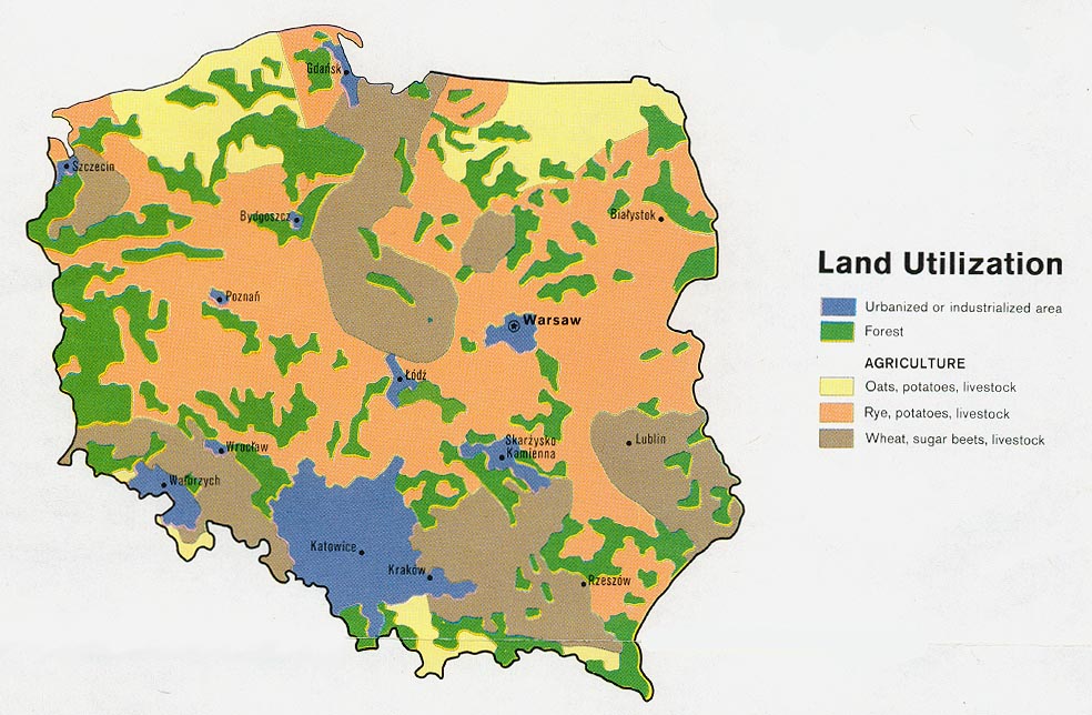
- Poland - Land Utilization from Map No. 503478 1977 (166K)
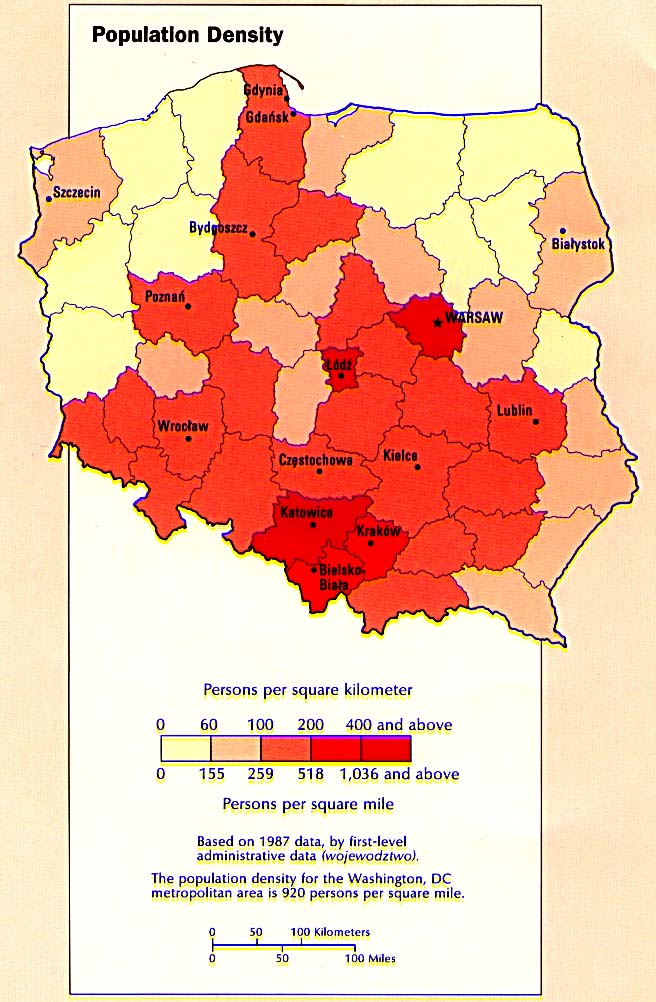
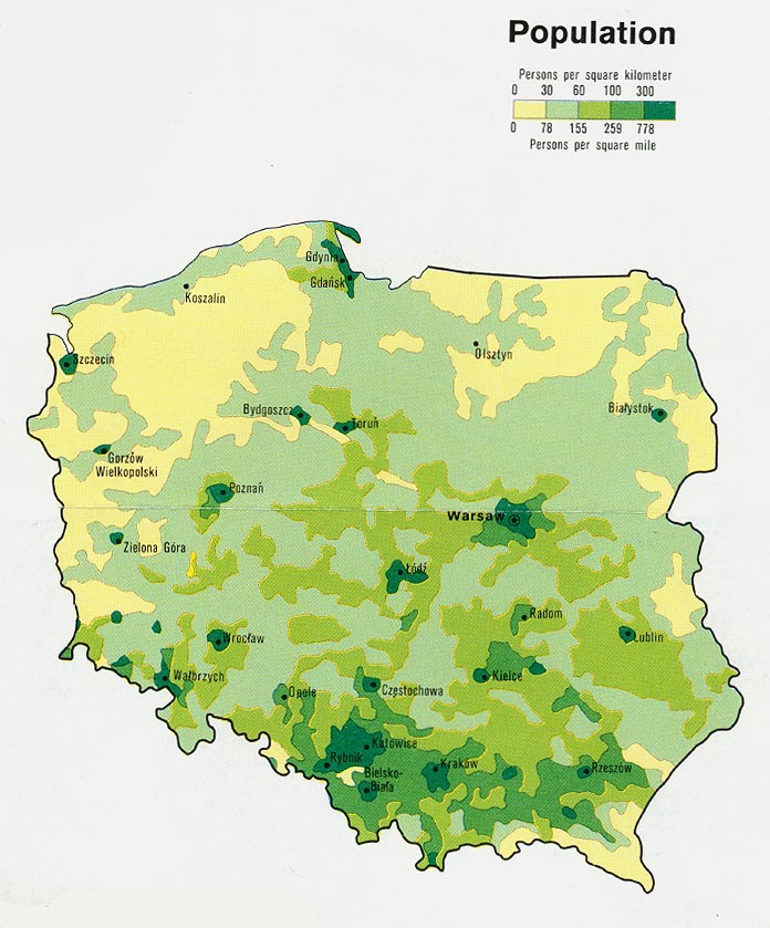
- Poland - Population Density from the CIA Atlas of the Eastern Europe 1990 (123K)
- Poland - Population from Map No. 503478 1977 (141K)
- 1:1,000,000 - Operational Navigation Chart Series U.S. Defense Mapping Agency Aerospace Center. Not for navigational use
- Sheets E-2 and E-3 cover all of Poland
- 1:500,000 - Europe Series M404 (4072), Great Britain War Office, 1942-
- This series covers all of Poland
- 1:500,000 - Tactical Pilotage Charts U.S. National Imagery and Mapping Agency. Not for navigational use
- This series covers Poland
- 1:500,000 - World Series 1404, Great Britain. War Office and Air Ministry. 1958-
- This series covers all of Poland
- 1:250,000 - Central Europe Series M508, U.S. Army Map Service, 1942-
- This series covers Poland
- 1:250,000 Eastern Europe Series N501, U.S. Army Map Service, 1954
- This series covers eastern Poland.
- 1:250,000 - Western Europe Series M501, U.S. Army Map Service, 1959-
- This series covers western and central Poland
- 1:100,000 - Poland Series M651, U.S. Army Map Service, 1944-
- Sheets E-2 and E-3 cover all of Poland
Maps on Other Web Sites