Perry-Castañeda Library
Map Collection
Peru Maps
The following maps were produced by the U.S. Central Intelligence Agency, unless otherwise indicated.
Country Maps- Peru (Physiography) 2006 (1.3MB) and pdf format (1.2MB)
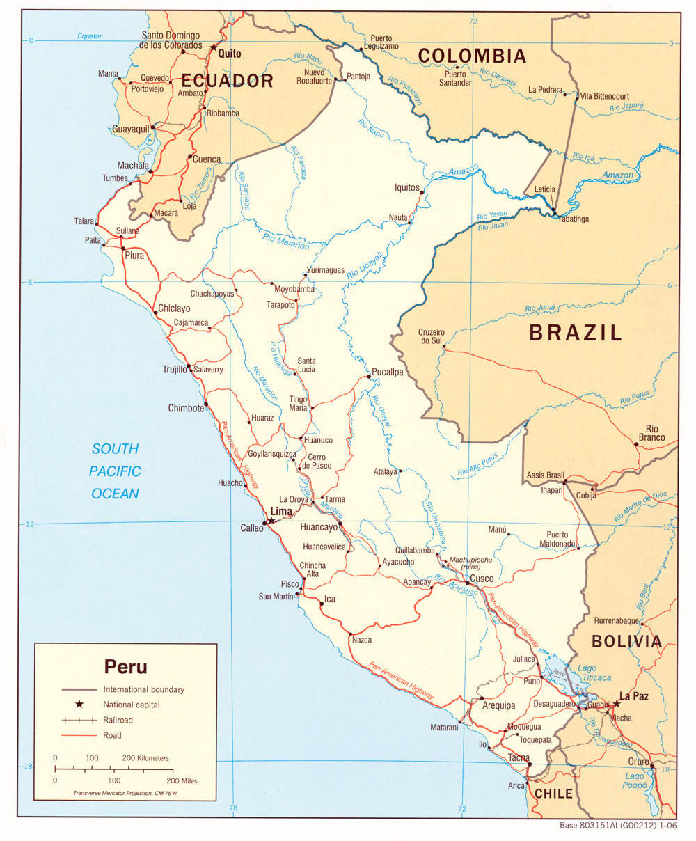
- Peru (Political) 2006 (465K) and pdf format (569K)
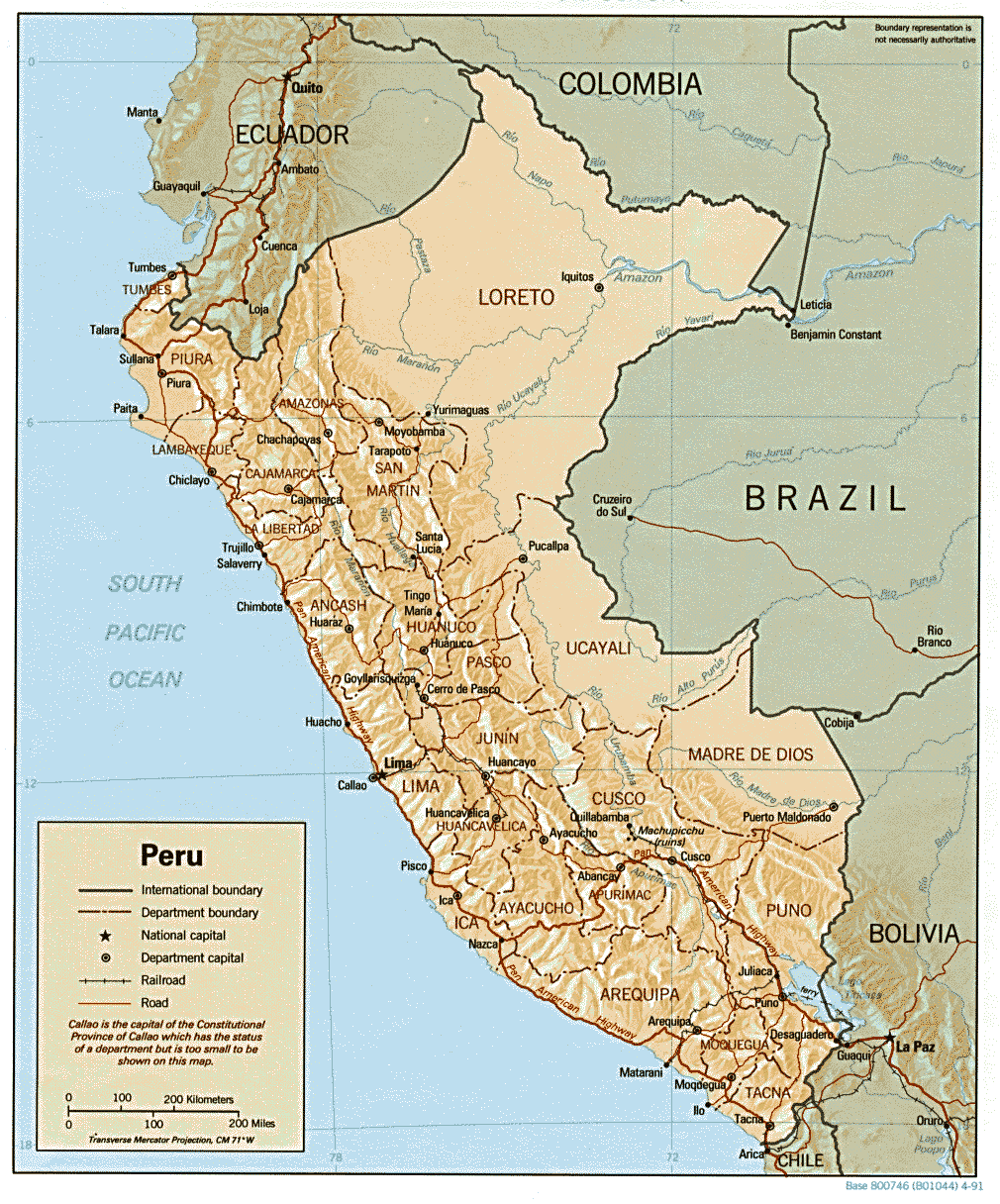
- Peru (Political) 1991 (230K) and pdf format (240K)
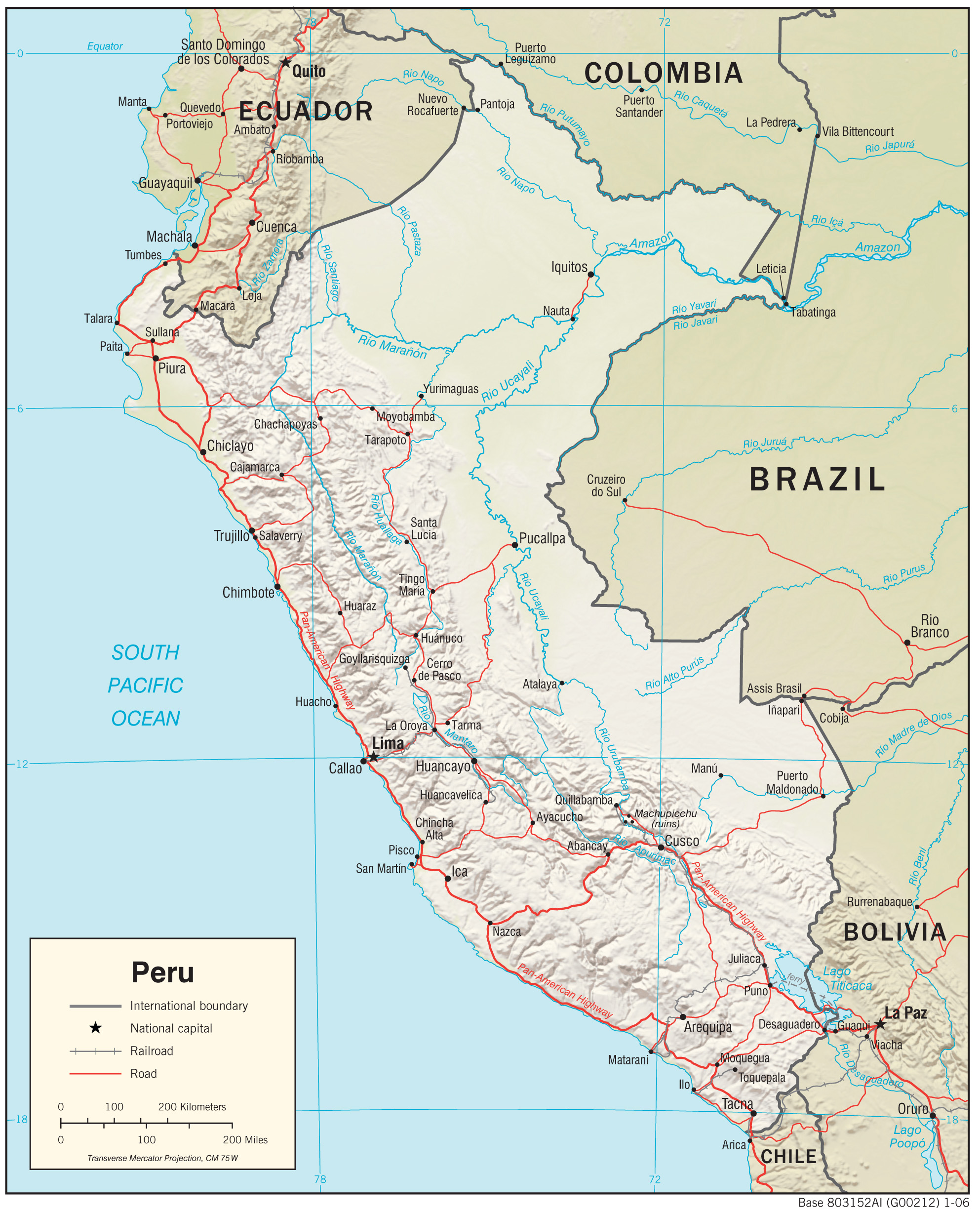
- Peru (Shaded Relief) 2006 (519K) and pdf format (622K)
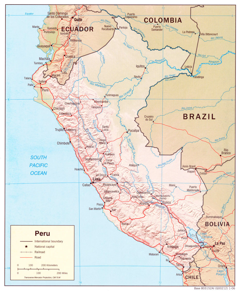
- Peru (Shaded Relief) 1991 (309K) and pdf format (312K)
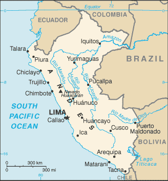
- Peru (Small Map) 2016 (14.8K)
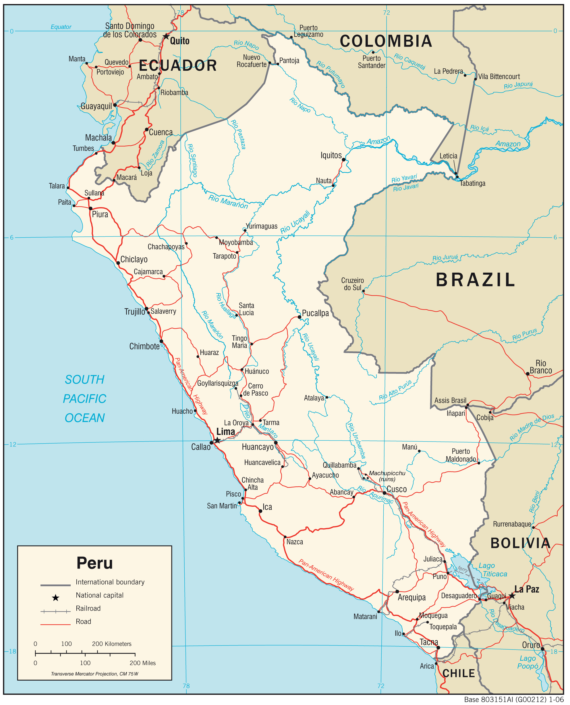
- Peru (Transportation) 2006 (1.1MB) and pdf format (287K)
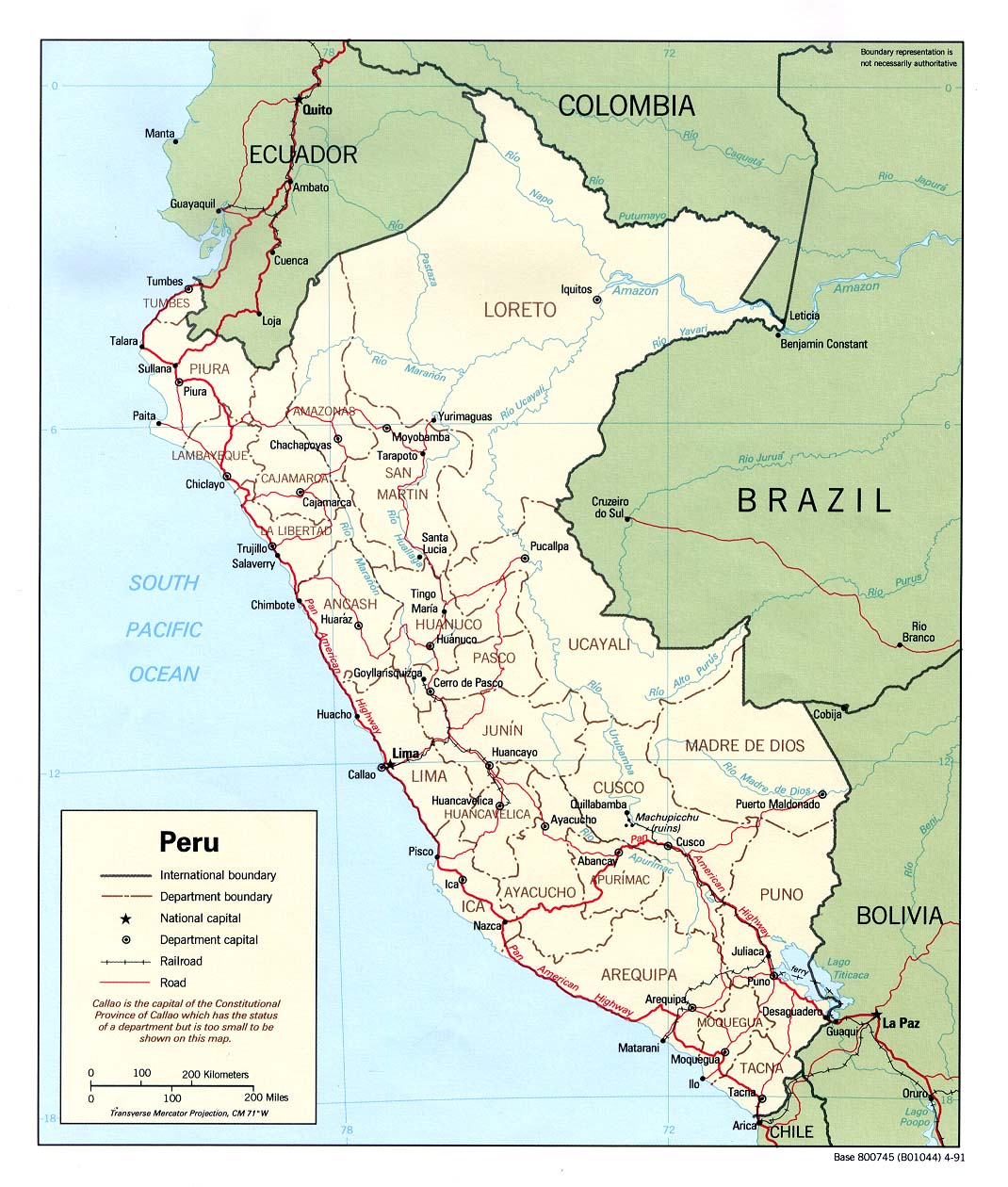
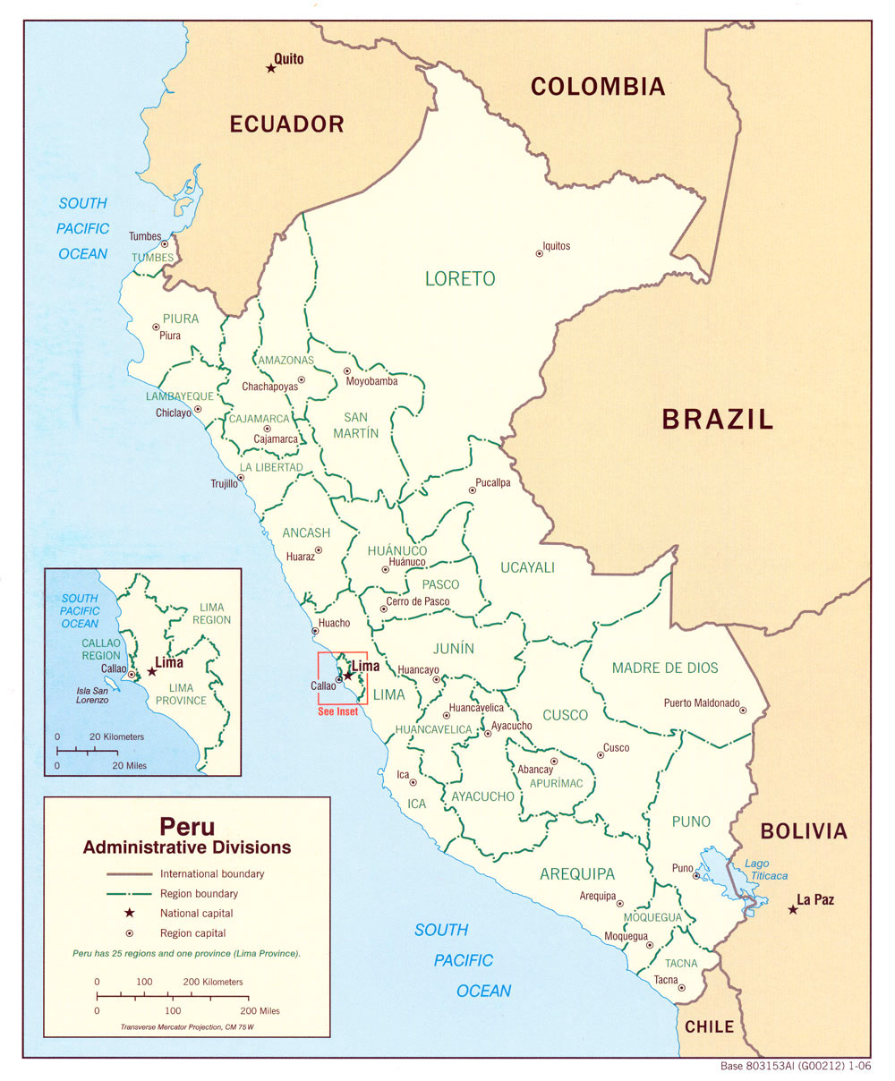
- Peru: Administrative Divisions 2006 (405K) and pdf format (508K)
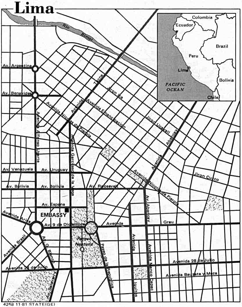
- Lima U.S. Dept. of State 1981 (87K)
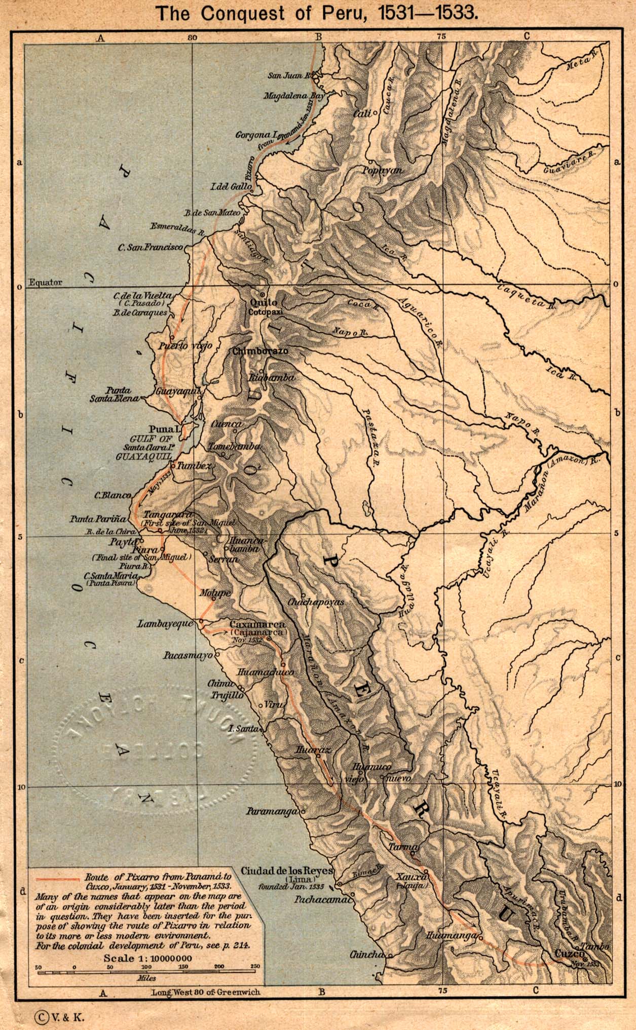
- The Conquest of Peru, 1531 - 1533 From The Historical Atlas by William R. Shepherd, 1923. (431K)
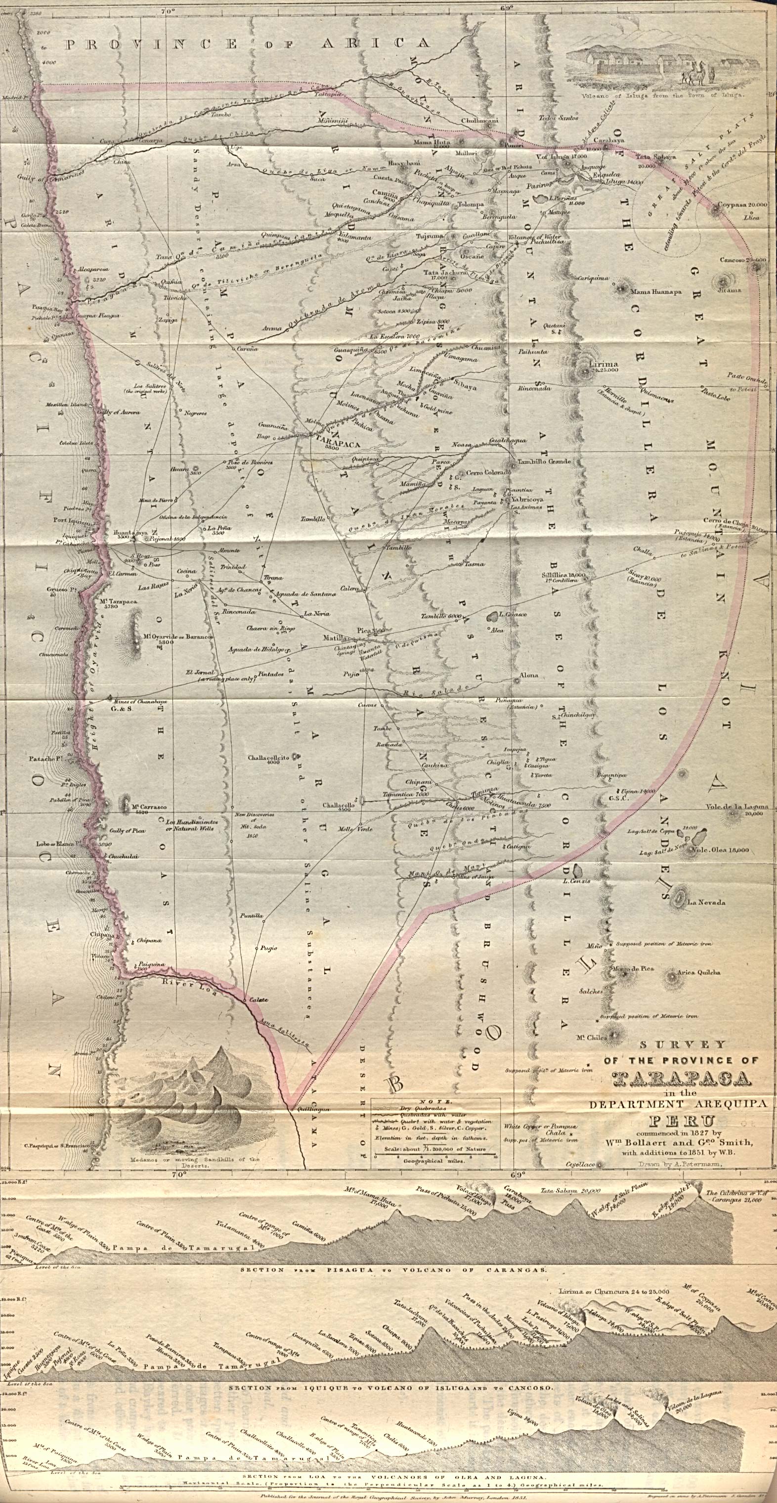
- Peru - Tarapaca Province 1851 "Survey of the Province of Tarapaca in the Department of Arequipa Peru commenced in 1827 by Wm. Bollaert and Geo. Smith with additions to 1851 by W.B." From The Journal of the Royal Geographical Society. (896K)
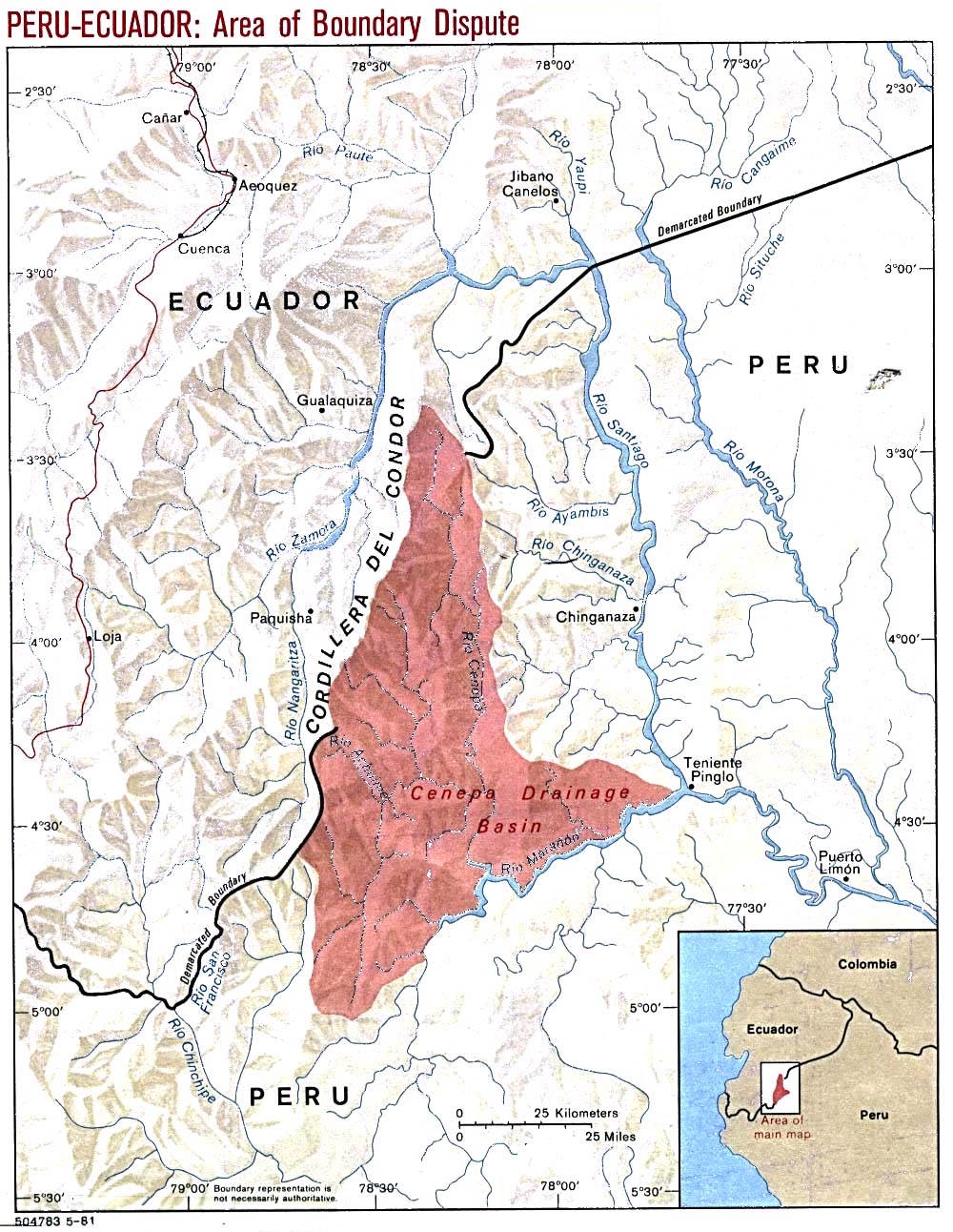
- Peru-Ecuador (Area of Boundary Dispute) 1981 (288K)
- Peru - Economic Activity from Map No. 76868 1970 (182K)
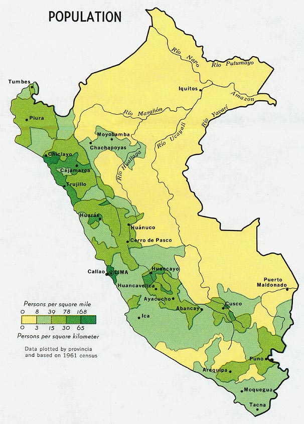
- Peru - Population from Map No. 76868 1970 (132K)
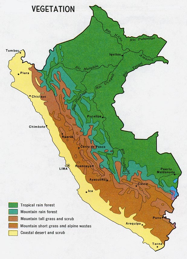
- Peru - Vegetation from Map No. 76868 1970 (149K)
- 1:1,000,000 - Latin America (aeronautical charts) Operational Navigation Chart Series, U.S. Defense Mapping Agency (dates vary) clickable index map for this series Not for navigational use
- This series includes all of Peru
- 1:500,000 - Tactical Pilotage Charts U.S. National Imagery and Mapping Agency. Not for navigational use
- This series covers Peru
- 1:250,000 - Latin America (aeronautical charts) Joint Operations Graphic, U.S. National Imagery and Mapping Agency Not for navigational use
- This series includes most of Peru
- 1:100,000 - Peru (topographic maps) Defense Mapping Agency, Series J632
- This series includes part of Peru
- This series includes all of Peru
Maps on Other Web Sites