Perry-Castañeda Library
Map Collection
North Dakota Maps
State Maps
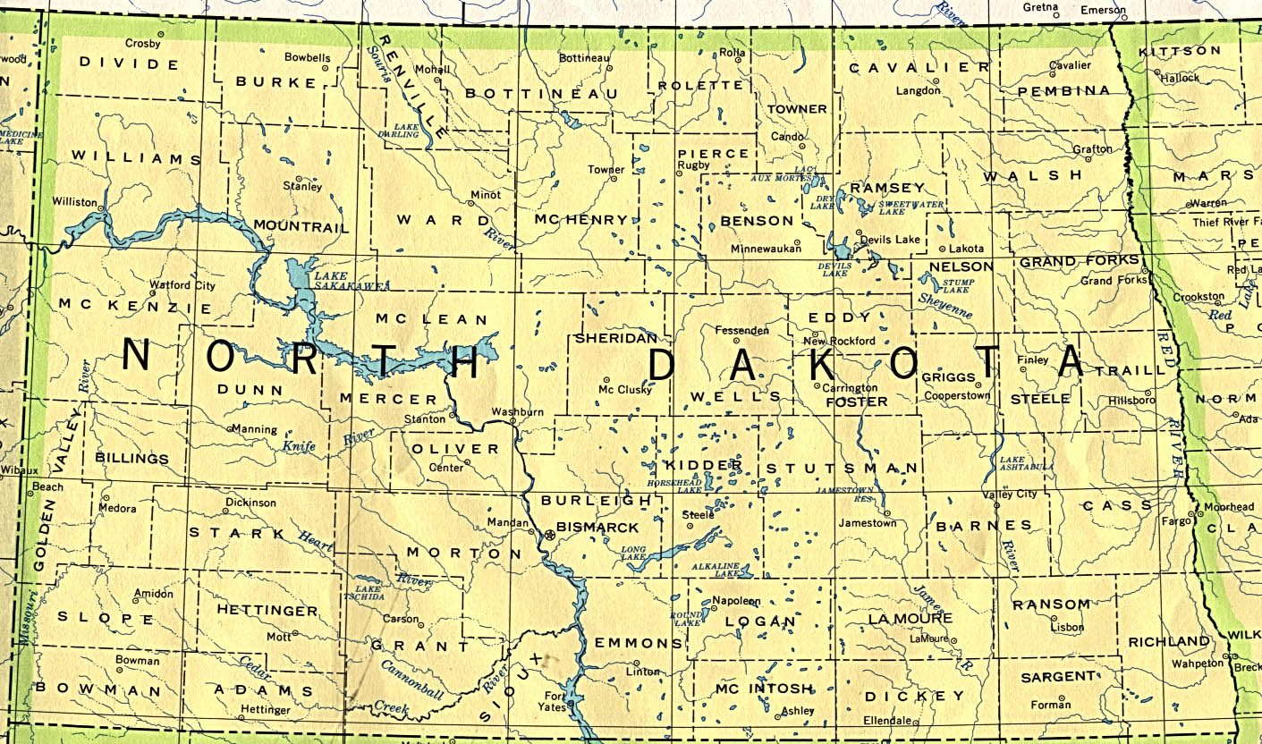
- North Dakota (base map) JPEG format (383K) County boundaries and names, county seats, rivers. Original scale 1:2,500,000 U.S. Geological Survey, 1972 limited update 1990
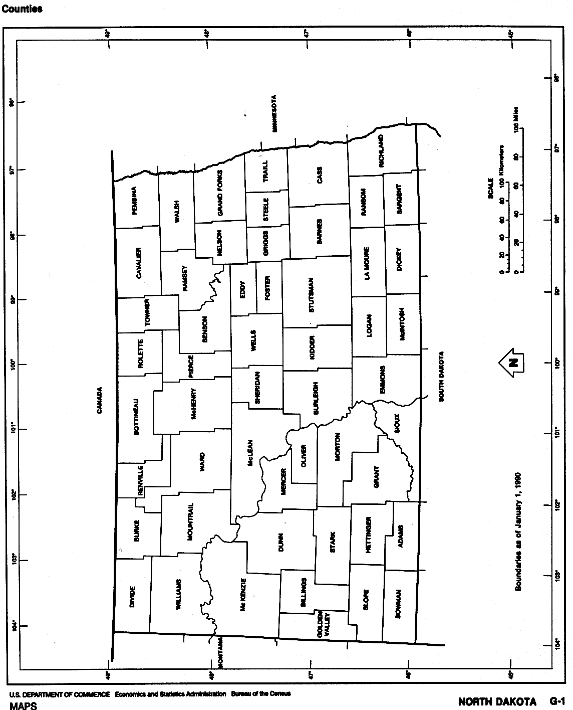
- North Dakota (outline map) JPEG format (77K) County boundaries and names. U.S. Bureau of the Census, 1990
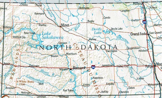
- North Dakota (reference map) JPEG format (180K) Shaded relief map with state boundaries, forest cover, place names, major highways. Portion of "The National Atlas of the United States of America. General Reference", compiled by U.S. Geological Survey 2001, printed 2002
- North Dakota (reference map) PDF format (124K) Shaded relief map with state boundaries, forest cover, place names, major highways. Portion of "The National Atlas of the United States of America. General Reference", compiled by U.S. Geological Survey 2001, printed 2002
- North Dakota - Federal Lands and Indian Reservations PDF format (627K) The National Atlas of the United States of America, U.S. Geological Survey, 2003
Historical Topographic Maps
- North Dakota Historical Topographic Maps (U.S. Geological Survey)
- Pre-1945 historical maps, scales 1:62,500 and 1:125,000
City Maps
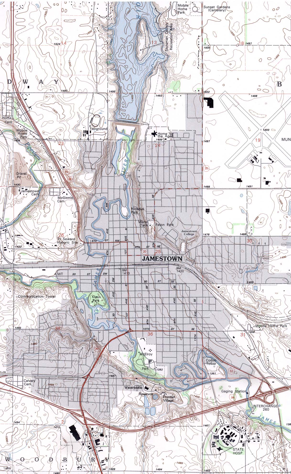
- Jamestown (topographic) original scale 1:24,000 U.S.G.S. 1990 (638K)
Historical City Maps
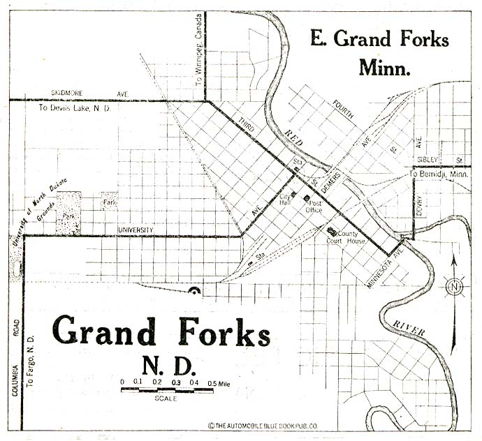
- Grand Forks 1920 Automobile Blue Book 1920, Volume 11 (93K)
Maps of National Parks, Monuments, and Historic Sites
The following maps were produced by the U.S. National Park Service unless otherwise noted.
- Fort Union Trading Post National Historic Site (Area Map) 1998 (129K) (PDF Format)
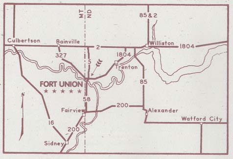
- Fort Union Trading Post National Historic Site (Location Map) (1999) (27K)
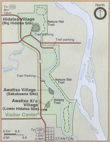
- Knife River Indian Villages National Historic Site (Park Map) 2000 (34K)
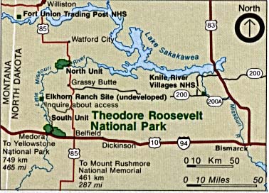
- Theodore Roosevelt National Park (Area Map) (36K)
- Theodore Roosevelt National Park (Area Map) 1999 (65K) (PDF Format)
- Theodore Roosevelt National Park (Park Map) 1999 (323K) (PDF Format)
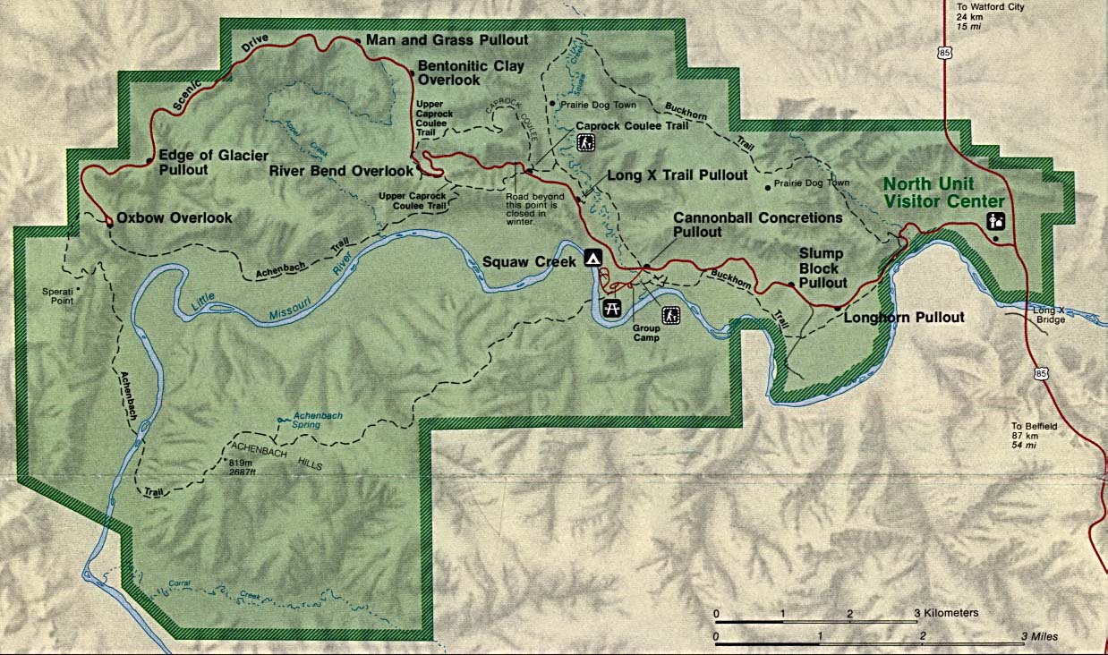
- Theodore Roosevelt National Park - North Unit (Park Map) (288K)
- Theodore Roosevelt National Park - South Unit (Park Map) (258K)
Maps on Other Web Sites