Perry-Castañeda Library
Map Collection
Netherlands Maps
The following maps were produced by the U.S. Central Intelligence Agency, unless otherwise indicated.
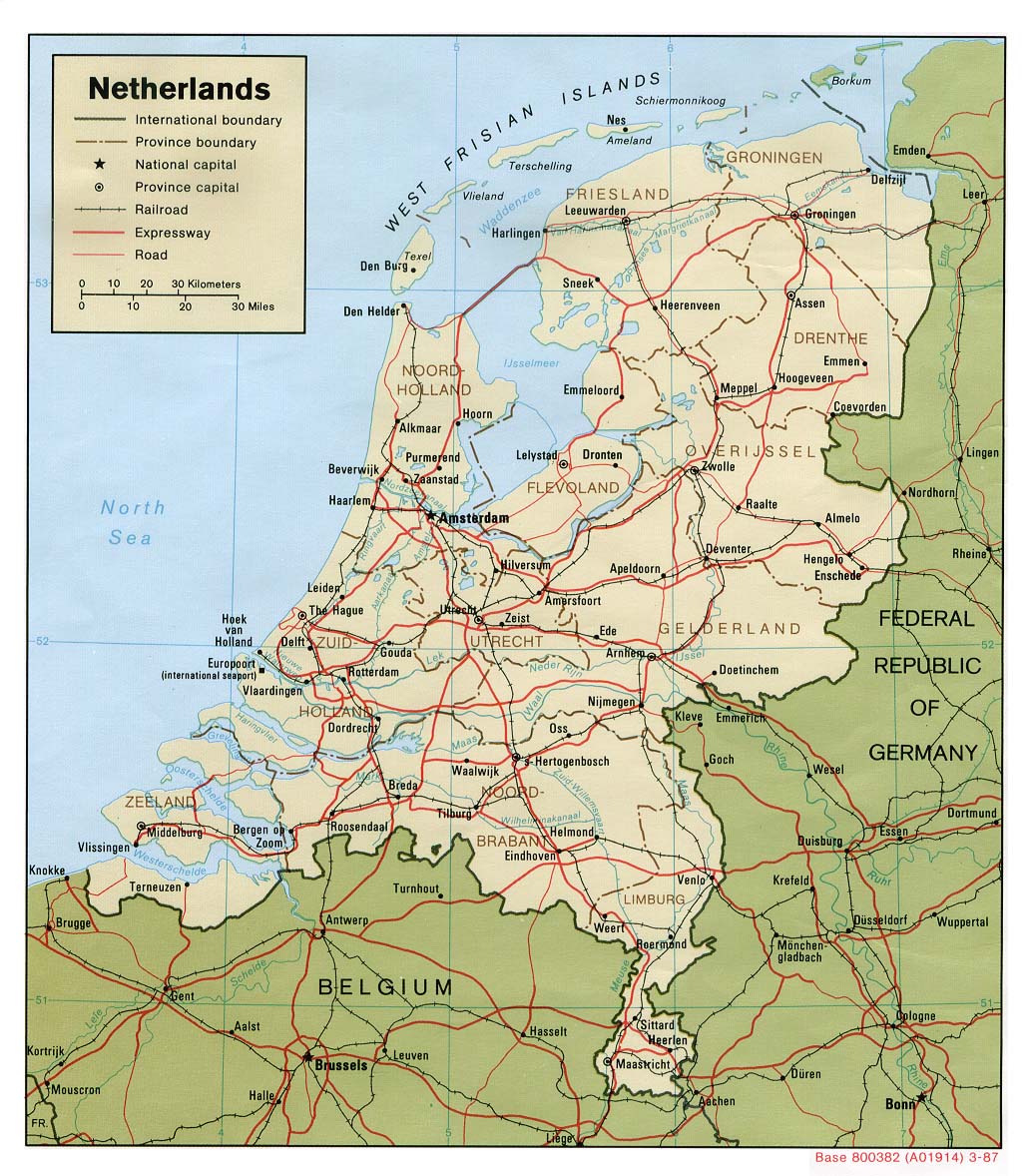
Country Maps- Netherlands (Political) 1987 (267K) and pdf format (275K)
- Netherlands (Shaded Relief) 1987 (320K) and pdf format (329K)
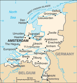
- Netherlands (Small Map) 2016 (22.5K)
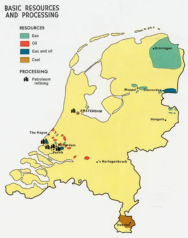
- Netherlands - Basic Resources and Processing from Map No. 76863 1970 (98K)
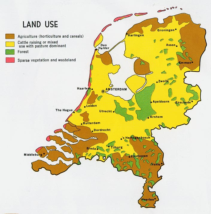
- Netherlands - Land Use from Map No. 76863 1970 (153K)
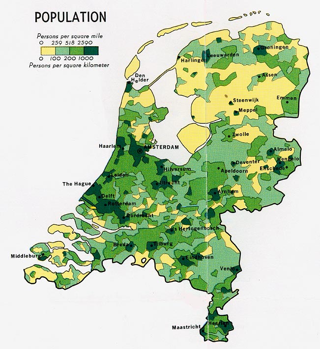
- Netherlands - Population from Map No. 76863 1970 (153K)
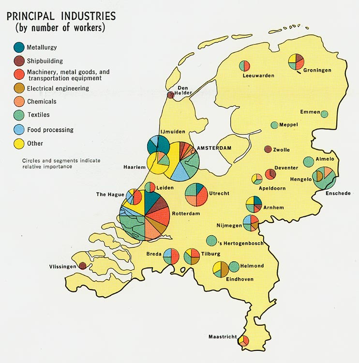
- Netherlands - Principal Industries from Map No. 76863 1970 (125K)
- 1:1,000,000 - International Map of the World
- This series covers all of the country. Clickable map
- 1:1,000,000 - Operational Navigation Charts Series U.S. Defense Mapping Agency Aerospace Center Not for navigational use
- This series covers the Netherlands on sheet E-2
- 1:500,000 - Europe Road Maps for Allied Forces Series M406 (GSGS 4798), Great Britain War Office, 1942-
- This series covers the Netherlands
- 1:500,000 - Europe Series M404 (4072), Great Britain War Office, 1942-
- This series covers most of the Netherlands
- 1:500,000 - Tactical Pilotage Charts U.S. National Imagery and Mapping Agency. Not for navigational use
- This series covers the Netherlands
- 1:500,000 - World Series 1404, Great Britain. War Office and Air Ministry. 1958-
- This series covers all of the Netherlands
- 1:500,000 - Europe Series M406 (4798), Great Britain War Office, 1942-
- This series covers all of the Netherlands
- 1:250,000 - Northwest Europe Series M503 (4042), Great Britain War Office, 1937-
- This series covers most of the Netherlands
- 1:250,000 - Western Europe Series M501, U.S. Army Map Service, 1959-
- This series covers most of the Netherlands
- 1:200,000 - Europe Road Maps Series M505 (GSGS 4238), U.S. Army Map Service, 1941-
- This series covers most of the Netherlands
- 1:100,000 - Holland Series M641, U.S. Army Map Service, 1942-
- This series covers most of the Netherlands
- This series covers all of the country. Clickable map
Maps on Other Web Sites