Perry-Castañeda Library
Map Collection
Missouri Maps
State Maps
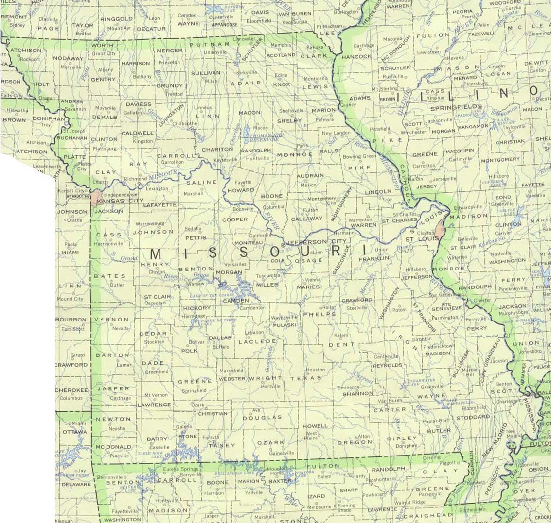
- Missouri (base map) JPEG format (276K) County boundaries and names, county seats, rivers. Original scale 1:2,500,000 U.S. Geological Survey, 1972 limited update 1990
- Missouri (outline map) JPEG format (107K) County boundaries and names. U.S. Bureau of the Census, 1990
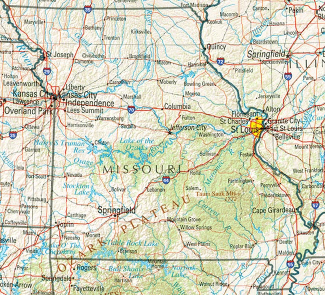
- Missouri (reference map) JPEG format (300K) Shaded relief map with state boundaries, forest cover, place names, major highways. Portion of "The National Atlas of the United States of America. General Reference", compiled by U.S. Geological Survey 2001, printed 2002
- Missouri (reference map) PDF format (232K) Shaded relief map with state boundaries, forest cover, place names, major highways. Portion of "The National Atlas of the United States of America. General Reference", compiled by U.S. Geological Survey 2001, printed 2002
- Missouri - Federal Lands and Indian Reservations PDF format (586K) The National Atlas of the United States of America, U.S. Geological Survey, 2003
City Maps
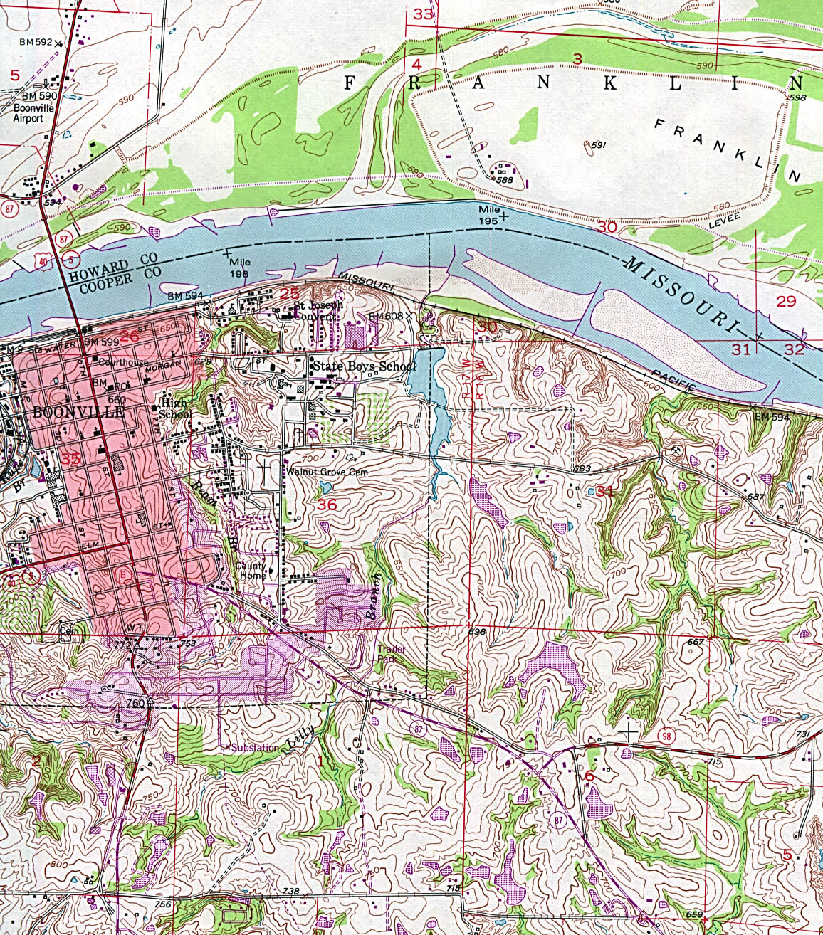
- Boonville (topographic) original scale 1:24,000 U.S.G.S. 1952 photorevised 1979 (663K)
- Branson (topographic) original scale 1:24,000 U.S.G.S. 1989 (876K)
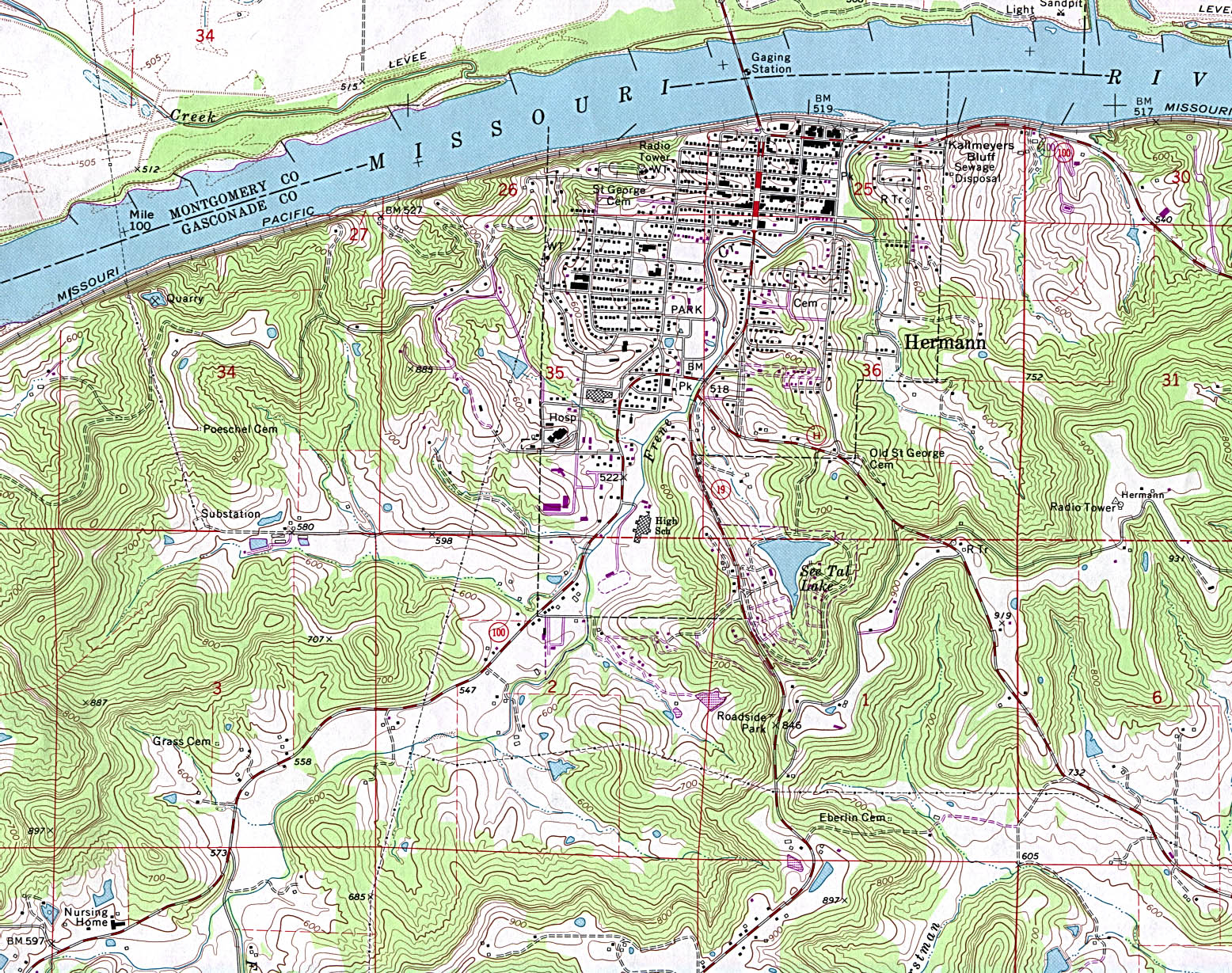
- Hermann (topographic) original scale 1:24,000 U.S.G.S. 1974 photorevised 1985 (833K)
- Kansas City (Missouri and Kansas) original scale 1:500,000 U.S. National Atlas 1970 (282K)
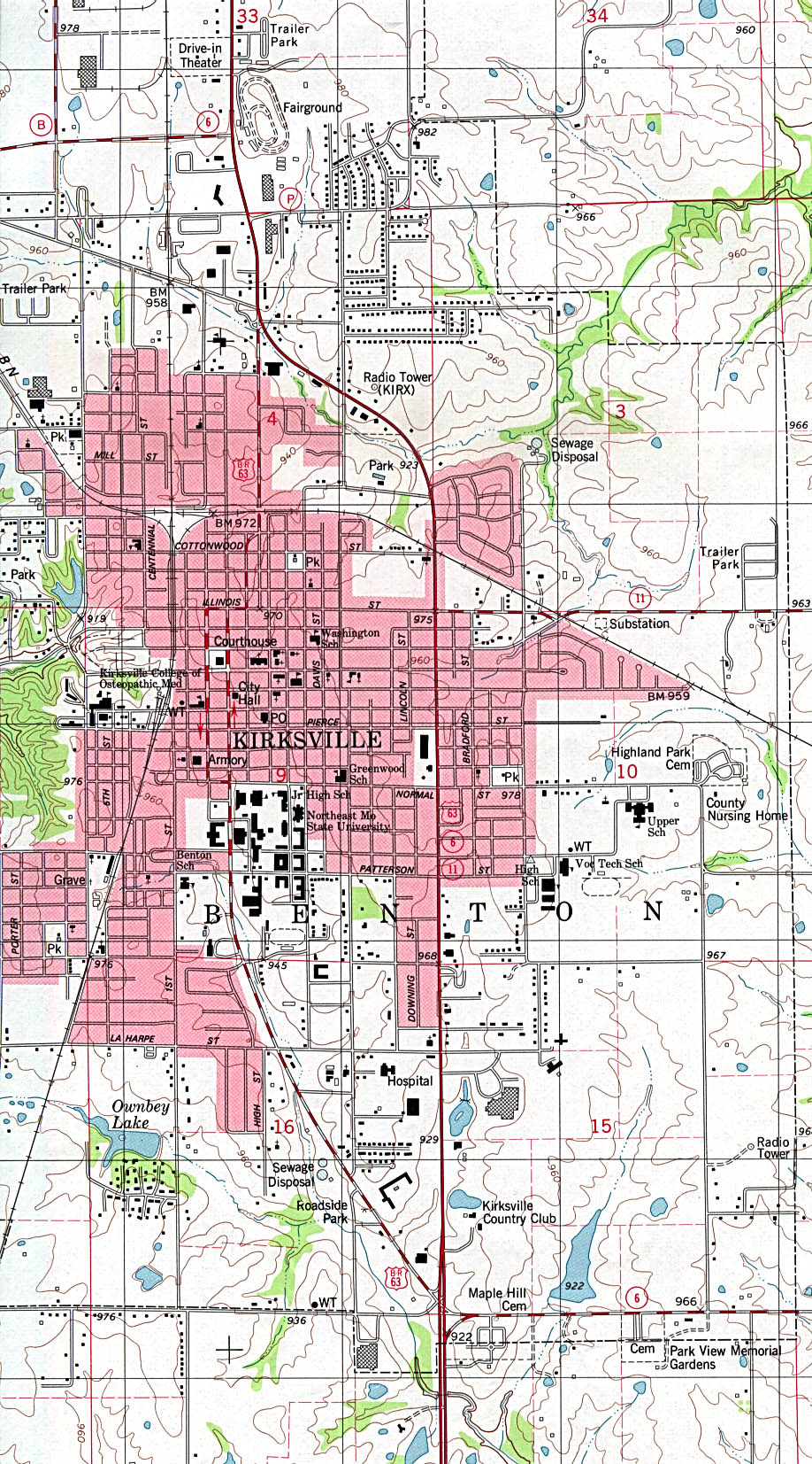
- Kirksville (topographic) original scale 1:24,000 U.S.G.S. 1979 (502K)
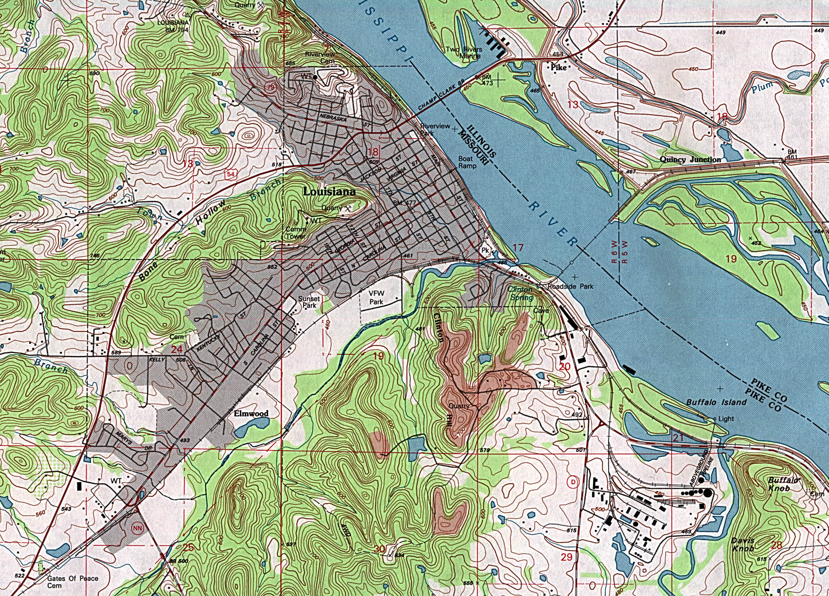
- Louisiana (topographic) original scale 1:24,000 U.S.G.S. 1991 (842K)
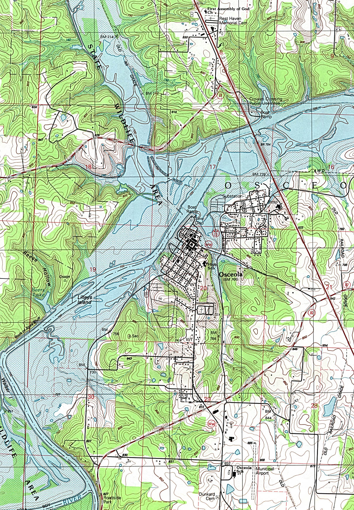
- Osceola (topographic) original scale 1:24,000 U.S.G.S. 1991 (935K)
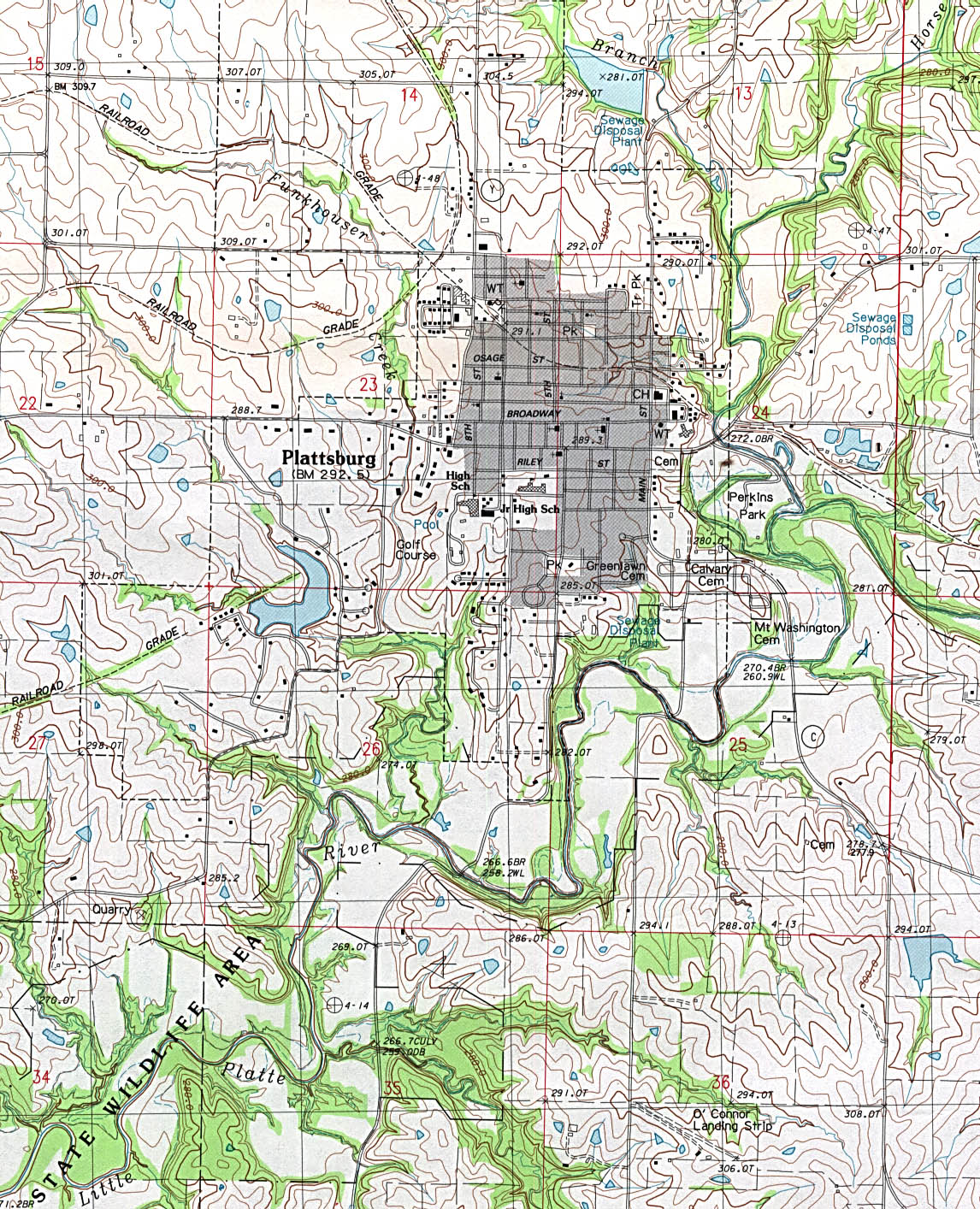
- Plattsburg (topographic) original scale 1:24,000 U.S.G.S. provisional edition 1984 (638K)
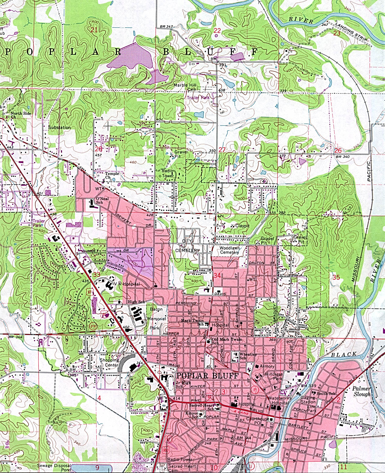
- Poplar Bluff (topographic) original scale 1:24,000 U.S.G.S. 1966 photorevised 1979 (748K)
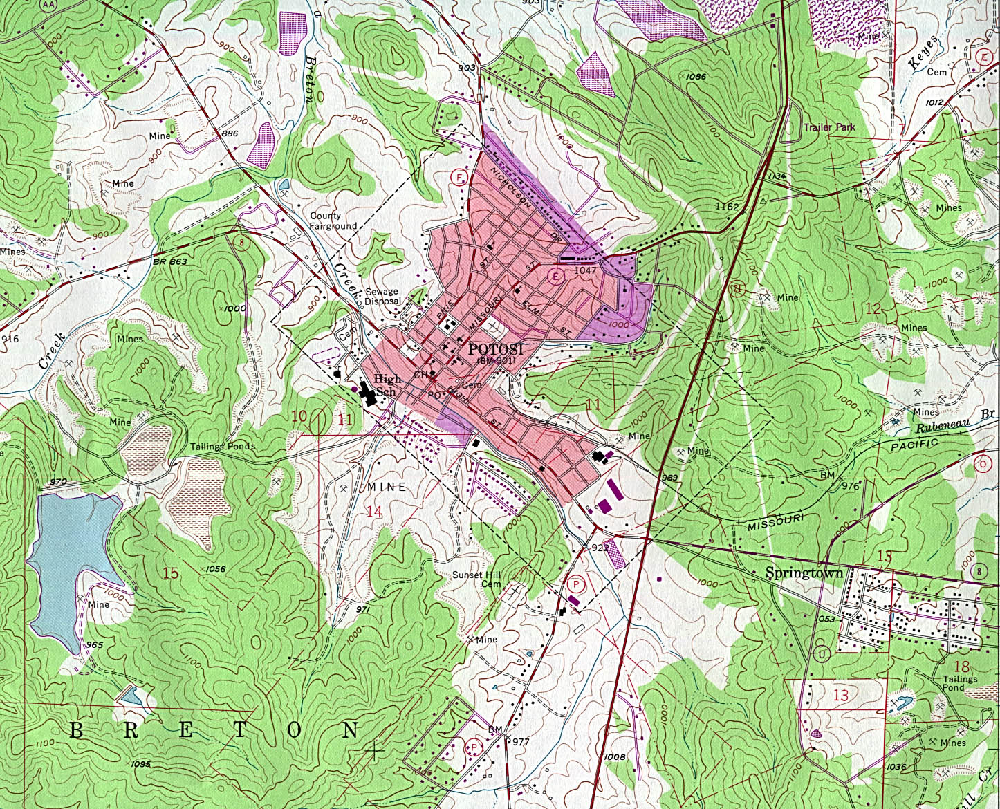
- Potosi (topographic) original scale 1:24,000 U.S.G.S. 1958 photorevised 1982 (663K)
- Rolla (topographic) original scale 1:24,000 U.S.G.S. 1992 (1,114K)
- Salem (topographic) original scale 1:24,000 U.S.G.S. 1981 (774K)
- St.Louis original scale 1:500,000 U.S. National Atlas 1970 (377K)
Historical City Maps
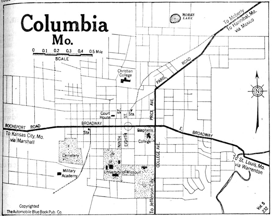
- Columbia 1920 Automobile Blue Book, 1920, Vol. 5 (123K)
- Excelsior Springs 1920 Automobile Blue Book, 1920, Vol. 5 (99K)
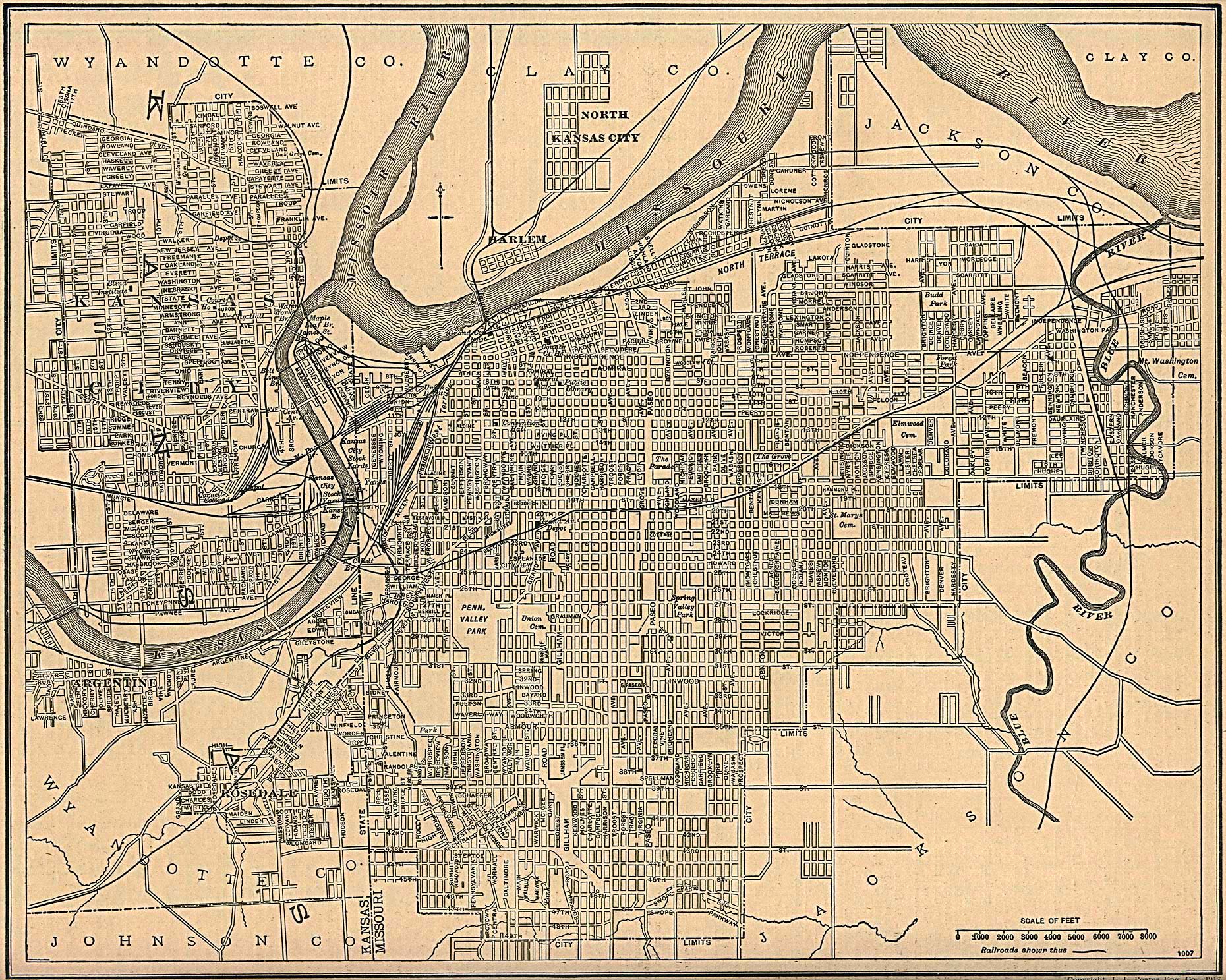
- Kansas City, Kansas and Missouri 1907 From The New Encyclopedic Atlas and Gazetteer of the World, Edited by Francis J. Reynolds, P.F. Collier & Son, New York, 1917 (139K)
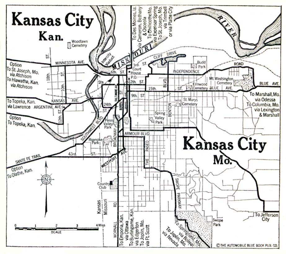
- Kansas City, Kansas and Missouri 1920 Automobile Blue Book (139K)
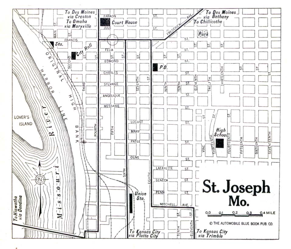
- Saint Joseph 1920 Automobile Blue Book (150K)
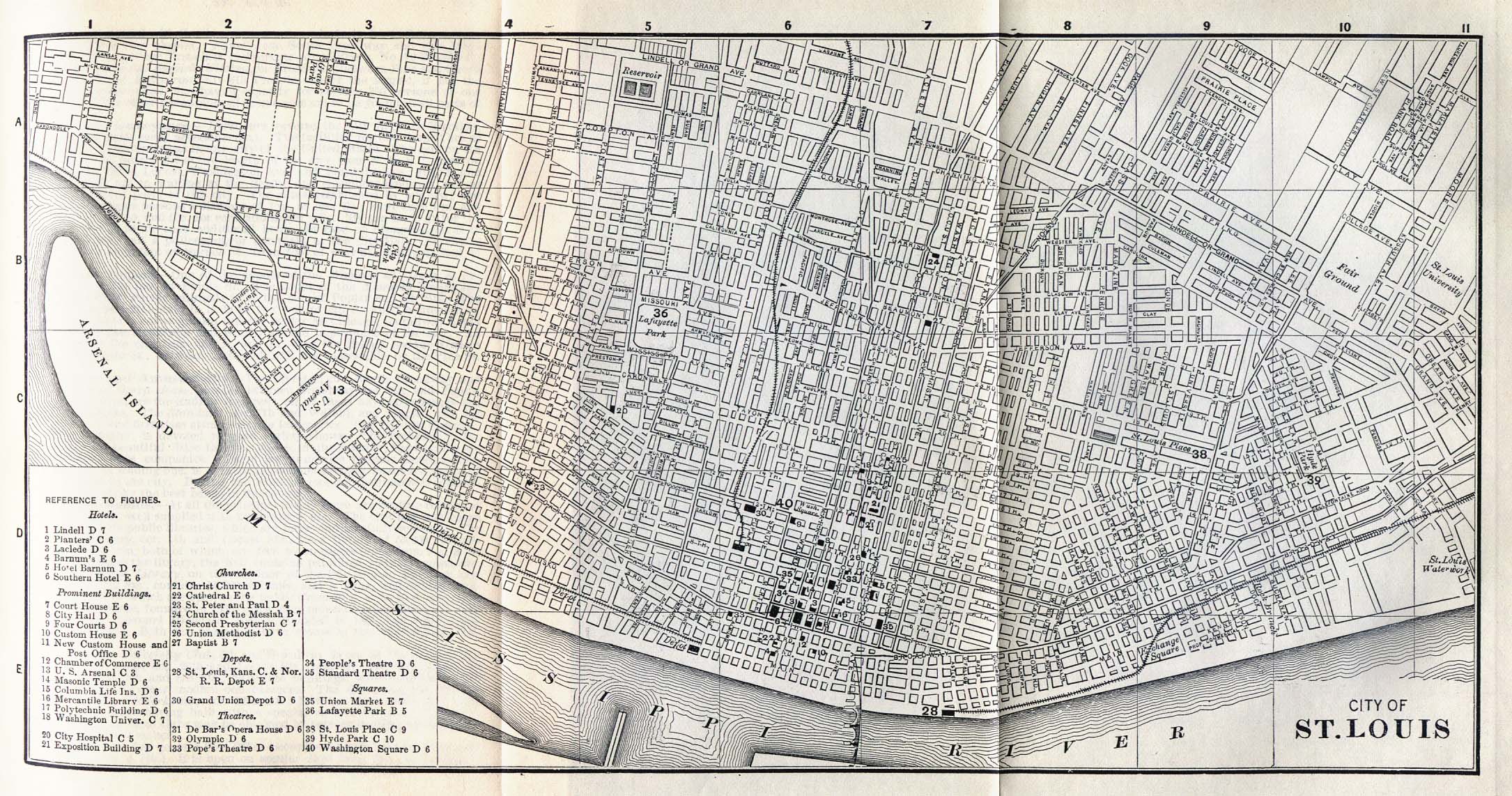
- Saint Louis 1885 Appletons' General Guide to the United States and Canada. Part II. Western and Southern States. New York: D. Appleton and Company. 1885 (728K)
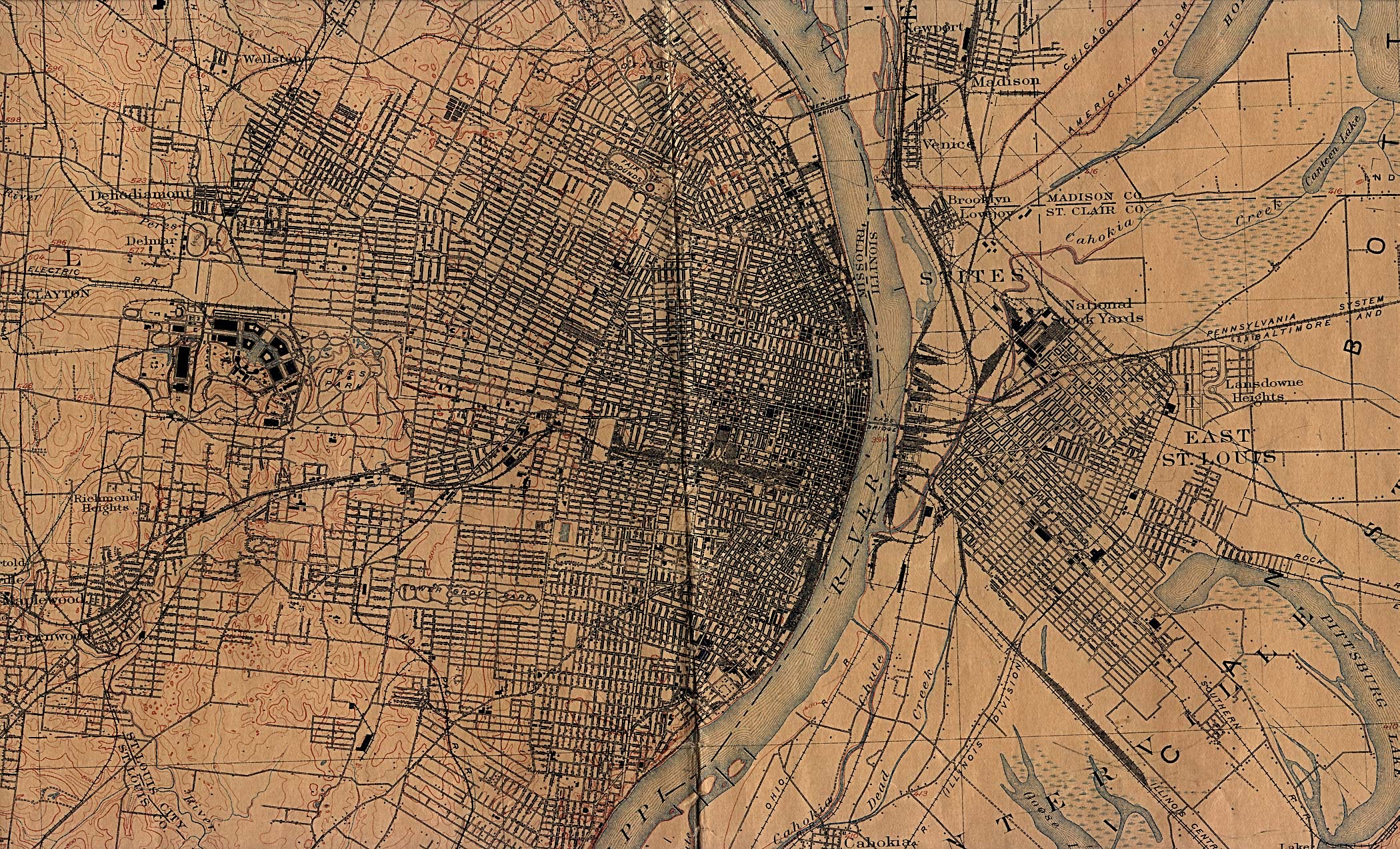
- Saint Louis 1912 U.S. Geological Survey (1,241K)
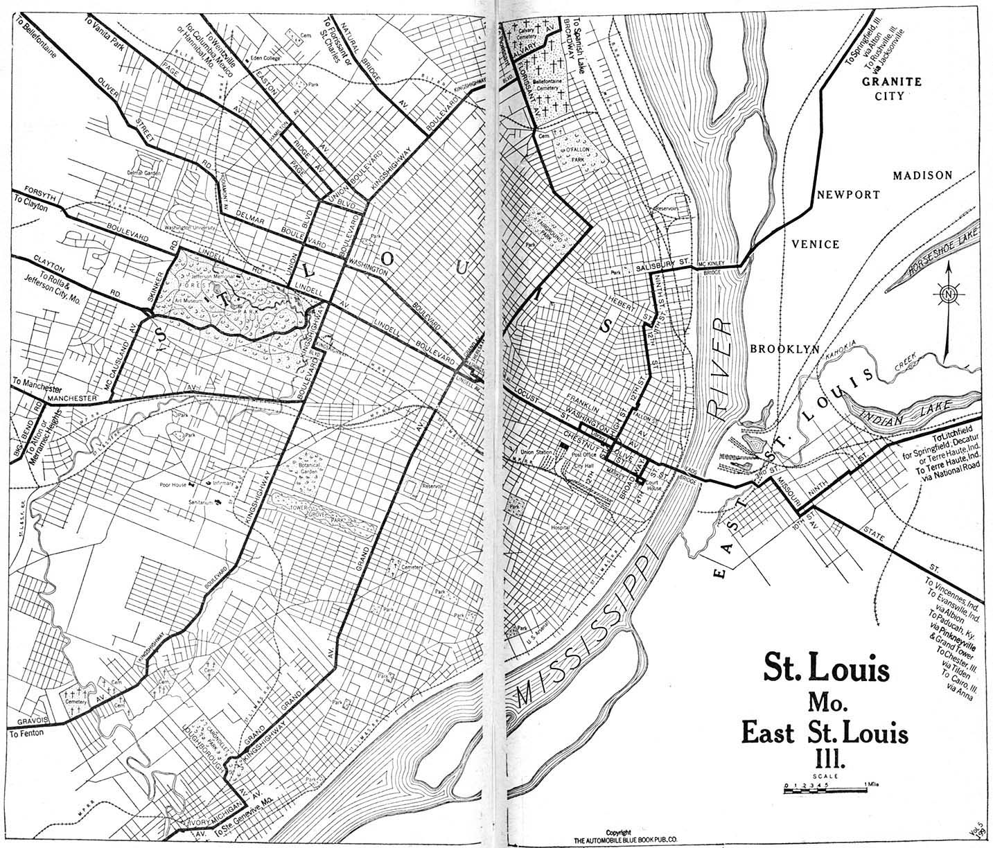
Surveyed in 1903. Edition of April 1904, reprinted Nov. 1912, with corrections. - Saint Louis 1920 Automobile Blue Book, 1920, Vol. 7 (493K)
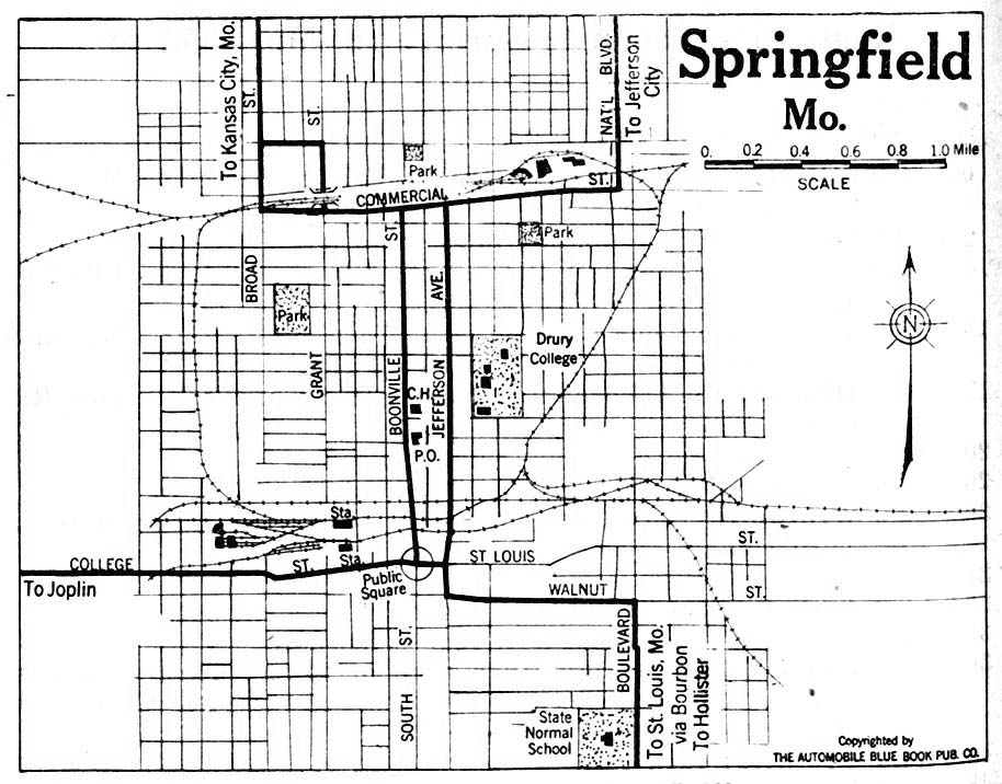
- Springfield 1920 Automobile Blue Book, 1920, Vol. 5 (158K)
Historical Topographic Maps
- Missouri Historical Topographic Maps (U.S. Geological Survey)
- Pre-1945 maps, scales 1:62,500 and 1:125,000
Maps of National Parks, Monuments, and Historic Sites
The following maps were produced by the U.S. National Park Service unless otherwise noted.
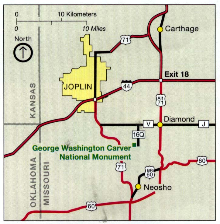
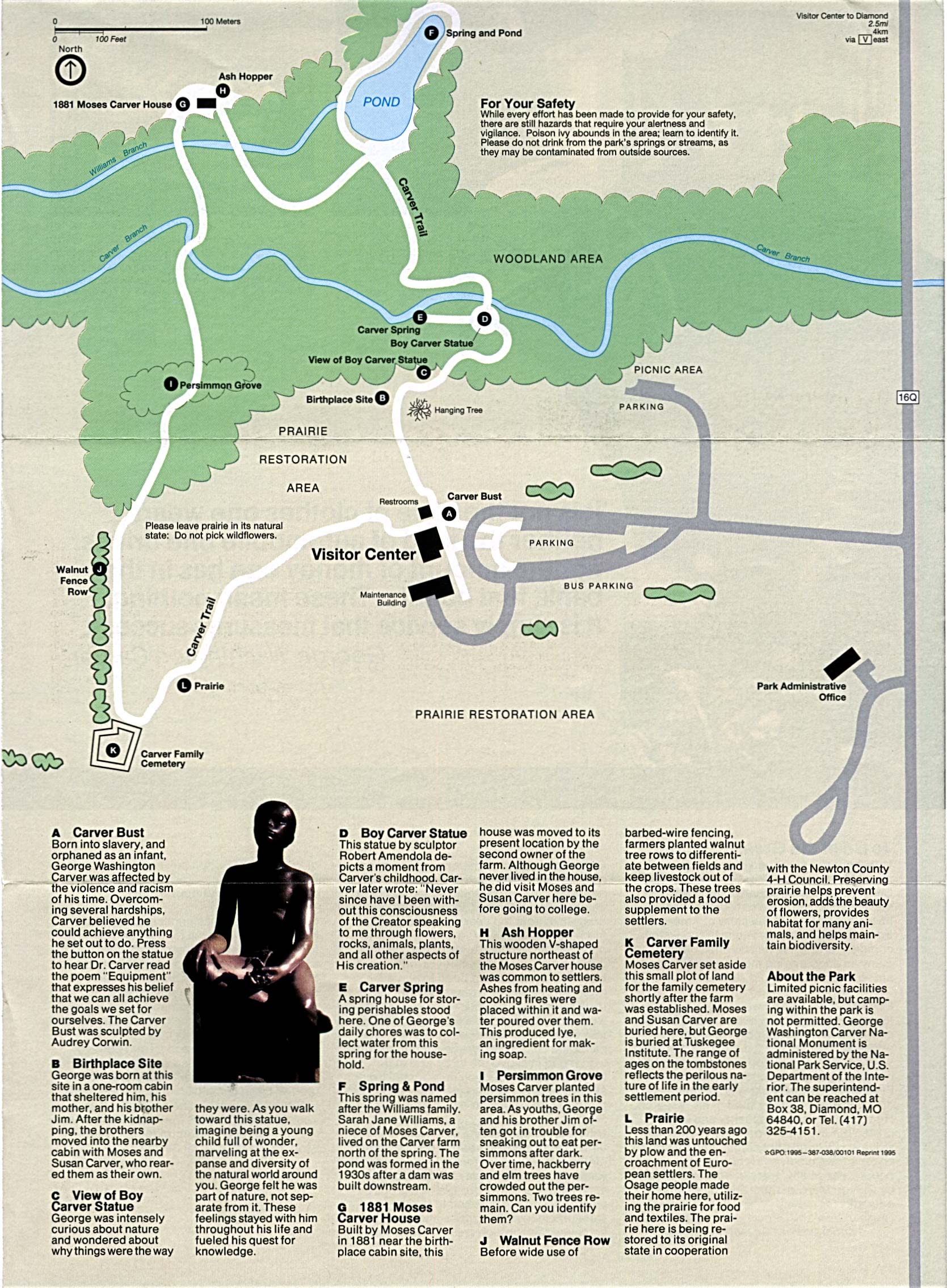
- George Washington Carver National Monument (Area Map) 1995 (106K)
- George Washington Carver National Monument (Area Map) 1998 (65K) (PDF Format)
- George Washington Carver National Monument (Park Map) 1995 (661K)
- George Washington Carver National Monument (Park Map) 1998 (65K) (PDF Format)
- Harry S. Truman National Historic Site (Location and Park Maps) 2001 (116K)
- Ozark National Scenic River (Park Map) 1999 (323K) (PDF Format)
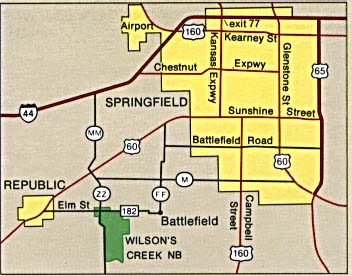
- Wilson's Creek National Battlefield (Area Map) (27K)
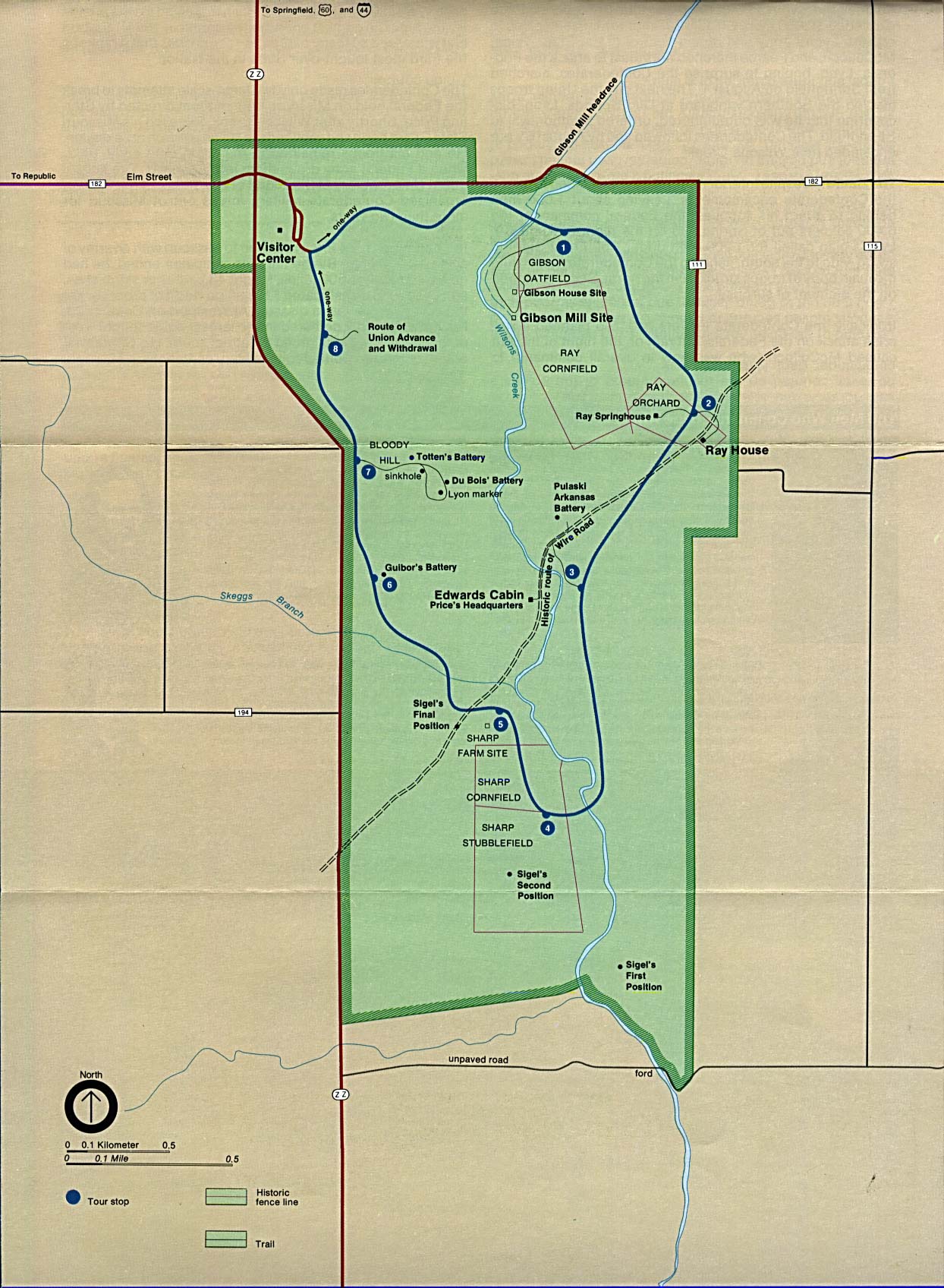
- Wilson's Creek National Battlefield (Park Map) (290K)
Maps on Other Web Sites