Perry-Castañeda Library
Map Collection
Republic of the Marshall Islands Maps
Country Maps
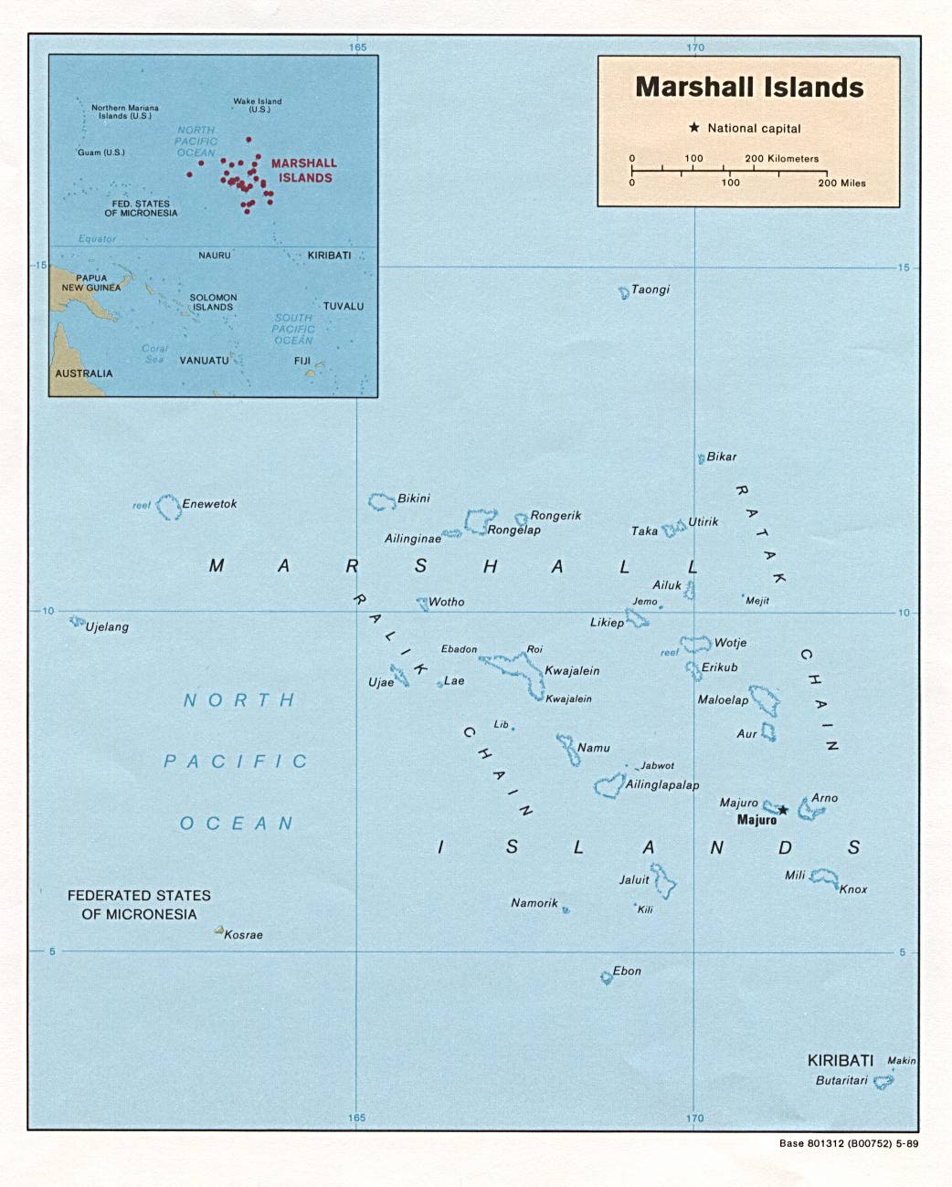
- Marshall Islands (Political) 1989 (159K) and pdf format (162K)
- Marshall Islands (Small Map) 2016 (19K)
- 1:1,000,000 - Operational Navigation Chart Series U.S. Defense Mapping Agency Aerospace Center
- Sheets K-12 and A-16 include the Marshall Islands. Not for navigational use
- 1:500,000 - Tactical Pilotage Charts U.S. National Imagery and Mapping Agency. Not for navigational use
- This series covers Marshall Islands
- Sheets K-12 and A-16 include the Marshall Islands. Not for navigational use
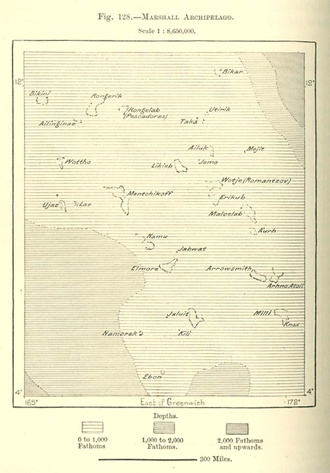
- Marshall Archipelago 1890 From "The Earth and Its Inhabitants, Oceania" by Elisee Reclus, Edited by A.H. Keane, New York: D. Appleton and Company, 1890. (113K)
- Arhno Islands [Arno Atoll] 1890 From "The Earth and Its Inhabitants, Oceania" by Elisee Reclus, Edited by A.H. Keane, New York: D. Appleton and Company, 1890. (106K)
![Arhno Islands [Arno Atoll] 1890](historical/arhno_island_1890.jpg)
Maps on Other Web Sites