Perry-Castañeda Library
Map Collection
Madagascar Maps
The following maps were produced by the U.S. Central Intelligence Agency, unless otherwise indicated.
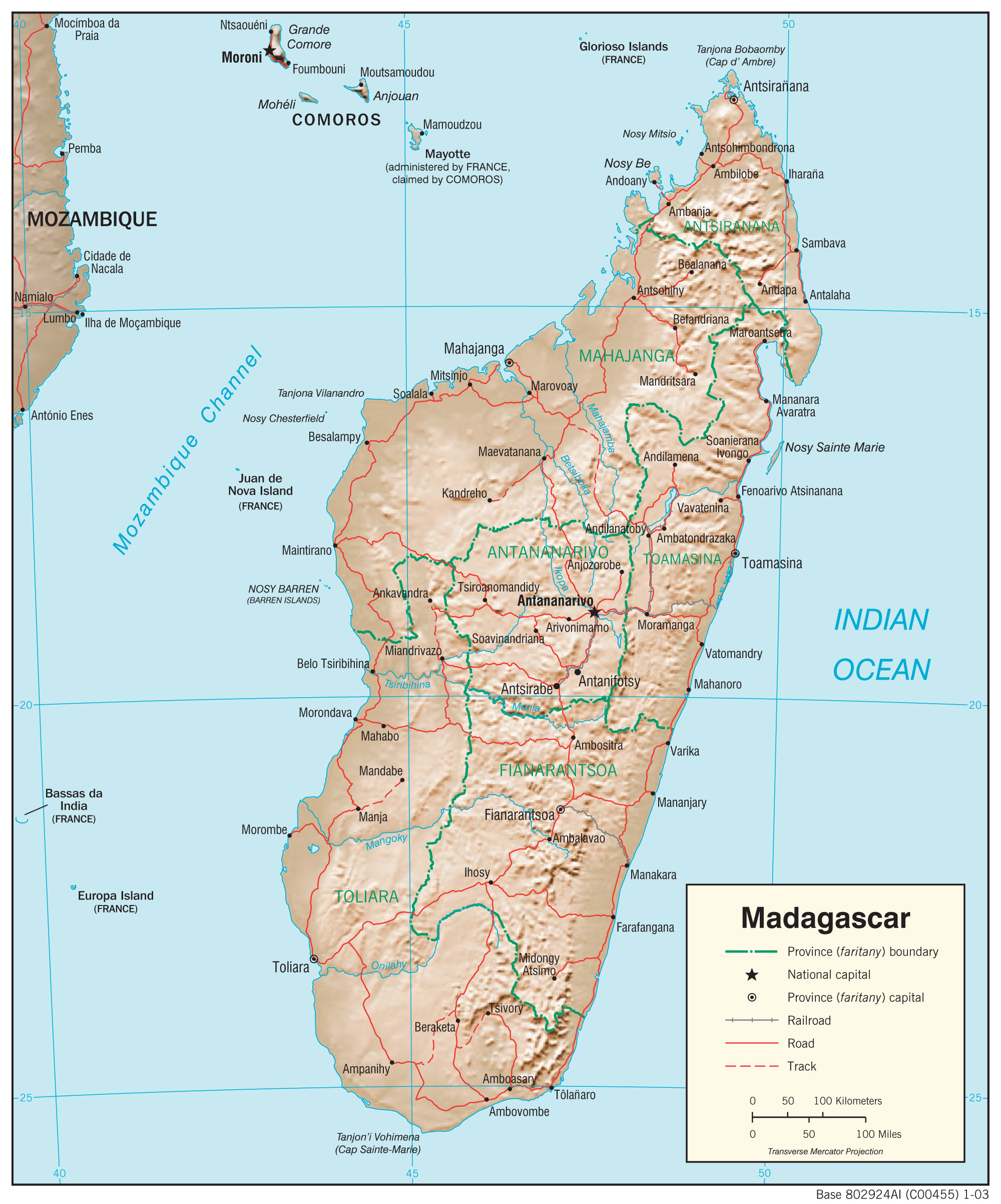
- Madagascar (Physiography) 2003 (1.2MB) and pdf format (371K)
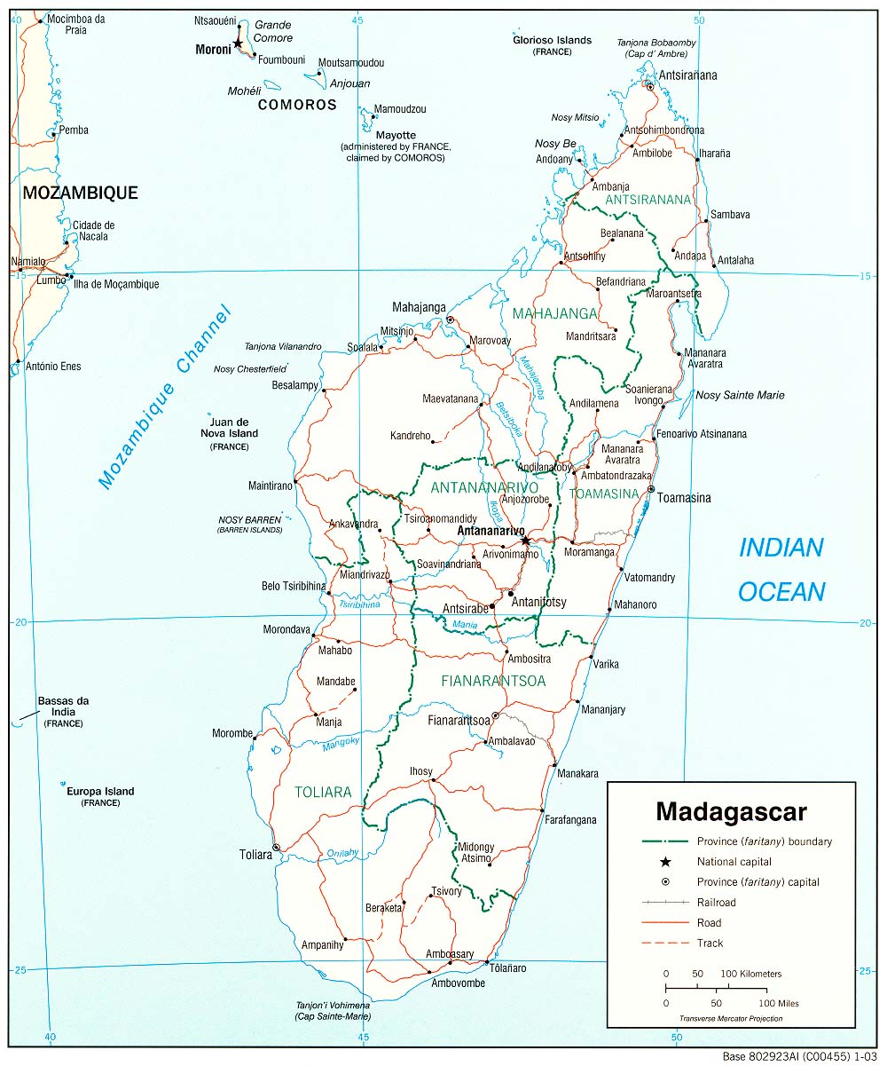
- Madagascar (Political) 2003 (223K) and pdf format (217K)
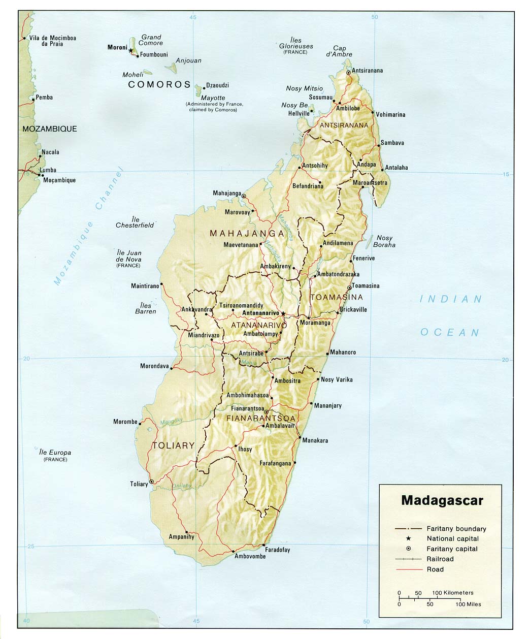
- Madagascar (Political) 1981 (174K) and pdf format (186K)
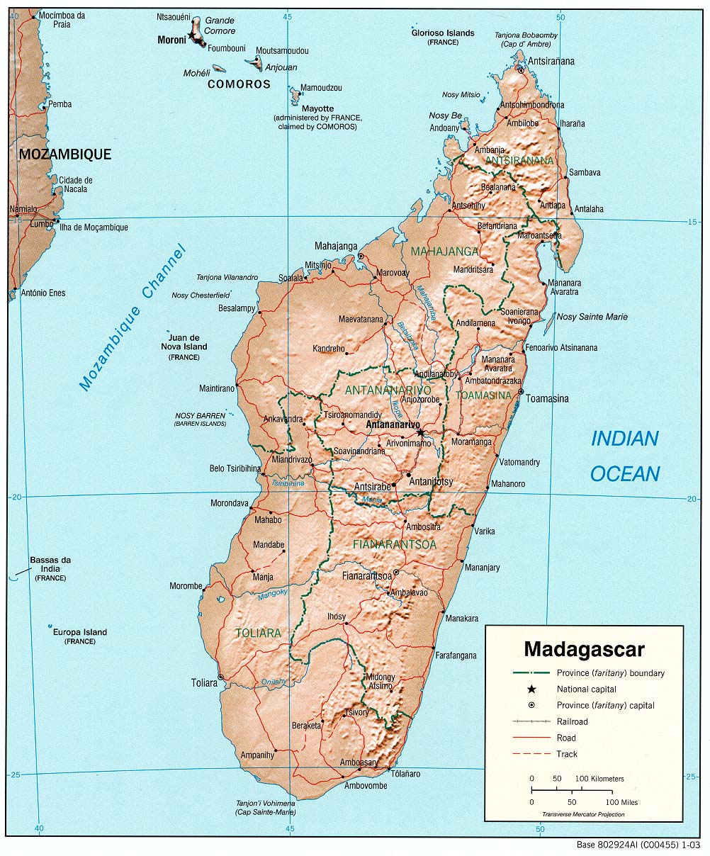
- Madagascar (Shaded Relief) 2003 (291K) and pdf format (285K)
- Madagascar (Shaded Relief) 1981 (159K) and pdf format (166K)
- Madagascar (Small Map) 2016 (17.7K)
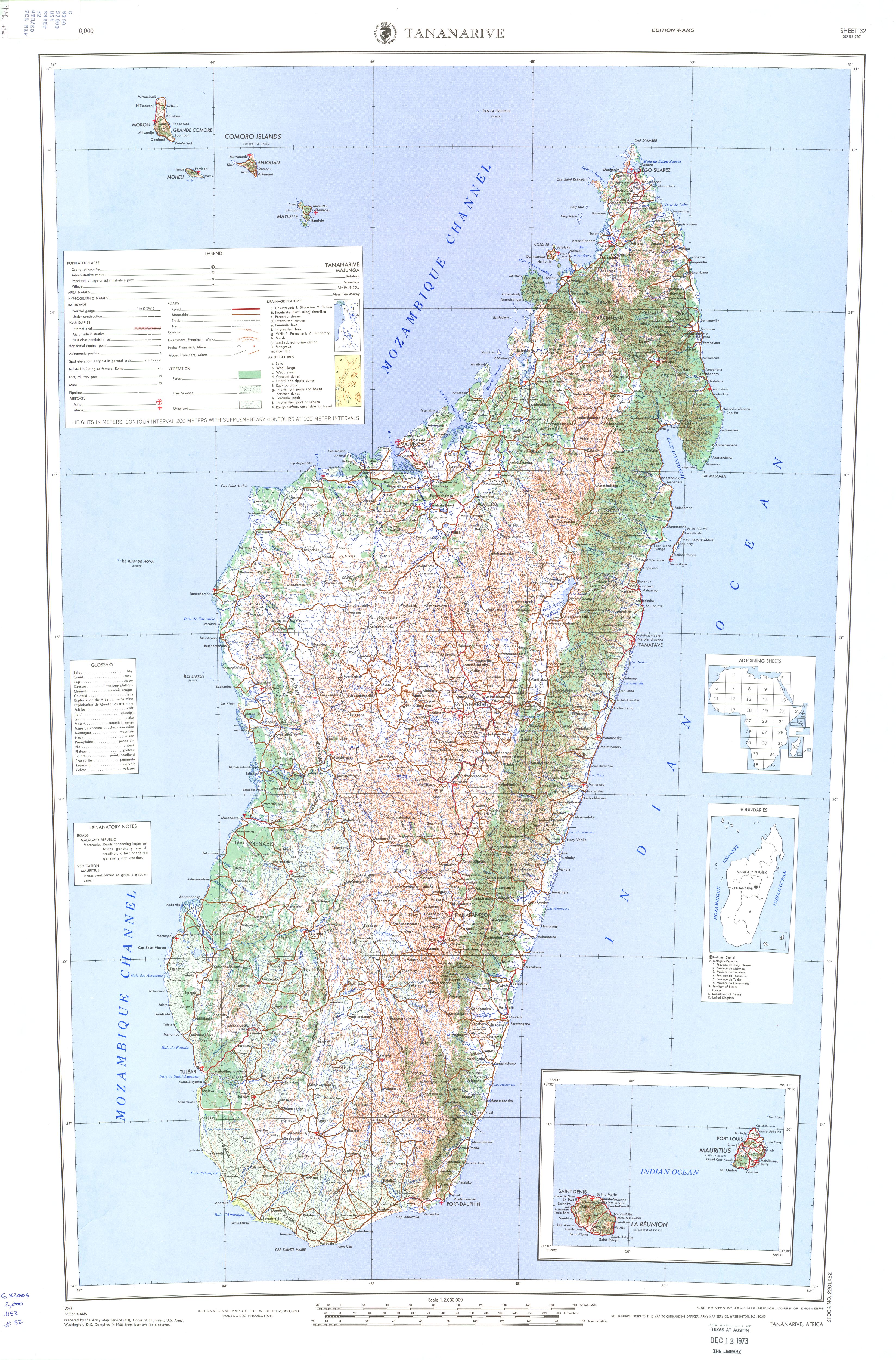
- Madagascar (Topographic Map) Sheet 32, Series 2201, Edition 4-AMS. 1:2,000,000. U.S. Army Map Service, 1968 (3.5 MB)
- Madagascar (Transportation) 2003 (1.0MB) and pdf format (307K)
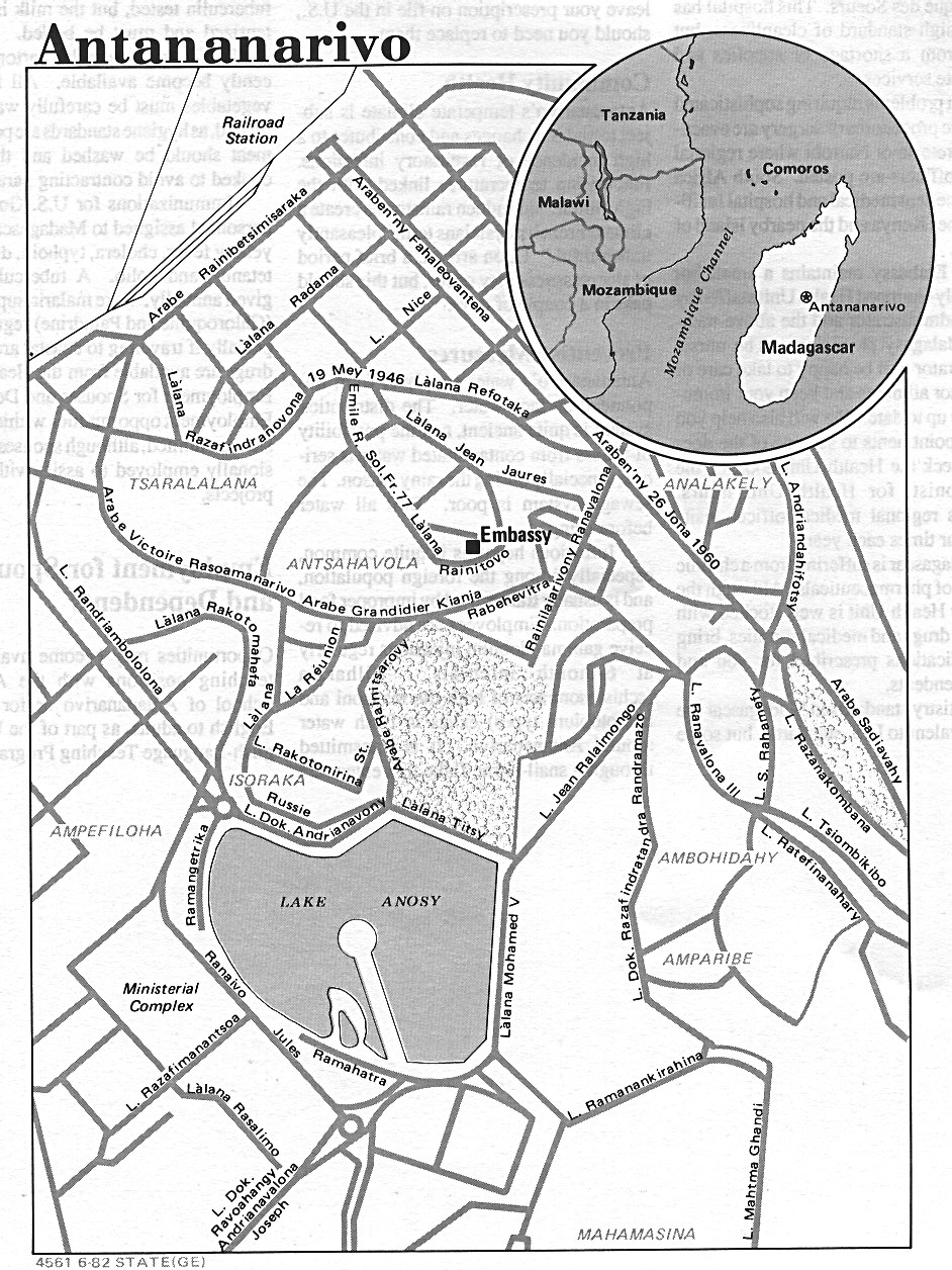
- Antananarivo U.S. Dept. of State 1982 (402K)
- Diego-Suarez [Antsiranana] 1976 (60K)
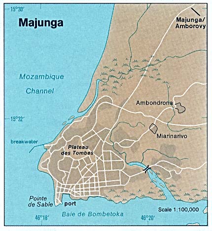
- Majunga 1976 (50K)
- Tamatave [Taomasina] 1976 (59K)
![Diego-Suarez [Antsiranana]](islands_oceans_poles/diego-suarez_76.jpg)
![Tamatave [Taomasina]](islands_oceans_poles/tamatave_76.jpg)
- 1:2,000,000 - Africa Topographic Maps U.S. Army Map Service
- Tananarive Sheet 32, Edition 4, AMS, 1968 includes all of Madagascar (3.5 MB)
- 1:1,000,000 - Operational Navigation Chart U.S. Defense Mapping Agency Aerospace Center. Not for navigational use
- Sheets N-6, P-6 and Q-6 include all of Madagascar
- 1:1,000,000 - International Map of the World U.S. Army Map Service
- Clickable map. Six maps include all of Madagascar
- 1:500,000 - Tactical Pilotage Charts U.S. National Imagery and Mapping Agency. Not for navigational use
- This series covers most of Madagascar
- 1:500,000 - Madagascar Series O471 (GSGS 4243), U.S. Army Map Service, 1941
- This series includes all of Madagascar
- 1:250,000 - Joint Operations Graphic Series U.S. National Imagery and Mapping Agency. Not for navigational use
- Eight maps include parts of Madagascar
- Tananarive Sheet 32, Edition 4, AMS, 1968 includes all of Madagascar (3.5 MB)
- Madagascar - Agricultural Products from The Indian Ocean Atlas, 1976 (68K)
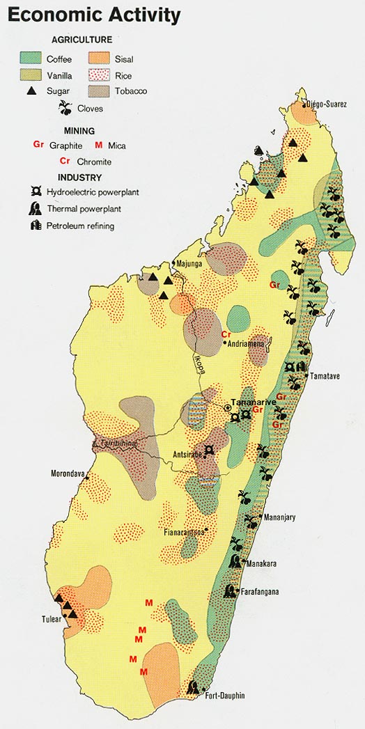
- Madagascar - Economic Activity 1973 (134K)
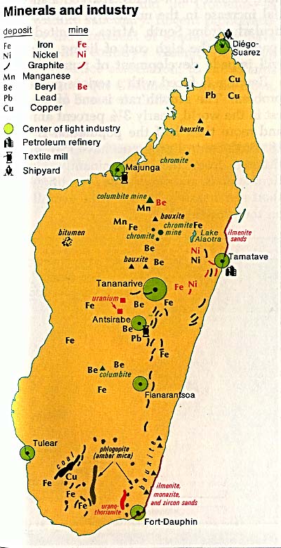
- Madagascar - Minerals and Industry from The Indian Ocean Atlas, 1976 (76K)
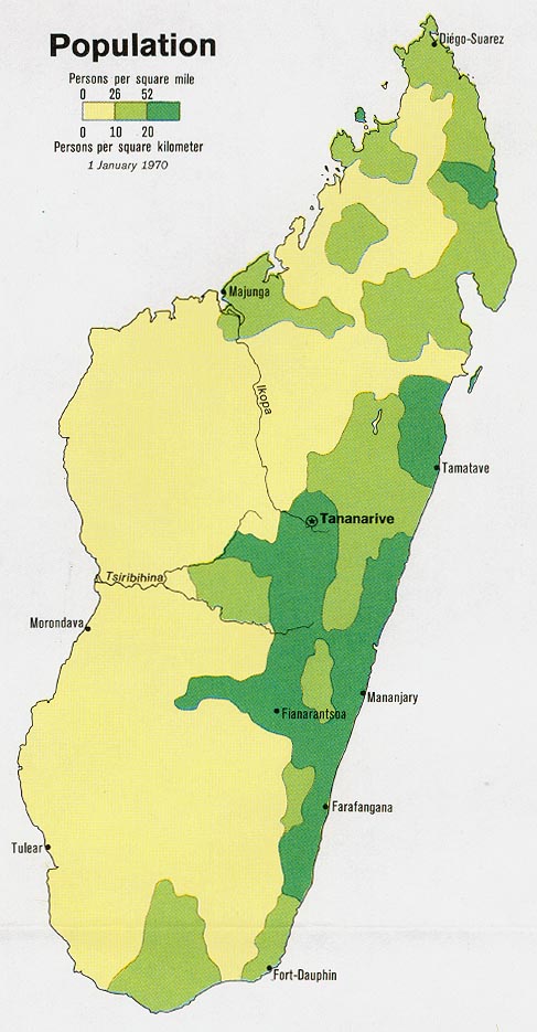
- Madagascar - Population 1973 (97K)
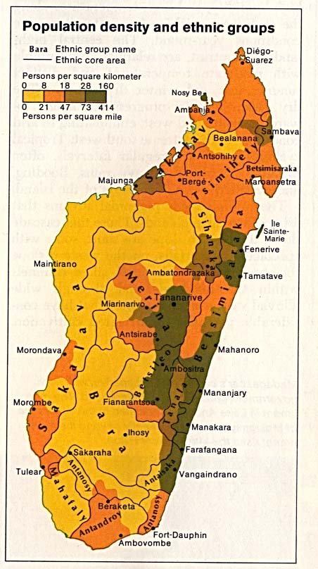
- Madagascar - Population Density and Ethnic Groups from The Indian Ocean Atlas, 1976 (80K)
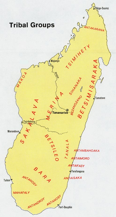
- Madagascar - Tribal Groups 1973 (100K)
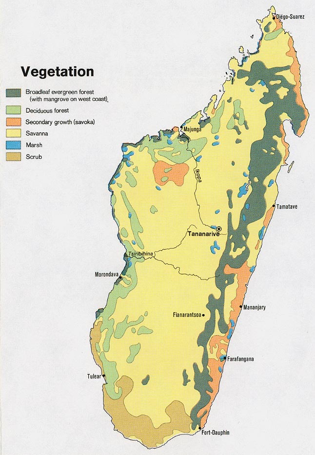
- Madagascar - Vegetation 1973 (134K)
- Madagascar 1895 Annales de Geographie, Tome IV 1895 (1.1MB)
Maps on Other Web Sites