Perry-Castañeda Library
Map Collection
Liberia Maps
The following maps were produced by the U.S. Central Intelligence Agency, unless otherwise indicated.
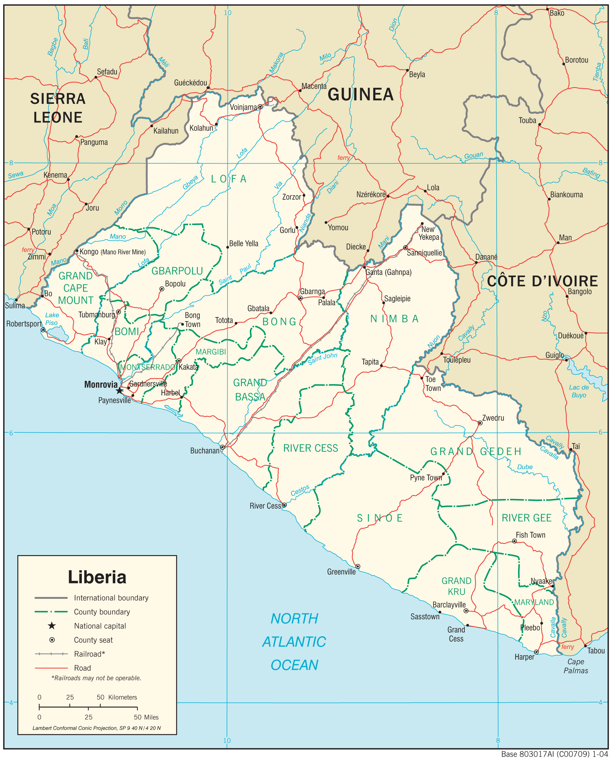
Country Maps- Liberia (Physiography) 2004 (1.2MB) and pdf format (623K)
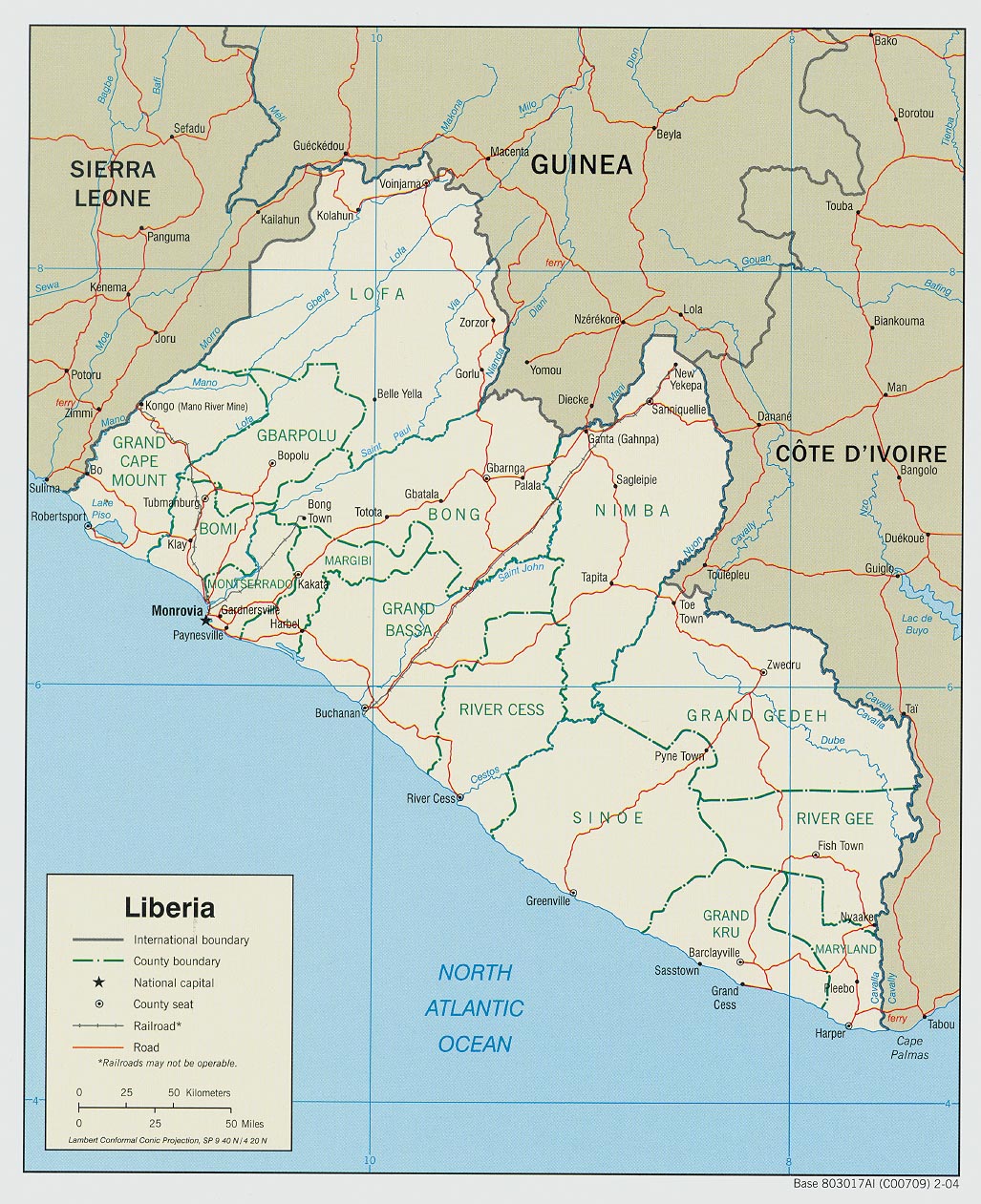
- Liberia (Political) 2004 (367K) and pdf format (379K)
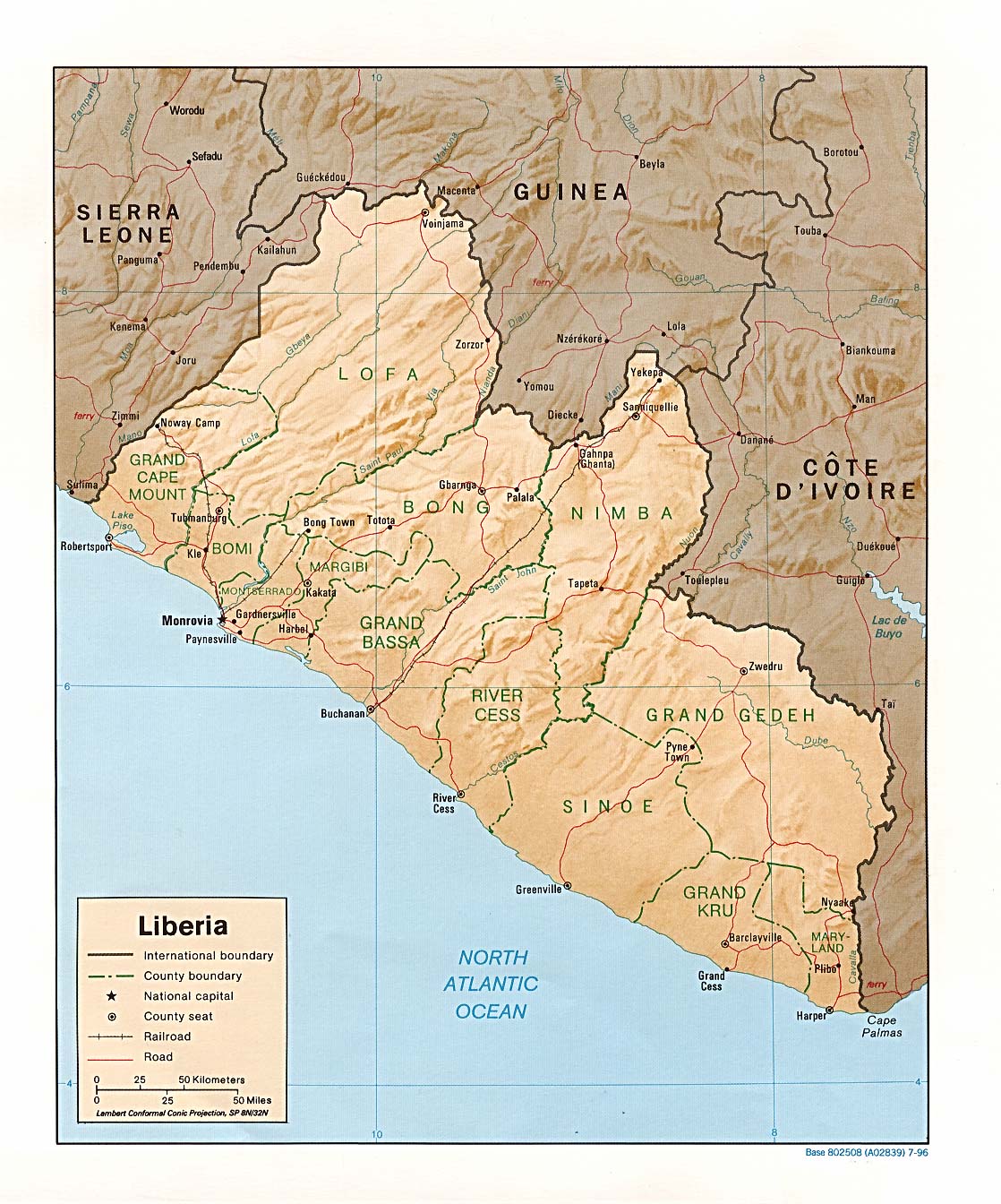
- Liberia (Political) 1996 (252K) and pdf format (257K)
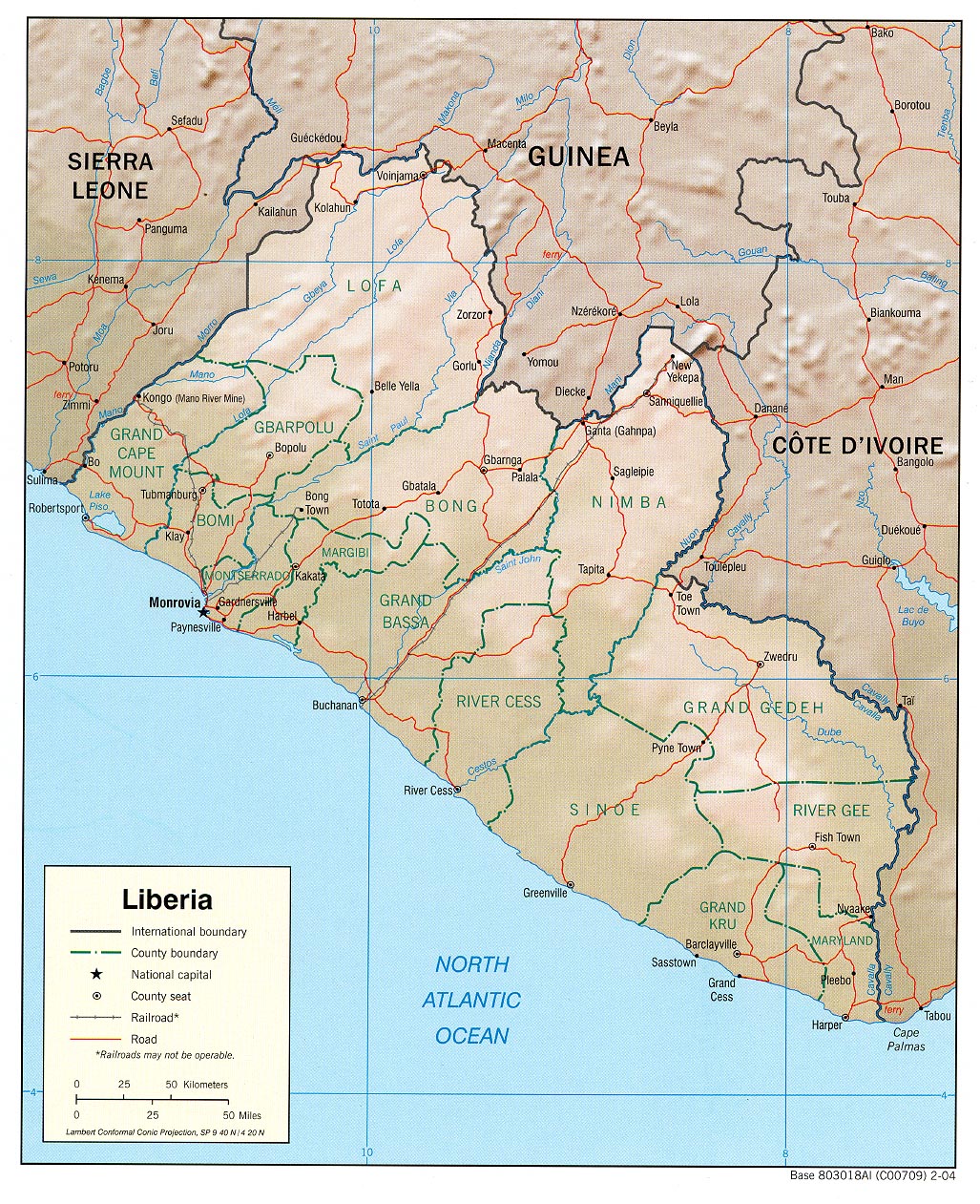
- Liberia (Shaded Relief) 2004 (494K) and pdf format (509K)
- Liberia (Shaded Relief) 1996 (285K) and pdf format (289K)
- Liberia (Shaded Relief) 1990 (271K) and pdf format (281K)
- Liberia (Small Map) 2016 (11.1K)
- Liberia (Transportation) 2004 (1.2MB) and pdf format (213K)
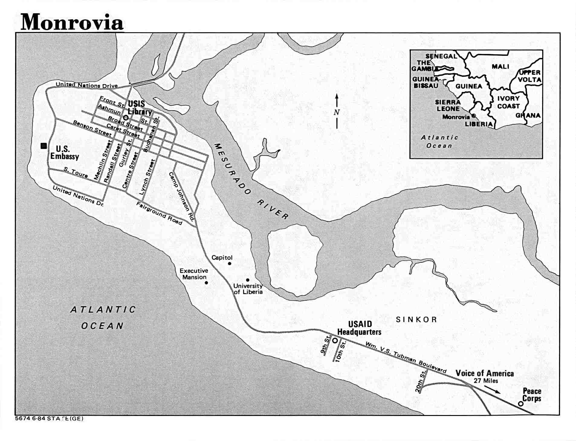
- Monrovia U.S. Dept. of State 1984 (138K)
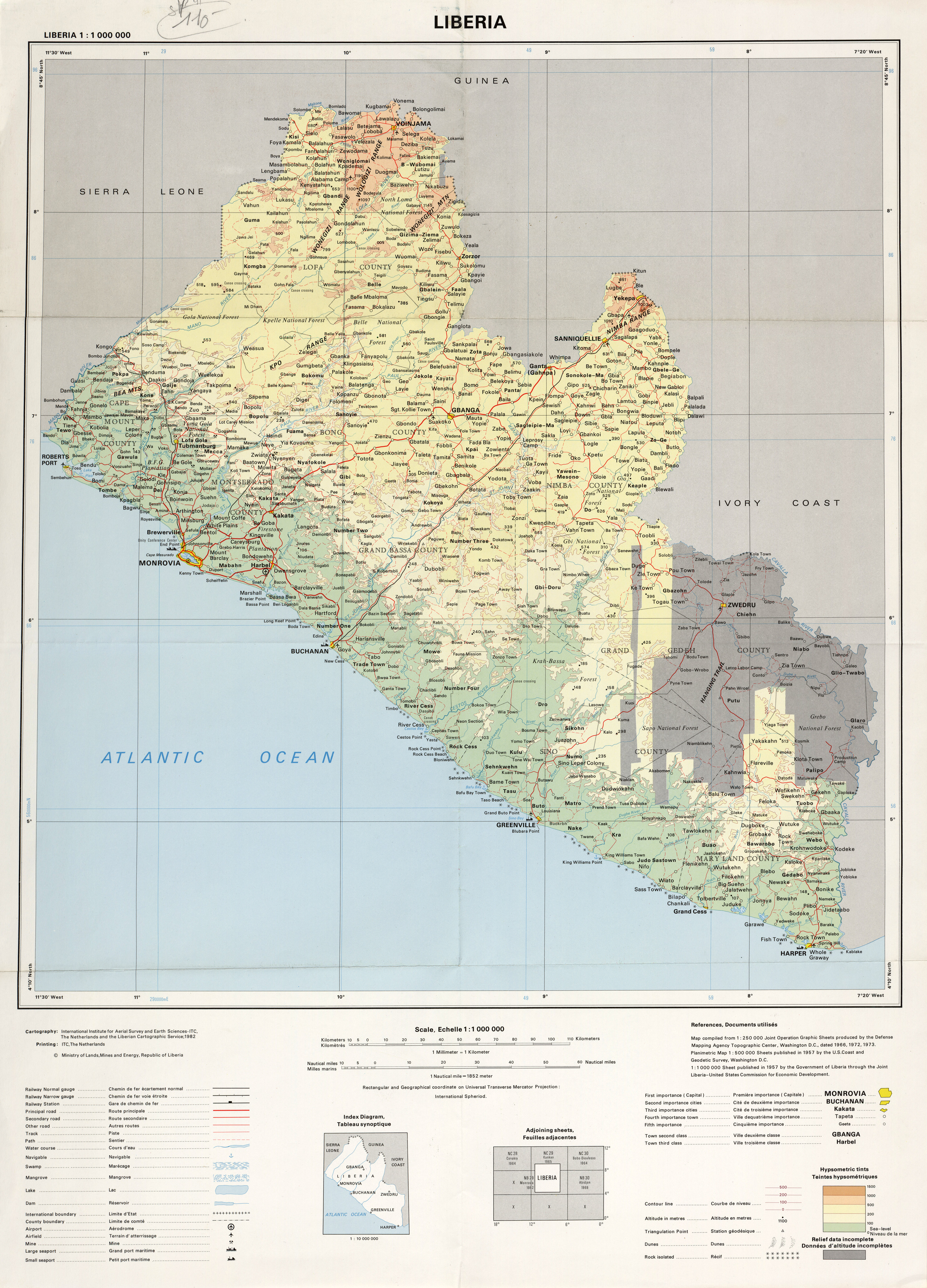
- Liberia original scale 1:1,000,000, Ministry of Lands, Mines and Industry, Republic of Liberia 1982 (4.3MB)
- Monrovia and Buchanan Area (Tactical Pilotage Chart) original scale 1:500,000 Portion of Defense Mapping Agency TPC L-1B 1996 (494K) Not for navigational use
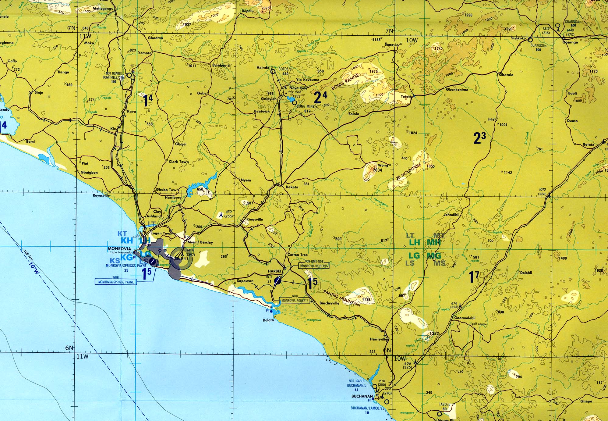
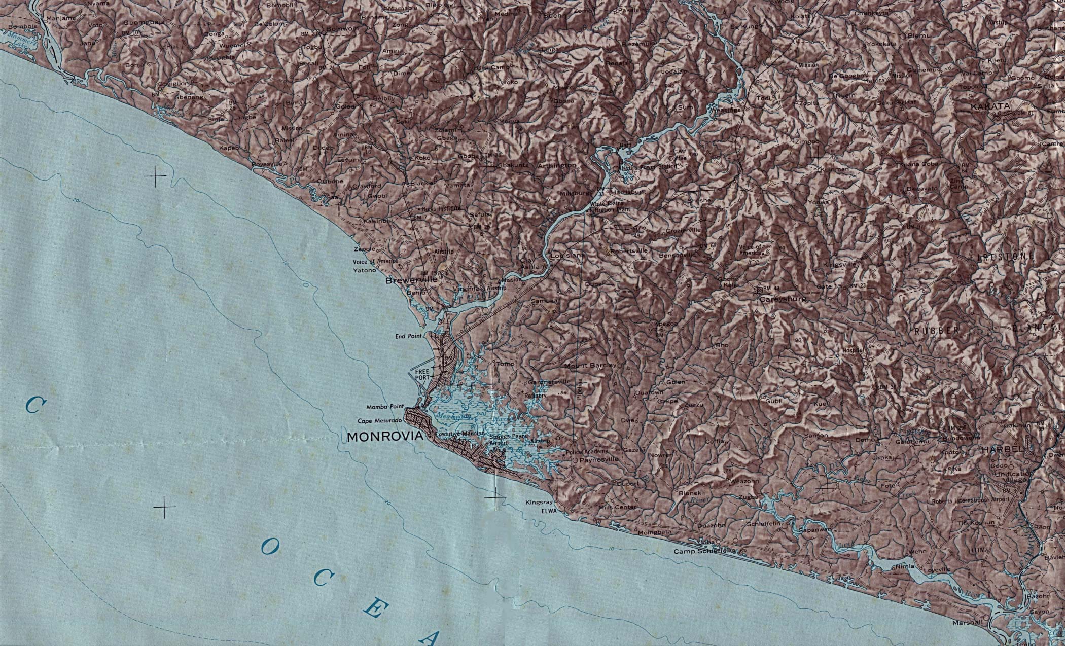
- Monrovia Area (Shaded Relief) original scale 1:250,000 Portion of U.S.G.S Map 1-775-A 1973 (516K)
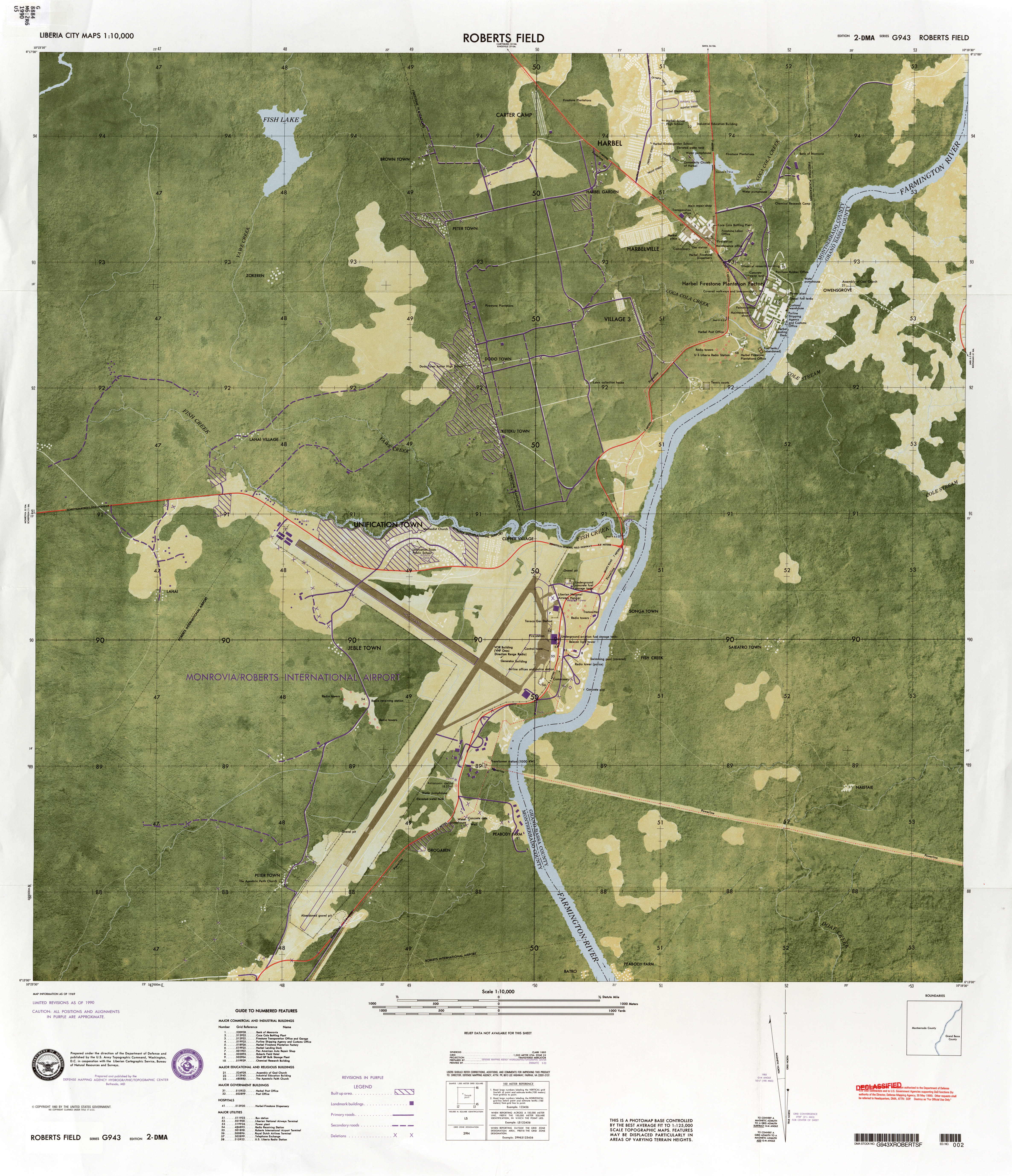
- Roberts Field original scale 1:10,000 Defense Mapping Agency (10.3MB)
- 1:2,000,000 - Africa Topographic Maps U. S. Army Map Service. Sheet 16 includes Liberia
- 1:1,000,000 - International Map of the World U. S. Army Map Service. Includes all of Liberia. Clickable map
- 1:1,000,000 - Operational Navigation Chart U.S. Defense Mapping Agency Aerospace Center. Not for navigational use
- Sheets L-1 and K-1 cover all of Liberia
- 1:500,000 - Tactical Pilotage Charts U.S. National Imagery and Mapping Agency. Not for navigational use
- This series covers all of Liberia
- 1:250,000 - Liberia Geographic Maps U.S. Geological Survey, 1972-1973
- This series covers all of Liberia
- 1:250,000 - Joint Operations Graphic U.S. National Imagery and Mapping Agency, Series 1501 Air Not for navigational use
- This series covers all of Liberia
- 1:250,000 - West Africa Topographic Maps, Series G504 U. S. Army Map Service.
- Includes extreme northern parts of Liberia
- Sheets L-1 and K-1 cover all of Liberia
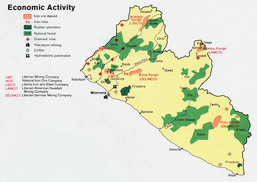
- Liberia - Economic Activity from Map No. 501556 1973 (143K)
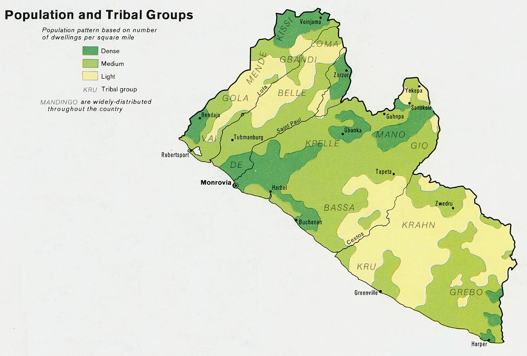
- Liberia - Population and Tribal Groups from Map No. 501556 1973 (132K)
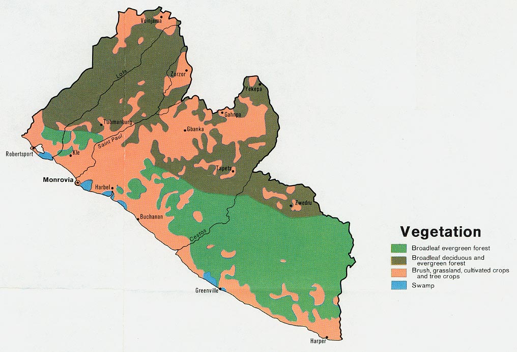
- Liberia - Vegetation from Map No. 501556 1973 (138K)
Maps on Other Web Sites