Perry-Castañeda Library
Map Collection
Kosovo Maps
The following maps were produced by the U.S. Central Intelligence Agency unless otherwise indicated.
Kosovo Maps
- Kosovo (Political) 1998 (323K)
- Kosovo (Reference Map) 2001 (238K)
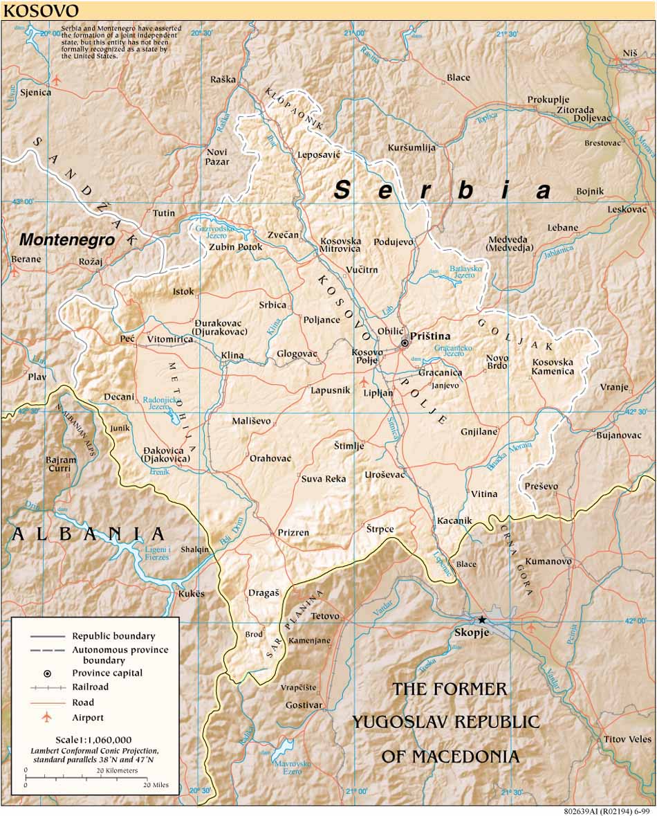
- Kosovo (Reference Map) 1999 (202K)
- Kosovo (Reference Map) (PDF Format) 2001 (1.2MB)
- Kosovo (Reference Map) (PDF Format) 2000 (689K)
- Kosovo (Reference Map) (PDF Format) 1999 (468K)
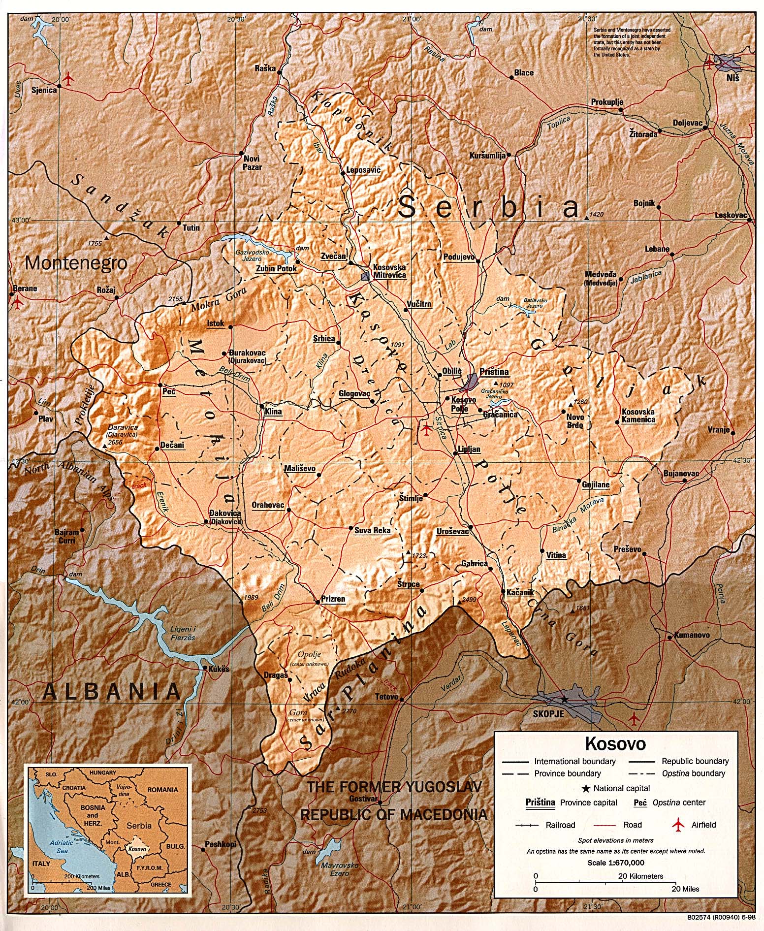
- Kosovo (Shaded Relief) original scale 1:670,000 1998 (968K)
- Kosovo (Shaded Relief) 1993 (624K)
- Kosovo (Shaded Relief) 1992 (332K)
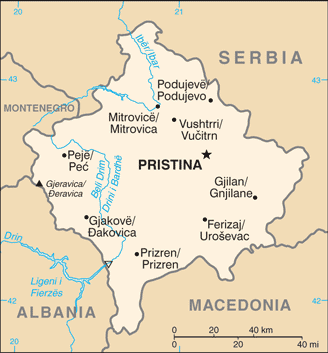
- Kosovo (Small Map) 2016 (17.8K)
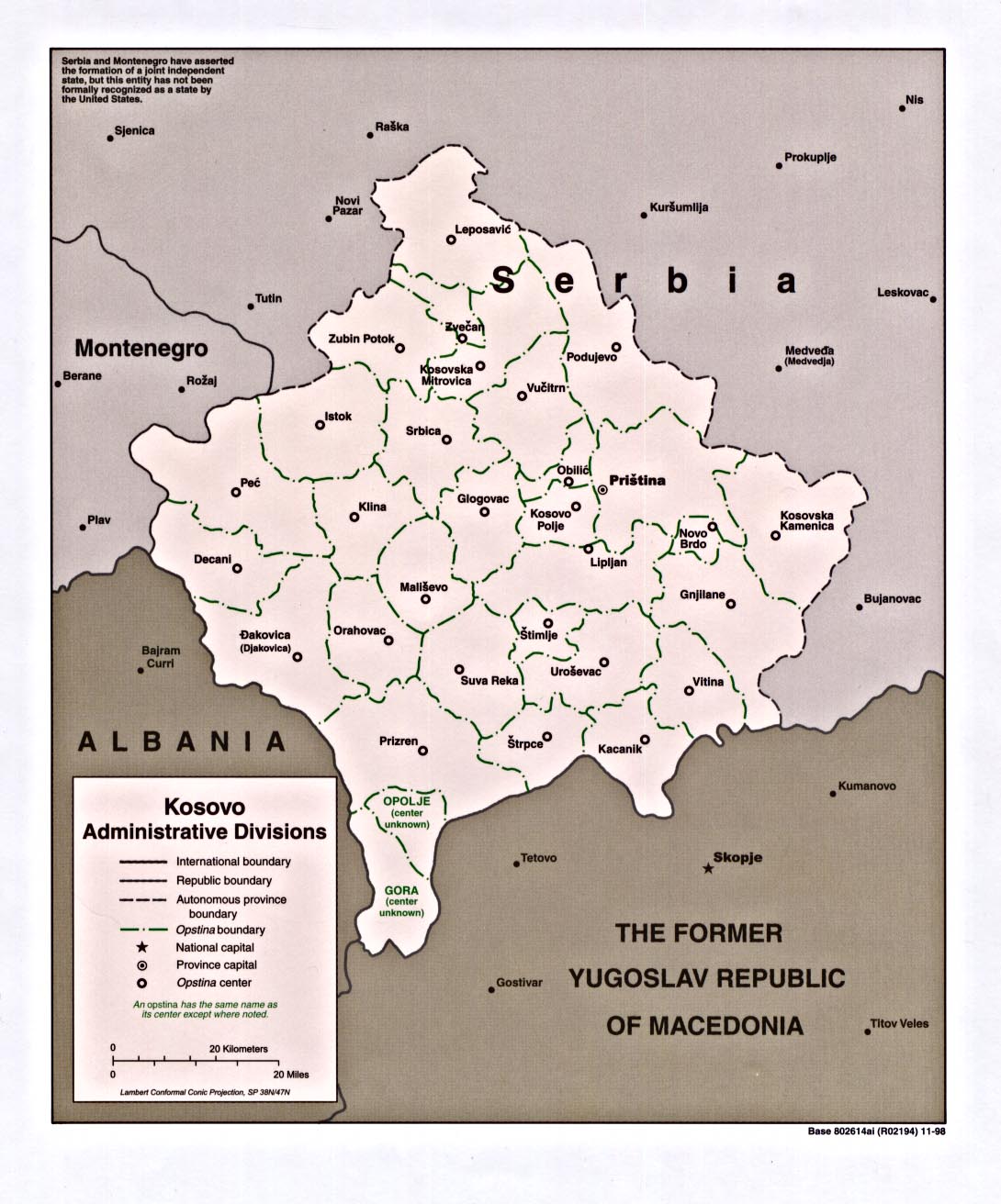
- Kosovo (Administrative Divisions) 1998 (258K)
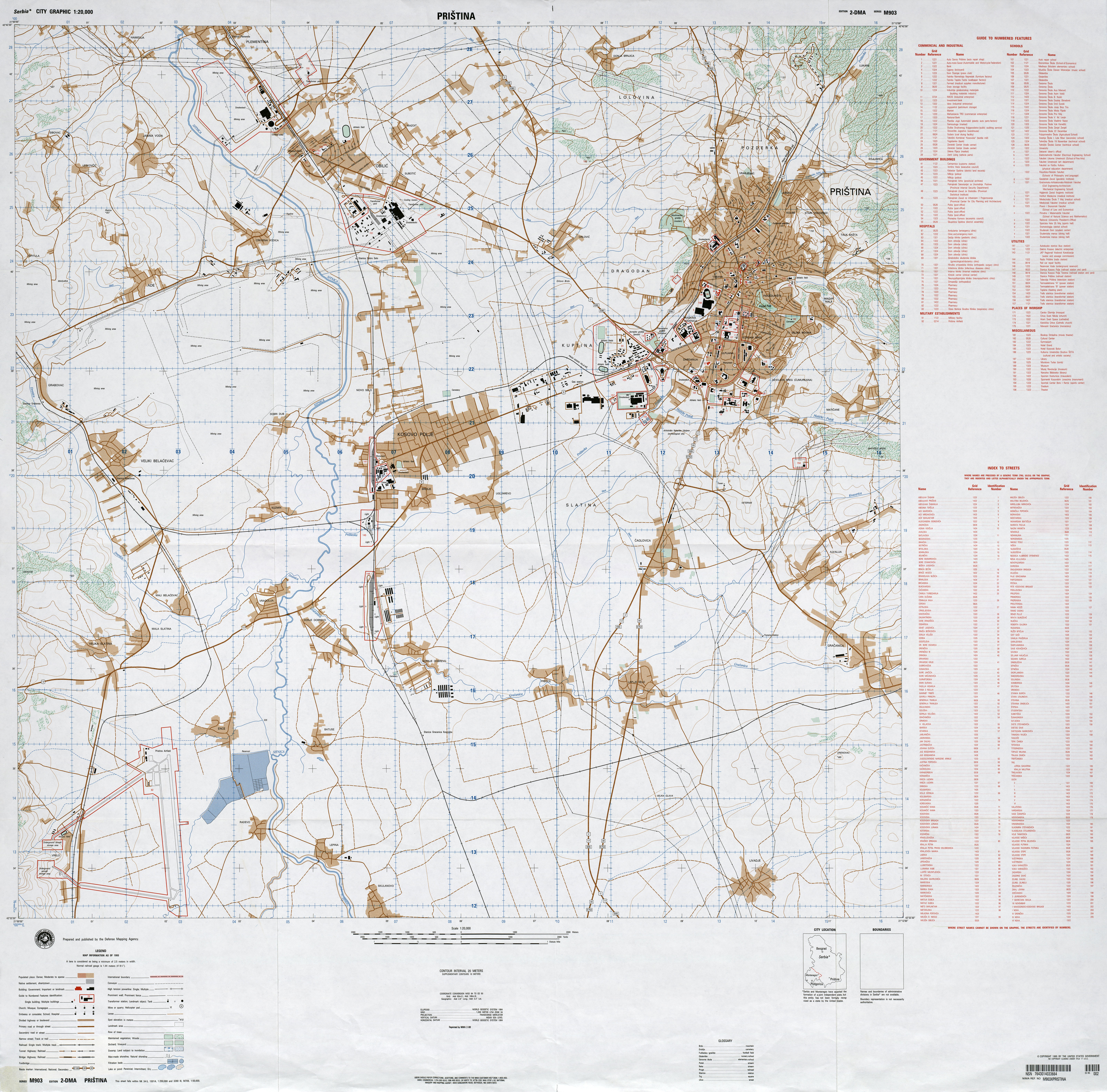
- Pristina 1:20,000, Edition 2-DMA, Series M903. U.S. Defense Mapping Agency, 1993 (7.1MB)
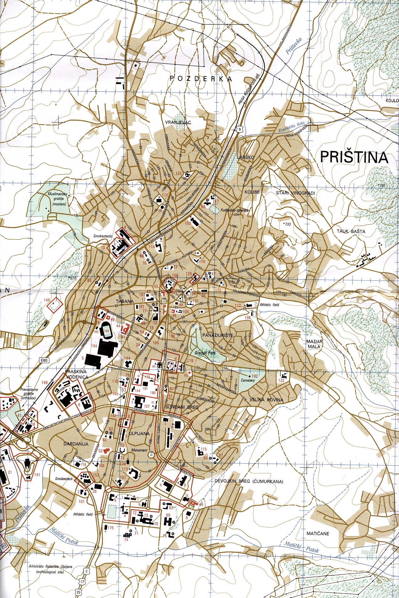
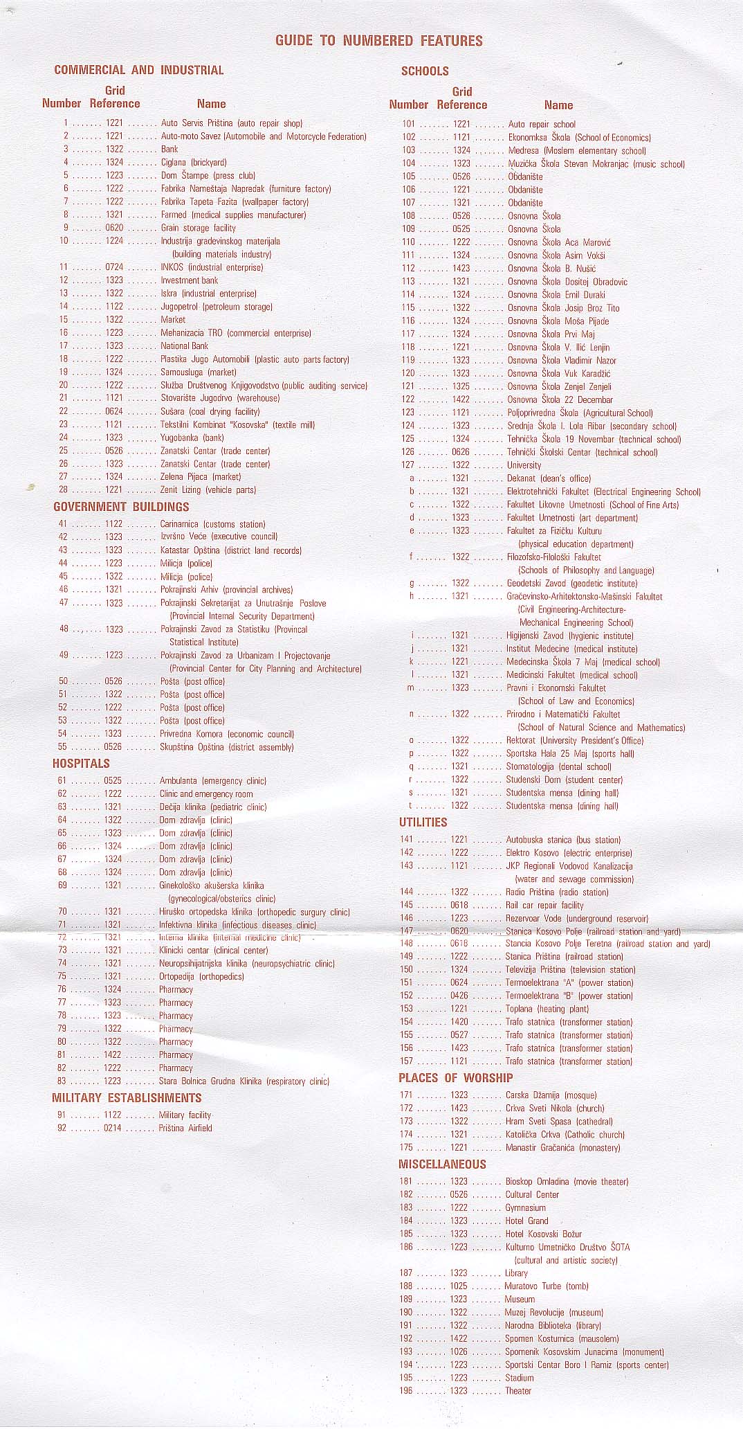
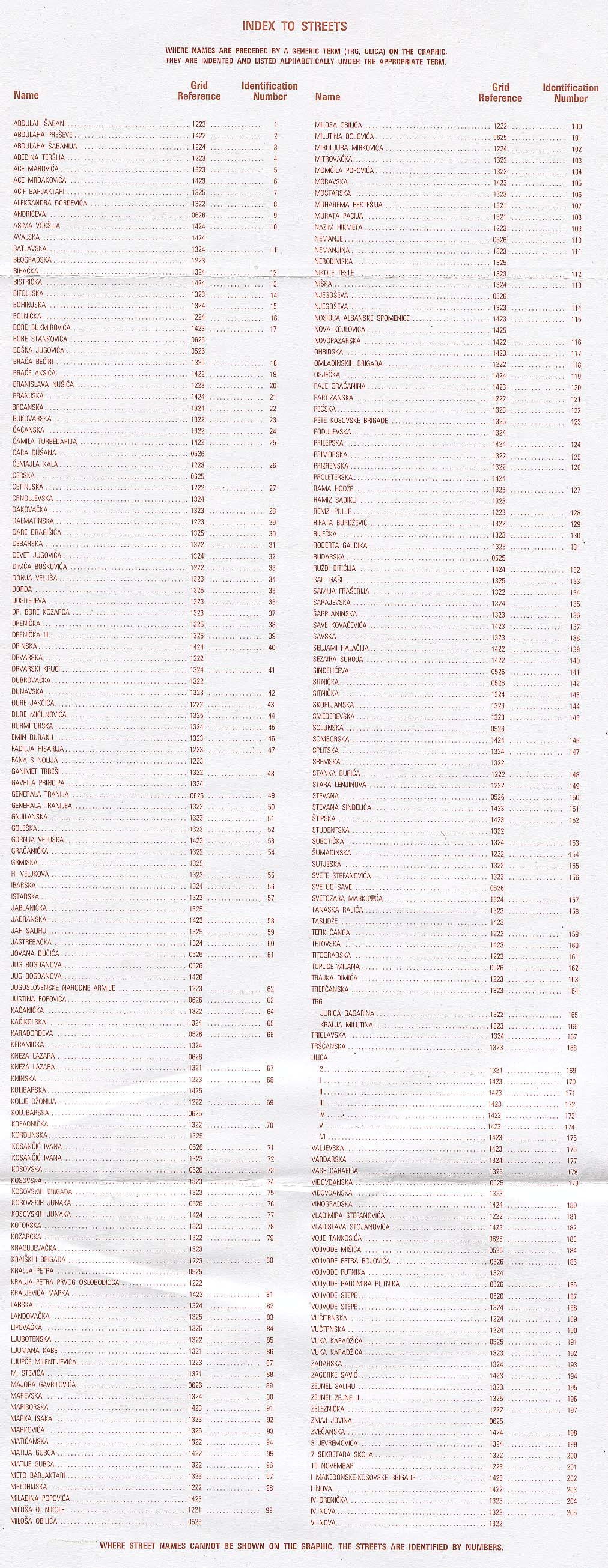
- Pristina 1:20,000. Portion of Pristina City Graphic, Series M903, Edition 2-DMA. U.S. Defense Mapping Agency, 1993 (670K) Guide to Numbered Features (437K) and Index to Streets (578K)
- 1:1,000,000 - Operational Navigation Chart, Sheet F-3 Albania; Bosnia and Herzegovina; Bulgaria; Croatia; Former Yugoslav Republic of Macedonia; Greece; Hungary; Moldova; Romania; Slovakia; Turkey; Ukraine; Yugoslavia [Not for navigational use] U.S. Defense Mapping Agency Aerospace Center, compiled 1973, revised 2000 (20.3MB)
- Sheet F-3 includes Kosovo
- 1:500,000 - Tactical Pilotage Charts U.S. National Imagery and Mapping Agency. Not for navigational use
- This series covers Kosovo
- 1:250,000 - Pristina, Sheet NK 34-5 U.S. Army Map Service, Corps of Engineers 1959 (8.6MB) Note: Includes most of Kosovo. Note: The city labeled as Tetovo on this map was incorrectly named. The correct name is Skopje.
- 1:250,000 - Nis, Sheet NK 34-2 U.S. Army Map Service, Corps of Engineers 1959 (8.0MB) Note: Includes far north of Kosovo
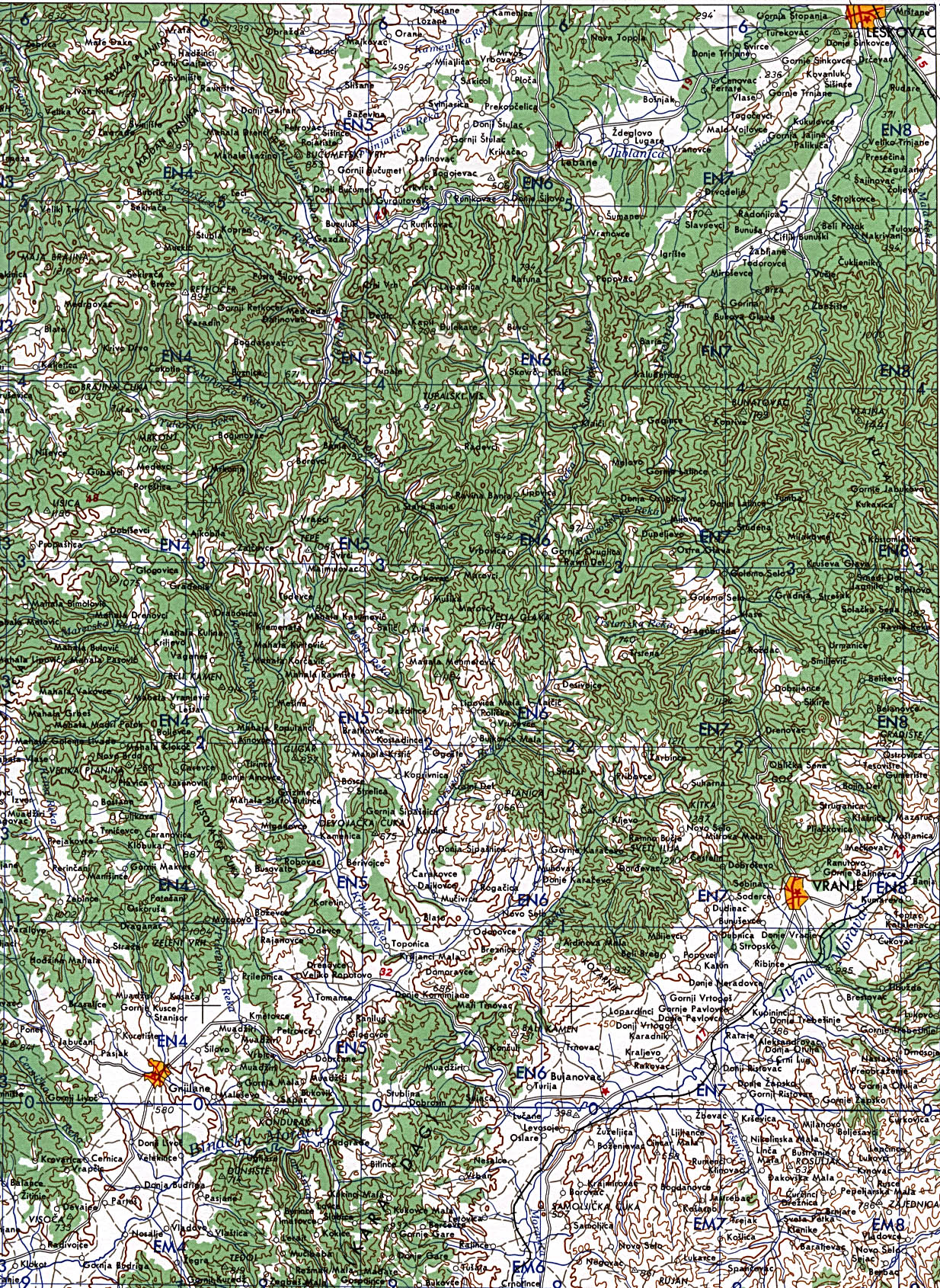
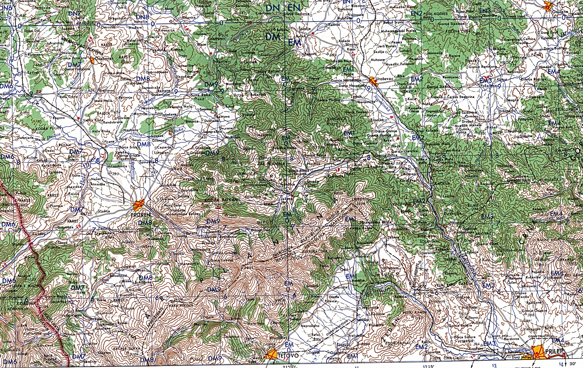
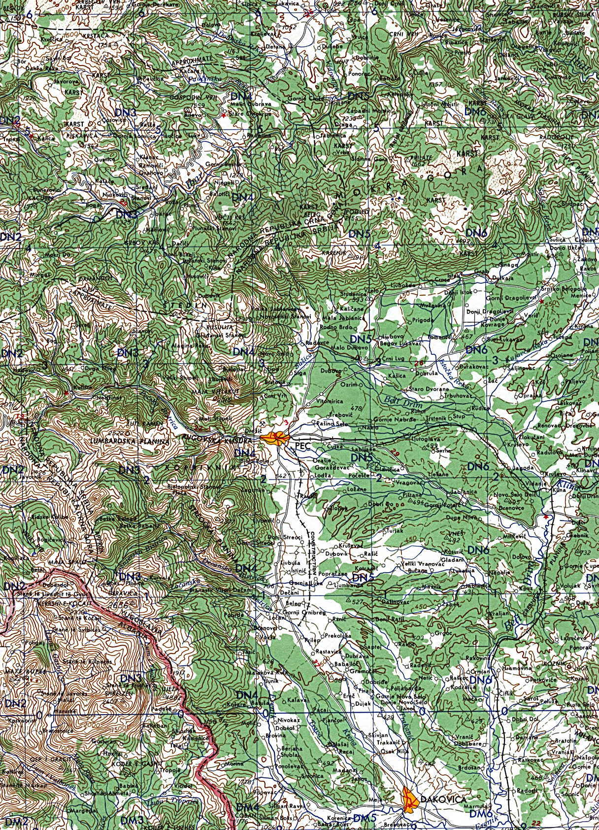
- 1:100,000 - Former Yugoslavia Topographic Maps Series M6010, U.S. Defense Mapping Agency
- This series includes part of Kosovo
- 1:50,000 - Former Yugoslavia Topographic Maps Series M709, U.S. Defense Mapping Agency
- This series includes parts of Kosovo Portions of the maps above:
- 1:250,000 - Kosovo (Central) 1959 Portion of Army Map Service Corps of Engineers NK 34-5 1959 (1.2MB)
- 1:250,000 - Kosovo (East) 1959 Portion of Army Map Service Corps of Engineers NK 34-5 1959 (1.1MB)
- 1:250,000 - Kosovo (North) 1959 Portion of Army Map Service Corps of Engineers NK 34-2 1959 (1.3MB)
- 1:250,000 - Kosovo (South) 1959 Portion of Army Map Service Corps of Engineers NK 34-5 1959 (1.4MB) Note: On Kosovo (South) 1959 the city labeled Tetovo at the bottom of the map was incorrectly named. The correct name is Skopje.
- 1:250,000 - Kosovo (West) 1959 Portion of Army Map Service Corps of Engineers NK 34-5 1959 (1.1MB)
Note: The borders within Former Yugoslavia are not indicated on these topographic maps, which were published in 1959. We recommend using the general maps of Kosovo at the top of this page to help in locating places on these maps. - Sheet F-3 includes Kosovo
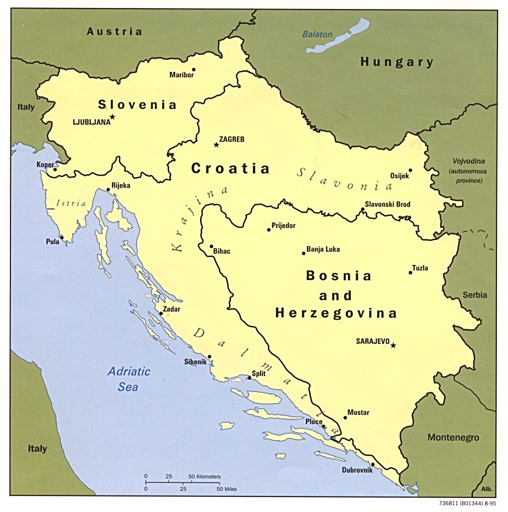
- Former Yugoslavia (Political) 1996 (162K)
- Former Yugoslavia (Shaded Relief) 1996 (1237K)
- Former Yugoslavia (Political) 1995 (131K)
- Former Yugoslavia (Political) 1993 (146K)
- Former Yugoslavia: A Map Folio
- Former Yugoslavia - Ethnic Majorities From Former Yugoslavia: A Map Folio (412K)
- Former Yugoslavia - Military Geography 1998 (581K)
- Historical Maps of the Balkans
Kosovo Maps on Other Web Sites Kosovo Historical Maps on Other Web Sites
- Balkans Special Report - Maps (Washington Post)
- Kosovo (U.K. Ministry of Defence/Web Archive)
- Kosovo 1998 (United Nations/Internet Archive) [PDF]
- Kosovo - The First Liberation of Kosovo, April 1941 (Giovanni Armillotta/Internet Archive)
- Former Yugoslavia March 1999 (U.N. Cartographic Section) [PDF]
- The Killing of Kosovo 1999 (BBC)
- Kosovo - Administrative Divisions 1998 (CIA/American Memory) [MrSID format]
- Kosovo Imagery [includes maps] (Federation of American Scientists)
- NATO Bombing Targets - Day by Day (CNN)
- Strikes Briefings - Maps (BBC)
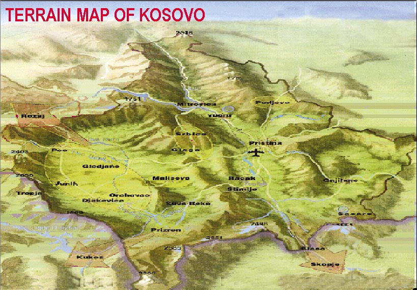
- Terrain Map of Kosovo (NATO/FAS)
- Towns and Villages in Kosovo Attacked by the Serbs (U.S. Department of State)
- Yugoslavia and the Balkans - History Maps (BBC News)