Perry-Castañeda Library
Map Collection
Hawaii Maps
State Maps
- Hawaii International Map of the World, Sheet NE/NF-4,5, 1:1,000,000, U.S. Geological Survey, 1971 (3.6MB)
- Hawaii original scale 1:7,500,000 From the U.S. National Atlas, 1970 (223K)
- Hawaii (outline map) JPEG format (76K) County boundaries and names. U.S. Bureau of the Census, 1990
- Hawaii (reference map) JPEG format (168K) Shaded relief map with state boundaries, forest cover, place names, major highways. Portion of "The National Atlas of the United States of America. General Reference", compiled by U.S. Geological Survey 2001, printed 2002
- Hawaii (reference map) PDF format (120K) Shaded relief map with state boundaries, forest cover, place names, major highways. Portion of "The National Atlas of the United States of America. General Reference", compiled by U.S. Geological Survey 2001, printed 2002
- Hawaii - Aeronautical Chart Operational Navigation Chart, Sheet J-19, U.S. Defense Mapping Agency Aerospace Center, compiled 1969, revised 1991 [Not for navigational use] (8.9MB)
- Hawaii - Federal Lands and Indian Reservations PDF format (564K) The National Atlas of the United States of America, U.S. Geological Survey, 2003
Island Maps
- Hawaii Topographic Maps
- U.S. Geological Survey, scales 1:1,000,000, 1:250,000 and Pre-1945 maps
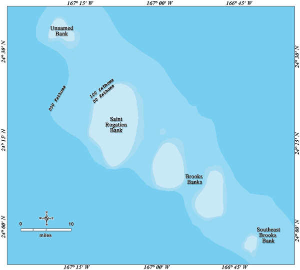
- Banks Near French Frigate Shoals NOAA/Papahanaumokuakea Marine National Monument 2006 (13K)
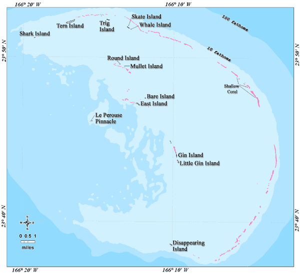
- French Frigate Shoals NOAA/Papahanaumokuakea Marine National Monument 2006 (19K)
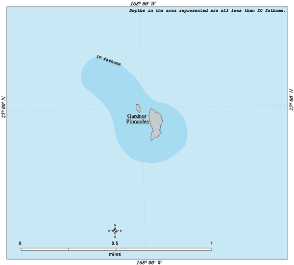
- Gardner Pinnacles NOAA/Papahanaumokuakea Marine National Monument 2006 (9K)
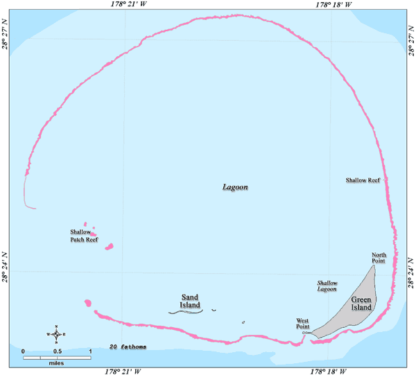
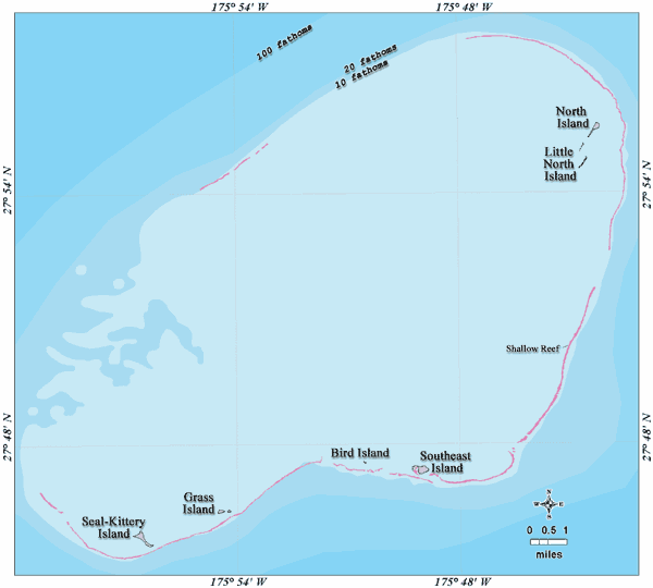
- Kure Atoll NOAA/Papahanaumokuakea Marine National Monument 2006 (19K)
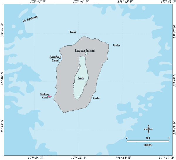
- Laysan Island NOAA/Papahanaumokuakea Marine National Monument 2006 (17K)
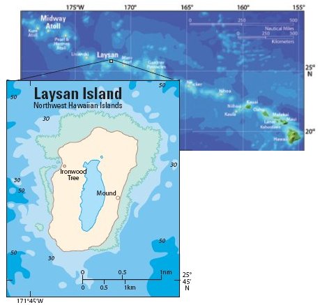
- Laysan Island U.S.G.S. Pacific Island Ecosystems Research Center 2005 (34K)
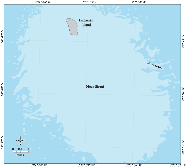
- Lisianski Island NOAA/Papahanaumokuakea Marine National Monument 2006 (16K)
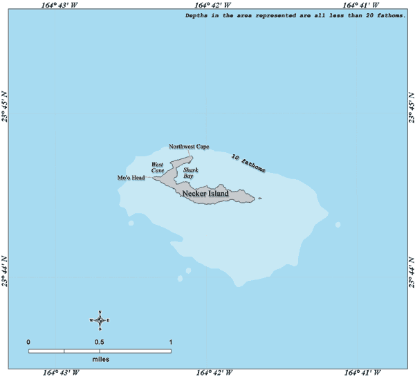
- Necker Island NOAA/Papahanaumokuakea Marine National Monument 2006 (12K)
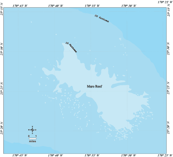
- Maro Reef NOAA/Papahanaumokuakea Marine National Monument 2006 (17K)
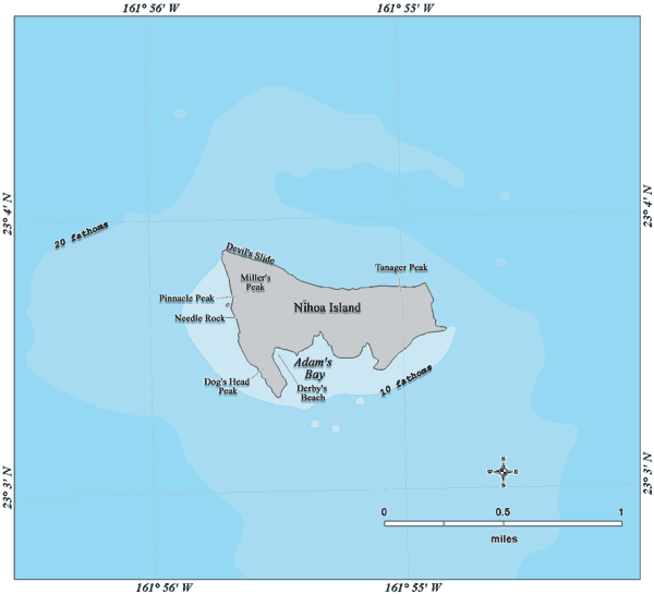
- Nihoa Island NOAA/Papahanaumokuakea Marine National Monument 2006 (14K)
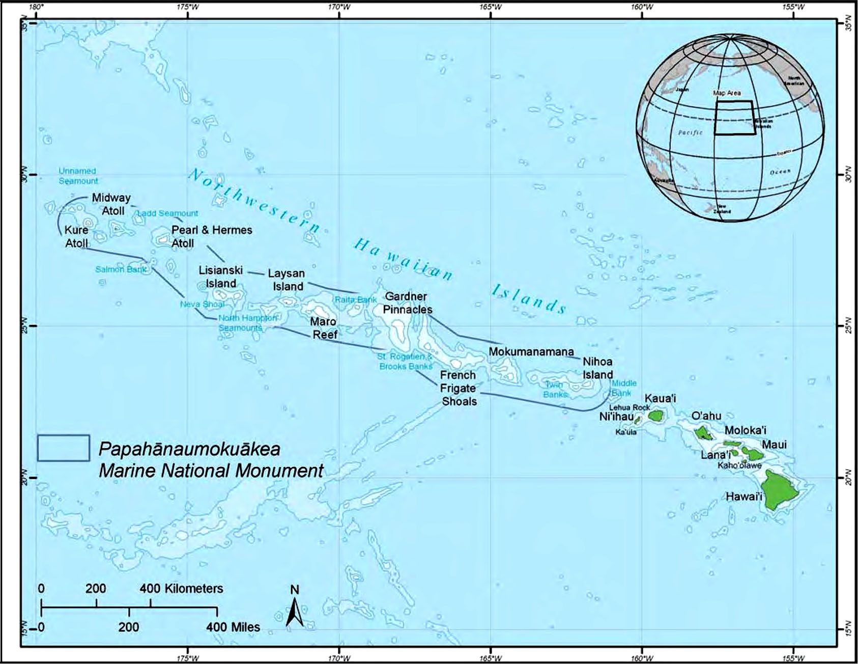
- Papahanaumokuakea Marine National Monument from Papahanaumokuakea Marine National Monument Draft Management Plan, 2008 (325K)
- Pearl and Hermes Atoll NOAA/Papahanaumokuakea Marine National Monument 2006 (18K)
- U.S. Geological Survey, scales 1:1,000,000, 1:250,000 and Pre-1945 maps
City Maps
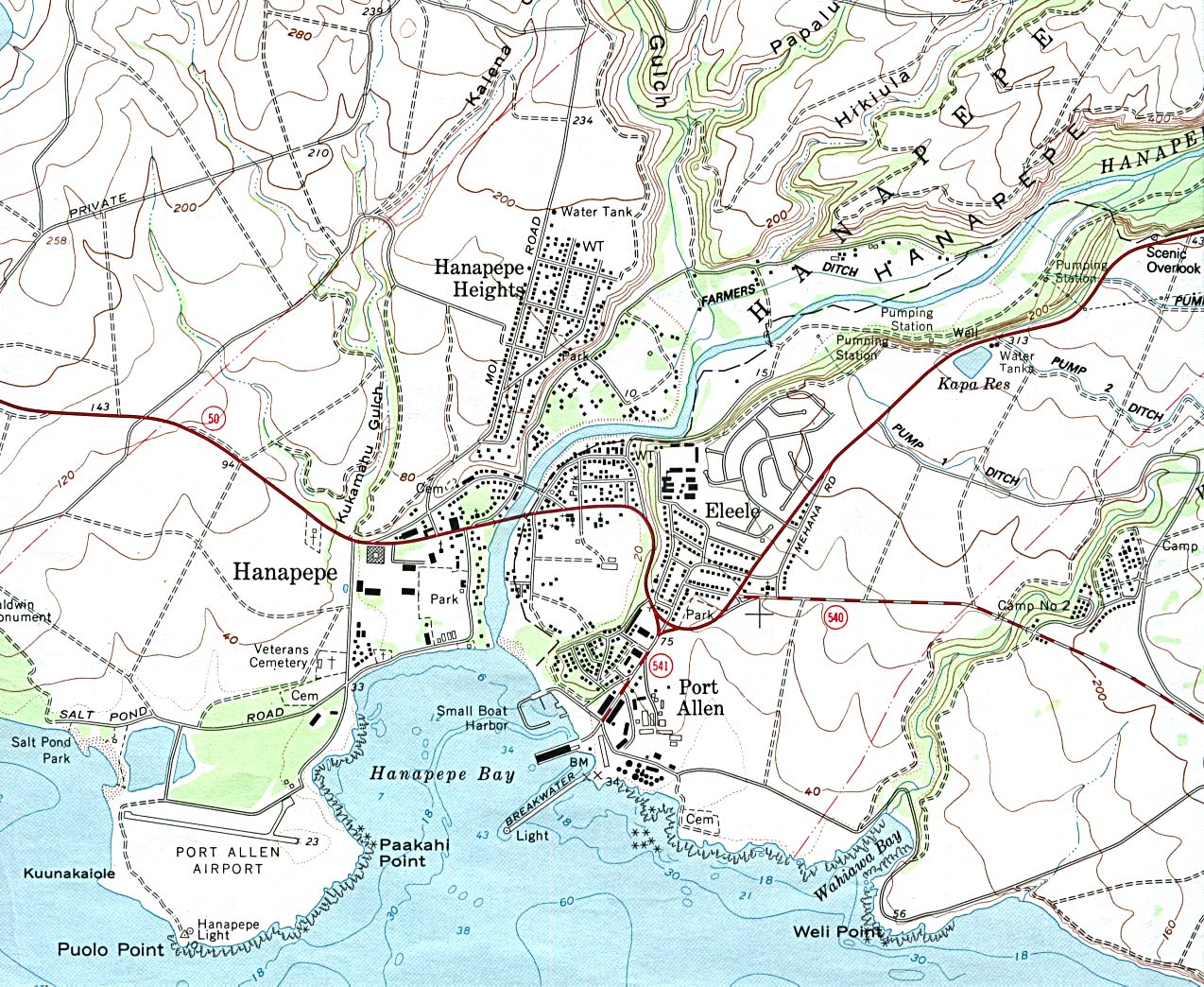
- Hanapepe (topographic) original scale 1:24,000 U.S.G.S. 1983 (417K)
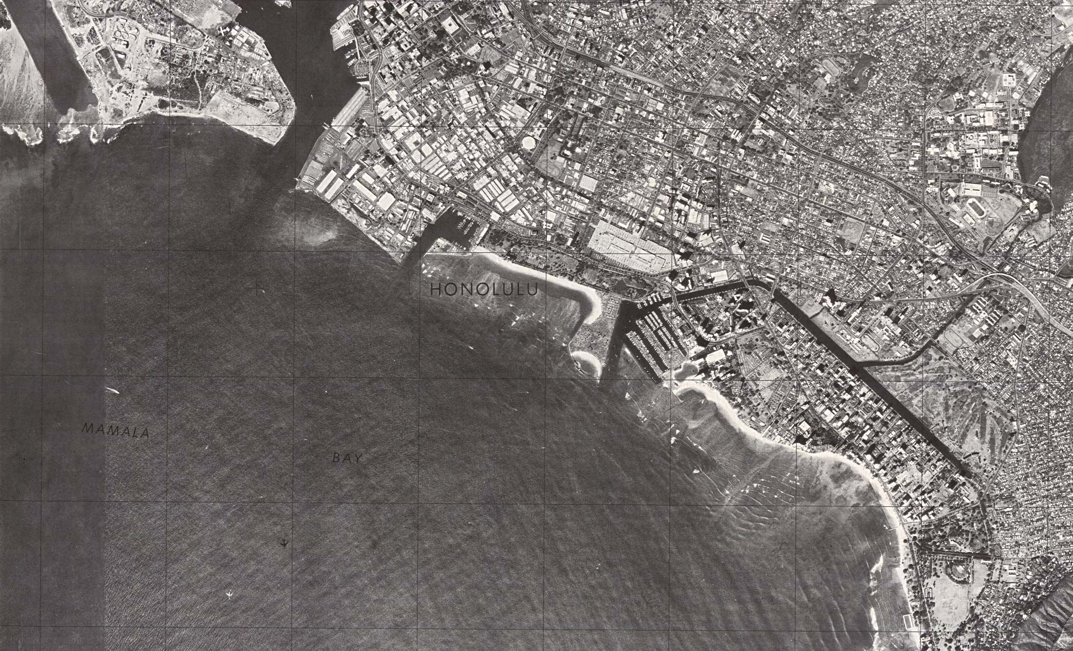
- Honolulu Central (orthophoto map) original scale 1:24,000 U.S.G.S.1978, photo taken 1976(746K)
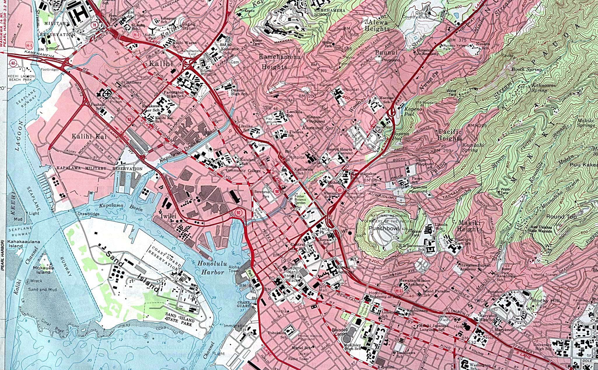
- Honolulu Central (topographic) original scale 1:24,000 U.S.G.S. 1953, photorevised 1968, field checked 1969 (972K)
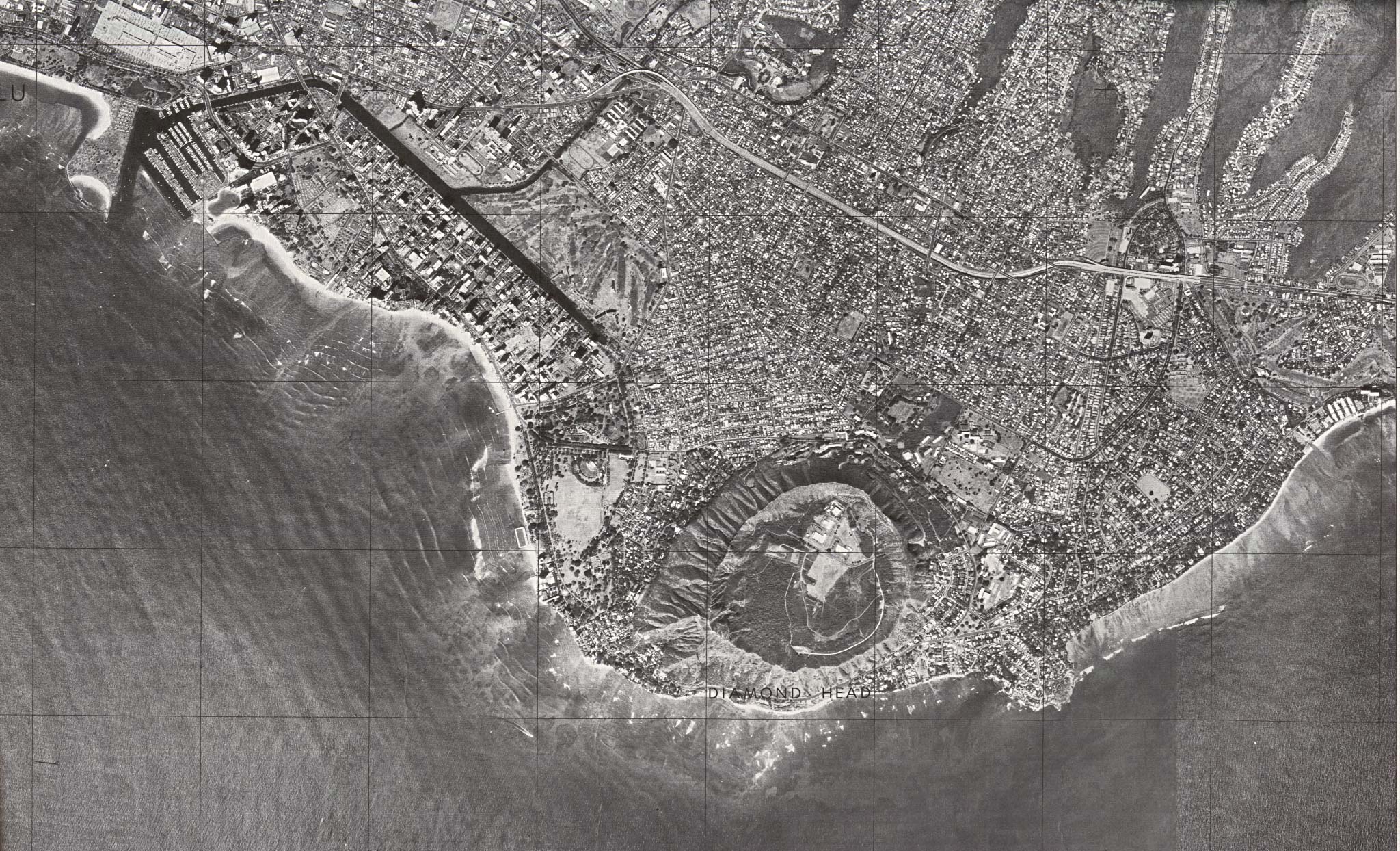
- Honolulu - Diamond Head/Waikiki (orthophoto map) original scale 1:24,000 U.S.G.S. 1978, photo taken 1976 (739K)
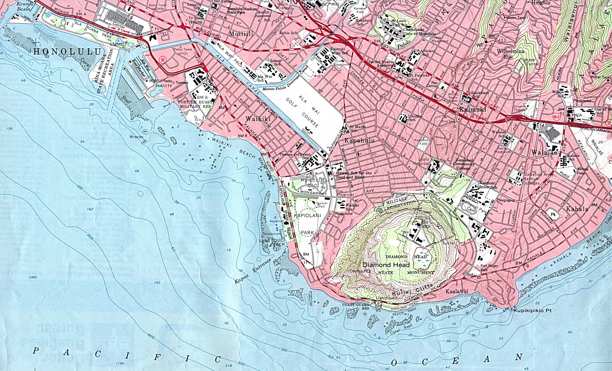
- Honolulu - Diamond Head/Waikiki (topographic) original scale 1:24,000 U.S.G.S. 1953, photorevised 1968, field checked 1969 (986K)
- Honolulu West (topographic) original scale 1:24,000 U.S.G.S. 1953, photorevised 1968, field checked 1969 (1081K)
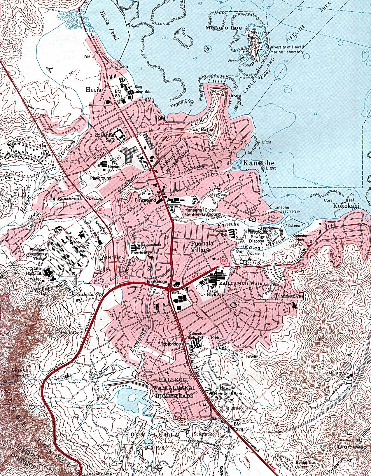
- Kaneohe (topographic) original scale 1:24,000 U.S.G.S. 1983 (876K)
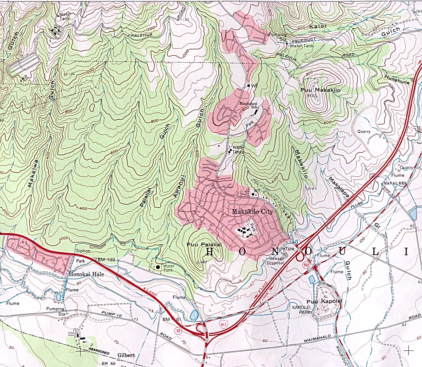
- Makakilo City (topographic) original scale 1:24,000 U.S.G.S. 1983 (578K)
- Makawao (topographic) original scale 1:24,000 U.S.G.S. 1983 (527K)
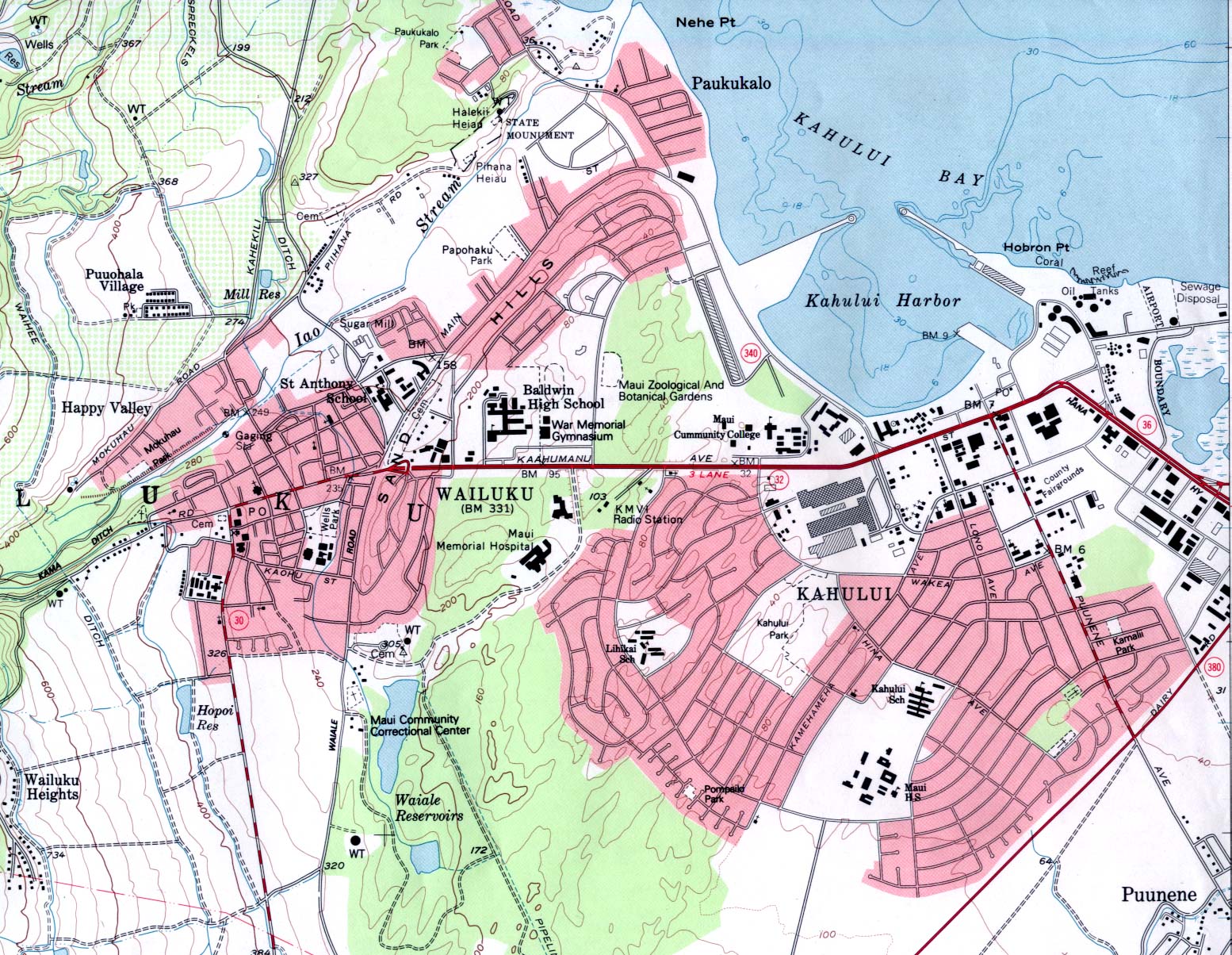
- Wailuku (topographic) original scale 1:24,000 U.S.G.S. 1983 (519K)
Historical Maps
- Hawaii Historical Topographic Maps (Pre-1945)
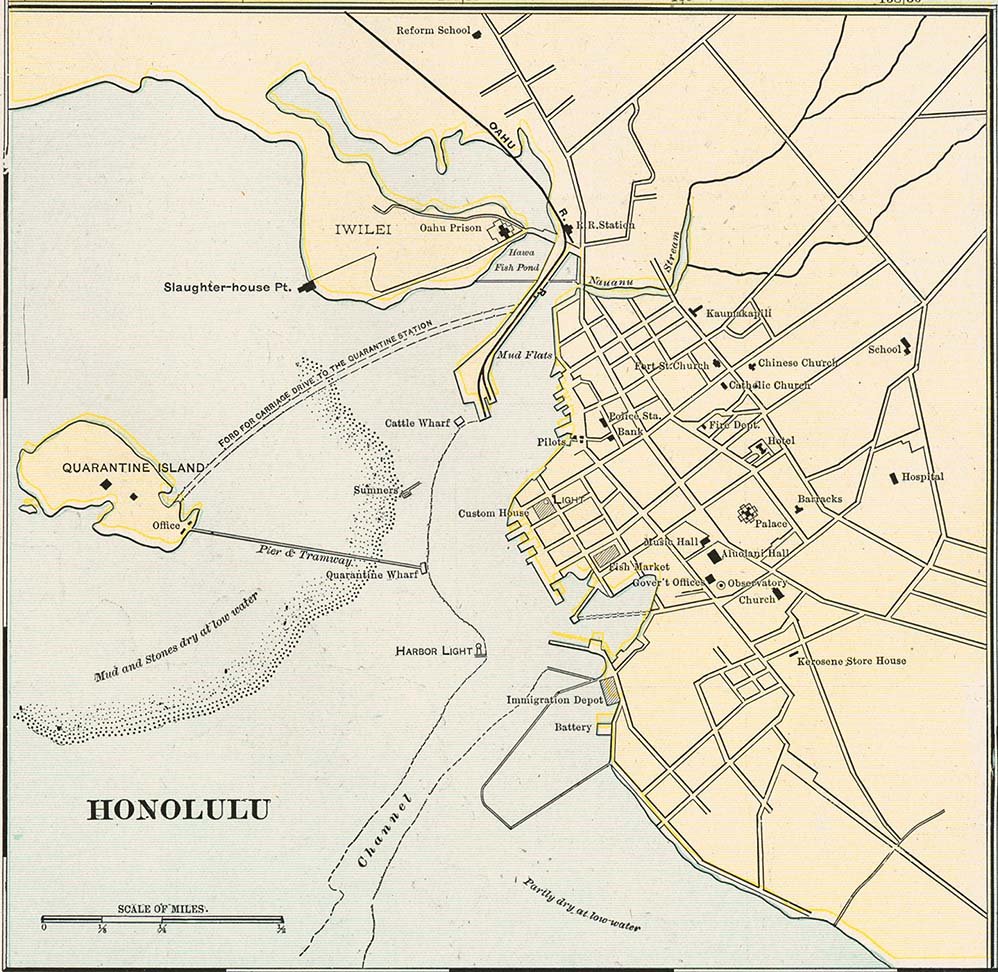
- Honolulu from Cram's Modern Atlas, 1901 (175K)
Maps of National Parks, Monuments, and Historic Sites
The following maps were produced by the U.S. National Park Service unless otherwise noted.
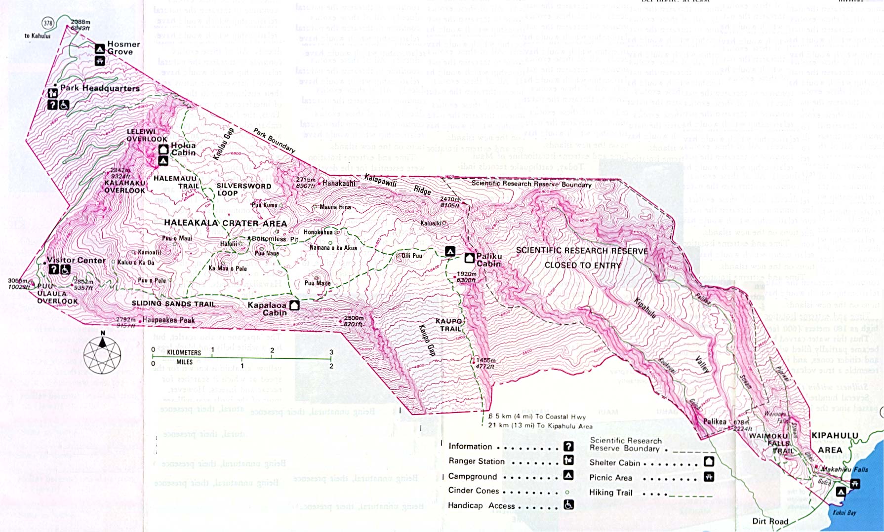
- Haleakala National Park (Park Map) 1998 (129K) (PDF Format)
- Haleakala National Park (Topographic) 1995 (351K)
- Haleakala National Park - Maui Island (Park Map) 1998 (129K) (PDF Format)
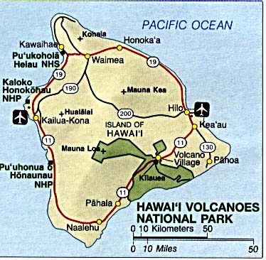
- Hawaii Volcanoes National Park (Area Map) (46K)
- Hawaii Volcanoes National Park (Park Map) 1999 (387K) (PDF Format)
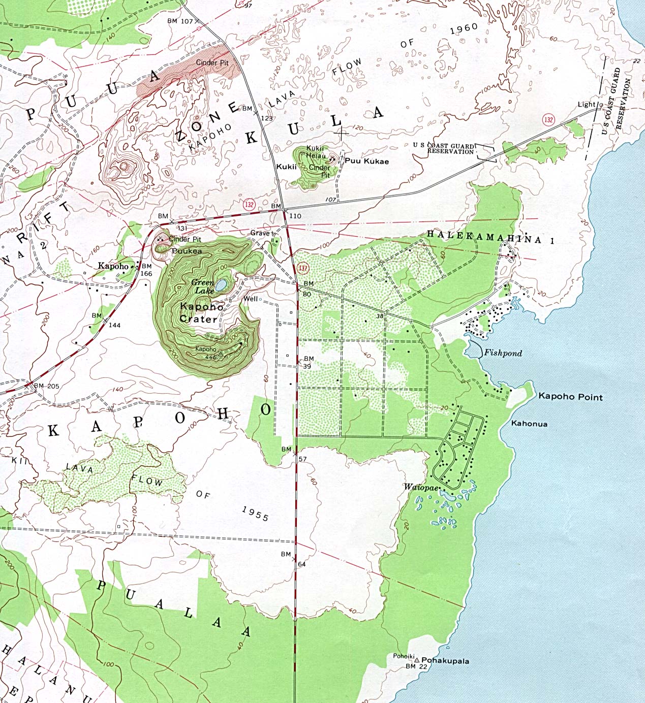
- Kapoho Crater Scale 1:24,000 U.S.G.S. (topographic) 1981 (408K)
- Papahanaumokuakea Marine National Monument from Papahanaumokuakea Marine National Monument Draft Management Plan, 2008 (325K)
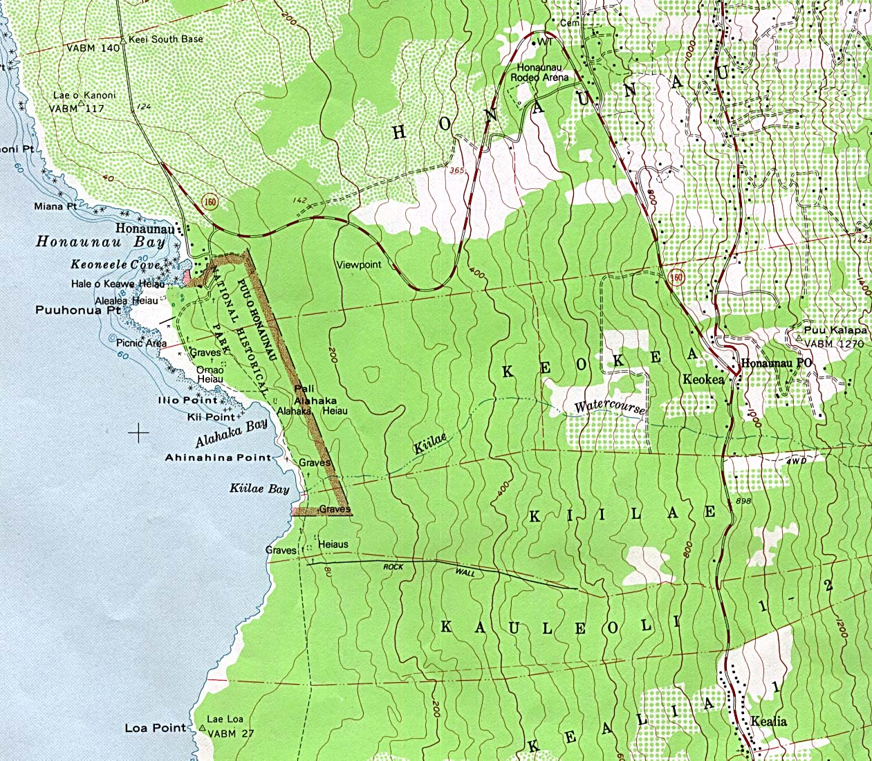
- Pu'uhonua Honaunau National Historic Park Scale 1:24,000 U.S.G.S. (topographic) 1982 (434K)
- Puukohola Heiau National Historic Site (Park Map) 1999 (65K) (PDF Format)
Maps on Other Web Sites