Perry-Castañeda Library
Map Collection
Guatemala Maps
The following maps were produced by the U.S. Central Intelligence Agency, unless otherwise indicated.
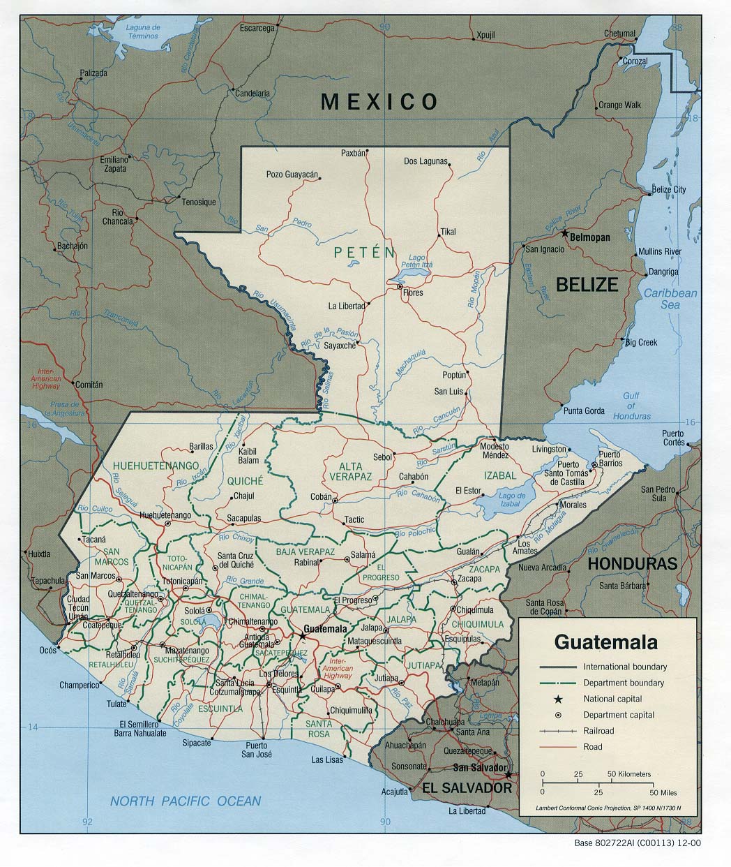
Country Maps- Guatemala (Political) 2000 (281K) and pdf format (282K)
- Guatemala (Physiography) 2001 (1.7MB) and pdf format (1.9MB)
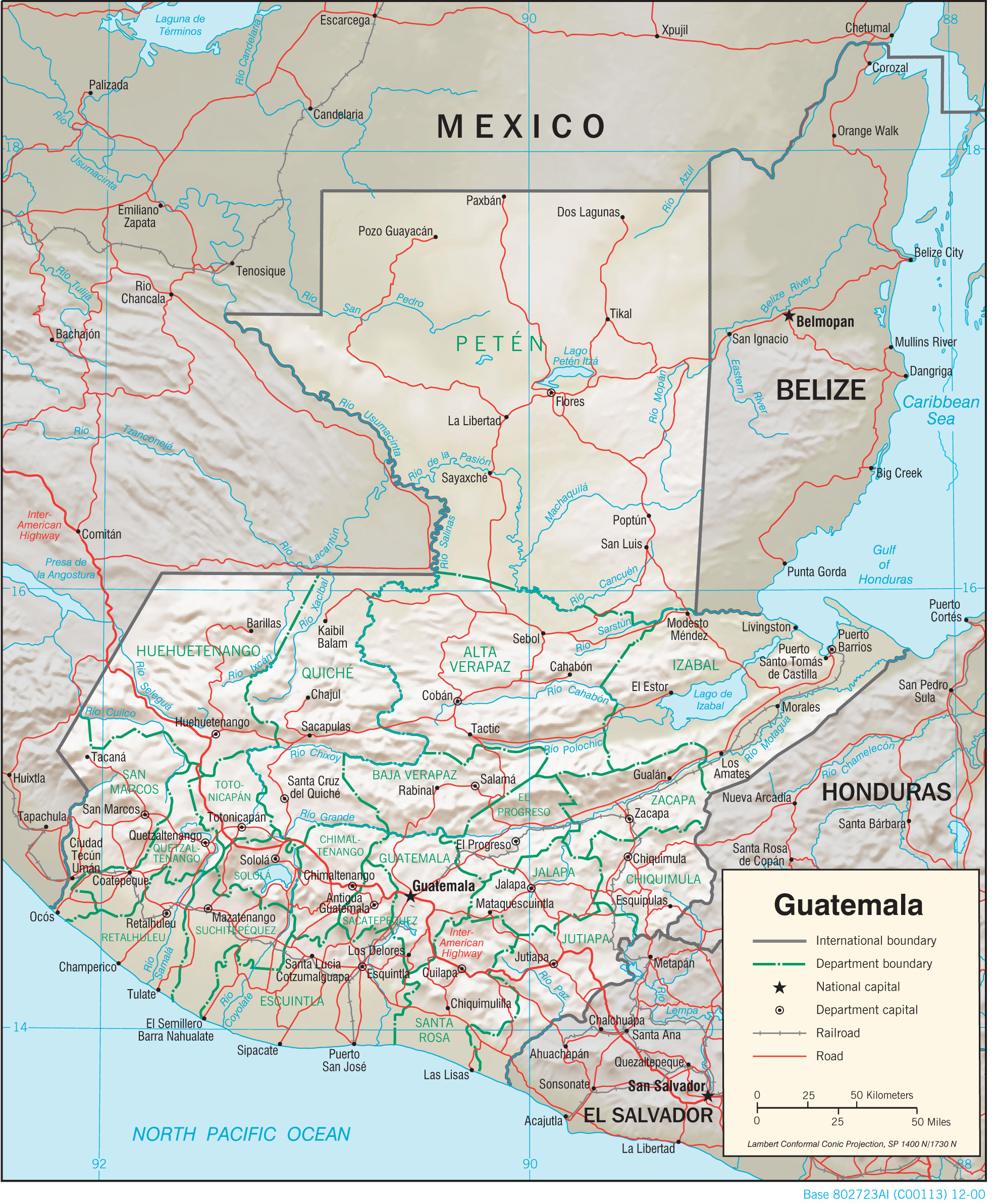
- Guatemala (Shaded Relief) 2000 (332K) and pdf format (328K)
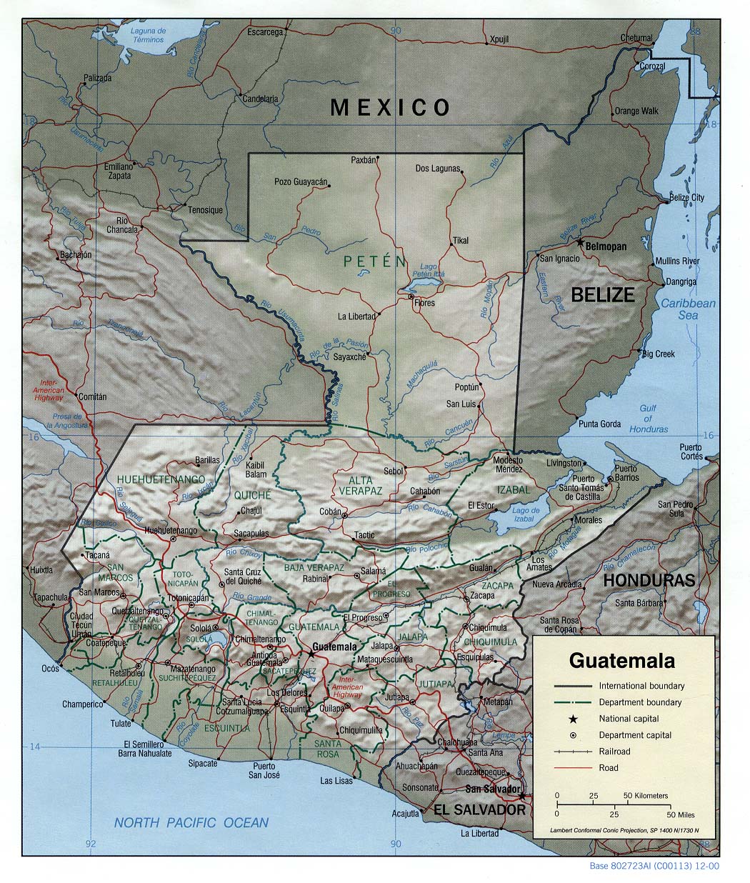
- Guatemala (Shaded Relief) 1982 (356K) and pdf format (281K)
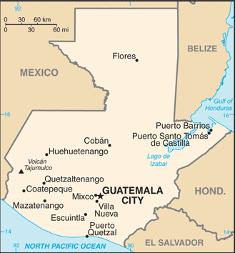
- Guatemala (Small Map) 2016 (20.7K)
- Guatemala (Transportation) 2001 (1.6MB) and pdf format (556K)
- Guatemala USGS/CINDI 1998
- Guatemala City U.S. Dept. of State 1981 (175K)
- Guatemala City, Sheet 1 1:15,000, Edition 3-NIMA, Series E954. National Imagery and Mapping Agency, 1996 [small] (8.4MB)
- Guatemala City, Sheet 1 1:15,000, Edition 3-NIMA, Series E954. National Imagery and Mapping Agency, 1996 (23MB)
- Guatemala City, Sheet 1 Edition 3-NIMA, Series E954. National Imagery and Mapping Agency, 1996 [verso] (5.8MB)
- Guatemala City, Sheet 2 1:15,000, Edition 3-NIMA, Series E954. National Imagery and Mapping Agency, 1996 [small] (8.8MB)
- Guatemala City, Sheet 2 1:15,000, Edition 3-NIMA, Series E954. National Imagery and Mapping Agency, 1996 (24MB)
- Guatemala City, Sheet 2 Edition 3-NIMA, Series E954. National Imagery and Mapping Agency, 1996 [verso] (6.7MB)
- Guatemala City, Sheet 3 1:15,000, Edition 3-NIMA, Series E954. National Imagery and Mapping Agency, 1996 [small] (8.6MB)
- Guatemala City, Sheet 3 1:15,000, Edition 3-NIMA, Series E954. National Imagery and Mapping Agency, 1996 (21MB)
- Guatemala City, Sheet 3 Edition 3-NIMA, Series E954. National Imagery and Mapping Agency, 1996 [verso] (6.2MB)
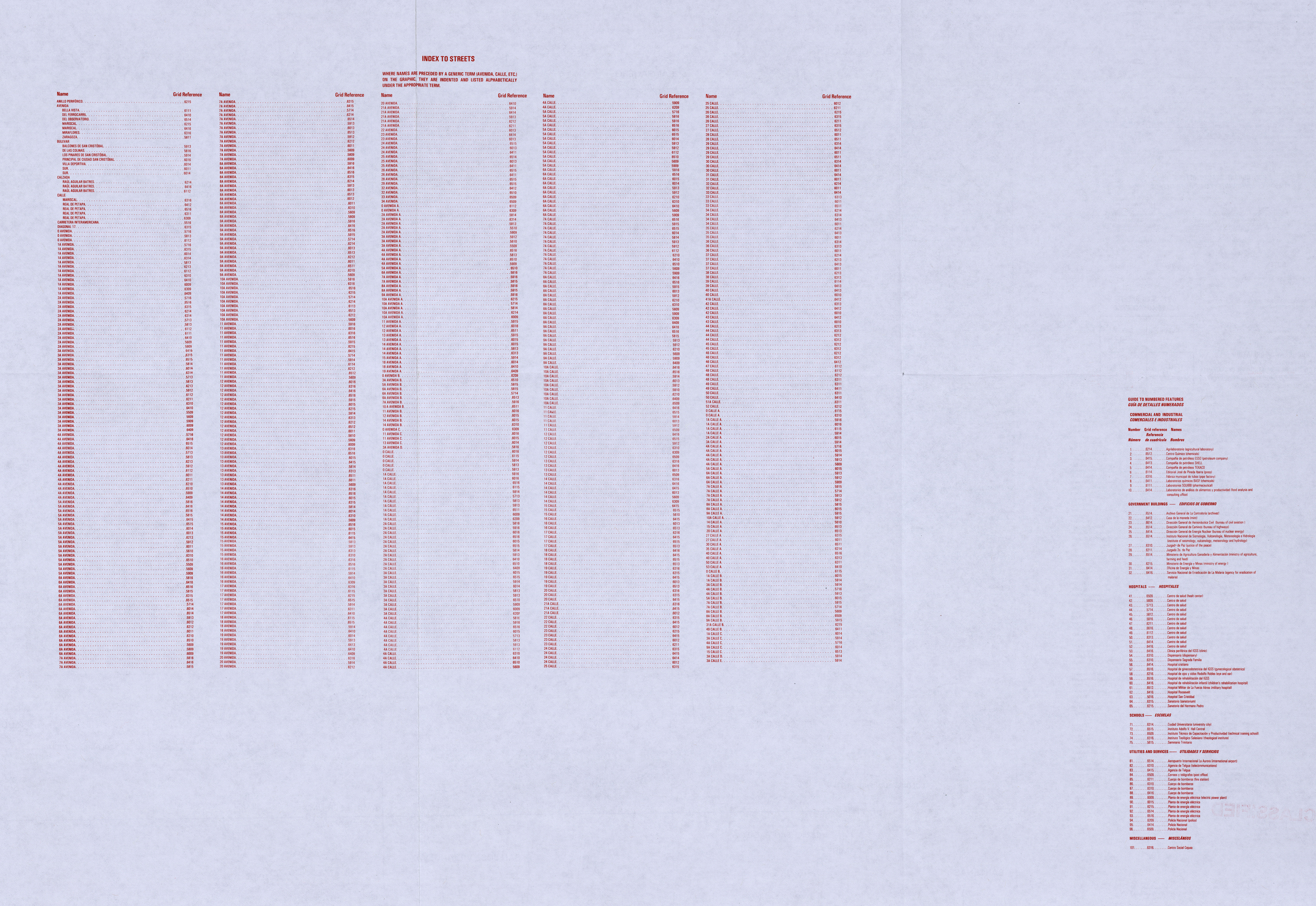
- Guatemala City, Sheet 4 1:15,000, Edition 3-NIMA, Series E954. National Imagery and Mapping Agency, 1996 [small] (7.7MB)
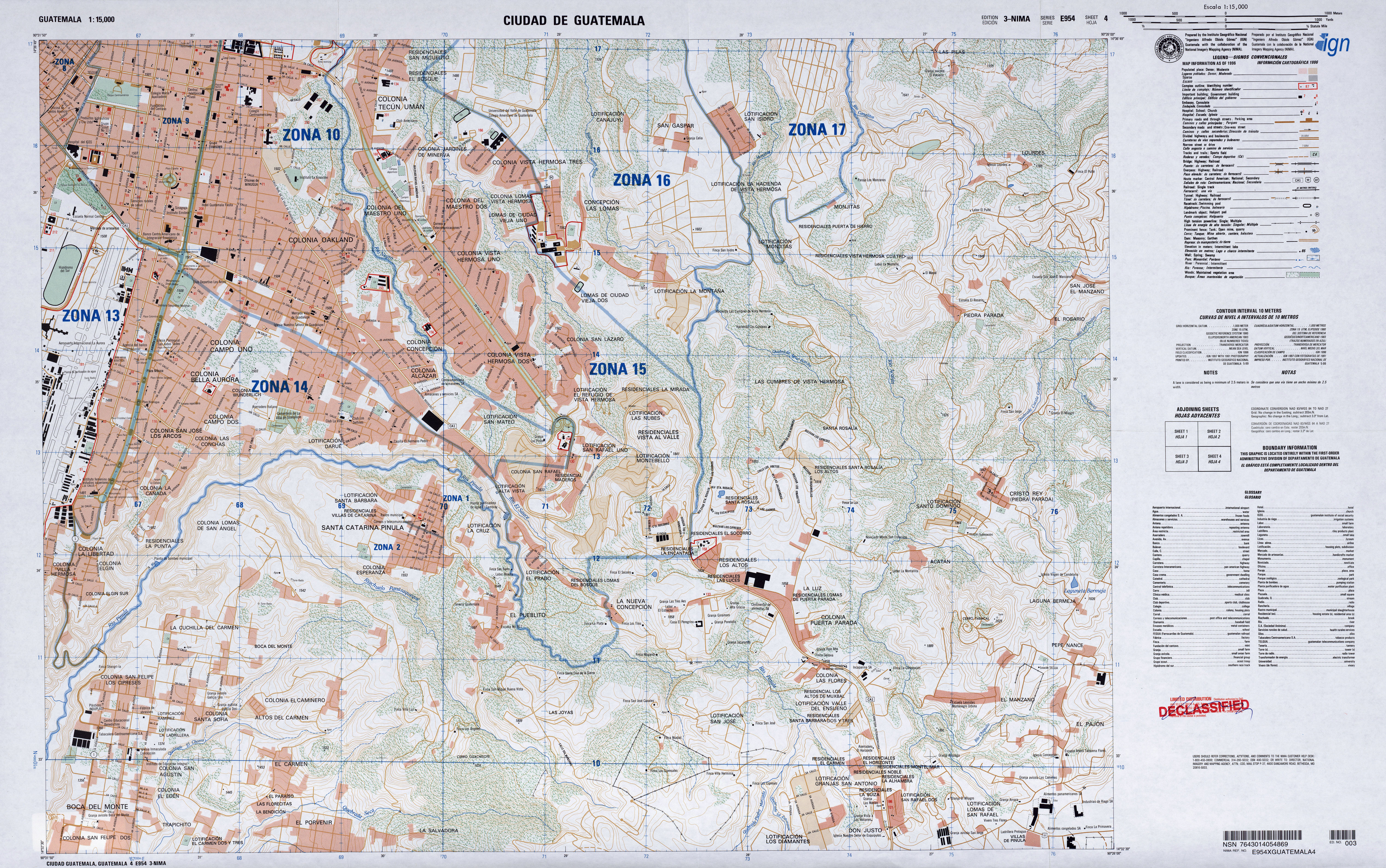
- Guatemala City, Sheet 4 1:15,000, Edition 3-NIMA, Series E954. National Imagery and Mapping Agency, 1996 (19MB)
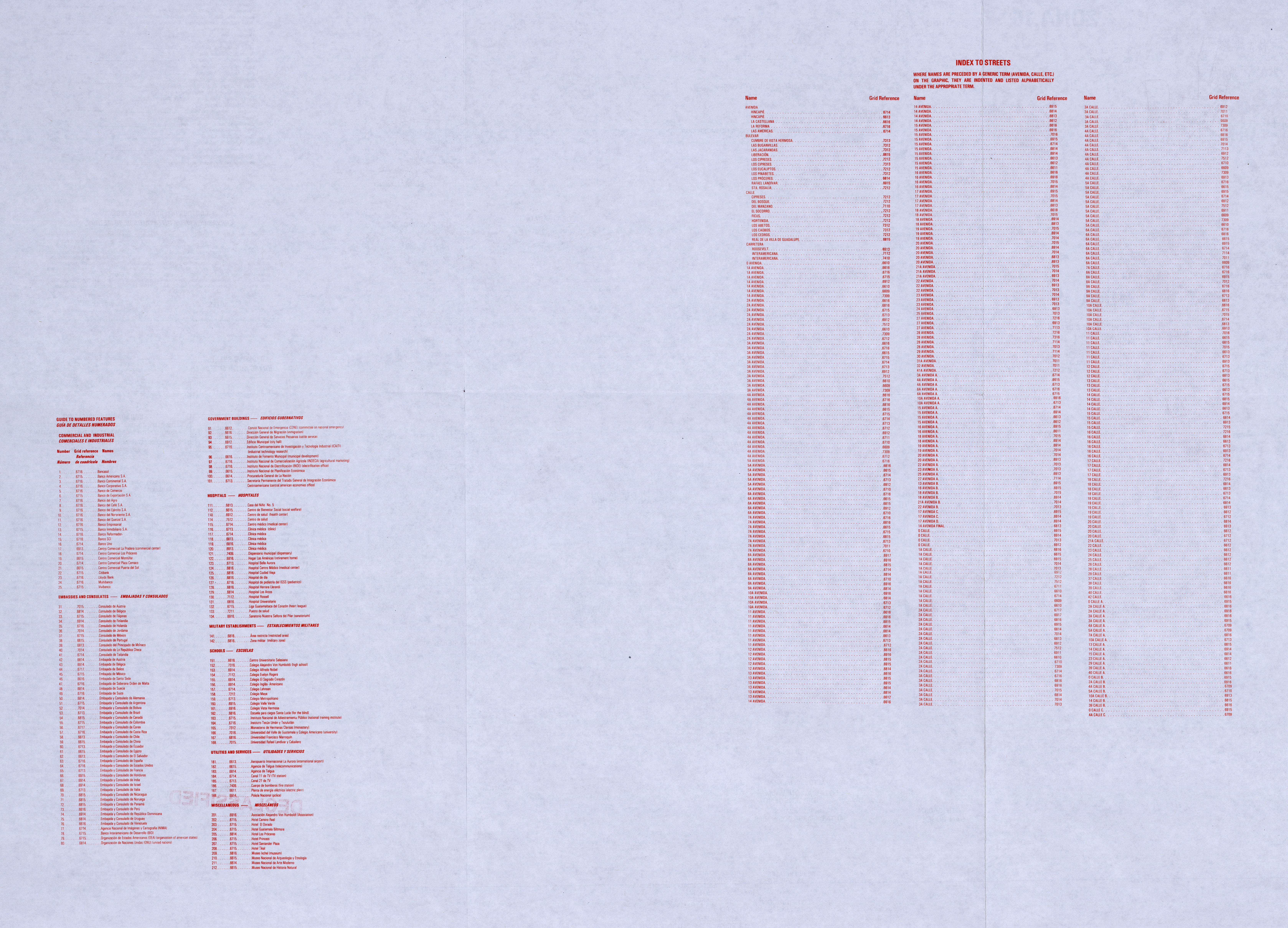
- Guatemala City, Sheet 4 Edition 3-NIMA, Series E954. National Imagery and Mapping Agency, 1996 [verso] (5.8MB)
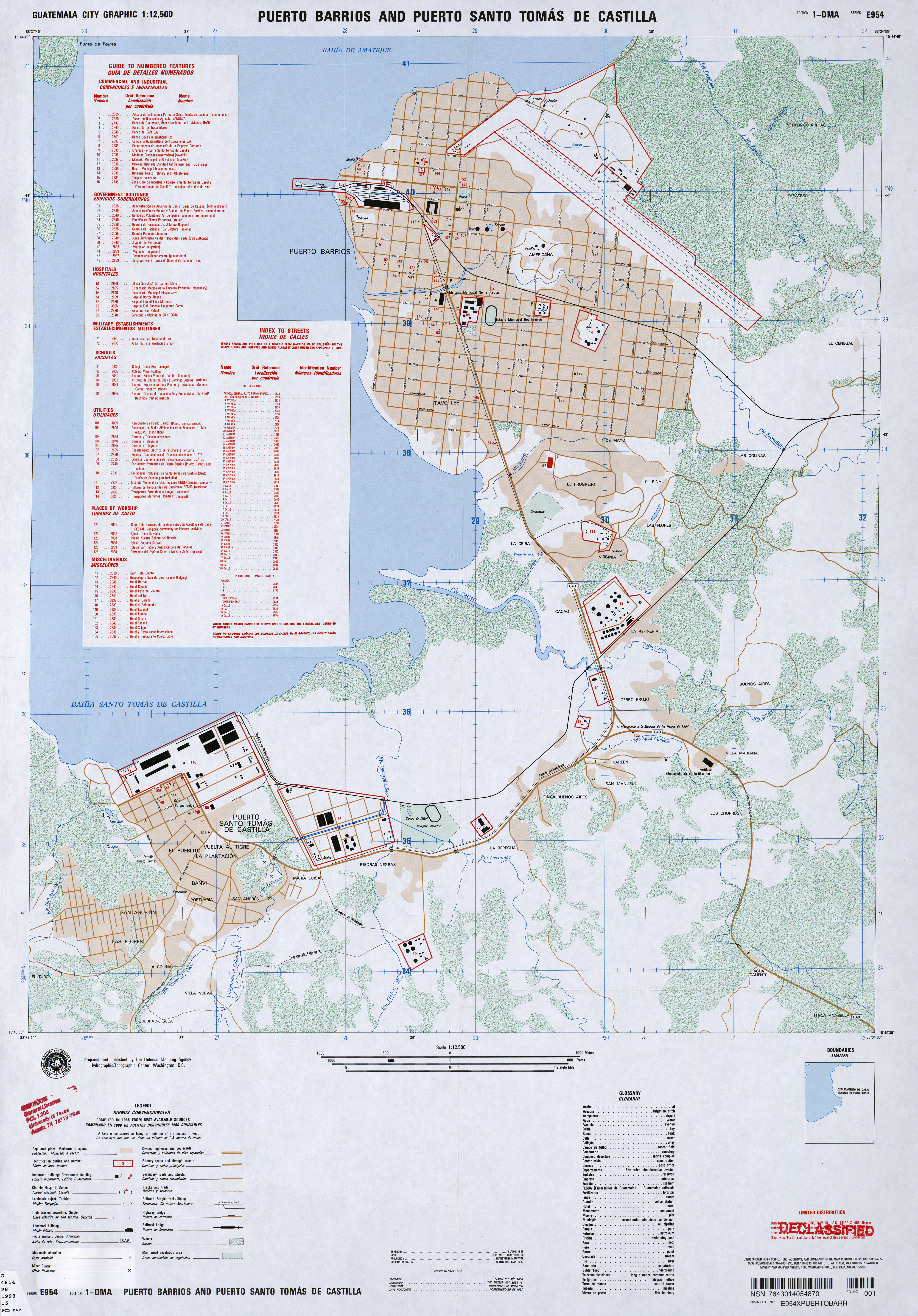
- Puerto Barrios and Puerto Santo Tomas de Castilla 1:12,500, Edition 1-DMA, Series E954, Defense Mapping Agency, 1986 (5.7MB)
- 1:1,000,000 - Latin America (aeronautical charts) Operational Navigation Chart Series, U.S. Defense Mapping Agency (dates vary) clickable index map for this series Not for navigational use
- Sheets J-25 and K-25 all of Guatemala
- 1:500,000 - Tactical Pilotage Charts U.S. National Imagery and Mapping Agency. Not for navigational use
- This series covers Guatemala
- 1:250,000 - Latin America (aeronautical charts) Joint Operations Graphic, U.S. National Imagery and Mapping Agency (dates vary) Not for navigational use
- This series covers most of Guatemala
- 1:50,000 - Guatemala U.S. National Imagery and Mapping Agency, Series E754
- This series covers most western Guatemala and some other parts of the country
- Sheets J-25 and K-25 all of Guatemala
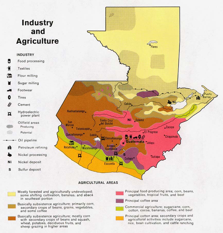
- Guatamala - Industry and Agriculture from Map No. 504829 1983 (161K)
- Guatemala - Internal Migration from Map No. 504829 1983 (108K)
- Guatemala - Population from Map No. 504829 1983 (115K)
- Honduras, El Salvador, Guatemala - Unaccompanied Children by Location Department of Homeland Security, 2014 (1.4MB) [PDF format]
Maps on Other Web Sites