Perry-Castañeda Library
Map Collection
Denmark Maps
The following maps were produced by the U.S. Central Intelligence Agency, unless otherwise indicated.
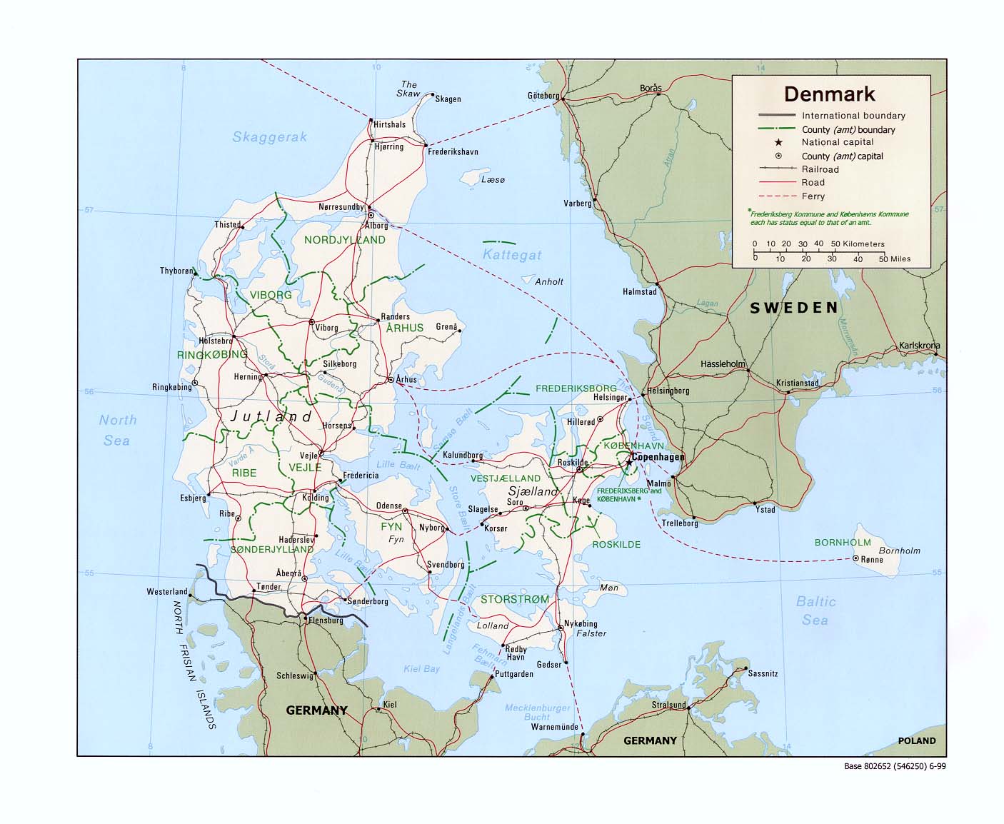
Denmark Maps- Denmark (Political) 1999 (195K) and pdf format (198K)
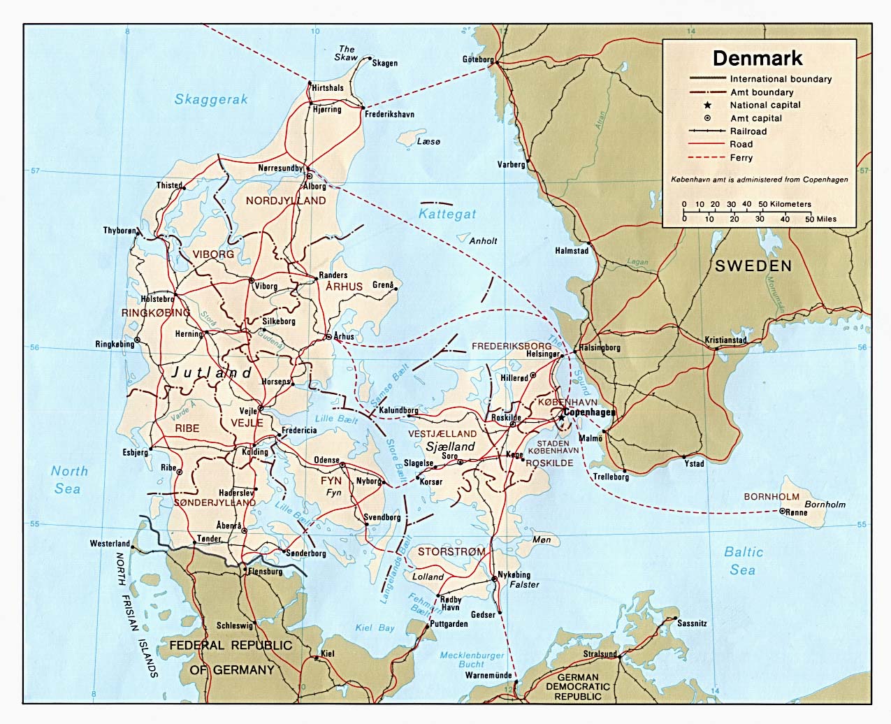
- Denmark (Political) 1981 (253K)and pdf format (257K)
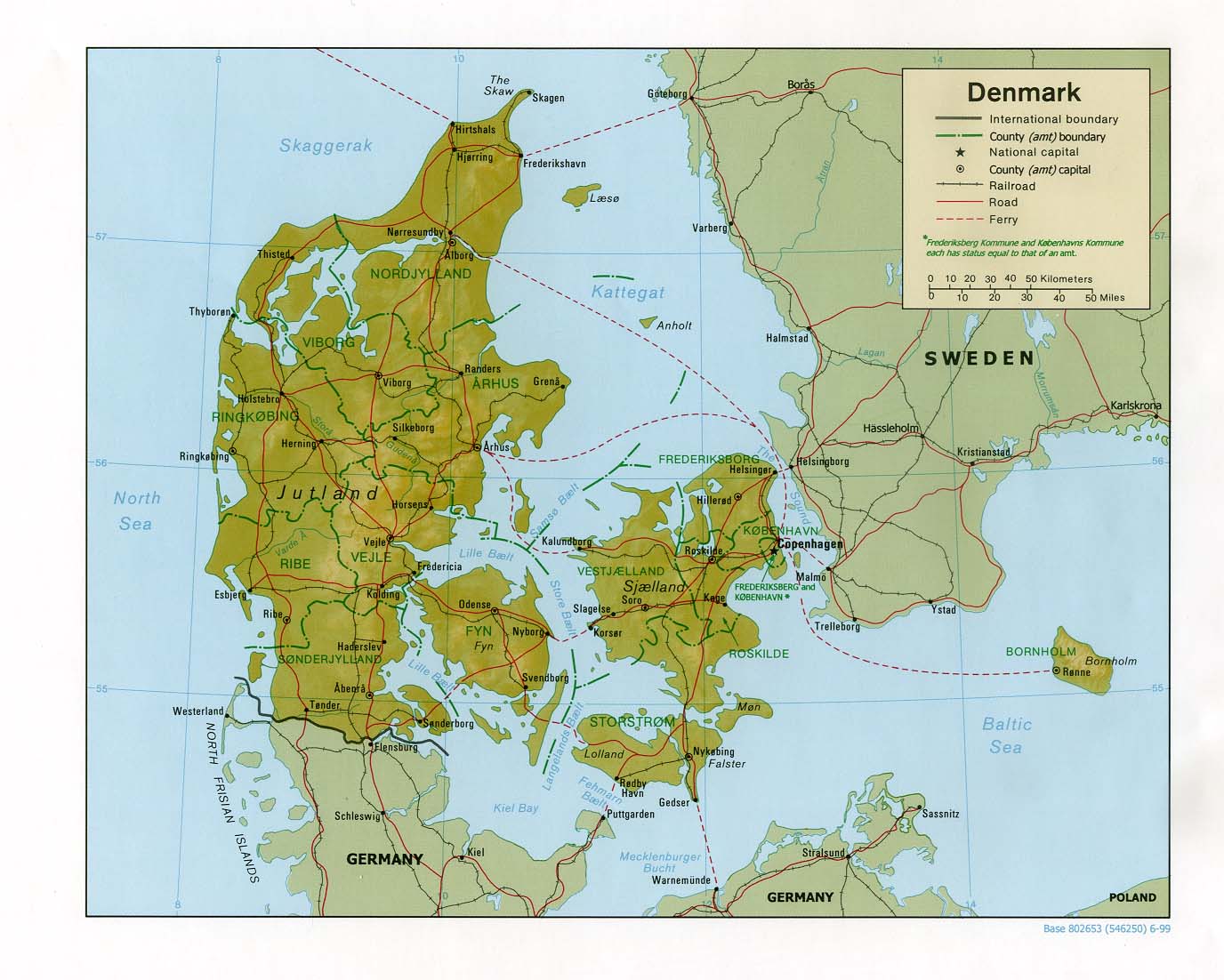
- Denmark (Shaded Relief) 1999 (191K) and pdf format (204K)
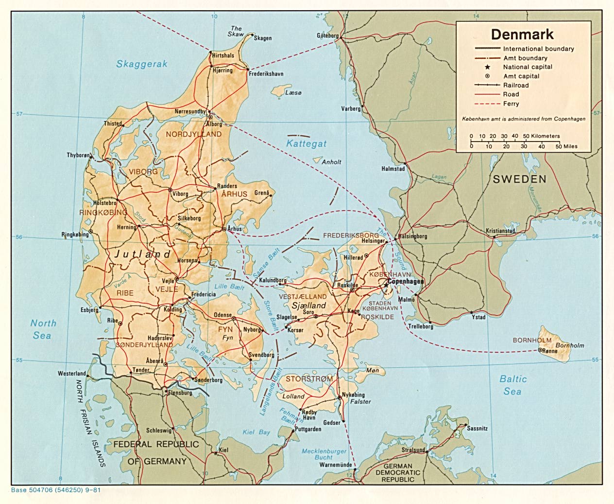
- Denmark (Shaded Relief) 1981 (235K)and pdf format (238K)
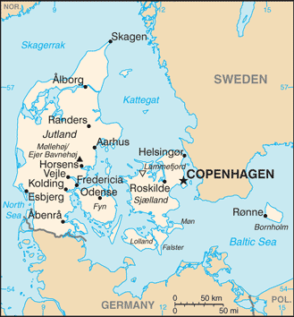
- Denmark (Small Map) 2016 (8.4K)
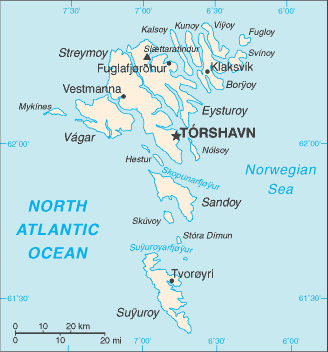
- Faroe Islands (Small Map) 2014 (10.9K)
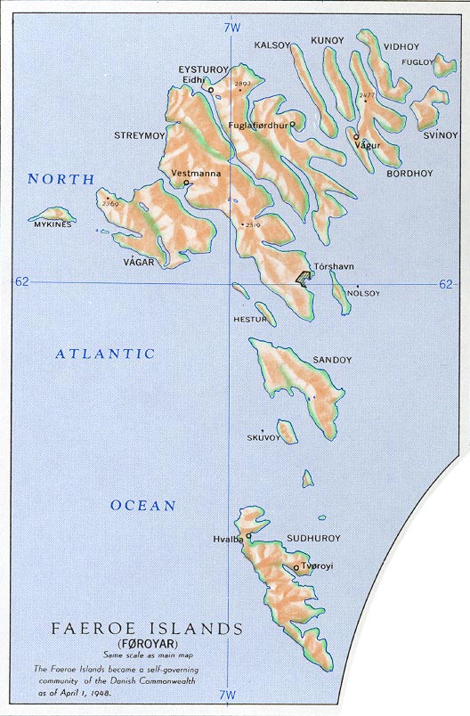
- Faroe Islands from Nuclear Weapons and NATO: Analytical Survey of Literature, United States. Department of the Army, 1970 (167K)
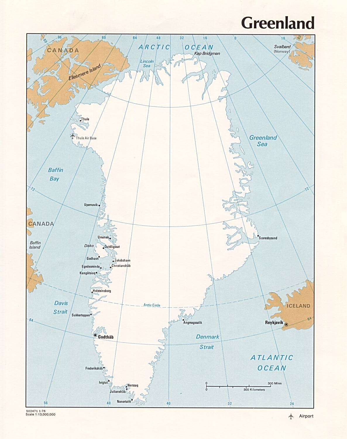
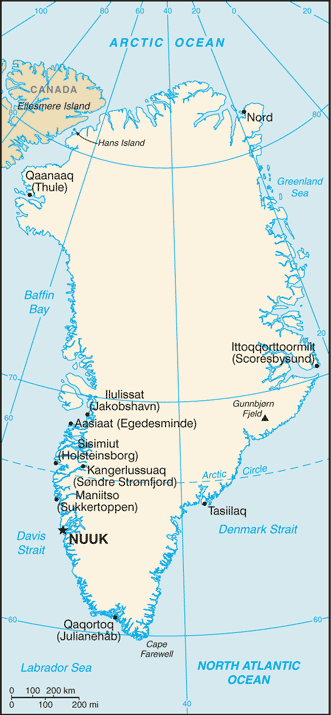
- Greenland (Political) 1976 (182K)
- Greenland (Small Map) 2014 (35.6K)
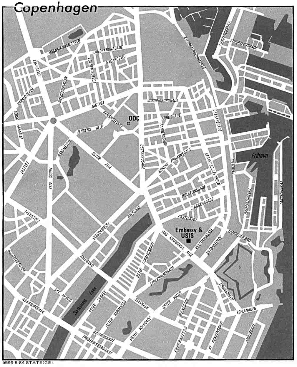
- Copenhagen U.S. Dept. of State 1984 (100K)
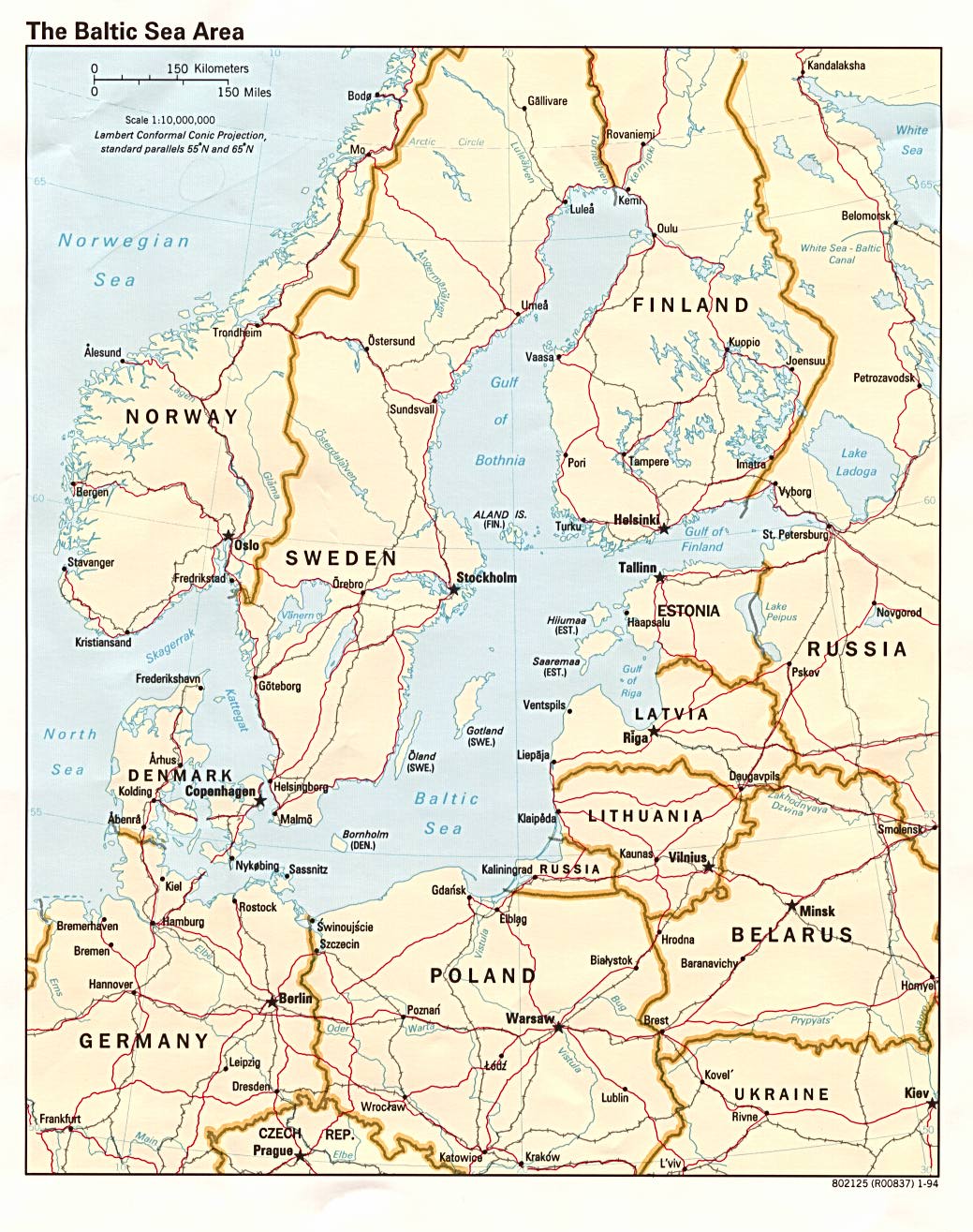
- Baltic Sea Area (Political) 1994 (276K)
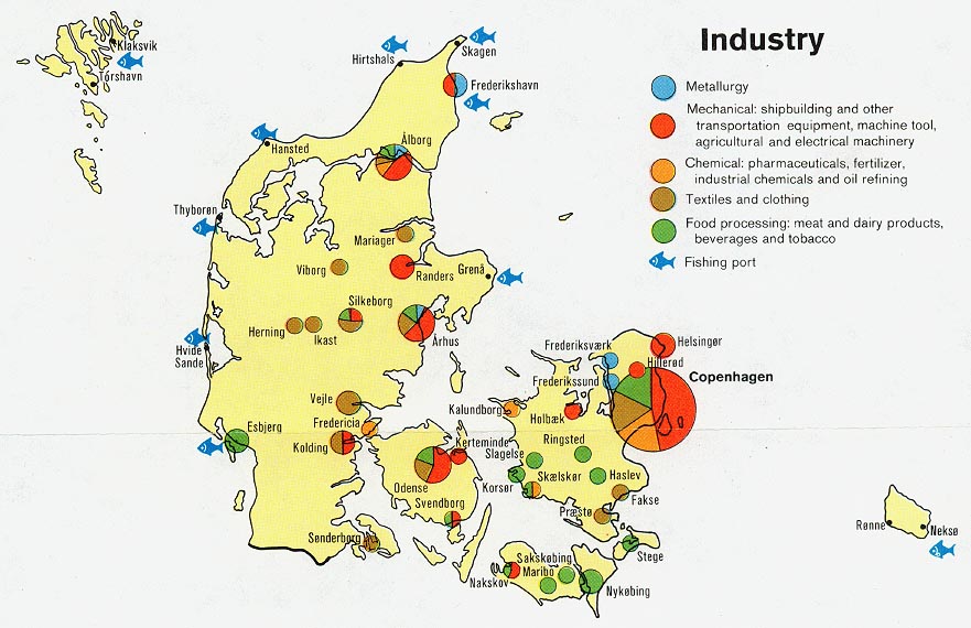
- Denmark - Industry from Map No. 501760 1974 (128K)
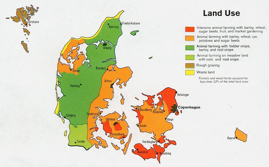
- Denmark - Land Use from Map No. 501760 1974 (131K)
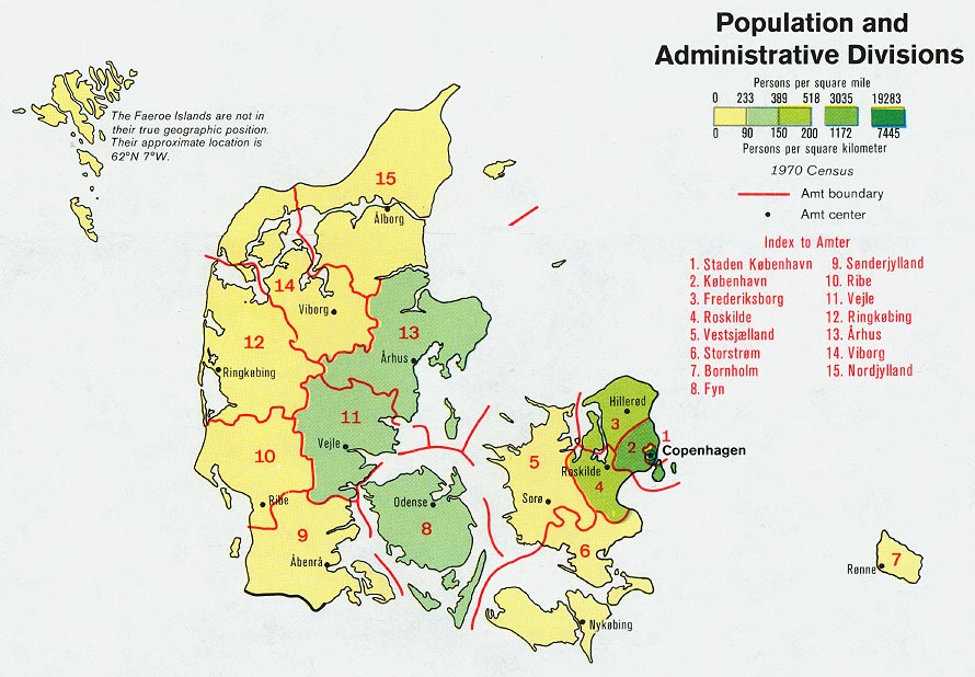
- Denmark - Population and Administrative Divisions from Map No. 501760 1974 (136K)
- 1:1,000,000 - Operational Navigation Chart Series [aeronautical charts] U.S. Defense Mapping Agency Aerospace Center Not for navigational use
- This series covers all of Denmark on sheets D-2 and E-2
- 1:1,000,000 - International Map of the World
- This series covers part of southern Denmark. Clickable map
- 1:500,000 - Europe Series M404 (4072), Great Britain War Office, 1942-
- This series covers all of Denmark
- 1:500,000 - Tactical Pilotage Charts U.S. National Imagery and Mapping Agency. Not for navigational use
- This series covers Denmark
- 1:500,000 - World Series 1404, Great Britain. War Office and Air Ministry. 1958-
- This series covers all of Denmark
- 1:250,000 - Northern Europe Series M515, U.S. Army Map Service. 1951-
- This series covers most of Denmark
- This series covers all of Denmark on sheets D-2 and E-2
Maps on Other Web Sites