Perry-Castañeda Library
Map Collection
Dagestan Maps
The following maps were produced by the U.S. Central Intelligence Agency, unless otherwise indicated.
Administrative and Political Maps- Caucasus Region U.S.Department of State 1994 (1.2MB)
- Russia: Administrative Divisions 1994 (225K)
- Russia: Administrative Divisions 1993 (317K)
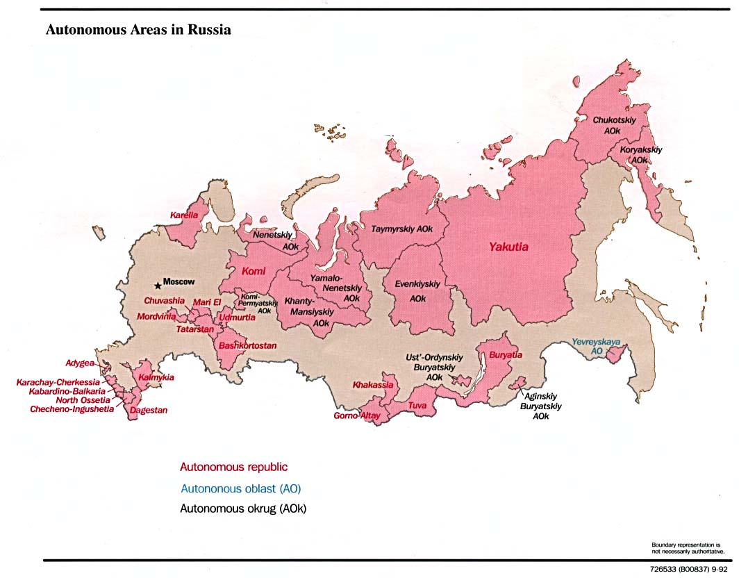
- Russia: Autonomous Areas 1996 (83K)
- Russia: Autonomous Areas 1992 (102K)
- [Caspian Region] Oil and Gas Infrastructure in the Caspian Sea Region 2012 (6.9MB)
- [Caspian Region] Oil and Gas Infrastructure in the Caspian Sea Region 2001 (2.5 MB)
- Caspian Region Oil Pipelines April 2002 (633K) [pdf format]
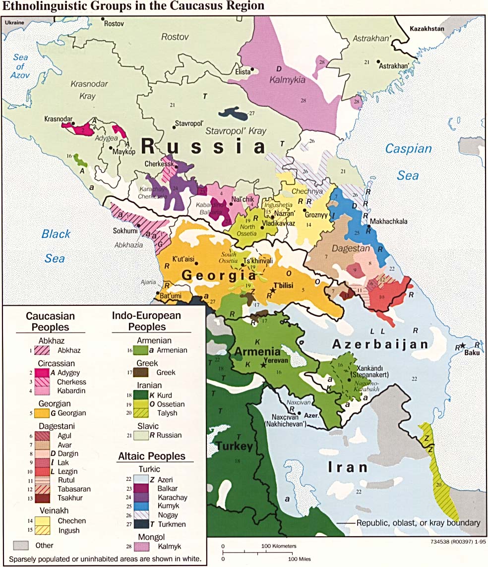
- Caucasus Region: Ethnolinguistic Groups 1995 (255K)
- Russia: Environmental Problem Areas 1998 (2.3MB) from Handbook of International Economic Statistics (CIA) [PDF Format]
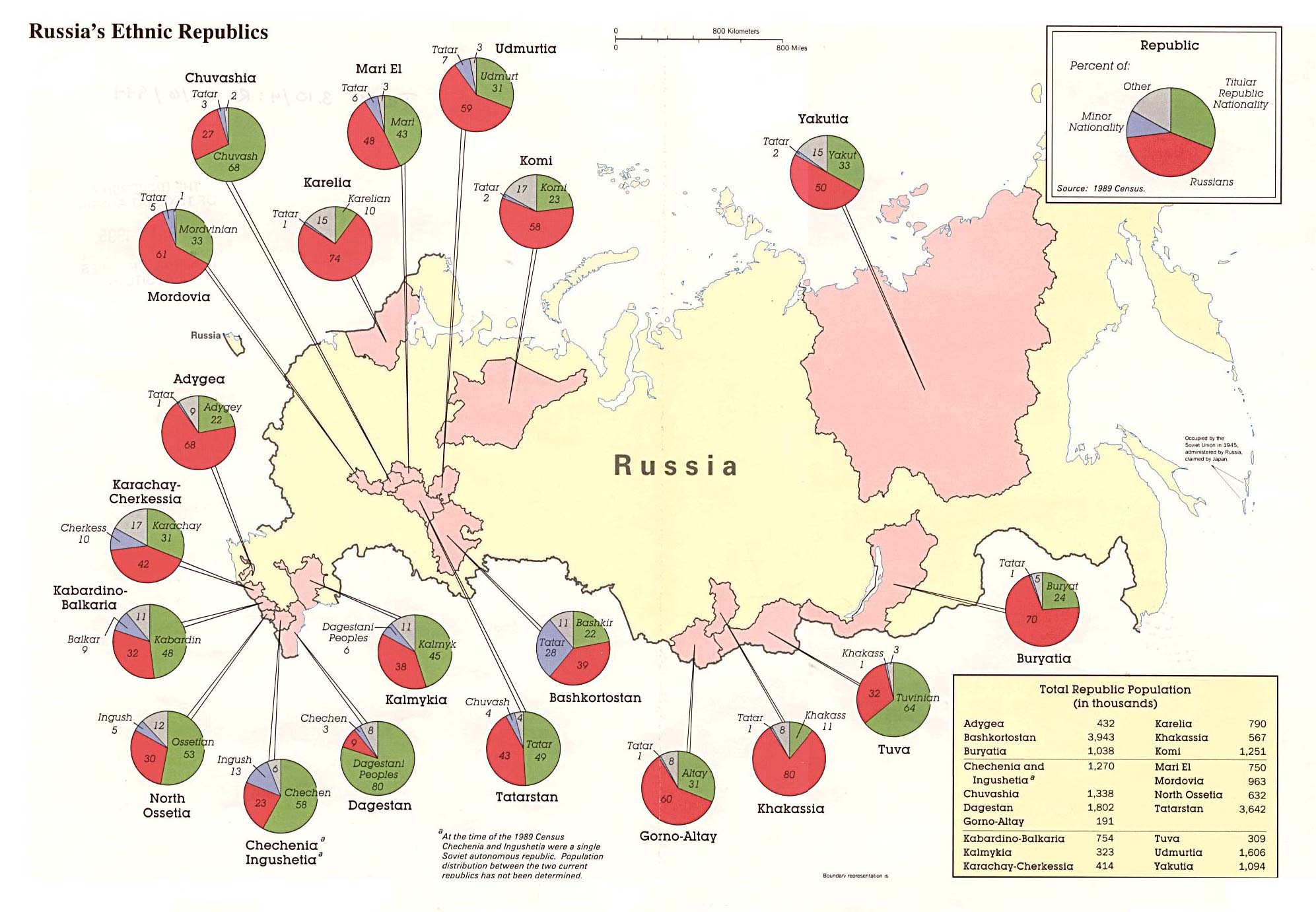
- Russia's Ethnic Republics 1994 (312K)
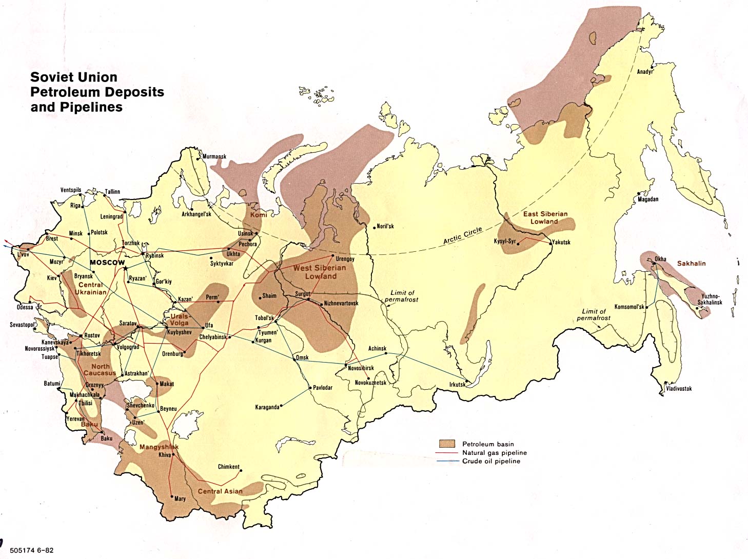
- Soviet Union Petroleum Deposits and Pipelines 1982 (206K)
![[Caspian Region] Oil and Gas Infrastructure in the Caspian Sea Region](middle_east_and_asia/txu-pclmaps-oclc-785323952-caspian_sea_oil_and_gas.jpg)
![[Caspian Region] Oil and Gas Infrastructure in the Caspian Sea Region](middle_east_and_asia/caspian_sea_oil_gas-2001.jpg)
- 1:1,000,000 - Operational Navigation Charts Series U.S. Defense Mapping Agency Aerospace Center Not for navigational use
- This series includes Dagestan on sheet F-4
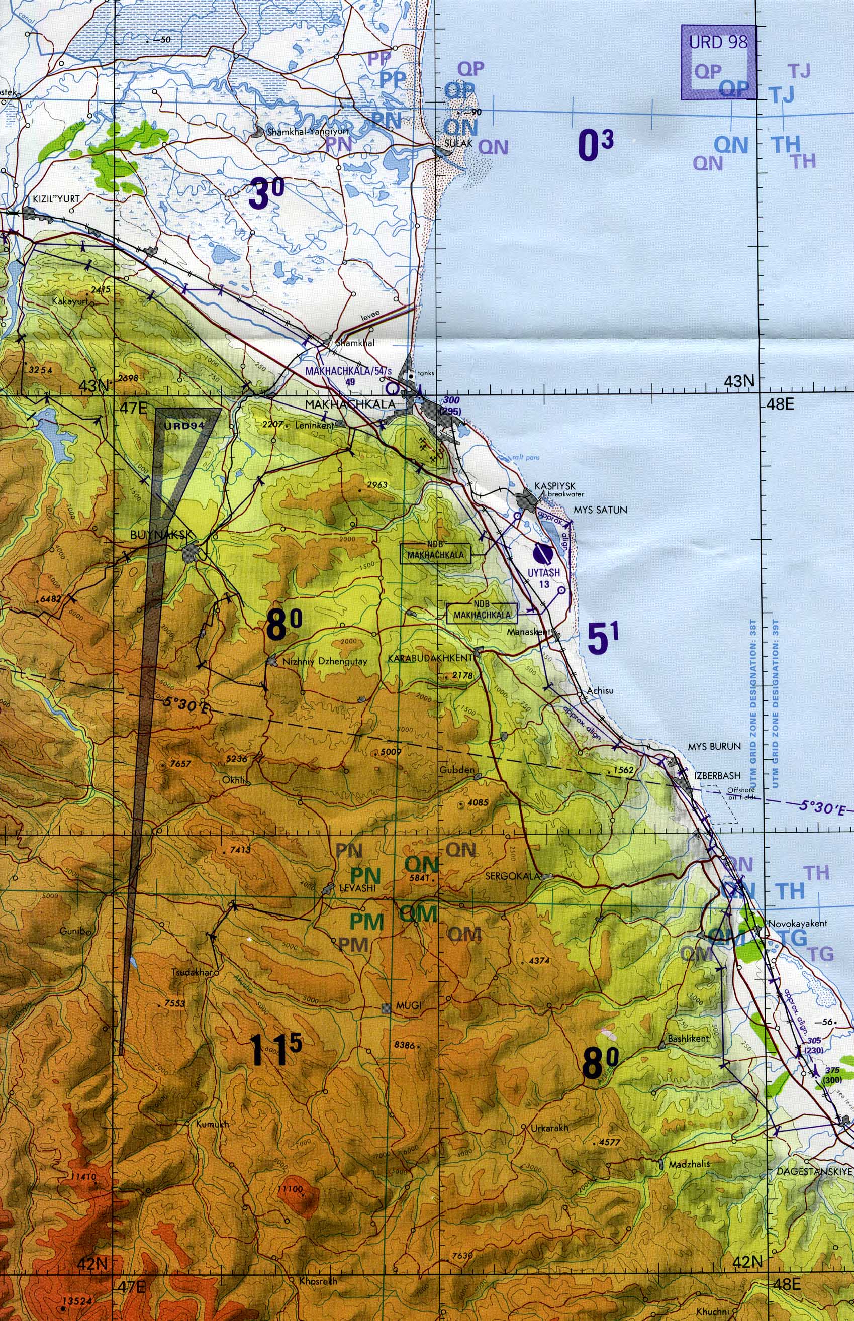
- 1:500,000 - Makhachkala 1996 (tactical pilotage chart) Portion of U.S. Defense Mapping Agency sheet TPC F-4C, 1:500,000 (884K) Not for navigational use
- 1:250,000 - Eastern Europe Topographic Maps U.S. Army Map Service Series N501, 1954-
- This series includes Dagestan
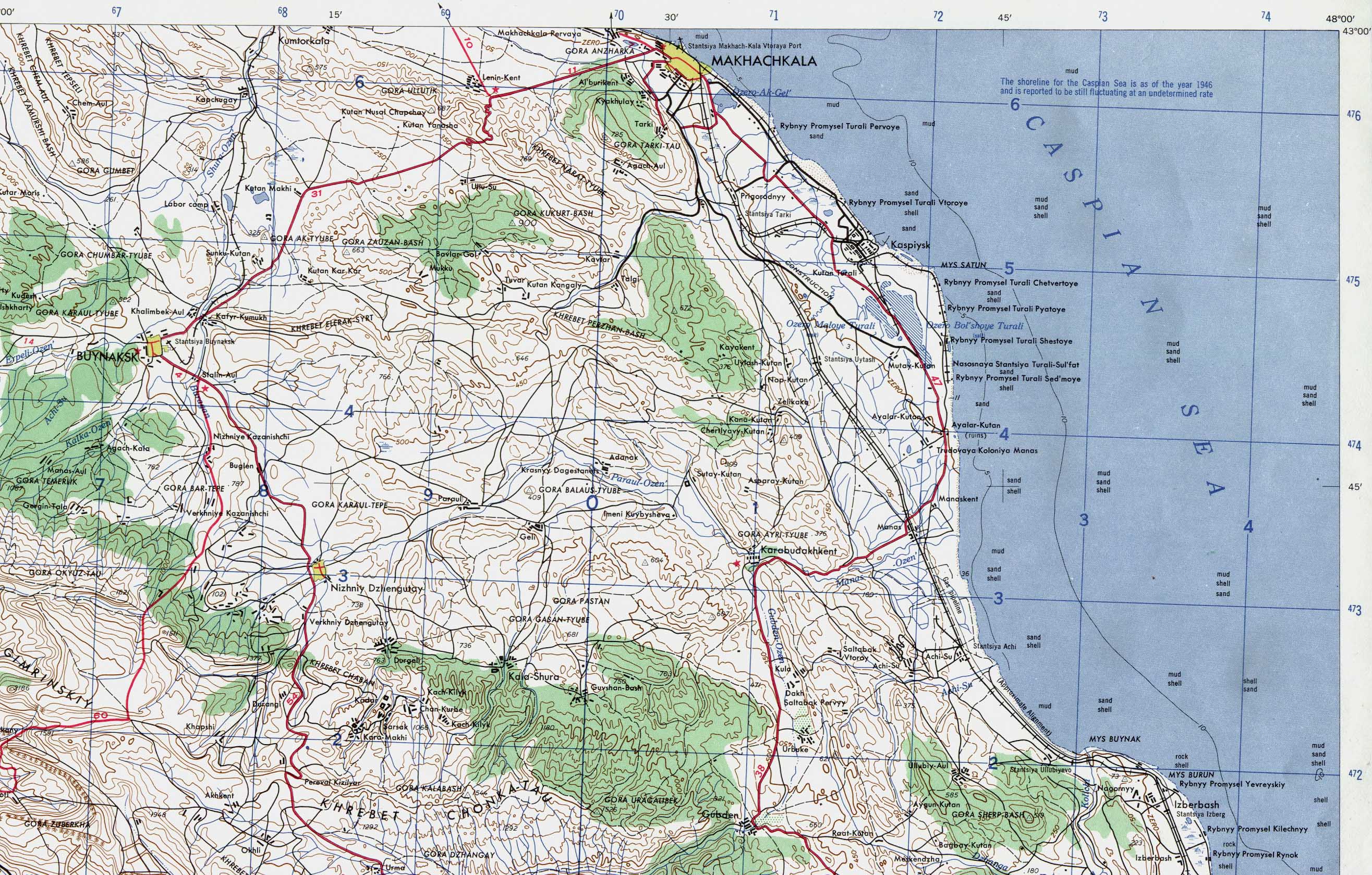
- 1:250,000 - Makhachkala 1958 (topographic) Portion of U.S. Army Map Service map, Series N501, sheet NK38-6, 1:250,000 (1MB) Full map is available in the Eastern Europe series above
- 1:250,000 - Joint Operations Graphic U.S. National Imagery and Mapping Agency Not for navigational use
- This series includes part of Dagestan
- This series includes Dagestan on sheet F-4
Maps on Other Web Sites