Perry-Castañeda Library
Map Collection
Benin Maps
The following maps were produced by the U.S. Central Intelligence Agency, unless otherwise indicated.
Country Maps- Benin (Physiography) 2007 (1.5MB) and pdf format (1.3MB)
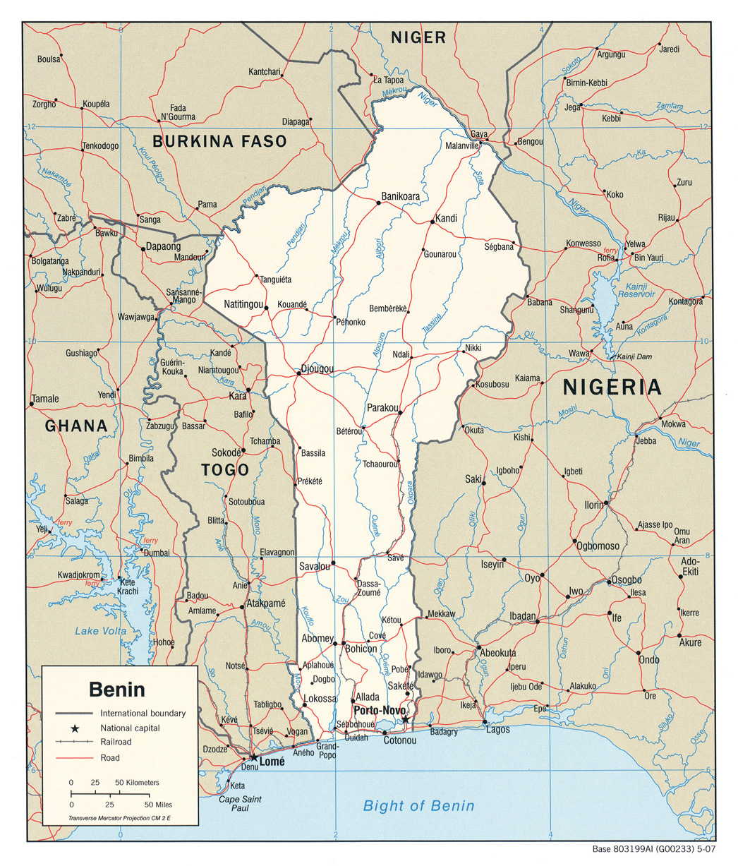
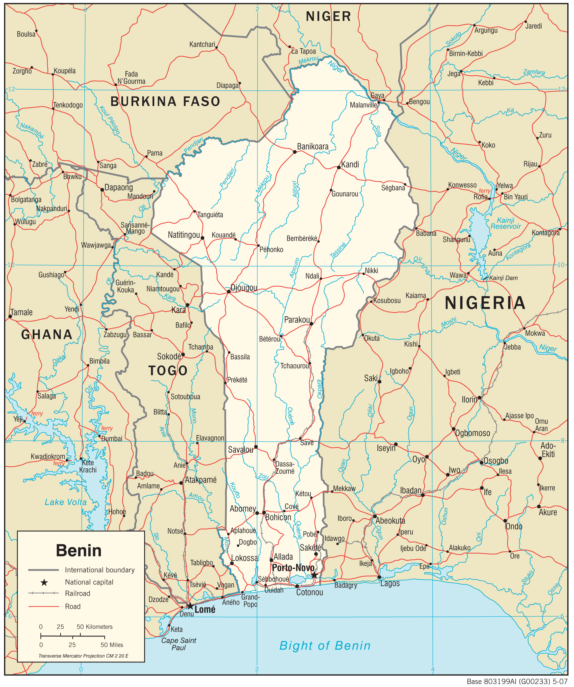
- Benin (Political) 2007 (776K) and pdf format (318K)
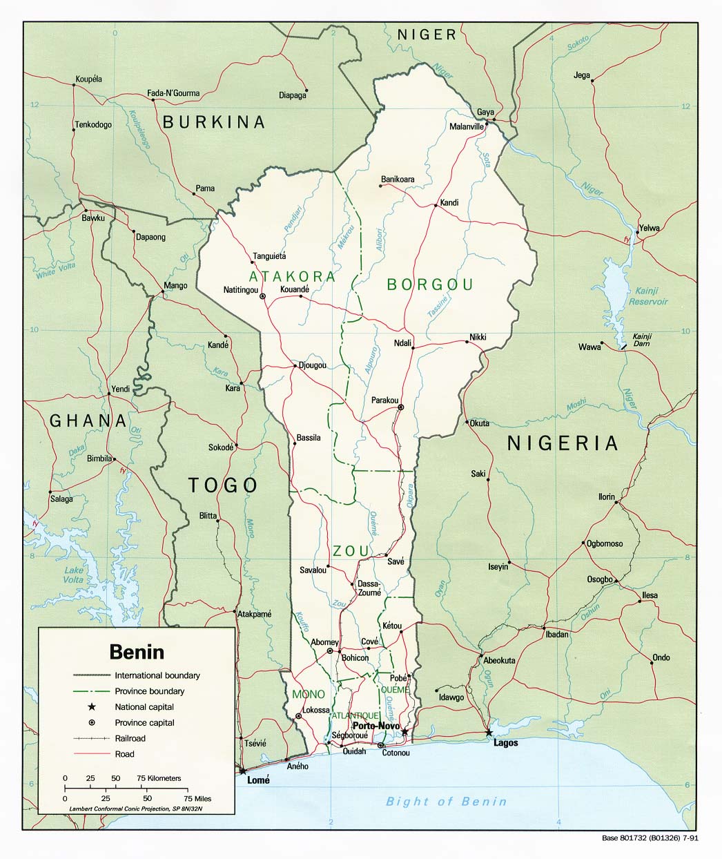
- Benin (Political) 1991 (193K) and pdf format (208K)
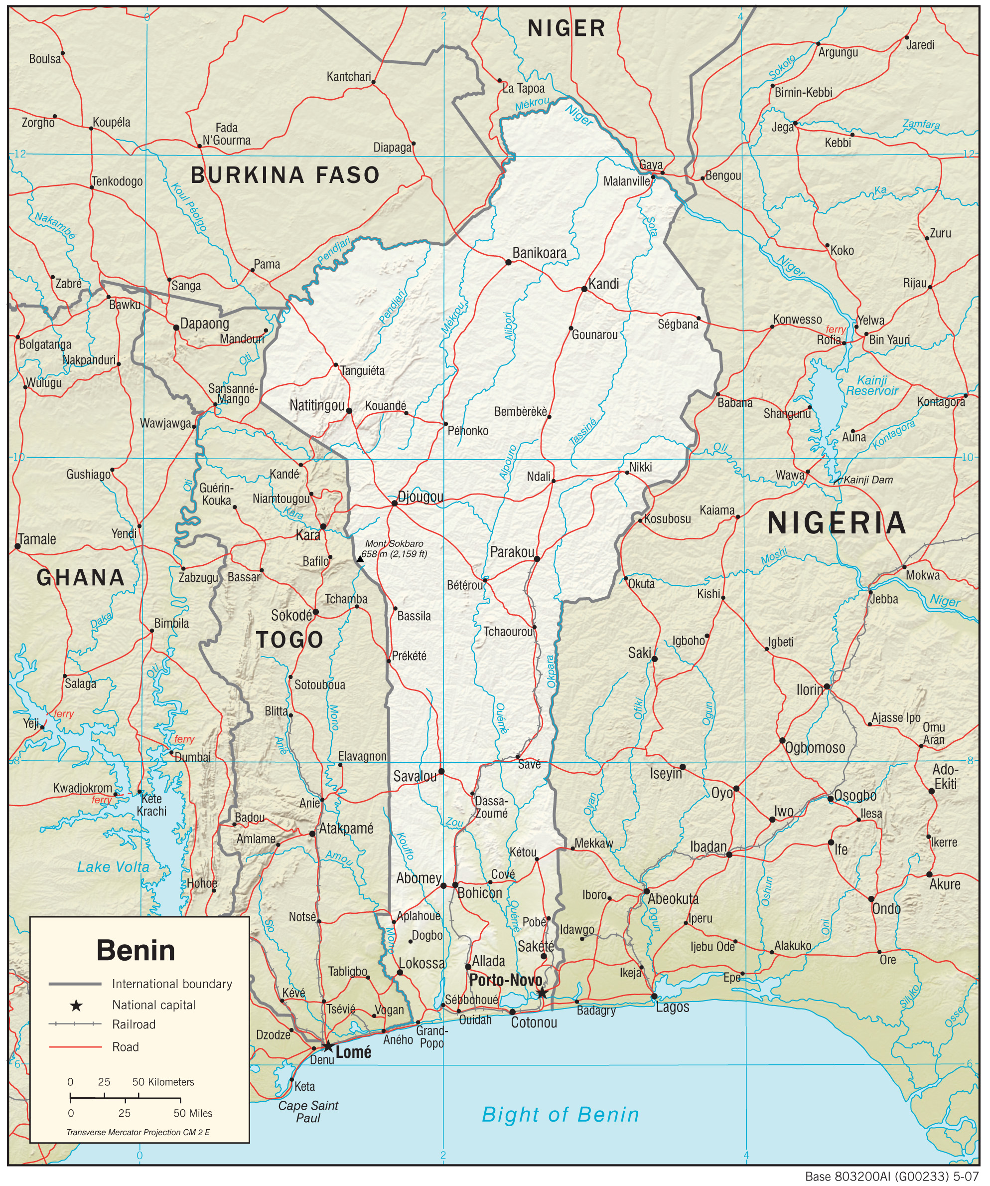
- Benin (Shaded Relief) 2007 (1.8MB) and pdf format (1.2MB)
- Benin (Shaded Relief) 1991 (219K)
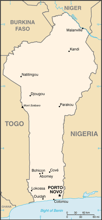
- Benin (Small Map) 2016 (14K)
- Benin (Transportation) 2007 (1.5MB) and pdf format (318K)
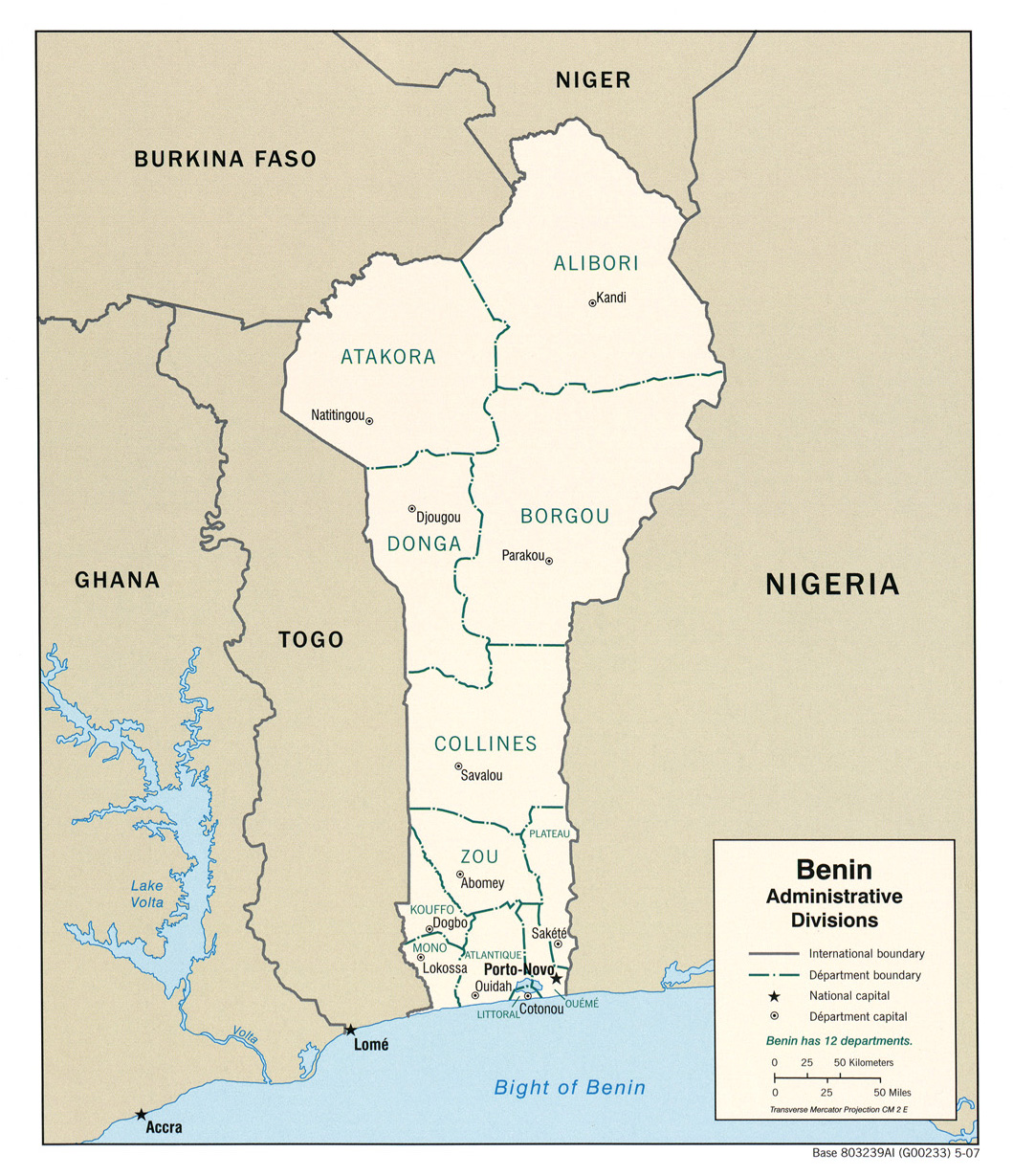
- Benin (Administrative Divisions) 2007 (493K) and pdf format (165K)
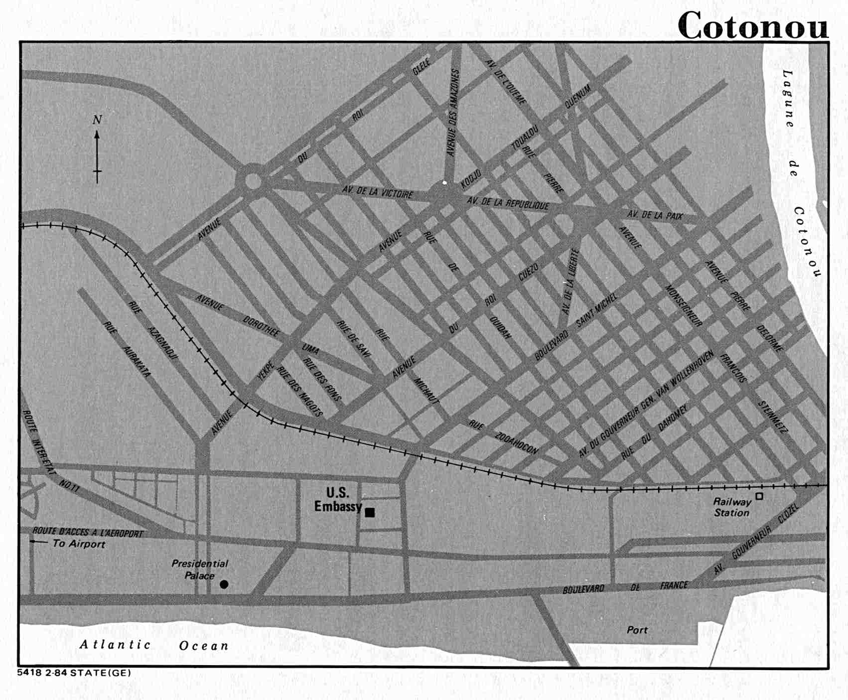
- Cotonou U.S. Dept. of State 1984 (116K)
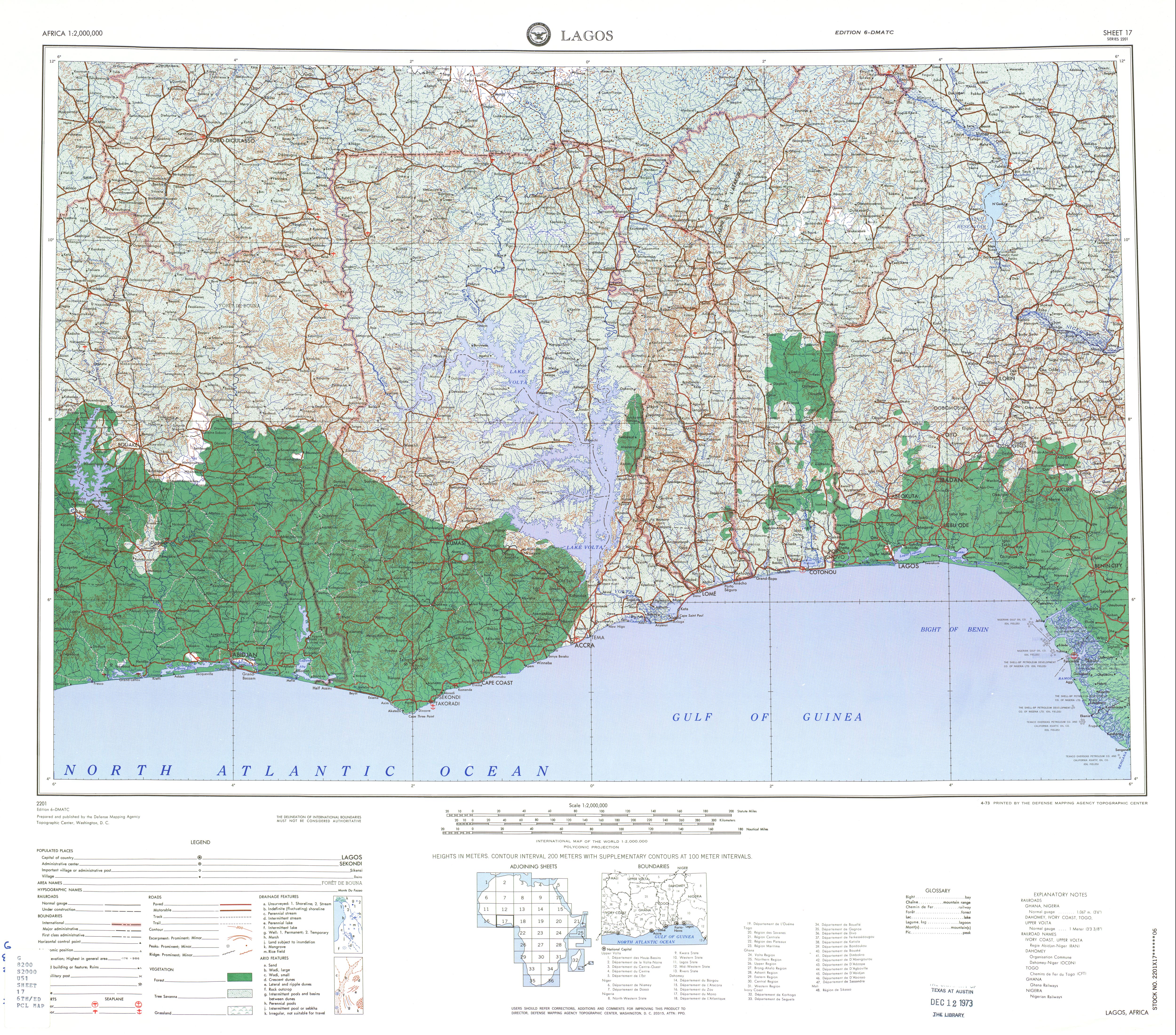
- 1:2,000,000 - Africa Topographic Maps
Series 2201, U.S. Army Map Service
- Sheet 17 includes most of Benin
- 1:1,000,000 - Operational Navigation Chart Series U.S. Defense Mapping Agency Aerospace Center. Not for navigational use
- Sheets K-2 and L-2 cover all of Benin
- 1:1,000,000 - International Map of the World U.S. Army Map Service
- Sheets NB 31 and NC 31 cover most of Benin (former Dahomey). Clickable map
- 1:500,000 - Tactical Pilotage Charts U.S. National Imagery and Mapping Agency. Not for navigational use
- This series covers Benin
- 1:250,000 - Abomey, Dahomey Joint Operations Graphic, Sheet NB 31-2, U.S. Army Map Service [GeoPDF] (10.8MB) Not for navigational use
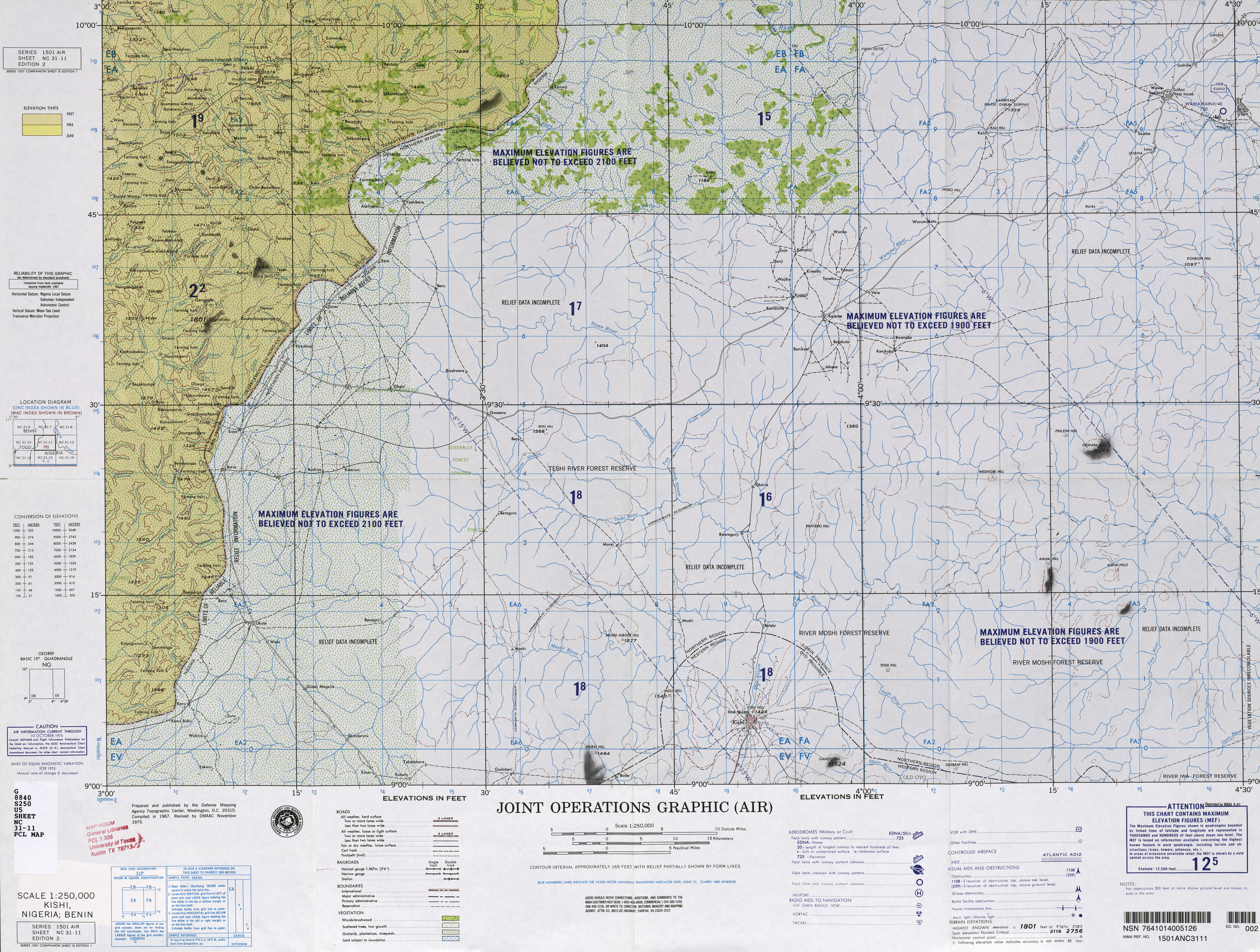
- 1:250,000 - Kishi, Nigeria; Benin Joint Operations Graphic, Sheet NC 31-11, U.S. Army Map Service (7.2MB) Not for navigational use
- Sheet 17 includes most of Benin
- Benin - Economic Acticity from Map No. 77258 1970 (95K)
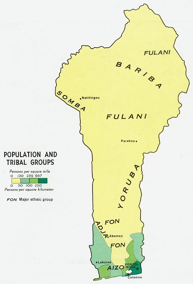
- Benin - Population and Tribal Groups from Map No. 77258 1970 (81K)
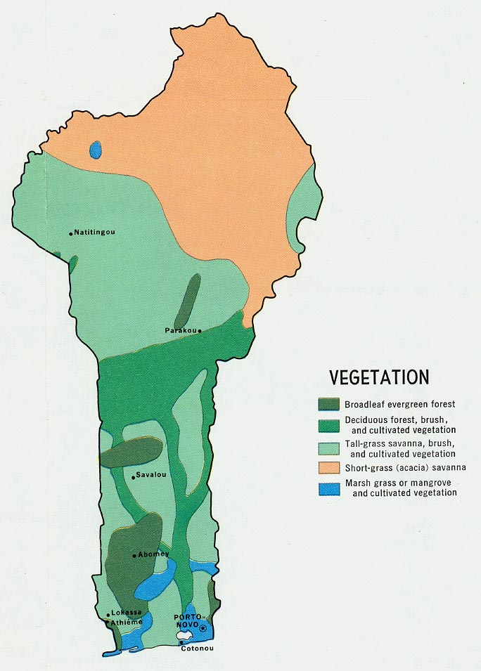
- Benin - Vegetation from Map No. 77258 1970 (120K)
Maps on Other Web Sites