Perry-Castañeda Library
Map Collection
Austria Maps
The following maps were produced by the U.S. Central Intelligence Agency, unless otherwise indicated.
Country Maps- Austria (Physiography) 2000 (2.8MB) and pdf format (3MB)
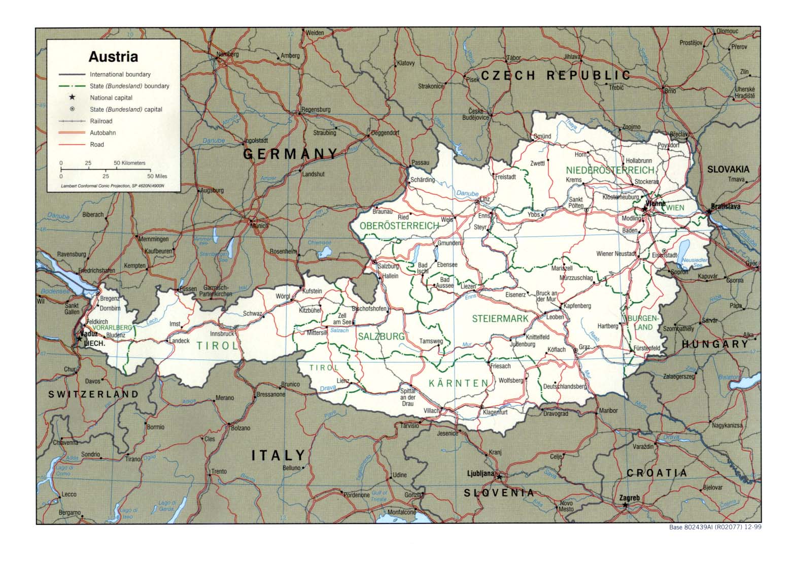
- Austria (Political) 1999 (387K) and pdf format (377K)
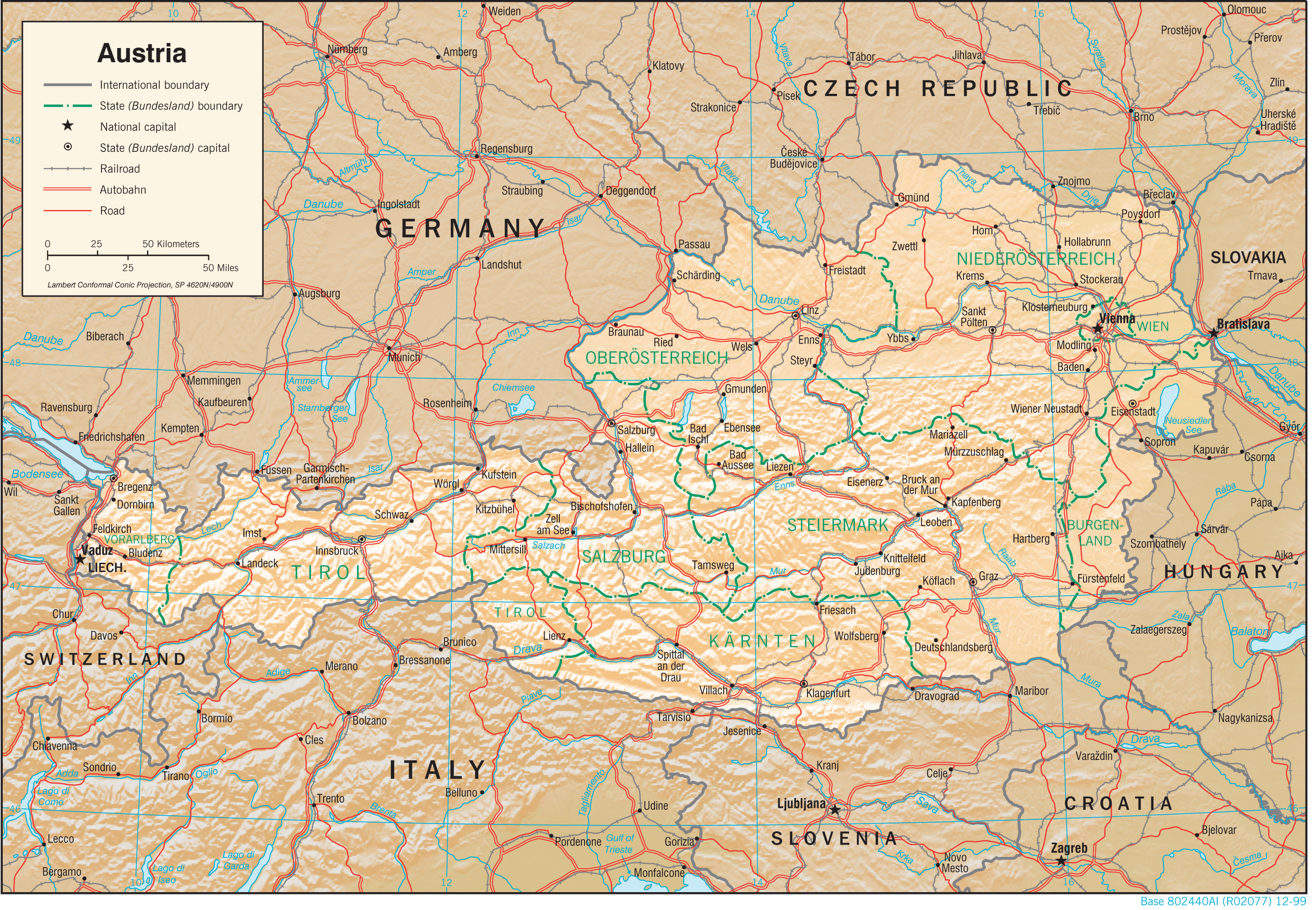
- Austria (Shaded Relief) 1999 (2.8MB) and pdf format (2.9MB)
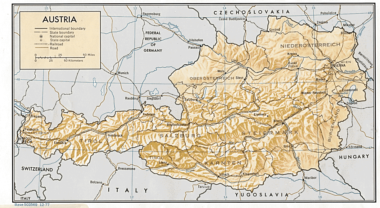
- Austria (Shaded Relief) 1977 (304K) and pdf format (323K)
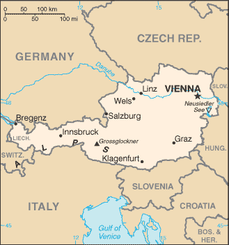
- Austria (Small Map) 2016 (20.8K)
- Austria (Transportation) 2000 (2.1MB) and pdf format (377K)
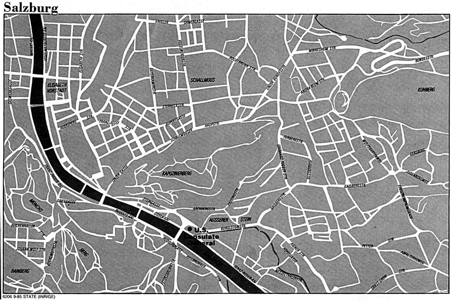
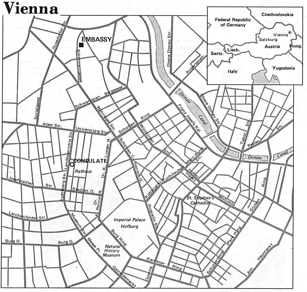
- Ischl [Bad Ischl] 1911 From Karl Baedeker's Autriche-Hongrie, 13th Edition, Paris 1911. (774K)
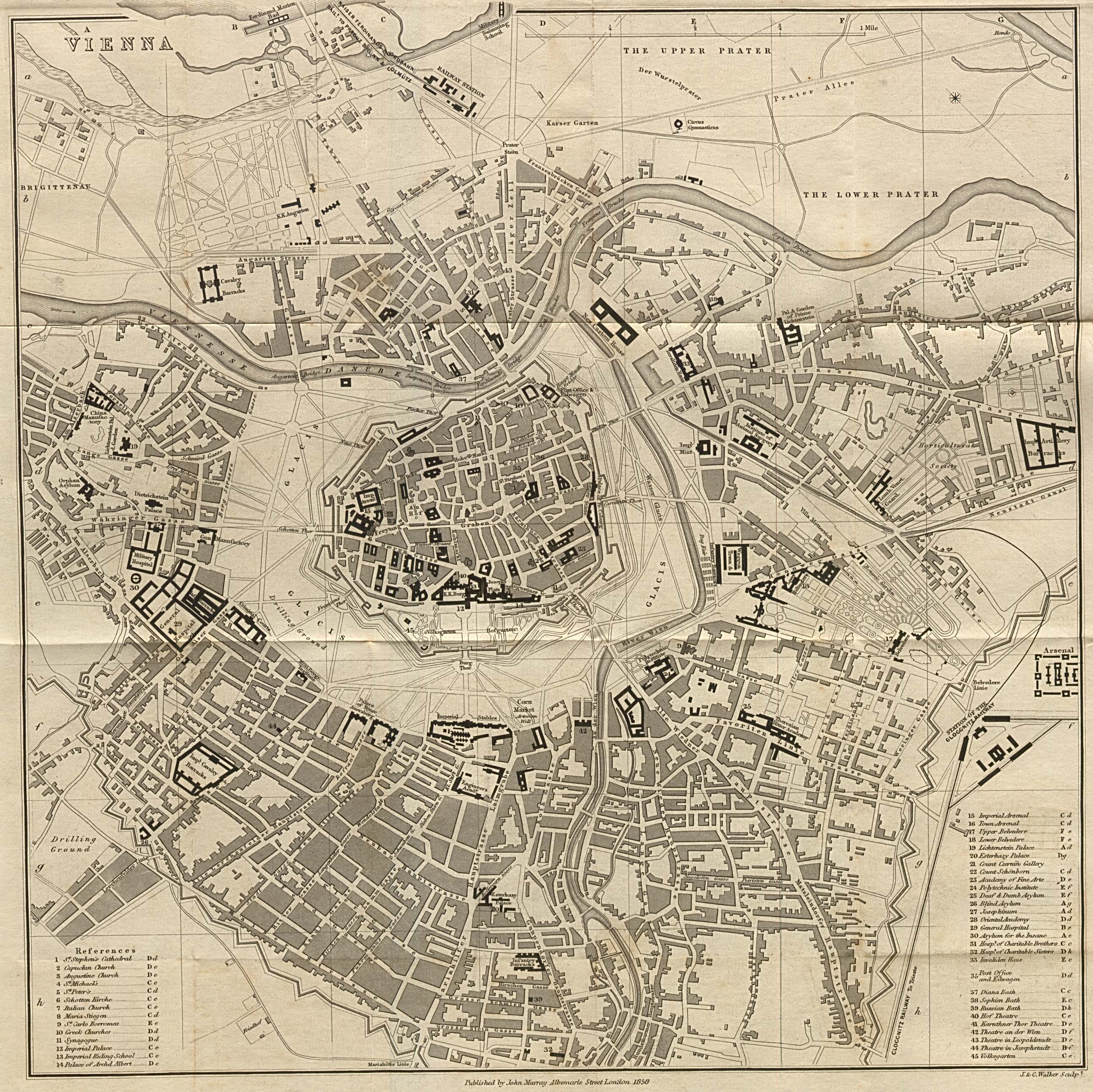
- Vienna 1858 From A Handbook for Travellers in Southern Germany, Eighth Edition. London: John Murray, 1858. (1.7MB)
![Ischl [Bad Ischl] 1911](historical/ischl_1911.jpg)
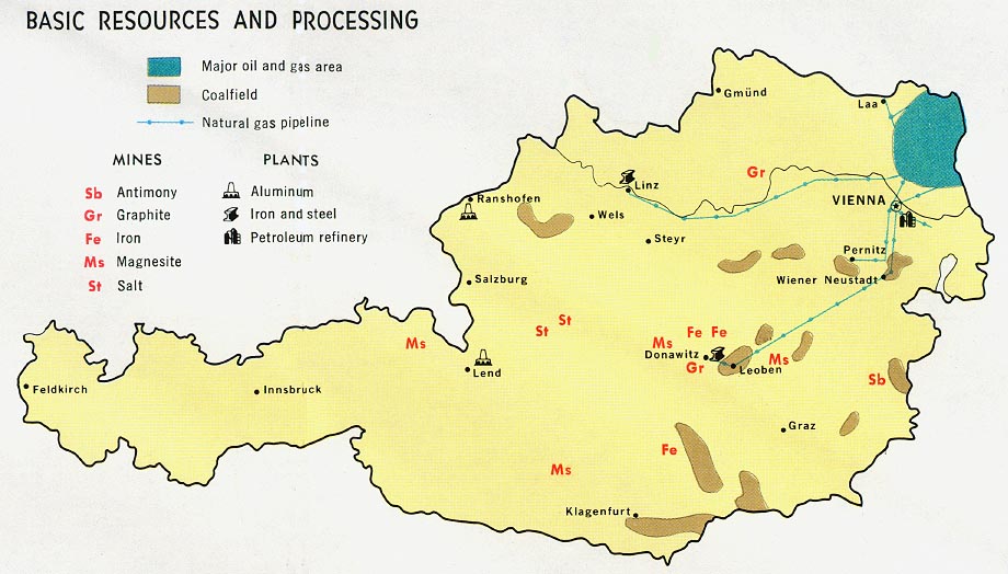
- Austria - Basic Resources and Processing from Map No. 77706 1969 (109K)
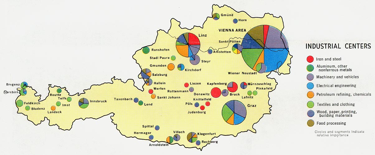
- Austria - Industrial Centers from Map No. 77706 1969 (135K)
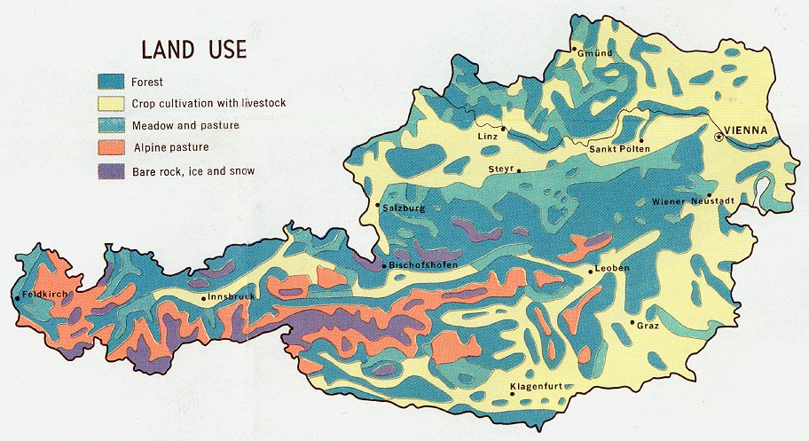
- Austria - Land Use from Map No. 77706 1969 (151K)
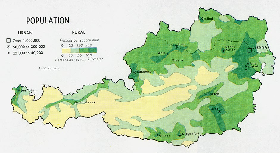
- Austria - Population from Map No. 77706 1969 (120K)
- 1:1,000,000 - International Map of the World
- This series covers parts of northern and western Austria
- 1:1,000,000 - Operational Navigation Chart Series [aeronautical charts] U.S. Defense Mapping Agency Aerospace Center [Not for navigational use]
- This series covers all of Austria on sheets E-2, E-3 and F-2
- 1:500,000 - Europe Series M404 (4072), Great Britain War Office, 1942-
- This series covers most of Austria
- 1:500,000 - Tactical Pilotage Charts U.S. National Imagery and Mapping Agency. [Not for navigational use]
- This series covers all of Austria
- 1:500,000 - World Series 1404, Great Britain. War Office and Air Ministry. 1958-
- This series covers all of Austria
- 1:250,000 - Western Europe Series M501, U.S. Army Map Service, 1959-
- This series covers most of Austria
- 1:250,000 - Joint Operations Graphic [Not for navigational use]
- This series covers part of southeast Austria
- 1:100,000 - Middle Danube, Series M671 U.S. Army Map Service, 1943-
- This series covers parts of northern and western Austria
Maps on Other Web Sites