Perry-Castañeda Library
Map Collection
United Arab Emirates Maps
The following maps were produced by the U.S. Central Intelligence Agency, unless otherwise indicated.
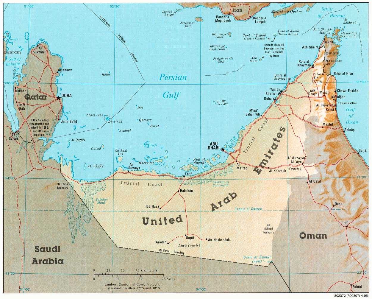
Country Maps- United Arab Emirates (Shaded Relief) 1995 (275K) and pdf format (275K)
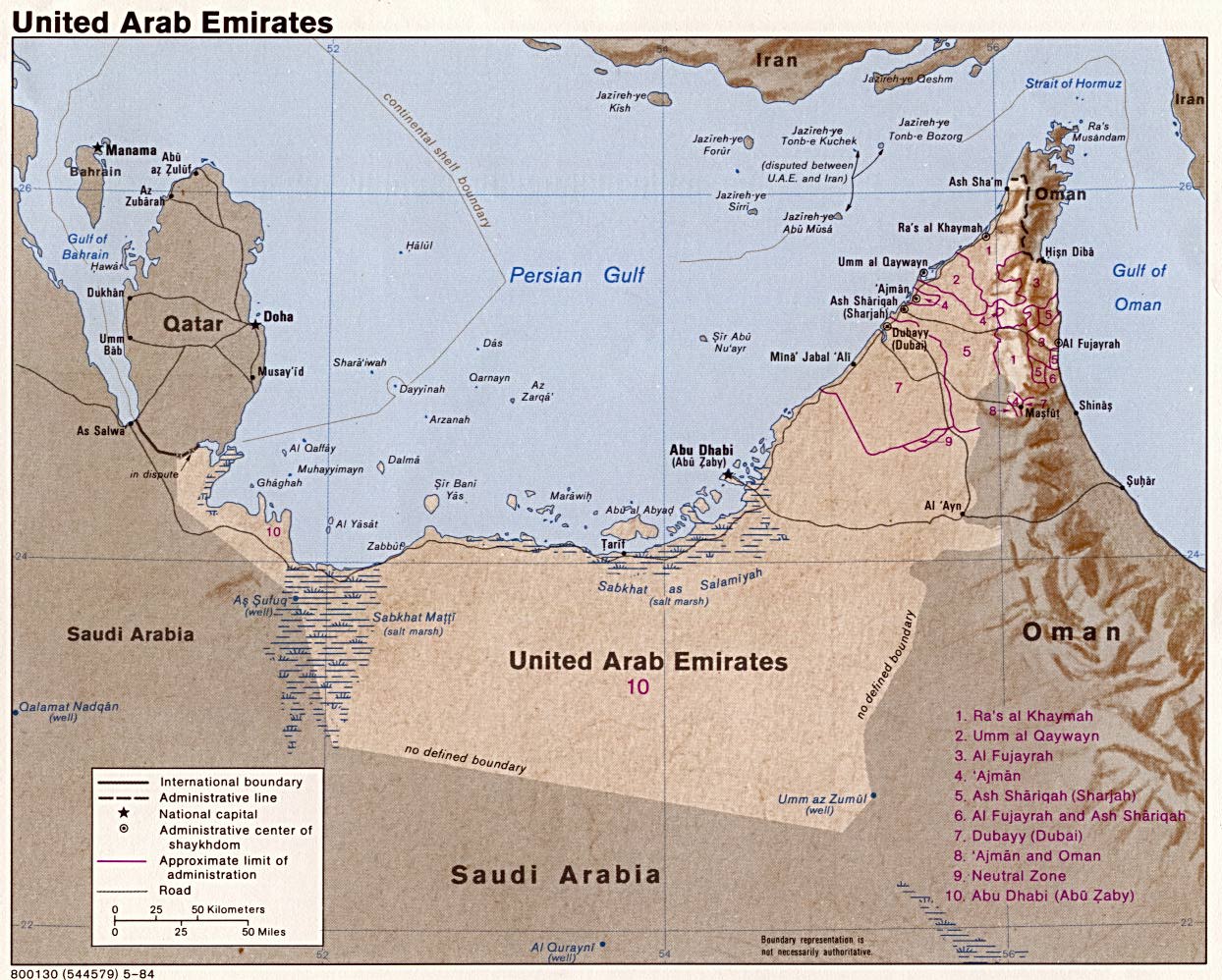
- United Arab Emirates(Shaded Relief) 1984 (263K) and pdf format (266K)
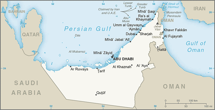
- United Arab Emirates (Small Map) 2016 (21.7K)
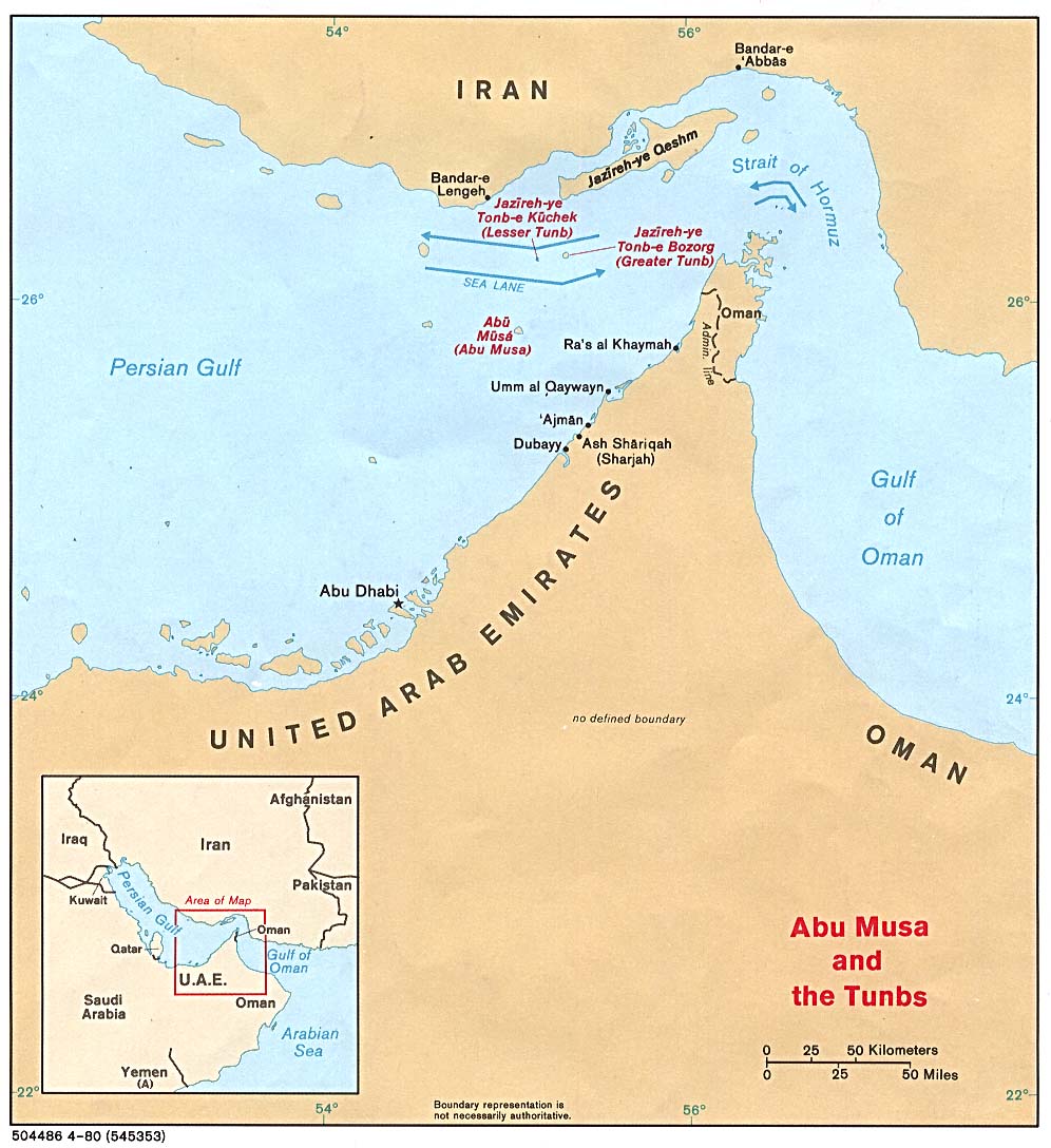
- Strait of Hormuz (Political) 1980 (149K)
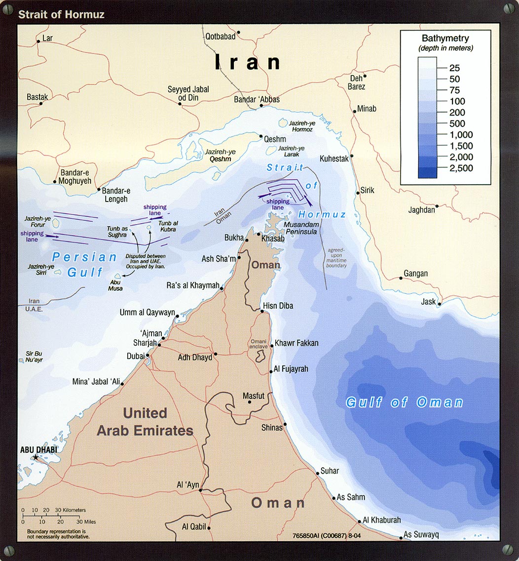
- Strait of Hormuz portion of Iran Country Profile 2004 (311K)
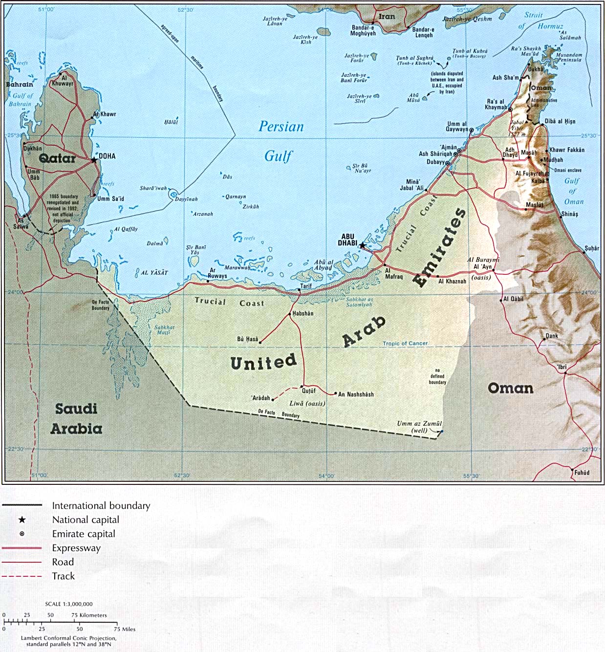
- Country Map From the CIA Atlas of the Middle East 1993 (310K)
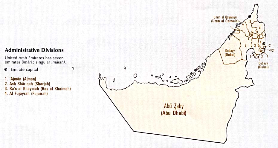
- Administrative Divisions From the CIA Atlas of the Middle East 1993 (61K)
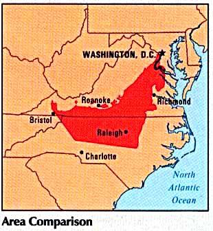
- Area Comparison From the CIA Atlas of the Middle East 1993 (30K)
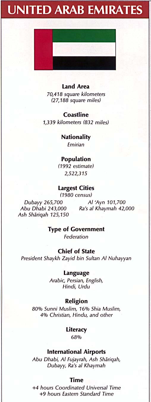
- Country Information From the CIA Atlas of the Middle East 1993 (83K)
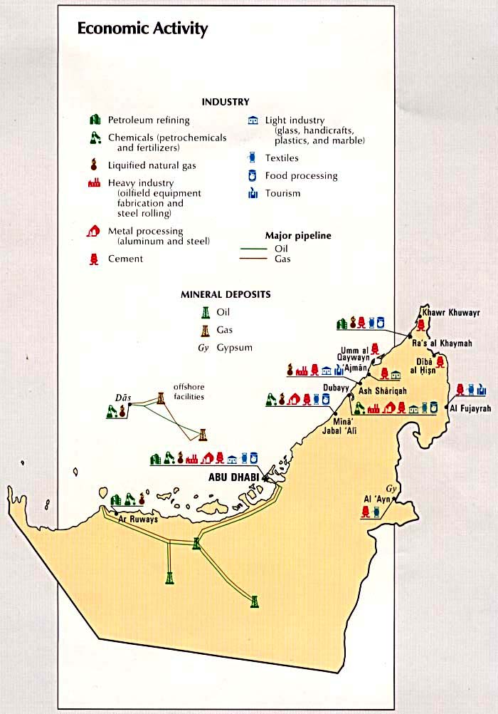
- Economic Activity From the CIA Atlas of the Middle East 1993 (87K)
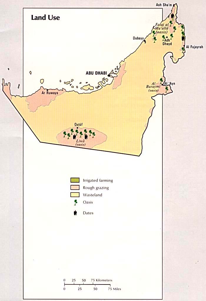
- Land Use From the CIA Atlas of the Middle East 1993 (62K)
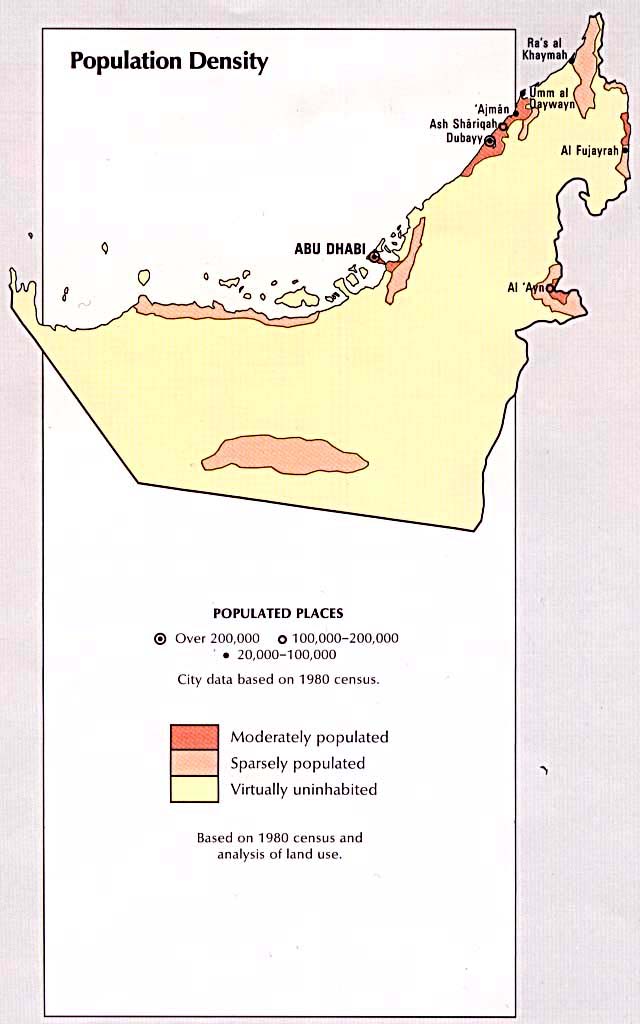
- Population Density From the CIA Atlas of the Middle East 1993 (63K)
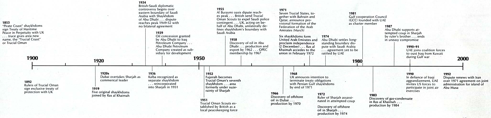
- Time Line From the CIA Atlas of the Middle East 1993 (154K)
- 1:1,000,000 - Operational Navigation Chart Series and Clickable Index Map U.S. Defense Mapping Agency Aerospace Center. Not for navigational use
- This series covers all of United Arab Emirates
- 1:500,000 - Tactical Pilotage Charts U.S. National Imagery and Mapping Agency. Not for navigational use
- This series covers all of United Arab Emirates
- 1:500,000 - Southeast Arabia Series K461, U.S. Army Map Service, 1956-
- This series covers all of United Arab Emirates
- 1:500,000 - World Series 1404, Great Britain. War Office and Air Ministry. 1958-
- This series covers parts of United Arab Emirates
- 1:250,000 - Southwestern Asia Series K502, U.S. Army Map Service, 1953-
- This series covers all of United Arab Emirates
- This series covers all of United Arab Emirates
Maps at Other Web Sites