Bolivia Topographic Maps 1:100,000
U.S. Defense Mapping Agency, Series H632
- Apolo (topographic), Sheet 3241, 1:100,000 (12.0MB) [GeoPDF]
- Arbol Solo (topographic), Sheet 3943, 1:100,000 (5.5MB) [GeoPDF]
- Arroyo Guanachonoca (topographic), Sheet 4043, 1:100,000 (9.7MB) [GeoPDF]
- Arroyo Toromonas (topographic), Sheet 3245, 1:100,000 (10.1MB) [PDF]
- Asariamas (topographic), Sheet 3142, 1:100,000 (11.2MB) [PDF]
- Ascencion de Guarayos (topographic), Sheet 4239, 1:100,000 (10.2MB) [GeoPDF]
- Bahia Horizonte (topographic), Sheet 4146, 1:100,000 (4.3MB) [GeoPDF]
- Bandera (topographic), Sheet 3744, 1:100,000 (7.0MB) [PDF]
- Barraca Copacabana (topographic), Sheet 3347, 1:100,000 (10.9MB) [PDF]
- Barraca Fortaleza (topographic), Sheet 3546, 1:100,000 (7.8MB) [PDF]
- Barraca Puerto Romero (topographic), Sheet 3450, 1:100,000 (5.8MB) [PDF]
- Barraca San Juan de Nuevo Mundo (topographic), Sheet 3549, 1:100,000 (10.4MB) [PDF]
- Barraca Santa Rita (topographic), Sheet 3447, 1:100,000 (10.6MB) [PDF]
- Barraca Santa Rosa (topographic), Sheet 3446, 1:100,000 (9.5MB) [PDF]
- Batallas (topographic), Sheet 3138, 1:100,000 (10.5MB) [PDF]
- Belmonte (topographic), Sheet 3651, 1:100,000 (6.0MB) [PDF]
- Blanca Flor (topographic), Sheet 3547, 1:100,000 (9.5MB) [PDF]
- Bolivar (topographic), Sheet 3535, 1:100,000 (10.5MB) [PDF]
- Bolpebra (topographic), Sheet 3048, 1:100,000 (6.0MB) [PDF]
- Buen Horno (topographic), Sheet 4245, 1:100,000 (8.4MB) [GeoPDF]
- Buena Vista (topographic), Sheet 4136, 1:100,000 (10.1MB) [GeoPDF]
- Cachuela Esperanza (topographic), Sheet 3749, 1:100,000 (9.3MB) [PDF]
- Cairoma (topographic), Sheet 3337, 1:100,000 (11.7MB) [PDF]
- Candelaria (topographic), Sheet 5137, 1:100,000 (8.9MB) [JPEG]
- Caquiaviri (topographic), Sheet 3136, 1:100,000 (9.4MB) [PDF]
- Carmen Viejo (topographic), Sheet 4241, 1:100,000 (8.9MB) [GeoPDF]
- Carnavai (topographic), Sheet 3339, 1:100,000 (12.2MB) [PDF]
- Casa de Lienzo (topographic), Sheet 3543, 1:100,000 (7.4MB) [PDF]
- Celina (topographic), Sheet 4477, 1:100,000 (10.2MB) [PDF]
- Cerro Chipe (topographic), Sheet 2936, 1:100,000 (4.2MB) [PDF]
- Cerro El Encanto (topographic), Sheet 4936, 1:100,000 (10.4MB) [JPEG]
- Cerro Tapanaquis (topographic), Sheet 5035, 1:100,000 (11.2MB) [JPEG]
- Charana (topographic), Sheet 3035, 1:100,000 (9.1MB) [GeoPDF]
- Chevejecure (topographic), Sheet 3641, 1:100,000 (8.1MB) [GeoPDF]
- Chimimita (topographic), Sheet 3738, 1:100,000 (5.1MB) [GeoPDF]
- Chive (topographic), Sheet 3146, 1:100,000 (7.5MB) [GeoPDF]
- Chocolatal (topographic), Sheet 3840, 1:100,000 (6.4MB) [GeoPDF]
- Chulumani (topographic), Sheet 3338, 1:100,000 (13.7MB) [GeoPDF]
- Chuma (topographic), Sheet 3140, 1:100,000 (20.5MB) [GeoPDF]
- Cobija (topographic), Sheet 3148, 1:100,000 (5.6MB) [GeoPDF]
- Colonia Hardeman (topographic), Sheet 4137, 1:100,000 (5.4MB) [GeoPDF]
- Colonia Villa El Carmen (topographic), Sheet 3441, 1:100,000 (11.3MB) [GeoPDF]
- Colquiri (topographic), Sheet 3436, 1:100,000 (10.5MB) [GeoPDF]
- Comarapa (topographic), Sheet 3935, 1:100,000 (11.6MB) [GeoPDF]
- Comunidad Agua Clara (topographic), Sheet 3645, 1:100,000 (6.5MB) [GeoPDF]
- Comunidad Calama (topographic), Sheet 3748, 1:100,000 (10.5MB) [GeoPDF]
- Comunidad Chorito (topographic), Sheet 3537, 1:100,000 (11.1MB) [GeoPDF]
- Comunidad El Cerrito (topographic), Sheet 4537, 1:100,000 (11.2MB) [JPEG]
- Comunidad El Tornito (topographic), Sheet 5037, 1:100,000 (9.2MB) [JPEG]
- Comunidad Instituto (topographic), Sheet 4337, 1:100,000 (8.8MB) [GeoPDF]
- Comunidad La Cantera (topographic), Sheet 4635, 1:100,000 (8.3MB) [JPEG]
- Comunidad La Embocada (topographic), Sheet 3540, 1:100,000 (5.4MB) [GeoPDF]
- Comunidad La Esperanza (topographic), Sheet 4736, 1:100,000 (9.5MB) [JPEG]
- Comunidad Las Palmas (topographic), Sheet 3647, 1:100,000 (9.8MB) [GeoPDF]
- Comunidad Majo Pampa (topographic), Sheet 3836, 1:100,000 (11.4MB) [GeoPDF]
- Comunidad Montinea (topographic), Sheet 3750, 1:100,000 (4.6MB) [GeoPDF]
- Comunidad Nueva Ethea (topographic), Sheet 3548, 1:100,000 (10.9MB) [GeoPDF]
- Comunidad Palmarito (topographic), Sheet 4437, 1:100,000 (11.1MB) [GeoPDF]
- Comunidad San Antonio (topographic), Sheet 3848, 1:100,000 (6.0MB) [GeoPDF]
- Comunidad San Bartolo (topographic), Sheet 4938, 1:100,000 (6.5MB) [JPEG]
- Comunidad San Fernando (topographic), Sheet 5136, 1:100,000 (8.0MB) [JPEG]
- Comunidad San Jose (topographic), Sheet 3650, 1:100,000 (11.1MB) [GeoPDF]
- Comunidad San Pedro (topographic), Sheet 4237, 1:100,000 (8.9MB) [GeoPDF]
- Comunidad Santa Rosa Del Isiboro (topographic), Sheet 3838, 1:100,000 (10.8MB) [GeoPDF]
- Comunidad Santa Rosita (topographic), Sheet 4638, 1:100,000 (9.8MB) [JPEG]
- Comunidad Tacoygo (topographic), Sheet 4637, 1:100,000 (9.8MB) [JPEG]
- Comunidad Villa Verde (topographic), Sheet 3246, 1:100,000 (11.1MB) [GeoPDF]
- Concepcion (topographic), Sheet 4438, 1:100,000 (12.6MB) [GeoPDF]
- Conquista (topographic), Sheet 3448, 1:100,000 (11.1MB) [GeoPDF]
- Copacabana (topographic), Sheet 4040, 1:100,000 (7.2MB) [GeoPDF]
- Copacabana (topographic), Sheet 3038, 1:100,000 (5.7MB) [GeoPDF]
- Corocoro (topographic), Sheet 3236, 1:100,000 (6.8MB) [GeoPDF]
- Covendo (topographic), Sheet 3539, 1:100,000 (6.2MB) [GeoPDF]
- Cotoca (topographic), Sheet 4335, 1:100,000 (8.9MB) [GeoPDF]
- Crespo "A" (topographic), Sheet 3839, 1:100,000 (8.2MB) [GeoPDF]
- Desaguadero (topographic), Sheet 3037, 1:100,000 (5.7MB) [GeoPDF]
- El Cusi (topographic), Sheet 4143, 1:100,000 (10.5MB) [GeoPDF]
- El Tucuaral (topographic), Sheet 3742, 1:100,000 (8.7MB) [GeoPDF]
- Entre Rios (topographic), Sheet 3841, 1:100,000 (7.1MB) [GeoPDF]
- Escoma (topographic), Sheet 3039, 1:100,000 (10.0MB) [GeoPDF]
- Espiritu (topographic), Sheet 3542, 1:100,000 (8.9MB) [GeoPDF]
- Estacion Pozo Del Tigre (topographic), Sheet 4535, 1:100,000 (9.7MB) [JPEG]
- Estacion Tres Cruces (topographic), Sheet 4435, 1:100,000 (9.2MB) [GeoPDF]
- Estancia Firmeza (topographic), Sheet 3747, 1:100,000 (11.2MB) [GeoPDF]
- Estancia Huaytu (topographic), Sheet 4135, 1:100,000 (11.5MB) [GeoPDF]
- Estancia La Colorada (topographic), Sheet 4837, 1:100,000 (9.9MB) [JPEG]
- Estancia Las Madres (topographic), Sheet 4439, 1:100,000 (11.3MB) [GeoPDF]
- Estancia Maguecito (topographic), Sheet 5036, 1:100,000 (9.6MB) [JPEG]
- Estancia Natividad (topographic), Sheet 5235, 1:100,000 (8.4MB) [JPEG]
- Estancia Santa Lourdes (topographic), Sheet 3248, 1:100,000 (10.5MB) [GeoPDF]
- Eucaliptus (topographic), Sheet 3335, 1:100,000 (9.4MB) [GeoPDF]
- Eviato (topographic), Sheet 4041, 1:100,000 (10.1MB) [GeoPDF]
- Fortin Libertad (topographic), Sheet 4336, 1:100,000 (8.8MB) [GeoPDF]
- Fortin Teniente G Mendoza (topographic), Sheet 4580, 1:100,000 (9.7MB) [GeoPDF]
- Fortin Villazon (topographic), Sheet 4429, 1:100,000 (9.4MB) [GeoPDF]
- Guacanaguas (topographic), Sheet 3244, 1:100,000 (10.5MB) [GeoPDF]
- Guayamerin (topographic), Sheet 3849, 1:100,000 (5.9MB) [GeoPDF]
- Huachi (topographic), Sheet 4242, 1:100,000 (9.0MB) [GeoPDF]
- Inava (topographic), Sheet 3147, 1:100,000 (10.1MB) [GeoPDF]
- Independencia (topographic), Sheet 3536, 1:100,000 (10.5MB) [GeoPDF]
- Irupana (topographic), Sheet 3438, 1:100,000 (3.8MB) [GeoPDF]
- Ixiamas (topographic), Sheet 3243, 1:100,000 (9.8MB) [GeoPDF]
- Julo (topographic), Sheet 3133, 1:100,000 (8.1MB) [GeoPDF]
- La Capital (topographic), Sheet 4044, 1:100,000 (10.6MB) [GeoPDF]
- La Chonta (topographic), Sheet 4339, 1:100,000 (7.2MB) [GeoPDF]
- La Cruz (topographic), Sheet 4139, 1:100,000 (10.3MB) [GeoPDF]
- La Estrella (topographic), Sheet 4138, 1:100,000 (9.4MB) [GeoPDF]
- La Horquilla (topographic), Sheet 4045, 1:100,000 (10.0MB) [GeoPDF]
- La Paz (North) (topographic), Sheet 3238, 1:100,000 (8.4MB) [PDF]
- La Paz (South) (topographic), Sheet 3237, 1:100,000 (8.4MB) [PDF]
- Laguna De Aquiles (topographic), Sheet 4140, 1:100,000 (8.9MB) [GeoPDF]
- Laguna Pato (topographic), Sheet 3444, 1:100,000 (10.8MB) [GeoPDF]
- Laguna San Jose (topographic), Sheet 4244, 1:100,000 (8.7MB) [GeoPDF]
- Laguna Tanguina (topographic), Sheet 4345, 1:100,000 (4.1MB) [GeoPDF]
- Laguna Yuquis (topographic), Sheet 3938, 1:100,000 (9.5MB) [GeoPDF]
- Las Marias (topographic), Sheet 3745, 1:100,000 (8.8MB) [GeoPDF]
- Limoquije (topographic), Sheet 3939, 1:100,000 (10.1MB) [GeoPDF]
- Loreto (topographic), Sheet 3940, 1:100,000 (8.5MB) [GeoPDF]
- Los Angeles (topographic), Sheet 3346, 1:100,000 (9.3MB) [GeoPDF]
- Maguncia (topographic), Sheet 3740, 1:100,000 (8.0MB) [GeoPDF]
- Manuel Vargas (topographic), Sheet 3743, 1:100,000 (8.0MB) [GeoPDF]
- Mapiri (topographic), Sheet 3240, 1:100,000 (11.7MB) [GeoPDF]
- Matucara (topographic), Sheet 3845, 1:100,000 (10.6MB) [GeoPDF]
- Melgarejo (topographic), Sheet 4344, 1:100,000 (9.8MB) [GeoPDF]
- Mercier (topographic), Sheet 3249, 1:100,000 (11.8MB) [GeoPDF]
- Mizque (topographic), Sheet 3835, 1:100,000 (10.1MB) [GeoPDF]
- Monte Verde (topographic), Sheet 4440, 1:100,000 (5.3MB) [GeoPDF]
- Montero (topographic), Sheet 4236, 1:100,000 (8.2MB) [GeoPDF]
- Morguicho (topographic), Sheet 3637, 1:100,000 (11.3MB) [GeoPDF]
- Nazareth (topographic), Sheet 3842, 1:100,000 (8.5MB) [GeoPDF]
- North of Villazon (topographic), Sheet 4430, 1:100,000 (13.4MB) [GeoPDF]
- Nuevas Tribus (topographic), Sheet 3345, 1:100,000 (10.2MB) [GeoPDF]
- Nuevo Distrito (topographic), Sheet 3350, 1:100,000 (3.6MB) [GeoPDF]
- Okoruro (topographic), Sheet 3135, 1:100,000 (11.0MB) [GeoPDF]
- Oruro (topographic), Sheet 3435, 1:100,000 (7.7MB) [GeoPDF]
- Palacito (topographic), Sheet 4038, 1:100,000 (10.5MB) [GeoPDF]
- Palmera (topographic), Sheet 3844, 1:100,000 (8.3MB) [GeoPDF]
- Paquia (topographic), Sheet 3439, 1:100,000 (12.7MB) [GeoPDF]
- Paraiso (topographic), Sheet 3741, 1:100,000 (7.0MB) [GeoPDF]
- Patacamaya (topographic), Sheet 3336, 1:100,000 (8.3MB) [GeoPDF]
- Patroncito (topographic), Sheet 4243, 1:100,000 (9.9MB) [GeoPDF]
- Pelechuco (topographic), Sheet 3041, 1:100,000 (8.9MB) [GeoPDF]
- Perseverancia (topographic), Sheet 4341, 1:100,000 (11.3MB) [GeoPDF]
- Puerto Canoa (topographic), Sheet 3640, 1:100,000 (10.0MB) [GeoPDF]
- Puerto Cavinas (topographic), Sheet 3545, 1:100,000 (10.6MB) [GeoPDF]
- Puerto Chacobos (topographic), Sheet 3746, 1:100,000 (7.9MB) [GeoPDF]
- Puerto De Ixiamas (topographic), Sheet 3443, 1:100,000 (10.0MB) [GeoPDF]
- Puerto Gonzalo Moreno (topographic), Sheet 3648, 1:100,000 (10.8MB) [GeoPDF]
- Puerto Grether (topographic), Sheet 4036, 1:100,000 (10.5MB) [GeoPDF]
- Puerto Guaqui (topographic), Sheet 3137, 1:100,000 (8.3MB) [GeoPDF]
- Puerto Heath (topographic), Sheet 3145, 1:100,000 (7.1MB) [GeoPDF]
- Puerto Leigue (topographic), Sheet 3942, 1:100,000 (5.7MB) [GeoPDF]
- Puerto Rico (topographic), Sheet 3348, 1:100,000 (11.4MB) [GeoPDF]
- Puerto Saucedo (topographic), Sheet 4343, 1:100,000 (8.9MB) [GeoPDF]
- Puerto Vigo (topographic), Sheet 3846, 1:100,000 (10.1MB) [GeoPDF]
- Puerto Villarroel (topographic), Sheet 3937, 1:100,000 (9.7MB) [GeoPDF]
- Puesto Estrella (topographic), Sheet 4478, 1:100,000 (9.6MB) [GeoPDF]
- Punata (topographic), Sheet 3735, 1:100,000 (8.9MB) [GeoPDF]
- Quebrada Laboreta (topographic), Sheet 3638, 1:100,000 (12.3MB) [GeoPDF]
- Quebrada Undumo (topographic), Sheet 3445, 1:100,000 (10.3MB) [GeoPDF]
- Quillacollo (topographic), Sheet 3636, 1:100,000 (8.6MB) [GeoPDF]
- Rancho Francia (topographic), Sheet 3646, 1:100,000 (9.6MB) [GeoPDF]
- Remanzo (topographic), Sheet 4145, 1:100,000 (10.9MB) [GeoPDF]
- Reyes (topographic), Sheet 3442, 1:100,000 (7.6MB) [GeoPDF]
- Riberalta (topographic), Sheet 3649, 1:100,000 (11.0MB) [GeoPDF]
- Rio Apere (topographic), Sheet 3639, 1:100,000 (10.7MB) [GeoPDF]
- Rio El Motacu (topographic), Sheet 4436, 1:100,000 (9.1MB) [GeoPDF]
- Rio Esmeralda (topographic), Sheet 3344, 1:100,000 (10.3MB) [GeoPDF]
- Rio Machupo (topographic), Sheet 4046, 1:100,000 (3.9MB) [GeoPDF]
- Rio Tapado (topographic), Sheet 3644, 1:100,000 (6.3MB) [GeoPDF]
- Rio Tayota (topographic), Sheet 3739, 1:100,000 (10.7MB) [GeoPDF]
- Rio Utubo (topographic), Sheet 4539, 1:100,000 (8.8MB) [JPEG]
- Rio Yapacani (topographic), Sheet 4037, 1:100,000 (4.3MB) [GeoPDF]
- Riozihno (topographic), Sheet 4342, 1:100,000 (11.1MB) [GeoPDF]
- Rurrenabaque (topographic), Sheet 3342, 1:100,000 (11.9MB) [GeoPDF]
- San Andres (topographic), Sheet 4039, 1:100,000 (20.7MB) [GeoPDF]
- San Bartolo (topographic), Sheet 3642, 1:100,000 (10.1MB) [GeoPDF]
- San Borja (topographic), Sheet 3541, 1:100,000 (8.7MB) [GeoPDF]
- San Ignacio De Velasco (topographic), Sheet 4738, 1:100,000 (10.4MB) [JPEG]
- San Javier (topographic), Sheet 4338, 1:100,000 (11.7MB) [GeoPDF]
- San Joaquin (topographic), Sheet 3944, 1:100,000 (6.2MB) [GeoPDF]
- San Jose (topographic), Sheet 3242, 1:100,000 (11.4MB) [GeoPDF]
- San Jose De Chiquitos (topographic), Sheet 4735, 1:100,000 (9.4MB) [JPEG]
- San Juan Del Potrero (topographic), Sheet 4035, 1:100,000 (11.8MB) [GeoPDF]
- San Miguel (topographic), Sheet 4737, 1:100,000 (9.5MB) [JPEG]
- San Nicolas (topographic), Sheet 4042, 1:100,000 (10.2MB) [GeoPDF]
- San Pablo (topographic), Sheet 3049, 1:100,000 (2.9MB) [GeoPDF]
- San Pedro De Curahuara (topographic), Sheet 3235, 1:100,000 (8.8MB) [GeoPDF]
- San Pedro (topographic), Sheet 4142, 1:100,000 (7.5MB) [GeoPDF]
- Santa Ana (topographic), Sheet 3936, 1:100,000 (7.1MB) [GeoPDF]
- Santa Ana (topographic), Sheet 3843, 1:100,000 (7.1MB) [GeoPDF]
- Santa Clara (topographic), Sheet 3643, 1:100,000 (9.3MB) [GeoPDF]
- Santa Cruz (topographic), Sheet 4235, 1:100,000 (9.5MB) [GeoPDF]
- Santa Cruz Del Valle Ameno (topographic), Sheet 3141, 1:100,000 (10.8MB) [GeoPDF]
- Santa Rosa (topographic), Sheet 3737, 1:100,000 (11.0MB) [GeoPDF]
- Santa Rosa De Abuna (topographic), Sheet 3449, 1:100,000 (11.1MB) [GeoPDF]
- Santiago De Machaca (topographic), Sheet 3036, 1:100,000 (11.4MB) [GeoPDF]
- Saucedo (topographic), Sheet 4443, 1:100,000 (11.0MB) [GeoPDF]
- Serrania Las Cutas (topographic), Sheet 4836, 1:100,000 (9.3MB) [JPEG]
- Sorata (topographic), Sheet 3139, 1:100,000 (10.0MB) [GeoPDF]
- Suma Uma (topographic), Sheet 3550, 1:100,000 (9.7MB) [GeoPDF]
- Tahua (topographic), Sheet 3343, 1:100,000 (9.6MB) [GeoPDF]
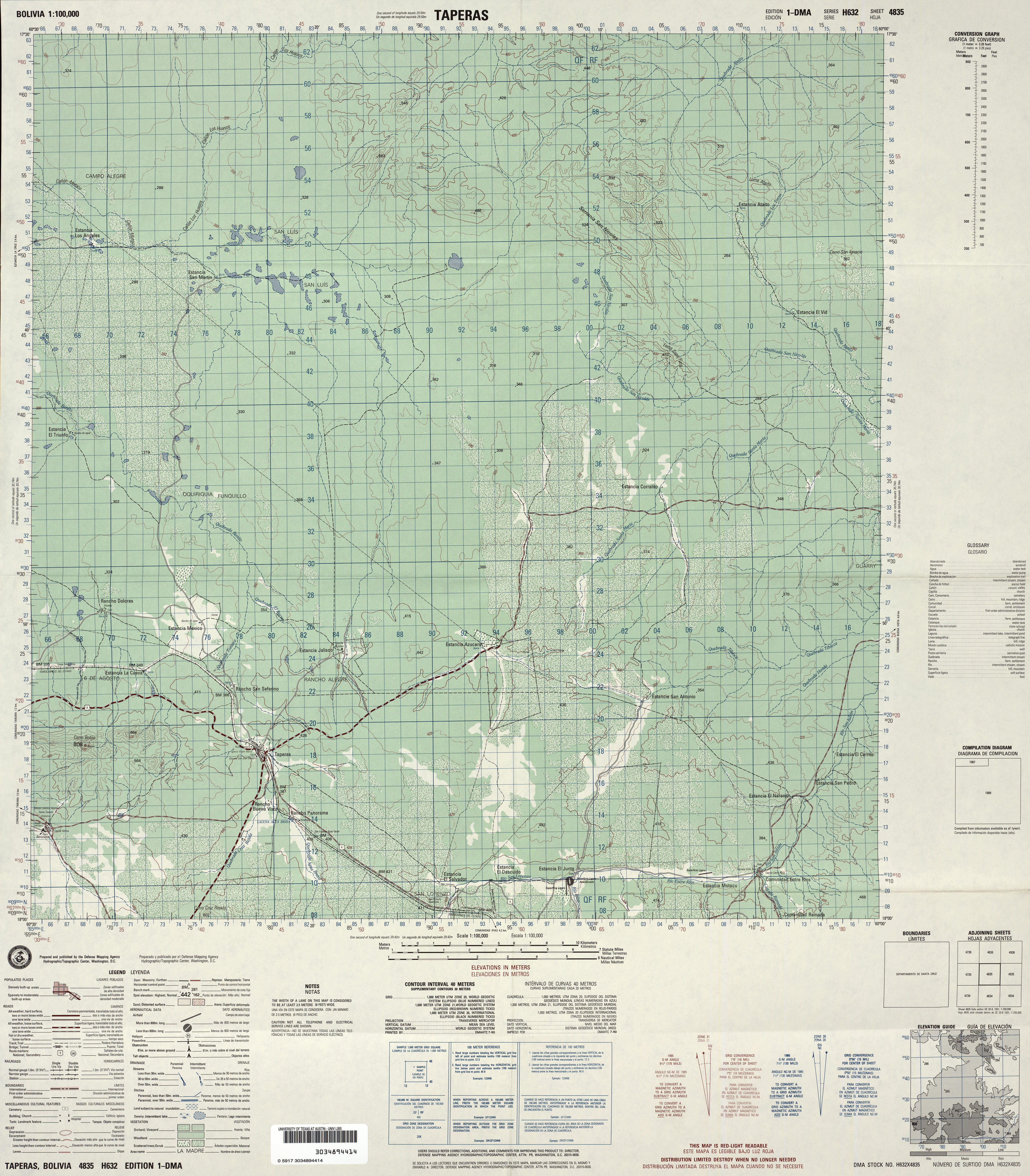
- Taperas (topographic), Sheet 4835, 1:100,000 (9.9MB) [JPEG]
- Tarata (topographic), Sheet 3635, 1:100,000 (9.8MB) [GeoPDF]
- Teoponte (topographic), Sheet 3340, 1:100,000 (10.5MB) [GeoPDF]
- Tipuani (topographic), Sheet 3239, 1:100,000 (10.4MB) [GeoPDF]
- Todos Santos (topographic), Sheet 4144, 1:100,000 (10.2MB) [GeoPDF]
- Tiraque "A" (topographic), Sheet 3736, 1:100,000 (10.6MB) [GeoPDF]
- Trinidad (topographic), Sheet 3941, 1:100,000 (8.9MB) [GeoPDF]
- Tupinamba (topographic), Sheet 3945, 1:100,000 (6.9MB) [GeoPDF]
- Umanata (topographic), Sheet 3040, 1:100,000 (6.9MB) [GeoPDF]
- Ventana (topographic), Sheet 3341, 1:100,000 (11.9MB) [GeoPDF]
- Villa Bella (topographic), Sheet 3850, 1:100,000 (6.1MB) [GeoPDF]
- Villa Tunari (topographic), Sheet 3837, 1:100,000 (9.7MB) [GeoPDF]
- Villazon (topographic), Sheet 4429, 1:100,000 (9.8MB) [GeoPDF]
- West of Monte Verde (topographic), Sheet 4340, 1:100,000 (10.9MB) [GeoPDF]
- Yaguaru (topographic), Sheet 4240, 1:100,000 (10.9MB) [GeoPDF]
- Yata (topographic), Sheet 3544, 1:100,000 (4.5MB) [GeoPDF]
- Yotaucito (topographic), Sheet 4238, 1:100,000 (9.9MB) [GeoPDF]
- [Untitled] (topographic), Sheet 3538, 1:100,000 (3.8MB) [GeoPDF]
- Arbol Solo (topographic), Sheet 3943, 1:100,000 (5.5MB) [GeoPDF]