Perry-Castañeda Library
Map Collection
Commonwealth of Puerto Rico Maps
Puerto Rico Maps
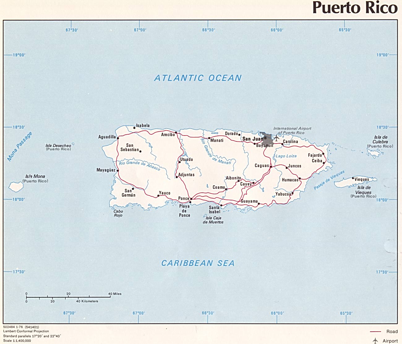
- Puerto Rico (Political) U.S. Central Intelligence Agency 1976 (152K) and pdf format (155K)
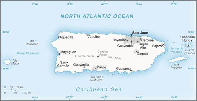
- Puerto Rico (Small Map) U.S. Central Intelligence Agency 2016 (30.4K)
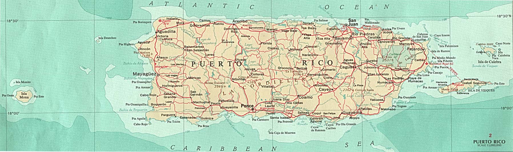
- Puerto Rico U.S. National Atlas 1970 (214K) Note: The locations of the cities of Sabana Grande and San German are reversed in error on this map.
- Puerto Rico - Federal Lands and Indian Reservations PDF format (635K) The National Atlas of the United States of America, U.S. Geological Survey, 2003
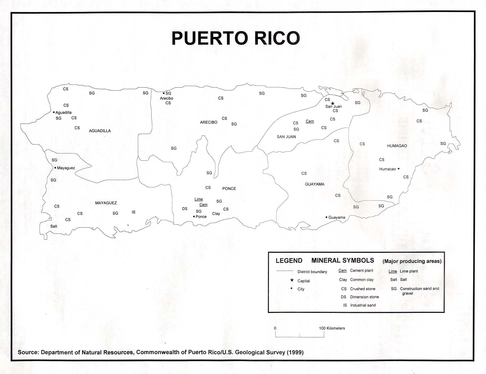
- Puerto Rico - Minerals U.S.G.S 1999 (129K)
City Maps
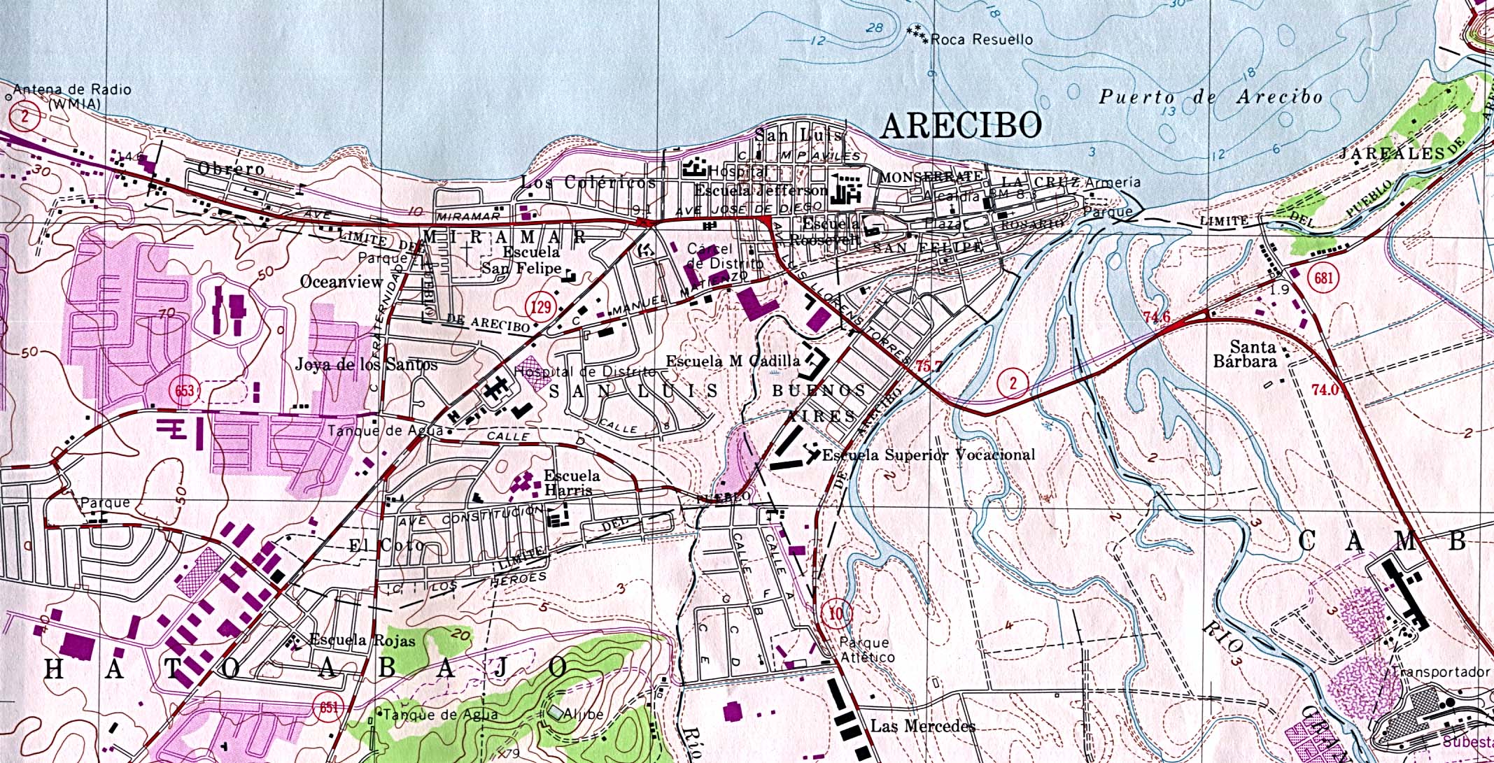
- Arecibo (Topographic) original scale 1:20,000 U.S. Geological Survey 1964, photorevised 1982 (612K)
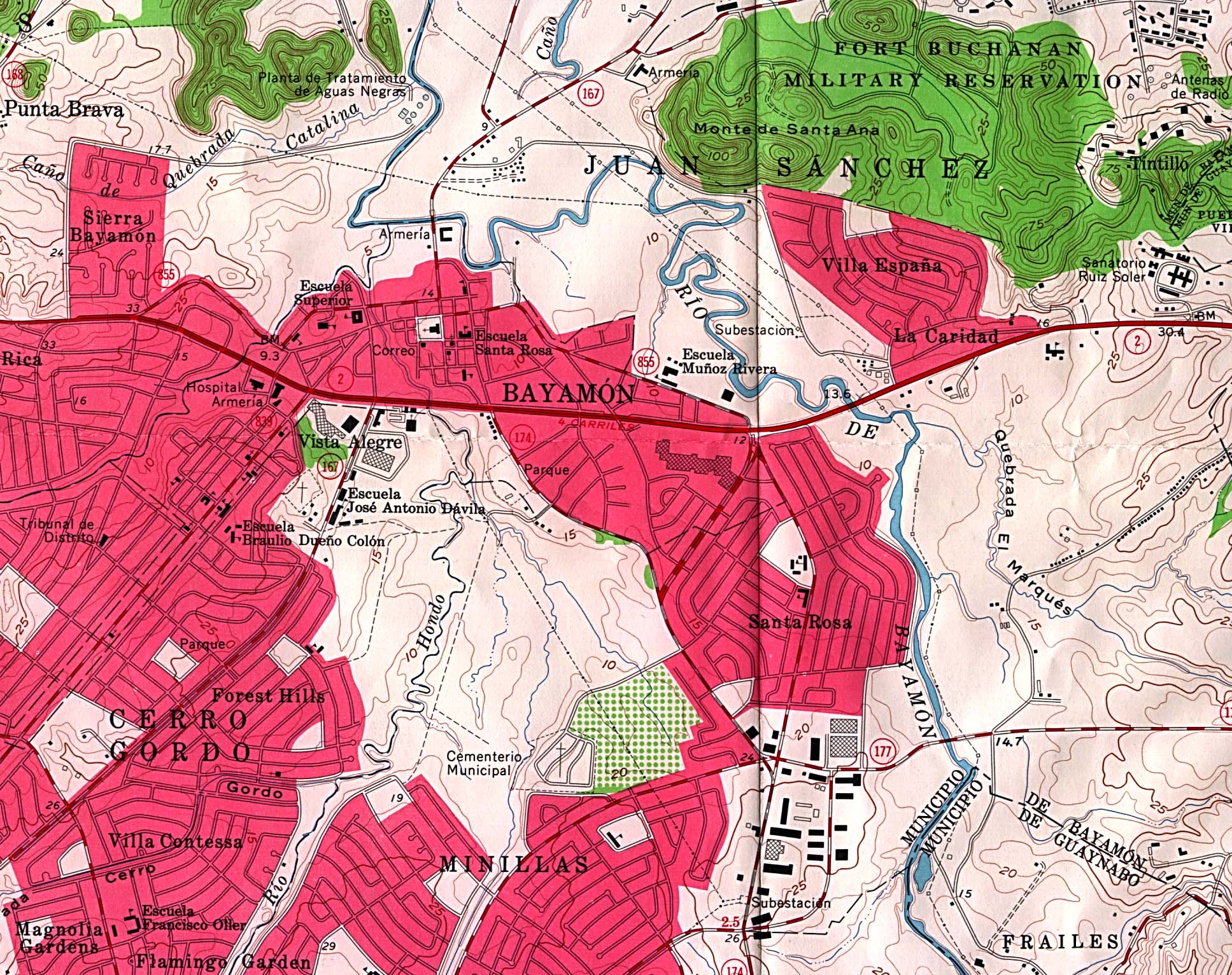
- Bayamon (Topographic) original scale 1:20,000 U.S. Geological Survey 1963 (706K)
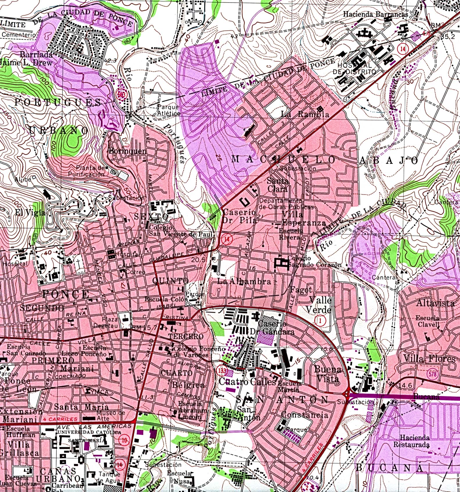
- Ponce (Topographic) original scale 1:20,000 U.S. Geological Survey 1970, photorevised 1982 (927K)
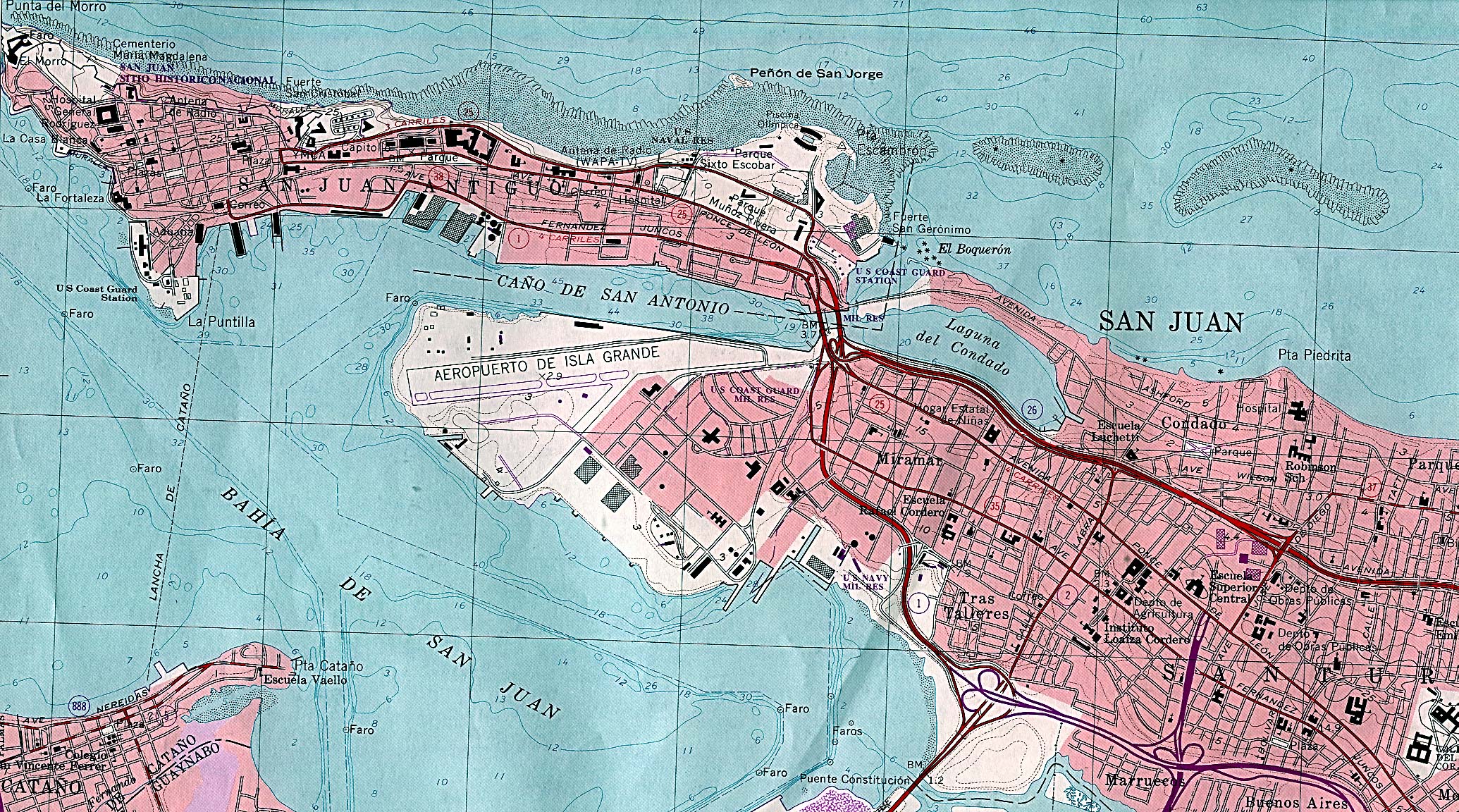
- San Juan (Topographic) original scale 1:20,000 U.S. Geological Survey 1982 (1,037K)
Detailed Maps
- 1:1,000,000 - Operational Navigation Chart, Sheet J-27 (aeronautical chart) U.S. Defense Mapping Agency Aerospace Center, revised 1980 Not for navigational use (9.5MB)
- This sheet includes Puerto Rico
- Isla De Vieques - Central Section (Topographic) original scale 1:50,000 U.S. Geological Survey 1981 (591K)
- Land Use: U.S. Naval Installations Vieques Island, Puerto Rico U.S. Navy Office of Information Press Release - October 18, 1999 (846K)
- 1:500,000 - Tactical Pilotage Charts U.S. National Imagery and Mapping Agency. Not for navigational use
- This series covers Puerto Rico
- Puerto Rico Historical Topographic Maps Pre-1945, scale 1:30,000
- This sheet includes Puerto Rico
Historical Maps
- Puerto Rico Historical Topographic Maps Pre-1945, scale 1:30,000
- Porto [Puerto] Rico, 1920 (387K)
- From Putnam's Handy Volume Atlas of the World, with an Index of Cities and Towns giving the Complete 1920 Census of the United States and lists of the Countries and Cities of the World, With Latest Population Figures and Useful Statistical Information. 1921.
![Porto [Puerto] Rico, 1920](historical/porto_rico_1920.jpg)
Maps on Other Web Sites