Perry-Castañeda Library
Map Collection
Kyrgyzstan Maps
The following maps were produced by the U.S. Central Intelligence Agency, unless otherwise indicated.
Kyrgyzstan Maps- Kyrgyzstan (Physiography) 2005 (1.9MB) and pdf format (542K)
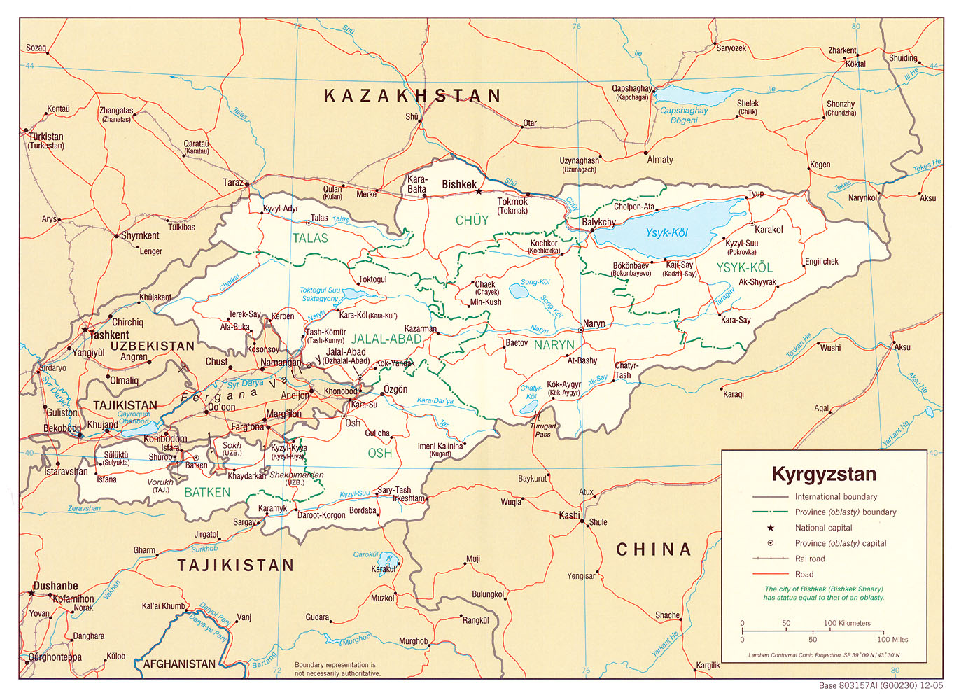
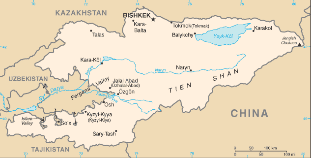
- Kyrgyzstan (Political) 2005 (585K) and pdf format (688K)
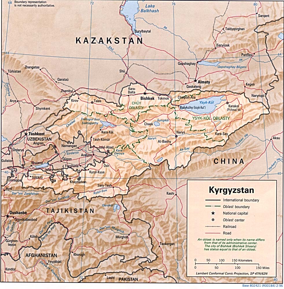
- Kyrgyzstan (Political) 1996 (226K) and pdf format (265K)
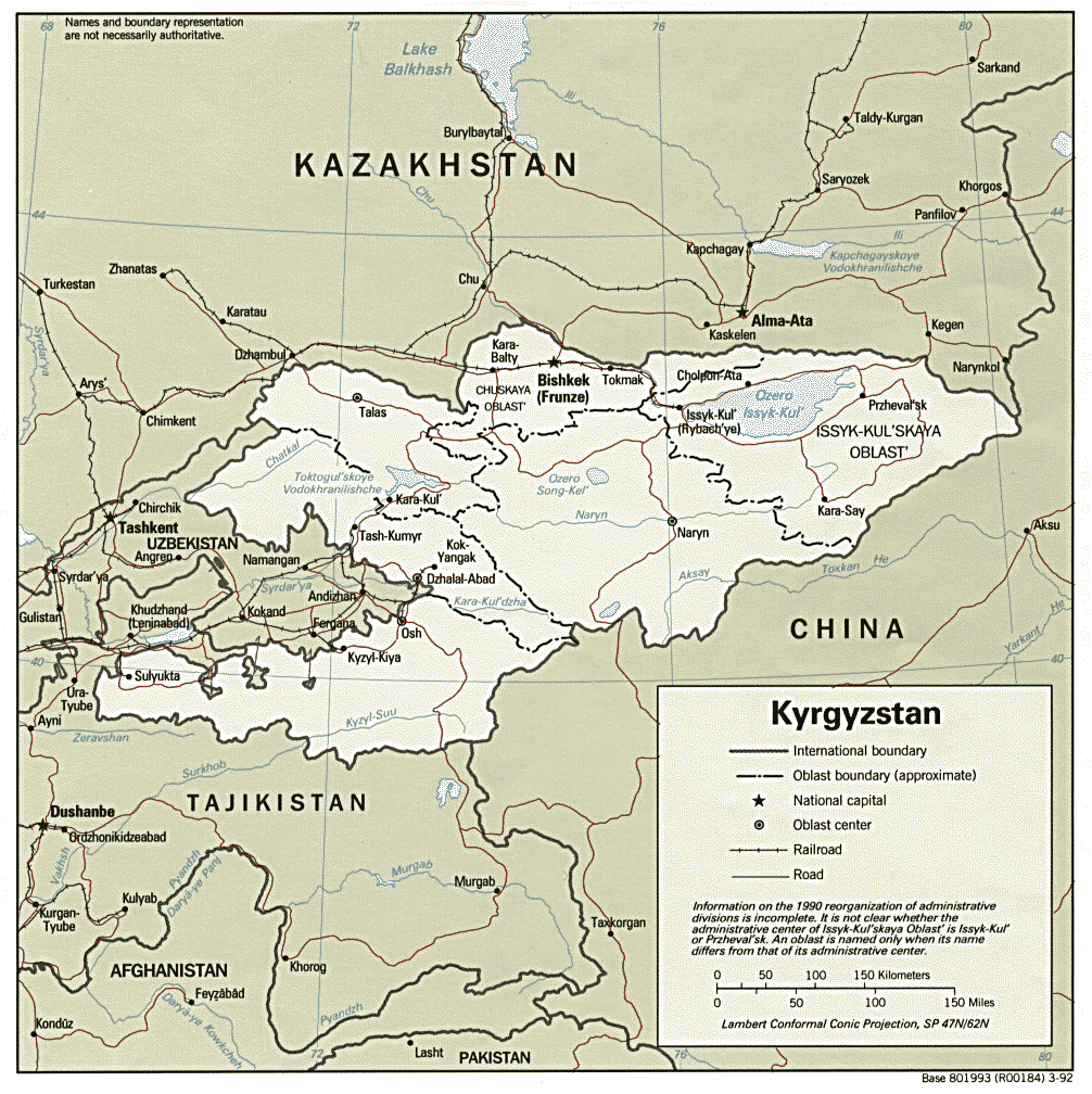
- Kyrgyzstan (Political) 1992 (267K) and pdf format (282K)
- Kyrgyzstan (Shaded Relief) 1996 (256K) and pdf format (299K)
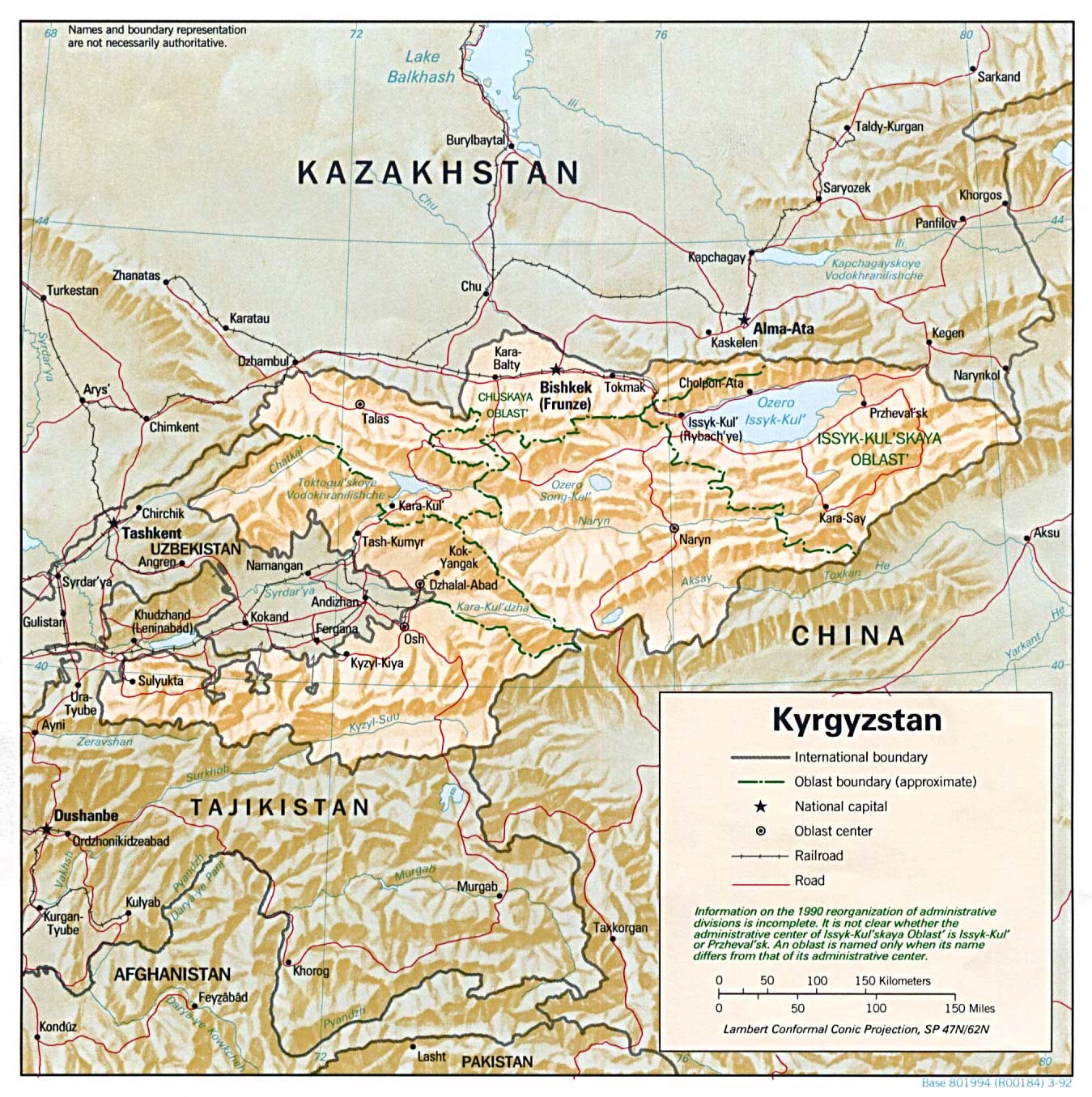
- Kyrgyzstan (Shaded Relief) 1992 (376K) and pdf format (378K)
- Kyrgyzstan (Small Map) 2016 (17.1K)
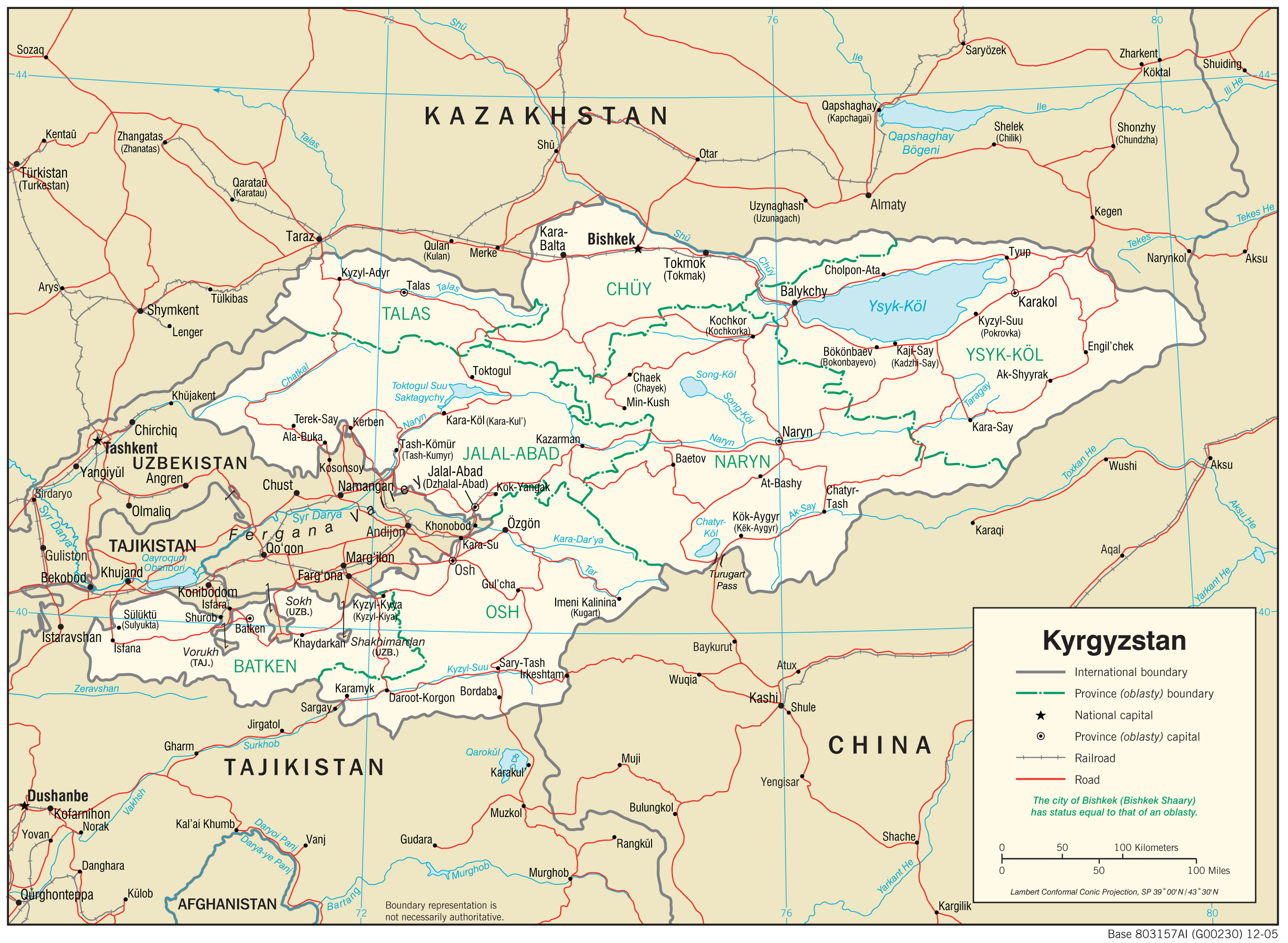
- Kyrgyzstan (Transportation) 2005 (1.6MB) and pdf format (542K)
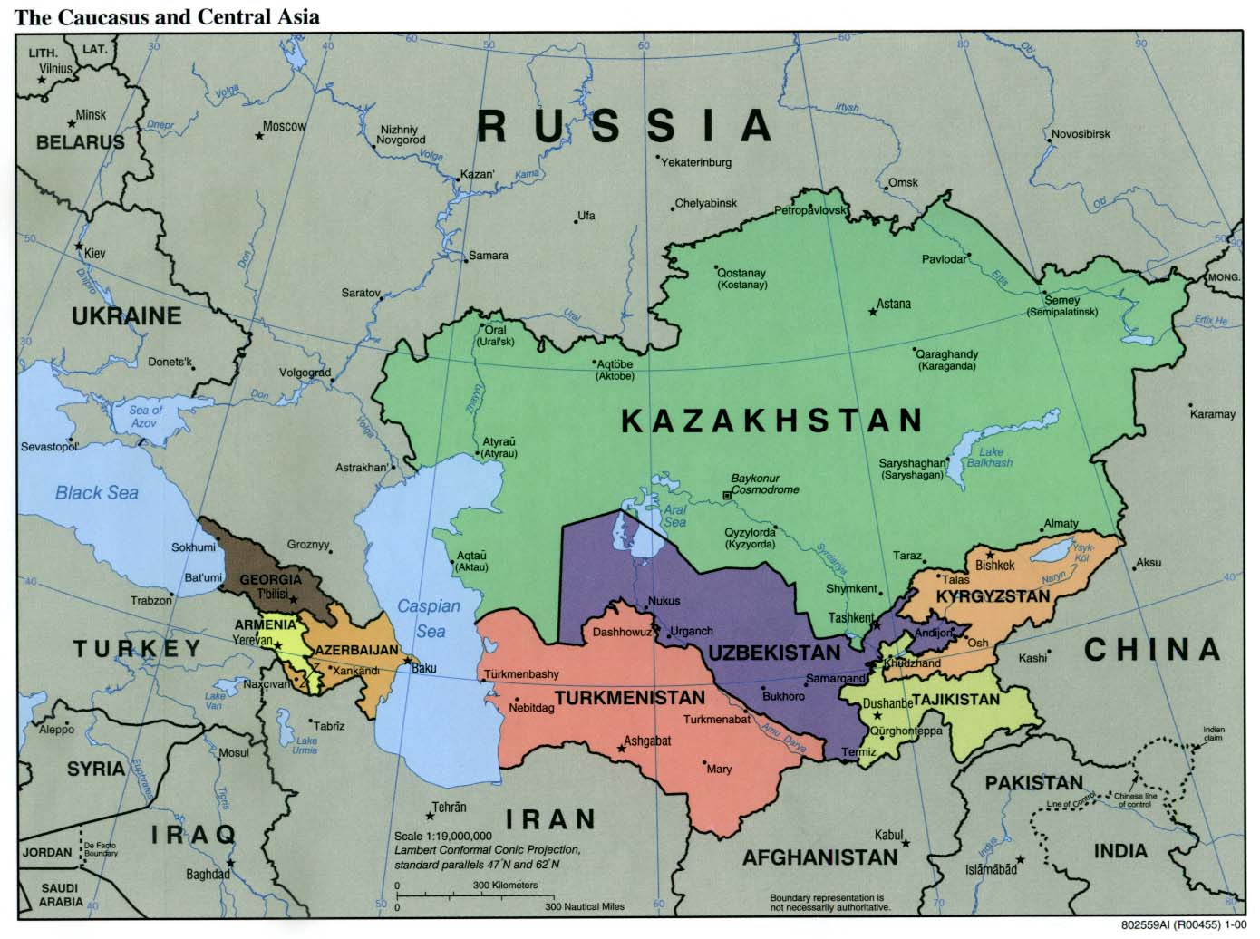
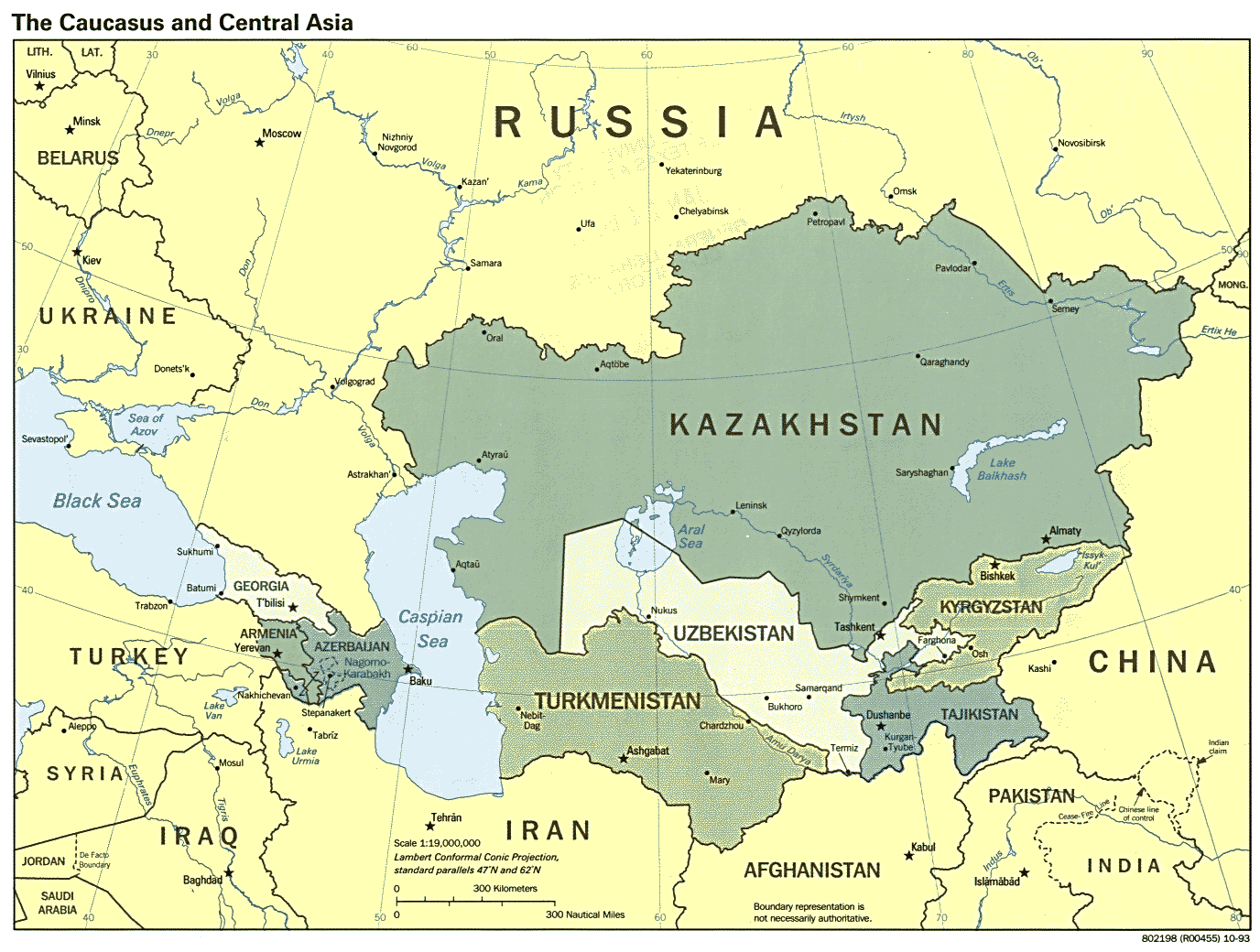
- Caucasus and Central Asia (Political) 2000 (171K)
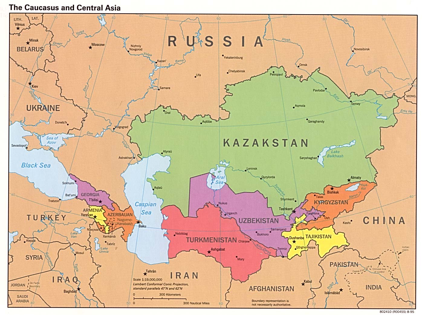
- Caucasus and Central Asia (Political) 1995 (231K)
- Caucasus and Central Asia (Political) 1993 (223K)
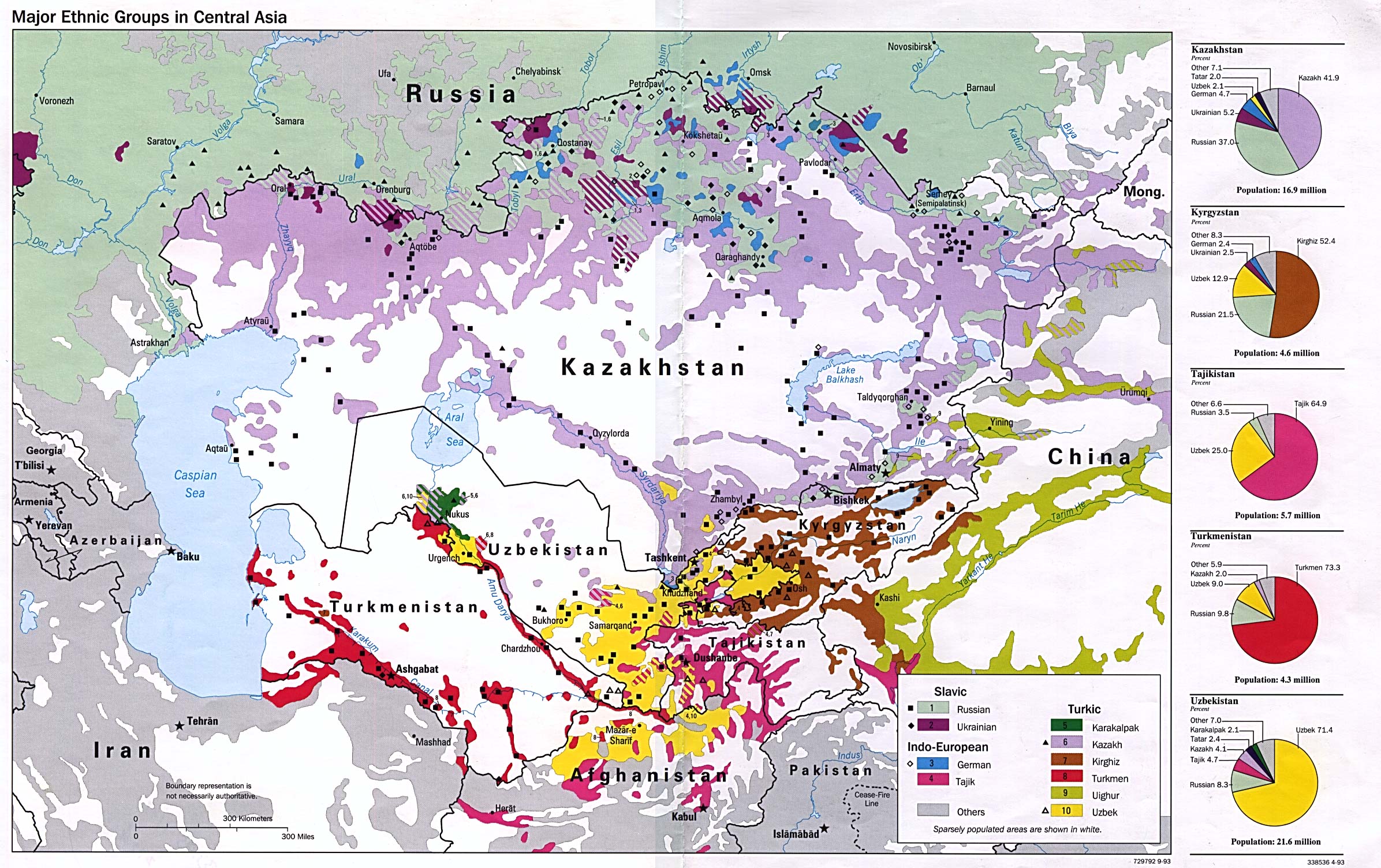
- Major Ethnic Groups in Central Asia 1993 (694K)
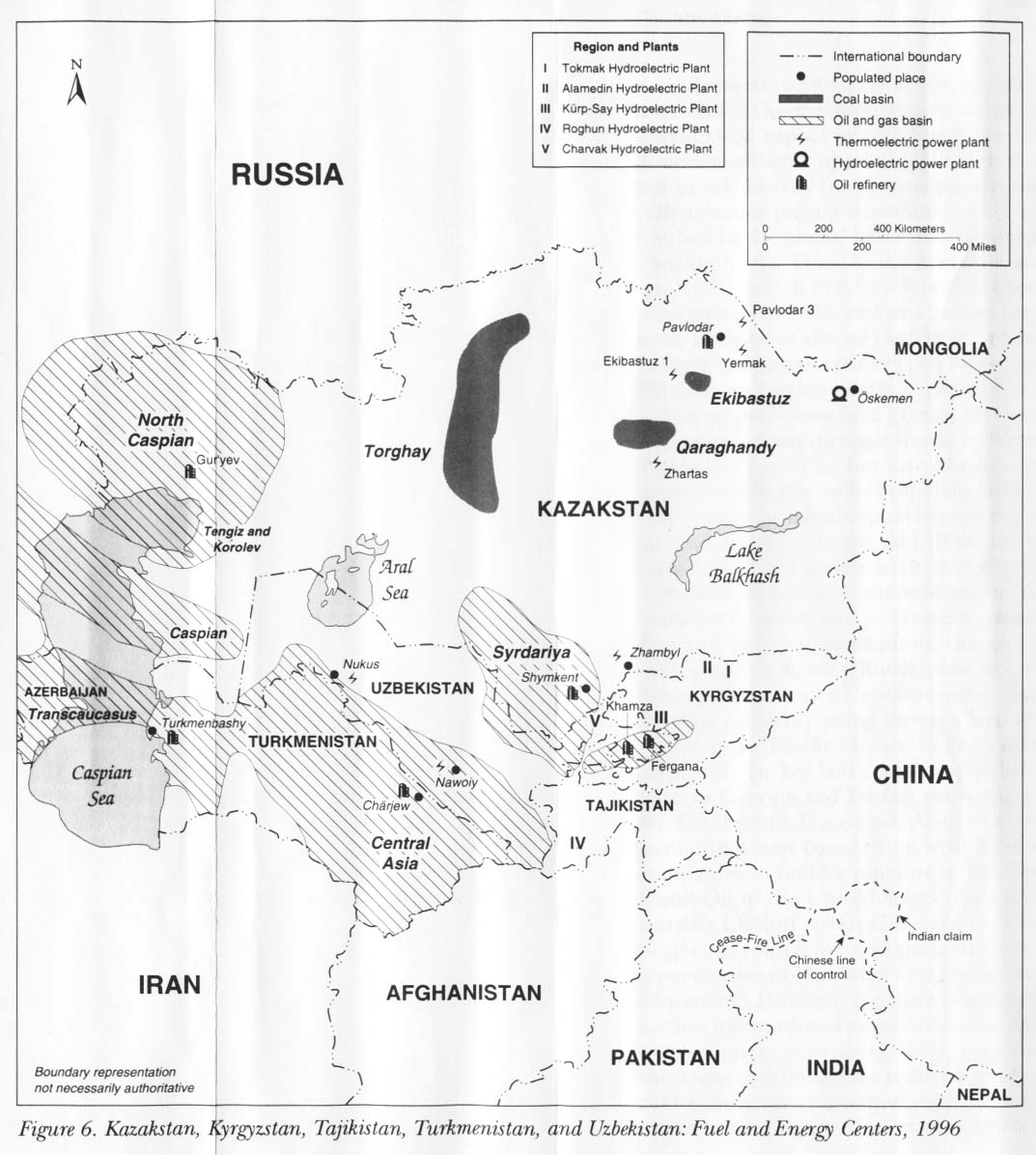
- Kazakstan, Kyrgyzstan, Tajikistan, Turkmenistan, and Uzbekistan: Fuel and Energy Centers 1996 from Kazakstan, Kyrgyzstan, Tajikistan, Turkmenistan, and Uzbekistan: Country Studies. 1997 (142K)
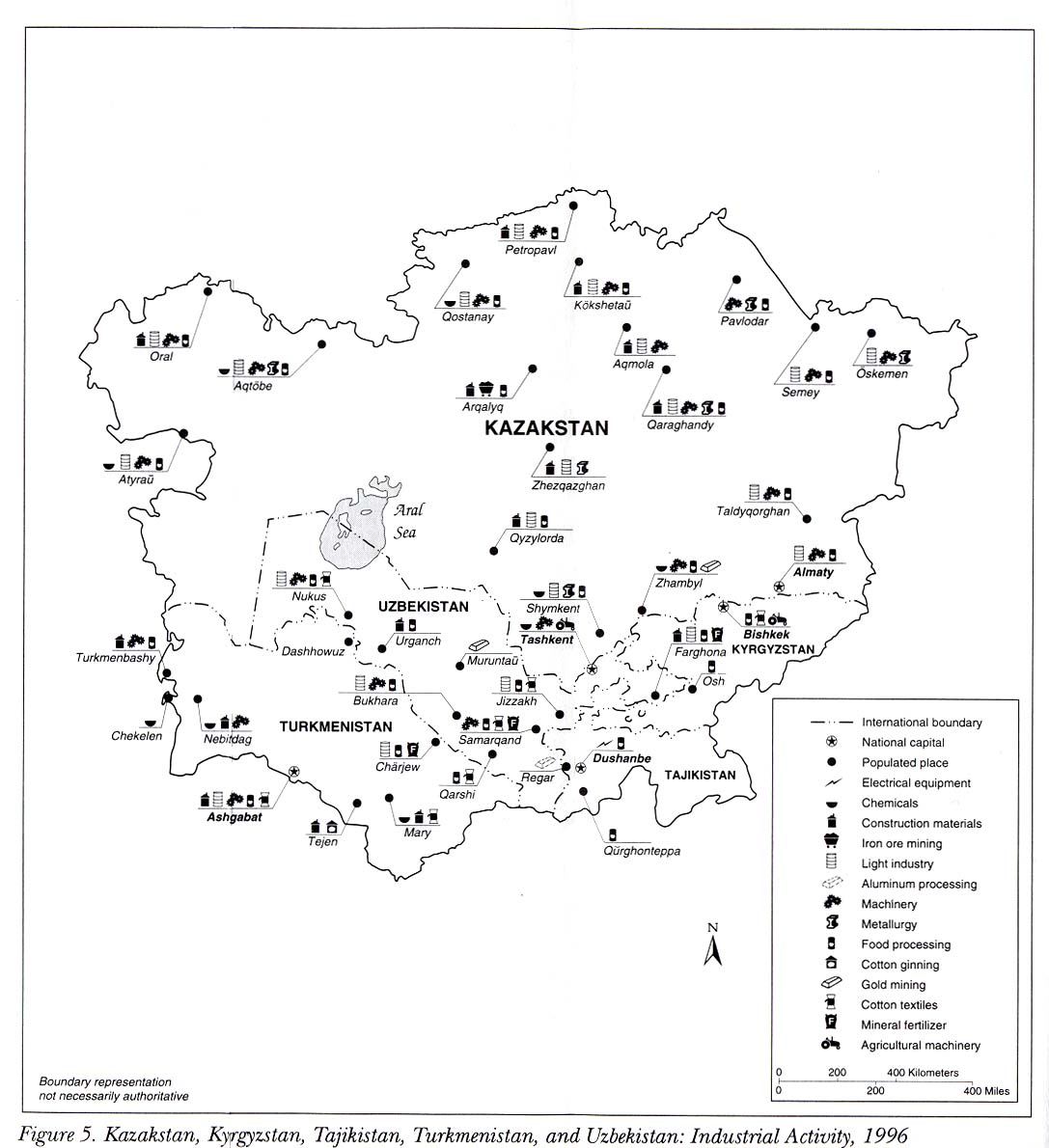
- Kazakstan, Kyrgyzstan, Tajikistan, Turkmenistan, and Uzbekistan: Industrial Activity 1996 from Kazakstan, Kyrgyzstan, Tajikistan, Turkmenistan, and Uzbekistan: Country Studies. 1997 (151K)
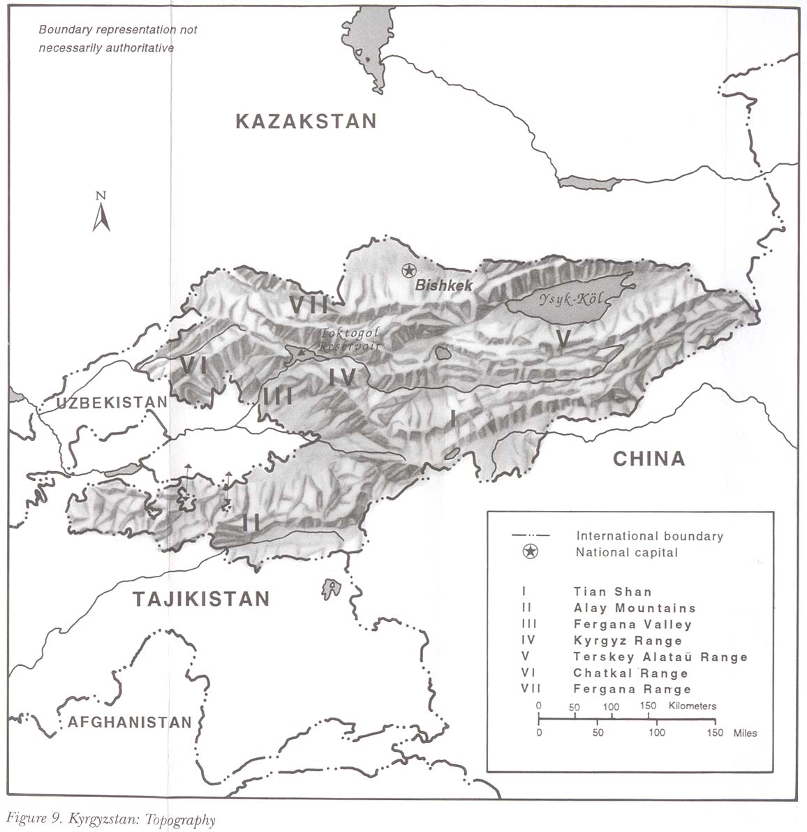
- Kyrgyzstan: Topography from Kazakstan, Kyrgyzstan, Tajikistan, Turkmenistan, and Uzbekistan: Country Studies. 1997 (138K)
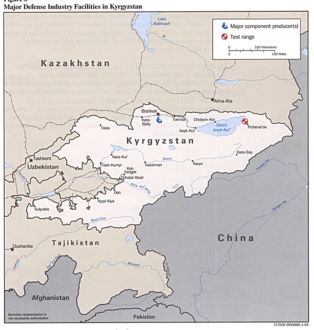
- Major Defense Industries in Kyrgyzstan from Defense Industries of the Newly Independent States of Eurasia. 1993 (152K)
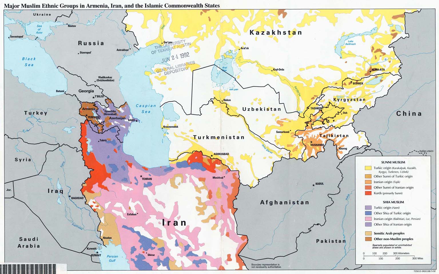
- Major Muslim Ethnic Groups in Armenia, Iran, and the Islamic Commonwealth States 1992 (203K)
- 1:1,000,000 - Operational Navigation Chart Series U.S. Defense Mapping Agency Aerospace Center. This series covers all of Kyrgyzstan. Not for navigational use
- 1:1,000,000 - International Map of the World This series dates from the Soviet period and covers all of Kyrgyzstan. Clickable Index Map
- 1:500,000 - Tactical Pilotage Charts U.S. National Imagery and Mapping Agency. Not for navigational use
- This series covers Kyrgyzstan
- 1:250,000 - Joint Operations Graphic Series U.S. National Imagery and Mapping Agency. This series covers part of Kyrgyzstan. Not for navigational use
- This series covers Kyrgyzstan
Maps on Other Web Sites