Perry-Castañeda Library
Map Collection
Cartographic Reference Resources
Updated 4/27/15
DISTANCE CALCULATORS- Canada Distance Guide (United Van Lines)
- Distance Calculator (Infoplease)
- Distance Calculator Between Airports (Landings.com)
- Distance Calculator Between Cities (Mapcrow.info)
- Google Maps Distance Calculator (Daft Logic)
- Great Circle Mapper (Karl L. Swartz)
- How Far Is It (Indo.com)
- Mexico Distance Calculator (Maps of Mexico)
- Mexico Mileage Charts (Ontheroadin)
- Texas Distance Calculator (GlobeFeed)
- United States, Canada, Mexico - Driving Distance, Time and Routing (MapQuest)
- Australia Place Name Search (AUSLIG)
- Central and Eastern Europe [historical] (ShtetlSeeker)
- U.S. Geographic Names Information System (USGS)
- U.S. and Territories and Antarctica (U.S. Geological Survey)
- World - GeoNames Search (National Geospatial-Intelligence Agency)
- World - Getty Thesaurus of Geographic Names
- World - MapQuest [location maps]
- World - National Geographic Map Machine [location maps]
- More Gazetteers (Wikipedia [see end of page])
- Cartographic Relief Presentation (Eduard Imhof/Google Books)
- Geographic Correspondence Engine (MCDC)
- GIS Dictionary (ESRI)
- Glossary of Cartographic Terms
- Guide: Coordinate Systems Overview
- Guide: Finding Your Way With Map and Compass (USGS/Internet Archive)
- Guide: Geodetic Datum Overview
- Guide: Geography Resources (UT Austin)
- Guide: Global Positioning Systems (CU Boulder)
- Guide: Internet Resources for Geographers (CU Boulder)
- Guide: Map Projections (Peter H. Dana)
- Guide: Reading Topographic Maps (USGS/Internet Archive)
- Guide: Scale Values, Geographic Measurement Conversions, Location of Prime Meridians (Internet Archive)
- Guide: Map Scales [PDF]
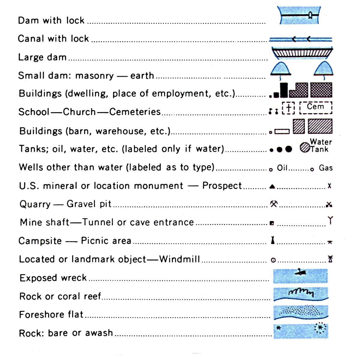
- Guide: USGS Symbols 1 Dams, Canals, Buildings, Tanks, Wells, Quarries and Mines, Campsites, Windmills, Water Features
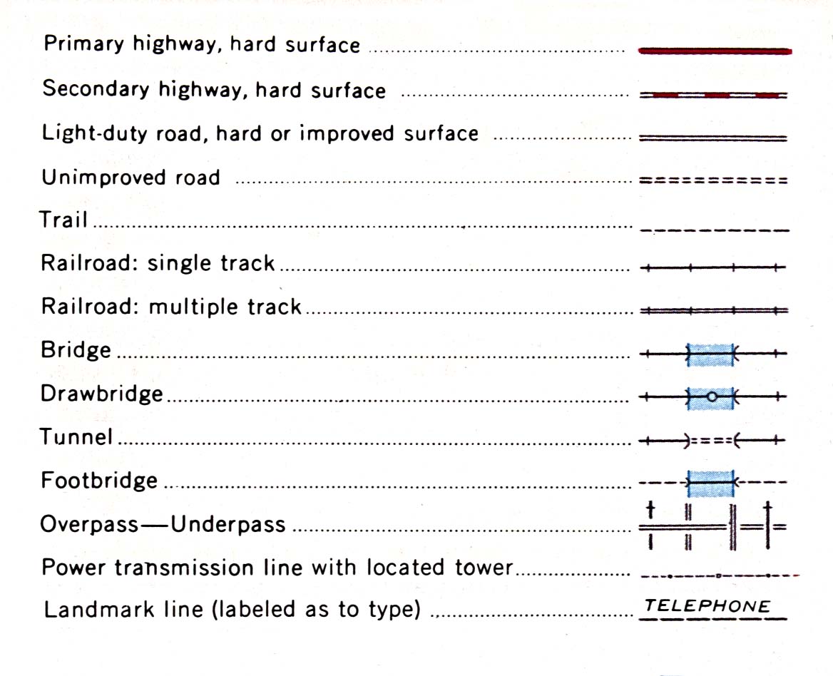
- Guide: USGS Symbols 2 Roads, Railroads, Bridges and Tunnels, Utility Lines
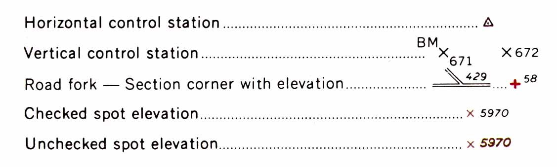
- Guide: USGS Symbols 3 Horizontal and Vertical Control Stations, Elevation Symbols
- Guide: USGS Symbols 4 Boundary Lines
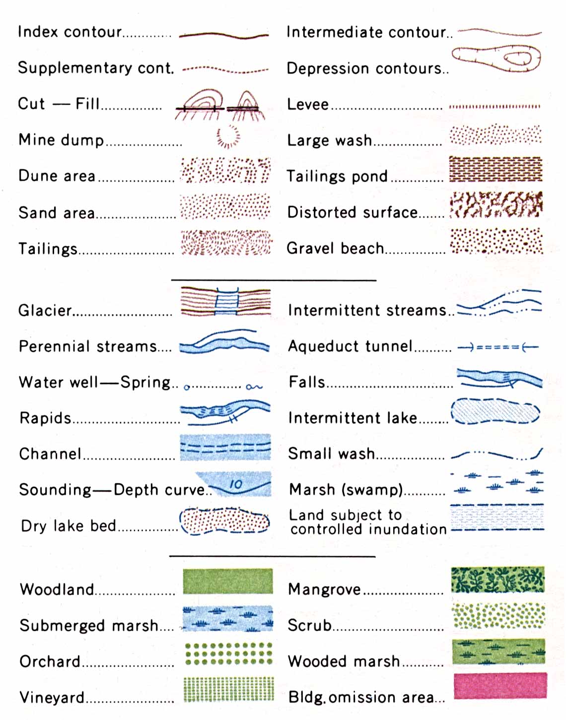
- Guide: USGS Symbols 5 Contour Lines, Water Features, Vegatative Features
- Map: Meridians and Baselines - U.S.
- GPS/GIS Waypoint Databank (Swopnet.com)
- Convert U.S. Street Address to Latitute and Longitude (LatLong.net)
- Convert Township/Range/Section to Latitude and Longitude (Marty Wefald)
- Latitude and Longitude - Basic Information (World Atlas.com)
- Latitude and Longitude Lookup (Lat-Long)
- Latitude, The Art and Science of Fifteenth Century Navigation (Patricia Seed)
- Texas Land Survey (Earth Point)
- Township and Range - Search by Latitude and Longitude (Earthpoint)
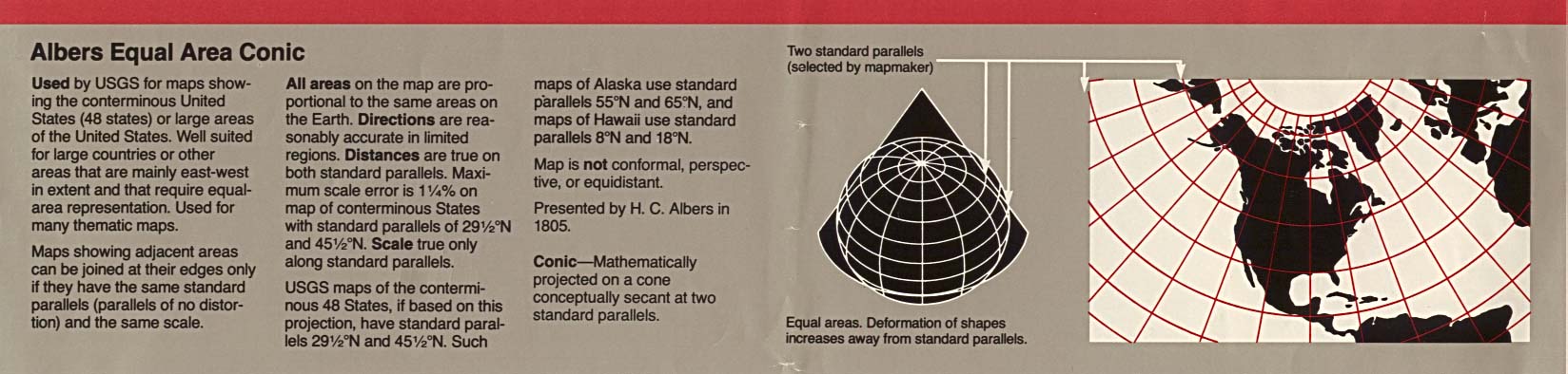
- Albers Equal Area
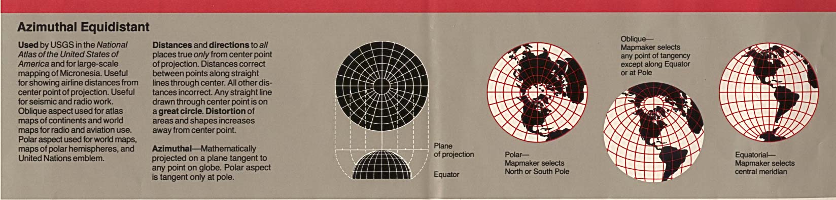
- Azimuthal Equidistant
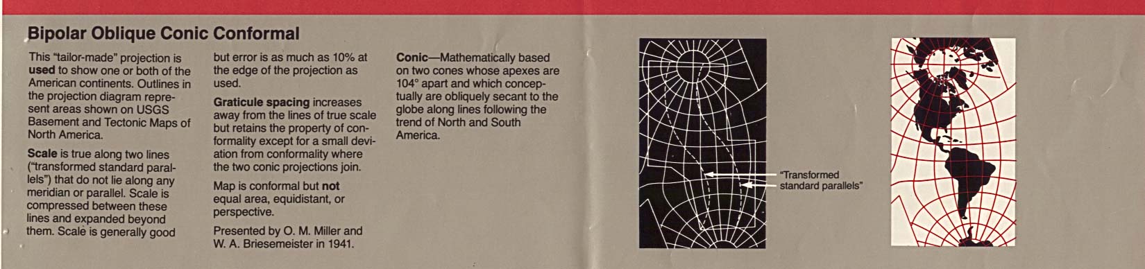
- Bipolar Oblique
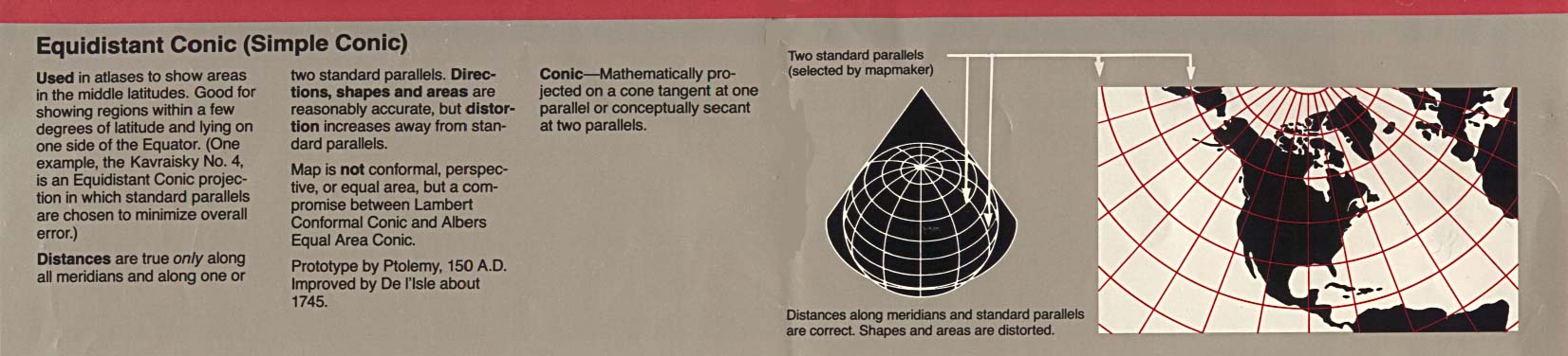
- Equidistant Conic
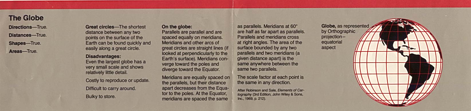
- Globe
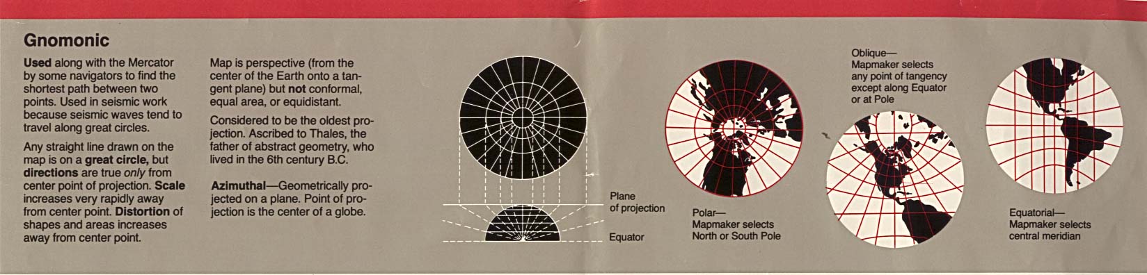
- Gnomonic
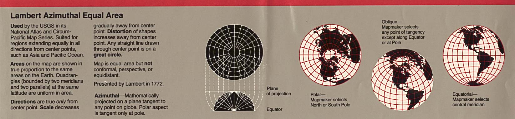
- Lambert Azimuthal
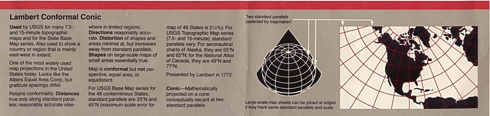
- Lambert Conformal
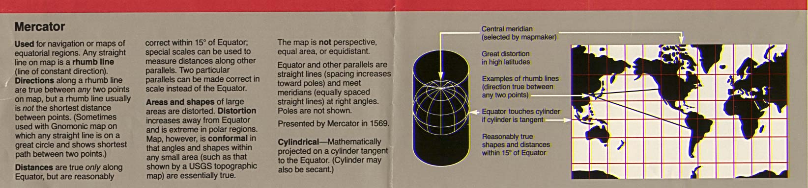
- Mercator
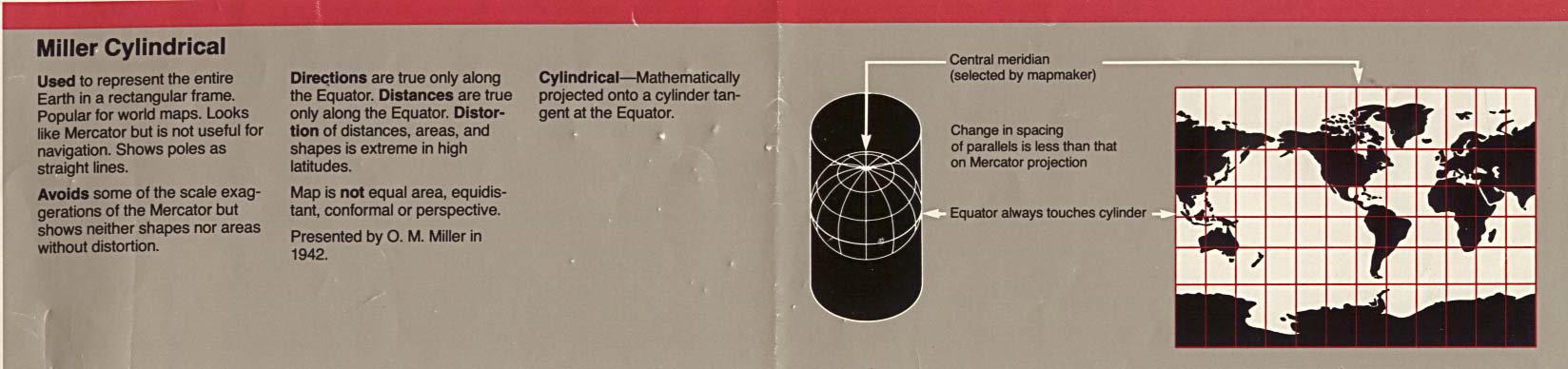
- Miller cylindrical
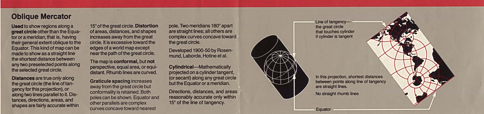
- Oblique Mercator
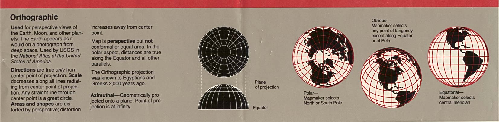
- Orthographic
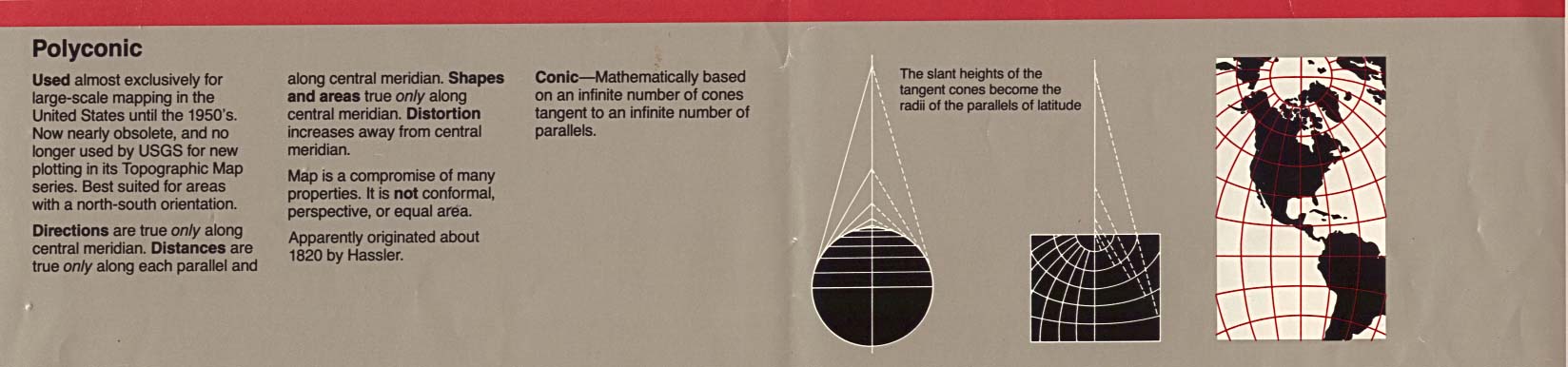
- Polyconic
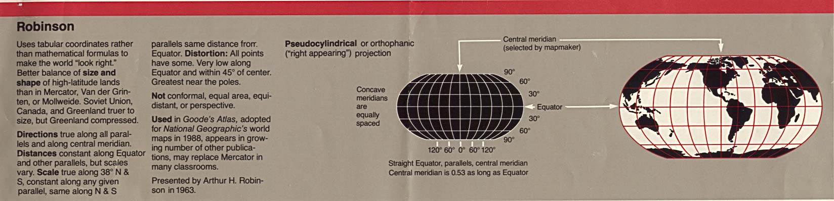
- Robinson
- Sinusoidal Equal Area
- Space Oblique
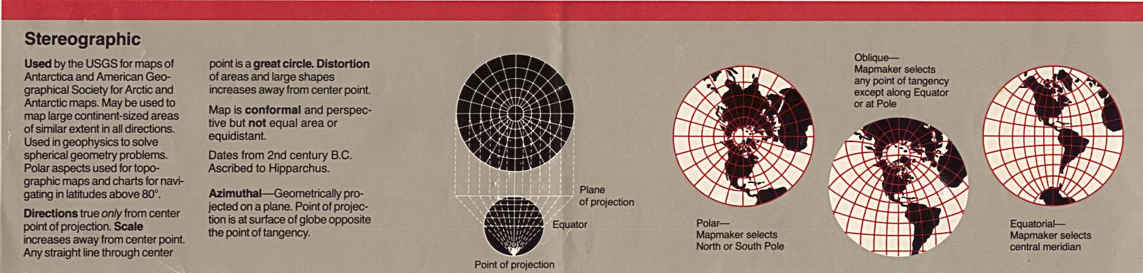
- Stereographic
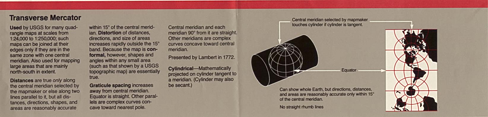
- Transverse Mercator
- Summary Table
- Map Projections - Interactive Display (vector.co.jp)
- Map Projections - Overview (Paul B. Anderson)
- Map Projections - Overview (Peter H. Dana)
- Map Scale Calculator - Scale Buddy (Maps International)
- Guide: Scale Values, Geographic Measurement Conversions, Location of Prime Meridians (Internet Archive)
- Coordinate Conversion (EarthPoint)
- Tide and Current Predictions - U.S. and World (University of South Carolina)
- Tide Predictions and Water Level Observations for United States (NOS/NOAA)